 Block
Threet, Alabama
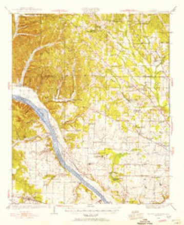
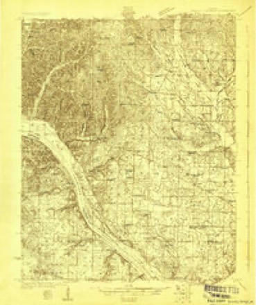
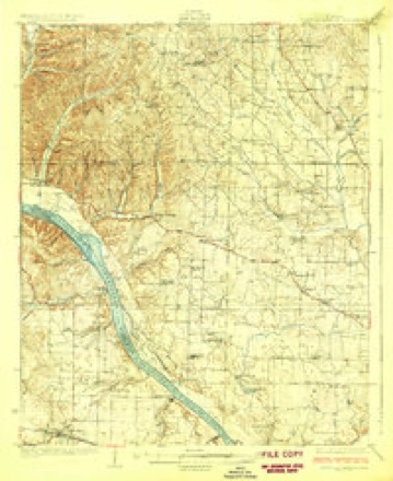
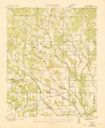
19 topographic sheets cover this place, the earliest surveyed in 1924 and the latest in 1986. It stands in the Cloverdale census division. It lies in ZIP code area 35633. It stands on North Fork Cypress Creek. The Survey maps it on the Threet quadrangle. It stands 643 feet above sea level.
Topographic sheets covering this place
10 surveys from 19 printed sheetsMatched by testing this settlement's coordinate against the published boundary of every sheet in the United States Geological Survey's historical collection. Each opens the scanned sheet at the Survey.
- 1924 USGS Gravelly Springs quadrangle1:62500
- 1924 USGS Gravelly Springs quadrangle1:48000
- 1926 USGS Gravelly Springs quadrangle1:62500, 2 printings
- 1936 USGS Threet quadrangle1:24000
- 1954 USGS Threet quadrangle1:24000, 4 printings
- 1956 USGS Gadsden quadrangle1:250000, 3 printings
- 1958 USGS Gadsden quadrangle1:250000
- 1960 USGS Gadsden quadrangle1:250000, 2 printings
- 1963 USGS Gadsden quadrangle1:250000
- 1986 USGS Tuscumbia quadrangle1:100000, 3 printings




Fires near this place
243 since 1995Regional context, not property-specific evidence. The federal wildfire occurrence database lists 243 fires within 5 miles of Threet between 1995 and 2020, burning about 1,466 acres in total. 1 started naturally. 110 were recorded as arson. Distance is straight-line from the map coordinates, so a fire counted here may appear on a neighbouring settlement's page as well.
| Reported cause | Fires |
|---|---|
| Arson/incendiarism | 110 |
| Debris and open burning | 77 |
| Equipment and vehicle use | 28 |
| Missing data/not specified/undetermined | 16 |
| Smoking | 8 |
| Recreation and ceremony | 2 |
| Natural | 1 |
| Misuse of fire by a minor | 1 |
The most recent of them, most recent first, with the day each was reported and the service that recorded it.
| Date | Cause | Size | Reported by | Name on the report |
|---|---|---|---|---|
| 9 September 1998 | Debris and open burning | 1.0 acres | Alabama Forestry Commission | not named |
| 8 September 1998 | Arson/incendiarism | under an acre | Alabama Forestry Commission | not named |
| 6 September 2002 | Arson/incendiarism | under an acre | Alabama Forestry Commission | not named |
| 6 September 1999 | Equipment and vehicle use | 1.5 acres | Alabama Forestry Commission | not named |
| 6 September 1998 | Equipment and vehicle use | under an acre | Alabama Forestry Commission | not named |
| 5 September 1999 | Arson/incendiarism | 4.5 acres | Alabama Forestry Commission | not named |
| 4 September 2000 | Debris and open burning | 5.0 acres | Alabama Forestry Commission | not named |
| 4 September 1999 | Smoking | 1.0 acres | Alabama Forestry Commission | not named |
Settlements close enough to share some of these fires:
Storms near this place
42 since 1997Regional context, not property-specific evidence. The National Weather Service names Threet in 42 storm reports between 1997 and 2025: 36 thunderstorm wind, 3 hail, 1 flash flood, 1 heavy rain. The reports record 1 death. Each account below is quoted exactly as the forecast office filed it, from the NOAA Storm Events Database, and each date opens the federal record of that event.
| When | Event | Place named | Harm | What the report says |
|---|---|---|---|---|
| May 2008 | Flash Flood | Threet | 1 killed, $30,000 | Rounds of thunderstorms producing very heavy rainfall caused several inches of water to cover the roadway on the Natchez Parkway, about a half mile from the Alabama Highway 20 intersection near Central Heights. This caused a 72 year old man to hydroplane off the road at this location into a nearby creek, which was 7 to 8 feet deep. Tragically, he was unable to swim to shore and passed away. |
| March 2007 | Thunderstorm Wind | Threet | $10,000 | Thunderstorm winds destroyed a carport and damaged a porch. |
| April 2025 | Thunderstorm Wind | Threet | $5,000 | Several large trees were knocked across the roadway at 3995 CR 5. |
| August 2023 | Thunderstorm Wind | Threet | $5,000 | A tree was knocked down onto a vehicle on Natchez Trace at mile marker 340. No injuries. Time estimated by radar. |
| March 2012 | Thunderstorm Wind | Threet | $5,000 | Trees and power lines were blown down. |
| May 2010 | Thunderstorm Wind | Threet | $5,000 | A tree was blown down near the intersection of CR 6 and CR 15. |
| April 2025 | Thunderstorm Wind | Threet | $3,000 | A tree was knocked down onto power lines at CR 8 and CR 81. |
| April 2014 | Thunderstorm Wind | Threet | $3,000 | A tree and a few powerlines downed by thunderstorm winds along County road 8 in northwest Lauderdale county. |
| May 2010 | Thunderstorm Wind | Threet | $3,000 | Three trees were blown down within one half of a mile of the intersection of CR 8 and Natchez Trace Parkway. |
| July 2009 | Thunderstorm Wind | Threet | $3,000 | A tree was blown down on CR 139. |
| November 1997 | Hail | Threet | $3,000 | Dime sized hail was reported just north of Threet, near the Alabama/Tennessee state line on CR 157. |
| April 2025 | Thunderstorm Wind | Threet | $2,000 | A tree was knocked down into the roadway at CR 200 and CR 228. |
| April 2025 | Thunderstorm Wind | Threet | $2,000 | A tree was knocked down blocking both lanes at CR 5 at CR 158. |
| June 2011 | Thunderstorm Wind | Threet | $2,000 | Trees were knocked down. |
| June 2011 | Thunderstorm Wind | Threet | $2,000 | Trees were knocked down. |
| June 2025 | Thunderstorm Wind | Threet | $1,000 | A tree was reported down near the intersection of 3500 CR 5 and 8600 CR 189 blocking both lanes. Time was estimated from radar. |
| September 2025 | Thunderstorm Wind | Threet | $1,000 | Tree down was knocked down across the road near CR 10. |
| August 2023 | Thunderstorm Wind | Threet | $1,000 | A tree was reported down on Natchez Trace Parkway at this location. Time was estimated from radar. |
| August 2023 | Thunderstorm Wind | Threet | $1,000 | A tree was reported down on CR 158 at this location. Time was estimated from radar. |
| July 2023 | Thunderstorm Wind | Threet | $1,000 | A tree was uprooted just west of Natchez Trace Parkway north of Cloverdale, about two miles south of the Tennessee state line. |
| July 2023 | Thunderstorm Wind | Threet | $1,000 | Trees were knocked down at this location. |
| July 2023 | Thunderstorm Wind | Threet | $1,000 | Trees were knocked down at this location. |
| July 2023 | Thunderstorm Wind | Threet | $1,000 | Trees were knocked down at this location. |
| June 2022 | Thunderstorm Wind | Threet | $1,000 | A tree was reported down on the turnlane onto the Natchez Trace Parkway from Highway 20 blocking traffic. |
| August 2023 | Thunderstorm Wind | Threet | $500 | A tree was knocked down on Natchez Trace north of CR 8. Time estimated by radar. |
| July 2023 | Thunderstorm Wind | Threet | $500 | A tree was knocked down across the road on CR 154 just east of the Natchez Trace Parkway. Time estimated by radar. |
| July 2023 | Thunderstorm Wind | Threet | $500 | A tree was knocked down on Natchez Trace Parkway between mile post 338 and 339. Time estimated by radar. |
| July 2023 | Thunderstorm Wind | Threet | $500 | A tree was knocked down at this location. |
| April 2018 | Thunderstorm Wind | Threet | $500 | A tree was knocked down at Highway 20 at Natchez Trace. |
| July 2016 | Thunderstorm Wind | Threet | $500 | Trees downed in 17000 block of cr 8. Time estimated. |
| July 2019 | Thunderstorm Wind | Threet | $400 | Two trees were knocked down near the intersection of Alabama Highway 20 and the Natchez Trace Parkway. |
| June 2020 | Thunderstorm Wind | Threet | $200 | Tree limbs were knocked down on CR 85. |
| June 2020 | Thunderstorm Wind | Threet | $200 | A tree was knocked down at 700 CR 261. |
| November 2018 | Thunderstorm Wind | Threet | $200 | A tree was knocked down at CR 85 at CR 261. |
| May 2017 | Thunderstorm Wind | Threet | $200 | A tree was knocked down across the roadway at 3673 CR 158. |
| October 2017 | Thunderstorm Wind | Threet | $200 | A tree was knocked down onto Natchez Trace Parkway, just south of the Tennessee state line. |
| April 2018 | Thunderstorm Wind | Threet | - | Multiple trees were knocked down along Natchez Trace Parkway near Highway 20. |
| November 2018 | Tornado (EF1) | Threet | - | A tornado touched down west of Alabama Highway 157 and north of Lauderdale County Road 141, northwest of the Cloverdale community. The tornado snapped multiple trees as it tracked to the northeast. A house off CR 141 had its windows broken and some roofing material removed, several vehicles were pushed aside, and two campers were lifted and moved. The inhabitants took shelter in their basement upon receiving the warning and were unharmed. The tornado tracked further northeast along CR 141, mainly snapping and uprooting trees. The tornado reached peak intensity of 105 mph off CR 10, where a single family home was more heavily damaged, and a nearby barn was completely destroyed. Fortunately nobody was in the home at the time. The tornado reached its peak width along CR 259, where numerous trees were snapped and uprooted in a wooded area. Additional tree damage was noted along CR 10, and again along CR 259 just south of where it crosses intoTennessee. At this point, the tornado crossed into Wayne County, Tennessee. |
| July 2015 | Thunderstorm Wind | Threet | - | A bowing segment within the QLCS moved through the northern portion of Lauderdale county. Damaging wind gusts began to affect areas just north of Cloverdale, knocking a few trees and power lines down. As the storm continued to move to the east/southeast, several more trees were downed. The storm weakened as it neared Killen. |
| July 2013 | Hail | Threet | - | Penny sized hail was reported near Threet Alabama. |
| March 2012 | Hail | Threet | - | Quarter sized hail was reported. |
| September 2012 | Heavy Rain | Threet | - | Heavy rainfall occurred, with 4.25 inches measured, just southwest of Threet. |
Nearest settlements
The eight closest, with where each one stands in the county. Distances are straight-line, computed from the Geographic Names Information System coordinates.
| Map | Place | Distance | Sheets |
|---|---|---|---|
| Melvin (historical) | 1.8 miles | 19 | |
| Stewartville | 2.1 miles | 19 | |
| Cloverdale | 3.2 miles | 19 | |
| Kendell (historical) | 3.3 miles | 18 | |
| Sullivan Crossroads | 3.8 miles | 19 | |
| Johnson Crossroads | 4.2 miles | 19 | |
| Murphy Cross Roads | 4.3 miles | 18 | |
| Central Heights | 4.4 miles | 19 |
Elsewhere
Matched on this settlement's Geographic Names Information System number rather than its name, so it cannot be a different place of the same name in another state.
| Wikipedia article on Threet | An encyclopaedic summary. Its text is share-alike, so it is linked here rather than copied. |
| Wikidata item Q7798050 | The structured record the population and elevation above come from. Public domain (CC0). |
Provenance
This settlement is recorded in the Geographic Names Information System as feature 157157. The sheet list is computed by point-in-boundary test against the United States Geological Survey's historical topographic inventory. Both are works of the United States government and carry no copyright under 17 U.S.C. 105.
Wildfire. Short, Karen C. 2022. Spatial wildfire occurrence data for the United States, 1992-2020 [FPA_FOD_20221014]. 6th Edition. Fort Collins, CO: Forest Service Research Data Archive. https://doi.org/10.2737/RDS-2013-0009.6 Collected with United States Government funding and usable without additional permissions or fees.
Storms. NOAA National Centers for Environmental Information, Storm Events Database https://www.ncei.noaa.gov/stormevents/ A work of the United States government, no copyright under 17 U.S.C. 105. Narratives are quoted verbatim from the National Weather Service report and are not edited or summarised.