 Block
From the record
25 National Register listings published here.
Sources: the National Register database, National Park Service
66 topographic sheets cover 62 settlements here, and 25 properties are on the National Register of Historic Places.
25 National Register listings published here.
Sources: the National Register database, National Park Service
Every property in this county listed on the National Register of Historic Places, with the year it was listed and the federal nomination document.
| Photograph | Property | Type | Listed | Reference |
|---|---|---|---|---|
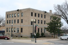 | Baxter County Courthouse | building | 1995 | 95000658 |
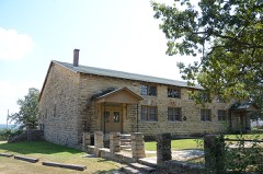 | Big Flat School Gymnasium | building | 1993 | 93001255 |
| Big Spring | structure | 2025 | 100011816 | |
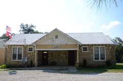 | Buford School Building | building | 1992 | 92001128 |
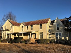 | Case-Shiras-Dearmore House | building | 1992 | 91000580 |
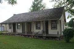 | Casey House | building | 1975 | 75000374 |
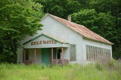 | Cold Water School | building | 2008 | 08000485 |
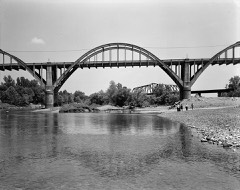 | Cotter Bridge | structure | 1990 | 90000518 |
 | Cotter High School Gymnasium, Old | building | 1995 | 95001147 |
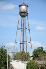 | Cotter Water Tower | structure | 2007 | 06001280 |
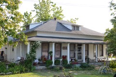 | Davis House | building | 1995 | 95000271 |
| Domino Shed | structure | 2025 | 100011298 | |
| Galatia Church | building | 100005579 | ||
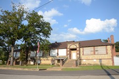 | Horace Mann School Historic District | district | 2007 | 06001311 |
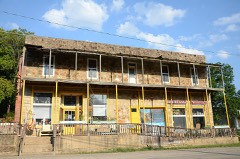 | Sid Hutcheson Building | building | 2014 | 14000789 |
| Mountain Home Cemetery, Historic Section | site | 2020 | 100004895 | |
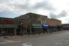 | Mountain Home Commercial Historic District | district | 2010 | 10000348 |
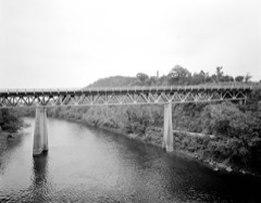 | North Fork Bridge | structure | 90000512 | |
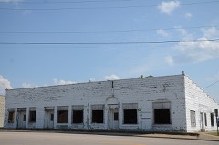 | Rollins Hospital | building | 2007 | 07000970 |
| Uncle Willie Huffines Park | site | 2025 | 100011299 | |
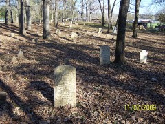 | Wolf Cemetery | site | 2013 | 13000063 |
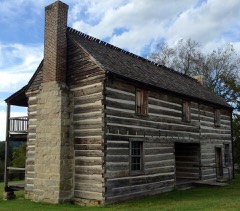 | Jacob Wolf House | building | 1973 | 73000380 |
Every wildfire the federal occurrence database records inside this county: 431 of them, burning about 9,987 acres. 8 started naturally and 193 were recorded as arson. Each settlement page carries the fires within five miles of it.
| Reported cause | Fires |
|---|---|
| Arson/incendiarism | 193 |
| Missing data/not specified/undetermined | 113 |
| Debris and open burning | 88 |
| Equipment and vehicle use | 16 |
| Natural | 8 |
| Recreation and ceremony | 4 |
| Smoking | 4 |
| Other causes | 2 |
| Fireworks | 1 |
| Power generation/transmission/distribution | 1 |
| Misuse of fire by a minor | 1 |
The five largest, by the area the report gives. Five of them were set deliberately.
| Date | Cause | Size | Reported by | Name on the report |
|---|---|---|---|---|
| 19 March 2017 | Missing data/not specified/undetermined | 582 acres | Arkansas Forestry Commission | not named |
| 24 January 2009 | Arson/incendiarism | 423 acres | Ozark-St. Francis National Forests | MERRILL RIDGE |
| 3 April 2011 | Missing data/not specified/undetermined | 398 acres | Ozark-St. Francis National Forests | WINDY |
| 18 March 2006 | Debris and open burning | 360 acres | Ozark-St. Francis National Forests | FREEMAN FIRE |
| 22 April 2000 | Arson/incendiarism | 255 acres | Ozark-St. Francis National Forests | RAND |
| 16 February 2011 | Arson/incendiarism | 230 acres | Arkansas Forestry Commission | HOPEWELL HOLLOW |
| 9 March 2004 | Arson/incendiarism | 200 acres | Arkansas Forestry Commission | NORFORK |
| 17 August 1995 | Arson/incendiarism | 175 acres | Ozark-St. Francis National Forests | PRETTY HILL |
Every settlement page carries the fires within five miles of it - see the settlement index below.
The NOAA Storm Events Database holds 558 reports for this county, causing 6 deaths, 112 injuries and about $51,742,030 in recorded property damage. Each settlement page carries the reports that name it.
| Kind of event | Reports |
|---|---|
| Thunderstorm Wind | 266 |
| Hail | 209 |
| Flash Flood | 32 |
| Tornado | 22 |
| Heavy Rain | 14 |
| Lightning | 7 |
| Flood | 6 |
| Funnel Cloud | 2 |
The most serious of them, by death, then injury, then recorded damage. The accounts are quoted exactly as the forecast office filed them.
| When | Event | Place named | Harm | What the report says |
|---|---|---|---|---|
| May 1968 | Tornado (F3) | not stated | 3 killed, 25 hurt, $25,000 | no account filed |
| February 2008 | Tornado (EF2) | Cotter | 1 killed, 35 hurt, $15,750,000 | The tornado moved from Marion County, north-northeast of Rea Valley, into Baxter County, just east-southeast of Cotter. A survey by the Red Cross indicated 21 houses were destroyed, 23 suffered major damage, 35 had minor damage, and 147 others were affected. In addition, 9 mobile homes were destroyed, 12 suffered major damage, 10 had minor damage, and 10 others were affected. One fatality occurred in a mobile home park. Most of the residential structures were in the area around Gassville. A number of businesses in Gassville, along U.S. Highway 62/412, were damaged. Numerous trees, power lines, and power poles were blown down. The tornado dissipated before reaching Mountain Home. |
| May 2024 | Tornado (EF3) | Buffalo | 1 killed, 17 hurt | The Briarcliff Tornado continued in Baxter County from Marion County and|moved through a small residential area along the White River,|pulling siding and shingles off houses in addition to causing|significant tree damage. The tornado continued eastward, further|expanding in width, and reached a maximum width of up to 1 mile|wide, crossing mostly rural areas and causing significant tree|damage, passing across Wild Hog Mountain, and crossing Shipps|Ferry Road and Round Rock Trail. As it approached the Arkana and|Norfork Village area, the path width contracted slightly, and|large swaths of trees were found uprooted and snapped as it|crossed the White River briefly once again north of Hwy 341 at|Riverside Dr. The tornado continued northeast towards Briarcliff,|where mostly tree damage was observed to the west of Highway 5.|As the tornado crossed the highway, widespread tree damage became|prevalent, with most trees snapped at their trunks. A few|structures were severely damaged, including a home, and a metal|shop building. The tornado also impacted a local RV/trailer|camping park, where five fifth-wheel recreation trailers were|tossed and completely destroyed. One fatality was reported out of|this area as well. The tornado also moved over a 350 kV|transmission line that intersected Hwy 5, snapping several wooden|two-poled line towers, and bending two steel two-poled line|towers to the ground, indicative of EF2 wind speeds. After|crossing Hwy 5, the tornado moved into the Briarcliff residential|area, encountering significant topography. 17 injuries were|reported within the Briarcliff community. The tornado path width|expanded again, reaching a width of up to 1 mile wide for a short|duration as it moved through Briarcliff. Significant tree damage|was observed over a large portion of the roads in the area, and|via satellite imagery. A few homes sustained moderate damage,|likely exacerbated by debris and projectiles. The Briarcliff City|Hall building, which sat on top of a hill on Scenic Drive,|sustained significant structural damage, with most of the second|level of the building destroyed, indicative of EF3 wind speeds of|up to 140 mph. The tornado then continued to move northeast,|moving over several hills on the east side of Briarcliff. A two-|story home located off of the Shoal Creek tributary sustained|significant roof damage with most of the structure pulled off to|the wall plates, and all the surrounding trees to the east|uprooted from the road to the waterline. The tornado then crossed|the lake, and struck a few peninsulas, where more significant|tree damage was observed. After crossing Norfork Lake, the|tornado continued northeast on the north side of the lake, moving|over mostly rural areas, eventually crossing over the Holiday|Hills Resort Area on Baxter County Road 149. A few buildings|sustained minor roof damage, and a smaller cabin building had the|roof structure pulled off with a few exterior walls collapsed.|Most trees around the resort were uprooted as well. The tornado|then kept moving northeast into Fulton County. |
| June 2017 | Thunderstorm Wind | Ellis | 1 killed | ONE FATAL, and this is a delayed report. A man was in Lake Norfork when thunderstorm winds overturned his kayak. Emergency personnel tried to revive him...but he eventually died. |
| July 1986 | Thunderstorm Wind | not stated | 8 hurt | no account filed |
| July 1986 | Thunderstorm Wind | not stated | 5 hurt | no account filed |
| November 1985 | Tornado (F3) | not stated | 3 hurt, $25,000,000 | no account filed |
| June 1964 | Tornado (F1) | not stated | 3 hurt, $2,500 | no account filed |
| August 2002 | Thunderstorm Wind | Lakeview | 3 hurt | Thunderstorm winds, estimated between 70 and 80 mph, destroyed a large boat dock. About 40 boats were also destroyed or badly damaged. Three people that were on the dock at the time of the storm suffered minor injuries. |
| December 1971 | Tornado (F3) | not stated | 2 hurt, $250,000 | no account filed |
| June 1968 | Tornado (F2) | not stated | 2 hurt, $2,500 | no account filed |
| August 1986 | Thunderstorm Wind | not stated | 2 hurt | no account filed |
| July 2009 | Lightning | Gassville | 1 hurt | A 14 year-old male was injured by lightning while adjusting a tall, outdoor television antenna. |
| April 2006 | Thunderstorm Wind | Briarcliff | 1 hurt | One person suffered minor injuries from flying glass when thunderstorm winds blew in the window of a home. |
| July 2006 | Thunderstorm Wind | Henderson | 1 hurt | A couple of camping trailers were overturned. A boy was injured in one of the trailers at Robinson Point. |
| November 2006 | Flood | Henderson | 1 hurt | Several county roads in the area remained flooded from heavy rainfall earlier in the day. A man had to be rescued from his pickup truck after he drove into the rising water along County Road 48. He was taken to a local hospital and was later released after suffering hypothermia. |
| January 2000 | Thunderstorm Wind | Norfork | 1 hurt | no account filed |
| August 1998 | Thunderstorm Wind | Gassville | 1 hurt | no account filed |
| June 1996 | Lightning | Mountain Home | 1 hurt | no account filed |
| March 2008 | Flood | Arkana | $4,000,000 | Heavy rain caused the White River in Baxter County to flood. Thirty feet of River View Road on the North Fork of the White River were washed out. River View Drive and River Ridge Road were washed out. Deputies used helicopters to rescue about a dozen people from Norfork Village. One family was evacuated from their residence on River Valley Road. Seven campers and 20 residences were evacuated at Buffalo City. Approximately 60 homes were damaged to some degree with about 30 having major damage, 15 with moderate damage, and the remainder with minor damage in the county. Some livestock and pasture losses were noted also. |
| March 2008 | Flash Flood | Three Brothers | $1,500,000 | Many roads were closed across the county and a number of mudslides occurred. Arkansas Highway 201 between Shady Grove and Arkana was flooded, as were County Roads 510 and 10 near Midway, County Road 806 in the Gamaliel area, County Road 63, County Road 65 in the Jordan area, County Road 72 at Plum Tree Lane, County Roads 7 and 1 in the Cotter area, County Road 105 at Norfork, Old Mill Road, and Tucker Cemetery Road. |
| April 2008 | Flash Flood | Ellis | $1,500,000 | Excessive releases from Norfork Dam caused flash flooding along the two mile stretch of the Norfork River between the dam and the White River. About four homes were flooded, two resorts flooded, and two trout docks were swept away in the rushing water. Boats, motors, and supplies were carried away with the docks. |
| May 2011 | Flood | Clarkridge | $750,000 | Some of the campsites around Lake Norfork were closed due to flooding. |
| March 1993 | Thunderstorm Wind | Mountain Home | $500,000 | Thunderstorm winds blew down a house that was under construction. Roofs were also blown off several homes. |
| April 2011 | Flood | Clarkridge | $300,000 | Widespread areal flooding occurred. |
| April 2008 | Flood | Buffalo | $250,000 | Heavy rain produced significant rises on the upper White River and tributaries. The combination of high river flows and the excessive upstream reservoir releases caused a second major flood event from the mouth of the Buffalo River to the Calico Rock gage. Homes and businesses were flooded for a second time in less than month in the Norfork vicinity and upstream. Damages were limited to repairs made since the March flooding. |
| March 2012 | Thunderstorm Wind | Midway | $150,000 | At a mobile home park, four mobile homes were severely damaged and eight other suffered lesser amounts of damage. Several people were briefly trapped inside the mobile homes, but there were no injuries. The laundromat building had its roof taken off and some of the walls removed. |
| August 2011 | Thunderstorm Wind | Hand | $150,000 | A boat dock was overturned and thrown ashore at Lake Norfork. Several boats went ashore with the dock. |
| May 2009 | Thunderstorm Wind | Mountain Home | $150,000 | A hangar door was blown off at the Ozark Regional Airport northwest of Mountain Home. A roof was blown off a home in Mountain Home. Trees and power lines were down across the area. Fencing was knocked down at a sports complex. |
| July 2023 | Thunderstorm Wind | Norfork Lake North | $120,000 | A large tree fell and damaged a house and a vehicle. |
| March 2020 | Tornado (EF1) | Whiteville | $120,000 | The tornado uprooted or snapped several large trees and damaged outbuildings. A large tree was uprooted and fell through the bedroom of a residence. A large portion of the roof of a house was torn off and blown into nearby trees. |
| January 2020 | Thunderstorm Wind | Hand | $100,000 | Boat docks were damaged at Lake Norfork at Frog Pond, Hand Cover, and School Bus Cove. |
| July 2014 | Thunderstorm Wind | Mountain Home | $100,000 | Docks were damaged at Buzzard Roost Marina and trees were blown down in the area. |
| October 2009 | Flash Flood | Gamaliel | $100,000 | A number of county roads were flooded. |
| June 2014 | Thunderstorm Wind | Mountain Home | $75,000 | Numerous power lines were blown down, leaving thousands without power in Mountain Home and surrounding areas. |
| August 2011 | Thunderstorm Wind | Norfork Lake North | $75,000 | Roofs were blown off five docks at the Panther Bay Marina. |
| January 2020 | Thunderstorm Wind | Three Brothers | $50,000 | A barn was flattened and another barn roof landed on vehicles. |
| April 2018 | Thunderstorm Wind | Mountain Home | $50,000 | Utility poles were blown down. Several businesses sustained heavy damage. A nursing home lost part of its roof and had to be evacuated. The survey team found damage consistent with straight line or microburst winds, with sustained wind speeds estimated at 85-90 mph. |
| July 2008 | Lightning | Mountain Home | $50,000 | Numerous transformers were out because of lightning strikes. One structure fire was started by an exploding transformer. |
| May 1997 | Thunderstorm Wind | Mountain Home | $50,000 | Thunderstorm winds damaged a number of boats and boat sheds along a portion of Norfork Lake. A number of trees and power lines were also blown down. |
| May 2013 | Thunderstorm Wind | Mountain Home | $30,000 | Numerous trees were blown down in and near Mountain Home. One tree fell onto the roof of a house. |
| July 2010 | Thunderstorm Wind | Mountain Home | $30,000 | A lean-to at a roofing business was blown from the back of the business to the front parking lot and roofing supplies were scattered around. Part of the tin blew into a transformer. Trees and power lines were blown down, and a metal carport was destroyed. |
| October 2007 | Thunderstorm Wind | Arkana | $30,000 | A large red oak tree fell through the ceiling of a house on Baxter County Road 676. |
| September 2012 | Thunderstorm Wind | Mountain Home | $25,000 | Trees were blown down in Mountain Home and other parts of Baxter County. |
| June 2011 | Thunderstorm Wind | Mountain Home | $25,000 | Many trees were blown down south and east of Mountain Home. |
| July 2010 | Flash Flood | Three Brothers | $25,000 | Small creeks overflowed throughout Baxter County. |
| October 2007 | Thunderstorm Wind | Mountain Home | $25,000 | Gusty winds from a thunderstorm broke off a large hickory tree near its base. The tree hit a house, breaking a sunroof and cracking the ceiling at the rear of the house. |
| March 1997 | Tornado (F1) | Norfork | $25,000 | no account filed |
| May 1973 | Tornado (F2) | not stated | $25,000 | no account filed |
| August 2013 | Thunderstorm Wind | Monkey Run | $20,000 | Trees were blown down. One of the trees fell on a house. |
| April 2009 | Thunderstorm Wind | Norfork | $20,000 | Trees were down and the awning was blown down at a gas station. |
| July 2009 | Flash Flood | Mountain Home | $20,000 | Many locations were flooded north of Mountain Home. |
| August 2013 | Thunderstorm Wind | Midway | $15,000 | A tree fell onto a car, trapping the people inside. They were extricated and found to have no injuries. |
| September 2010 | Flash Flood | Three Brothers | $15,000 | Streets were flooded in Mountain Home and several roads west of town were damaged. |
| May 2009 | Thunderstorm Wind | Mountain Home | $15,000 | Trees were down. A utility pole was snapped, causing power outages. |
| June 2009 | Thunderstorm Wind | Mountain Home Arpt | $15,000 | A barn under construction was blown down. |
| May 2022 | Thunderstorm Wind | Big Flat | $10,000 | A picture was shown on social media of a tree blown over onto a truck in Big Flat. |
| April 2018 | Tornado (EF1) | Gamaliel | $10,000 | This tornado touched down near the intersection of Arkansas Hwy 101 and County Road 804, with several trees either uprooted or trunks snapped. There was also some minor damage to a church, along with damage to a garage and outbuildings. |
| October 2017 | Thunderstorm Wind | Mountain Home | $10,000 | Damage occurred to a home along cr 712 west of Mountain Home. Some Siding was blown off the house with piles of metal and wood strewn across the yard. Across the street, some tree damage occurred and shingles were removed from a shed. |
| July 2014 | Thunderstorm Wind | Buford | $10,000 | Trees were blown down. |
The Survey's mineral resources record lists 45 workings inside this county. 6 still produce and 39 are closed or unrecorded. Each settlement page carries the workings within five miles of it.
| Commodity | Workings |
|---|---|
| Zinc | 16 |
| Lead | 15 |
| Sand and Gravel, Construction | 10 |
| Stone | 9 |
| Stone, Crushed/Broken | 3 |
| Manganese | 2 |
| Iron | 2 |
| Dolomite | 1 |
| Mercury, Zinc | 1 |
| Zinc, Lead | 1 |
| Iron Oxide Pigments | 1 |
The least common of them first, because a county's hundredth gravel pit says nothing its first ten did not.
| Where | Site | Commodity | Status | Recorded |
|---|---|---|---|---|
| L. R. Cox Mine | Iron Oxide Pigments | Unknown | ||
| Mcguire Quarry | Dolomite | Past Producer | ||
| Meerscheidt | Lead, Mercury, Zinc | Prospect | ||
| Shiras Mine | Iron, Zinc, Lead | Prospect | ||
| Earl Sword Property | Manganese | Prospect | ||
| Gentry Mine | Iron | Prospect | ||
| Johnson Prospect | Manganese | Prospect | ||
| Baxter County Quarry | Stone, Crushed/Broken | Producer | ||
| Mcguire Plant | Stone, Crushed/Broken | Producer | ||
| Mcguire Quarry No.1 | Stone, Crushed/Broken | Producer | ||
| Old Joe | Stone | Producer | ||
| Unk | Stone | Unknown | ||
| Unk | Stone | Unknown | ||
| Unk | Stone | Unknown | ||
| Unk | Stone | Unknown | ||
| Unk | Stone | Unknown | ||
| Unk | Stone | Unknown | ||
| Unk | Stone | Unknown | ||
| Unk | Stone | Unknown | ||
| Mountain Home Plant | Sand and Gravel, Construction | Producer | ||
| Unk | Sand and Gravel, Construction | Unknown | ||
| Unk | Sand and Gravel, Construction | Producer | ||
| Unk | Sand and Gravel, Construction | Unknown | ||
| Unk | Sand and Gravel, Construction | Unknown | ||
| Unk | Sand and Gravel, Construction | Unknown | ||
| Unk | Sand and Gravel, Construction | Unknown | ||
| Unk | Sand and Gravel, Construction | Unknown | ||
| Unk | Sand and Gravel, Construction | Unknown | ||
| Unk | Sand and Gravel, Construction | Unknown | ||
| Annie May Mine | Lead, Zinc | Prospect | ||
| Bald Dave Prospect | Lead, Zinc | Prospect | ||
| Big John Prospect | Lead, Zinc | Prospect | ||
| Cedar Gap Prospect | Lead, Zinc | Prospect | ||
| Cincinnati Prospect | Lead, Zinc | Prospect | ||
| Commercial Prospect | Lead, Zinc | Prospect | ||
| Hawkeye Prospect | Lead, Zinc | Prospect | ||
| Hulsenbeck Prospect | Lead, Zinc | Prospect | ||
| Ida Webber | Lead, Zinc | Prospect | ||
| Michigan Mine | Lead, Zinc | Unknown | ||
| Morgon Prospect | Lead, Zinc | Prospect | ||
| Otis Robbins | Lead, Zinc | Prospect | ||
| Sorrel & Stratton Prospect | Lead, Zinc | Prospect | ||
| Whipple Claims | Lead, Zinc | Prospect | ||
| Bean Prospect | Zinc | Unknown | ||
| Bluebird Mine & Plant | Zinc | Prospect |
Named settlements recorded in the Geographic Names Information System, each with the topographic sheets covering it. Villages, hamlets and abandoned places alike. Each is shown with the nearest named watercourse or landform and the survey quadrangle it falls on.
District 3 · 72537 · On Little Creek · Gamaliel quadrangle
18 sheets, 1890 to 1985
No longer a settlement
District 11 · 72519 · Near Schinette Hollow · Norfork Dam South quadrangle
19 sheets, 1890 to 1985
No longer a settlement
District 9 · 72653 · On Shoal Creek · Mountain Home East quadrangle
18 sheets, 1890 to 1985
District 11 · 72653 · On Cunningham Creek · Buffalo City quadrangle
18 sheets, 1890 to 1985
District 11 · 72519 · Near Grassy Hollow · Calico Rock quadrangle
19 sheets, 1890 to 1985
No longer a settlement
District 11 · 72658 · By White Bluff · Norfork quadrangle
17 sheets, 1890 to 1985
No longer a settlement
District 11 · 72653 · On Jenkins Creek · Mountain Home West quadrangle
18 sheets, 1890 to 1985
No longer a settlement
District 11 · 72519 · On Barren Fork · Norfork Dam North quadrangle
18 sheets, 1890 to 1985
No longer a settlement
District 3 · 72537 · On Walker Branch · Gamaliel quadrangle
18 sheets, 1890 to 1985
No longer a settlement
District 3 · 72531 · On Diamond Creek · Norfork Dam North quadrangle
18 sheets, 1890 to 1985
District 11 · 72519 · On Barren Fork · Norfork Dam North quadrangle
18 sheets, 1890 to 1985
No longer a settlement
District 8 · 72653 · On Hicks Creek · Mountain Home East quadrangle
18 sheets, 1890 to 1985
District 3 · 72531 · On Float Creek · Norfork Dam North quadrangle
18 sheets, 1890 to 1985
District 10 · 72635 · On Monkey Run Creek · Mountain Home West quadrangle
18 sheets, 1890 to 1985
No longer a settlement
District 11 · 72658 · Near Birmingham Hollow · Norfork SE quadrangle
18 sheets, 1890 to 1985
No longer a settlement
District 3 · 72653 · Near Camp Spring Hollow · Clarkridge quadrangle
20 sheets, 1890 to 1985
District 3 · 72653 · Near Camp Spring Hollow · Clarkridge quadrangle
20 sheets, 1890 to 1985
District 11 · 72653 · Near Fletcher Mountain · Buffalo City quadrangle
18 sheets, 1890 to 1985
No longer a settlement
District 11 · 72658 · Near Ellen Cockran Hollow · Norfork quadrangle
17 sheets, 1890 to 1985
District 6 · 72635 · On Monkey Run Hill · Mountain Home West quadrangle
18 sheets, 1890 to 1985
District 5 · 72653 · Near Capitol Hill · Mountain Home West quadrangle
18 sheets, 1890 to 1985
District 11 · 72658 · Near Naked Joe Knob · Norfork Dam South quadrangle
19 sheets, 1890 to 1985
District 9 · 72653 · On Dry Creek · Norfork Dam North quadrangle
18 sheets, 1890 to 1985
No longer a settlement
District 2 · 72653 · Near Hickman Knob · Mountain Home West quadrangle
18 sheets, 1890 to 1985
District 9 · 72653 · On Shoal Creek · Mountain Home East quadrangle
18 sheets, 1890 to 1985
District 9 · 72653 · On Shoal Creek · Norfork Dam North quadrangle
18 sheets, 1890 to 1985
District 3 · 72531 · Near Wolf Knob · Norfork Dam North quadrangle
18 sheets, 1890 to 1985
District 3 · 72531 · Near Wolf Knob · Norfork Dam North quadrangle
18 sheets, 1890 to 1985
No longer a settlement
District 10 · 72635 · On Monkey Run Creek · Mountain Home West quadrangle
18 sheets, 1890 to 1985
The vanished settlements of Baxter County: the places named above that are no longer on the map.