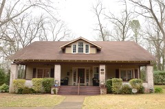
Block
From the record
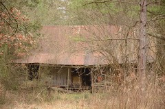
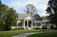
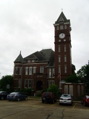
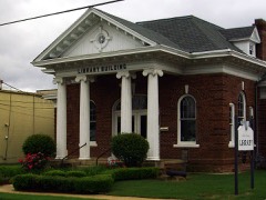
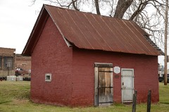
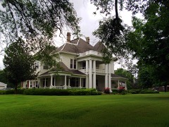
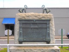
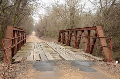
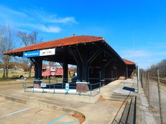
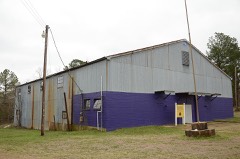
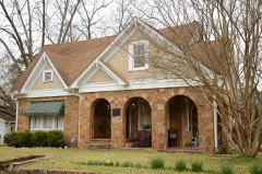
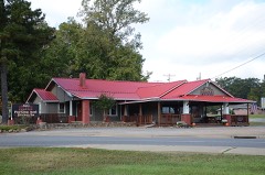
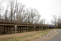
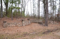
43 National Register listings published here.
Sources: the National Register database, National Park Service
58 topographic sheets cover 50 settlements here, and 43 properties are on the National Register of Historic Places.
43 National Register listings published here.
Sources: the National Register database, National Park Service
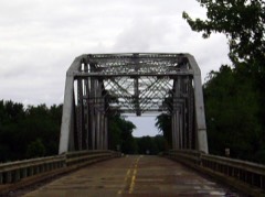
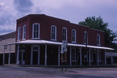
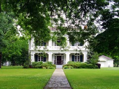
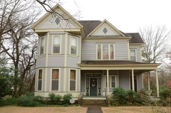
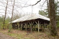
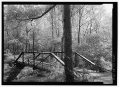
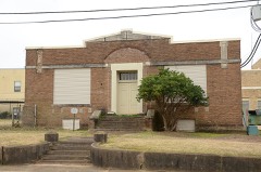
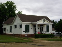
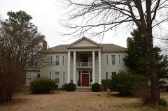
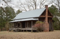
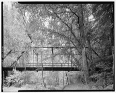
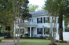
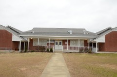
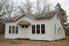
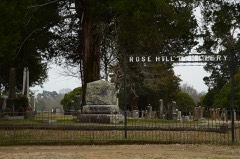
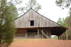
Every property in this county listed on the National Register of Historic Places, with the year it was listed and the federal nomination document.
Every wildfire the federal occurrence database records inside this county: 1,003 of them, burning about 12,121 acres. 83 started naturally and 209 were recorded as arson. Each settlement page carries the fires within five miles of it.
| Reported cause | Fires |
|---|---|
| Debris and open burning | 276 |
| Arson/incendiarism | 209 |
| Missing data/not specified/undetermined | 177 |
| Equipment and vehicle use | 142 |
| Railroad operations and maintenance | 84 |
| Natural | 83 |
| Recreation and ceremony | 12 |
| Misuse of fire by a minor | 11 |
| Smoking | 9 |
The five largest, by the area the report gives. Three of them were set deliberately.
| Date | Cause | Size | Reported by | Name on the report |
|---|---|---|---|---|
| 13 August 2012 | Missing data/not specified/undetermined | 852 acres | Arkansas Forestry Commission | ROSE HILL |
| 29 June 2012 | Equipment and vehicle use | 640 acres | Arkansas Forestry Commission | AMITY |
| 3 September 2000 | Arson/incendiarism | 502 acres | Arkansas Forestry Commission | not named |
| 4 September 2011 | Missing data/not specified/undetermined | 475 acres | Arkansas Forestry Commission | VAUGHN CREEK |
| 5 December 2019 | Missing data/not specified/undetermined | 376 acres | Arkansas Forestry Commission | not named |
| 22 March 2016 | Arson/incendiarism | 312 acres | Arkansas Forestry Commission | not named |
| 28 August 2010 | Equipment and vehicle use | 255 acres | Arkansas Forestry Commission | SKYLINE |
| 1 July 2012 | Arson/incendiarism | 250 acres | Arkansas Forestry Commission | GURDON 2 |
Every settlement page carries the fires within five miles of it - see the settlement index below.
The NOAA Storm Events Database holds 644 reports for this county, causing 9 deaths, 127 injuries and about $138,934,600 in recorded property damage. Each settlement page carries the reports that name it.
| Kind of event | Reports |
|---|---|
| Thunderstorm Wind | 259 |
| Hail | 192 |
| Flood | 72 |
| Flash Flood | 65 |
| Tornado | 35 |
| Lightning | 11 |
| Heavy Rain | 7 |
| Funnel Cloud | 3 |
The most serious of them, by death, then injury, then recorded damage. The accounts are quoted exactly as the forecast office filed them.
| When | Event | Place named | Harm | What the report says |
|---|---|---|---|---|
| March 1997 | Tornado (F4) | Okolona | 6 killed, 100 hurt, $120,000,000 | no account filed |
| July 1997 | Lightning | Gum Spgs | 1 killed, 2 hurt | Three men were working in a landfill when lightning struck where they were standing. One man was killed instantly when he was directly struck. Two other men standing nearby sustained only minor injuries. |
| August 1999 | Lightning | Alpine | 1 killed | no account filed |
| July 1990 | Thunderstorm Wind | not stated | 1 killed | no account filed |
| January 1971 | Tornado (F2) | not stated | 10 hurt, $25,000 | no account filed |
| May 2013 | Tornado (EF2) | Amity | 5 hurt, $125,000 | This tornado exited Pike County 1.5 miles northeast of Rosboro and entered Clark County 2.3 miles northwest of Amity. In Clark County, the tornado destroyed a mobile home, injuring five people. Four houses had minor damage. A large metal building was badly damaged. Many trees were uprooted or snapped off; one of the trees fell on a house. The tornado exited Clark County 3.2 miles west-northwest of Elm and entered Montgomery County 2.1 miles east-southeast of Welsh. This is the second segment of a four-segment tornado. |
| March 1950 | Tornado (F2) | not stated | 3 hurt, $25,000 | no account filed |
| May 1979 | Tornado (F2) | not stated | 2 hurt, $2,500,000 | no account filed |
| December 2009 | Flood | Amity | 2 hurt, $1,250,000 | Flash flooding, which developed early on the 24th, became widespread areal flooding later on the 24th and continued into Christmas morning. Point Cedar Road, near Amity, was blocked by flooding. Arkansas Highway 51 was blocked near Beirne, as was Arkansas 128 south of Joan. U.S. Highway 67 was flooded near Curtis. A high water rescue occurred on Arkansas Highways 7/8 about 4 miles east of Arkadelphia on Christmas Eve, after a motorist drove into flood waters. The two people rescued were taken to a hospital to be checked for hypothermia. |
| July 1991 | Thunderstorm Wind | not stated | 2 hurt | no account filed |
| November 1984 | Tornado (F1) | not stated | 1 hurt, $250,000 | no account filed |
| November 1988 | Tornado (F2) | not stated | $2,500,000 | no account filed |
| March 1999 | Tornado (F3) | Amity | $2,000,000 | no account filed |
| May 1996 | Tornado (F3) | Okolona | $1,800,000 | no account filed |
| December 2009 | Flash Flood | Amity | $1,250,000 | Widespread heavy rain resulted in the development of flash flooding. Numerous county roads were flooded, as were streets in Arkadelphia. Garner Mountain Road was washed out. Arkansas Highway 53 northwest of Gurdon was partially blocked on the evening of the 23rd. By the wee hours of the 24th, Arkansas Highways 7 and 8 were blocked east of Arkadelphia due to water over the road. Arkansas Highway 128 was blocked as well. Arkansas Highway 26 was barricaded. |
| May 2011 | Flood | Amity | $1,000,000 | On the 3rd, a woman had to be rescued after her car was washed off Arkansas Highway 7 near Arkadelphia. The water rose up to the steering wheel in the car. The woman had driven around a barricade and received a ticket. |
| July 2013 | Thunderstorm Wind | Arkadelphia | $400,000 | Trees and power lines were blown down. Approximately 17 houses were damaged by falling trees. Of this number, two houses had substantial damage. Around 2,000 electric customers lost power. In some cases, it took more than 24 hours before power was restored. |
| May 2009 | Flash Flood | Caddo Vly | $350,000 | There were 14 homes and 5 businesses with flood damage. The North Eighth Street Bridge was closed due to flooding. A number of county roads suffered flood damage. |
| September 2008 | Flash Flood | Vaden | $330,000 | Arkansas Highways 7, 8 and 51 were closed due to flooding. Arkansas Highway 51 at section 2A was closed due to high water. |
| September 2008 | Flood | Arkadelphia Muni Arp | $330,000 | Heavy rainfall from Tropical Depression Gustav created minor flooding along the Ouachita River. Arkansas Highway 7 was flooded southeast of Arkadelphia at the railroad underpass. Approximately 1100 acres of rice, soybeans, and corn were flooded and destroyed in the Arkadelphia vicinity. |
| April 2008 | Flood | Caddo Vly | $250,000 | Heavy rainfall and large releases from Remmel Dam produced moderate flooding at the Arkadelphia stream gage. State highways and county roads were flooded along with a large portion of the airport property. This was the highest crest since May, 1990. |
| July 2007 | Thunderstorm Wind | Arkadelphia | $250,000 | Trees were uprooted or snapped off by thunderstorm winds. A few large oak trees in the northern part of town were toppled. Eight homes suffered light to moderate damage, and two other homes had moderate to heavy damage. One of the homes was unlivable. |
| May 1988 | Tornado (F1) | not stated | $250,000 | no account filed |
| April 1982 | Tornado (F1) | not stated | $250,000 | no account filed |
| December 1982 | Tornado (F2) | not stated | $250,000 | no account filed |
| April 1964 | Tornado (F1) | not stated | $250,000 | no account filed |
| April 1964 | Tornado (F1) | not stated | $250,000 | no account filed |
| April 2011 | Flood | Amity | $200,000 | Widespread areal flooding occurred. |
| July 2008 | Lightning | Joan | $200,000 | Lightning sparked a fire on a young pine plantation off Round Hill Road. Approximately 100 acres burned. |
| October 2014 | Tornado (EF1) | Griffithtown | $150,000 | Hundreds of trees were snapped off or blown down. Several trees landed on one house. Outbuildings were damaged or destroyed. |
| April 2014 | Thunderstorm Wind | Arkadelphia | $150,000 | Thunderstorm winds blew down trees and power lines. A few of the trees fell on houses. |
| July 2011 | Thunderstorm Wind | Arkadelphia | $150,000 | Trees were blown down in Arkadelphia. Some of the trees fell on houses. |
| March 2008 | Flood | Arkadelphia | $150,000 | Heavy rain resulted in high releases from Remmel Dam in Hot Spring County. Maximum release rate was near 40,000 cubic feet per second. The resulting rise of the Ouachita River at Arkadelphia crested at minor flood levels. Numerous county roads were flooded along with Arkansas Highway 7 on the east side of town. Agricultural lands were flooded both upstream and downstream of town. |
| August 2008 | Thunderstorm Wind | Caddo Vly | $150,000 | A portion of the roof was blown off a dock at the Iron Mountain Marina on Lake DeGray. |
| July 2009 | Flash Flood | Hollywood | $125,000 | A portion of Arkansas Highway 53 South was flooded. A gas station on U.S. Highway 67 had to be closed due to minor flooding. A severe washout occurred on Old Gurdon Highway between Gurdon and Beirne, with at least 75% of the road surface washed away on one part of the road. A part of Vaden Road east of Curtis was washed away, as was a bridge on Mount Olive Road. Also, Cedar Grove Road was damaged, as was a bridge on Central Road. Terre Noire and Bell Creeks flooded Davidson Campground, causing people to move their campers and RVs to higher ground. |
| August 2012 | Thunderstorm Wind | Gurdon | $100,000 | Large oak trees were snapped and uprooted. Shingles were removed from several structures and tin roofing was ripped off and thrown 500 feet. Power lines and power poles were knocked down. Several trees fell into an electric substation, knocking out power to most of the Gurdon area. A tractor-trailer truck was blown off the road. |
| April 2011 | Thunderstorm Wind | Gurdon | $100,000 | Trees and power lines were blown down around Gurdon. One tree fell on a house. Arkansas Highway 53 and U.S. Highway 67 were blocked by fallen trees, as were a number of county roads. |
| July 2009 | Thunderstorm Wind | Amity | $100,000 | Trees and power lines were down in the area. Store windows were blown out downtown. Outbuildings were destroyed. A roof was peeled back on a mobile home. Minor damage occurred to several homes. |
| August 2011 | Thunderstorm Wind | Amity | $75,000 | Much of the roofs were blown off two chicken houses. A number of trees were blown down, with one of the tree falling on the porch of a house. Outbuildings were blown over. |
| October 2014 | Thunderstorm Wind | Gurdon | $50,000 | A tree was blown down onto a house. Numerous trees were blown down around Clark County, with trees falling onto U.S. 67 and Arkansas 51 and 53. |
| April 2011 | Thunderstorm Wind | Okolona | $50,000 | Trees and power lines were blown down, and some chicken houses were damaged. |
| April 2011 | Tornado (EF1) | Whelen Spgs | $50,000 | A house had shingles and siding blown off, and its TV antenna blown over. At the same residence, a huge tree smashed into the tractor shed, and a canning shed was destroyed, scattering jars and bottles all over the back yard and an adjacent pasture. Numerous trees were blown down, as were a few power poles and power lines. Farm gates were destroyed. |
| May 2009 | Flash Flood | Ozan Point | $50,000 | In Arkadelphia, Caddo Road and South 26th Streets, Crawford and South 16th Streets, Walnut and South Seventh Streets and a portion of Eighth Street were all closed due to flooding. A number of county roads were flooded, as well. |
| May 2009 | Flash Flood | Gravel Jct | $50,000 | Arkansas Highway 128 was closed due to water covering the road. Also, Arkansas Highway 7 and Arkansas Highway 51 south of Arkadelphia were closed due to high water. Numerous county roads were flooded as well. |
| May 2009 | Flood | Mcgill Ford | $50,000 | County roads in southern Clark County were impacted by high Ouachita River stages. The Ouachita River was over flood stage from May 6th until the 8th of the month. |
| January 2008 | Thunderstorm Wind | Okolona | $50,000 | One home and several outbuildings received minor damage on Campground Road. Also, trees were reported down in the area. |
| July 2008 | Thunderstorm Wind | Open Banks | $50,000 | Numerous trees were blown down, power lines were knocked down, and the roof was taken off a farm shop. |
| June 1994 | Thunderstorm Wind | Gurdon | $50,000 | Thunderstorm winds downed a number of trees. |
| June 1994 | Thunderstorm Wind | Curtis | $50,000 | Numerous trees were knocked down. |
| June 1994 | Thunderstorm Wind | Arkadelphia | $50,000 | Thunderstorm winds blew down trees and power lines, blew shingles off roofs and blew the window out of a building. |
| April 2011 | Tornado (EF1) | Amity | $40,000 | This tornado exited Pike County north-northeast of Rosboro and moved into Clark County north-northwest of Amity. In Clark County, numerous trees were blown down. The tornado exited Clark County west-northwest of Elm and moved into Montgomery County east-southeast of Welsh. |
| February 2008 | Lightning | Arkadelphia | $40,000 | Lightning struck a house in the Henderson State University area. |
| December 2021 | Thunderstorm Wind | Copeland Ridge | $30,000 | Portions of a roof of a church were blown off, just off of Vaden Road near Curtis. |
| October 2009 | Thunderstorm Wind | Griffithtown | $30,000 | Dozens of large trees and power lines were down. |
| July 2013 | Thunderstorm Wind | Caddo Vly | $25,000 | Numerous trees and power lines were blown down. |
| February 2013 | Lightning | Arkadelphia | $25,000 | Lightning struck a church in Arkadelphia, destroying the steeple and damaging the roof. |
| August 2012 | Thunderstorm Wind | Gurdon | $25,000 | A severe storm struck Gurdon for the second day in a row, knocking out power once again. Trees and power lines were blown down. One tree fell on U.S. 67 just north of Gurdon while another fell a couple of miles north of town, taking down power, phone, and cable lines. A plate glass window was blown out of a store downtown. |
| September 2008 | Flood | Arkadelphia Muni Arp | $25,000 | Water was reported over the roads. |
| March 1988 | Tornado (F0) | not stated | $25,000 | no account filed |
| April 1983 | Tornado (F1) | not stated | $25,000 | no account filed |
The Survey's mineral resources record lists 83 workings inside this county. 7 still produce and 76 are closed or unrecorded. Each settlement page carries the workings within five miles of it.
| Commodity | Workings |
|---|---|
| Sand and Gravel, Construction | 67 |
| Clay | 7 |
| Mercury | 5 |
| Diatomite, Antimony | 2 |
| Aluminum | 2 |
| Stone, Crushed/Broken | 1 |
| Antimony | 1 |
The least common of them first, because a county's hundredth gravel pit says nothing its first ten did not.
| Where | Site | Commodity | Status | Recorded |
|---|---|---|---|---|
| Murray Quarry & Mill | Stone, Crushed/Broken | Producer | ||
| Ozan Lumber Co. | Antimony | Prospect | ||
| (Facility) Arkadelphia Smelter | Aluminum | Plant | ||
| Caddo Mine | Mercury, Diatomite, Antimony | Past Producer | Calomel, Cinnabar, Metacinnabar, Stibiconite, Stibnite | |
| Humphreys Mine | Mercury, Diatomite, Antimony | Past Producer | Calomel, Cinnabar, Metacinnabar, Stibiconite, Stibnite | |
| Robert P Patterson Plant | Aluminum | Past Producer | ||
| Hill 34 | Mercury | Past Producer | Cinnabar | |
| Okolona Road | Mercury | Occurrence | Cinnabar | |
| Victory Mining Company | Mercury | Unknown | ||
| Arkadelphia Mine | Clay | Producer | ||
| Delta Asphalt of Ark.Inc,Pit No 2 | Clay | Producer | ||
| Unk | Clay | Past Producer | ||
| Unk | Clay | Unknown | ||
| Unk | Clay | Unknown | ||
| Unk | Clay | Past Producer | ||
| Unk | Clay | Unknown | ||
| Arkadelphia Sand & Gravel Pit | Sand and Gravel, Construction | Occurrence | ||
| Cochise Row | Sand and Gravel, Construction | Past Producer | ||
| Deroche Creek Quarry | Sand and Gravel, Construction | Producer | ||
| Guy Bucy | Sand and Gravel, Construction | Past Producer | ||
| Highnight Pit | Sand and Gravel, Construction | Past Producer | ||
| Piggott Pit | Sand and Gravel, Construction | Past Producer | ||
| Rickets Trucking Co Pit | Sand and Gravel, Construction | Past Producer | ||
| Silis Williams Pit | Sand and Gravel, Construction | Producer | ||
| Smith & Houston Pit | Sand and Gravel, Construction | Past Producer | ||
| Smoots Sand & Gravel Co Pit | Sand and Gravel, Construction | Producer | ||
| Stahl Gravel Pit | Sand and Gravel, Construction | Past Producer | ||
| Unk | Sand and Gravel, Construction | Unknown | ||
| Unk | Sand and Gravel, Construction | Unknown | ||
| Unk | Sand and Gravel, Construction | Unknown | ||
| Unk | Sand and Gravel, Construction | Unknown | ||
| Unk | Sand and Gravel, Construction | Unknown | ||
| Unk | Sand and Gravel, Construction | Unknown | ||
| Unk | Sand and Gravel, Construction | Unknown | ||
| Unk | Sand and Gravel, Construction | Unknown | ||
| Unk | Sand and Gravel, Construction | Unknown | ||
| Unk | Sand and Gravel, Construction | Unknown | ||
| Unk | Sand and Gravel, Construction | Unknown | ||
| Unk | Sand and Gravel, Construction | Unknown | ||
| Unk | Sand and Gravel, Construction | Unknown | ||
| Unk | Sand and Gravel, Construction | Unknown | ||
| Unk | Sand and Gravel, Construction | Unknown | ||
| Unk | Sand and Gravel, Construction | Unknown | ||
| Unk | Sand and Gravel, Construction | Unknown | ||
| Unk | Sand and Gravel, Construction | Unknown | ||
| Unk | Sand and Gravel, Construction | Unknown | ||
| Unk | Sand and Gravel, Construction | Unknown | ||
| Unk | Sand and Gravel, Construction | Unknown | ||
| Unk | Sand and Gravel, Construction | Unknown | ||
| Unk | Sand and Gravel, Construction | Unknown | ||
| Unk | Sand and Gravel, Construction | Unknown | ||
| Unk | Sand and Gravel, Construction | Unknown | ||
| Unk | Sand and Gravel, Construction | Unknown | ||
| Unk | Sand and Gravel, Construction | Unknown | ||
| Unk | Sand and Gravel, Construction | Unknown | ||
| Unk | Sand and Gravel, Construction | Unknown | ||
| Unk | Sand and Gravel, Construction | Unknown | ||
| Unk | Sand and Gravel, Construction | Unknown | ||
| Unk | Sand and Gravel, Construction | Unknown | ||
| Unknown | Sand and Gravel, Construction | Unknown | ||
| Unknown | Sand and Gravel, Construction | Unknown | ||
| Unknown | Sand and Gravel, Construction | Unknown | ||
| Unknown | Sand and Gravel, Construction | Unknown | ||
| Unknown | Sand and Gravel, Construction | Unknown | ||
| Unknown | Sand and Gravel, Construction | Unknown | ||
| Unknown | Sand and Gravel, Construction | Unknown | ||
| Unknown | Sand and Gravel, Construction | Unknown | ||
| Unknown | Sand and Gravel, Construction | Unknown | ||
| Unknown | Sand and Gravel, Construction | Unknown | ||
| Unknown | Sand and Gravel, Construction | Unknown | ||
| Unknown | Sand and Gravel, Construction | Unknown | ||
| Unknown | Sand and Gravel, Construction | Unknown | ||
| Unknown | Sand and Gravel, Construction | Unknown | ||
| Unknown | Sand and Gravel, Construction | Unknown | ||
| Unknown | Sand and Gravel, Construction | Unknown | ||
| Unknown | Sand and Gravel, Construction | Unknown | ||
| Unknown | Sand and Gravel, Construction | Unknown | ||
| Unknown | Sand and Gravel, Construction | Unknown | ||
| Unknown | Sand and Gravel, Construction | Unknown | ||
| Unknown | Sand and Gravel, Construction | Unknown | ||
| Unknown | Sand and Gravel, Construction | Unknown | ||
| Unknown | Sand and Gravel, Construction | Unknown | ||
| Unknown | Sand and Gravel, Construction | Unknown |
Named settlements recorded in the Geographic Names Information System, each with the topographic sheets covering it. Villages, hamlets and abandoned places alike. Each is shown with the nearest named watercourse or landform and the survey quadrangle it falls on.
Caddo township · 71743 · Near Whetstone Mountain · Whelen Springs quadrangle
17 sheets, 1901 to 1989
Caddo township · 71743 · On Boggy Creek · Prescott East quadrangle
15 sheets, 1901 to 1989
No longer a settlement
Caddo township · 71923 · On Caney Creek · Caddo Valley quadrangle
9 sheets, 1955 to 1986
Caddo township · 71921 · Near Little Mountain · Amity quadrangle
7 sheets, 1955 to 1986
No longer a settlement
Caddo township · 71923 · On McCargo Creek · Dalark quadrangle
7 sheets, 1955 to 1985
Caddo township · 71923 · On Little Deceiper Creek · Arkadelphia quadrangle
9 sheets, 1955 to 1986
Caddo township · 71923 · On White Oak Creek · De Gray quadrangle
9 sheets, 1955 to 1986
No longer a settlement
Caddo township · 71923 · Sparkman NW quadrangle
15 sheets, 1903 to 1989
No longer a settlement
Caddo township · 71743 · On Scrouge Creek · Gurdon quadrangle
16 sheets, 1901 to 1989
No longer a settlement
Caddo township · 71921 · On Yancey Creek · Chalybeate Mountain East quadrangle
10 sheets, 1943 to 1986
Caddo township · 71962 · On Love Creek · Okolona North quadrangle
10 sheets, 1943 to 1986
Caddo township · 71921 · On Little Antoine Creek · Chalybeate Mountain West quadrangle
10 sheets, 1943 to 1986
Caddo township · 71962 · On Little Antoine Creek · Antoine quadrangle
10 sheets, 1943 to 1986
Caddo township · 71962 · Okolona South quadrangle
15 sheets, 1901 to 1989
No longer a settlement
Caddo township · 71962 · On Little Antoine Creek · Antoine quadrangle
10 sheets, 1943 to 1986
Caddo township · 71923 · On Black Branch · Sparkman NW quadrangle
15 sheets, 1903 to 1989
Caddo township · 71743 · On Coffee Creek · Gurdon quadrangle
16 sheets, 1901 to 1989
No longer a settlement
Caddo township · 71743 · Near Whetstone Mountain · Whelen Springs quadrangle
17 sheets, 1901 to 1989
Caddo township · 71743 · On McNeeley Creek · Whelen Springs quadrangle
17 sheets, 1901 to 1989
The vanished settlements of Clark County: the places named above that are no longer on the map.