 Block
From the record
19 National Register listings published here.
Sources: the National Register database, National Park Service
56 topographic sheets cover 43 settlements here, and 19 properties are on the National Register of Historic Places.
19 National Register listings published here.
Sources: the National Register database, National Park Service
Every property in this county listed on the National Register of Historic Places, with the year it was listed and the federal nomination document.
| Photograph | Property | Type | Listed | Reference |
|---|---|---|---|---|
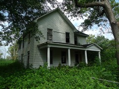 | Baynham House | building | 1978 | 78000579 |
| Chalk Bluff | site | 1974 | 74000470 | |
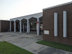 | Clay County Courthouse, Eastern District | building | 2018 | 100002945 |
 | Clay County Courthouse, Western District | building | 2018 | 100002946 |
| County Home Cemetery | site | 2005 | 04001495 | |
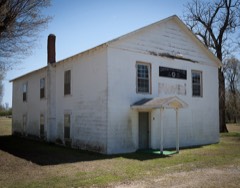 | Eastern Star Lodge 207 F&AM | building | 2002 | 02001074 |
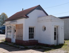 | Esso Station | building | 2000 | 00000604 |
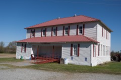 | Knob School-Masonic Lodge | building | 1991 | 91000679 |
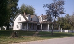 | Oliver House | building | 1978 | 78000578 |
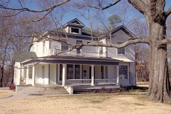 | Pfeiffer House and Carriage House | building | 1982 | 82002097 |
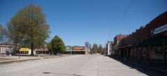 | Piggott Commercial Historic District | district | 2009 | 09000867 |
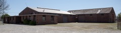 | Piggott National Guard Armory | building | 2006 | 06000440 |
 | Piggott Post Office | building | 1998 | 98000917 |
| Rector Commercial Historic District | district | 2009 | 09000369 | |
 | Rector Waterworks Building | building | 2009 | 09000312 |
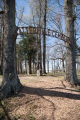 | Scatterville Cemetery | site | 1995 | 95000364 |
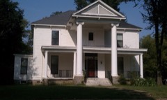 | Sheeks House | building | 1975 | 75000376 |
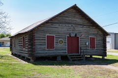 | Sink-Crumb Post No. 72 American Legion Hut | building | 2008 | 08000934 |
| Waddle House | building | 1977 | 77000246 |
Every wildfire the federal occurrence database records inside this county: 13 of them, burning about 257 acres. None started naturally and 1 was recorded as arson. Each settlement page carries the fires within five miles of it.
| Reported cause | Fires |
|---|---|
| Missing data/not specified/undetermined | 5 |
| Debris and open burning | 5 |
| Equipment and vehicle use | 1 |
| Arson/incendiarism | 1 |
| Smoking | 1 |
The five largest, by the area the report gives. One of them was set deliberately.
| Date | Cause | Size | Reported by | Name on the report |
|---|---|---|---|---|
| 12 April 2018 | Missing data/not specified/undetermined | 80 acres | Arkansas Forestry Commission | not named |
| 28 November 2017 | Missing data/not specified/undetermined | 60 acres | Arkansas Forestry Commission | not named |
| 25 August 1997 | Debris and open burning | 40 acres | Arkansas Forestry Commission | not named |
| 10 November 2005 | Debris and open burning | 20 acres | Arkansas Forestry Commission | not named |
| 27 February 2012 | Debris and open burning | 20 acres | Arkansas Forestry Commission | not named |
| 17 August 2001 | Missing data/not specified/undetermined | 15 acres | Arkansas Forestry Commission | not named |
| 29 August 1999 | Arson/incendiarism | 10 acres | Arkansas Forestry Commission | not named |
| 7 September 1999 | Smoking | 4.0 acres | Arkansas Forestry Commission | not named |
Every settlement page carries the fires within five miles of it - see the settlement index below.
The NOAA Storm Events Database holds 338 reports for this county, causing 3 deaths, 1 injury and about $25,530,530 in recorded property damage. Each settlement page carries the reports that name it.
| Kind of event | Reports |
|---|---|
| Thunderstorm Wind | 163 |
| Hail | 110 |
| Tornado | 27 |
| Flash Flood | 27 |
| Flood | 7 |
| Lightning | 2 |
| Heavy Rain | 2 |
The most serious of them, by death, then injury, then recorded damage. The accounts are quoted exactly as the forecast office filed them.
| When | Event | Place named | Harm | What the report says |
|---|---|---|---|---|
| May 1990 | Tornado (F2) | not stated | 1 killed, 1 hurt | no account filed |
| February 2018 | Tornado (EF2) | Knobel | 1 killed, $500,000 | The one fatality was east of Knobel Arkansas near the intersection of Highway 90 and Highway 135 in a mobile home. A few homes, trees and power poles were damaged as the tornado tracked toward the St. Francis River. The path was intermittent. The tornado continued into Dunklin County. |
| August 2011 | Lightning | Hargrave Corner | 1 killed | A lightning fatality occurred near Highway 49, east of Rector. The lightning victim was outdoors chopping cotton when he was struck and killed. |
| January 1999 | Tornado (F2) | Datto | $8,000,000 | The tornado developed east of Datto and moved northeast. Several homes were badly damaged. Several hangars were destroyed and some planes were destroyed at the Corning airport. |
| September 2012 | Tornado (EF2) | Corning Muni Arpt | $5,000,000 | A tornado briefly touched down southwest of the Corning Municipal Airport and traveled northeast across the northern portion of the airport. Two hangars were extensively damaged with a few others receiving minor damage. Many of the aircraft that were housed inside the hangar were heavily damaged as well. Two homes near the airport had windows blown out and a shed had the roof blown off. The tornado continued northeast crossing Highway 67. Power poles along the highway were knocked down. A clear path was seen in the bean field north of Highway 67. The tornado lifted near County Road 135. Large amounts of debris were found nearly 1.5 miles away from the airfield with one 930 pound piece of equipment found nearly a quarter of mile away from the building which it was being stored. |
| May 2011 | Flood | Pollard | $1,300,000 | Heavy rain during late April into the beginning of May caused the St. Francis River to rise above flood stage. The river rose to near record levels in the beginning of May and remained above flood stage through the end of May. A break in the levee in Butler County, Missouri, north of Clay County, caused some concern that additional flood water would move into Clay County. However, the water never made it into Clay County. A few homes sustained minor damage. Several roads were closed and/or sustained damage. Several hundred acres of cropland was flooded. A man drowned when his boat capsized in the flood waters. |
| April 2011 | Flood | Datto | $1,300,000 | Heavy rain brought the Black River near Corning to record levels in late April that continued into the beginning of May. The record crest surpassed the Flood of 1945. Shallow flooding extended for several miles away from the river. Several homes and businesses sustained minor damage from the flooding. Many roads and bridges were closed and/or damaged including Highway 62, Highway 67 and Highway 155. The Clay County Airport was flooded as well. |
| May 2011 | Flood | Datto | $1,300,000 | Heavy rain brought the Black River near Corning to record levels in late April that continued into the beginning of May. The record crest surpassed the Flood of 1945. Shallow flooding extended for several miles away from the river. Several homes and businesses sustained minor damage from the flooding. Many roads and bridges were closed and/or damaged including Highway 62, Highway 67 and Highway 155. The Clay County Airport was flooded as well. |
| May 2017 | Flood | Success | $1,000,000 | The Current River experienced a record flood upstream at Doniphan, MO in early May. The water moved downstream and caused the evacuation of Success, AR on May 1st. Highways 328 and 211 were flooded along with thousands of acres of farmland. The swiftness of the water deposited large amounts of sand and gravel across much of the farmland. Highway 67 south of Corning was flooded. |
| January 1999 | Tornado (F4) | Knobel | $1,000,000 | The tornado started southeast of Knobel and tracked northeast. The most serious damage occurred early in the life of the tornado. Two homes were destroyed on County Road 238. Several other homes were damaged. Two trailer trucks were rolled over. As the tornado continued east it gradually diminished in intensity. Several trees and power lines were knocked down along the way. |
| April 2014 | Flash Flood | St Francis | $685,000 | Several highway were flooded across Clay County. Heavy rain flooded Highway 62 in Northeast Arkansas. The highway was closed at the Missouri State line. Highway 119, Highway 90, Highway 49 and Highway 139 were also flooded. |
| May 2000 | Thunderstorm Wind | Countywide | $500,000 | A few structures were damaged. Several trees and power lines were blown down. Some of the downed trees fell on houses and vehicles. |
| November 1993 | Thunderstorm Wind | Corning | $500,000 | Thunderstorm winds blew down numerous trees. A number of buildings were damaged and several were destroyed. |
| June 2001 | Hail | Corning | $400,000 | Numerous homes and automobiles were damaged by hail. |
| March 2025 | Tornado (EF2) | Datto | $300,000 | This tornado touched down in Independence County and moved northeast across southern Sharp County where it reached a peak strength of EF-3 with peak winds of 165 mph in Cave City. The tornado then tracked across northwest Lawrence County and southeast Randolph County before exiting through the Reyno community and entering Clay County. A power pole was destroyed on County Road 112 and six empty grain bins were destroyed. The tornado weakened as it moved northeast, producing scattered tree damage as it crossed County Roads 110 and 125. A center irrigation pivot was overturned and several power poles were snapped where the tornado crossed Highway 67, approximately one mile west of the Corning Municipal Airport. An outbuilding was damaged near Highway 67, spreading metal debris in the field north of the airport. The damage became very sporadic from this point with only minor tree damage and some siding pulled off an outbuilding. The tornado lifted near the intersection of County Roads 147 and 154. Peak winds in Clay County were estimated at 120 mph. |
| March 2025 | Tornado (EF2) | Knobel | $250,000 | The tornado developed just east of Knobel, crossing Highway 90 and snapping several power poles. This tornado continued to track northeast, producing minor tree damage south and east of County Road 250. As the tornado approached the Walnut Grove community, it began to widen and intensify. Several outbuildings were destroyed at the intersection of County Road 250 and Highway 135. Eight wooden power poles were snapped along Highway 135. Just to the east of Highway 135, a large metal building structure was destroyed, a steel-reinforced awning was lifted and tossed, and several pieces of heavy farm machinery were overturned. The tornado gradually weakened as it moved northeast across open farmland, producing only sporadic, minor tree damage. A generator and pump were damaged just northwest of Hickoria with the tornado lifting near County Road 245. Peak winds were estimated at 135 mph. |
| April 2025 | Tornado (EF2) | Datto | $250,000 | The tornado crossed into Clay County from Randolph County at County Road 109. The tornado destroyed several grain bins as it entered Clay County. Additional damage to structures and trees was observed as the tornado moved northeast across the Heelstring area, including significant damage to a church and several residences along County Road 125 between County Roads 116 and 124. Mostly tree damage was noted along County Road 131, but several utility poles were snapped on County Road 139. Numerous trees and minor structure damage occurred on the western side of Corning Lake, with the final damage points along Elm St near and just east of County Road 173. Peak winds were estimated to be 115 mph in Clay County. |
| January 2013 | Thunderstorm Wind | Rector | $250,000 | Straight line winds damaged a couple farm buildings and overturned two irrigation pivots. |
| January 1964 | Tornado (F2) | not stated | $250,000 | no account filed |
| December 2009 | Flash Flood | Pollard | $241,000 | Heavy rain produced flash flooding north of Pollard. Highway 139 was covered by 3 feet of water and was closed as a result. |
| September 2006 | Flash Flood | Countywide | $202,000 | Heavy rains caused flash flooding to occur over much of Clay County. The towns of Piggott, Greenway, Pollard, and McDougal were especially hit hard. Highway 49 north of Greenway was completely submersed by flood waters. Water 6 inches deep covered many county roads. The city airport of Piggott was also underwater. A number of homes were also flooded. Officials estimated some 50 households were displaced by flooding. Many fall crops were devastated and heavy damage to roads and bridges also occurred across the county. 14 goats were killed by the flood waters near McDougal. Officials estimated about 22 roads were closed to flooding or bridge damage. In addition, a levee was breached along the Number Nine ditch between Pollard and Fagus. |
| March 2006 | Thunderstorm Wind | Piggott | $125,000 | Several businesses were damaged. The roof of a gas company building was blown off. Several trees fell on some houses. Several homes also had shingles blown off. An airplane was damaged at the Campbell Airport. Several telephone polls were knocked down. |
| April 2026 | Thunderstorm Wind | Piggott | $100,000 | Survey teams found substantial wind damage to trees and a few structures in the community of Piggott. Tree damage was relatively widespread, with numerous uprooted and downed trees. Minor structural damage and a few downed utility lines were also noted. The damage swath was approximately one mile wide, mainly affecting the northern side of town, with trees and debris blown to the southeast, consistent with an intense rear flank downdraft. Maximum wind speeds were estimated at around 80 mph. |
| April 2017 | Tornado (EF1) | Datto | $100,000 | A weak tornado touched down southeast of Datto and destroyed some grain bins. The tornado tracked northeast heavily damaging a mobile home and ripping much of the roof off another home. A few farm outbuildings were destroyed after the tornado crossed US highway 62/67. The tornado then lifted. Peak winds were estimated at 110 mph. |
| April 2008 | Thunderstorm Wind | Nimmons | $90,000 | Straight line winds sheared off the upper portion of a pine tree and struck a house on County Road 534. The eve trough was damaged as a result. Some shingle damage was also reported as well. A quarter mile west three barns were damaged at an unoccupied farm. Two were destroyed. The third barn had the front and rear doors blown out. In addition, an irrigation pivot was blown over and a power line was knocked down in the vicinity as well. |
| March 2006 | Thunderstorm Wind | Rector | $75,000 | A farm shop collapsed. A hangar and an airplane were damaged at the Rector Airport. A portion of the roof was damaged at Crockett Oil Company. Some trees and power lines were knocked down. |
| October 2004 | Tornado (F1) | Brookings | $75,000 | The tornado moved into Clay county from Randolph county and continued to move east. The tornado damaged a couple of cabins in Brookings and destroyed a small farm house near Peach Orchard. Two persons living in the farm house abandoned the house before the tornado struck. Several tombstones were blown down at a cemetery near Peach Orchard. Twelve utility poles were knocked down. Several trees were blown down and some soybean fields were damaged. |
| October 2014 | Tornado (EF0) | Mc Dougal | $70,000 | A tornado briefly touched down just north of Highway 62 near McDougal. Four homes sustained damage. The most significant damage was to a double wide mobile home which had half of the roof torn off. Several trees were knocked down with a few falling onto homes. |
| April 2006 | Hail | Knobel | $65,000 | no account filed |
| April 2017 | Thunderstorm Wind | Corning Muni Arpt | $60,000 | Roof blown off a home southwest of Corning. |
| April 2017 | Thunderstorm Wind | Corning Muni Arpt | $60,000 | House destroyed in Corning. |
| March 2026 | Tornado (EF1) | Rector Muni Arpt | $50,000 | A tornado touched down on county road 420 northwest of Rector, AR, where tree damage was observed. The tornado continued northeast, causing minor roof damage to a residence near the intersection of County Roads 420 and 418. In addition, roof uplift occurred to a metal outbuilding on the property. Damage was consistent with a 90 mph EF1 tornado. The tornado lifted shortly after crossing County Road 418. |
| August 2024 | Flash Flood | Rector | $50,000 | Several bridges were washed or under water between Rector and Greenway. |
| December 2015 | Flash Flood | Corning | $50,000 | Heavy rain resulting in flash flooding in the Corning area. Neighborhoods were flooded and cars stalled. |
| June 2013 | Flash Flood | Pollard | $50,000 | Three inches of rain fell in a span of 3 hours which caused a creek outside of Pollard to flood its banks. The water flooded a house as a result. |
| March 2008 | Flood | Datto | $50,000 | Heavy Rain produced flooding along the Black River and the river's tributaries in western portions of Clay County. Arkansas 211 was closed due to flooding from U.S. 67 to the Arkansas-Missouri Border near Success. Arkansas 280 near Brookings was also closed due to flooding. Clay County was declared a state disaster area. |
| May 2004 | Thunderstorm Wind | Rector | $50,000 | Some sheds were destroyed and several trailers were damaged. Numerous trees were knocked down. |
| January 2000 | Thunderstorm Wind | Hargrave Corner | $50,000 | A small shed was blown over. A few homes lost some shingles off their roofs. Several carports were blown off. Several trees and power lines were knocked down. |
| January 1999 | Tornado (F1) | Palatka | $50,000 | The tornado started east of Palatka and travelled northeast. Several homes were damaged in the area. |
| April 1998 | Thunderstorm Wind | Rector | $50,000 | One house was destroyed. A barn was spread out over a one-half mile area. Numerous trees were blown down. |
| April 1993 | Tornado (F0) | McDougal | $50,000 | An F0 tornado touched down briefly at McDougal. A barn was blown down. A house had several windows blown out as well as a television antenna knocked down. A small outbuilding was also destroyed. |
| November 1993 | Thunderstorm Wind | McDougal | $50,000 | Thunderstorm winds knocked down several trees and damaged a few buildings. |
| August 2019 | Thunderstorm Wind | Corning | $30,000 | Trees and power-lines down in the community of Corning. |
| April 2017 | Thunderstorm Wind | Mc Dougal | $30,000 | Grain bins and storage shed damaged. |
| September 2006 | Thunderstorm Wind | Corning | $30,000 | Straight line winds blew down several trees in Corning, some of which fell on homes. In addition, roofs were blown from homes and buildings. |
| April 2012 | Thunderstorm Wind | Boydsville | $25,000 | Straight line winds blew a roof and knocked down walls of a double wide mobile home along County Road 417 near Rector. |
| March 2006 | Thunderstorm Wind | Greenway | $25,000 | A newly constructed building had its roof and some large beams blown away into a field. Some power lines were also knocked down. |
| May 2003 | Thunderstorm Wind | Rector | $25,000 | A barn was destroyed. Several farm shops and barns were damaged. A car and a truck were also damaged. A patio cover was blown away. Some trees were uprooted and some utility poles were blown down. |
| November 2000 | Thunderstorm Wind | Rector | $25,000 | A barn was destroyed. A church steeple was torn off. Several trees and power lines were blown down. |
| September 2000 | Thunderstorm Wind | Piggott | $25,000 | A tree was blown down on top of a house. A few power lines were blown down. |
| February 1999 | Thunderstorm Wind | Corning | $25,000 | At least one home and several businesses lost part of their roofs. Several sheds were damaged. Several trees and power lines were blown down. |
| July 1999 | Thunderstorm Wind | Rector | $25,000 | A crop duster flipped over at the Rector airport. Several trees were knocked down. |
| November 1991 | Tornado (F1) | not stated | $25,000 | no account filed |
| April 1971 | Tornado (F1) | not stated | $25,000 | no account filed |
| January 2023 | Flash Flood | Holly Corner | $20,000 | County Road 450 was washed out just east of County Road 461. |
| February 2023 | Thunderstorm Wind | Corning | $20,000 | Several power poles were knocked down on both sides of Highway 67 just west of Corning. A portable storage building was also blown down. |
| March 2017 | Thunderstorm Wind | Piggott | $20,000 | Front of wooded retail building/overhang collapsed. |
| June 2009 | Thunderstorm Wind | Piggott | $20,000 | Winds were estimated at 70 mph in Piggott. A 31 ft. travel trailer was destroyed by the wind. |
| February 2001 | Thunderstorm Wind | Countywide | $20,000 | Some trees, power lines and power poles were knocked down. |
| January 1996 | Thunderstorm Wind | Rector | $20,000 | no account filed |
The Survey's mineral resources record lists 42 workings inside this county. 6 still produce and 36 are closed or unrecorded. Each settlement page carries the workings within five miles of it.
| Commodity | Workings |
|---|---|
| Sand and Gravel, Construction | 41 |
| Silica | 1 |
The least common of them first, because a county's hundredth gravel pit says nothing its first ten did not.
| Where | Site | Commodity | Status | Recorded |
|---|---|---|---|---|
| Piggott Prospect | Silica | Unknown | ||
| C Roberts Pit | Sand and Gravel, Construction | Past Producer | ||
| C Thomas Pit | Sand and Gravel, Construction | Past Producer | ||
| Clay County Pits | Sand and Gravel, Construction | Producer | ||
| I Golden | Sand and Gravel, Construction | Past Producer | ||
| I Stahl | Sand and Gravel, Construction | Past Producer | ||
| Johnson Pit | Sand and Gravel, Construction | Past Producer | ||
| Melvin Copeland Pit | Sand and Gravel, Construction | Producer | ||
| R Mulholen Pit | Sand and Gravel, Construction | Past Producer | ||
| Stahl Gravel Pit | Sand and Gravel, Construction | Producer | ||
| Stahl Gravel Pit | Sand and Gravel, Construction | Past Producer | ||
| Trs Trucking Pit | Sand and Gravel, Construction | Producer | ||
| Unk | Sand and Gravel, Construction | Unknown | ||
| Unk | Sand and Gravel, Construction | Unknown | ||
| Unk | Sand and Gravel, Construction | Unknown | ||
| Unk | Sand and Gravel, Construction | Unknown | ||
| Unk | Sand and Gravel, Construction | Unknown | ||
| Unk | Sand and Gravel, Construction | Unknown | ||
| Unk | Sand and Gravel, Construction | Unknown | ||
| Unk | Sand and Gravel, Construction | Unknown | ||
| Unk | Sand and Gravel, Construction | Unknown | ||
| Unk | Sand and Gravel, Construction | Unknown | ||
| Unk | Sand and Gravel, Construction | Unknown | ||
| Unk | Sand and Gravel, Construction | Unknown | ||
| Unk | Sand and Gravel, Construction | Unknown | ||
| Unk | Sand and Gravel, Construction | Unknown | ||
| Unk | Sand and Gravel, Construction | Unknown | ||
| Unk | Sand and Gravel, Construction | Unknown | ||
| Unk | Sand and Gravel, Construction | Unknown | ||
| Unk | Sand and Gravel, Construction | Unknown | ||
| Unk | Sand and Gravel, Construction | Unknown | ||
| Unk | Sand and Gravel, Construction | Producer | ||
| Unk | Sand and Gravel, Construction | Unknown | ||
| Unk | Sand and Gravel, Construction | Unknown | ||
| Unk | Sand and Gravel, Construction | Unknown | ||
| Unk | Sand and Gravel, Construction | Unknown | ||
| Unk | Sand and Gravel, Construction | Unknown | ||
| Unk | Sand and Gravel, Construction | Unknown | ||
| Unk | Sand and Gravel, Construction | Unknown | ||
| Unk | Sand and Gravel, Construction | Unknown | ||
| Unk | Sand and Gravel, Construction | Unknown | ||
| York Sand & Gravel Pit | Sand and Gravel, Construction | Producer |
Named settlements recorded in the Geographic Names Information System, each with the topographic sheets covering it. Villages, hamlets and abandoned places alike. Each is shown with the nearest named watercourse or landform and the survey quadrangle it falls on.
Payne-Swain township · 72461 · On Hampton Slough · Kennett North quadrangle
11 sheets, 1940 to 1984
Clark township · 72453 · On Little River · Peach Orchard quadrangle
14 sheets, 1935 to 1984
Payne-Swain township · 72454 · On Old River · Kennett North quadrangle
11 sheets, 1940 to 1984
Bradshaw-Haywood township · 72454 · On South Fork Big Creek · Pollard quadrangle
14 sheets, 1935 to 1984
Bradshaw-Haywood township · 72430 · On Quick Creek · Greenway quadrangle
12 sheets, 1940 to 1984
Bradshaw-Haywood township · 72430 · On Payne Creek · Greenway quadrangle
12 sheets, 1940 to 1984
No longer a settlement
East Oak Bluff-Blue Cane township · 72461 · Greenway quadrangle
12 sheets, 1940 to 1984
Gleghorn-South Kilgore township · 72422 · Peach Orchard quadrangle
14 sheets, 1935 to 1984
East Oak Bluff-Blue Cane township · 72461 · On White Walnut Creek · Senath quadrangle
12 sheets, 1934 to 1984
Johnson township · 72461 · On North Big Creek · Boydsville quadrangle
15 sheets, 1935 to 1984
Cache-Wilson township · 72435 · Knobel quadrangle
14 sheets, 1935 to 1984
No longer a settlement
Cleveland-North Kilgore township · 72422 · On Moark Ridge · Corning quadrangle
13 sheets, 1935 to 1984
Payne-Swain township · 72461 · On Hampton Slough · Kennett North quadrangle
11 sheets, 1940 to 1984
North St. Francis township · 72454 · On Sugar Creek · Piggott quadrangle
11 sheets, 1940 to 1984
Brown-Carpenter township · 72470 · Datto quadrangle
13 sheets, 1935 to 1984
No longer a settlement
Chalk Bluff-Liddell township · 72454 · On Old River · Piggott quadrangle
11 sheets, 1940 to 1984
Cache-Wilson township · 72435 · Knobel quadrangle
14 sheets, 1935 to 1984
No longer a settlement
Pollard township · 72456 · On Housman Creek · Pollard quadrangle
14 sheets, 1935 to 1984
No longer a settlement
The vanished settlements of Clay County: the places named above that are no longer on the map.