Block
From the record
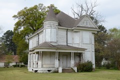
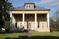
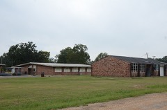
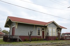
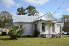
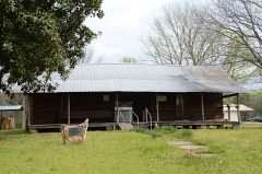
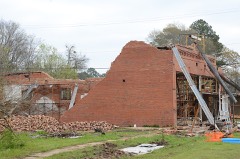
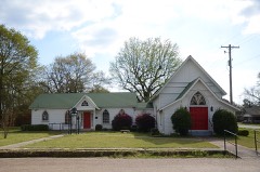
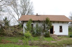
20 National Register listings published here.
Sources: the National Register database, National Park Service
72 topographic sheets cover 38 settlements here, and 20 properties are on the National Register of Historic Places.
20 National Register listings published here.
Sources: the National Register database, National Park Service
Every property in this county listed on the National Register of Historic Places, with the year it was listed and the federal nomination document.
Every wildfire the federal occurrence database records inside this county: 382 of them, burning about 5,339 acres. 32 started naturally and 128 were recorded as arson. Each settlement page carries the fires within five miles of it.
| Reported cause | Fires |
|---|---|
| Arson/incendiarism | 128 |
| Missing data/not specified/undetermined | 94 |
| Debris and open burning | 82 |
| Natural | 32 |
| Equipment and vehicle use | 27 |
| Recreation and ceremony | 8 |
| Smoking | 7 |
| Misuse of fire by a minor | 3 |
| Railroad operations and maintenance | 1 |
The five largest, by the area the report gives. 6 of them were set deliberately.
| Date | Cause | Size | Reported by | Name on the report |
|---|---|---|---|---|
| 13 September 2002 | Arson/incendiarism | 190 acres | Arkansas Forestry Commission | not named |
| 4 February 2001 | Arson/incendiarism | 175 acres | Arkansas Forestry Commission | not named |
| 27 December 2005 | Arson/incendiarism | 175 acres | Arkansas Forestry Commission | not named |
| 2 March 2006 | Arson/incendiarism | 161 acres | Arkansas Forestry Commission | not named |
| 10 August 2002 | Natural | 131 acres | Arkansas Forestry Commission | not named |
| 27 September 2002 | Arson/incendiarism | 130 acres | Arkansas Forestry Commission | not named |
| 13 September 1999 | Missing data/not specified/undetermined | 125 acres | Arkansas Forestry Commission | not named |
| 8 September 2011 | Arson/incendiarism | 124 acres | Arkansas Forestry Commission | RED BLUFF |
Every settlement page carries the fires within five miles of it - see the settlement index below.
The NOAA Storm Events Database holds 439 reports for this county, causing 5 deaths, 12 injuries and about $8,987,000 in recorded property damage. Each settlement page carries the reports that name it.
| Kind of event | Reports |
|---|---|
| Thunderstorm Wind | 190 |
| Hail | 184 |
| Flash Flood | 30 |
| Tornado | 24 |
| Lightning | 4 |
| Funnel Cloud | 4 |
| Flood | 3 |
The most serious of them, by death, then injury, then recorded damage. The accounts are quoted exactly as the forecast office filed them.
| When | Event | Place named | Harm | What the report says |
|---|---|---|---|---|
| October 2014 | Tornado (EF2) | Comet | 1 killed, 4 hurt, $200,000 | A tornado quickly spun up, embedded in a squall line across Little River County in Southwest Arkansas. A National Weather Service Storm Survey crew determined that an EF-2 tornado touched down 9 miles west of Ashdown, Arkansas near the Arden community. The tornado touched down just south of Hwy. 32 where it snapped and uprooted numerous trees. The tornado then crossed Hwy. 32 where it completely destroyed a mobile home with 5 family members inside. A 33 year old male was killed and a 34 year old female was critically injured after being thrown from the mobile home. Three children, a 16 year old female, an 11 year old male and a 6 year old male were injured when they were trapped in the debris. The tornado also damaged another nearby mobile home as it quickly moved northeast, lifting it as it crossed CR. 16. |
| April 1982 | Tornado (F3) | not stated | 1 killed, 2 hurt, $2,500,000 | no account filed |
| March 2006 | Lightning | Ashdown | 1 killed, $100,000 | Lightning struck a home causing a fire to ignite. One male, age 83 was killed as a result of the house fire. House sustained considerable damage. |
| June 2021 | Flood | Jewell | 1 killed, $2,000 | Widespread rainfall amounts of 3-6+ inches, with isolated amounts up to 10 inches, fell across Central and Southern McCurtain County Oklahoma on June 7th-8th, resulting in widespread flooding across these areas. This did result in considerable rises along the Little River some 40-50 river miles downstream at Horatio, AR (Sevier County), which crested at 30.89 feet on June 10th, 2021. This was just above the 30ft major flood stage, although impacts were mainly confined to considerable lowland flooding of several hundred acres of grazing and farmland, along with significant backwater flooding along the Cossatot River with its confluence with the Little River north of Wilton. This high water routed downstream along the Little River south of Horatio to just northwest of the Winthrop community in Northern Little River County, where a 63 year old white female tried to paddle a small boat down a country backroad off of LR-52 to her cabin along the Little River during the night of June 10th. Unfortunately, her boat capsized with the victim drowning due to the strong currents. Her body was not found until June 11th, after the Arkansas Game and Fish Commission initiated a search for her. |
| May 2015 | Flood | Lanesport | 1 killed | Excessive heavy rainfall during the month of May resulted in very high water on the Red River bordering Little River, Hempstead, Lafayette and Miller Counties in Southwest Arkansas as well as Bowie County in Northeast Texas. Rainfall amounts during the month of May across the Upper and Middle Red River basins of Southern Oklahoma and Northern Texas totaled over 20 inches of rain. This excessive heavy rainfall resulted in Red River levels that eclipsed the flood of May of 1990 at Pecan Point and was just shy of the Red River flood of May of 1908 at Pecan Point. Downstream of Pecan Point at Index, Arkansas, the Red River rose above the 25 foot flood stage on May 28th and remained above that flood stage through the end of the month. The Red River at Index, Arkansas went above the 30 foot major flood stage on May 29th and remained above that stage through the end of the month. The Red River at Index, Arkansas did not crest until the month of June, 2015 so final crest information will be contained in the June, 2015 Storm Data report. Thousands of acres of pasture and and farm land were flooded and livestock had to be evacuated. Bank erosion was extreme on the Little River, Hempstead, Lafayette and Miller County sides of the Red River as well as the Bowie County side of the river. Considerable backwater flooding of Walnut Bayou in Little River County was reported with farming and pasture land affected. The United States Highway 259 bridge, Hwy 8 bridge and the Hwy. 71 bridge going over the Red River were closed. On May 27th, three individuals headed out in a boat on the Little River side of the Red River. The boat capsized and the individuals were reported missing the next day. Two of the three individuals were rescued after they were heard screaming for help but one of the individuals drowned in the swift current. |
| October 1980 | Tornado (F2) | not stated | 2 hurt, $250,000 | no account filed |
| July 1975 | Tornado (F1) | not stated | 2 hurt, $25,000 | no account filed |
| December 1999 | Thunderstorm Wind | Ashdown | 1 hurt, $400,000 | John Moon, who lives near Hwy 108 West of Ashdown, had three chicken houses, one metal building and farm equipment destroyed and a fourth house damaged. In addition, he lost 44,000 two day old chicks with an estimated total damage of $350 thousand dollars. Moon was inside one of the chicken houses when the winds struck. A large fan fell on his back causing minor injuries. The winds also damaged the home of Ashdown Police Sargent Danny Hallet, Hwy 108 west of Ashdown. Windows were broken out on his patrol car and a camper trailer was overturned. Two other homes reported roof damage; several trees were uprooted and some snapped off above the ground accounting for the remainder of monetary loss. |
| May 1957 | Tornado (F2) | not stated | 1 hurt | no account filed |
| April 1982 | Tornado (F3) | not stated | $2,500,000 | no account filed |
| June 2015 | Flood | Lanesport | $1,000,000 | Excessive heavy rainfall during the month of May resulted in very high water on the Red River bordering Little River, Hempstead, Miller and Lafayette Counties in Southwest Arkansas as well as Bowie County in Northeast Texas during the entire month of June. Rainfall amounts during the month of May across the Upper and Middle Red River basins of Southern Oklahoma and Northern Texas totaled over 20 inches of rain. The Oklahoma state climatologist reported that May of 2015 was the all time wettest month of any month in state history. Lake Texhoma, a flood control reservoir to the Red River upstream of Arthur City, Texas rose to its highest pool stage on record early on June 1st at 645.66 feet with peak releases of around 140,000 CFS. The Muddy Boggy Creek tributary to the Red River rose to near its flood of record cresting near 55 feet earlier on May 29th with inflows upwards of 70,000 CFS into the Red River. Muddy Boggy Creek crested just shy of the 1990 flood of record with 55.27 feet near Unger, Oklahoma. Other tributaries of the Red River also crested at very high levels during the final week of May and early in June, 2015 below Lake Texhoma including Bois D'Arc and Bokchito Creeks. Finally the Kiamichi River at Hugo Reservoir crested just below a new pool stage record after May 25th and contributed peak releases of near 60,000 CFS as well to the Red River. This excessive heavy rainfall and inflow into the Red River resulted in river levels that eclipsed the flood of May of 1990 at Pecan Point and was just shy of the Red River flood of May of 1908 at Pecan Point. The Red River at Pecan Point north of Dekalb, Texas went above the 24 foot flood stage on May 10th, 2015 and remained above that flood stage through the entire month of June and did not fall below flood stage until until July, 2015. The Red River at Pecan Point north of Dekalb, Texas went above the 30 foot major flood stage on May 24th, 2015 and crested at a stage of 35.0 feet on June 2nd, 2015. This is the 3rd highest crest in recorded history at the gauging location, eclipsed only by the flood of record of 36.0 feet in 1938 and 35.5 feet in 1908. The river fell below the 30 foot major flood stage on June 10th. A secondary rise on the Red River developed because of excessive heavy rainfall once again in the middle Red River Basin from the remnants of Tropical Storm Bill. As a result, the Red River at Pecan Point north of Dekalb, Texas went back above the 30 foot major flood stage on June 22nd and crested at a stage of 32.5 feet on June 24th. The Red River then fell below the 30 foot major flood stage on June 28th. Below Pecan Point north of Dekalb, Texas, the Red River at Index, Arkansas crested at 31.4 feet on June 3rd. This was the 3rd highest flood at Index, Arkansas in recorded history at the gauging location, eclipsed only by the flood of record of 34.4 feet in 1938 and 32.3 feet in 1990. The river fell below the 28 foot major flood stage on June 8th. A secondary rise on the Red River developed because of excessive heavy rainfall once again in the middle Red River Basin from the remnants of Tropical Storm Bill. As a result, the Red River at Index, Arkansas crested again at 26.6 feet on June 27th and fell below the 25 foot flood stage on June 29th. Bank erosion was extreme on the Little River County side of the Red River with nearly 100 thousand acres of farmland and pastureland inundated. Additional acres flooded by high levels on the Little River and Millwood Lake areas totaled 56,000 acres. Nearly 10 thousand heads of cattle had to be relocated with some lost. The United States Highway 259 bridge, Hwy 8 bridge and the Hwy. 71 bridge going over the Red River were closed. Highway 41 Section 3 at the junction of Hwy. 32 to the Red River Bridge was closed as was Hwy. 108, Section 1 near Foreman. As many as 80 homes were affected by flood waters with 28 homes inundated. A Federal Disaster Declaration was issued for Little River and Miller Counties in Southwest Arkansas for the Red River flooding event of 2015. |
| April 2011 | Thunderstorm Wind | Ashdown | $500,000 | A downburst occurred on the southwest side of Ashdown which resulted in numerous trees and powerlines to be snapped in the town of Ashdown. As many as 50 county and city roads were closed in Little River County from the damaging winds which started approximately 8AM west of Ashdown. In the town of Ashdown trees were noted to point NE and N away from the downburst region very indicative of a strong straight line wind. Damage included numerous homes and businesses as well as a school. Very little structural damage occurred from the wind alone. Most of the damage was the result of falling trees. Maximum winds are estimated at 95-105 mph. |
| March 2008 | Flash Flood | Pine Prairie | $250,000 | Heavy rainfall flooded and washed out several county roads across the southern portion of the county. Several recreational facilities surrounding Lake Millwood also had to be closed. Flooding was particularly bad in the Cerrogordo area of northern Little River county. Pine prairie Road in the southern portion of the county was also flooded. Other roads across the county that were flooded included County Roads 15, 23, 29, 42, 56 and 59. |
| April 1954 | Tornado (F3) | not stated | $250,000 | no account filed |
| June 2003 | Thunderstorm Wind | Ashdown | $150,000 | Numerous trees down and numerous trees had their tops blown off. A roof was torn off a house and a telephone pole fell on a car. |
| May 2009 | Flash Flood | Wilton | $100,000 | Flash flood waters beginning to enter a few homes in Ashdown, Arkansas. |
| May 2009 | Flash Flood | Ashdown | $100,000 | Hwy. 71 near the paper mill was flooded and closed. Heavy rainfall plummeted through the roof of the planned Two Rivers Museum annex, soaking museum artifacts and exhibits. The Central Baptist Church and several other homes sustained water damage from the high waters that clogged city drainage ditches. Rainwater also backed up into a mobile home park near the Arkansas 32 Bypass causing some flooding concerns. |
| December 2012 | Thunderstorm Wind | Foreman | $60,000 | Structural damage was reported to several properties across the Foreman, Arkansas area. There were no reports of injuries. |
| May 2006 | Thunderstorm Wind | Ashdown | $50,000 | Several trees downed across the county including trees that fell across two homes in Ashdown. |
| June 2004 | Thunderstorm Wind | Winthrop | $50,000 | Numerous trees downed. Structural damage to a paper mill. 2 metal buildings were also destroyed. |
| April 1994 | Thunderstorm Wind | Foreman | $50,000 | Thunderstorm winds downed several trees. |
| June 1994 | Thunderstorm Wind | Foreman | $50,000 | Thunderstorm winds downed trees and power lines along Highway 41. |
| November 1994 | Thunderstorm Wind | Richmond | $50,000 | Thunderstorm winds blew down numerous trees. |
| August 1993 | Thunderstorm Wind | Richmond | $50,000 | Thunderstorm winds blew down numerous trees. |
| May 1993 | Thunderstorm Wind | Arden | $50,000 | Thunderstorm winds damaged a garage and knocked down numerous trees. |
| January 2018 | Tornado (EF1) | Lanesport | $40,000 | An EF-1 tornado with maximum estimated winds between 100-110 mph touched down on the Legacy Ranch along County Road 1 in Southern Little River County, bending the fence, stripping the siding and roofing material on a large barn, and flipping two semi trailers on their side. The tornado then moved northeast across County Road 4 and Highway 41, snapping power poles and trees. As the tornado continued moving northeast, several trees were snapped and uprooted as it entered the Wallace community. The First Baptist Church in Wallace lost several shingles, and several homes sustained minor roof damage along Highway 32, County Road 10, and County Road 76, primarily losing shingles. Two additional outbuildings and barns sustained minor damage. The tornado finally lifted just north of County Road 76. |
| December 2015 | Thunderstorm Wind | Foreman | $30,000 | An NWS Storm Survey team determined that damage northeast of Foreman, Arkansas was consistent with that of straight line wind damage. This damage included several trees were snapped and/or uprooted. The metal roofing of a mobile home was peeled back. Two outbuildings were destroyed. Damage was the most concentrated near the intersection of CR. 153 and AR. 108 as well as CR. 345 and CR. 51. |
| April 2011 | Tornado (EF1) | Peytonville | $25,000 | The National Weather Service conducted a storm survey in Little River County Arkansas and concluded that the bulk of the storm damage was the result of a downburst and straight line winds. Howeverfurther investigation of the damage area southeast of Ashdown indicate damage from an EF1 tornado. The tornado touched down at around 8:10 AM, on the southeast side of Ashdown along Hwy 32. The tornado snapped and uprooted trees along CR 700 where a metal building with steel beam frame was completely destroyed. Tornado evidence is more conclusive east of this area where trees were uprooted and snapped along a convergent path. The tornado continued east south of hwy 32 snapping more trees and collapsing a carport. The tornado crossed CR 35 snapping a few trees before lifting. Maximum winds are estimated at 95-105 mph. |
| May 2015 | Flash Flood | Cross Rds | $20,000 | A bridge was washed out on Hwy. 234 near Billingsly Corner in the Winthrop community. |
| March 2008 | Tornado (EF0) | Pine Prairie | $20,000 | An EF0 tornado occurred southwest of Ashdown, Arkansas, damaging a metal building, some farm equipment and some trees. Trees were uprooted along Little River Road 23. The path was approximately 3 miles long and 100 yards wide. |
| May 2007 | Thunderstorm Wind | Foreman | $20,000 | Trees down and a barn destroyed along Hwy 41 north of Foreman. |
| October 2014 | Tornado (EF0) | Oak Hill | $10,000 | An National Weather Service Storm Survey team determined that a brief and weak EF-0 tornado touched down south of CR 108 where it snapped a number of trees and destroyed a barn. |
| September 2000 | Thunderstorm Wind | Foreman | $10,000 | Numerous trees and power lines down. A tin roof was blown off of a church. |
| November 1996 | Thunderstorm Wind | Ashdown | $10,000 | no account filed |
| April 2021 | Tornado (EF1) | Richmond | $5,000 | A brief EF-1 tornado with estimated maximum winds near 90 mph touched down near Little River 21 and the intersection of Little River 15 and Little River 713, where an area of concentrated convergent tree damage occurred in the midst of much wider straight line wind damage throughout the southern portion of Little River County. Damage to structures in the tornado path was very minimal. It is possible that the tornado path extends farther than what the storm survey indicated, but the actual survey length was limited by road access. |
| May 1994 | Thunderstorm Wind | Critten Ridge | $5,000 | Thunderstorm winds blew down several trees. |
| June 1994 | Thunderstorm Wind | Richmond | $5,000 | Thunderstorm winds blew down several trees. |
| October 1994 | Thunderstorm Wind | Richmond | $5,000 | Thunderstorm winds downed several trees. |
| October 1993 | Thunderstorm Wind | Red Bluff | $5,000 | Thunderstorm winds knocked down some trees. |
| November 1993 | Thunderstorm Wind | Red Bluff | $5,000 | Thunderstorm winds knocked down several trees. |
| August 1993 | Thunderstorm Wind | Wilton | $5,000 | Several trees were downed. |
| May 1993 | Thunderstorm Wind | Ashdown | $5,000 | Thunderstorm winds partially destroyed a barn. |
| August 1993 | Thunderstorm Wind | Foreman | $5,000 | Thunderstorm winds downed several trees. |
| October 1993 | Thunderstorm Wind | Foreman | $5,000 | Thunderstorm winds blew down several trees. |
| November 1973 | Tornado (F2) | not stated | $2,500 | no account filed |
| March 1971 | Tornado (F1) | not stated | $2,500 | no account filed |
| August 1964 | Tornado (F1) | not stated | $2,500 | no account filed |
| May 2020 | Tornado (EF0) | Red Bluff | $2,000 | An EF-0 tornado with estimated maximum winds near 70 mph very briefly touched down at a residence off of LR-239 in extreme Southeast Little River County. This tornado partially damaged the roof of a single family home and downed multiple large tree branches before lifting. |
| August 1999 | Lightning | Ashdown | $2,000 | Lightening hit a vent pipe starting a fire in the attic of a residence. Damage was light with a little smoke damage and smoke water damage. |
| November 2011 | Tornado (EF0) | Jewell | $1,000 | The tornado touched down southwest of Horatio, Arkansas, just west of Hwy. 41 where numerous trees were snapped. The tornado crossed Hwy. 41, snapping additional trees and ripping shingles off of the roof of a home. The tornado continued northeast, finally lifting on the east side of the Little River in Sevier County, Arkansas. Maximum winds were estimated at 70-75 mph. |
| June 2007 | Lightning | Ashdown | $1,000 | Lightning struck a transformer resulting in power outages. |
| March 1996 | Lightning | Ashdown | $1,000 | no account filed |
| October 1994 | Thunderstorm Wind | Red Bluff | $500 | Thunderstorm winds blew down a few trees. |
| March 2026 | Thunderstorm Wind | Cerrogordo | - | Three structures were damaged near the Arkansas/Oklahoma state line. |
| March 2026 | Thunderstorm Wind | Foreman | - | Large limbs downed near County Road 1 just outside of Foreman. |
| May 2025 | Thunderstorm Wind | Millwood Lake | - | A tree was blown down on Old Millwood Road along Millwood Lake. |
| May 2025 | Thunderstorm Wind | Cross Rds | - | A tree was downed near Winthrop. |
| March 2025 | Thunderstorm Wind | Wallace | - | Tractor trailer blown over near the intersection of Highway 41 South and County Road 4. |
| March 2025 | Thunderstorm Wind | Rocky Comfort | - | Several trees were downed across Little River County. |
| April 2025 | Thunderstorm Wind | Foreman | - | A NWS Survey Team concluded that a large swath of straight line winds with estimated wind gusts between 80-90 mph began in the Lime Rock Hill area just south of Foreman, and continued into the Gum Flats to the northeast side of Foreman. The damage path began along Highway 108 West between South 1st Street and South Bell Street where numerous large trees were uprooted or snapped. Sporadic damage continued northeastward, crossing Highway 41 South, with additional damage noted along Highway 108 east of Foreman across County Road 51 North to County Road 153. The vast majority of the tree damage along this path was oriented to the northeast. The maximum path width of these straight line winds was approximately 650 yards. |
The Survey's mineral resources record lists 55 workings inside this county. 5 still produce and 50 are closed or unrecorded. Each settlement page carries the workings within five miles of it.
| Commodity | Workings |
|---|---|
| Sand and Gravel, Construction | 46 |
| Limestone, General | 4 |
| Clay | 2 |
| Clay, Sand and Gravel, Construction | 1 |
| Sand and Gravel, Construction, Stone, Crushed/Broken | 1 |
| Stone | 1 |
| Calcium | 1 |
| Stone, Crushed/Broken | 1 |
The least common of them first, because a county's hundredth gravel pit says nothing its first ten did not.
| Where | Site | Commodity | Status | Recorded |
|---|---|---|---|---|
| Arkansas Louisiana Cement Plant | Stone, Crushed/Broken | Producer | ||
| Foreman Limestone Quarry | Stone, Clay | Producer | ||
| Foreman Quarry & Plant | Sand and Gravel, Construction, Stone, Crushed/Broken | Producer | ||
| Unk | Clay, Sand and Gravel, Construction | Past Producer | ||
| Unk | Calcium | Past Producer | ||
| Unk | Sand and Gravel, Construction, Clay | Past Producer | ||
| Arkansas Lousiana Limes | Limestone, General | Producer | ||
| Rocky Comfort | Limestone, General | Past Producer | ||
| Unk | Limestone, General | Past Producer | ||
| Unk | Limestone, General | Past Producer | ||
| J Dreher | Sand and Gravel, Construction | Past Producer | ||
| Unk | Sand and Gravel, Construction | Occurrence | ||
| Unk | Sand and Gravel, Construction | Past Producer | ||
| Unk | Sand and Gravel, Construction | Past Producer | ||
| Unk | Sand and Gravel, Construction | Past Producer | ||
| Unk | Sand and Gravel, Construction | Past Producer | ||
| Unk | Sand and Gravel, Construction | Past Producer | ||
| Unk | Sand and Gravel, Construction | Past Producer | ||
| Unk | Sand and Gravel, Construction | Past Producer | ||
| Unk | Sand and Gravel, Construction | Past Producer | ||
| Unk | Sand and Gravel, Construction | Past Producer | ||
| Unk | Sand and Gravel, Construction | Past Producer | ||
| Unk | Sand and Gravel, Construction | Past Producer | ||
| Unk | Sand and Gravel, Construction | Past Producer | ||
| Unk | Sand and Gravel, Construction | Past Producer | ||
| Unk | Sand and Gravel, Construction | Past Producer | ||
| Unk | Sand and Gravel, Construction | Past Producer | ||
| Unk | Sand and Gravel, Construction | Past Producer | ||
| Unk | Sand and Gravel, Construction | Past Producer | ||
| Unk | Sand and Gravel, Construction | Past Producer | ||
| Unk | Sand and Gravel, Construction | Past Producer | ||
| Unk | Sand and Gravel, Construction | Past Producer | ||
| Unk | Sand and Gravel, Construction | Past Producer | ||
| Unk | Sand and Gravel, Construction | Past Producer | ||
| Unk | Sand and Gravel, Construction | Past Producer | ||
| Unk | Sand and Gravel, Construction | Past Producer | ||
| Unk | Sand and Gravel, Construction | Past Producer | ||
| Unk | Sand and Gravel, Construction | Past Producer | ||
| Unk | Sand and Gravel, Construction | Past Producer | ||
| Unk | Sand and Gravel, Construction | Past Producer | ||
| Unk | Sand and Gravel, Construction | Past Producer | ||
| Unk | Sand and Gravel, Construction | Past Producer | ||
| Unk | Sand and Gravel, Construction | Past Producer | ||
| Unk | Sand and Gravel, Construction | Past Producer | ||
| Unk | Sand and Gravel, Construction | Past Producer | ||
| Unk | Sand and Gravel, Construction | Past Producer | ||
| Unk | Sand and Gravel, Construction | Past Producer | ||
| Unk | Sand and Gravel, Construction | Past Producer | ||
| Unk | Sand and Gravel, Construction | Past Producer | ||
| Unk | Sand and Gravel, Construction | Past Producer | ||
| Unk | Sand and Gravel, Construction | Past Producer | ||
| Unk | Sand and Gravel, Construction | Past Producer | ||
| Unk | Sand and Gravel, Construction | Past Producer | ||
| Unk | Sand and Gravel, Construction | Past Producer | ||
| Wilton Pits & Plant | Sand and Gravel, Construction | Producer |
Named settlements recorded in the Geographic Names Information System, each with the topographic sheets covering it. Villages, hamlets and abandoned places alike. Each is shown with the nearest named watercourse or landform and the survey quadrangle it falls on.
District 1 · 71866 · On Caney Creek · Cerrogordo quadrangle
11 sheets, 1951 to 1990
District 4 · 71822 · Falls Chapel quadrangle
11 sheets, 1950 to 1990
No longer a settlement
District 1 · 71866 · On Caney Creek · Cerrogordo quadrangle
11 sheets, 1951 to 1990
No longer a settlement
District 9 · 71822 · On Bell Branch · Ashdown East quadrangle
11 sheets, 1950 to 1990
The vanished settlements of Little River County: the places named above that are no longer on the map.