 Block
From the record
15 National Register listings published here.
Sources: the National Register database, National Park Service
80 topographic sheets cover 55 settlements here, and 15 properties are on the National Register of Historic Places.
15 National Register listings published here.
Sources: the National Register database, National Park Service
Every property in this county listed on the National Register of Historic Places, with the year it was listed and the federal nomination document.
| Photograph | Property | Type | Listed | Reference |
|---|---|---|---|---|
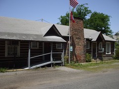 | American Legion Hut-Des Arc | building | 1995 | 95000692 |
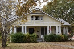 | Bethel House | building | 1982 | 82000872 |
 | Bedford Brown Bethell House | building | 1978 | 78000619 |
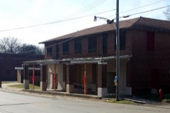 | Castleberry Hotel | building | 2007 | 07000960 |
 | De Valls Bluff Waterworks | structure | 2007 | 07000969 |
| Des Arc High School Home Economics Building | building | 2021 | 100006928 | |
 | First Presbyterian Church | building | 1990 | 90000897 |
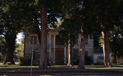 | Frith-Plunkett House | building | 1982 | 82002127 |
 | Kocourek and Son Hardware | building | 2015 | 15000257 |
 | Oak Grove Cemetery | site | 2001 | 01000507 |
 | Prairie County Courthouse | building | 1977 | 77000266 |
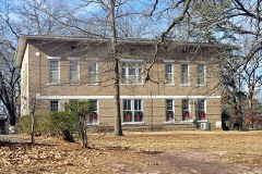 | Prairie County Courthouse | building | 1995 | 95000457 |
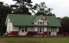 | Rock Island Depot | building | 1987 | 87002285 |
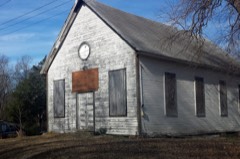 | St. Elizabeth's Catholic Church | building | 2009 | 09000744 |
| Wingmead | district | 2011 | 11000302 |
Every wildfire the federal occurrence database records inside this county: 45 of them, burning about 1,040 acres. None started naturally and 7 were recorded as arson. Each settlement page carries the fires within five miles of it.
| Reported cause | Fires |
|---|---|
| Debris and open burning | 26 |
| Missing data/not specified/undetermined | 8 |
| Arson/incendiarism | 7 |
| Equipment and vehicle use | 2 |
| Railroad operations and maintenance | 1 |
| Smoking | 1 |
The five largest, by the area the report gives. None of them was recorded as arson.
| Date | Cause | Size | Reported by | Name on the report |
|---|---|---|---|---|
| 14 October 2017 | Missing data/not specified/undetermined | 238 acres | Arkansas Forestry Commission | not named |
| 14 February 2015 | Debris and open burning | 117 acres | Arkansas Forestry Commission | not named |
| 30 September 2000 | Debris and open burning | 98 acres | Arkansas Forestry Commission | not named |
| 21 February 2014 | Debris and open burning | 85 acres | Arkansas Forestry Commission | PRA1196619 |
| 5 October 2000 | Debris and open burning | 60 acres | Arkansas Forestry Commission | not named |
| 20 November 2014 | Equipment and vehicle use | 59 acres | Arkansas Forestry Commission | PRA419837 |
| 25 December 2014 | Debris and open burning | 41 acres | Arkansas Forestry Commission | PRA4378831 |
| 29 June 1992 | Debris and open burning | 40 acres | Central Arkansas Refuges Complex | GEORGE 1 |
Every settlement page carries the fires within five miles of it - see the settlement index below.
The NOAA Storm Events Database holds 402 reports for this county, causing 7 deaths, 42 injuries and about $68,824,100 in recorded property damage. Each settlement page carries the reports that name it.
| Kind of event | Reports |
|---|---|
| Thunderstorm Wind | 166 |
| Hail | 92 |
| Flood | 58 |
| Tornado | 36 |
| Flash Flood | 35 |
| Funnel Cloud | 7 |
| Heavy Rain | 5 |
| Lightning | 3 |
The most serious of them, by death, then injury, then recorded damage. The accounts are quoted exactly as the forecast office filed them.
| When | Event | Place named | Harm | What the report says |
|---|---|---|---|---|
| March 1952 | Tornado (F2) | not stated | 5 killed, 15 hurt, $250,000 | no account filed |
| March 1952 | Tornado | not stated | 1 killed, 5 hurt, $2,500 | no account filed |
| May 2011 | Flood | Hickory Plains | 1 killed, $15,000,000 | Part of U.S. Highway 70 was closed by flooding, as were parts of Arkansas Highways 11, 33, and 38. Part of the asphalt pavement on U.S. Highway 70 was scoured away by the water between DeValls Bluff and Biscoe. The force of the water left holes two feet deep on Arkansas Highway 38 in the northern part of the county. Dozens of houses flooded in the Des Arc area and evacuations were necessary in DeValls Bluff. Altogether, more than 270 homes in the county suffered flood damage. On the 4th, a 53 year-old man was found drowned near his home in the North Side community near Des Arc. On the 4th, westbound lanes of Interstate 40 near Biscoe were closed when the White River overflowed onto the freeway. Motorists traveling from Memphis to Little Rock had to exit the interstate at Brinkley, take U.S. Highway 49 north to Fair Oaks, then U.S. Highway 64 to Bald Knob, then U.S. Highway 67/167 to Little Rock. This detour was about 120 miles long. On the 5th, the flood waters overtook the eastbound lanes of the interstate, making it the first time that the interstate had ever been closed by flooding on the White River. Motorists exited the interstate at Hazen and took U.S. Highway 63 to Stuttgart, then U.S. Highway 165 to DeWitt, then Arkansas Highway 1 back to the interstate at Forrest City. The eastbound detour lasted only one day before the White River flooded Arkansas Highway 1 at the Arkansas/Monroe County line and a new detour had to be established. The new detour took cars from Interstate 40 south on U.S. Highway 63 to Stuttgart, east on U.S. Highway 79 to U.S. Highway 49, and then north on 49 back to the interstate. Because the bridge over the White River is old and narrow with very narrow shoulders, trucks were unable to use this route and had to take a much longer detour. Trucks went south to Dumas via U.S. Highways 63, 79, and 65 or via U.S. Highways 63 and 165. From Dumas, the trucks followed U.S. Highway 65 south all the way to Lake Village, crossed the Mississippi River on U.S. Highway 82 through Greenville, Mississippi, and then turned north on U.S. Highway 61 to Memphis. Altogether, the truck detour added about 300 miles onto the trip from Little Rock to Memphis. Water on I-40 eventually rose to the top of the concrete wall in the median. The eastbound lanes of Interstate 40 reopened on the 9th, followed by the westbound lanes on the 11th. Flooding in Prairie County continued into June. |
| March 1950 | Tornado (F3) | not stated | 20 hurt, $250,000 | no account filed |
| March 1996 | Thunderstorm Wind | Des Arc | 1 hurt | no account filed |
| March 1986 | Thunderstorm Wind | not stated | 1 hurt | no account filed |
| November 1988 | Tornado (F2) | not stated | $25,000,000 | no account filed |
| October 2004 | Tornado (F2) | Fairmont | $12,200,000 | The F2 tornado moved from Lonoke County into Prairie County about 6.1 miles west-southwest of the Fairmount Community. The tornado gained intensity as it tracked to the east-northeast and then to the east as it approached the Stuttgart Airport. The tornado continued to track to the east before lifting east-northeast of the town of Ulm. The maximum damage was observed at the airport where numerous planes were damaged or destroyed. Damage at the airport was estimated at just over 12 million dollars. Also, most of the hangers and other buildings on the airport property sustained damage. Elsewhere along the path of the tornado, many power poles were snapped off or blown down. Metal irrigation pipe was carried for a mile and deposited in the field. Numerous outbuildings and farm shops were destroyed or damaged. A combine was destroyed and another was badly damaged. A farm tractor was destroyed as well. In the town of Ulm, a number of trees had large limbs broken and there was minor damage to house roofs. Underpinning was also blown out from under several mobile homes. The tornado weakened considerably before reaching Ulm. |
| March 2008 | Flood | Enarc | $10,000,000 | Heavy rain caused the White River at Des Arc to go above major flood level. This was the highest the river had been since April, 1973. The river was at minor flood level at the beginning of the month and continued to rise throughout most of the month due to the heavy rains. Substantial portions of the towns of Des Arc and DeValls Bluff were flooded, as were portions of U.S. Highway 70 near DeValls Bluff. Arkansas Highways 11, 38, and 33 were flooded in and near Des Arc. Riverfront Park on the east bank of the White River flooded. Some 80 homes, campers and cabins were flooded along Bayou Des Arc and at Spring Lake east of Des Arc. There were also about 20 to 30 homes flooded in and near DeValls Bluff. Low areas in the Spring Lake and Horn Lake areas on to the east, and Leisure Acres north of Des Arc were underwater. Many residences on Webb Road were flooded. First Street in Des Arc was flooded. Agricultural losses to winter wheat were also noted. The flooding continued into April. |
| July 2008 | Heavy Rain | Biscoe | $1,200,000 | Heavy rain contributed to a fiery pile-up on Interstate 40 near mile marker 203. When the heavy rain began, one vehicle tried to pull onto the shoulder. That vehicle was rear-ended, and in the ensuing chain-reaction, six tractor-trailers and three cars were destroyed. A large fire ensued. Ten fire engines and rescue trucks responded with a total of 28 firefighters. Eight people were injured in the crash, two of them critically. The westbound lanes of the interstate were blocked for more than 4 1/2 hours. |
| December 2009 | Flood | Hickory Plains | $1,000,000 | Flash flooding, which developed early on the morning of the 24th, became widespread areal flooding later in the morning on the 24th and continued into Christmas morning. Numerous county roads and state highways were flooded. Approximately 25 homes were damaged. |
| May 2011 | Flash Flood | Hickory Plains | $325,000 | Numerous county roads were flooded. Arkansas Highway 38 between Johnson Chapel and Hickory Plains was heavily flooded and closed. Parts of Arkansas Highway 11 were also closed. |
| May 2012 | Lightning | Hickory Plains | $300,000 | Lightning struck a church, resulting in a fire. The church was destroyed. |
| December 2009 | Flash Flood | Hickory Plains | $250,000 | Widespread heavy rain led to the development of flash flooding early on the morning of the 24th. |
| April 2008 | Flood | Jasmine | $250,000 | Major flooding continued in April from the initial heavy rain event in the middle of March. Additional heavy rainfall in April both prolonged the event and raised crests to just over the levels attained in March. The river fell out about three feet in between crests of 33.74 feet on March 26th and 33.78 feet on April 17th. Both crests were the highest the White River at Des Arc had been since April, 1973. Damages were primarily to whatever recovery efforts had been made since the March flooding. Arkansas Highways 11, 33, and 38 were closed again by high water. The White River at Des Arc remained above flood stage into May. |
| March 1989 | Tornado (F1) | not stated | $250,000 | no account filed |
| April 1985 | Tornado (F2) | not stated | $250,000 | no account filed |
| April 1982 | Tornado (F2) | not stated | $250,000 | no account filed |
| April 1978 | Tornado (F2) | not stated | $250,000 | no account filed |
| March 2008 | Flash Flood | Stuttgart Muni Arpt | $100,000 | Some of the dirt roads were closed due to flooding. Arkansas Highway 323 was under water south of Des Arc. Flooding occurred on 8th Street in Des Arc. |
| June 2008 | Thunderstorm Wind | Des Arc | $100,000 | Trees were down. One tree was on a house. Signs were knocked down near the baseball field and transformers were knocked out. |
| September 2012 | Thunderstorm Wind | Des Arc | $75,000 | Many large trees were blown down, as were power lines. Minor damage occurred to one house and mobile home due to falling trees, while another house had more extensive damage. |
| August 2009 | Thunderstorm Wind | Des Arc | $75,000 | The roof of the high school was damaged. Part of the roof and the smokestack on a riverboat restaurant were blown off. A large tree and some power lines were blown down. Downtown Des Arc was without power for most of the day. |
| October 2009 | Flash Flood | Hickory Plains | $70,000 | Flash flooding caused damage to a number of county roads. The intersection of Arkansas Highways 249 and 302 flooded. |
| June 2014 | Flash Flood | Hickory Plains | $60,000 | Little Dixie measured 10.32 inches of rain and Des Arc collected 4.75 inches. Part of Arkansas 11 north of Des Arc flooded, along with numerous county roads. Farm fields were flooded, as well. The University of Arkansas Cooperative Extension Service reported that 5,000 acres of soybeans and rice were flooded in the county. |
| October 2007 | Thunderstorm Wind | Des Arc | $60,000 | A large metal shop building was destroyed. Flying debris from the building struck the adjacent house, sending a board through a wall and knocking out windows. |
| May 2022 | Thunderstorm Wind | Hazen | $50,000 | Social media showed a picture of a tree that was blown onto an Airstream trailer, significantly damaging the trailer. No injuries were reported. Time is based on radar data. |
| April 2022 | Tornado (EF0) | Four Mile Corner | $50,000 | A video posted to social media showed a brief weak tornado south of Des Arc. The tornado initially began in a farm field near the intersection of North Simmons Road and East Skarda Road. It affected farming facilities on East Skarda Road, blowing the roof and doors off of a farm shop. It also blew propane tanks out of the shop. Two trees were blown over, and multiple power poles were snapped in two. It then lifted shortly after hitting the farm shop. |
| July 2018 | Thunderstorm Wind | Hickory Plains | $50,000 | Several silos were damaged, and limbs were downed. |
| May 2010 | Thunderstorm Wind | Hazen | $50,000 | Trees were blown down, flagpoles were snapped, and several homes were damaged in Hazen. |
| May 2008 | Thunderstorm Wind | Hayley | $50,000 | A shop was destroyed. A mobile home was overturned and the roof was blown off of another mobile home. A couple of trees and some limbs were down. |
| June 1994 | Thunderstorm Wind | Des Arc | $50,000 | Thunderstorm winds destroyed a small airplane hangar, damaged a cotton trailer and blew down several tree limbs. |
| July 1994 | Thunderstorm Wind | Biscoe | $50,000 | Thunderstorm winds destroyed several large utility buildings. |
| June 1994 | Thunderstorm Wind | Hazen | $50,000 | Several trees were blown down and some roofs were damaged. |
| June 1994 | Thunderstorm Wind | Slovak | $50,000 | Thunderstorm winds downed some trees and damaged several roofs. |
| June 1994 | Thunderstorm Wind | Fairmont | $50,000 | Thunderstorm winds up to 100 mph damaged 10 small planes at the Stuttgart Airport. Doors were blown off 16 hangars and several other hangars were damaged. |
| March 1994 | Hail | not stated | $50,000 | Several roofs and vehicles were damaged by dime-sized hail in Center Point. |
| February 2012 | Thunderstorm Wind | (Sgt)Stuttgart Municipal Airport | $40,000 | A wind gust to 82 mph was measured by AWOS at the Stuttgart Municipal Airport. An anemometer atop the terminal building measured a gust to 86 mph. Minor damage occurred at three hangars. The hangar doors were strengthened after a tornado in 2004 and thus did not blow in with this storm. A window was blown out of an SUV parked at the terminal. Near the airport, sheds were destroyed, tin was peeled off a barn, a vehicle was damaged by flying tin, a power pole was broken off, and power lines were blown down. |
| June 2010 | Thunderstorm Wind | Fairmount | $40,000 | A farm shop under construction was blown down, microwave dishes on a communications tower were knocked out of alignment, a few large limbs were blown down, and tin was blown off a barn. |
| June 2009 | Thunderstorm Wind | Des Arc | $40,000 | Several trees were uprooted and a barn and a house sustained damage. |
| May 1997 | Lightning | Hazen | $30,000 | Lightning struck a house which resulted in a fire. The fire spread from the attic area and eventually destroyed much of the house. |
| August 2014 | Thunderstorm Wind | Des Arc | $25,000 | Trees and power lines were blown down. |
| February 2013 | Thunderstorm Wind | Des Arc | $25,000 | Trees and power lines were blown down in the area around Des Arc. One house had some roofing and siding damage. |
| September 2012 | Thunderstorm Wind | Enarc | $25,000 | Many large trees and some power lines were blown down. |
| August 2012 | Flash Flood | Four Mile Corner | $25,000 | Several roads were underwater and had to be barricaded. |
| April 2011 | Tornado (EF1) | Crossroad | $25,000 | A mobile home was knocked off its foundation, shingles were blown off a few houses, and numerous trees were blown down. |
| June 2009 | Thunderstorm Wind | Des Arc | $25,000 | Trees were down across several roads, and one of the trees fell on a power line. |
| March 1992 | Tornado (F1) | not stated | $25,000 | no account filed |
| February 1975 | Tornado (F1) | not stated | $25,000 | no account filed |
| February 1951 | Tornado (F2) | not stated | $25,000 | no account filed |
| October 2014 | Tornado (EF1) | (Sgt)Stuttgart Municipal Airport | $20,000 | Most of the tornado's track was across farm fields. A number of power poles were knocked down or broken off. |
| January 2007 | Flash Flood | De Valls Bluff | $17,000 | Heavy rains produced widespread flash flooding across Prairie County. Numerous secondary roads were impassible for several hours due to high water levels. |
| March 2019 | Tornado (EF1) | Slovak | $15,000 | This tornado continued northeast out of Lonoke County into rural southwest Prairie county, uprooting some trees along the path. Near the end of the path, metal roofing material was removed from a metal farm building along South Lisko Road. |
| August 2010 | Thunderstorm Wind | Hickory Plains | $15,000 | A grain silo was blown over onto Arkansas Highway 38. |
| June 2009 | Thunderstorm Wind | Des Arc | $15,000 | Power lines were down across the area. |
| June 2009 | Thunderstorm Wind | Childers | $15,000 | Power lines were down across the area. |
| March 2019 | Tornado (EF1) | Screeton | $10,000 | This tornado moved out of Lonoke County into Prairie County near the intersection of West Zion Road and County Road 817. Additional damage from this tornado was limited to broken power poles along the track in Prairie County. |
| June 2014 | Flood | Hickory Plains | $10,000 | Due to the excessive rain on the morning of the 29th, some roads and fields remained flooded into July. |
| July 2014 | Flood | Hickory Plains | $10,000 | Due to excessive rain on the morning of June 29th, some roads and fields remained flooded into July. |
| June 2012 | Thunderstorm Wind | Hickory Plains | $10,000 | Trees were blown down. |
Named settlements recorded in the Geographic Names Information System, each with the topographic sheets covering it. Villages, hamlets and abandoned places alike. Each is shown with the nearest named watercourse or landform and the survey quadrangle it falls on.
Tyler township · 72064 · On Wolf Island Slash · Slovak quadrangle
16 sheets, 1937 to 1994
No longer a settlement
Calhoun township · 72040 · On Bear Slough · Des Arc East quadrangle
14 sheets, 1941 to 1990
Roc Roe township · 72160 · Stuttgart North quadrangle
15 sheets, 1937 to 1990
No longer a settlement
Lower Surrounded Hill township · 72017 · On Maloy Bayou · De Valls Bluff quadrangle
17 sheets, 1941 to 1996
Lower Surrounded Hill township · 72017 · On Maloy Bayou · De Valls Bluff quadrangle
17 sheets, 1941 to 1996
White River township · 72040 · On Snipe Creek · De Valls Bluff quadrangle
17 sheets, 1941 to 1996
Hickory Plain township · 72066 · On Dunn Creek · Hickory Plains quadrangle
15 sheets, 1935 to 1994
Watensaw township · 72041 · By Arkapola Bluff · De Valls Bluff quadrangle
17 sheets, 1941 to 1996
White River township · 72040 · On Tubbs Creek · Des Arc East quadrangle
14 sheets, 1941 to 1990
Des Arc township · 72040 · On Long Branch · Jasmine quadrangle
12 sheets, 1932 to 1994
No longer a settlement
Watensaw township · 72041 · Near Pfennighausen Ridge · De Valls Bluff quadrangle
17 sheets, 1941 to 1996
White River township · 72040 · On Biene Creek · Des Arc East quadrangle
14 sheets, 1941 to 1990
No longer a settlement
Des Arc township · 72040 · On Brownings Branch · Jasmine quadrangle
12 sheets, 1932 to 1994
No longer a settlement
Des Arc township · 72060 · Near Little Greenbrier Hill · Jasmine quadrangle
12 sheets, 1932 to 1994
Belcher township · 72160 · Geridge quadrangle
16 sheets, 1937 to 1990
No longer a settlement
Hickory Plain township · 72066 · Walker quadrangle
13 sheets, 1932 to 1994
No longer a settlement
Watensaw township · 72041 · On Whisky Creek · Roe quadrangle
15 sheets, 1935 to 1990
Upper Surrounded Hill township · 72017 · On Culotches Bay Slough · Des Arc East quadrangle
14 sheets, 1941 to 1990
Tyler township · 72160 · Slovak quadrangle
16 sheets, 1937 to 1994
No longer a settlement
Des Arc township · 72060 · Near Little Greenbrier Hill · Jasmine quadrangle
12 sheets, 1932 to 1994
No longer a settlement
Union township · 72064 · On Little Faras Run · Hickory Plains quadrangle
15 sheets, 1935 to 1994
No longer a settlement
Des Arc township · 72060 · On Darst Branch · Jasmine quadrangle
12 sheets, 1932 to 1994
No longer a settlement
Watensaw township · 72064 · On Miller Creek · De Valls Bluff quadrangle
17 sheets, 1941 to 1996
No longer a settlement
The vanished settlements of Prairie County: the places named above that are no longer on the map.