Block
From the record
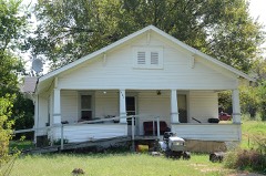
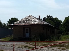
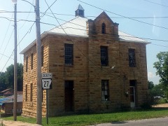
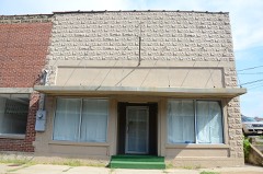
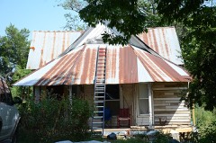
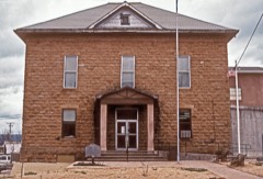
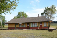
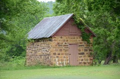
52 National Register listings published here.
Sources: the National Register database, National Park Service
72 topographic sheets cover 60 settlements here, and 52 properties are on the National Register of Historic Places.
52 National Register listings published here.
Sources: the National Register database, National Park Service
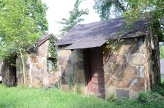
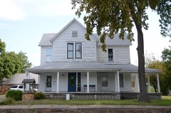
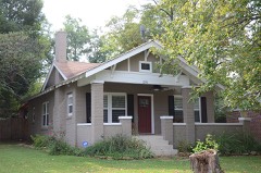
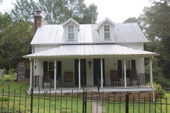
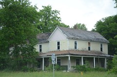
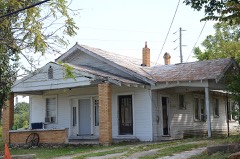
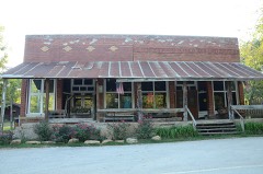
Every property in this county listed on the National Register of Historic Places, with the year it was listed and the federal nomination document.
Every wildfire the federal occurrence database records inside this county: 936 of them, burning about 54,243 acres. 23 started naturally and 478 were recorded as arson. Each settlement page carries the fires within five miles of it.
| Reported cause | Fires |
|---|---|
| Arson/incendiarism | 478 |
| Missing data/not specified/undetermined | 269 |
| Debris and open burning | 132 |
| Natural | 23 |
| Equipment and vehicle use | 13 |
| Recreation and ceremony | 11 |
| Smoking | 8 |
| Power generation/transmission/distribution | 1 |
| Other causes | 1 |
The five largest, by the area the report gives. Five of them were set deliberately.
| Date | Cause | Size | Reported by | Name on the report |
|---|---|---|---|---|
| 9 February 2016 | Arson/incendiarism | 3,984 acres | Ozark-St. Francis National Forests | BIG POINT |
| 4 October 2011 | Debris and open burning | 2,008 acres | Buffalo National River | FLAT ROCK |
| 6 March 2007 | Arson/incendiarism | 1,653 acres | Ozark-St. Francis National Forests | BIG POINT |
| 13 March 2001 | Debris and open burning | 1,470 acres | Buffalo National River | FLAT ROCK |
| 29 March 2006 | Arson/incendiarism | 1,340 acres | Arkansas Forestry Commission | HORN MOUNTAIN |
| 17 November 1999 | Arson/incendiarism | 1,063 acres | Buffalo National River | ROBERTSON |
| 31 January 2017 | Missing data/not specified/undetermined | 1,052 acres | Arkansas Forestry Commission | not named |
| 2 March 2012 | Arson/incendiarism | 1,032 acres | Arkansas Forestry Commission | TURKEY PEN SPRINGS |
Every settlement page carries the fires within five miles of it - see the settlement index below.
The NOAA Storm Events Database holds 304 reports for this county, causing no deaths, 2 injuries and about $11,031,700 in recorded property damage. Each settlement page carries the reports that name it.
| Kind of event | Reports |
|---|---|
| Thunderstorm Wind | 127 |
| Hail | 112 |
| Flash Flood | 25 |
| Tornado | 17 |
| Flood | 15 |
| Heavy Rain | 6 |
| Lightning | 1 |
| Funnel Cloud | 1 |
The most serious of them, by death, then injury, then recorded damage. The accounts are quoted exactly as the forecast office filed them.
| When | Event | Place named | Harm | What the report says |
|---|---|---|---|---|
| March 1961 | Tornado (F2) | not stated | 2 hurt, $250,000 | no account filed |
| May 2011 | Flood | Pindall | $3,000,000 | Parts of the Buffalo National River were closed due to flooding, flood damage, and debris piles. |
| March 1997 | Thunderstorm Wind | Marshall | $2,000,000 | no account filed |
| March 2008 | Flash Flood | Marshall | $1,200,000 | Localized flooding was reported across the county. The Health Department and Civic Center in Marshall had minor flooding in the building, Arkansas Highway 333 at Gilbert was blocked due to flooding. Part of Arkansas Highway 74 near Calf Creek was washed out. |
| April 2011 | Flood | Pindall | $750,000 | Widespread areal flooding occurred. |
| March 2008 | Flood | Woolum | $500,000 | Heavy rain caused the Buffalo River at St. Joe to crest above major flood level. The river crested at the third highest crest of history. There was some minor damage to county roads and infrastructure. National Park facilities were also damaged with losses to campgrounds and other park facilities. |
| April 1993 | Tornado (F1) | Canaan to | $500,000 | An F1 tornado touched down 1 mile northeast of Canaan and traveled approximately 16.5 miles northeastward before lifting back up into the clouds 1.5 miles northeast of Landis. Most of the tornado's damage consisted of trees being blown down, twisted or split. The greatest damage along the tornado's path occurred about 4 miles west-southwest of Landis which was the site of a large dairy farm. A number of large trees were blown down on the farm. A large barn was flattened and several small sheds near the barn were destroyed. A large riding lawn tractor was turned over and an empty grain container was destroyed. Damage to the dairy farm itself was estimated at around $200,000. Around 18 structures sustained some damage, much of it minor. |
| May 2013 | Flash Flood | Pindall | $250,000 | Heavy rain caused considerable damage to county roads and bridges. |
| September 2012 | Thunderstorm Wind | Marshall | $250,000 | Numerous trees were blown down, with some trees landing on houses. A boat was flipped over. Houses and businesses were damaged. There were also reports of trees being blown down in other sections of the county. |
| May 1974 | Tornado (F1) | not stated | $250,000 | no account filed |
| May 1973 | Tornado (F2) | not stated | $250,000 | no account filed |
| April 1958 | Tornado (F2) | not stated | $250,000 | no account filed |
| March 2017 | Tornado (EF2) | Pindall | $200,000 | An EF-2 tornado cut a 36.7 mile path across Newton and Searcy counties. The damage included trees being uprooted and snapped. Several residences were damaged. The post office at Parthenon was destroyed. Maximum winds with this tornado were 120 mph. This tornado touched down north of Mossville in Newton County, and lifted east northeast of Saint Joe in Searcy County. At Parthenon, several homes were damaged. Outbuildings were damaged or destroyed. The post office was destroyed. A residence was destroyed north of Vendor. North of Saint Joe, a family of five (two adults and 3 small children) heard the tornado warning, went into a storm shelter before the tornado hit. Their manufactured home was completely destroyed. The damage was likely not survivable. Also, north of Saint Joe, trees and power lines were blown down. Outbuildings were damaged. A residence had significant damage. There was one minor injury. |
| March 2017 | Thunderstorm Wind | St Joe | $150,000 | A house was destroyed with many trees and power lines down in St. Joe. |
| April 2008 | Flash Flood | Baker | $150,000 | The city of Leslie was flooded. U.S. Highway 65 between Marshall and Leslie was also flooded. |
| April 2008 | Flood | Woolum | $150,000 | The Buffalo River near St. Joe stream gage rose to moderate flood level after heavy rainfall in the upper portion of the watershed. While mostly a wildness area, some recreational facilities were damaged by flooding. Some road damage was also reported in the county near the river crossings. |
| February 2023 | Thunderstorm Wind | Pindall | $100,000 | Initial reports of trees and power lines downed were received. Several homes sustained roof damage. This was possibly a tornado. |
| February 2023 | Tornado (EF2) | Pindall | $100,000 | Damage consisted of a couple of houses losing roofing material, barns/sheds damaged or destroyed, and numerous trees uprooted or snapped. The trees blocked half a dozen roads, including Highway 65 which was closed temporarily. The most substantial damage was a house moved from its foundation and then partially collapsing. We would like to thank Searcy and Marion County Emergency Management for assistance with the survey. |
| March 2017 | Thunderstorm Wind | St Joe | $100,000 | A house was destroyed with many trees and power lines down in St. Joe. |
| March 2017 | Thunderstorm Wind | St Joe | $100,000 | A second home in Saint Joe has been reported as destroyed by the sheriff's office. |
| March 2017 | Thunderstorm Wind | Jameson | $50,000 | Damage was reported in and around Marshall. Roof, tree, and building damage was reported. The county barn was reported demolished. |
| June 1994 | Thunderstorm Wind | Witts Spring | $50,000 | Thunderstorm winds downed many trees. |
| April 1994 | Thunderstorm Wind | Marshall | $50,000 | Thunderstorm winds destroyed a barn. |
| April 2011 | Flood | Duff | $50,000 | no account filed |
| January 2007 | Flash Flood | Marshall | $31,700 | Several roads across Searcy County were flooded due to heavy rainfall. |
| March 2022 | Tornado (EF1) | Oxley | $30,000 | This tornado started in the southeast corner of Searcy county. The tornado uprooted several trees along its path, along with ripping roof panels off of a barn, and damaging others. It tracked northeast for 0.8 miles in Searcy county. |
| April 1980 | Tornado (F1) | not stated | $25,000 | no account filed |
| May 1961 | Tornado (F2) | not stated | $25,000 | no account filed |
| May 1961 | Tornado (F2) | not stated | $25,000 | no account filed |
| March 2022 | Thunderstorm Wind | Oxley | $20,000 | Widespread tree damage was reported in the area as well as damage to a few barns. |
| April 2011 | Thunderstorm Wind | Marshall | $15,000 | Multiple trees were blown down along U.S. Highway 65. |
| March 2008 | Flash Flood | Begley | $15,000 | Water was over the low water bridges. |
| February 2023 | Tornado (EF1) | Canaan | $10,000 | This tornado touched down near Dakota Rd. and Highway 27. Along the path, trees were uprooted and snapped, , in addition to a roof removed from a small shed. The tornado appears to have dissipated at 225 am CST. |
| October 2016 | Thunderstorm Wind | Leslie | $10,000 | A roof was dislodged on a building and a few trees were blown over onto houses. |
| September 2014 | Tornado (EF0) | Point Peter | $10,000 | Trees were uprooted or snapped off. |
| June 2012 | Thunderstorm Wind | Marshall | $10,000 | Trees were blown down. |
| April 2011 | Thunderstorm Wind | Leslie | $10,000 | Several trees were blown down onto roads. |
| April 2001 | Thunderstorm Wind | Marshall | $6,000 | Severe thunderstorm winds just over 60 mph downed several trees and damaged the roofs of a few buildings in Marshall. |
| September 2014 | Thunderstorm Wind | Booster | $5,000 | Trees were blown down. |
| September 2014 | Thunderstorm Wind | Woolum | $5,000 | Some trees were blown down. |
| August 2013 | Flash Flood | Booster | $5,000 | Low-water crossings were flooded after 2 inches of rain fell in one hour. |
| December 2010 | Thunderstorm Wind | Marshall | $5,000 | Several trees were blown down in the city of Marshall. |
| August 2010 | Thunderstorm Wind | Jameson | $5,000 | Trees were blown down on U.S. Highway 65 west of Marshall. |
| February 2009 | Thunderstorm Wind | Blanco | $5,000 | A few trees were blown down across Arkansas Highway 74 west of Dongola. |
| July 2009 | Thunderstorm Wind | Harriet | $5,000 | Shingles were off a roof and a sign was blown over. |
| September 2009 | Flash Flood | Baker Hollow | $5,000 | Minor flooding occurred across low lying areas. |
| April 2005 | Thunderstorm Wind | Leslie | $5,000 | Thunderstorm winds blew the metal roofing off several buildings in Leslie. |
| July 1994 | Thunderstorm Wind | Landis | $5,000 | Thunderstorm winds downed several large trees. |
| July 1994 | Thunderstorm Wind | Marshall | $5,000 | Thunderstorm winds downed several trees. |
| June 1994 | Thunderstorm Wind | Marshall | $5,000 | Thunderstorm winds blew down some trees. |
| April 1993 | Tornado (F0) | Marshall to | $5,000 | A short-lived F0 tornado touched down 6 miles east of Marshall, and moved northward approximately 1.5 miles before lifting back into the clouds. The tornado traveled over a ridge that consisted only of forest area. |
| April 1993 | Thunderstorm Wind | Marshall | $5,000 | Thunderstorm winds knocked down some trees. |
| April 2013 | Thunderstorm Wind | Lebanon | $3,000 | Trees were blown down, blocking the highway. |
| May 1981 | Tornado (F0) | not stated | $2,500 | no account filed |
| May 2013 | Flash Flood | Canaan | $2,000 | Several roads were under water south of Marshall. |
| August 2013 | Thunderstorm Wind | Marshall | $2,000 | A tree was blown down on U.S. 65. |
| May 2009 | Thunderstorm Wind | Marshall | $2,000 | A tree was down on U.S. Highway 65. |
| June 2020 | Thunderstorm Wind | Duff | $1,000 | Shingles were blown off of a roof and tree limbs were broken. |
| October 2014 | Thunderstorm Wind | Booster | $1,000 | Large limbs were blown down. |
| October 2014 | Thunderstorm Wind | Gilbert | $1,000 | Large limbs were blown down. |
The Survey's mineral resources record lists 29 workings inside this county. 4 still produce and 25 are closed or unrecorded. Each settlement page carries the workings within five miles of it.
| Commodity | Workings |
|---|---|
| Zinc | 18 |
| Stone | 4 |
| Sand and Gravel, Construction | 3 |
| Copper | 1 |
| Copper, Zinc | 1 |
| Lead | 1 |
| Manganese | 1 |
| Quartz | 1 |
| Iron, Phosphorus-Phosphates | 1 |
The least common of them first, because a county's hundredth gravel pit says nothing its first ten did not.
| Where | Site | Commodity | Status | Recorded |
|---|---|---|---|---|
| Copper | Copper, Zinc | Prospect | ||
| Lucky Dog Mine | Lead | Unknown | ||
| Orville Pemberton place | Manganese, Quartz, Iron, Phosphorus-Phosphates | Occurrence | ||
| Tomahawk | Copper | Past Producer | ||
| Buffalo River Pit & Plant | Sand and Gravel, Construction | Producer | ||
| Searcy County Pit | Sand and Gravel, Construction | Producer | ||
| Searcy County Pit | Sand and Gravel, Construction | Producer | ||
| St Joe Quarry | Stone | Producer | ||
| Unk | Stone | Past Producer | ||
| Unk | Stone | Past Producer | ||
| Unk | Stone | Past Producer | ||
| Big Hurricane | Zinc | Past Producer | ||
| Campbell | Zinc | Past Producer | ||
| Churchill | Zinc | Past Producer | ||
| Davy Crockett | Zinc | Past Producer | ||
| Electric | Zinc | Past Producer | ||
| Excelsior | Zinc | Past Producer | ||
| Hazeldell | Zinc | Prospect | ||
| Jackpot | Zinc | Prospect | ||
| Lone Star | Zinc | Past Producer | ||
| Maumee | Zinc | Past Producer | ||
| Mays & Redwine | Zinc | Past Producer | ||
| Mud Hollow | Zinc | Past Producer | ||
| Roaring Hollow | Zinc | Unknown | ||
| Ruby | Zinc | Prospect | ||
| Silver Run | Zinc | Past Producer | ||
| Turkey Fat | Zinc | Past Producer | ||
| Unk | Zinc | Past Producer | ||
| Winchester | Zinc | Prospect |
Named settlements recorded in the Geographic Names Information System, each with the topographic sheets covering it. Villages, hamlets and abandoned places alike. Each is shown with the nearest named watercourse or landform and the survey quadrangle it falls on.
Bear Creek No. 6 township · 72645 · Near Devils Backbone · Harriet quadrangle
15 sheets, 1892 to 1992
Spring township · 72675 · Near Williams Hollow · Marshall quadrangle
17 sheets, 1892 to 1992
Long Creek township · 72650 · Near Grassy Hollow · Harriet quadrangle
15 sheets, 1892 to 1992
Mount Pleasant township · 72650 · Near Watts Hollow · Witts Springs quadrangle
20 sheets, 1892 to 1992
Wileys Cove township · 72645 · Near Barr Mountain · Harriet quadrangle
15 sheets, 1892 to 1992
No longer a settlement
Mount Pleasant township · 72650 · Near Sulphur Springs Hollow · Witts Springs quadrangle
20 sheets, 1892 to 1992
Shady Grove township · 72645 · On Truck Wheel Branch · Alread quadrangle
15 sheets, 1892 to 1992
Prairie township · 72633 · Near Chinquapin Spring Ridge · Western Grove quadrangle
16 sheets, 1893 to 1985
No longer a settlement
Rock Creek township · 72639 · On Hickory Creek · Cozahome quadrangle
16 sheets, 1893 to 1985
Calf Creek township · 72675 · On Dry Creek · Eula quadrangle
20 sheets, 1892 to 1992
No longer a settlement
72633 · On Dugget Creek · Saint Joe quadrangle
16 sheets, 1893 to 1985
No longer a settlement
Wileys Cove township · 72645 · Near Griffin Hollow · Leslie quadrangle
15 sheets, 1892 to 1992
Calf Creek township · 72675 · Near Point Peter · Eula quadrangle
20 sheets, 1892 to 1992
No longer a settlement
Rock Creek township · 72639 · Near Cartwright Hollow · Harriet quadrangle
15 sheets, 1892 to 1992
Calf Creek township · 72675 · On Horn Mountain · Eula quadrangle
20 sheets, 1892 to 1992
No longer a settlement
Mount Pleasant township · 72650 · Near Bradley Hollow · Witts Springs quadrangle
20 sheets, 1892 to 1992
Bear Creek No. 5 township · 72650 · Near Pea Vine Hollow · Marshall quadrangle
17 sheets, 1892 to 1992
No longer a settlement
Spring township · 72650 · Near Possum Hollow · Marshall quadrangle
17 sheets, 1892 to 1992
No longer a settlement
Mount Pleasant township · 72650 · Near Round Hill · Moore quadrangle
21 sheets, 1892 to 1992
No longer a settlement
Calf Creek township · 72686 · Near Granny Mountain · Snowball quadrangle
19 sheets, 1892 to 1992
Tomahawk township · 72675 · Near Green Haw Hollow · Maumee quadrangle
17 sheets, 1893 to 1985
Calf Creek township · 72675 · Near Scott Hollow · Eula quadrangle
20 sheets, 1892 to 1992
Long Creek township · 72650 · Near Grassy Hollow · Harriet quadrangle
15 sheets, 1892 to 1992
St. Joe township · 72675 · On Saint Joe Mountain · Saint Joe quadrangle
16 sheets, 1893 to 1985
Long Creek township · 72645 · Near Shiloh Hollow · Harriet quadrangle
15 sheets, 1892 to 1992
No longer a settlement
Calf Creek township · 72650 · On Gourd Creek · Snowball quadrangle
19 sheets, 1892 to 1992
No longer a settlement
Calf Creek township · 72650 · On Lick Fork Creek · Snowball quadrangle
19 sheets, 1892 to 1992
Red River township · 72650 · On Schoolhouse Branch · Canaan quadrangle
16 sheets, 1892 to 1992
Mount Pleasant township · 72650 · Near Bradley Ridge · Witts Springs quadrangle
20 sheets, 1892 to 1992
Wileys Cove township · 72645 · On Trace Creek · Leslie quadrangle
15 sheets, 1892 to 1992
Bear Creek No. 4 township · 72650 · Near Scott Hollow · Marshall quadrangle
17 sheets, 1892 to 1992
Spring township · 72675 · Near Pate Mountain · Snowball quadrangle
19 sheets, 1892 to 1992
No longer a settlement
The vanished settlements of Searcy County: the places named above that are no longer on the map.