 Block
From the record
58 National Register listings published here.
Sources: the National Register database, National Park Service
79 topographic sheets cover 40 settlements here, and 58 properties are on the National Register of Historic Places.
58 National Register listings published here.
Sources: the National Register database, National Park Service
Every property in this county listed on the National Register of Historic Places, with the year it was listed and the federal nomination document.
| Photograph | Property | Type | Listed | Reference |
|---|---|---|---|---|
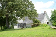 | Jessie Abernathy House | building | 1985 | 85002216 |
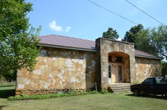 | Alco School | building | 1992 | 92001125 |
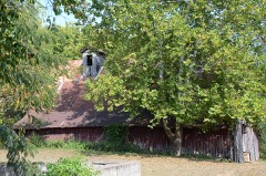 | Clarence Anderson Barn | building | 1985 | 85002217 |
| George Anderson House | building | 1985 | 85002218 | |
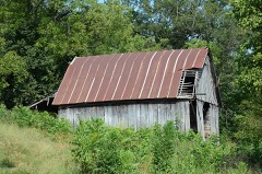 | John Avey Barn | building | 1985 | 85002219 |
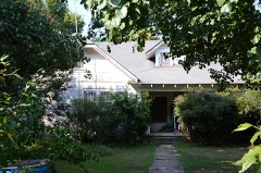 | John Bettis House | building | 1985 | 85002220 |
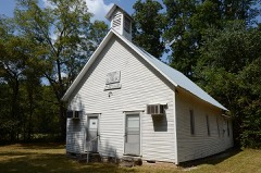 | Bluff Springs Church and School | building | 1985 | 85002210 |
| Bonds House | building | 1992 | 91000691 | |
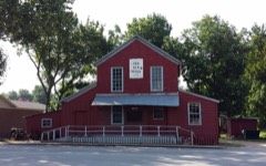 | Brewer's Mill | building | 1985 | 85002221 |
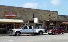 | A. B. Brewer Building | building | 1985 | 85003395 |
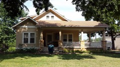 | John F. Brewer House | building | 1985 | 85003398 |
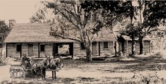 | Samuel Brown House | building | 1985 | 85002204 |
 | C. B. Case Motor Co. Building | building | 1985 | 85002222 |
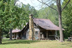 | Clark-King House | building | 1985 | 85002234 |
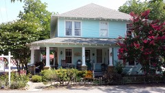 | Commercial Hotel | building | 1985 | 85002223 |
 | Henry Copeland House | building | 1985 | 85002224 |
| Wesley Copeland House | building | 1985 | 85002208 | |
| Davis Barn | building | 1985 | 85002225 | |
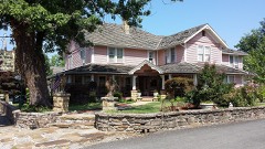 | Dew Drop Inn | building | 1985 | 85002231 |
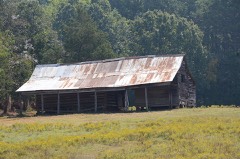 | William Dillard Homestead | building | 1985 | 85002214 |
| H. J. Doughtery House | building | 1985 | 85002232 | |
 | Farmers and Merchants Bank | building | 1985 | 85002228 |
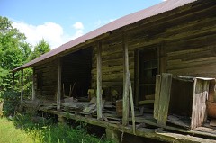 | Zachariah Ford House | building | 1985 | 85002206 |
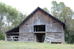 | Orvall Gammill Barn | building | 1985 | 85002229 |
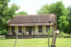 | Walter Gray House | building | 1985 | 85002212 |
| Joe Guffey House | building | 1985 | 85002211 | |
| Binks Hess House and Barn | building | 1985 | 85002227 | |
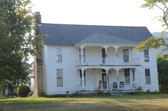 | Thomas E. Hess House | building | 1983 | 83003548 |
| Thomas M. Hess House | building | 1985 | 85002226 | |
| Miles Jeffery Barn | building | 1985 | 85002215 | |
 | Lackey General Merchandise and Warehouse | building | 1985 | 85002233 |
 | George W. Lackey House | building | 1990 | 90000992 |
| Albert and Almeda Lancaster House | building | 2021 | 100006931 | |
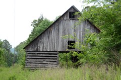 | Fred Lancaster Barn | building | 1985 | 85002213 |
| John L. Lancaster House | building | 85002235 | ||
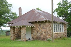 | Luber School | building | 1992 | 92001124 |
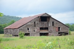 | H. S. Mabry Barn | building | 1985 | 85002236 |
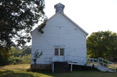 | Marcella Church & School | building | 1985 | 85002237 |
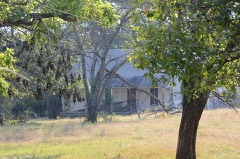 | Owen Martin House | building | 1985 | 85003397 |
| Noah McCarn House | building | 1985 | 85002238 | |
 | Mirror Lake Historic District | district | 1995 | 94001614 |
| Jim Morris Barn | building | 1985 | 85002209 | |
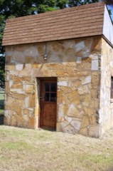 | Mountain View Waterworks | structure | 2006 | 06000906 |
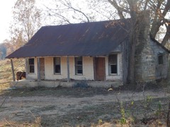 | Newton Sutterfield Farmstead | building | 2003 | 03000398 |
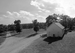 | Noricks Chapel School | building | 1998 | 98000615 |
| North Sylamore Creek Bridge | structure | 2010 | 10000034 | |
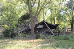 | Pinky Pruitt Barn | building | 1985 | 85002239 |
 | Roasting Ear Church and School | building | 1985 | 85002230 |
 | Smith, C. L., & Son General Store | building | 1985 | 85002240 |
 | Stegall General Store | building | 1985 | 85002241 |
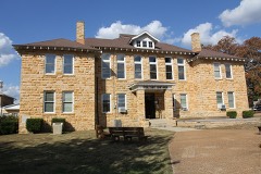 | Stone County Courthouse | building | 1976 | 76000470 |
| Stone County Recorder Building | building | 85002242 | ||
| Sugarloaf Fire Tower Historic District | district | 1995 | 94001615 | |
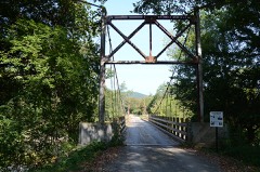 | Sylamore Creek Bridge | structure | 1999 | 99001353 |
| Taylor-Stokes House | building | 1985 | 85002207 | |
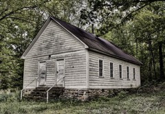 | Turkey Creek School | building | 1985 | 85003396 |
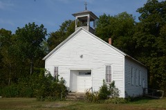 | West Richwoods Church & School | building | 1985 | 85002205 |
Every wildfire the federal occurrence database records inside this county: 573 of them, burning about 13,358 acres. 16 started naturally and 189 were recorded as arson. Each settlement page carries the fires within five miles of it.
| Reported cause | Fires |
|---|---|
| Arson/incendiarism | 189 |
| Debris and open burning | 154 |
| Missing data/not specified/undetermined | 142 |
| Equipment and vehicle use | 23 |
| Power generation/transmission/distribution | 19 |
| Recreation and ceremony | 18 |
| Natural | 16 |
| Smoking | 8 |
| Fireworks | 3 |
| Other causes | 1 |
The five largest, by the area the report gives. Two of them were set deliberately.
| Date | Cause | Size | Reported by | Name on the report |
|---|---|---|---|---|
| 29 November 2002 | Arson/incendiarism | 1,779 acres | Arkansas Forestry Commission | not named |
| 23 November 2005 | Arson/incendiarism | 1,591 acres | Arkansas Forestry Commission | MARYS HOLLOW |
| 15 April 2003 | Debris and open burning | 508 acres | Arkansas Forestry Commission | not named |
| 2 April 2006 | Debris and open burning | 466 acres | Arkansas Forestry Commission | HAPPY HOLLOW |
| 10 March 2001 | Missing data/not specified/undetermined | 456 acres | Arkansas Forestry Commission | not named |
| 27 November 2017 | Missing data/not specified/undetermined | 347 acres | Arkansas Forestry Commission | not named |
| 25 November 2017 | Missing data/not specified/undetermined | 330 acres | Arkansas Forestry Commission | not named |
| 19 November 2005 | Recreation and ceremony | 236 acres | Arkansas Forestry Commission | BRUCE BOYD |
Every settlement page carries the fires within five miles of it - see the settlement index below.
The NOAA Storm Events Database holds 275 reports for this county, causing 7 deaths, 18 injuries and about $47,504,600 in recorded property damage. Each settlement page carries the reports that name it.
| Kind of event | Reports |
|---|---|
| Thunderstorm Wind | 113 |
| Hail | 83 |
| Flash Flood | 35 |
| Tornado | 24 |
| Heavy Rain | 9 |
| Flood | 8 |
| Funnel Cloud | 2 |
| Lightning | 1 |
The most serious of them, by death, then injury, then recorded damage. The accounts are quoted exactly as the forecast office filed them.
| When | Event | Place named | Harm | What the report says |
|---|---|---|---|---|
| April 1996 | Tornado (F4) | Fox | 5 killed, 5 hurt, $2,500,000 | no account filed |
| February 2008 | Tornado (EF4) | Rushing | 1 killed, 7 hurt, $29,000,000 | The tornado moved from Van Buren County, north of Shirley, into Stone County, south-southwest of Rushing. According to a Red Cross survey, 24 houses were destroyed, 11 suffered major damage, 11 had minor damage, and 21 others were affected. Mobile home damage included 14 destroyed, 4 with major damage, 4 with minor damage, and 6 others affected. Major damage to businesses occurred near the intersection of Arkansas Highways 5 and 14 on the southeast side of Mountain View. A car dealership was destroyed and some of the cars on the sales lot were thrown across the highway. One car was lofted over a building across the highway and then thrown down into a ravine. Nearby, a utility pole was pulled up by the tornado, and then a large part of the pole was jammed back into the ground with all the wires still attached. The Stone County Medical Center suffered substantial damage, and a number of doctors' offices nearby were destroyed. Other businesses destroyed included a body shop, a paint shop, and a car parts store. A fire station had major damage. A major electrical transmission line outside of Mountain View was destroyed. It was nearly a week before the line could be rebuilt and power restored. One person was killed in a house just east of the Highway 5/14 intersection. The tornado continued into Izard County, in the area just northwest of Guion. |
| March 2008 | Flash Flood | Sugarloaf Mountain | 1 killed, $2,000,000 | A 64 year old man died in the flooding, northwest of Onia. He was driving back to his home and apparently missed his turn off Arkansas Highway 263 due to the entire intersection being flooded. His car ended up going into the floodwaters rather than on the county road. It was believed that he tried to exit his vehicle and was swept away. Most of the low water crossings in the county were flooded, as were many of the county roads. Approaches to 15 bridges were washed out, and one bridge was completely gone. Arkansas Highway 9 at Allison was closed due to flooding. Debris from the February 5th tornado jammed ditches and culverts, especially in the Mountain View area. |
| November 1988 | Tornado (F2) | not stated | 4 hurt, $250,000 | no account filed |
| April 1999 | Tornado (F0) | Ben | 2 hurt | no account filed |
| March 2008 | Flood | St James | $6,000,000 | Heavy rain caused the White River in Stone County to flood. Approximately 41 residences were flooded. A motel, restaurant, resort, Allison-Sylamore fire station and the Mountain View telephone substation were flooded. One trout outfitting business was destroyed. |
| December 1982 | Tornado (F3) | not stated | $2,500,000 | no account filed |
| May 2011 | Flood | Allison | $1,000,000 | no account filed |
| May 2013 | Flash Flood | Fifty Six | $600,000 | Heavy rain caused considerable damage to county roads and bridges. |
| May 1993 | Thunderstorm Wind | Mountain View | $500,000 | Thunderstorm winds blew the roofs off four hangars at the Mountain View airport. Several hangars also had their doors blown in by the winds. A nearby grocery store also had its roof blown off. |
| April 2011 | Flood | Allison | $400,000 | Widespread areal flooding occurred. |
| April 2008 | Flood | Sugarloaf Mountain | $250,000 | Heavy rain produced significant rises on the upper White River and tributaries. The combination of high river flows and the excessive upstream reservoir releases caused a second major flood event at the Calico Rock gage. Homes and businesses were flooded for a second time in less than month in Calico Rock and Sylamore. Damages were limited to repairs made since the March flooding. |
| April 1979 | Tornado (F1) | not stated | $250,000 | no account filed |
| May 1978 | Tornado (F2) | not stated | $250,000 | no account filed |
| May 1974 | Tornado (F1) | not stated | $250,000 | no account filed |
| March 1953 | Tornado (F2) | not stated | $250,000 | no account filed |
| April 2013 | Tornado (EF1) | Rushing | $200,000 | An EF1 tornado blew down several hay barns and some unused chicken houses. Numerous trees and some power lines were also blown down. |
| September 2012 | Thunderstorm Wind | Pleasant Grove | $150,000 | Trees and power lines were blown down around Pleasant Grove and Melrose. Some barns and chicken houses had their roofs blown off. |
| October 2009 | Flash Flood | Optimus | $150,000 | Flooding occurred throughout the Mountain View area and at the Martin Access Road near Arkansas Highway 14. Many county roads and some small bridges were damaged. |
| December 2015 | Thunderstorm Wind | Mountain View | $100,000 | Several trees were blown down, some of which fell onto 2 homes. A barn was blown over and there was roof damage to other buildings. Some of the trees fell onto Hwy 87 north of Mountain View. |
| March 2012 | Flood | Mountain View | $100,000 | Creeks were out of their banks. |
| April 2001 | Thunderstorm Wind | Fox | $100,000 | Severe thunderstorm winds destroyed a chicken house at Fox. |
| April 2011 | Thunderstorm Wind | Onia | $75,000 | Empty chicken houses were damaged. A barn roof was blown off. Roads were blocked by fallen trees. |
| April 2010 | Tornado (EF1) | Old Lexington | $75,000 | This tornado exited Van Buren County northeast of Rubek and entered Stone County east-southeast of Old Lexington. One house had its roof damaged and a window blown out, and another house had roof damage. The porch and the roof of a mobile home were damaged. Sheds were destroyed and barns were damaged. Trees and power lines were blown down. The city park at Fox suffered considerable damage. |
| April 2009 | Thunderstorm Wind | Mountain View | $60,000 | One business had a section of its roof peeled back. A fence around a football field has a 12 foot section blown down. A roof was blown off a dugout at the baseball complex. Twelve trees in the area were blown down. A car dealership had minor damage to their awning. |
| April 2008 | Flash Flood | Old Lexington | $50,000 | Damages occurred across the county due to heavy rains. |
| November 1994 | Thunderstorm Wind | Mtn. View | $50,000 | Thunderstorm winds tore sections of a roof off a building. |
| November 1993 | Thunderstorm Wind | Rushing | $50,000 | Thunderstorm winds damaged several roofs and downed several trees. |
| March 1997 | Tornado (F1) | Marcella | $50,000 | no account filed |
| July 2012 | Thunderstorm Wind | Allison | $30,000 | Trees were blown down and a number of barns were damaged. |
| October 2014 | Thunderstorm Wind | Mountain View | $25,000 | Trees were blown down around Mountain View and throughout Stone County. |
| March 2012 | Flash Flood | Hedges | $25,000 | Extensive flooding occurred along Sylamore Creek. All campers were safely evacuated. |
| December 1982 | Tornado (F1) | not stated | $25,000 | no account filed |
| September 2008 | Flash Flood | Herpel | $20,000 | Arkansas Highway 14 was under water about 5 miles east of Mountain View. |
| September 2009 | Lightning | Mountain View | $15,000 | Lightning struck an electric substation just north of Mountain View. Over 2500 customers lost power. |
| March 2022 | Tornado (EF1) | Flag | $10,000 | This tornado started in the southeast corner of Searcy county. The tornado uprooted several trees along its path, along with ripping roof panels off of a barn, and damaging others. It tracked northeast for 2.4 miles. |
| April 2013 | Flash Flood | West Richwoods | $10,000 | Ditches overflowed onto roadways, making several of them impassable. Low water crossings were under water. Widespread street flooding occurred. |
| June 2012 | Thunderstorm Wind | Old Lexington | $10,000 | Several trees were blown down. One of the trees landed on the porch of a house. |
| June 2011 | Thunderstorm Wind | Mountain View Arpt | $10,000 | Trees were blown down along Arkansas Highway 5 north of Mountain View. |
| April 2011 | Thunderstorm Wind | Timbo | $10,000 | Trees were blown down. |
| April 2011 | Thunderstorm Wind | Onia | $10,000 | Trees were blown down. |
| May 2011 | Flood | Sugarloaf Mountain | $10,000 | no account filed |
| February 2019 | Thunderstorm Wind | Mountain View | $5,000 | Numerous trees were down across the county with at least one home receiving roof damage. |
| April 2013 | Thunderstorm Wind | Newnata | $5,000 | Trees were blown down and shingles were blown off a roof. |
| August 2013 | Thunderstorm Wind | Allison | $5,000 | Trees were blown down along Arkansas 5. |
| August 2013 | Thunderstorm Wind | Timbo | $5,000 | Trees were blown down along Arkansas 66. |
| January 2013 | Flash Flood | Mountain View | $5,000 | Streets flooded in Mountain View. |
| June 2011 | Thunderstorm Wind | Mountain View Arpt | $5,000 | Trees were blown down along Arkansas Highway 14 east of Mountain View. |
| September 2010 | Flash Flood | Oula | $5,000 | Low water crossings were flooded. |
| July 1994 | Thunderstorm Wind | Alco | $5,000 | Thunderstorm winds twisted and broke off several trees. |
| November 1994 | Thunderstorm Wind | Mtn. View | $5,000 | Thunderstorm winds damaged the roof of a house. |
| November 1994 | Thunderstorm Wind | Newnata | $5,000 | Thunderstorm winds blew the roof off a hay shed. |
| November 1994 | Thunderstorm Wind | Mtn. View | $5,000 | Thunderstorm winds downed some trees. |
| April 2011 | Flood | Sugarloaf Mountain | $5,000 | no account filed |
| May 2011 | Flood | Sugarloaf Mountain | $5,000 | no account filed |
| August 2010 | Thunderstorm Wind | Timbo | $3,000 | Several trees were blown down. |
| August 2010 | Thunderstorm Wind | St James | $3,000 | Trees were blown down on Arkansas Highway 14 west of Pleasant Grove. |
| March 1997 | Tornado (F0) | Rushing | $3,000 | no account filed |
| June 1976 | Tornado (F1) | not stated | $2,500 | no account filed |
| April 1970 | Tornado | not stated | $2,500 | no account filed |
The Survey's mineral resources record lists 31 workings inside this county. 25 still produce and 6 are closed or unrecorded. Each settlement page carries the workings within five miles of it.
| Commodity | Workings |
|---|---|
| Sand and Gravel, Construction | 15 |
| Stone | 6 |
| Manganese | 5 |
| Stone, Crushed/Broken | 2 |
| Copper | 1 |
| Iron, Phosphorus-Phosphates, Tantalum, Zinc | 1 |
| Iron | 1 |
| Clay | 1 |
| Phosphorus-Phosphates | 1 |
The least common of them first, because a county's hundredth gravel pit says nothing its first ten did not.
| Where | Site | Commodity | Status | Recorded |
|---|---|---|---|---|
| Canard-Cajun | Clay, Phosphorus-Phosphates | Producer | ||
| E.B.Matheson | Iron | Producer | ||
| Unk | Copper, Iron, Phosphorus-Phosphates, Tantalum, Zinc | Occurrence | ||
| Allison Mine & Plant | Stone, Crushed/Broken | Producer | ||
| Allison Plant | Stone, Crushed/Broken | Producer | ||
| A.T.Foster Prospect | Manganese | Occurrence | ||
| Alex Fulks Prospect | Manganese | Prospect | ||
| Enos-Lindsey Cave Prospect | Manganese | Past Producer | 1939 | |
| G.F.Fulks Prospect | Manganese | Unknown | ||
| Gunther | Manganese | Unknown | ||
| Unk | Stone | Producer | ||
| Unk | Stone | Producer | ||
| Unk | Stone | Producer | ||
| Unk | Stone | Producer | ||
| Unk | Stone | Producer | ||
| Unk | Stone | Producer | ||
| Mountain View Pit | Sand and Gravel, Construction | Producer | ||
| Mountain View Plant | Sand and Gravel, Construction | Producer | ||
| Stone County Pit | Sand and Gravel, Construction | Producer | ||
| Stone County Plant | Sand and Gravel, Construction | Producer | ||
| Unk | Sand and Gravel, Construction | Producer | ||
| Unk | Sand and Gravel, Construction | Producer | ||
| Unk | Sand and Gravel, Construction | Producer | ||
| Unk | Sand and Gravel, Construction | Producer | ||
| Unk | Sand and Gravel, Construction | Producer | ||
| Unk | Sand and Gravel, Construction | Producer | ||
| Unk | Sand and Gravel, Construction | Producer | ||
| Unk | Sand and Gravel, Construction | Producer | ||
| Unk | Sand and Gravel, Construction | Producer | ||
| Unk | Sand and Gravel, Construction | Producer | ||
| Unk | Sand and Gravel, Construction | Producer |
Named settlements recorded in the Geographic Names Information System, each with the topographic sheets covering it. Villages, hamlets and abandoned places alike. Each is shown with the nearest named watercourse or landform and the survey quadrangle it falls on.
District 5 · 72560 · By Taylor Point · Marcella quadrangle
15 sheets, 1890 to 1986
No longer a settlement
District 6 · 72560 · Near Logan Hollow · Drasco quadrangle
15 sheets, 1890 to 1986
No longer a settlement
District 3 · 72519 · Near Caney Hollow · Calico Rock quadrangle
19 sheets, 1890 to 1985
No longer a settlement
District 5 · 72560 · Near Knights Cove · Marcella quadrangle
15 sheets, 1890 to 1986
District 5 · 72560 · Near Squirrel Hollow · Mountain View SW quadrangle
14 sheets, 1892 to 1992
District 3 · 72533 · Near Bud Wallis Hollow · Fiftysix quadrangle
16 sheets, 1892 to 1992
No longer a settlement
District 5 · 72560 · On Chalybeate Spring Creek · Marcella quadrangle
15 sheets, 1890 to 1986
No longer a settlement
District 3 · 72617 · Near Round Mountain · Landis quadrangle
15 sheets, 1892 to 1992
No longer a settlement
District 7 · 72560 · Near Indian Knob · Mountain View quadrangle
14 sheets, 1892 to 1992
District 3 · 72533 · On Mill Creek · Onia quadrangle
15 sheets, 1892 to 1992
No longer a settlement
District 4 · 72031 · Near Ab Smith Hollow · Old Lexington quadrangle
16 sheets, 1892 to 1992
District 4 · 72031 · Near Sally Flats · Shirley quadrangle
17 sheets, 1892 to 1992
No longer a settlement
District 6 · 72567 · On Knights Cove Creek · Marcella quadrangle
15 sheets, 1890 to 1986
District 4 · 72560 · On Brushy Creek · Mountain View SW quadrangle
14 sheets, 1892 to 1992
District 5 · 72560 · Near Collins Hill · Mountain View SW quadrangle
14 sheets, 1892 to 1992
The vanished settlements of Stone County: the places named above that are no longer on the map.