 Block
Little Rock, Arkansas
26 topographic sheets cover this place, the earliest surveyed in 1891 and the latest in 1994. It stands in Big Rock Township. It lies in ZIP code area 72201. The Survey maps it on the Little Rock quadrangle. 202,591 people lived here at the 2020 count. It stands 335 feet above sea level.
Research this city
On record in Little Rock
Buildings and businesses the archive holds for this place. Each opens its own page, with the source record it came from.
On the National Register 12 of 291 shown
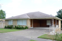 Daisy Bates HouseNational Historic Landmark · listed 2001
 Front Step, Little Rock Central High SchoolNational Historic Landmark · listed 1977
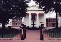 Old State HouseNational Historic Landmark · listed 1969
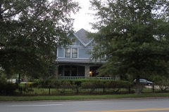 Joseph Taylor Robinson HouseNational Historic Landmark · listed 1975
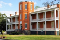 U.S. Arsenal BuildingNational Historic Landmark · listed 1970
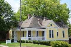 Abrams Houselisted 1999
 Albert Pike Memorial Templelisted 1986
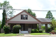 H.M. Anderson Houselisted 2001
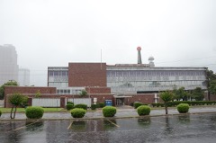 Arkansas Power & Light Buildinglisted 1992
 Arkansas State Capitollisted 1974
 Associated Reformed Presbyterian Churchlisted 1982
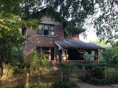 Baer Houselisted 1982
Population over time
2 figuresLittle Rock grew from 193,524 to 202,591 between 2010 and 2020. These are the recorded population figures Wikidata holds for this place, reached through the Geographic Names Information System number this page is keyed on rather than by name, so they belong to this place and not to another of the same name. Most are census counts, but not all are: an early figure may be a founding or settlement estimate, and an estimate published within five years of a census is left out. The change column is computed, and is left blank where more than 20 years separate a figure from the one before it, because a gap that long is not a change between two counts.
| Year | People | Change |
|---|---|---|
| 2010 | 193,524 | |
| 2020 | 202,591 | +9,067 (+5%) |
Topographic sheets covering this place
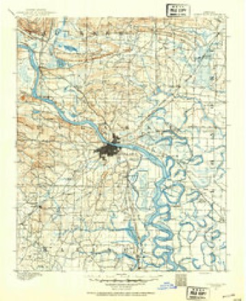
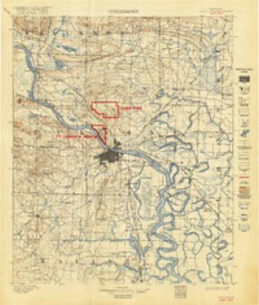
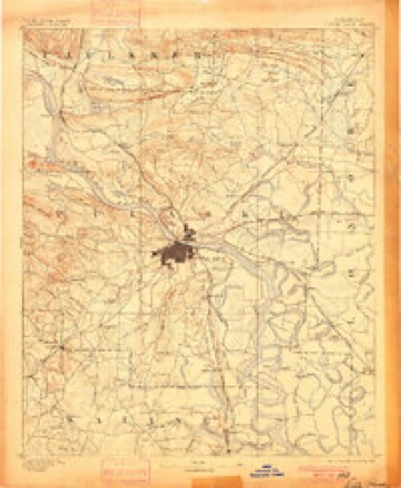
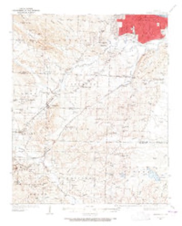
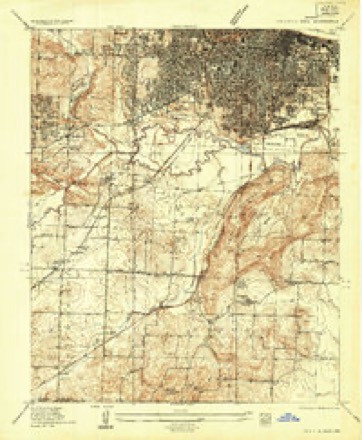
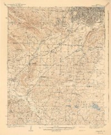
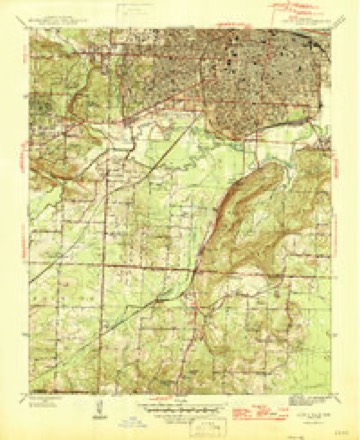
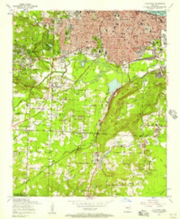
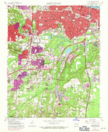
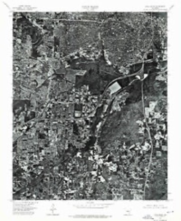
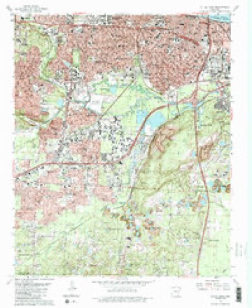
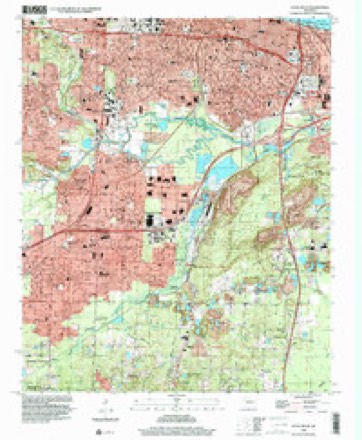
18 surveys from 26 printed sheetsMatched by testing this settlement's coordinate against the published boundary of every sheet in the United States Geological Survey's historical collection. Each opens the scanned sheet at the Survey.
- 1891 USGS Little Rock quadrangle1:125000
- 1893 USGS Camp Pike quadrangle1:125000
- 1893 USGS Little Rock quadrangle1:125000, 4 printings
- 1935 USGS Alexander quadrangle1:48000
- 1935 USGS Alexander quadrangle1:62500
- 1935 USGS Little Rock quadrangle1:24000
- 1941 USGS Alexander quadrangle1:62500, 2 printings
- 1944 USGS Little Rock quadrangle1:31680, 2 printings
- 1954 USGS Little Rock quadrangle1:24000
- 1955 USGS Little Rock quadrangle1:250000
- 1956 USGS Little Rock quadrangle1:250000
- 1960 USGS Little Rock quadrangle1:250000
- 1961 USGS Little Rock quadrangle1:24000, 3 printings
- 1964 USGS Little Rock quadrangle1:250000
- 1975 USGS Little Rock quadrangle1:24000
- 1985 USGS Little Rock quadrangle1:100000
- 1986 USGS Little Rock quadrangle1:24000, 2 printings
- 1994 USGS Little Rock quadrangle1:24000
Fires near this place
14 since 1998Regional context, not property-specific evidence. The federal wildfire occurrence database lists 14 fires within 5 miles of Little Rock between 1998 and 2019, burning about 71 acres in total. None started naturally. 1 was recorded as arson. Distance is straight-line from the map coordinates, so a fire counted here may appear on a neighbouring settlement's page as well.
| Reported cause | Fires |
|---|---|
| Missing data/not specified/undetermined | 9 |
| Arson/incendiarism | 1 |
| Railroad operations and maintenance | 1 |
| Recreation and ceremony | 1 |
| Smoking | 1 |
| Debris and open burning | 1 |
The most recent of them, most recent first, with the day each was reported and the service that recorded it.
| Date | Cause | Size | Reported by | Name on the report |
|---|---|---|---|---|
| 22 September 2017 | Missing data/not specified/undetermined | 1.0 acres | Arkansas Forestry Commission | not named |
| 16 September 2013 | Missing data/not specified/undetermined | 2.0 acres | Arkansas Forestry Commission | not named |
| 15 September 2019 | Missing data/not specified/undetermined | 1.0 acres | Arkansas Forestry Commission | not named |
| 19 July 2007 | Debris and open burning | 1.0 acres | Arkansas Forestry Commission | not named |
| 17 July 2013 | Missing data/not specified/undetermined | 30 acres | Arkansas Forestry Commission | not named |
| 27 June 2012 | Railroad operations and maintenance | 10 acres | Arkansas Forestry Commission | not named |
| 23 June 2016 | Arson/incendiarism | 2.0 acres | Arkansas Forestry Commission | not named |
| 6 April 2017 | Missing data/not specified/undetermined | 2.0 acres | Arkansas Forestry Commission | not named |
Settlements close enough to share some of these fires:
Mines and quarries near this place
10 of 25 shownRegional context, not property-specific evidence. The federal mineral resources record lists 25 workings within 5 miles of Little Rock: 14 producers, 8 unknowns, 3 past producers. 14 still produce. What was taken out: Stone, Crushed/Broken, Aluminum, Clay, Sand and Gravel, Construction. Distance is straight-line from the map coordinates, so a quarry counted here may appear on a neighbouring settlement's page as well.
| Where | Site | Commodity | Status | Recorded |
|---|---|---|---|---|
| Construction Products Division | Vermiculite | Producer | ||
| Little Rock Plant | Aluminum, Clay | Unknown | ||
| Arkansas Calcine Mill | Clay | Producer | ||
| Big Sandy No. 3 | Sand and Gravel, Construction | Producer | ||
| Hoffman | Clay | Producer | ||
| Little Rock Industrial Minerals Pnt | Clay | Producer | ||
| North Little Rock Plant and Dredge | Sand and Gravel, Construction | Producer | ||
| Unknown S & G Pit | Sand and Gravel, Construction | Unknown | ||
| Dixie Extension Deposit | Aluminum | Unknown | ||
| Fuller School Deposit | Aluminum | Unknown |
Storms near this place
60 of 324 shownRegional context, not property-specific evidence. The National Weather Service names Little Rock in 324 storm reports between 1993 and 2023: 156 hail, 119 thunderstorm wind, 34 flash flood, 8 lightning. The reports record 3 deaths and 80 injuries. Each account below is quoted exactly as the forecast office filed it, from the NOAA Storm Events Database, and each date opens the federal record of that event.
| When | Event | Place named | Harm | What the report says |
|---|---|---|---|---|
| January 1999 | Tornado (F3) | Little Rock | 3 killed, 72 hurt | no account filed |
| January 1999 | Tornado (F2) | Little Rock | 6 hurt | no account filed |
| May 2014 | Thunderstorm Wind | Little Rock | 1 hurt, $25,000 | A large limb broke off a tree on the edge of the Arkansas State Capitol grounds. The limb fell on a passing car, resulting in one injury. |
| June 1998 | Thunderstorm Wind | North Little Rock | 1 hurt | no account filed |
| April 2007 | Lightning | Little Rock | $2,500,000 | Lightning struck an electric substation and also set fire to a building at the substation. Power was knocked out to 11,900 customers until power could be rerouted. The electric utility estimated that it would take three months to repair the damage to the substation. |
| April 2006 | Flash Flood | Little Rock | $2,000,000 | no account filed |
| August 2011 | Lightning | North Little Rock | $175,000 | Lightning struck a house on East C Ave. in the Park Hill neighborhood of North Little Rock, setting it on fire. The house was badly damaged. A firefighter was injured battling the blaze. |
| April 2014 | Thunderstorm Wind | Little Rock | $150,000 | Thunderstorm winds blew down trees and power lines. A few of the trees landed on houses. |
| November 2012 | Lightning | Little Rock | $125,000 | Lightning struck a church near downtown Little Rock. A chimney and a corner of the bell tower were knocked apart. The falling stones and bricks punched several holes in the tile roof, and rafters were split or shattered in several places. Heavy rain caused water to pour into the attic and work its way down a couple of floors into the choir loft of the sanctuary. The church's phone lines and elevator were knocked out. The church, built in 1921, is on the National Registry of Historic Places. |
| December 2009 | Flood | North Little Rock | $100,000 | Numerous streets were flooded in the Dark Hollow neighborhood of North Little Rock. Yards were covered in water, and the North Little Rock Fire Department evacuated about 20 people from their homes. |
| November 2006 | Flash Flood | Little Rock | $100,000 | Heavy rains produced flash flooding in the cities of Little Rock and North Little Rock. Numerous streets were flooded by high water, with a number of people rescued from flooded vehicles. A number of homes and businesses were flooded in the area. |
| August 2010 | Lightning | Little Rock | $75,000 | Lightning stuck Little Rock's central communications center, disabling phone equipment for 911 and 311, some police radio channels, and the city's business phone lines and voice mail system. It took about 2 1/2 hours to restore the radio channels and 6 hours to restore 911. Some of the other repairs took as long as 2 days. |
| June 2009 | Thunderstorm Wind | Little Rock | $75,000 | Much of a concrete block wall was blown down at a car dealership. |
| May 2015 | Flash Flood | North Little Rock | $50,000 | The intersection of Chester Street and La Harpe Boulevard west of the River Market area of Downtown Little Rock was flooded. Some cars had stalled in the high water. |
| July 2007 | Flash Flood | North Little Rock | $50,000 | The local emergency manager reported flooding on Riverfront Drive, Parker, and Pike Avenue. Several homes at 7th and Division were surrounded by water. Several vehicles stalled in the high water. |
| June 1994 | Thunderstorm Wind | Little Rock | $50,000 | Thunderstorm winds blew some windows out of a building in the western part of Little Rock. |
| August 1993 | Thunderstorm Wind | Little Rock | $50,000 | Thunderstorm winds blew down several trees and power lines. |
| September 1993 | Thunderstorm Wind | Little Rock | $50,000 | Thunderstorm winds blew down some trees and power lines in the southwest part of Little Rock. |
| June 1998 | Lightning | North Little Rock | $40,000 | no account filed |
| August 2012 | Thunderstorm Wind | North Little Rock | $25,000 | A number of power lines were blown down in North Little Rock. |
| August 2011 | Thunderstorm Wind | Little Rock | $25,000 | Winds were estimated at 50 mph in the downtown Little Rock area, causing some trees and power lines to be blown down. |
| July 1999 | Thunderstorm Wind | North Little Rock | $25,000 | no account filed |
| July 2016 | Flash Flood | Little Rock | $20,000 | Flooding occurred on the east side of downtown Little Rock under the 6th and 9th street bridge. |
| October 2010 | Thunderstorm Wind | Little Rock | $20,000 | A large tree fell onto the fence at the Arkansas Governor's Mansion. The tree also blocked Spring St., broke a light pole, and uprooted a sidewalk. |
| June 2009 | Lightning | North Little Rock | $5,000 | A lightning strike took a chunk of concrete off the side column on North Little Rock High School's midsection tower. |
| March 2008 | Thunderstorm Wind | Little Rock | $5,000 | A boat shed was damaged and tree limbs were down near the intersection of Reservoir Rd and Rodney Parham Road. |
| June 1994 | Thunderstorm Wind | Little Rock | $5,000 | Thunderstorm winds downed some trees. |
| June 1994 | Thunderstorm Wind | North Little Rock | $5,000 | Several trees and power lines were blown down. |
| June 1994 | Thunderstorm Wind | Little Rock | $5,000 | Thunderstorm winds downed trees and power lines. |
| June 1994 | Thunderstorm Wind | Little Rock | $5,000 | Thunderstorm winds downed some trees. |
| July 1994 | Thunderstorm Wind | Little Rock | $5,000 | Thunderstorm winds downed some trees and power lines. |
| July 1994 | Thunderstorm Wind | Little Rock | $5,000 | Some trees were blown down in the southwest part of Little Rock. |
| July 1994 | Thunderstorm Wind | Little Rock | $5,000 | Thunderstorm winds downed several trees. |
| August 1993 | Thunderstorm Wind | Little Rock | $5,000 | A tree blew down onto a house in Little Rock. |
| August 2012 | Thunderstorm Wind | Little Rock | $3,000 | Trees were blown down. |
| May 2009 | Thunderstorm Wind | Little Rock | $2,000 | A tree was down at the intersection of University Avenue and Berkshire Drive. |
| June 2023 | Thunderstorm Wind | Little Rock | - | Multiple large tree limbs fell in the Quapaw Quarter neighborhood. |
| February 2022 | Flash Flood | Little Rock | - | The public reported thunderstorms produced heavy rain on I-30 between the Arkansas River bridge and I-630. Also, the public reported ponding of water and mud flow over the interstate due to construction. |
| April 2022 | Thunderstorm Wind | Little Rock | - | A report was received of trees down near the Little Rock Zoo. |
| January 2020 | Flash Flood | Little Rock | - | Two cars were stuck in high water on LaHarpe Blvd. near the Broadway Bridge. |
| June 2020 | Thunderstorm Wind | North Little Rock | - | A tree and power lines were reported down at 5th and Orange St. in North Little Rock. |
| June 2019 | Thunderstorm Wind | North Little Rock | - | Tree limbs were blown down in Argenta. |
| May 2019 | Flash Flood | Little Rock | - | Flooding was reported on Cantrell Rd. in downtown Little Rock near Allsopp Park. |
| May 2018 | Thunderstorm Wind | Little Rock | - | Trees were blown down in Little Rock at the ridge off of Cantrell Road. |
| May 2018 | Thunderstorm Wind | North Little Rock | - | Trained spotter reported 60 mph wind gusts on East 5th Street in North Little Rock. |
| May 2018 | Flash Flood | Little Rock | - | Flash flooding resulted in many roadways being flooded. |
| May 2018 | Flash Flood | Little Rock | - | Large amounts of water covered the road. |
| March 2016 | Flash Flood | Little Rock | - | Flash flooding was reported at the University of Arkansas at Little Rock campus. Coleman Creek which runs through the campus, overflowed its banks. Water was flowing over the 28th Street bridge. |
| March 2016 | Flash Flood | Little Rock | - | Flash flooding was reported at the intersection of Van Buren and Markham Streets. |
| March 2016 | Flash Flood | Little Rock | - | Flash flooding was reported in War Memorial Park. |
| July 2016 | Thunderstorm Wind | North Little Rock | - | Three large trees were uprooted at Dickey-Stephens Park in downtown North Little Rock. |
| June 2015 | Thunderstorm Wind | Little Rock | - | Several trees were blown down across downtown Little Rock. |
| April 2013 | Hail | Little Rock | - | Dime to nickel size hail fell at the Pulaski County Sheriff's Office. |
| April 2011 | Hail | Little Rock | - | The hail fell at W. 20th St. and Spring St. |
| April 2011 | Hail | Little Rock | - | The hail fell at Interstate 630 and Chester St. |
| April 2011 | Hail | Little Rock | - | The hail fell at W. Markham and Victory St. |
| April 2011 | Hail | Little Rock | - | The hail fell in downtown Little Rock. |
| June 2011 | Hail | Little Rock | - | There were several reports of penny size hail on Interstate 30. |
| May 2011 | Heavy Rain | Little Rock | - | One and a half inches of rain fell in 20 minutes near the Governor's Mansion. |
| October 2010 | Hail | Little Rock | - | Hail fell at 7th and Gaines in downtown Little Rock. |
Nearest settlements
The eight closest, with where each one stands in the county. Distances are straight-line, computed from the Geographic Names Information System coordinates.
| Map | Place | Distance | Sheets |
|---|---|---|---|
| Pulaski Heights | 1.6 miles | 21 | |
| Pulaski | 1.9 miles | 21 | |
| North Little Rock | 2.0 miles | 21 | |
| Oak Forest | 2.1 miles | 26 | |
| Hot Springs Junction | 2.3 miles | 26 | |
| Biddle | 2.5 miles | 26 | |
| North Oaks | 2.7 miles | 21 | |
| Levy | 3.0 miles | 21 |
Elsewhere
Matched on this settlement's Geographic Names Information System number rather than its name, so it cannot be a different place of the same name in another state.
| Wikipedia article on Little Rock | An encyclopaedic summary. Its text is share-alike, so it is linked here rather than copied. |
| Wikidata item Q33405 | The structured record the population and elevation above come from. Public domain (CC0). |
Provenance
This settlement is recorded in the Geographic Names Information System as feature 83350. The sheet list is computed by point-in-boundary test against the United States Geological Survey's historical topographic inventory. Both are works of the United States government and carry no copyright under 17 U.S.C. 105.
Wildfire. Short, Karen C. 2022. Spatial wildfire occurrence data for the United States, 1992-2020 [FPA_FOD_20221014]. 6th Edition. Fort Collins, CO: Forest Service Research Data Archive. https://doi.org/10.2737/RDS-2013-0009.6 Collected with United States Government funding and usable without additional permissions or fees.
Mines and quarries. USGS Mineral Resources Data System (MRDS) https://mrdata.usgs.gov/mrds/ A work of the United States government, no copyright under 17 U.S.C. 105.
Storms. NOAA National Centers for Environmental Information, Storm Events Database https://www.ncei.noaa.gov/stormevents/ A work of the United States government, no copyright under 17 U.S.C. 105. Narratives are quoted verbatim from the National Weather Service report and are not edited or summarised.