 Block
From the record
One of 35 National Register listings published here for Crawford County · listed in 2023 · category: Building.
Sources: the National Register database, National Park Service
Listed on the National Register of Historic Places in 2023.
One of 35 National Register listings published here for Crawford County · listed in 2023 · category: Building.
Sources: the National Register database, National Park Service
Regional context, not property-specific evidence. The federal wildfire occurrence database lists 163 fires within 5 miles of Wing School between 1992 and 2019, burning about 6,221 acres in total. 1 started naturally. 111 were recorded as arson. Distance is straight-line from the map coordinates, so a fire counted here may appear on a neighbouring settlement's page as well.
| Reported cause | Fires |
|---|---|
| Arson/incendiarism | 111 |
| Debris and open burning | 22 |
| Missing data/not specified/undetermined | 17 |
| Recreation and ceremony | 4 |
| Power generation/transmission/distribution | 2 |
| Equipment and vehicle use | 2 |
| Misuse of fire by a minor | 2 |
| Railroad operations and maintenance | 1 |
| Smoking | 1 |
| Natural | 1 |
The most recent of them, most recent first, with the day each was reported and the service that recorded it.
| Date | Cause | Size | Reported by | Name on the report |
|---|---|---|---|---|
| 9 September 2000 | Arson/incendiarism | 3.0 acres | Arkansas Forestry Commission | not named |
| 3 September 1998 | Arson/incendiarism | 3.0 acres | Arkansas Forestry Commission | not named |
| 28 September 2003 | Power generation/transmission/distribution | under an acre | Ozark-St. Francis National Forests | SHILOH |
| 7 August 2012 | Natural | 1.0 acres | Arkansas Forestry Commission | not named |
| 7 August 2011 | Arson/incendiarism | under an acre | Ozark-St. Francis National Forests | STARR RD. FIRE |
| 31 August 2010 | Debris and open burning | 226 acres | Oklahoma Division of Forestry | 30462 |
| 31 August 2010 | Missing data/not specified/undetermined | 250 acres | Oklahoma Division of Forestry | HAGAN MOUNTAIN |
| 30 August 2000 | Missing data/not specified/undetermined | 750 acres | Oklahoma Division of Forestry | HAGEN MOUNTAIN |
Regional context, not property-specific evidence. The National Weather Service names Natural Dam, the town this property stands in, in 38 storm reports between 1993 and 2017: 17 thunderstorm wind, 16 hail, 3 flash flood, 2 tornado. No death or injury is recorded in these reports. Each account below is quoted exactly as the forecast office filed it, from the NOAA Storm Events Database, and each date opens the federal record of that event.
| When | Event | Place named | Harm | What the report says |
|---|---|---|---|---|
| April 1996 | Tornado (F1) | Natural Dam | $75,000 | no account filed |
| May 2011 | Hail | Natural Dam | $25,000 | no account filed |
| March 2017 | Thunderstorm Wind | Natural Dam | $10,000 | Strong thunderstorm wind blew down a tree onto a house. |
| April 2017 | Thunderstorm Wind | Natural Dam | $5,000 | Strong thunderstorm wind blew down power lines, and damaged buildings. |
| August 2011 | Thunderstorm Wind | Natural Dam | $5,000 | Strong thunderstorm wind blew down the steeple of a local church. Numerous large tree limbs were also blown down by the wind. |
| May 1999 | Tornado (F3) | Natural Dam | $3,000 | A significant long-track tornado first developed 4 miles west of Short, OK, moving northeast to about 7 miles southwest of Fayetteville, AR. This tornado reached its peak strength as an F3 tornado as it clipped extreme southeast Adair County, OK. This tornado then clipped extreme northwest Crawford County, passing through an unpopulated, forested area in the Ozark National Forest. An aerial survey by NWS personnel just west of the Oklahoma/Arkansas state line west of Natural Dam revealed that every tree in a hardwood forest was completely leveled. Property damage listed with this entry reflects tree damage sustained in Crawford County, while the F-rating reflects the tornado's peak strength in Adair County, OK. |
| May 1999 | Thunderstorm Wind | Natural Dam | $1,000 | Numerous trees were blown down. |
| May 1999 | Thunderstorm Wind | Natural Dam | $500 | A church sign was blown down. |
| April 2017 | Flash Flood | Natural Dam | - | Natural Dam Road was closed due to flooding. |
| May 2013 | Thunderstorm Wind | Natural Dam | - | Strong thunderstorm wind blew down a tree. |
| June 2013 | Thunderstorm Wind | Natural Dam | - | Several trees were blown down by strong thunderstorm winds, partially blocking Highway 59. |
| August 2013 | Thunderstorm Wind | Natural Dam | - | Strong thunderstorm wind blew down large tree limbs, blocking the roadway north of Natural Dam. |
| June 2012 | Thunderstorm Wind | Natural Dam | - | Strong thunderstorm wind blew down large tree limbs. |
| August 2012 | Thunderstorm Wind | Natural Dam | - | Strong thunderstorm wind blew down a few large tree limbs and one dead tree. |
| May 2011 | Thunderstorm Wind | Natural Dam | - | Thunderstorm wind gusts to 60 mph were estimated by emergency management personnel. |
| May 2011 | Thunderstorm Wind | Natural Dam | - | Strong thunderstorm wind blew down large tree limbs. |
| May 2010 | Thunderstorm Wind | Natural Dam | - | Strong thunderstorm wind blew down several trees just southeast of the Davidson community, along Highway 59. |
| July 2009 | Thunderstorm Wind | Natural Dam | - | Thunderstorm winds estimated at 70 miles an hour blew down a few large trees. The trees blocked Highway 59. |
| June 2009 | Thunderstorm Wind | Natural Dam | - | Thunderstorm winds estimated at 60 miles an hour blew down large tree limbs. |
| February 2008 | Flash Flood | Natural Dam | - | Runoff from locally heavy rainfall resulted in flooding of roads in Mountainburg and Van Buren. |
| June 2008 | Thunderstorm Wind | Natural Dam | - | Thunderstorm winds estimated at 70 miles an hour blew down several trees. |
| August 2001 | Thunderstorm Wind | Natural Dam | - | Thunderstorm winds estimated at 60 miles an hour blew down large tree limbs. |
| April 2011 | Hail | Natural Dam | - | no account filed |
| May 2010 | Hail | Natural Dam | - | no account filed |
| February 2009 | Hail | Natural Dam | - | no account filed |
| May 2008 | Hail | Natural Dam | - | no account filed |
| January 2006 | Hail | Natural Dam | - | no account filed |
| April 2006 | Hail | Natural Dam | - | no account filed |
| September 2006 | Hail | Natural Dam | - | no account filed |
| February 2005 | Hail | Natural Dam | - | no account filed |
| November 2005 | Hail | Natural Dam | - | no account filed |
| July 2003 | Hail | Natural Dam | - | no account filed |
| April 1999 | Hail | Natural Dam | - | no account filed |
| May 1999 | Hail | Natural Dam | - | no account filed |
| April 1998 | Hail | Natural Dam | - | no account filed |
| February 1998 | Hail | Natural Dam | - | no account filed |
| September 1996 | Flash Flood | Natural Dam | - | no account filed |
| April 1993 | Hail | Natural Dam | - | no account filed |
No historic map-sheet match is published for this property yet. That does not mean no map exists. This record needs a coordinate-quality review before it can be joined to a sheet boundary. Browse the county's mapped places while that work is pending.
Other National Register properties close enough to walk or drive between, ordered by distance from this one. Both positions come from the same geocoding pass that matched these properties to their map sheets.
| Photograph | Property | Distance | Listed |
|---|---|---|---|
 | Lee Creek Bridge | 1.1 miles | 1990 |
| Lee Creek Bridge | 1.2 miles | 1990 |
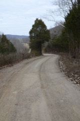 | Butterfield Overland Mail Route Lee Creek Road Segment | 3.5 miles | 2009 |
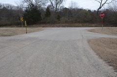 | Butterfield Overland Mail Route Lucian Wood Road Segment | 5.2 miles | 2009 |
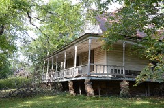 | Slack-Comstock-Marshall Farm | 5.7 miles | 1995 |
 | Cedarville School Building | 6.4 miles | 1992 |
| National Archives record | The nomination case file for reference 100008655 in Record Group 79. |
| Crawford County | All 35 listed properties in this county. |