Block
From the record
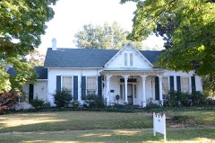
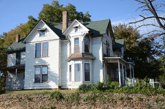
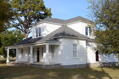
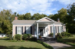
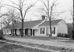
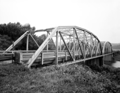
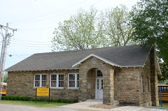
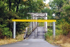
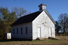
35 National Register listings published here.
Sources: the National Register database, National Park Service
117 topographic sheets cover 55 settlements here, and 35 properties are on the National Register of Historic Places.
35 National Register listings published here.
Sources: the National Register database, National Park Service
Every property in this county listed on the National Register of Historic Places, with the year it was listed and the federal nomination document.
Every wildfire the federal occurrence database records inside this county: 728 of them, burning about 13,771 acres. 10 started naturally and 223 were recorded as arson. Each settlement page carries the fires within five miles of it.
| Reported cause | Fires |
|---|---|
| Debris and open burning | 252 |
| Arson/incendiarism | 223 |
| Missing data/not specified/undetermined | 150 |
| Equipment and vehicle use | 49 |
| Misuse of fire by a minor | 14 |
| Smoking | 14 |
| Natural | 10 |
| Recreation and ceremony | 8 |
| Power generation/transmission/distribution | 5 |
| Railroad operations and maintenance | 3 |
The five largest, by the area the report gives. Four of them were set deliberately.
| Date | Cause | Size | Reported by | Name on the report |
|---|---|---|---|---|
| 27 February 2016 | Arson/incendiarism | 3,285 acres | Ozark-St. Francis National Forests | PIPELINE |
| 30 August 2000 | Missing data/not specified/undetermined | 750 acres | Oklahoma Division of Forestry | HAGEN MOUNTAIN |
| 1 March 2006 | Arson/incendiarism | 405 acres | Ozark-St. Francis National Forests | KIMES TOWER #2 |
| 30 July 2006 | Missing data/not specified/undetermined | 320 acres | Arkansas Forestry Commission | not named |
| 21 February 1992 | Arson/incendiarism | 303 acres | Ozark-St. Francis National Forests | not named |
| 25 November 2006 | Recreation and ceremony | 279 acres | Ozark-St. Francis National Forests | RICHARDSON POINT |
| 31 October 2016 | Arson/incendiarism | 237 acres | Ozark-St. Francis National Forests | BIRCHFIELD |
| 29 August 2000 | Missing data/not specified/undetermined | 230 acres | Arkansas Forestry Commission | not named |
Every settlement page carries the fires within five miles of it - see the settlement index below.
The NOAA Storm Events Database holds 789 reports for this county, causing 1 death, 102 injuries and about $182,050,200 in recorded property damage. Each settlement page carries the reports that name it.
| Kind of event | Reports |
|---|---|
| Thunderstorm Wind | 321 |
| Hail | 311 |
| Flash Flood | 79 |
| Tornado | 42 |
| Flood | 31 |
| Lightning | 3 |
| Funnel Cloud | 2 |
The most serious of them, by death, then injury, then recorded damage. The accounts are quoted exactly as the forecast office filed them.
| When | Event | Place named | Harm | What the report says |
|---|---|---|---|---|
| May 2015 | Flood | Rudy | 1 killed | A man was swimming in Frog Bayou near Rudy at about 3:15 pm CDT on May 12th. He was taken swiftly downstream and drown. His body was recovered on May 15th. |
| April 1996 | Tornado (F3) | Van Buren | 49 hurt, $150,000,000 | no account filed |
| May 1973 | Tornado (F1) | not stated | 23 hurt, $250,000 | no account filed |
| April 2018 | Tornado (EF2) | Rudy | 4 hurt, $600,000 | This tornado developed north of Rudy where numerous trees were snapped and uprooted as it crossed Frog Bayou Drive. The tornado then severely damaged a home, destroyed outbuildings, and snapped or uprooted numerous trees on Stapp Lane. Outbuildings were destroyed and numerous trees were snapped or uprooted as the tornado crossed Lancaster Road and County Road 27. The tornado continued to move northeast across Highway 282 and I-49 where several cars were rolled off the highway and severe damage to trees occurred. Several mobile homes were destroyed, a permanent home was damaged, and severe tree damage occurred as the tornado moved across Overlook Trail. A well-built outbuilding was destroyed and a home was severely damaged on Locust Mountain Road. Numerous trees were also snapped and uprooted in this area. Another home was severely damaged on Dollard Road before moving into Mountainburg, where numerous homes and businesses were damaged, outbuildings were destroyed, and trees and power poles were blown down. The tornado then moved across the south and east side of Lake Fort Smith, where homes were damaged, outbuildings were destroyed, and trees and power poles were blown down. Based on this damage, maximum estimated wind in the tornado was 110 to 120 mph. |
| March 1984 | Tornado (F1) | not stated | 4 hurt, $25,000 | no account filed |
| April 1960 | Tornado (F3) | not stated | 3 hurt, $250,000 | no account filed |
| February 1997 | Thunderstorm Wind | Van Buren | 3 hurt, $170,000 | no account filed |
| November 2018 | Tornado (EF2) | Van Buren | 2 hurt, $2,500,000 | This tornado developed north of I-40 and just west of Lee Creek Road where homes sustained minor roof damage, trees were uprooted, and the roofs of several apartment complexes were damaged. The tornado moved northeast across Rena Road, damaging numerous homes, some severely, snapping three large wooden utility structures, and snapping and uprooting numerous trees. The tornado then crossed Uniontown Road and Fayetteville Road near Rena, and dissipated as it approached N Rudy Road. Based on this damage, maximum estimated wind in the tornado was 110 to 120 mph. |
| October 1984 | Tornado (F2) | not stated | 2 hurt, $2,500,000 | no account filed |
| October 2014 | Flash Flood | Chester | 2 hurt, $100,000 | Heavy rains produced flooding that washed out several roads in the county. Two crew members were injured when a train derailed seven miles north of Chester as a result of the tracks being washed out. |
| March 2016 | Tornado (EF2) | Davidson | 2 hurt, $75,000 | This is the second segment of a three segment tornado. In Crawford County, this tornado destroyed a mobile home and snapped or uprooted numerous trees. Two people in the mobile home at the time the tornado hit were severely injured. Based on this damage, maximum estimated wind in this segment of the tornado was 110 to 120 mph. The tornado continued into Washington County, Arkansas. |
| May 2021 | Tornado (EF1) | Van Buren | 1 hurt, $15,000,000 | This is the fourth segment of a four segment tornado. After moving back into Crawford County, the tornado removed a large portion of the roof of the Crawford County Courthouse in Van Buren. Numerous homes and businesses were also damaged in Van Buren, and numerous power poles and trees were snapped by the tornado. This very large tornado then moved northeast across portions of Rudy and Alma, and then dissipated southeast of Mountainburg. Many trees were snapped or uprooted, outbuildings were destroyed, homes and businesses were damaged, and numerous power poles were snapped. Based on this damage, maximum estimated wind in this segment of the tornado was 100 to 110 mph. |
| October 1984 | Tornado (F2) | not stated | 1 hurt, $2,500,000 | no account filed |
| March 1999 | Hail | Alma | 1 hurt, $800,000 | There were several reports of extremely large hail from Alma. The largest report was of giant softball-sized hail, while there were also reports of quarter and golfball-sized hail just north of Alma.Such enormous hail caused widespread damage in Alma. Many cars sustained windshield and body damage. Just one auto body shop reported that it had written estimates from hail damage totaling $140,000. Many roofs also sustained major damage. At the Eagle Crest Golf Course, the hail left small craters on the greens, closing the course for several days while the crater marks were filled. A photo in the Alma Journal newspaper showed a softball-sized pock mark on the golf greens.A child was treated for injuries at a local hospital after being struck by the hail. |
| June 2025 | Tornado (EF1) | Van Buren | 1 hurt, $500,000 | This tornado developed in southeast Van Buren, near S 4th Street and Wood Street. The tornado moved rapidly northeast into the area just south of the Baptist Health-Van Buren complex. A commercial building was damaged, along with multiple homes on Ozier Street, Mulberry Street, and S 19th Street. Winds that reached near 105 mph blew in walls that contained windows of two homes. This over-pressured the two homes, resulting in one home losing its entire roof, and the other losing a substantial portion of its roof. The tornado also uprooted trees and blew down power poles. The tornado quickly dissipated, lasting a little more than one minute. |
| October 1993 | Thunderstorm Wind | Kibler | 1 hurt, $50,000 | Thunderstorm winds completely destroyed a mobile home. A woman and two small children were in the house at the time of the storm. The woman sustained very minor injuries. The occupants ended up approximately 200 feet from the original mobile home site. |
| April 1999 | Lightning | Kibler | 1 hurt | A 39-year old man standing outside near Kibler was injured when lightning struck a nearby tree or the ground. |
| November 1991 | Thunderstorm Wind | not stated | 1 hurt | no account filed |
| February 1985 | Thunderstorm Wind | not stated | 1 hurt | no account filed |
| May 2024 | Tornado (EF1) | Shibley | $500,000 | This tornado developed just south of I-40, and north of Highway 64. It moved east, crossing Highway 64 snapping and uprooting trees, and damaging homes. Numerous trees were snapped or uprooted, and numerous homes were damaged as the tornado continued to move generally east, crossing Highway 162, and then dissipating east of Sharp Chapel Road. A tornadic debris signature was detected by the KSRX WSR-88D with this tornado. Based on this damage, maximum estimated wind in the tornado was 100 to 110 mph. |
| June 1994 | Thunderstorm Wind | Van Buren | $500,000 | Thunderstorm winds blew down a communications tower. |
| April 1993 | Thunderstorm Wind | Chester | $500,000 | Thunderstorm winds blew down two barns and damaged a chicken house. A fence was also destroyed and several trees were uprooted. |
| April 2004 | Flash Flood | North Portion | $300,000 | Several rounds of thunderstorms caused period of flash flooding over the northern part of Crawford county. Rainfall for the 72 hour period ending 7 am cdt April 24 was 6.57 inches at Mountainburg. Numerous county roads were flooded at times with damage to the roads totaling in excess of $200,000. A stretch of railroad tracks near Chester were also washed out. Some flooding occurred in downtown Chester and as many as 3 homes and 12 mobile homes in the areas sustained damage.On April 25th, the governor of Arkansas declared the county a disaster area. |
| May 1989 | Tornado (F2) | not stated | $250,000 | no account filed |
| December 1982 | Tornado (F3) | not stated | $250,000 | no account filed |
| April 1954 | Tornado (F3) | not stated | $250,000 | no account filed |
| June 2000 | Flash Flood | Countywide | $210,000 | Heavy thunderstorm rains caused widespread flooding of roads across Crawford county causing excessive damage to many roads and bridges. Roads near Alma, Dyer, Mountainburg, Chester and Natural Dam were flooded. |
| April 2011 | Flash Flood | Chester | $200,000 | Several county roads were washed out by flood water and some small bridges between Chester and Winslow were also washed out. |
| February 1997 | Thunderstorm Wind | Cedarville | $200,000 | no account filed |
| April 2008 | Hail | Van Buren | $150,000 | Baseball size hail damaged homes, automobiles, and businesses. |
| September 2010 | Flash Flood | Kibler | $125,000 | Crawford County Emergency Management reported many roads flooded in and around Van Buren, which resulted in numerous swift water rescues. The basement of the courthouse, portions of the police department, and the senior citizen's center were flooded. People were evacuated from several homes threatened by flood waters. At least one bridge was damaged by flooding. The Cedarville Elementary School and library were damaged by flood waters. |
| April 2023 | Hail | Alma | $100,000 | Tennis ball size hail damaged homes, businesses, and vehicles. |
| April 2023 | Hail | Mulberry | $100,000 | Tennis ball size hail damaged homes, businesses, and vehicles. |
| August 2019 | Flash Flood | Mountainburg | $100,000 | Ash Street bridge in Mountainburg was washed out by flood water. |
| July 2006 | Thunderstorm Wind | Alma | $100,000 | Thunderstorm winds estimated at 70 miles an hour caused roof damage to numerous homes. A tree was blown down onto a home and several highway signs were blown down. A large billboard was also damaged. |
| July 2004 | Flash Flood | Countywide | $100,000 | Heavy thunderstorm rains which totalled 4.51 inches near Natural Dam and 4.42 inches at Van Buren caused extensive flooding across Crawford county. City streets in Van Buren were flooded as well as numerous county road across nearly all of the county. One road which received heavy damage was Pine Hollow road between Uniontown and Highway 59. Between Uniontown and Figure Five a double wide mobile home was washed away due to the flood waters. |
| June 2000 | Flash Flood | Countywide | $100,000 | Heavy rains caused numerous roads to be flooded and washed out across Crawford county. A bridge was washed out near Mountainburg. |
| April 2016 | Hail | Van Buren | $100,000 | no account filed |
| April 2011 | Hail | Van Buren | $100,000 | no account filed |
| February 1997 | Thunderstorm Wind | Dora | $100,000 | no account filed |
| April 2023 | Hail | Dyer | $75,000 | Hen egg size hail damaged homes and vehicles. |
| November 2018 | Tornado (EF1) | Rudy | $75,000 | This tornado developed just north of Rudy, where trees were uprooted on Whitson Drive to the west of Highway 282. The tornado moved east-northeast uprooting more trees and destroying barns along Highway 282. Trees were uprooted as the tornado crossed Peach Drive, with extensive tree damage as it approached I-49 on Cozy Cove and Lancaster Road. Trees were uprooted on Gregory Chapel Road. Extensive tree and power pole damage occurred along Highway 71 near Winn Mountain Road and Cain Road. The tornado dissipated after crossing Old Turner Road, to the south of Highway 348, where barns were destroyed and trees were uprooted. Based on this damage, maximum estimated wind in the tornado was 90 to 100 mph. |
| June 2007 | Tornado (EF1) | Figure Five | $75,000 | A tornado damaged several homes, destroyed a boat storage building and blew down a number of trees. |
| April 2011 | Hail | Mulberry | $75,000 | no account filed |
| April 1996 | Tornado (F1) | Natural Dam | $75,000 | no account filed |
| May 2025 | Hail | Kibler | $50,000 | Golf ball size hail damaged homes, businesses, and vehicles. |
| May 2024 | Tornado (EF1) | Graphic | $50,000 | This tornado uprooted trees, a couple of which fell onto homes, and snapped large tree limbs. Based on this damage, maximum estimated wind in the tornado was 90 to 100 mph. |
| August 2019 | Flash Flood | Mountainburg | $50,000 | Multiple homes were flooded with up to fourteen inches of water. |
| April 2017 | Tornado (EF1) | Davidson | $50,000 | A tornado developed northwest of Natural Dam and moved northeast. It destroyed a mobile home, uprooted numerous trees, and damaged a permanent home along Highway 59. The tornado uprooted more trees as it crossed Liberty Hill Road, and then dissipated over wooded terrain south of Cove Creek Crossing. Based on this damage, maximum estimated wind in the tornado was 90 to 100 mph. |
| April 2016 | Tornado (EF1) | Crutcher | $50,000 | This tornado uprooted numerous trees, damaged homes, and damaged chicken houses. Based on this damage, maximum estimated wind in the tornado was 90 to 100 mph. |
| May 2011 | Tornado (EF1) | Van Buren | $50,000 | This is the second of two segments of this tornado. In Crawford County, this tornado destroyed several barns, damaged several permanent homes, blew siding off a metal building, and snapped or uprooted a number of large trees. |
| April 2002 | Flash Flood | Countywide | $50,000 | Heavy rain fell on and off across Crawford County from the late afternoon hours of the 7th til just after midnight on the 8th. 6.04 inches of rain fell at Van Buren while 7.11 inches and 6.41 inches of rain fell in Mountainburg respectively. This rain caused flooding of low lying areas and roads across the county.Several vehicle resues were needed in Van Buren and flooding occurred in the neighboring Industrial Park. |
| June 1999 | Lightning | Alma | $50,000 | A nursing home in Alma caught fire and was destroyed when lightning struck the home. All of the residents were evacuated safely, and none were injured. |
| June 1999 | Flash Flood | South Portion | $50,000 | A subdivision around Rickey Circle on the east side of Van Buren saw considerable flooding, causing some residents to abandon their homes. Employees at Van Buren's Industrial Park had to leave work late in the morning by boat. Firefighters helped evacuate two residences on Flat Rock Circle. In all, firefighters responded to nine flood-related calls and assisted stranded motorists in two of those incidents. Police rescued a woman and her infant child who were stranded by flood waters on Northview Drive. Several downtown Van Buren businesses were flooded with several inches of water. Portions of US Hwys 64 and 71 between Van Buren and Alma were closed by flooding for a time. AR Hwy 59 in Van Buren was also closed for a time. A portion of Rudy Road had to closed briefly when the road was covered by 8 feet of water from the flooding Frog Bayou. Flash floods also hit portions of Orrick Road east of Alma. Otherwise, there was lots of street flooding in Van Buren. Damage to county roads was at least $50,000. |
| May 1999 | Lightning | Alma | $50,000 | A bolt of lightning knocked the door and several bricks off of a house north of Alma. The bolt ultimately lit fire to and destroyed the house. The house was located in the 7500 block of Mote Road off of US Hwy 71 north of Alma. |
| May 1998 | Thunderstorm Wind | Chester | $50,000 | Thunderstorm winds damaged the Boston Mountain Riding Stables along US Hwy 71 just north of Artist Point. The roof of a house on Boston Mountain Road was also torn off and the old zoo building was destroyed. There was also some damage in and near Chester. |
| January 1994 | Hail | Alma | $50,000 | Golf ball-size hail damaged some cars and street lights in Alma. |
| June 1994 | Thunderstorm Wind | Cedarville | $50,000 | Thunderstorm winds blew the roof off a house. |
| November 1994 | Thunderstorm Wind | Van Buren | $50,000 | Thunderstorm winds destroyed a garage and knocked over several storage sheds. |
| April 2011 | Hail | Van Buren | $50,000 | no account filed |
The Survey's mineral resources record lists 13 workings inside this county. 7 still produce and 6 are closed or unrecorded. Each settlement page carries the workings within five miles of it.
| Commodity | Workings |
|---|---|
| Sand and Gravel, Construction | 9 |
| Stone | 2 |
| Zinc | 1 |
| Flagstone | 1 |
The least common of them first, because a county's hundredth gravel pit says nothing its first ten did not.
| Where | Site | Commodity | Status | Recorded |
|---|---|---|---|---|
| (Facility) Zinc Smelter | Zinc | Plant | ||
| Arkhola Sand & Gravel Co Quarry | Flagstone | Past Producer | ||
| Unk | Stone | Producer | ||
| Unk | Stone | Past Producer | ||
| Arkhola Dredge & Plant | Sand and Gravel, Construction | Producer | ||
| Ashland Sand& Gravel | Sand and Gravel, Construction | Producer | ||
| General Inn Quarry | Sand and Gravel, Construction | Producer | ||
| Jeffrey Sand Co | Sand and Gravel, Construction | Producer | ||
| Preston Quarry | Sand and Gravel, Construction | Producer | ||
| Unk | Sand and Gravel, Construction | Past Producer | ||
| Unk | Sand and Gravel, Construction | Past Producer | ||
| Unk | Sand and Gravel, Construction | Past Producer | ||
| Unk | Sand and Gravel, Construction | Past Producer |
Named settlements recorded in the Geographic Names Information System, each with the topographic sheets covering it. Villages, hamlets and abandoned places alike. Each is shown with the nearest named watercourse or landform and the survey quadrangle it falls on.
District 1 · 72934 · On Blackburn Creek · Rudy NE quadrangle
16 sheets, 1898 to 1978
No longer a settlement
District 13 · 72946 · On Riley Creek · Mountainburg quadrangle
16 sheets, 1898 to 1978
No longer a settlement
District 13 · 72946 · Near Cartwright Mountain · Mountainburg quadrangle
16 sheets, 1898 to 1978
District 10 · 72921 · Near Winn Mountain · Mountainburg SW quadrangle
17 sheets, 1898 to 1978
No longer a settlement
District 10 · 72921 · Near Bonita Hollow · Mountainburg SW quadrangle
17 sheets, 1898 to 1978
District 10 · 72946 · Mountainburg SW quadrangle
17 sheets, 1898 to 1978
No longer a settlement
District 13 · 72946 · Near Cartwright Mountain · Mountainburg quadrangle
16 sheets, 1898 to 1978
District 13 · 72959 · Near Gaylor Mountain · Brentwood quadrangle
15 sheets, 1898 to 1978
District 13 · 72946 · On Warloop Creek · Mountainburg quadrangle
16 sheets, 1898 to 1978
District 12 · 72947 · On Miller Branch · Mountainburg SE quadrangle
16 sheets, 1898 to 1978
District 12 · 72947 · On Maxey Creek · Mountainburg SE quadrangle
16 sheets, 1898 to 1978
District 1 · 72948 · Near Tom Jack Hollow · Natural Dam quadrangle
16 sheets, 1898 to 1978
No longer a settlement
District 1 · 72948 · Near Tom Jack Hollow · Evansville quadrangle
15 sheets, 1898 to 1978
No longer a settlement
The vanished settlements of Crawford County: the places named above that are no longer on the map.