 Block
Arlington, Arizona
17 topographic sheets cover this place, the earliest surveyed in 1954 and the latest in 1984. It stands in the Buckeye census division. It lies in ZIP code area 85322. It stands on Luke Wash. The Survey maps it on the Arlington quadrangle. 150 people lived here at the 2020 count.
On record in Arlington
Buildings and businesses the archive holds for this place. Each opens its own page, with the source record it came from.
Surveyed buildings and structures 2 records
- Gillespie Dam Bridge, Spanning Gila River on Old US 80 Highway, south of Gillespie Dam, Arlingtonfederal building survey, 30 photographs
- Hassayampa Bridge, Spanning Hassayampa River at old U.S. Highway 80, Arlingtonfederal building survey, 18 photographs
Population over time
2 figuresArlington fell from 194 to 150 between 2010 and 2020. These are the recorded population figures Wikidata holds for this place, reached through the Geographic Names Information System number this page is keyed on rather than by name, so they belong to this place and not to another of the same name. Most are census counts, but not all are: an early figure may be a founding or settlement estimate, and an estimate published within five years of a census is left out. The change column is computed, and is left blank where more than 20 years separate a figure from the one before it, because a gap that long is not a change between two counts.
| Year | People | Change |
|---|---|---|
| 2010 | 194 | |
| 2020 | 150 | -44 (-23%) |
Topographic sheets covering this place
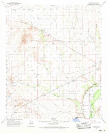
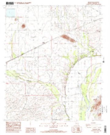
9 surveys from 17 printed sheetsMatched by testing this settlement's coordinate against the published boundary of every sheet in the United States Geological Survey's historical collection. Each opens the scanned sheet at the Survey.
- 1954 USGS Phoenix quadrangle1:250000, 5 printings
- 1957 USGS Phoenix quadrangle1:250000
- 1958 USGS Phoenix quadrangle1:250000
- 1960 USGS Phoenix quadrangle1:250000
- 1962 USGS Arlington quadrangle1:62500, 2 printings
- 1969 USGS Phoenix quadrangle1:250000, 2 printings
- 1971 USGS Phoenix quadrangle1:250000
- 1981 USGS Phoenix South quadrangle1:100000, 2 printings
- 1984 USGS Arlington quadrangle1:24000, 2 printings






Photographs
1 photograph,Taken for the Office of War Information and the Farm Security Administration, who photographed the country between 1935 and 1944. Works of United States government photographers, with no known restriction on use. Each opens its catalogue record.
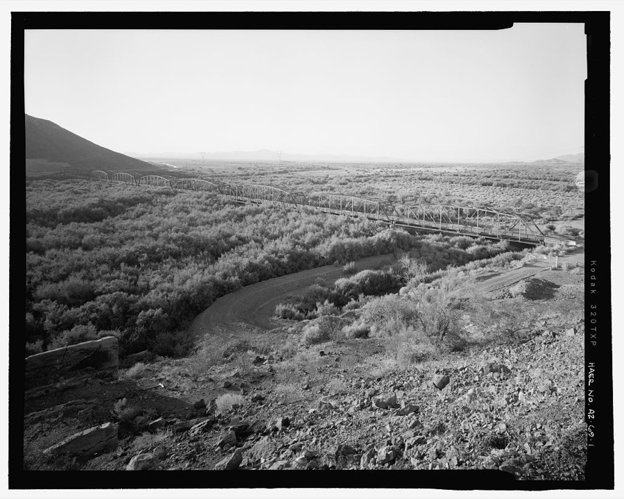
Photographer not recorded. Library of Congress
Fires near this place
69 since 1992Regional context, not property-specific evidence. The federal wildfire occurrence database lists 69 fires within 5 miles of Arlington between 1992 and 2020, burning about 2,498 acres in total. 3 started naturally. 3 were recorded as arson. Distance is straight-line from the map coordinates, so a fire counted here may appear on a neighbouring settlement's page as well.
| Reported cause | Fires |
|---|---|
| Missing data/not specified/undetermined | 57 |
| Debris and open burning | 3 |
| Arson/incendiarism | 3 |
| Natural | 3 |
| Smoking | 2 |
| Equipment and vehicle use | 1 |
The most recent of them, most recent first, with the day each was reported and the service that recorded it.
| Date | Cause | Size | Reported by | Name on the report |
|---|---|---|---|---|
| 7 September 2020 | Missing data/not specified/undetermined | under an acre | Arizona Department of Forestry and Fire Management - State Office | not named |
| 21 September 1995 | Natural | 150 acres | Arizona Department of Forestry and Fire Management - State Office | not named |
| 18 September 2018 | Arson/incendiarism | under an acre | Buckeye Fire Department | 346788 |
| 11 September 2018 | Missing data/not specified/undetermined | under an acre | Buckeye Fire Department | 337123 |
| 8 August 2008 | Natural | 517 acres | Phoenix District Office | ROBBINS |
| 7 August 1992 | Missing data/not specified/undetermined | 5.0 acres | Arizona Department of Forestry and Fire Management - State Office | not named |
| 28 August 2019 | Natural | under an acre | Buckeye Fire Department | NOT NAMED |
| 18 August 2013 | Missing data/not specified/undetermined | under an acre | Arizona Department of Forestry and Fire Management - State Office | AZ-133254 |
Settlements close enough to share some of these fires:
Mines and quarries near this place
4 within 5 milesRegional context, not property-specific evidence. The federal mineral resources record lists 4 workings within 5 miles of Arlington: 2 occurrences, 2 unknowns. None of them still produces. What was taken out: Perlite, Semiprecious Gemstone, Uranium, Feldspar, Iron, Mica, Niobium (Columbium), Quartz, Titanium, Sand and Gravel, Construction. Distance is straight-line from the map coordinates, so a quarry counted here may appear on a neighbouring settlement's page as well.
| Where | Site | Commodity | Status | Recorded |
|---|---|---|---|---|
| Arrowhead | Semiprecious Gemstone, Uranium, Feldspar, Iron, Mica, Niobium (Columbium), Quartz, Titanium | Occurrence | ||
| Sandpit | Sand and Gravel, Construction | Unknown | ||
| Powers Butte | Perlite | Unknown | ||
| Powers Butte Perlite Deposit | Perlite | Occurrence |
Storms near this place
7 since 2008Regional context, not property-specific evidence. The National Weather Service names Arlington in 7 storm reports between 2008 and 2025: 6 flash flood, 1 thunderstorm wind. No death or injury is recorded in these reports. Each account below is quoted exactly as the forecast office filed it, from the NOAA Storm Events Database, and each date opens the federal record of that event.
| When | Event | Place named | Harm | What the report says |
|---|---|---|---|---|
| September 2008 | Thunderstorm Wind | Arlington | $100,000 | According to Arizona Public Service, 48 power poles across a distance of 3 miles were blown down along Old Highway 80 between Buckeye and Gila Bend. Winds were measured up to 56 mph on the Palo Verde Nuclear Generating Station tower. |
| September 2019 | Flash Flood | Arlington | $2,000 | Scattered monsoon thunderstorms developed during the evening hours across the lower desert to the southwest of Phoenix. Some of the stronger storms produced intense rainfall with peak rain rates well in excess of one inch per hour. The heavy rain led to some flash flooding to the north of Gila Bend and to the west of Highway 85. According the the Arizona Department of Transportation, at 2230MST flash flooding along Centennial Wash resulted in the closure of old US Highway 80 at Agua Caliente Road. In addition, a mesonet gage 6 miles upstream at Centennial Railroad reported that alarm stage was exceeded with a peak stage height of 7.48 feet reached. A Flash Flood Warning was in effect at the time of the flooding and was issued at 1951MST. No accidents or injuries were reported due to the flooding. |
| October 2018 | Flash Flood | Arlington | $2,000 | Isolated showers and thunderstorms developed across the deserts to the west and southwest of Phoenix during the morning hours on October 7th. Some of the stronger storms generated locally heavy rain that led to significant flow in area washes, such as the Centennial Wash. According to a local emergency manager, at 0504MST old US Highway 80 was closed near Agua Caliente Road due to flash flooding down the Centennial Wash. The time of the flooding was based on the expected travel time of flood waters that exceeded alert stage from the Centennial Wash at SPRR Flood Control District stream gauge. No accidents were reported due to the flash flooding. A Flash Flood Warning was issued for the area starting at 0413MST and continuing through 0715MST. |
| November 2025 | Flash Flood | Arlington | - | Old US 80 closed between Agua Caliente Rd and Desert Rose Rd due to flooding. Timing based on travel time from upstream streamflow gauge on Centennial Wash at the UPR railroad crossing. No damages or injuries reported. |
| July 2024 | Flash Flood | Arlington | - | Old US-80 Highway closed due to flooding. No damages nor injuries were reported. |
| October 2022 | Flash Flood | Arlington | - | A Maricopa County Flood Control District Streamflow Gauge along Centennial Wash at the Union Pacific Railroad showed flow going above alarm stage (8.5 feet) between 21:53 and 21:56 MST and continuing to rise for several hours more to reach a peak flow of 13 feet (4315 cfs) at 02:06 MST on the 16th. Flooding along the wash likely occurred along the Old US Highway 80, located 6 miles downstream. Flow fell below alarm stage at 13:34 MST on the 16th. No damages or injuries were reported. |
| September 2022 | Flash Flood | Arlington | - | The Flood Control District of Maricopa County Gauge along Centennial Wash near the Railroad area reached action stage at 954 MST, with a peak flow of 10.12 feet (1341 cfs) at 1112 MST. Flash Flood impacts downstream where Centennial Wash crosses old U.S. 80 occurred 1.5 hours after action stage was reached, which is 6 miles downstream of the gauge. The flow returned below alarm stage at 1507 MST. No damages or injuries were reported. |
Nearest settlements
The eight closest, with where each one stands in the county. Distances are straight-line, computed from the Geographic Names Information System coordinates.
| Map | Place | Distance | Sheets |
|---|---|---|---|
| Dixie | 2.4 miles | 17 | |
| Hassayampa | 2.6 miles | 19 | |
| Palo Verde | 4.8 miles | 19 | |
| Conger | 6.5 miles | 19 | |
| Crag | 7.5 miles | 16 | |
| Wintersburg | 8.8 miles | 17 | |
| Allenville | 9.6 miles | 19 | |
| Buckeye | 10.0 miles | 19 |
Elsewhere
Matched on this settlement's Geographic Names Information System number rather than its name, so it cannot be a different place of the same name in another state.
| Wikipedia article on Arlington | An encyclopaedic summary. Its text is share-alike, so it is linked here rather than copied. |
| Wikidata item Q4792251 | The structured record the population and elevation above come from. Public domain (CC0). |
Provenance
This settlement is recorded in the Geographic Names Information System as feature 788. The sheet list is computed by point-in-boundary test against the United States Geological Survey's historical topographic inventory. Both are works of the United States government and carry no copyright under 17 U.S.C. 105.
Wildfire. Short, Karen C. 2022. Spatial wildfire occurrence data for the United States, 1992-2020 [FPA_FOD_20221014]. 6th Edition. Fort Collins, CO: Forest Service Research Data Archive. https://doi.org/10.2737/RDS-2013-0009.6 Collected with United States Government funding and usable without additional permissions or fees.
Mines and quarries. USGS Mineral Resources Data System (MRDS) https://mrdata.usgs.gov/mrds/ A work of the United States government, no copyright under 17 U.S.C. 105.
Storms. NOAA National Centers for Environmental Information, Storm Events Database https://www.ncei.noaa.gov/stormevents/ A work of the United States government, no copyright under 17 U.S.C. 105. Narratives are quoted verbatim from the National Weather Service report and are not edited or summarised.