 Block
Crag, Arizona
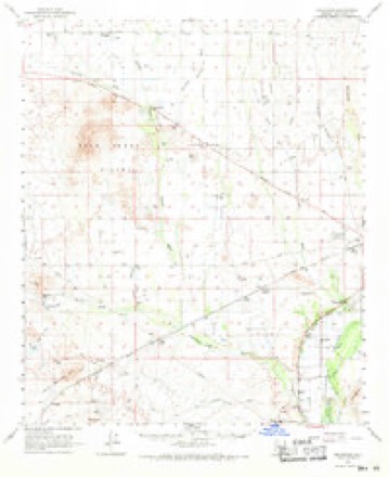
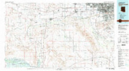
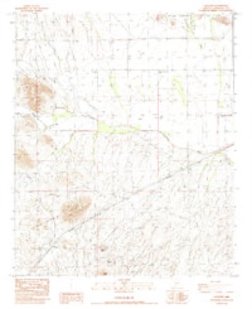
16 topographic sheets cover this place, the earliest surveyed in 1954 and the latest in 1984. It stands in the Buckeye census division. It lies in ZIP code area 85322. The Survey maps it on the Gillespie quadrangle.
Topographic sheets covering this place
9 surveys from 16 printed sheetsMatched by testing this settlement's coordinate against the published boundary of every sheet in the United States Geological Survey's historical collection. Each opens the scanned sheet at the Survey.
- 1954 USGS Phoenix quadrangle1:250000, 5 printings
- 1957 USGS Phoenix quadrangle1:250000
- 1958 USGS Phoenix quadrangle1:250000
- 1960 USGS Phoenix quadrangle1:250000
- 1962 USGS Arlington quadrangle1:62500, 2 printings
- 1969 USGS Phoenix quadrangle1:250000, 2 printings
- 1971 USGS Phoenix quadrangle1:250000
- 1981 USGS Phoenix South quadrangle1:100000, 2 printings
- 1984 USGS Gillespie quadrangle1:24000






Fires near this place
8 since 1993Regional context, not property-specific evidence. The federal wildfire occurrence database lists 8 fires within 5 miles of Crag between 1993 and 2020, burning about 37 acres in total. None started naturally. None was recorded as arson. Distance is straight-line from the map coordinates, so a fire counted here may appear on a neighbouring settlement's page as well.
| Reported cause | Fires |
|---|---|
| Missing data/not specified/undetermined | 4 |
| Debris and open burning | 2 |
| Equipment and vehicle use | 1 |
| Recreation and ceremony | 1 |
The most recent of them, most recent first, with the day each was reported and the service that recorded it.
| Date | Cause | Size | Reported by | Name on the report |
|---|---|---|---|---|
| 6 August 1994 | Missing data/not specified/undetermined | 2.0 acres | Arizona Department of Forestry and Fire Management - State Office | not named |
| 23 July 2015 | Missing data/not specified/undetermined | under an acre | Arizona Department of Forestry and Fire Management - State Office | 155245 |
| 5 June 1995 | Equipment and vehicle use | 30 acres | Arizona Department of Forestry and Fire Management - State Office | not named |
| 12 May 1993 | Recreation and ceremony | 4.0 acres | Arizona Department of Forestry and Fire Management - State Office | not named |
| 26 April 2020 | Missing data/not specified/undetermined | under an acre | Arizona Department of Forestry and Fire Management - State Office | not named |
| 25 April 2020 | Missing data/not specified/undetermined | under an acre | Arizona Department of Forestry and Fire Management - State Office | not named |
| 28 December 2001 | Debris and open burning | under an acre | Phoenix District Office | IDAZONA |
| 20 November 1995 | Debris and open burning | 1.0 acres | Arizona Department of Forestry and Fire Management - State Office | not named |
Settlements close enough to share some of these fires:
Mines and quarries near this place
5 within 5 milesRegional context, not property-specific evidence. The federal mineral resources record lists 5 workings within 5 miles of Crag: 3 occurrences, 1 prospect, 1 unknown. None of them still produces. What was taken out: Copper, Barium-Barite, Gold, Barium-Barite, Fluorine-Fluorite. Distance is straight-line from the map coordinates, so a quarry counted here may appear on a neighbouring settlement's page as well.
| Where | Site | Commodity | Status | Recorded |
|---|---|---|---|---|
| B & H Claim No. 6 | Barium-Barite | Occurrence | Vein | |
| Black Butte Group | Gold | Occurrence | ||
| Butte | Copper, Gold, Feldspar, Clay, Fluorine-Fluorite, Magnesite, Silica, Barium-Barite | Unknown | ||
| Butte Mine | Barium-Barite, Fluorine-Fluorite | Occurrence | Vein | |
| Idazona Mines | Copper, Silver, Gold, Lead | Prospect |
Storms near this place
5 since 2020Regional context, not property-specific evidence. The National Weather Service names Crag in 5 storm reports between 2020 and 2024: 5 flash flood. No death or injury is recorded in these reports. Each account below is quoted exactly as the forecast office filed it, from the NOAA Storm Events Database, and each date opens the federal record of that event.
| When | Event | Place named | Harm | What the report says |
|---|---|---|---|---|
| March 2020 | Flash Flood | Crag | $5,000 | A powerful Pacific low pressure system spread deep moisture into the central deserts on Marcth 12th; aided by modest instability it allowed scattered to numerous showers and thunderstorms to develop during the afternoon and evening hours. Moderate to heavy rain fell with many of the storms, affecting areas to the southwest of central Phoenix. Peak rain rates were well in excess of 1 inch per hour; earlier in the day at about 1100MST a rain gage at Woolsey Peak measured 2.37 inches in a 2 hour period. The heavy rain led to some flash flooding as streams and washes rose rapidly, exceeding alarm stages on gages and causing road closures. At 2303MST county officials reported that Agua Caliente Road was closed as the Cruff Wash reached action stage. The wash crested at flood stage of 4.8 feet. This was about 9 miles south of the Palo Verge Nuclear Generating Station. Shortly after that, at 2324MST, county officials reported that Old Highway 80 was closed at Rainbow Wash as the wash reached action stage. This was about 15 miles southwest of Buckeye. Finally, at 2356MST officials reported that Old Highway 80 was closed due to the Centennial Wash reaching action stage; this occurred about 10 miles south-southeast of the Palo Verde station. Flash Flood Warnings were issued and in effect at the time of the road closures. Fortunately there were no reports of injuries or accidents due to the flooding. |
| August 2024 | Flash Flood | Crag | - | According to the Maricopa County Flood Control District Gauge located at Cruff Wash, water levels rose above the alarm level stage of 2.5 feet at around 1952MST and crested at 3.91 feet, which is above the bank full level stage of 3.88 feet, at around 2015MST. Water levels fell below alarm stage at around 2105MST. Based on the information of problem areas produced by the Maricopa County Flood Control District, flooding was likely along the low water crossing of Agua Caliente Road located above 2 miles downstream of the gauge. No damages nor injuries were reported. |
| October 2022 | Flash Flood | Crag | - | A Maricopa County Flood Control District Streamflow Gauge along Cruff Wash showed flow going above alarm stage (2.5 feet) between 20:29 and 20:31 MST, reaching a peak flow of 3.25 feet (448 cfs) at 21:13 MST. Flooding along the wash likely occurred at Agua Caliente Road, located about 2 miles downstream. Flow fell below alarm stage between 21:42 and 21:48 MST. No damages or injuries were reported. |
| July 2022 | Flash Flood | Crag | - | Cruff Wash streamflow gauge reached bank full with peak flow of 1000 cfs and a rapid 3.75 foot rise. A low water crossing along Agua Caliente Rd was likely impacted. No damages or injuries were reported. |
| August 2021 | Flash Flood | Crag | - | Maricopa County Department of Transportation reported at 0226MST that Agua Caliente Road, a dirt road, was closed between Old US 80 to Lahman Road due to flooding. Timing of impacts adjusted based on radar and location focused on area with greatest radar rainfall estimates. No damages or injuries were reported. |
Nearest settlements
The eight closest, with where each one stands in the county. Distances are straight-line, computed from the Geographic Names Information System coordinates.
| Map | Place | Distance | Sheets |
|---|---|---|---|
| Gillespie | 5.0 miles | 16 | |
| Harqua | 6.5 miles | 17 | |
| Arlington | 7.5 miles | 17 | |
| Dixie | 8.6 miles | 17 | |
| Wintersburg | 8.7 miles | 17 | |
| Hassayampa | 9.9 miles | 19 | |
| Palo Verde | 12.3 miles | 19 | |
| Tonopah | 13.4 miles | 16 |
Provenance
This settlement is recorded in the Geographic Names Information System as feature 24391. The sheet list is computed by point-in-boundary test against the United States Geological Survey's historical topographic inventory. Both are works of the United States government and carry no copyright under 17 U.S.C. 105.
Wildfire. Short, Karen C. 2022. Spatial wildfire occurrence data for the United States, 1992-2020 [FPA_FOD_20221014]. 6th Edition. Fort Collins, CO: Forest Service Research Data Archive. https://doi.org/10.2737/RDS-2013-0009.6 Collected with United States Government funding and usable without additional permissions or fees.
Mines and quarries. USGS Mineral Resources Data System (MRDS) https://mrdata.usgs.gov/mrds/ A work of the United States government, no copyright under 17 U.S.C. 105.
Storms. NOAA National Centers for Environmental Information, Storm Events Database https://www.ncei.noaa.gov/stormevents/ A work of the United States government, no copyright under 17 U.S.C. 105. Narratives are quoted verbatim from the National Weather Service report and are not edited or summarised.