 Block
Cortaro, Arizona
20 topographic sheets cover this place, the earliest surveyed in 1934 and the latest in 1996. It stands in the Tucson census division. It lies in ZIP code area 85743. The Survey maps it on the Jaynes quadrangle. It stands 2,159 feet above sea level.
Topographic sheets covering this place
12 surveys from 20 printed sheetsMatched by testing this settlement's coordinate against the published boundary of every sheet in the United States Geological Survey's historical collection. Each opens the scanned sheet at the Survey.
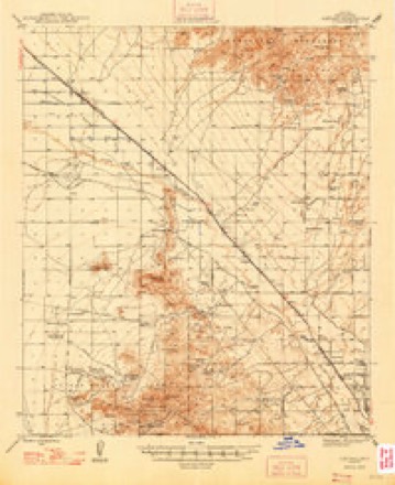
- 1934 USGS Tucson Mountains quadrangle1:125000
- 1947 USGS Cortaro quadrangle1:62500
- 1956 USGS Tucson quadrangle1:250000, 3 printings
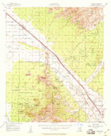
- 1957 USGS Cortaro quadrangle1:62500, 2 printings
- 1958 USGS Tucson quadrangle1:250000
- 1959 USGS Tucson quadrangle1:250000, 2 printings
- 1962 USGS Tucson quadrangle1:250000
- 1964 USGS Tucson quadrangle1:250000
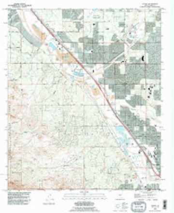
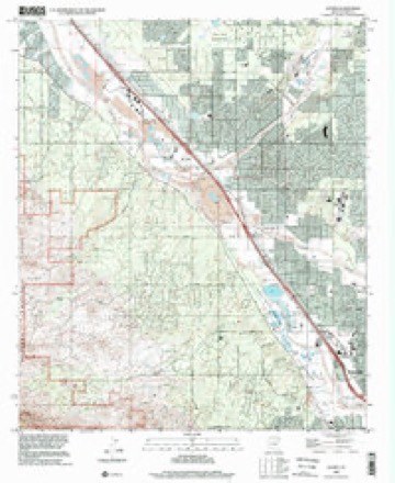
- 1968 USGS Jaynes quadrangle1:24000, 4 printings
- 1992 USGS Jaynes quadrangle1:24000
- 1994 USGS Silver Bell Mountains quadrangle1:100000, 2 printings
- 1996 USGS Jaynes quadrangle1:24000

Fires near this place
203 since 1992Regional context, not property-specific evidence. The federal wildfire occurrence database lists 203 fires within 5 miles of Cortaro between 1992 and 2020, burning about 760 acres in total. 9 started naturally. 4 were recorded as arson. Distance is straight-line from the map coordinates, so a fire counted here may appear on a neighbouring settlement's page as well.
| Reported cause | Fires |
|---|---|
| Missing data/not specified/undetermined | 180 |
| Natural | 9 |
| Equipment and vehicle use | 5 |
| Arson/incendiarism | 4 |
| Power generation/transmission/distribution | 2 |
| Railroad operations and maintenance | 2 |
| Misuse of fire by a minor | 1 |
The most recent of them, most recent first, with the day each was reported and the service that recorded it.
| Date | Cause | Size | Reported by | Name on the report |
|---|---|---|---|---|
| 9 September 2020 | Missing data/not specified/undetermined | under an acre | Arizona Department of Forestry and Fire Management - State Office | not named |
| 9 September 2019 | Missing data/not specified/undetermined | under an acre | Northwest Fire Rescue District | NOT NAMED |
| 8 September 2019 | Missing data/not specified/undetermined | under an acre | Northwest Fire Rescue District | NOT NAMED |
| 7 September 2020 | Missing data/not specified/undetermined | under an acre | Arizona Department of Forestry and Fire Management - State Office | not named |
| 7 September 2020 | Missing data/not specified/undetermined | under an acre | Arizona Department of Forestry and Fire Management - State Office | not named |
| 28 September 2018 | Missing data/not specified/undetermined | under an acre | Northwest Fire Rescue District | 1829223 |
| 27 September 2018 | Missing data/not specified/undetermined | under an acre | Northwest Fire Rescue District | 1829128 |
| 25 September 2020 | Missing data/not specified/undetermined | under an acre | Arizona Department of Forestry and Fire Management - State Office | not named |
Settlements close enough to share some of these fires:
Mines and quarries near this place
10 of 60 shownRegional context, not property-specific evidence. The federal mineral resources record lists 60 workings within 5 miles of Cortaro: 46 occurrences, 6 past producers, 4 producers, 2 unknowns. 4 still produce. What was taken out: Copper, Sand and Gravel, Construction, Lead, Vanadium. Distance is straight-line from the map coordinates, so a quarry counted here may appear on a neighbouring settlement's page as well.
| Where | Site | Commodity | Status | Recorded |
|---|---|---|---|---|
| Arizona Consolidated Mine | Copper, Silver, Gold | Producer | 1901, 1905 | |
| Boston Property | Copper, Silver, Gold | Prospect | ||
| Gatlin | Lead, Copper, Gold, Silver | Past Producer | ||
| Gila Monster Mine | Lead, Copper, Zinc | Past Producer | Contact Metasomatic | |
| Northern Tucson Mountains | Semiprecious Gemstone, Quartz | Past Producer | Agate, Chalcedony | |
| Old Yuma Mine | Lead, Copper, Gold, Semiprecious Gemstone, Zinc, Molybdenum, Silver, Vanadium | Past Producer | Vanadinite, Wulfenite | |
| Old Yuma Mine | Molybdenum, Silver, Zinc, Copper, Gold, Lead, Vanadium | Past Producer | ||
| Thunderbird Mine | Copper, Lead, Silver, Zinc | Unknown | ||
| Unknown | Geothermal | Occurrence | ||
| Unnamed Prospect 95-17 | Copper, Molybdenum, Lead | Occurrence | Wulfenite |
Storms near this place
32 since 2007Regional context, not property-specific evidence. The National Weather Service names Cortaro in 32 storm reports between 2007 and 2024: 14 thunderstorm wind, 11 flash flood, 3 heavy rain, 3 hail. No death or injury is recorded in these reports. Each account below is quoted exactly as the forecast office filed it, from the NOAA Storm Events Database, and each date opens the federal record of that event.
| When | Event | Place named | Harm | What the report says |
|---|---|---|---|---|
| July 2012 | Thunderstorm Wind | Cortaro | $50,000 | A microburst caused extensive damage to a mobile home park east of Interstate 10 and south of Cortaro Farms Road. An awning was blown over one home, causing part of the roof to peel off, which fell on a vehicle. Other homes suffered skirting, awning and minor roof damage and one tree were uprooted. Another tree was uprooted farther north near Bald Eagle Road and Condor Drive. |
| June 2016 | Thunderstorm Wind | Cortaro | $30,000 | Multiple reports and photos of trees uprooted and broken branches on the northwest side of Tucson. Some branches fell on vehicles. Wind damage to a church roof led to extensive water damage inside. |
| August 2011 | Heavy Rain | Cortaro | $25,000 | Heavy rainfall resulted in zero visibility along Interstate 10 near Ina Road resulting in an accident. A tractor trailer drove into the median and flipped as a result on the heavy rainfall. The driver sustained minor injuries and was treated on scene. |
| July 2021 | Thunderstorm Wind | Cortaro | $20,000 | Thunderstorm wind gusts downed several trees in western Oro Valley and Marana and downed power poles along Trico Rd. |
| August 2018 | Flash Flood | Cortaro | $20,000 | Heavy rain of 1 to just over 2 inches in parts of Oro Valley, Tortolita and Casas Adobes caused flash flooding of several washes and significant street flooding. At least four swift water rescues occurred at Camino De Oeste and Snow Leopard, Thornydale and Overton, Linda Vista and Highline, and Calle Maverick and Cerius Stravenue. Additionally, water flowed along Pima Farms Road up to the front porches of several homes. |
| August 2013 | Thunderstorm Wind | Cortaro | $15,000 | Thunderstorm winds downed several trees on Tucson's northwest side. One tree branch damaged three cars when it fell. Additionally, a small greenhouse was damaged by the wind. |
| September 2011 | Heavy Rain | Cortaro | $15,000 | Heavy rainfall resulted in two, single car accidents on Interstate 10 between Ina Road and Orange Grove Road due to hydroplaning. One person was taken to the hospital with minor injuries. |
| August 2022 | Thunderstorm Wind | Cortaro | $10,000 | Thunderstorm winds downed multiple trees near Cortaro and Thornydale Rds. and downed power poles along Linda Vista Blvd. |
| August 2013 | Heavy Rain | Cortaro | $10,000 | A thunderstorm dropped nearly an inch of rain in 20 minutes. The heavy rain caused drain spouts on the roof of a supermarket to break, sending water into the attic, which collapsed the ceiling. The store was evacuated but no one was injured. |
| July 2011 | Thunderstorm Wind | Cortaro | $10,000 | Thunderstorm winds blew through northwest portions of the Tucson area uprooting several trees from Ina Road and Interstate 10 to the Continental Ranch subdivision at Cortaro Road and Silverbell Road. Tree limbs were downed onto Interstate 10 creating traffic delays. Several trees were also downed in Arizona Pavilion Shopping Center. One tree in the Continental Ranch neighborhood knocked a brick wall down. Also, a trampoline was blown into a house causing minor damage to the home. |
| September 2018 | Flash Flood | Cortaro | $5,000 | Thunderstorms produced localized heavy rain of 1 to 2 inches, causing flash flooding and erosion of road surfaces on Shannon Rd. north of Magee Rd. and near the intersection of Cortaro Farms Rd. and West Club Dr. |
| July 2008 | Thunderstorm Wind | Cortaro | $5,000 | Several large trees were downed at the Tucson Omni National Resort. |
| June 2016 | Thunderstorm Wind | Cortaro | $3,000 | Thunderstorm winds damaged a fence and snapped 4 tree branches on the northwest side of Tucson. |
| August 2015 | Flash Flood | Cortaro | $2,000 | Water flowing across Linda Vista Blvd west of Hartman Lane caused at least 1 vehicle to become disabled. |
| May 2007 | Flash Flood | Cortaro | $2,000 | Flash flooding from thunderstorms caused a vehicle to be swept into fast moving water at North Bobcat Ridge Trail and West Ina Road on the northwest side of Tucson. The vehicle was washed downstream for about 200 feet before coming to a stop on a bank. |
| August 2015 | Thunderstorm Wind | Cortaro | $1,500 | A power pole was knocked down near the intersection of Camino de Oeste and Lambert Lane. |
| August 2024 | Flash Flood | Cortaro | $1,000 | Considerable water running along low water crossing on N. Thornydale Rd. just south of W. Hardy Rd. |
| August 2024 | Flash Flood | Cortaro | $1,000 | Considerable water running along low water crossing on N. Thornydale Rd. just south of W. Hardy Rd. |
| July 2023 | Thunderstorm Wind | Cortaro | $1,000 | Thunderstorm winds downed trees at Cortaro and Silverbell. |
| July 2014 | Thunderstorm Wind | Cortaro | $1,000 | Thunderstorm outflow winds flowed into air vents causing a section of drywall to fall into a breezeway, where it struck four people waiting for appointments at an office in a strip mall. Three of the four sustained minor injuries. |
| August 2022 | Thunderstorm Wind | Cortaro | $500 | Thunderstorms winds downed large limbs of several trees. |
| July 2018 | Thunderstorm Wind | Cortaro | $500 | Thunderstorm winds blew a tree down near Cortaro Farms and Magee Roads. |
| August 2017 | Flash Flood | Cortaro | $500 | A swift water rescue was conducted along Ina Road near Camino de los Caballos when a car was swept 20 feet off the road due to flash flooding. Sandario Road also became inundated by flood waters between Avra Valley and Twin Peaks Roads. |
| August 2023 | Funnel Cloud | Cortaro | - | A short-lived funnel cloud was photographed south of Ina and Silverbell in Marana. |
| July 2018 | Flash Flood | Cortaro | - | Over two inches of rain caused flowing water up to a foot deep across several roads in Oro Valley. |
| October 2015 | Hail | Cortaro | - | Multiple reports and pictures were received of 1 inch diameter hail occurring near Thornydale Road from the intersection its intersection with Cortaro Farms Road north to Overton Road. |
| August 2015 | Flash Flood | Cortaro | - | Road closures occurred due to flash flooding in the northwest Tucson metro, including Overton Rd at the Canada del Oro Wash, Thornydale Rd at Freer Drive and Oasis Drive, and Linda Vista between Thornydale Rd and Camino de Oeste. |
| July 2013 | Hail | Cortaro | - | Penny size hail was reported in Marana. |
| June 2012 | Thunderstorm Wind | Cortaro | - | Thunderstorm winds downed tree limbs about a mile west of the Twin Peaks exit of Interstate 10. |
| August 2011 | Flash Flood | Cortaro | - | Heavy rainfall amounts of 1 to 2 inches in less than 20 minutes resulted in widespread flash flooding near the Dove Mountain Community and Marana. Several streets were impassable for nearly an hour as water rushed through flooded washes and ditches. Notable road closures included Tangerine Road and Camino de Manana. |
| July 2007 | Flash Flood | Cortaro | - | A swift water rescue occurred on the Santa Cruz River north of Cortaro Road. |
| September 2018 | Hail | Cortaro | - | no account filed |
Nearest settlements
The eight closest, with where each one stands in the county. Distances are straight-line, computed from the Geographic Names Information System coordinates.
| Map | Place | Distance | Sheets |
|---|---|---|---|
| Kino | 2.0 miles | 20 | |
| Tucson National Estates | 3.3 miles | 20 | |
| Orange Grove Estates | 3.5 miles | 20 | |
| Tortolita | 3.9 miles | 19 | |
| Jaynes | 5.2 miles | 20 | |
| Rillito | 5.4 miles | 20 | |
| Casas Adobes | 5.4 miles | 26 | |
| Flowing Wells | 6.0 miles | 20 |
Elsewhere
Matched on this settlement's Geographic Names Information System number rather than its name, so it cannot be a different place of the same name in another state.
| Wikipedia article on Cortaro | An encyclopaedic summary. Its text is share-alike, so it is linked here rather than copied. |
| Wikidata item Q5173215 | The structured record the population and elevation above come from. Public domain (CC0). |
Provenance
This settlement is recorded in the Geographic Names Information System as feature 24384. The sheet list is computed by point-in-boundary test against the United States Geological Survey's historical topographic inventory. Both are works of the United States government and carry no copyright under 17 U.S.C. 105.
Wildfire. Short, Karen C. 2022. Spatial wildfire occurrence data for the United States, 1992-2020 [FPA_FOD_20221014]. 6th Edition. Fort Collins, CO: Forest Service Research Data Archive. https://doi.org/10.2737/RDS-2013-0009.6 Collected with United States Government funding and usable without additional permissions or fees.
Mines and quarries. USGS Mineral Resources Data System (MRDS) https://mrdata.usgs.gov/mrds/ A work of the United States government, no copyright under 17 U.S.C. 105.
Storms. NOAA National Centers for Environmental Information, Storm Events Database https://www.ncei.noaa.gov/stormevents/ A work of the United States government, no copyright under 17 U.S.C. 105. Narratives are quoted verbatim from the National Weather Service report and are not edited or summarised.