 Block
Higley, Arizona
20 topographic sheets cover this place, the earliest surveyed in 1904 and the latest in 1994. It stands in the Chandler census division. It lies in ZIP code area 85295. The Survey maps it on the Higley quadrangle. It stands 1,299 feet above sea level.
Topographic sheets covering this place
10 surveys from 20 printed sheetsMatched by testing this settlement's coordinate against the published boundary of every sheet in the United States Geological Survey's historical collection. Each opens the scanned sheet at the Survey.
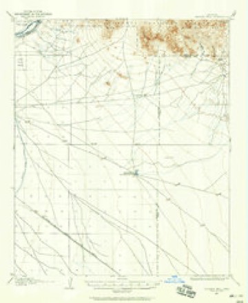
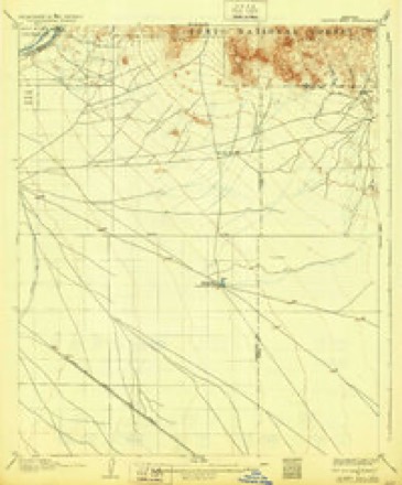
- 1904 USGS Desert Well quadrangle1:62500
- 1906 USGS Desert Well quadrangle1:62500, 3 printings
- 1954 USGS Mesa quadrangle1:250000, 4 printings
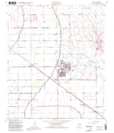
- 1956 USGS Higley quadrangle1:24000, 5 printings
- 1957 USGS Mesa quadrangle1:250000
- 1958 USGS Mesa quadrangle1:250000
- 1960 USGS Mesa quadrangle1:250000
- 1964 USGS Mesa quadrangle1:250000
- 1971 USGS Higley quadrangle1:24000
- 1994 USGS Mesa quadrangle1:100000, 2 printings







Fires near this place
309 since 1993Regional context, not property-specific evidence. The federal wildfire occurrence database lists 309 fires within 5 miles of Higley between 1993 and 2020, burning about 130 acres in total. 9 started naturally. 10 were recorded as arson. Distance is straight-line from the map coordinates, so a fire counted here may appear on a neighbouring settlement's page as well.
| Reported cause | Fires |
|---|---|
| Missing data/not specified/undetermined | 287 |
| Arson/incendiarism | 10 |
| Natural | 9 |
| Railroad operations and maintenance | 1 |
| Equipment and vehicle use | 1 |
| Power generation/transmission/distribution | 1 |
The most recent of them, most recent first, with the day each was reported and the service that recorded it.
| Date | Cause | Size | Reported by | Name on the report |
|---|---|---|---|---|
| 9 September 2020 | Missing data/not specified/undetermined | under an acre | Arizona Department of Forestry and Fire Management - State Office | not named |
| 6 September 2015 | Missing data/not specified/undetermined | under an acre | Arizona Department of Forestry and Fire Management - State Office | 154029 |
| 4 September 2018 | Missing data/not specified/undetermined | under an acre | Arizona Department of Forestry and Fire Management - State Office | 70324 |
| 30 September 2018 | Missing data/not specified/undetermined | under an acre | Queen Creek Fire Department | 77540 |
| 3 September 2018 | Missing data/not specified/undetermined | under an acre | Arizona Department of Forestry and Fire Management - State Office | 70124 |
| 29 September 2019 | Missing data/not specified/undetermined | under an acre | Arizona Department of Forestry and Fire Management - State Office | NOT NAMED |
| 21 September 2019 | Missing data/not specified/undetermined | under an acre | Arizona Department of Forestry and Fire Management - State Office | NOT NAMED |
| 21 September 2019 | Missing data/not specified/undetermined | under an acre | Chandler Fire Department | NOT NAMED |
Settlements close enough to share some of these fires:
Mines and quarries near this place
3 within 5 milesRegional context, not property-specific evidence. The federal mineral resources record lists 3 workings within 5 miles of Higley: 2 occurrences, 1 prospect. None of them still produces. What was taken out: Gypsum-Anhydrite, Geothermal. Distance is straight-line from the map coordinates, so a quarry counted here may appear on a neighbouring settlement's page as well.
| Where | Site | Commodity | Status | Recorded |
|---|---|---|---|---|
| Buckhorn-Higley Geothermal | Geothermal | Prospect | ||
| Higley Basin | Gypsum-Anhydrite | Occurrence | 1973 | |
| Higley Basin | Gypsum-Anhydrite | Occurrence |
Storms near this place
13 since 2012Regional context, not property-specific evidence. The National Weather Service names Higley in 13 storm reports between 2012 and 2023: 11 thunderstorm wind, 1 heavy rain, 1 tornado. No death or injury is recorded in these reports. Each account below is quoted exactly as the forecast office filed it, from the NOAA Storm Events Database, and each date opens the federal record of that event.
| When | Event | Place named | Harm | What the report says |
|---|---|---|---|---|
| November 2019 | Tornado (EF0) | Higley | $25,000 | A powerful Pacific upper low and associated cold front moved east across the central deserts during the early morning hours on November 29th. Due to elevated levels of both wind shear and instability, the cold front was able to produce several weak tornadoes in the Phoenix area including two to the southeast of central Phoenix. According to a NWS storm survey, one of the tornadoes tracked to the northeast along the Loop 202, about 2 miles southwest of Higley. The tornado was short lived with a width near 100 yards, and was rated as an EF0. The tornado did produce a bit of damage; small trees were damaged in 2 shopping center parking lots and there were multiple spotter reports of additional damage, mostly trees that were downed. |
| November 2019 | Thunderstorm Wind | Higley | $20,000 | A strong cold front associated with a powerful Pacific low pressure system pushed east across the lower deserts to the southeast of central Phoenix during the early morning hours on November 29th. Earlier in the morning as the front moved through central Phoenix it generated multiple episodes of wind damage as well as high wind reports. It then continued to produce damage to the southeast of Phoenix, affecting communities such as Higley and Queen Creek. According to a trained spotter located |about 2 miles southwest of Higley, gusty winds estimated to be as high as 60 mph blew down a number of trees and broke 12 inch diameter branches off of trees. The tree damage occurred just 300 feet to the east of the trained spotter's apartment which was near the intersection of Chandler Boulevard and Val Vista Drive. At about the same time and a few miles to the southeast, there was a public report of wind damage 3 miles to the southwest of Queen Creek. The report indicated significant damage to shingles on an asphalt roof rated to be in good condition. Most of the shingles were loosened and many were ripped away. There was also tree damage nearby. The damage was just northeast of the intersection of the Hunt Highway and Power Road. No injuries were reported due to the high winds. |
| July 2012 | Thunderstorm Wind | Higley | $20,000 | Numerous thunderstorms developed across the greater Phoenix metropolitan area during the afternoon hours on July 14th. Due to the very wet and unstable nature of the airmass, most of the thunderstorms produced very heavy rain. A few generated wet microbursts with damaging winds. At 345 pm, a Weather Service employee reported that numerous trees had been blown down at the San Tan Village Mall in Gilbert Ranch. One of the trees was about 40 feet tall and it fell over and landed on an automobile, causing significant damage. Peak wind gusts were estimated to be about 65 knots. No injuries were reported. |
| August 2022 | Thunderstorm Wind | Higley | $15,000 | Numerous downed trees (10+) along the area of Higley and Germann Roads in Gilbert. Timing estimated from radar. Winds were estimated at around 60 mph. No injuries were reported. |
| September 2020 | Thunderstorm Wind | Higley | $10,000 | Thunderstorms with gusty and damaging winds developed to the southeast of Phoenix during the late afternoon hours on September 8th. Some of the stronger storms affected communities such as Higley. At about 1700MST, a report from the public indicated that gusty outflow winds downed multiple trees near the intersection of Higley and Pecos Roads, about 1 miles south of the town of Higley. Wind gusts were estimated to be as high as 60 mph; at about 1705MST a wind gust to 58 mph was reported from the nearby AWOS weather station at Phoenix Mesa-Gateway airport. |
| July 2012 | Thunderstorm Wind | Higley | $10,000 | Widespread thunderstorms developed over the greater Phoenix metropolitan area during the afternoon hours on July 14th. Due to the very moist and unstable nature of the airmass, most of the storms generated very heavy rain. However, isolated storms produced wet microbursts with damaging winds across southeastern portions of the Phoenix area. At 404 pm, a trained weather spotter located in Gilbert reported several trees down along Greenfield road between Ray and Warner roads. The largest trees were around 12 inches in diameter. Peak wind gusts were estimated to be about 65 knots. No injuries were reported due to the fallen trees. |
| August 2015 | Thunderstorm Wind | Higley | $5,000 | Scattered thunderstorms developed across portions of the greater Phoenix metropolitan area during the evening hours on August 29th, and the stronger ones produced gusty and damaging winds which affected communities such as Chandler and Ahwatukee. According to a trained weather spotter, at 1949MST gusty winds estimated to at least 65 mph uprooted and snapped 2 trees at the San Tan Village mall. About one hour earlier, strong winds uprooted a 21 inch diameter tree 2 miles east of the town of Ahwatukee, according to a report from the public. |
| July 2014 | Thunderstorm Wind | Higley | $5,000 | Scattered thunderstorms affected much of the greater Phoenix area, including southeastern valley communities such as Gilbert, during the late afternoon hours on July 13th. The stronger storms produced damaging microburst winds in excess of 50 mph. A trained weather spotter 1 mile southeast of Gilbert reported that gusty outflow winds broke off a large branch which fell onto a car, damaging the vehicle. This occurred near the intersection of Loop 202 and Higley Road. |
| September 2014 | Thunderstorm Wind | Higley | $5,000 | Thunderstorms developed across the far southeast portion of the greater Phoenix metropolitan area during the afternoon hours on September 6th and they affected communities such as Chandler, San Tan Valley and Queen Creek. The stronger storms produced gusty and damaging outflow winds, estimated to be in excess of 60 mph at times. A trained weather spotter located about 2 miles northwest of the Seville Country Club reported thunderstorm wind damage. Wind gusts, estimated to be nearly 65 mph, blew off a section of the roof of a trailer in an RV park. Fortunately, no injuries were reported. |
| July 2023 | Thunderstorm Wind | Higley | $2,000 | Large tree branch down in the area of East Boston Street and South Santan Village Parkway in Gilbert. Tree branch is estimated to be three inches in diameter, breaking the windows of parked car. Wind gusts were estimated to be 55-60 mph. No injuries were reported. |
| August 2020 | Thunderstorm Wind | Higley | - | Multiple large trees were blown down in the Santan Village Marketplace near Market Street in Gilbert. Radar estimated winds were around 55-65 mph. No injuries were reported. |
| August 2015 | Heavy Rain | Higley | - | Scattered thunderstorms developed across the southeastern portion of the greater Phoenix metropolitan area during the evening hours on August 29th, and some of the stronger ones produced locally heavy rainfall with peak rain rates in excess of 1.5 inches per hour. At 1840MST a trained weather spotter living near Chandler Heights measured 1.4 inches of rain within the past 37 minutes. The rain fell near the intersection of South Higley and East Ocotillo Roads. The heavy rain in the area led to the issuance of an Urban and Small Stream Flood Advisory at 1917MST and also caused urban flooding. |
| July 2014 | Thunderstorm Wind | Higley | - | Scattered thunderstorms developed across the greater Phoenix area during the late afternoon hours on July 13th, and some of the stronger storms produced gusty microburst winds. According to a broadcast media report, a wind gust of 59 mph was measured in Higley, just to the west of Phoenix Mesa Gateway airport. |
Nearest settlements
The eight closest, with where each one stands in the county. Distances are straight-line, computed from the Geographic Names Information System coordinates.
| Map | Place | Distance | Sheets |
|---|---|---|---|
| Germann | 3.4 miles | 20 | |
| Nortons Corner | 3.6 miles | 20 | |
| Hacienda Solano Park | 3.7 miles | 20 | |
| Colonial Coronita | 4.0 miles | 20 | |
| Sonora Town | 4.1 miles | 20 | |
| Gilbert | 4.8 miles | 20 | |
| Rancho de Chandler | 5.4 miles | 20 | |
| The Haciendas | 5.4 miles | 20 |
Elsewhere
Matched on this settlement's Geographic Names Information System number rather than its name, so it cannot be a different place of the same name in another state.
| Wikipedia article on Higley | An encyclopaedic summary. Its text is share-alike, so it is linked here rather than copied. |
| Wikidata item Q5760125 | The structured record the population and elevation above come from. Public domain (CC0). |
Provenance
This settlement is recorded in the Geographic Names Information System as feature 5816. The sheet list is computed by point-in-boundary test against the United States Geological Survey's historical topographic inventory. Both are works of the United States government and carry no copyright under 17 U.S.C. 105.
Wildfire. Short, Karen C. 2022. Spatial wildfire occurrence data for the United States, 1992-2020 [FPA_FOD_20221014]. 6th Edition. Fort Collins, CO: Forest Service Research Data Archive. https://doi.org/10.2737/RDS-2013-0009.6 Collected with United States Government funding and usable without additional permissions or fees.
Mines and quarries. USGS Mineral Resources Data System (MRDS) https://mrdata.usgs.gov/mrds/ A work of the United States government, no copyright under 17 U.S.C. 105.
Storms. NOAA National Centers for Environmental Information, Storm Events Database https://www.ncei.noaa.gov/stormevents/ A work of the United States government, no copyright under 17 U.S.C. 105. Narratives are quoted verbatim from the National Weather Service report and are not edited or summarised.