 Block
Laveen, Arizona
26 topographic sheets cover this place, the earliest surveyed in 1912 and the latest in 1981. It stands in the Phoenix census division. It lies in ZIP code area 85339. The Survey maps it on the Laveen quadrangle.
On record in Laveen
Buildings and businesses the archive holds for this place. Each opens its own page, with the source record it came from.
On the National Register 1 record
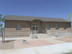 Laveen School Auditoriumlisted 1996
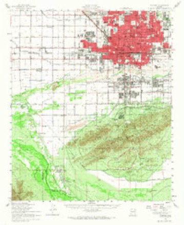
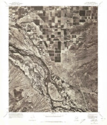
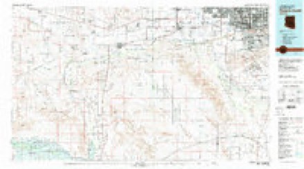
Topographic sheets covering this place
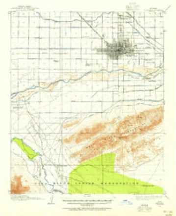
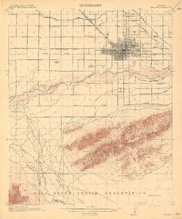
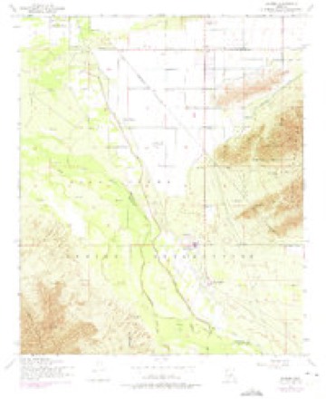
12 surveys from 26 printed sheetsMatched by testing this settlement's coordinate against the published boundary of every sheet in the United States Geological Survey's historical collection. Each opens the scanned sheet at the Survey.
- 1912 USGS Phoenix quadrangle1:62500
- 1914 USGS Phoenix quadrangle1:62500, 4 printings
- 1952 USGS Laveen quadrangle1:24000, 5 printings
- 1952 USGS Phoenix quadrangle1:62500, 2 printings
- 1954 USGS Phoenix quadrangle1:250000, 5 printings
- 1957 USGS Phoenix quadrangle1:250000
- 1958 USGS Phoenix quadrangle1:250000
- 1960 USGS Phoenix quadrangle1:250000
- 1969 USGS Phoenix quadrangle1:250000, 2 printings
- 1971 USGS Laveen quadrangle1:24000
- 1971 USGS Phoenix quadrangle1:250000
- 1981 USGS Phoenix South quadrangle1:100000, 2 printings






Fires near this place
1,414 since 1992Regional context, not property-specific evidence. The federal wildfire occurrence database lists 1,414 fires within 5 miles of Laveen between 1992 and 2020, burning about 8,744 acres in total. 6 started naturally. 133 were recorded as arson. Distance is straight-line from the map coordinates, so a fire counted here may appear on a neighbouring settlement's page as well.
| Reported cause | Fires |
|---|---|
| Missing data/not specified/undetermined | 1019 |
| Debris and open burning | 184 |
| Arson/incendiarism | 133 |
| Misuse of fire by a minor | 38 |
| Equipment and vehicle use | 19 |
| Natural | 6 |
| Smoking | 5 |
| Power generation/transmission/distribution | 4 |
| Fireworks | 3 |
| Recreation and ceremony | 2 |
| Other causes | 1 |
The most recent of them, most recent first, with the day each was reported and the service that recorded it.
| Date | Cause | Size | Reported by | Name on the report |
|---|---|---|---|---|
| 9 September 2000 | Missing data/not specified/undetermined | 4.2 acres | Pima Agency | EARLY |
| 8 September 2018 | Missing data/not specified/undetermined | under an acre | Phoenix Fire Department | 333529 |
| 8 September 2015 | Missing data/not specified/undetermined | under an acre | Arizona Department of Forestry and Fire Management - State Office | 154834 |
| 8 September 2013 | Missing data/not specified/undetermined | under an acre | Arizona Department of Forestry and Fire Management - State Office | AZ-132220 |
| 8 September 2010 | Missing data/not specified/undetermined | under an acre | Arizona Department of Forestry and Fire Management - State Office | AZ-101902 |
| 7 September 2015 | Missing data/not specified/undetermined | under an acre | Arizona Department of Forestry and Fire Management - State Office | 154138 |
| 7 September 2015 | Missing data/not specified/undetermined | under an acre | Arizona Department of Forestry and Fire Management - State Office | 154831 |
| 7 September 2014 | Missing data/not specified/undetermined | under an acre | Arizona Department of Forestry and Fire Management - State Office | AZ-142069 |
Settlements close enough to share some of these fires:
Mines and quarries near this place
10 of 14 shownRegional context, not property-specific evidence. The federal mineral resources record lists 14 workings within 5 miles of Laveen: 7 past producers, 5 producers, 2 unknowns. 5 still produce. What was taken out: Sand and Gravel, Construction, Gold, Copper, Silver, Gold, Silver. Distance is straight-line from the map coordinates, so a quarry counted here may appear on a neighbouring settlement's page as well.
| Where | Site | Commodity | Status | Recorded |
|---|---|---|---|---|
| Delta | Gold, Silver, Copper, Iron | Past Producer | ||
| Delta Mine | Gold, Copper, Silver | Past Producer | 1895, 1913, 1942 | |
| Gravel Pit | Sand and Gravel, Construction | Unknown | ||
| Gravel Pit | Sand and Gravel, Construction | Unknown | ||
| Phoenix Redi-Mix Pit | Sand and Gravel, Construction | Producer | ||
| Phoenix S&R, Agua Fria Pit & Plant | Sand and Gravel, Construction | Producer | ||
| Reeves Pit #1 | Sand and Gravel, Construction | Producer | ||
| Sand & Gravel Operation | Sand and Gravel, Construction | Past Producer | ||
| Sand and Gravel Quarry | Sand and Gravel, Construction | Past Producer | Sand and Gravel | |
| Sand and Gravel Quarry | Sand and Gravel, Construction | Past Producer | Sand and Gravel |
Storms near this place
21 since 1997Regional context, not property-specific evidence. The National Weather Service names Laveen in 21 storm reports between 1997 and 2025: 6 flash flood, 5 thunderstorm wind, 3 hail, 2 funnel cloud. No death or injury is recorded in these reports. Each account below is quoted exactly as the forecast office filed it, from the NOAA Storm Events Database, and each date opens the federal record of that event.
| When | Event | Place named | Harm | What the report says |
|---|---|---|---|---|
| January 2010 | Flood | Laveen | $2,000,000 | Streets were closed near the Salt River as well as many creeks and washes after the third major storm system moved through the area. Rainfall prior to and during the day on Friday amounted to between 5 and 7 inches. The swollen creeks and washes left many low-lying areas flooded for days, with damaged homes and businesses. |
| September 2014 | Flash Flood | Laveen | $500,000 | Widespread and intense showers and thunderstorms developed across the central portions of the greater Phoenix metropolitan area during the early morning hours on September 8th; peak rainfall rates were well in excess of 2 inches per hour. The heavy rain led to significant urban flooding as well as flash flooding which affected the area around South Mountain, including the community of Laveen. Between 2 and 4 inches of rain fell during the morning, resulting flash flooding which damaged a number of homes; one of the zones hit hardest included residents along Dobbins Road between 19th Avenue and 51st Avenue. Many of the homes in the flooded area experienced similar flooding back on August 12th when 3 inches of rain quickly fell in the area. According to an article posted on-line at the Arizona Republic website, flood waters seriously damaged the home of Daniel Magos, located at 23rd Avenue and Dobbins Road. Flood waters also inundated the home of Augustin Ramirez in Laveen, located next to a cotton farm at the corner of Sunrise Drive and 51st Avenue. He had spent 20 thousand dollars repairing flood damage from back in August; the current flooding destroyed everything, including his recent renovations. Flood waters also inundated the home of Nick Kriaris, located at 19th Avenue and Dobbins Road. Water filled up the living room knee-high, causing him to lose everything. The washes coming down from South Mountain have been directed into the area, partly due to the construction of new subdivisions such as Woodside Homes. Poor drainage in the area also contributed to the significant flooding. |
| September 2014 | Lightning | Laveen | $350,000 | Widespread showers and embedded thunderstorms developed across the greater Phoenix metropolitan area during the early morning hours on September 8th. Although the thunderstorms were rather isolated, at 0200MST lightning from one of the storms struck a house in south Phoenix. The house was located near 27th Avenue and Baseline Road, at 9624 S 26th Lane in Phoenix. Neighbors reported hearing a large boom at 0200MST when the lightning bolt struck; by the time firefighters arrived the flames were too intense and they were forced to go into a defensive mode. Four children and two adults made it out of the house safely, however the house was a total loss. |
| September 1999 | Thunderstorm Wind | Laveen | $165,000 | Four homes were reported damaged, with ceiling leaks, damaged windows, minor and major roof damage, and one home partially habitable. |
| August 2015 | Thunderstorm Wind | Laveen | $50,000 | Scattered thunderstorms affected the southern portion of the greater Phoenix metropolitan area during the evening hours on August 30th, and due to a favorable combination of elevated moisture, instability and winds aloft, the stronger storms generated gusty and damaging microburst winds. One of the areas that was impacted the most was the town of Laveen as well as South Mountain Park. According to a trained weather spotter 3 miles northwest of South Mountain Park, at 1830MST microburst winds estimated to be as high as 75 mph blew down the wall of a local pharmacy. The winds also destroyed 2 horse stables in the area and snapped a telephone pole in half near the intersection of 27th Drive and Cheyenne Road. Fortunately there were no injuries reported to humans or horses. |
| July 2016 | Flash Flood | Laveen | $30,000 | Isolated strong thunderstorms developed across the central portion of the greater Phoenix metropolitan area during the late afternoon and early evening hours on July 18th. The storms produced very heavy rain and radar estimated that over one inch fell quickly around south Phoenix, leading to flash flooding. According to local broadcast media, at 1825MST, heavy rain near 24th Street and Baseline Road led to significant street flooding as well as minor property damage to a local gas station. Another family in south Phoenix reported that water flowing down south Mountain knocked down the back wall to their property and rushed into and around their home leading to significant water damage at the home. |
| October 2025 | Flash Flood | Laveen | $20,000 | Water rescue due to flash flooding along West Dobbins Road near South 19th Avenue. No injuries reported. |
| October 2025 | Flash Flood | Laveen | $20,000 | Water rescue due to flash flooding along West Dobbins Road near South 19th Avenue. No injuries reported. |
| July 2024 | Lightning | Laveen | $20,000 | Cloud to ground lightning strike set a house on fire in the Laveen area in Phoenix. No injuries were reported. |
| May 2018 | Dust Devil | Laveen | $10,000 | A strong dust devil developed in the central portion of the greater Phoenix area during the middle of the afternoon on May 4. The dust devil was reported by a member of the public; at 1505MST the dust devil managed to produce roof tile damage to 6 houses in Laveen Village, just west of South Mountain Park and about 7 miles to the southwest of central Phoenix. This was a significant dust devil; pictures of the devil were obtained and posted on social media. No injuries were reported due to the dust devil. |
| July 2018 | Flash Flood | Laveen | $5,000 | Thunderstorms with heavy rainfall developed across the central portions of the greater Phoenix area, including around Laveen and South Mountain, during the late afternoon and early evening hours on July 9th. The stronger storms produced intense rainfall with peak rain rates in excess of 2 inches per hour. The heavy rain led to episodes of street flooding and flash flooding. According to a trained weather spotter located 5 miles northwest of Ahwatukee Foothills, at 1730MST street flooding had developed near the intersection of Dobbins Road and 27th Avenue. Irrigation canals in the area were reported to be overflowing and area streets were said to be impassable. Later in the evening, around 1945MST, county officials reported flash flooding 7 miles southwest of central Phoenix, in the area around Baseline Road and 43rd Avenue; the flooding was reported to extend south to Dobbins Road. The flash flooding involved flooded roadways, some of which were impassable. A Flash Flood Warning was issued for the area at 1722MST and it remained in effect until 2015MST. |
| October 2018 | Flash Flood | Laveen | $5,000 | Copious amounts of tropical moisture spread north and into south Phoenix during the morning hours on October 2nd. The moisture was associated with former hurricane Rosa and led widespread moderate to heavy showers; some locations picked up between 2 and 3 inches of rain. According to a trained spotter 3 miles northwest of Guadalupe, 2.6 inches of rain fell during the morning hours. The heavy rain resulted in episodes of flash flooding. At 1015MST, the Phoenix Police Department reported that flash flooding closed Baseline Road at 7th Street. Shortly thereafter, at 1032MST, the City of Phoenix reported that 19th Avenue was closed between Dobbins Road and South Mountain Avenue due to the flash flooding. A Flash Flood Warning was issued for the area at 0730MST and remained in effect through 1030MST. No accidents or injuries were reported due to the flooding or road closures. |
| August 2023 | Thunderstorm Wind | Laveen | $1,000 | A large uprooted tree in the area of South 35th Avenue and West Vineyard Road in Phoenix. Wind gusts were estimated of up to 65 mph. No injuries were reported. |
| July 2024 | Hail | Laveen | - | Half dollar sized hail reported in the area 19th Avenue and Southern Avenue in Phoenix. No damages nor injuries were reported. |
| October 2021 | Hail | Laveen | - | Hail just less than 1 inch in diameter fell for roughly 10 minutes based on a social media report. |
| November 2019 | Funnel Cloud | Laveen | - | A strong upper level low pressure system moving into the central deserts produced an unstable and dynamic environment that led to the formation of some very strong and potentially severe thunderstorms in the greater Phoenix area. Severe thunderstorm warnings were issued for at least one of the storms; although the storm did not produce damage, it did generate a funnel cloud. The funnel cloud, located about 5 miles southwest of central Phoenix, was reported by numerous members of the public and it was also confirmed by a National Weather Service employee. While no damage occurred from the funnel, it was noteworthy due to its rarity and high degree of interest from the local media. |
| May 2015 | Heavy Rain | Laveen | - | Scattered showers and thunderstorms developed shortly after midnight across the south central Arizona deserts on May 4th, and they produced locally moderate to heavy rainfall over the greater Phoenix metropolitan area. Around 0112MST, a coop observer near Chandler Fashion Square Mall estimated one half of an inch of rain fell since midnight. The thunderstorms that produced the heavy rain also generated frequent lighting and winds over 40 mph. Showers persisted through the early morning and at 0413MST, a trained spotter 3 miles northwest of South Mountain Park reported minor street flooding at the intersection of 27th Avenue and Dobbins Road. The local street flooding created disruptions to the start of the morning rush hour in Phoenix. |
| August 2015 | Thunderstorm Wind | Laveen | - | Thunderstorms developed over the central portion of the greater Phoenix metropolitan area during the evening hours, and some of the more intense ones produced very strong outflow winds as well as heavy rainfall. Some communities affected included the town of Laveen as well as South Mountain Park. According to a trained weather spotter located about 3 miles northwest of South Mountain Park, thunderstorm wind gusts estimated as high as 65 mph blew over a 300 pound barbeque grill. The spotter also measured 1.75 inches of rain from the storms. |
| July 2013 | Thunderstorm Wind | Laveen | - | Isolated thunderstorms developed across northwestern Pinal county during the early morning hours on July 2nd, and they moved westward and into the greater Phoenix metropolitan area. The storms generated gusty winds in excess of 50 mph. At 445 am, a trained weather spotter located at 2241 West South Mountain Avenue in Phoenix estimated wind gusts between 60 and 65 mph, with sustained speeds nearly 50 mph. The winds were associated with locally dense blowing dust. No damage was reported due to the high winds. |
| September 2002 | Hail | Laveen | - | no account filed |
| April 1997 | Funnel Cloud | Laveen | - | no account filed |
Nearest settlements
The eight closest, with where each one stands in the county. Distances are straight-line, computed from the Geographic Names Information System coordinates.
| Map | Place | Distance | Sheets |
|---|---|---|---|
| Co-op Village | 2.7 miles | 26 | |
| Maricopa Village | 3.7 miles | 26 | |
| Komatke | 4.8 miles | 26 | |
| Saint Johns Mission | 5.0 miles | 26 | |
| La Montana del Sur | 5.4 miles | 26 | |
| South Phoenix | 5.9 miles | 26 | |
| Gila Crossing | 5.9 miles | 26 | |
| Villa Monte Vista | 6.4 miles | 26 |
Provenance
This settlement is recorded in the Geographic Names Information System as feature 6920. The sheet list is computed by point-in-boundary test against the United States Geological Survey's historical topographic inventory. Both are works of the United States government and carry no copyright under 17 U.S.C. 105.
Wildfire. Short, Karen C. 2022. Spatial wildfire occurrence data for the United States, 1992-2020 [FPA_FOD_20221014]. 6th Edition. Fort Collins, CO: Forest Service Research Data Archive. https://doi.org/10.2737/RDS-2013-0009.6 Collected with United States Government funding and usable without additional permissions or fees.
Mines and quarries. USGS Mineral Resources Data System (MRDS) https://mrdata.usgs.gov/mrds/ A work of the United States government, no copyright under 17 U.S.C. 105.
Storms. NOAA National Centers for Environmental Information, Storm Events Database https://www.ncei.noaa.gov/stormevents/ A work of the United States government, no copyright under 17 U.S.C. 105. Narratives are quoted verbatim from the National Weather Service report and are not edited or summarised.