 Block
Magma, Arizona
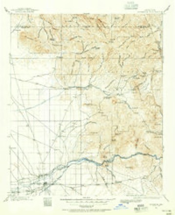
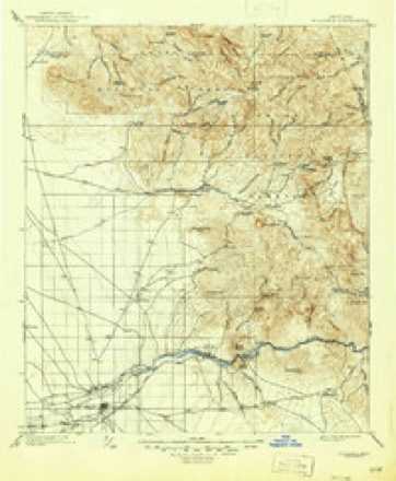
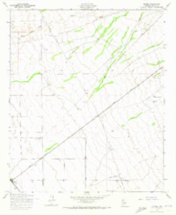
20 topographic sheets cover this place, the earliest surveyed in 1900 and the latest in 1994. It stands in the North Pinal census division. It lies in ZIP code area 85143. The Survey maps it on the Magma quadrangle.
Research this city
Topographic sheets covering this place
9 surveys from 20 printed sheetsMatched by testing this settlement's coordinate against the published boundary of every sheet in the United States Geological Survey's historical collection. Each opens the scanned sheet at the Survey.
- 1900 USGS Florence quadrangle1:125000
- 1902 USGS Florence quadrangle1:125000, 5 printings
- 1954 USGS Mesa quadrangle1:250000, 4 printings
- 1956 USGS Magma quadrangle1:24000, 4 printings
- 1957 USGS Mesa quadrangle1:250000
- 1958 USGS Mesa quadrangle1:250000
- 1960 USGS Mesa quadrangle1:250000
- 1964 USGS Mesa quadrangle1:250000
- 1994 USGS Mesa quadrangle1:100000, 2 printings






Fires near this place
59 since 1992Regional context, not property-specific evidence. The federal wildfire occurrence database lists 59 fires within 5 miles of Magma between 1992 and 2020, burning about 2,061 acres in total. None started naturally. 3 were recorded as arson. Distance is straight-line from the map coordinates, so a fire counted here may appear on a neighbouring settlement's page as well.
| Reported cause | Fires |
|---|---|
| Missing data/not specified/undetermined | 32 |
| Debris and open burning | 15 |
| Arson/incendiarism | 3 |
| Railroad operations and maintenance | 3 |
| Smoking | 2 |
| Misuse of fire by a minor | 2 |
| Equipment and vehicle use | 1 |
| Recreation and ceremony | 1 |
The most recent of them, most recent first, with the day each was reported and the service that recorded it.
| Date | Cause | Size | Reported by | Name on the report |
|---|---|---|---|---|
| 22 August 1993 | Debris and open burning | under an acre | Pima Agency | 587 #2 |
| 8 July 2020 | Missing data/not specified/undetermined | under an acre | Arizona Department of Forestry and Fire Management - State Office | not named |
| 21 July 1992 | Missing data/not specified/undetermined | 90 acres | Arizona Department of Forestry and Fire Management - State Office | not named |
| 15 July 1993 | Missing data/not specified/undetermined | 1.5 acres | Arizona Department of Forestry and Fire Management - State Office | not named |
| 15 July 1993 | Missing data/not specified/undetermined | under an acre | Arizona Department of Forestry and Fire Management - State Office | not named |
| 14 July 1993 | Railroad operations and maintenance | under an acre | Arizona Department of Forestry and Fire Management - State Office | not named |
| 9 June 2005 | Equipment and vehicle use | under an acre | Arizona Department of Forestry and Fire Management - State Office | HAT |
| 8 June 1995 | Misuse of fire by a minor | 20 acres | Arizona Department of Forestry and Fire Management - State Office | not named |
Settlements close enough to share some of these fires:
Mines and quarries near this place
3 within 5 milesRegional context, not property-specific evidence. The federal mineral resources record lists 3 workings within 5 miles of Magma: 3 prospects. None of them still produces. What was taken out: Copper, Gold, Copper, Gold, Molybdenum. Distance is straight-line from the map coordinates, so a quarry counted here may appear on a neighbouring settlement's page as well.
| Where | Site | Commodity | Status | Recorded |
|---|---|---|---|---|
| Mineral Butte Prospect | Copper, Gold, Molybdenum | Prospect | Porphyry Cu | |
| Blackwater Group | Copper, Gold | Prospect | ||
| Vantex Land and Development Co | Copper, Gold | Prospect |
Storms near this place
58 since 2003Regional context, not property-specific evidence. The National Weather Service names Magma in 58 storm reports between 2003 and 2025: 44 thunderstorm wind, 7 heavy rain, 4 flash flood, 2 hail. No death or injury is recorded in these reports. Each account below is quoted exactly as the forecast office filed it, from the NOAA Storm Events Database, and each date opens the federal record of that event.
| When | Event | Place named | Harm | What the report says |
|---|---|---|---|---|
| July 2008 | Flash Flood | Magma | $500,000 | Flooding caused the closure of state route 79 after heavy rain moved through the area. The gage at Magma recorded a storm total of 2.99 inches from the evening of the 10th into the early morning hours on the 11th of July. |
| August 2011 | Thunderstorm Wind | Magma | $225,000 | Thunderstorms with damaging microburst winds affected the area around Magma during the afternoon hours on August 18th. According to a report from the local utility company, approximately 30 power poles were blown down in the Johnson Ranch area, along the Hunt highway near Judd road. Winds were estimated to be in excess of 50 knots. |
| May 2012 | Thunderstorm Wind | Magma | $150,000 | A low pressure system moving east across southern Arizona spread moisture into south central Arizona which led to scattered thunderstorms over the lower deserts during the afternoon hours on May 9th. According to a trained weather spotter, microburst wind gusts estimated at 70 knots damaged 8 mobile homes in the Pleasant Valley Mobile Home Park at approximately 435 PM. The park was located near Germain and Ironwood, about 5 miles east of Queen Creek. Six of the homes had their northeast-facing awnings removed. The strong winds lifted up the overhangs and in some cases removed portions of the roofs. Many of these homes were blown off of their foundations. The strong microburst winds were likely enhanced by a gustnado, which increased the severity of the damage. In addition to the mobile home damage, the strong winds blew down a number of power lines in the area. |
| August 2003 | Thunderstorm Wind | Magma | $100,000 | Johnson Ranch subdivision received damaging winds with signs blown down, homes damaged, and power poles down. |
| August 2020 | Thunderstorm Wind | Magma | $90,000 | Thunderstorms with gusty and damaging outflow winds developed across the southeast portion of the greater Phoenix area during the evening hours on August 20th. Some of the stronger storms generated microburst conditions that affected areas from Queen Creek southeast to Florence. According to a local utility company, at 2010MST a microburst generated winds estimated to be as high as 70 mph. The winds blew down 15 wooden power poles in San Tan Valley, about 6 miles southeast of Queen Creek. The poles were downed on Combs Road from Kenworthy Road to Schnepf Road. At about the same time, a trained weather spotter located 3 miles north of Florence reported that gusty winds snapped a power pole in two resulting in a power outage at a mobile home park. Additionally, the winds blew down many trees in the area including one with a diameter of about 12 inches. Winds were estimated to be in excess of 60 mph. There were no reports of injury due to the strong wind. |
| July 2021 | Thunderstorm Wind | Magma | $60,000 | The roof of a mobile home was ripped off as severe thunderstorms moved through the Queen Creek area while a family of 4 were inside. Much of the interior property was destroyed from the wind and the rainwater that entered the home. The home suffered additional damage the following night when more severe winds blew through the area. The home is a total loss. No injuries were reported. |
| July 2021 | Thunderstorm Wind | Magma | $50,000 | Severe thunderstorms with measured winds upwards of 65 mph led to multiple reports of damage across San Tan Valley. At 2210MST, a trained weather spotter reported that numerous large trees 1-2 feet in diameter had been uprooted near Amira Park and in Johnson Ranch. Multiple downed trees were also reported in the Circle Cross Ranch and the Morning Sun Farms areas. Multiple power poles were reported down as well along Skyline Drive. No injuries were reported. |
| August 2015 | Thunderstorm Wind | Magma | $50,000 | Scattered thunderstorms developed over the southeast portion of the greater Phoenix area during the evening hours on August 11th, and they brought gusty outflow winds estimated to be in excess of 60 mph at times. The strong winds downed power lines and this led to widespread power outages. According to the Salt River Project utility company, at 2050MST approximately 11,400 SRP customers were without power across the southeastern greater Phoenix area and the area that was affected the most was the San Tan Valley. |
| July 2013 | Thunderstorm Wind | Magma | $50,000 | Isolated to scattered thunderstorms developed during the evening hours on July 6th and they affected portions of the central deserts including northern Pinal county. The storms generated strong, gusty and damaging outflow winds estimated to be in excess of 50 mph. According to local broadcast media, at 955 pm gusty winds blew down several trees about 4 miles east northeast of San Tan Valley. In addition, the winds blew over an RV causing damage, destoryed/damaged a small sheet metal building, blew off sheet metal of a few buildings, and caused shingle damage to a home. No injuries were reported. Although a Severe Thunderstorm Warning was not in effect at the time, a Significant Weather Advisory had been posted at 944 pm highlighting the potential for strong and gusty thunderstorm winds. |
| December 2011 | Heavy Rain | Magma | $50,000 | A wet and slow moving Pacific low pressure system brought widespread showers, some with locally heavy rain, to the central Arizona deserts on December 13th. Rainfall continued through the morning hours on December 14th, and many lower desert locations recorded more than one inch of rainfall during the event. Local media reported that Hunt Highway, or State Route 87, was closed between Arizona Farms Road and Merrill Ranch Parkway due to surface damage to the road. The road was reported closed at 730 am on December 14th. The damage was due to the excessive rainfall that fell in the area. The location of the closure was south of the San Tan Valley. |
| July 2021 | Thunderstorm Wind | Magma | $40,000 | Nearly 40 trees were uprooted around the Johnson Ranch subdivision in San Tan Valley due to strong winds during a severe warned thunderstorm. Some trees reportedly fell on roofs, fences, and concrete walls with unknown degrees of damage. Minor roof damage was also reported. In a separate report, at an unspecified location in San Tan Valley, photos show strong winds peeled up a portion of a residential roof and a large section of a bedroom ceiling collapsed. Winds were estimated around 55-65 mph. Timing based on radar. No injuries reported. |
| July 2021 | Thunderstorm Wind | Magma | $40,000 | Numerous social media photos and reports of significant damage the the Skyline RV Resort, east of San Tan, due to strong thunderstorm winds. Photos show awning, roof, and side panel damage to a few mobile homes. The number of RVs and mobile homes damaged is unknown. An awning and a shed for one home were destroyed, along with a broken window, and a large portion of metal roof blew off from another. A few street signs were bent in half in the community. There was also a photo of a power pole in the area that snapped near the base of the pole and fell. Power was knocked out to many customers in the area. Winds were estimated around 60-65 mph. Timing estimated from radar. No injuries reported. |
| August 2018 | Thunderstorm Wind | Magma | $30,000 | Thunderstorms with strong and gusty outflow winds developed over the east and southeast portions of the greater Phoenix area during the evening hours on August 8th. Some of the storms affected communities such as Queen Creek and San Tan Valley. According to a member of the public located 5 miles southeast of Queen Creek, at 1923MST winds estimated as high as 70 mph downed 6 power poles. The downed poles were near the Hunt Highway at Gary Road, just to the northwest of San Tan Valley. No injuries were reported due to the strong winds. |
| August 2018 | Thunderstorm Wind | Magma | $30,000 | Thunderstorms with gusty and damaging outflow winds developed to the southeast of Phoenix during the morning hours on August 9th and they affected the area between Queen Creek and San Tan Valley. At 073MST, a member of the public reported that 6 power poles were blown down by gusty winds estimated to be as high as 70 mph. The poles were located about 5 miles southeast of Queen Creek, just northwest of San Tan Valley and near the intersection of the Hunt Highway and Gary Road. No injuries were reported due to the strong winds and fallen power poles. |
| August 2011 | Thunderstorm Wind | Magma | $30,000 | Thunderstorms with damaging microburst winds affected the San Tan Valley area during the afternoon hours on August 18th. A trained National Weather Service storm spotter 4 miles west of Magma reported that 1 foot diameter trees were blown down. Additionally, a roof was blown off of a house. Wind speeds were estimated to be at least 60 mph. Hail one quarter inch in diameter occurred in association with the strong storms. |
| August 2011 | Thunderstorm Wind | Magma | $30,000 | Strong thunderstorms with damaging microburst winds moved through the San Tan Valley during the late afternoon hours on August 18th. Area law enforcement personnel reported that power lines were down at Bella Vista and Gantzel roads, and at least one of the lines fell onto a school bus from the Florence Unified school district. The bus driver and four children that were aboard were not injured. |
| August 2007 | Thunderstorm Wind | Magma | $30,000 | Roofs blown off homes located in the eastern portions of the Gila river Indian Reservation. |
| July 2018 | Thunderstorm Wind | Magma | $20,000 | Thunderstorms with strong gusty outflow winds developed over the high terrain of eastern Arizona during the afternoon hours on July 30th, and they spread west into the east portion of the Phoenix area during the early evening hours. According to a trained spotter in San Tan Valley, about 7 miles southeast of Queen Creek, gusty winds estimated as high as 65 mph downed numerous power lines along the Hunt Highway between Bella Vista Road and Gary Road. The damage occurred at approximately 1900MST. |
| June 2016 | Thunderstorm Wind | Magma | $20,000 | Intense thunderstorms developed across portions of south-central Arizona during the late afternoon hours on June 29th and one of them affected the area around the community of Magma. The severe thunderstorm produced gusty outflow winds estimated to be at least 70 mph in strength, and according to local broadcast media, at 1800MST the winds blew off a large portion of the roof of a block wall house. The house was located about 4 miles to the southeast of the town of Magma. No injuries were reported due to the strong winds. A Severe Thunderstorm Warning was in effect at the time of the damage. |
| June 2016 | Thunderstorm Wind | Magma | $20,000 | Scattered thunderstorms developed across portions of northern Pinal County during the late afternoon hours on June 29th and they moved through the community of Magma. Some of the stronger storms generated gusty and damaging winds estimated to be in excess of 70 mph. According to local law enforcement, at 1750MST gusty outflow winds blew down 100 feet of power poles as well as power lines in the town of Magma. A Severe Thunderstorm Warning was in effect for the town of Magma at the time of the wind damage. |
| September 2014 | Thunderstorm Wind | Magma | $20,000 | Thunderstorms developed across northern Pinal County during the afternoon hours on September 6th, and some of them affected the community of San Tan Valley. The stronger storms produced gusty and damaging microburst winds, estimated to be in excess of 60 mph at times. According to a trained weather spotter just south of San Tan Valley, gusty winds estimated at 65 mph downed multiple trees and flagpoles. In addition, the strong winds caused some roof damage. No injuries were reported. |
| September 2022 | Thunderstorm Wind | Magma | $10,000 | Two large trees (20-24 inch diameter trunks) were uprooted and each fell through concrete block walls and onto a couple homes in the Johnson Ranch community. The extent of the damage to the homes was unknown. There were also several street signs reportedly ripped from their posts or were twisted/mangled. Winds were estimated around 55-60 mph and timing was based on radar. No injuries were reported. |
| September 2022 | Thunderstorm Wind | Magma | $8,000 | A photo on social media shows part of a destroyed metal carport lodged in the side of a home near the intersection of Gantzel Road and Ocotillo Road. Timing and wind speed estimated from radar. No injuries were reported. |
| September 2022 | Thunderstorm Wind | Magma | $6,000 | Approximately 5-6 trees, at 20 to 30 feet tall, were toppled on Johnson Ranch Boulevard. Wind speeds estimated around 55-60 mph and timing estimated from radar. No injuries were reported. |
| July 2013 | Thunderstorm Wind | Magma | $6,000 | Strong thunderstorms developed during the early afternoon hours across portions of north central Pinal county on June 12th. The storms produced gusty and damaging winds estimated to be in excess of 60 mph, which affected communities such as San Tan Valley and Florence. At 1240 pm, a member of the public reported an 8 inch diameter tree blown down 1 mile east of San Tan Valley. At 1249 pm, a trained weather spotter 2 miles east of San Tan Valley reported several 6 to 8 inch diameter trees blown down. He estimated winds to be upwards of 60 mph. A Severe Thunderstorm Warning had been issued for the area beginning at 1224 pm and continuing through 115 pm. |
| September 2025 | Thunderstorm Wind | Magma | $5,000 | Approximately 5-7 downed power poles on Attaway Road between Arizona Farms Road and Judd Road in San Tan Valley. Wind gusts were estimated at 55-60 mph. Timing based on radar. No injuries reported. |
| August 2021 | Lightning | Magma | $5,000 | Photos on social media show a charred pickup truck after catching on fire from being struck by lightning in a neighborhood near Ocotillo Road and Schnepf Road. No injuries were reported. Timing was estimated using radar. |
| June 2016 | Thunderstorm Wind | Magma | $5,000 | Scattered thunderstorms developed during the late afternoon hours over portions of northern Pinal County on June 29th and they affected the area around the community of Magma. Some of the stronger storms produced gusty and damaging outflow winds estimated to be in excess of 60 mph. According to local broadcast media, at 1800MST gusty winds knocked over a parked tractor trailer loaded with large hay bales. Three large awnings covering the hay bales were destroyed. This occurred about 5 miles east of Magma, near the intersection of North Yeager Road and East Arizona Farms Road. No injuries were reported. A Severe Thunderstorm Warning was in effect for the town of Magma during the time of the wind damage. |
| September 2014 | Thunderstorm Wind | Magma | $5,000 | A severe squall line moved eastward across the southeastern portion of the greater Phoenix metropolitan area during the middle of the afternoon on September 27th, and the stronger storms brought strong and damaging winds to San Tan Valley. According to a trained weather spotter in San Tan Valley, thunderstorm microburst wind gusts estimated to be nearly 65 mph downed five trees. The diameter of the trees ranged from 12 to 14 inches. |
| July 2012 | Thunderstorm Wind | Magma | $5,000 | Thunderstorms developed over the greater Phoenix area during the afternoon hours on July 29th, and some of the storms generated gusty and damaging microburst winds. According to a trained weather spotter 5 miles northeast of San Tan Valley, at 355 pm gusty winds estimated to be at least 60 knots blew down a number of trees. |
| September 2022 | Thunderstorm Wind | Magma | $3,000 | A bus barn at Poston Butte High School had two 3X70 foot pieces of sheet metal roofing peeled off in a downburst. A stack of wooden pallets was reportedly tossed 150 feet and there was at least minor damage to other equipment and supplies. A light pole, rusted near the base, also toppled over at the high school. Wind speeds estimated around 55-60 mph and timing based on radar. No injuries were reported. |
| September 2025 | Thunderstorm Wind | Magma | $2,000 | Downed powerlines reported along North Desert Sky Road in Florence. Wind gusts were estimated at 55-60 mph. No injuries reported. |
| September 2025 | Thunderstorm Wind | Magma | $2,000 | Downed power lines along East Magma Road in San Tan Valley. Wind gusts were estimated at 55-60 mph. No injuries reported. |
| July 2018 | Thunderstorm Wind | Magma | $2,000 | Isolated high based thunderstorms developed over eastern and southeastern Arizona during the afternoon hours on July 5th. Some of the storms generated gusty outflow winds which moved westward and through the area around Queen Creek. At 1658MST a trained spotter 7 miles southeast of Queen Creek, near the San Tan Valley, reported that two trees were blown down by thunderstorm outflow winds. The winds were estimated to be nearly 50 mph in strength. The trees were downed just southeast of the intersection of the east Hunt Highway and east Bella Vista Road. |
| August 2021 | Thunderstorm Wind | Magma | $750 | Multiple trees were reported down along Hunt Highway between Gary Road and Bella Vista Road. A fence was destroyed by a downed tree near Hunt Highway and Gantzel Road. No injuries were reported. Multiple trees were also reported to be uprooted along Charbray Drive between between Empire Boulevard and Skyline Drive. Timing was estimated using radar. |
| September 2022 | Thunderstorm Wind | Magma | - | A trained spotter estimated thunderstorm wind gusts around 60 mph and some minor tree damage. No injuries were reported. |
| October 2022 | Thunderstorm Wind | Magma | - | A mesonet station located at San Tan Valley measured a 69 mph wind gust. |
| August 2022 | Thunderstorm Wind | Magma | - | A mesonet station in San Tan Valley measured a 64 mph gust. |
| August 2022 | Thunderstorm Wind | Magma | - | A mesonet station in San Tan Valley measured a 69 mph gust. |
| July 2022 | Thunderstorm Wind | Magma | - | An image showed a large branch of a tree snapped off and narrowly missed a home near Ocotillo Road and Meridian Road. A video taken in the area showed very strong winds estimated to be in excess of 60 mph. No injuries were reported. |
| July 2021 | Thunderstorm Wind | Magma | - | Mesonet station SRP22 at 10.9 miles NW of Florence measured a 59 mph wind gust. |
| August 2021 | Thunderstorm Wind | Magma | - | A large tree approximately 4 feet in diameter was uprooted near Oasis Lane and Hunt Highway. Additional large trees were reported down in a nearby subdivision. Reduced visibility was also reported due to blowing dust. Timing was estimated using radar. No injuries were reported. |
| July 2021 | Flash Flood | Magma | - | Heavy rainfall over the Florence area led to flash flooding. According to the Pinal County Sheriff's dispatch, Cooper road between Arizona Farms Road and Judd Road was closed to due running washes. No injuries or damage was reported. |
| July 2021 | Thunderstorm Wind | Magma | - | The Quail SRP mesonet station recorded a peak gust of 65 mph as severe thunderstorms ripped through the San Tan Valley area. |
| July 2021 | Flash Flood | Magma | - | A social media post showed knee deep water covering the road near Skyline Drive and Felix Road. No damage or injuries were reported. |
| August 2021 | Thunderstorm Wind | Magma | - | The SRP Quail mesonet station recorded a 73 mph gust. |
| August 2021 | Thunderstorm Wind | Magma | - | A trained weather spotter recorded a 59 mph gust on a home weather station. |
| July 2018 | Thunderstorm Wind | Magma | - | Thunderstorms developed over the south-central deserts during the afternoon hours, and some of them affected the area around the town of Florence. The stronger storms produced strong downburst winds well in excess of 60 mph. According to a local utility company, a wind gust to 80 mph was measured by an ALERT wind sensor at 1614MST. The reading was taken about 6 miles to the north of Florence. |
| October 2018 | Hail | Magma | - | Thunderstorms with large hail developed to the southeast of Phoenix during the late afternoon hours on October 21st. Some of the stronger storms affected areas near the town of Florence. According to a public report, at 1652MST large hail fell about 9 miles northwest of Florence and southeast of San Tan Valley. The large stones fell near the intersection of Judd Road and Cooper Road. The hailstones ranged in size from nickel to quarter, with the largest stones having a diameter of about 1 inch. No damage was reported. The reports were received via Twitter. |
| October 2018 | Hail | Magma | - | Thunderstorms with large hail developed to the southeast of the greater Phoenix area during the afternoon hours on October 23rd. Some of the stronger storms affected areas around the community of Queen Creek. According to a report from the general public, at 1350MST large hail fell about 7 miles east of Queen Creek, in north San Tan Valley. The hail fell near the intersection of Ocotillo Road and Schnepf Road. The diameter of the largest stones was 0.75 inches. No damage was reported due to the large hail. |
| June 2016 | Thunderstorm Wind | Magma | - | Scattered thunderstorms developed over portions of northern Pinal County during the late afternoon hours on June 29th and some of them affected the areas around the town of Magma. Some of the stronger storms produced strong gusty winds. An SRP weather station near the intersection of East Bella Vista Road and Quail Run Lane, about 2 miles northeast of Magma, measured a wind gust to 71 mph at 1800MST. |
| September 2014 | Heavy Rain | Magma | - | Scattered thunderstorms developed across the southeast portion of the greater Phoenix metropolitan area during the late afternoon hours on September 6th; the stronger storms generated locally heavy rainfall with peak rain rates in excess of 2 inches per hour. Some of the heaviest rain fell in the area around San Tan Valley. At 1830MST, a trained spotter 2 miles southeast of San Tan Valley measured 1.24 inches of rain in a span of 45 minutes. He indicated that there was curb to curb flooding in Johnson Ranch. At 1740MST, another trained spotter 2 miles southeast of San Tan Mountain Park measured 2.10 inches of rain in 45 minutes and he indicated that heavy rain was still occurring. The heavy rain led to the issuance of both an Urban and Small Stream Flood Advisory and a Flash Flood Warning for portions of northern Pinal county including the area around San Tan Valley. |
| July 2012 | Heavy Rain | Magma | - | Scattered thunderstorms developed across the deserts of south central Arizona, including the greater Phoenix area, during the afternoon hours on July 29th. Some of the heaviest rainfall occurred in the southeast valley communities, and the excessive rain led to episodes of urban flooding as well as flash flooding. At 445 pm a trained weather spotter 5 miles northeast of San Tan Valley reported 0.85 inches of rain within 40 minutes. At about the same time a spotter 5 miles southeast of Magma reported one half inch of rain within 17 minutes. The heavy rain led to flash flooding; at 5 pm a flash flood warning was issued for southeast portions of the greater Phoenix area. |
| August 2011 | Flash Flood | Magma | - | Thunderstorms with locally heavy rainfall developed in the area around Magma during the late afternoon hours on August 18th. Rainfall, with rates estimated in excess of one inch per hour, led to flash flooding on the Hunt Highway west of Magma. The flooding was reported by an amateur radio operator. |
| July 2010 | Heavy Rain | Magma | - | Total rain during a 30 minute period was 0.51 inch. |
| August 2010 | Heavy Rain | Magma | - | Spotter reported 0.76 inches of rain fell in 40 minutes. |
| August 2010 | Heavy Rain | Magma | - | Spotter reported heavy rain fall of 0.58 inches fell in 15 minutes. |
| July 2009 | Heavy Rain | Magma | - | Brief heavy rain moved across northern Pinal County, with rain rates of 2.5 inches per hour. |
Nearest settlements
The eight closest, with where each one stands in the county. Distances are straight-line, computed from the Geographic Names Information System coordinates.
| Map | Place | Distance | Sheets |
|---|---|---|---|
| San Tan Valley | 4.4 miles | 19 | |
| Blackwater | 8.2 miles | 17 | |
| Adamsville | 8.7 miles | 19 | |
| Florence | 9.1 miles | 19 | |
| Sacaton Flats | 9.9 miles | 18 | |
| Valley Farms | 10.3 miles | 16 | |
| Olberg | 10.3 miles | 18 | |
| Coolidge | 10.7 miles | 21 |
Provenance
This settlement is recorded in the Geographic Names Information System as feature 24503. The sheet list is computed by point-in-boundary test against the United States Geological Survey's historical topographic inventory. Both are works of the United States government and carry no copyright under 17 U.S.C. 105.
Wildfire. Short, Karen C. 2022. Spatial wildfire occurrence data for the United States, 1992-2020 [FPA_FOD_20221014]. 6th Edition. Fort Collins, CO: Forest Service Research Data Archive. https://doi.org/10.2737/RDS-2013-0009.6 Collected with United States Government funding and usable without additional permissions or fees.
Mines and quarries. USGS Mineral Resources Data System (MRDS) https://mrdata.usgs.gov/mrds/ A work of the United States government, no copyright under 17 U.S.C. 105.
Storms. NOAA National Centers for Environmental Information, Storm Events Database https://www.ncei.noaa.gov/stormevents/ A work of the United States government, no copyright under 17 U.S.C. 105. Narratives are quoted verbatim from the National Weather Service report and are not edited or summarised.