 Block
Pinal, Arizona
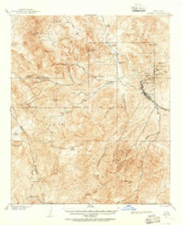
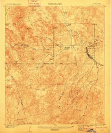
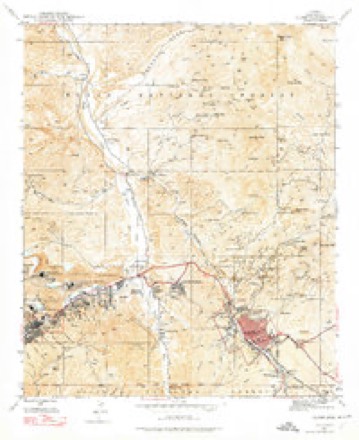
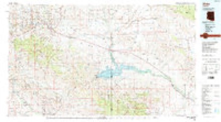
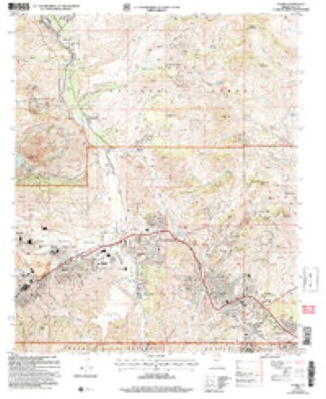
20 topographic sheets cover this place, the earliest surveyed in 1901 and the latest in 2004. It stands in the Globe-Miami census division. It lies in ZIP code area 85501. It lies near Sixshooter Canyon. The Survey maps it on the Globe quadrangle. 456 people lived here at the 2020 count. It stands 3,800 feet above sea level.
Population over time
2 figuresPinal grew from 439 to 456 between 2010 and 2020. These are the recorded population figures Wikidata holds for this place, reached through the Geographic Names Information System number this page is keyed on rather than by name, so they belong to this place and not to another of the same name. Most are census counts, but not all are: an early figure may be a founding or settlement estimate, and an estimate published within five years of a census is left out. The change column is computed, and is left blank where more than 20 years separate a figure from the one before it, because a gap that long is not a change between two counts.
| Year | People | Change |
|---|---|---|
| 2010 | 439 | |
| 2020 | 456 | +17 (+4%) |
Topographic sheets covering this place
10 surveys from 20 printed sheetsMatched by testing this settlement's coordinate against the published boundary of every sheet in the United States Geological Survey's historical collection. Each opens the scanned sheet at the Survey.
- 1901 USGS Globe quadrangle1:62500, 2 printings
- 1902 USGS Globe quadrangle1:62500, 3 printings
- 1945 USGS Globe quadrangle1:24000, 4 printings
- 1954 USGS Mesa quadrangle1:250000, 4 printings
- 1957 USGS Mesa quadrangle1:250000
- 1958 USGS Mesa quadrangle1:250000
- 1960 USGS Mesa quadrangle1:250000
- 1964 USGS Mesa quadrangle1:250000
- 1986 USGS Globe quadrangle1:100000, 2 printings
- 2004 USGS Globe quadrangle1:24000





Fires near this place
219 since 1992Regional context, not property-specific evidence. The federal wildfire occurrence database lists 219 fires within 5 miles of Pinal between 1992 and 2020, burning about 223 acres in total. 40 started naturally. 32 were recorded as arson. Distance is straight-line from the map coordinates, so a fire counted here may appear on a neighbouring settlement's page as well.
| Reported cause | Fires |
|---|---|
| Missing data/not specified/undetermined | 100 |
| Natural | 40 |
| Arson/incendiarism | 32 |
| Recreation and ceremony | 11 |
| Debris and open burning | 9 |
| Equipment and vehicle use | 8 |
| Railroad operations and maintenance | 8 |
| Smoking | 5 |
| Misuse of fire by a minor | 5 |
| Fireworks | 1 |
The most recent of them, most recent first, with the day each was reported and the service that recorded it.
| Date | Cause | Size | Reported by | Name on the report |
|---|---|---|---|---|
| 8 September 2017 | Missing data/not specified/undetermined | under an acre | Tri-City Fire District | not named |
| 4 September 2019 | Arson/incendiarism | under an acre | San Carlos Agency | BEVERLY HILLS |
| 30 September 2001 | Missing data/not specified/undetermined | 5.0 acres | Tonto National Forest | SIXSHOOTER |
| 30 September 1994 | Missing data/not specified/undetermined | 1.0 acres | Tonto National Forest | not named |
| 25 September 2018 | Missing data/not specified/undetermined | under an acre | Globe Fire Department | 1418 |
| 23 September 2018 | Missing data/not specified/undetermined | under an acre | Globe Fire Department | 1408 |
| 23 September 1992 | Equipment and vehicle use | under an acre | Tonto National Forest | not named |
| 15 September 1999 | Natural | under an acre | Tonto National Forest | NEST |
Settlements close enough to share some of these fires:
Mines and quarries near this place
10 of 83 shownRegional context, not property-specific evidence. The federal mineral resources record lists 83 workings within 5 miles of Pinal: 56 past producers, 20 producers, 5 prospects, 1 unknown. 20 still produce. What was taken out: Manganese, Copper, Silver, Copper, Silver. Distance is straight-line from the map coordinates, so a quarry counted here may appear on a neighbouring settlement's page as well.
| Where | Site | Commodity | Status | Recorded |
|---|---|---|---|---|
| Albert Lea Mine | Silver, Lead, Gold, Copper, Molybdenum, Vanadium, Zinc | Past Producer | 1941, 1946 | |
| Albert Lea Tunnels | Silver, Lead, Zinc, Copper, Gold, Vanadium | Past Producer | ||
| Arizona Commercial Mine | Copper, Gold, Silver, Silica | Past Producer | 1905, 1979 | |
| Big Johnnie Mine | Copper, Iron | Past Producer | 1901 | |
| Buffalo Mine | Silver, Copper | Past Producer | Replacement | |
| Copper Hill | Copper, Silica, Silver, Uranium | Past Producer | ||
| Doughboy Mine | Copper, Zinc, Vanadium, Silver, Manganese, Molybdenum | Past Producer | Vein | |
| Gem Mine | Copper, Gold, Silver, Lead, Manganese, Zinc | Past Producer | 1908, 1947 | |
| Gem Property | Copper, Silver, Manganese, Zinc, Gold | Past Producer | ||
| Globe Manganese Mine | Manganese, Iron, Silver | Producer | 1885, 1957 |
Storms near this place
8 since 2007Regional context, not property-specific evidence. The National Weather Service names Pinal in 8 storm reports between 2007 and 2025: 3 flash flood, 3 heavy rain, 1 hail, 1 thunderstorm wind. The reports record 3 deaths. Each account below is quoted exactly as the forecast office filed it, from the NOAA Storm Events Database, and each date opens the federal record of that event.
| When | Event | Place named | Harm | What the report says |
|---|---|---|---|---|
| September 2025 | Flash Flood | Pinal | 3 killed, $25,000,000 | Catastrophic and deadly flash flooding occurred in the Globe area following strong to severe thunderstorms that produced very high rainfall rates. Observed gauge reports and doppler radar rainfall estimates measured approximately 2 inches of rain within 30 minutes in the Globe area. A stream gauge along the typically dry Pinal Creek, just south of Downtown Globe, recorded a dramatic 6-foot rise in water in 30 minutes between 1825MST and 1855MST. This flood wave quickly moved through downtown Globe, overtopping bridges, inundating businesses, and sweeping away dozens of vehicles. Many sloped streets also became raging currents. Additionally, around 800 propane tanks were swept into the floodwaters from a distribution center along the creek. Several dozen homes and businesses were inundated with water, with some experiencing water levels of two to three feet deep. Floodwaters traveled over 15 miles north of Globe, within Pinal Creek, all the way to the Salt River and Roosevelt Lake with additional flooding impacts experienced in the Wheatfields area. A USGS gauge on Pinal Creek just south of the Salt River recorded an 8 ft water level rise and came within half a foot of reaching the gauge's historical peak. In the aftermath of the flooding, approximately 288 tons of trash and debris as well as 800 cubic yards of dirt were cleared. There were also over 60 vehicles damaged or destroyed, with some of them wedged under bridges. The flooding resulted in three fatalities, all from vehicles swept away. In response to the catastrophic flash flooding, Globe's Mayor, Al Gameros, declared a State of Emergency for Globe on the afternoon of the 27th followed shortly by an Arizona State of Emergency declaration from Arizona Governor Katie Hobbs. Preliminary damage assessments performed in the subsequent days had estimated damage costs of approximately $25 million. |
| July 2007 | Flash Flood | Pinal | $10,000 | At least one swift-water rescue was reported after streets and roads became flooded. |
| July 2022 | Flash Flood | Pinal | - | Videos on social media showed high flow in a wash near the San Carlos Apache Indian Reservation line between Globe and San Carlos, making low water crossings through the wash impassable. Further downstream, a 5 ft rise was recorded in Gilson Wash. No damage or injuries were reported. |
| July 2021 | Thunderstorm Wind | Pinal | - | The Globe RAWS weather station (QGLA3), south of Globe proper, measured a 59 mph thunderstorm wind gust. Timing was estimated from radar. |
| July 2010 | Heavy Rain | Pinal | - | Thunderstorms produced locally heavy rainfall, with rainfall totals in excess of one inch. Heavy rain led to flooding of washes in the areas near the intersection of Highway 60 and Highway 188. |
| August 2008 | Heavy Rain | Pinal | - | Thunderstorms moved slowly across southern Gila County during the early morning hours. Considerable runoff led to water in some small streams and creeks. By 730 am, water was reported deep in Pinal Creek with water and small debris flowing rapidly across highway 60 in downtown Globe. |
| July 2008 | Hail | Pinal | - | The Globe Sheriffs Office reported 3/4 inch diameter hail. Trained spotters in Globe estimated wind gusts between 40 and 50 mph. |
| July 2008 | Heavy Rain | Pinal | - | A total of 1.20 inches of rain fell in 18 minutes, resulting in street flooding. A trained spotter in Globe also had very heavy rain, with 1.36 inches in only 25 minutes. |
Nearest settlements
The eight closest, with where each one stands in the county. Distances are straight-line, computed from the Geographic Names Information System coordinates.
| Map | Place | Distance | Sheets |
|---|---|---|---|
| Globe | 2.1 miles | 20 | |
| Dimario Place | 3.4 miles | 20 | |
| Copper Hill | 3.8 miles | 20 | |
| Little Acres | 3.8 miles | 20 | |
| Central Heights | 4.1 miles | 20 | |
| Midland City | 4.5 miles | 20 | |
| Miami Gardens | 4.6 miles | 20 | |
| Claypool | 5.3 miles | 20 |
Elsewhere
Matched on this settlement's Geographic Names Information System number rather than its name, so it cannot be a different place of the same name in another state.
| Wikipedia article on Pinal | An encyclopaedic summary. Its text is share-alike, so it is linked here rather than copied. |
| Wikidata item Q6076059 | The structured record the population and elevation above come from. Public domain (CC0). |
Provenance
This settlement is recorded in the Geographic Names Information System as feature 32906. The sheet list is computed by point-in-boundary test against the United States Geological Survey's historical topographic inventory. Both are works of the United States government and carry no copyright under 17 U.S.C. 105.
Wildfire. Short, Karen C. 2022. Spatial wildfire occurrence data for the United States, 1992-2020 [FPA_FOD_20221014]. 6th Edition. Fort Collins, CO: Forest Service Research Data Archive. https://doi.org/10.2737/RDS-2013-0009.6 Collected with United States Government funding and usable without additional permissions or fees.
Mines and quarries. USGS Mineral Resources Data System (MRDS) https://mrdata.usgs.gov/mrds/ A work of the United States government, no copyright under 17 U.S.C. 105.
Storms. NOAA National Centers for Environmental Information, Storm Events Database https://www.ncei.noaa.gov/stormevents/ A work of the United States government, no copyright under 17 U.S.C. 105. Narratives are quoted verbatim from the National Weather Service report and are not edited or summarised.