 Block
Safford, Arizona
14 topographic sheets cover this place, the earliest surveyed in 1954 and the latest in 1998. It stands in the Safford census division. It lies in ZIP code area 85546. It stands on Wilson Wash. The Survey maps it on the Safford quadrangle. 10,129 people lived here at the 2020 count. It stands 2,917 feet above sea level.
Research this city
On record in Safford
Buildings and businesses the archive holds for this place. Each opens its own page, with the source record it came from.
On the National Register 12 of 25 shown
 Arizona Bank and Trustlisted 1988
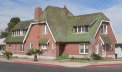 Paul Brooks Houselisted 1988
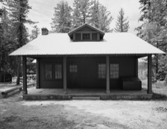 Columbine Work Stationlisted 1993
 T. D. Cross Houselisted 1988
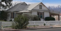 William Charles Davis Houselisted 1988
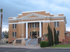 Graham County Courthouselisted 1982
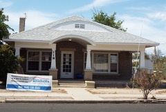 Joe Horowitz Houselisted 1988
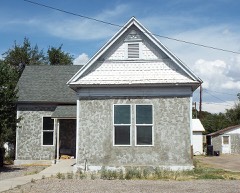 House at 611 Third Avenuelisted 1988
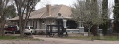 Mathew O'Brien Houselisted 1988
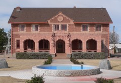 Oddfellows Homelisted 1988
 George A. Olney Houselisted 1988
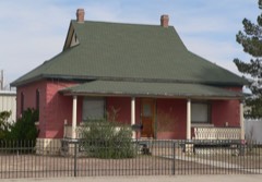 Alonzo Hamilton Packer Houselisted 1988
Every listing in Graham County
Surveyed buildings and structures 3 records
- Columbine Ranger Station, Garage, Milepost 1343, State Highway 366, Saffordfederal building survey, 6 photographs
- Columbine Ranger Station, Milepost 143, State Highway 336, Saffordfederal building survey, 2 photographs
- Columbine Ranger Station, Residence, Milepost 143, State Highway 366, Saffordfederal building survey, 10 photographs
Population over time
2 figuresSafford grew from 9,566 to 10,129 between 2010 and 2020. These are the recorded population figures Wikidata holds for this place, reached through the Geographic Names Information System number this page is keyed on rather than by name, so they belong to this place and not to another of the same name. Most are census counts, but not all are: an early figure may be a founding or settlement estimate, and an estimate published within five years of a census is left out. The change column is computed, and is left blank where more than 20 years separate a figure from the one before it, because a gap that long is not a change between two counts.
| Year | People | Change |
|---|---|---|
| 2010 | 9,566 | |
| 2020 | 10,129 | +563 (+6%) |
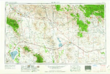
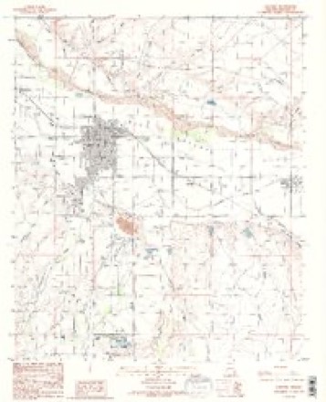
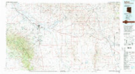
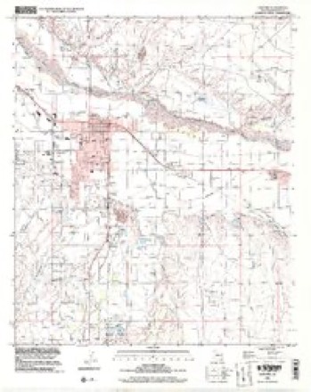
Topographic sheets covering this place
7 surveys from 14 printed sheetsMatched by testing this settlement's coordinate against the published boundary of every sheet in the United States Geological Survey's historical collection. Each opens the scanned sheet at the Survey.
- 1954 USGS Silver City quadrangle1:250000, 4 printings
- 1958 USGS Silver City quadrangle1:250000
- 1960 USGS Safford quadrangle1:62500, 3 printings
- 1962 USGS Silver City quadrangle1:250000
- 1985 USGS Safford quadrangle1:24000, 2 printings
- 1994 USGS Safford quadrangle1:100000, 2 printings
- 1998 USGS Safford quadrangle1:24000
Photographs
8 of 20 photographs shown, 1940Taken for the Office of War Information and the Farm Security Administration, who photographed the country between 1935 and 1944. Works of United States government photographers, with no known restriction on use. Each opens its catalogue record.

Lee, Russell, 1940. Library of Congress

Lee, Russell, 1940. Library of Congress

Lee, Russell, 1940. Library of Congress

Lee, Russell, 1940. Library of Congress

Lee, Russell, 1940. Library of Congress

Lee, Russell, 1940. Library of Congress
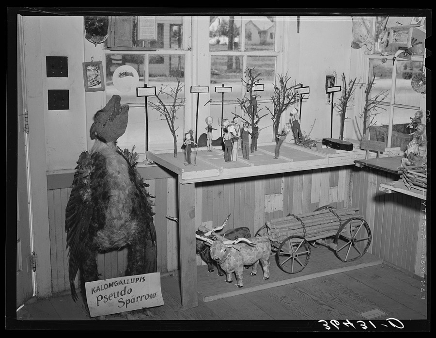
Lee, Russell, 1940. Library of Congress

Lee, Russell, 1940. Library of Congress
Every photograph of Graham County
Fires near this place
19 since 1993Regional context, not property-specific evidence. The federal wildfire occurrence database lists 19 fires within 5 miles of Safford between 1993 and 2020, burning about 542 acres in total. None started naturally. None was recorded as arson. Distance is straight-line from the map coordinates, so a fire counted here may appear on a neighbouring settlement's page as well.
| Reported cause | Fires |
|---|---|
| Missing data/not specified/undetermined | 15 |
| Debris and open burning | 2 |
| Recreation and ceremony | 1 |
| Fireworks | 1 |
The most recent of them, most recent first, with the day each was reported and the service that recorded it.
| Date | Cause | Size | Reported by | Name on the report |
|---|---|---|---|---|
| 8 September 1998 | Missing data/not specified/undetermined | under an acre | Gila District Office | R/M |
| 6 July 2010 | Missing data/not specified/undetermined | 7.0 acres | Gila District Office | RIVER |
| 5 July 2005 | Missing data/not specified/undetermined | 24 acres | Arizona Department of Forestry and Fire Management - State Office | FIRECRACKER |
| 2 July 1994 | Fireworks | 5.0 acres | Gila District Office | BONITA II |
| 5 June 2005 | Missing data/not specified/undetermined | 7.0 acres | Arizona Department of Forestry and Fire Management - State Office | SATURE |
| 23 June 1998 | Missing data/not specified/undetermined | under an acre | Gila District Office | WATSON |
| 21 June 2017 | Missing data/not specified/undetermined | under an acre | Clay Springs/Pinedale Fire Department | not named |
| 20 June 2005 | Missing data/not specified/undetermined | 49 acres | Arizona Department of Forestry and Fire Management - State Office | LONE MOUNTAIN |
Settlements close enough to share some of these fires:
Mines and quarries near this place
10 within 5 milesRegional context, not property-specific evidence. The federal mineral resources record lists 10 workings within 5 miles of Safford: 3 past producers, 3 prospects, 2 unknowns, 1 occurrence. 1 still produces. What was taken out: Sand and Gravel, Construction, Copper, Halite, Bromine, Geothermal. Distance is straight-line from the map coordinates, so a quarry counted here may appear on a neighbouring settlement's page as well.
| Where | Site | Commodity | Status | Recorded |
|---|---|---|---|---|
| Mt Graham Well | Geothermal | Unknown | ||
| Safford Well | Halite, Bromine | Occurrence | Brine, Halite | |
| Abeyta Properties | Copper | Prospect | ||
| Cobre Claims | Copper | Prospect | ||
| Norman Property | Copper | Prospect | ||
| Airport Pit | Sand and Gravel, Construction | Producer | ||
| Gravel Pit | Sand and Gravel, Construction | Past Producer | ||
| Gravel Pit | Sand and Gravel, Construction | Unknown | ||
| Gravel Pit | Sand and Gravel, Construction | Past Producer | ||
| Morris Sand and Gravel | Sand and Gravel, Construction | Past Producer |
Storms near this place
41 since 1995Regional context, not property-specific evidence. The National Weather Service names Safford in 41 storm reports between 1995 and 2021: 20 thunderstorm wind, 14 flash flood, 4 hail, 2 flood. No death or injury is recorded in these reports. Each account below is quoted exactly as the forecast office filed it, from the NOAA Storm Events Database, and each date opens the federal record of that event.
| When | Event | Place named | Harm | What the report says |
|---|---|---|---|---|
| October 2016 | Hail | Safford | $1,500,000 | One inch diameter hail began around 2300 LST as a large thunderstorm moved through Safford. The storm eventually produced hail up to 2.5 inches in diameter. Homes, vehicles and property were damaged throughout Safford and Solomon. Copious amounts of smaller hail fell for 20 minutes in some locations, causing accumulations of up to 6. In many spots, the hail did not melt overnight and was still piled up on roads, sidewalks and yards the following morning. In addition, where hail broke windows, rain and additional hail entered buildings causing water damage. This caused some schools in Safford to remain closed for two weeks until repairs were completed. The hailstorm also wiped out around 4000 acres of cotton crop, with several million dollars of loss estimated. Graham County issued a disaster declaration in the wake of the storm. |
| October 2016 | Flash Flood | Safford | $150,000 | More than two inches of rain accompanied by large hail that piled up to six inches deep in some locations caused flash flooding in Safford. Runoff filled Freeman Wash which caused minor damage to several homes and a school, and washed out part of 12th Avenue. The flood waters temporarily displaced twenty five residents. The school was closed for two weeks until repairs were completed. Flood waters also blocked roadways in rural areas, stranding 8,000 county fair visitors until waters receded. |
| June 1997 | Thunderstorm Wind | Safford | $60,000 | A severe thunderstorm that moved through Safford knocked down 6 power poles, blew part of a roof off a house , broke off several large tree limbs, and damaged several other structures. |
| July 2009 | Thunderstorm Wind | Safford | $30,000 | A trained spotter reported many trees were downed in the central part of Safford. ASOS measured a 63 mph thunderstorm wind gust at the Safford Regional Airport.|Amateur radio operators reported numerous power poles down near Safford. |
| August 2005 | Thunderstorm Wind | Safford | $25,000 | Strong winds associated with a thunderstorm in the City of Safford, caused damage to two large observation towers, several trailers, and several vehicles as sheet metal was blown off a roof hitting the cars. |
| January 2010 | Flood | Safford | $20,000 | Graham County law enforcement performed two swift water rescues just south of Safford during the late evening hours of January 21st. Deputies responded at 10:15 PM to a truck caught in a wash on Chastain Lane, just north of Highway 366. Law enforcement rescued the motorist of the truck. There were no injuries, but the truck was fully engulfed by the water. At approximately the same time, law enforcement spotted a van stuck in Stockton Wash, along Stockton Road south of Roper Lake. The occupants of the van exited the vehicle and waded to safety, before the van was washed further down Stockton Wash. |
| July 1997 | Thunderstorm Wind | Safford | $20,000 | Thunderstorm winds blew down several power poles in Safford and the nearby towns of Thatcher and Pima. |
| August 2003 | Thunderstorm Wind | Safford | $20,000 | no account filed |
| July 2021 | Thunderstorm Wind | Safford | $15,000 | Thunderstorm winds downed several trees and power poles in the east part of Safford. |
| August 2008 | Thunderstorm Wind | Safford | $15,000 | Multiple power lines were blown down between Safford and Thatcher. |
| July 2007 | Thunderstorm Wind | Safford | $15,000 | A strong thunderstorm knocked down two power poles in Safford. |
| August 2002 | Thunderstorm Wind | Safford | $15,000 | no account filed |
| August 2004 | Flash Flood | Safford | $10,000 | Arizona Department of Transportation reported that due to flooding portions of Highway 191 had been damaged and were closed. |
| July 2008 | Thunderstorm Wind | Safford | $7,500 | A power pole was knocked down at 2nd Ave. and Thatcher St. in Safford. |
| August 2018 | Thunderstorm Wind | Safford | $7,000 | Thunderstorm winds downed a tree that fell on a house on 7th Street in Safford and downed a power pole in Thatcher. In Eden, a power line a downed tree pulled down a power line, which set a tree on fire. |
| August 2004 | Thunderstorm Wind | Safford | $5,000 | A strong thunderstorm produced wind gusts up to 61 knots (70 mph) as is moved from the northeast toward the Safford area. The first severe wind gust occurred at 1605 MST and was 53 knots (61 mph), these strong winds continued being reported by the ASOS at the Safford Airport until 1645 MST. The last severe gust reported at the airport was 52 knots (60 mph). The storms then moved into the city of Safford and downed several power poles, and one large tree by 1648 MST. |
| October 2000 | Flood | Safford | $5,000 | Road closures due to flooding on Sally Bryce Road in Tally wash area. Heavy rain damaged cotton crops and pinto bean fields. |
| August 2007 | Thunderstorm Wind | Safford | $3,000 | A cinder block wall was knocked down at a residence in Safford due to strong winds. In addition, debris covered much of Highway 191 from just south of Safford to near Artesia. |
| October 2015 | Thunderstorm Wind | Safford | $2,000 | A power pole was snapped off at the base. In another area, power lines were snapped and were dangling from their poles. |
| July 2013 | Thunderstorm Wind | Safford | $1,000 | Thunderstorm winds picked up a storage container and blew it into a gas main. |
| April 2004 | Thunderstorm Wind | Safford | $1,000 | An isolated thunderstorm moving east produced a 56 mph wind gust and knocked down a power pole in Safford. Also the Safford Agricultural Station reported wind gusts up to 57 mph. |
| August 2004 | Thunderstorm Wind | Safford | $1,000 | Power lines were downed by strong winds. |
| July 2002 | Thunderstorm Wind | Safford | $500 | no account filed |
| September 2021 | Flash Flood | Safford | - | Nearly 1.5 of rain in about 30 minutes caused flash flooding of streets in Safford. |
| August 2018 | Flash Flood | Safford | - | Heavy rain of 1.5 to 2.5 inches caused Peterson Wash to overflow Safford Bryce Road, north of the Gila River in Safford. |
| July 2015 | Tornado (EF0) | Safford | - | A dust devil was stretched into a small landspout tornado by a passing thunderstorm near Safford. No damage was reported. |
| August 2008 | Flash Flood | Safford | - | A trained spotter reported 1.5 feet of water flowing over Cholla Street. |
| July 2007 | Flash Flood | Safford | - | Flooding and debris occurred along 8th street in Safford due to Flash Flooding. In addition, Klondyke Wash west of Safford was impassible. |
| July 2007 | Flash Flood | Safford | - | Low water crossings were flooded at Watson Canal, Kelley Canal and north of the Gila River/Pima Bridge. |
| July 2006 | Thunderstorm Wind | Safford | - | The ASOS (automated surface observing system) at the Safford International Airport recorded a severe thunderstorm wind gust of 56 knots (64 mph). |
| August 2006 | Flash Flood | Safford | - | Heavy rainfall over Mount Graham, just southwest of the City of Safford, caused roadway flooding along Highway 366. The Arizona Department of Transportation reported water, rocks and debris over the highway at mile post 121 (Noon Creek) and again at mile post 123 (Wet Canyon). |
| August 2005 | Flash Flood | Safford | - | Heavy rain over Mount Graham caused flooding and closure of several roads including: Aravapia Road, Bookerson Road, and Ash Creek Road. |
| August 2005 | Flash Flood | Safford | - | Noon Creek overtopped Highway 366, the road was reported to be impassable due to flood waters and was closed. Also a rockslide was reported at the intersection of Noon Creek and Highway 366. |
| August 2004 | Flash Flood | Safford | - | Significant rainfall on the Nuttal burn area caused Noon Creek to flood and overtop highway 366. Debris and large logs blocked the road making it impassable. |
| August 2004 | Hail | Safford | - | About 106 pounds of cotton crops were damaged by hail near Safford. These 106 pounds were reported to be worth about 4000 dollars. |
| August 2004 | Flash Flood | Safford | - | Significant rainfall on the Nuttall burn area caused Noon Creek to flood and overtop highway 366. Large logs and debris covered the road causing it to be impassable. |
| September 2004 | Hail | Safford | - | Significant hail damage was reported in the Safford area. The hail fell for about 30 minutes and stripped apples off of trees in a local orchard. |
| August 1997 | Flash Flood | Safford | - | Flooding was reported across state highway 191. |
| August 1995 | Thunderstorm Wind | Safford | - | Power lines knocked down. |
| September 2021 | Hail | Safford | - | no account filed |
| September 2003 | Flash Flood | Safford | - | no account filed |
Newspapers printed here
5,632 digitised pages2 papers published in this town, digitised by the Library of Congress and free to read: 1,314 issues, 5,632 pages. Every page is searchable, so a name or a street can be looked for directly in what the town printed about itself at the time.
| Newspaper | Published |
|---|---|
| Safford Rattler | 1896 to 189? |
| Graham Guardian | 1895 to 1923 |
What the paper printed
21,055 wordsFront pages of the local paper, read from the Library of Congress scans: 7 issues spread across its run from 1895 to 1922, 21,055 words in total. Each is reproduced on its own page, exactly as the recogniser returned it.
These pages read less well than anything else here, and the number is worth stating: about three words in four come through cleanly, against nine in ten for the building records. An 1896 broadsheet sets eight-point type in seven columns on microfilm, which is the hardest thing in this archive to read by machine. We tested our own recognisers against the Library's and they were not better, so the Library's text is what appears, with the wholly unreadable columns removed. Read it as a guide to what the paper covered, and follow the link to the scan before quoting anything.
| Issue | Paper | Length |
|---|---|---|
| 1896-09-09 | Safford Rattler | 748 words |
| 1896-09-16 | Safford Rattler | 798 words |
| 1895-05-11 | Graham Guardian | 4,659 words |
| 1895-07-12 | Graham Guardian | 4,416 words |
| 1895-09-20 | Graham Guardian | 4,650 words |
| 1895-11-22 | Graham Guardian | 4,673 words |
| 1922-12-26 | Graham Guardian | 1,111 words |
Nearest settlements
The eight closest, with where each one stands in the county. Distances are straight-line, computed from the Geographic Names Information System coordinates.
Elsewhere
Matched on this settlement's Geographic Names Information System number rather than its name, so it cannot be a different place of the same name in another state.
| Wikipedia article on Safford | An encyclopaedic summary. Its text is share-alike, so it is linked here rather than copied. |
| Wikidata item Q79767 | The structured record the population and elevation above come from. Public domain (CC0). |
Provenance
This settlement is recorded in the Geographic Names Information System as feature 10657. The sheet list is computed by point-in-boundary test against the United States Geological Survey's historical topographic inventory. Both are works of the United States government and carry no copyright under 17 U.S.C. 105.
Wildfire. Short, Karen C. 2022. Spatial wildfire occurrence data for the United States, 1992-2020 [FPA_FOD_20221014]. 6th Edition. Fort Collins, CO: Forest Service Research Data Archive. https://doi.org/10.2737/RDS-2013-0009.6 Collected with United States Government funding and usable without additional permissions or fees.
Mines and quarries. USGS Mineral Resources Data System (MRDS) https://mrdata.usgs.gov/mrds/ A work of the United States government, no copyright under 17 U.S.C. 105.
Storms. NOAA National Centers for Environmental Information, Storm Events Database https://www.ncei.noaa.gov/stormevents/ A work of the United States government, no copyright under 17 U.S.C. 105. Narratives are quoted verbatim from the National Weather Service report and are not edited or summarised.