 Block
Solomon, Arizona
14 topographic sheets cover this place, the earliest surveyed in 1954 and the latest in 1998. It stands in the Safford census division. It lies in ZIP code area 85546. It lies near Judia Canyon. The Survey maps it on the Safford quadrangle. 399 people lived here at the 2020 count. It stands 2,972 feet above sea level.
Topographic sheets covering this place
7 surveys from 14 printed sheetsMatched by testing this settlement's coordinate against the published boundary of every sheet in the United States Geological Survey's historical collection. Each opens the scanned sheet at the Survey.
- 1954 USGS Silver City quadrangle1:250000, 4 printings
- 1958 USGS Silver City quadrangle1:250000
- 1960 USGS Safford quadrangle1:62500, 3 printings
- 1962 USGS Silver City quadrangle1:250000
- 1985 USGS Safford quadrangle1:24000, 2 printings
- 1994 USGS Safford quadrangle1:100000, 2 printings
- 1998 USGS Safford quadrangle1:24000
Photographs
8 of 10 photographs shown, 1940Taken for the Office of War Information and the Farm Security Administration, who photographed the country between 1935 and 1944. Works of United States government photographers, with no known restriction on use. Each opens its catalogue record.
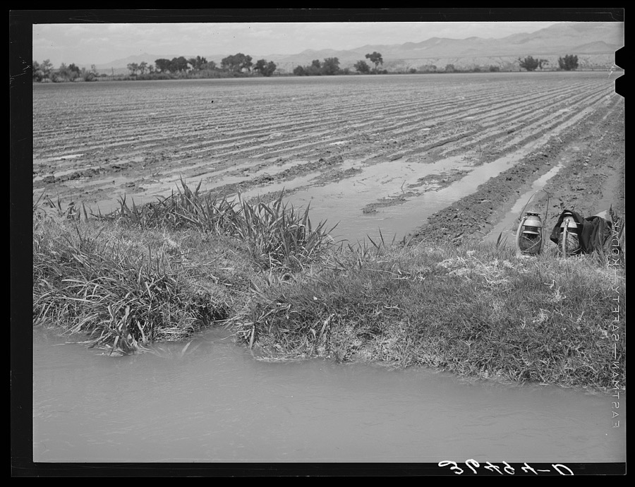
Lee, Russell, 1940. Library of Congress
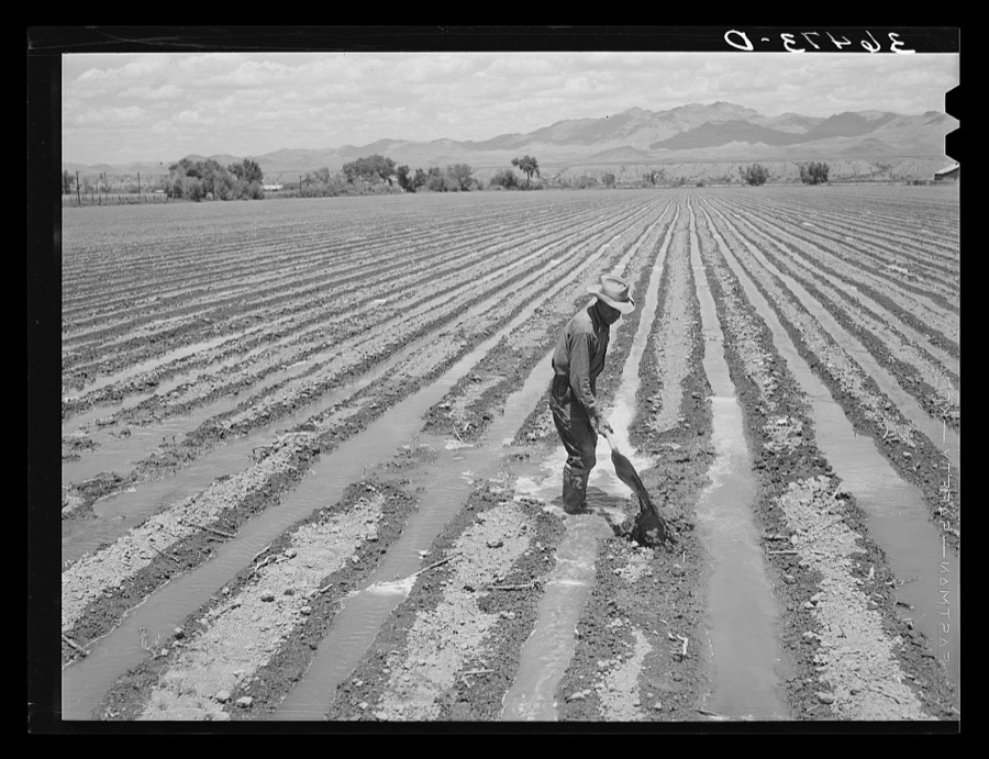
Lee, Russell, 1940. Library of Congress
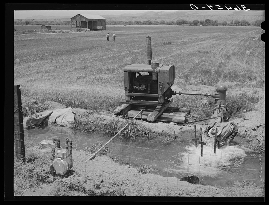
Lee, Russell, 1940. Library of Congress
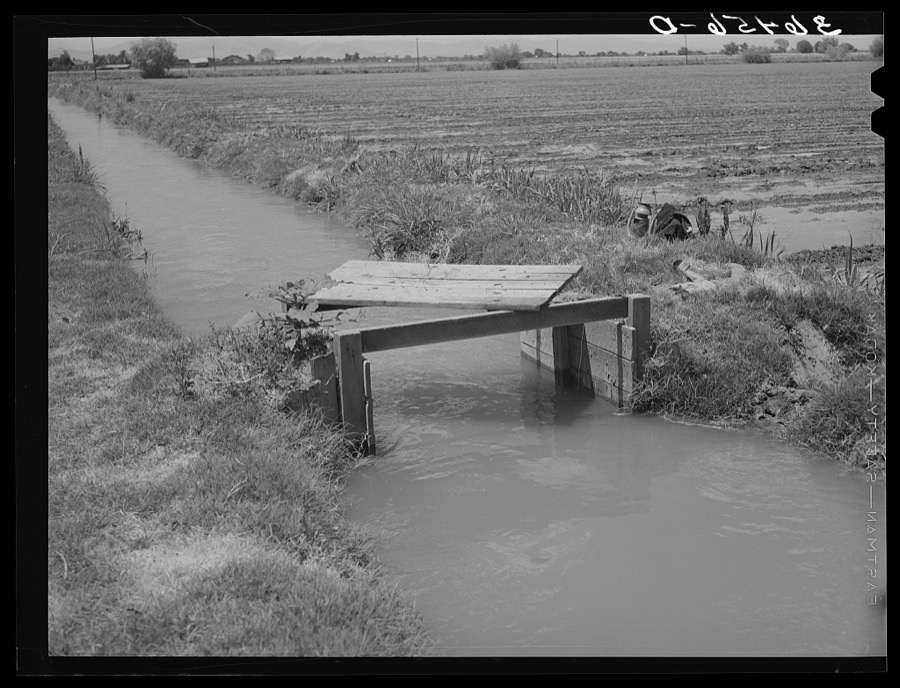
Lee, Russell, 1940. Library of Congress
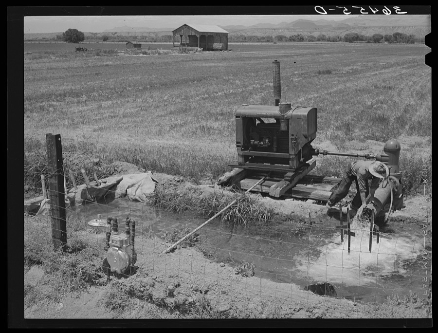
Lee, Russell, 1940. Library of Congress
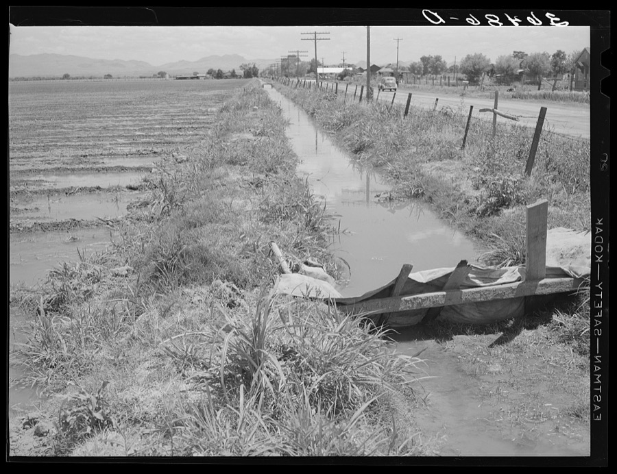
Lee, Russell, 1940. Library of Congress
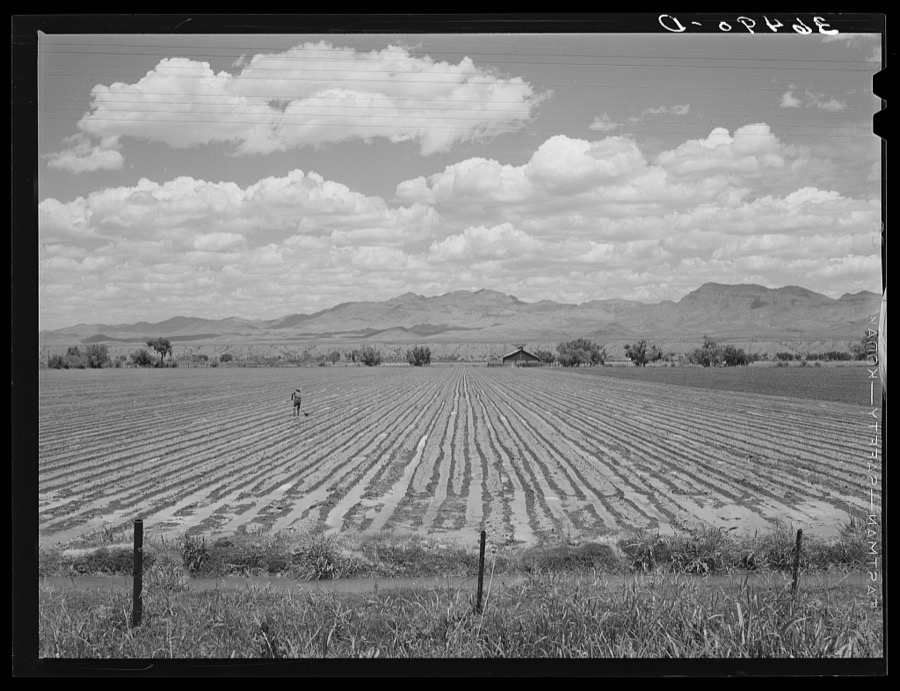
Lee, Russell, 1940. Library of Congress
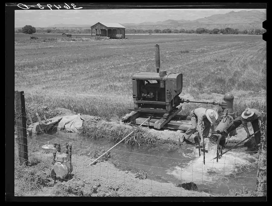
Lee, Russell, 1940. Library of Congress
Every photograph of Graham County
Fires near this place
22 since 1993Regional context, not property-specific evidence. The federal wildfire occurrence database lists 22 fires within 5 miles of Solomon between 1993 and 2017, burning about 291 acres in total. 3 started naturally. None was recorded as arson. Distance is straight-line from the map coordinates, so a fire counted here may appear on a neighbouring settlement's page as well.
| Reported cause | Fires |
|---|---|
| Missing data/not specified/undetermined | 16 |
| Natural | 3 |
| Fireworks | 1 |
| Recreation and ceremony | 1 |
| Debris and open burning | 1 |
The most recent of them, most recent first, with the day each was reported and the service that recorded it.
| Date | Cause | Size | Reported by | Name on the report |
|---|---|---|---|---|
| 29 August 1994 | Natural | 21 acres | Gila District Office | SOLOMON |
| 5 July 2005 | Missing data/not specified/undetermined | 24 acres | Arizona Department of Forestry and Fire Management - State Office | FIRECRACKER |
| 2 July 2008 | Natural | under an acre | Gila District Office | SOLOMON RIVER |
| 23 June 1999 | Missing data/not specified/undetermined | 5.0 acres | Arizona Department of Forestry and Fire Management - State Office | SAN JOSE #2 |
| 21 June 2017 | Missing data/not specified/undetermined | under an acre | Clay Springs/Pinedale Fire Department | not named |
| 20 June 2005 | Missing data/not specified/undetermined | 49 acres | Arizona Department of Forestry and Fire Management - State Office | LONE MOUNTAIN |
| 14 June 1993 | Missing data/not specified/undetermined | 80 acres | Gila District Office | BUG |
| 13 June 1999 | Natural | 24 acres | Arizona Department of Forestry and Fire Management - State Office | SAN JOSE |
Settlements close enough to share some of these fires:
Mines and quarries near this place
10 within 5 milesRegional context, not property-specific evidence. The federal mineral resources record lists 10 workings within 5 miles of Solomon: 5 producers, 2 past producers, 1 occurrence, 1 prospect. 5 still produce. What was taken out: Sand and Gravel, Construction, Halite, Bromine, Uranium. Distance is straight-line from the map coordinates, so a quarry counted here may appear on a neighbouring settlement's page as well.
| Where | Site | Commodity | Status | Recorded |
|---|---|---|---|---|
| Best Claim | Uranium | Prospect | ||
| Safford Well | Halite, Bromine | Occurrence | Brine, Halite | |
| Airport Pit | Sand and Gravel, Construction | Producer | ||
| Graham County Crusher | Sand and Gravel, Construction | Unknown | ||
| Gravel Pit | Sand and Gravel, Construction | Producer | ||
| Gravel Pit | Sand and Gravel, Construction | Producer | ||
| Gravel Pit | Sand and Gravel, Construction | Past Producer | ||
| Gravel Pit | Sand and Gravel, Construction | Producer | ||
| Morris Sand and Gravel | Sand and Gravel, Construction | Past Producer | ||
| Pit No.1 Ray Hatch | Sand and Gravel, Construction | Producer |
Storms near this place
31 since 2008Regional context, not property-specific evidence. The National Weather Service names Solomon in 31 storm reports between 2008 and 2025: 26 thunderstorm wind, 4 flash flood, 1 flood. No death or injury is recorded in these reports. Each account below is quoted exactly as the forecast office filed it, from the NOAA Storm Events Database, and each date opens the federal record of that event.
| When | Event | Place named | Harm | What the report says |
|---|---|---|---|---|
| September 2021 | Thunderstorm Wind | Solomon | $500,000 | Thunderstorm winds caused considerable damage near the junction of Highways 70 and 191 in Safford. Two hotel marquis signs were blown down. A large roof extending to the side of a building near a skate park was damaged and an attached tall block wall also fell. A wall south of this property where an animal shelter was located blew down along with a power line that caused a funeral home's cold storage unit to lose power. Damage extended several blocks south to 15th St. where the roof was peeled off an apartment complex. allowing rain to enter one unit. A few other buildings in Safford sustained moderate roof damage and solid fencing partitions were blown down. Several trees were blown down, some of which caused additional roof damage. causing roof damage. Some other tree/power line damage in other parts of town. A recreational vehicle was flipped on its side 5 miles south of Safford. The ASOS at Safford Municipal Airport measured a gust to 68 mph at 1545MST. |
| June 2016 | Thunderstorm Wind | Solomon | $15,000 | Facebook reports from the public indicated a measured 64 mph wind gust at Safford Ranch. One large tree was uprooted and fell on a vehicle. The Safford Electric Division reported power lines snapped and 3 or 4 poles had to be replaced. A chain linked fence was blown over. |
| September 2014 | Flash Flood | Solomon | $10,000 | Graham County Sheriff's Office reported 4 homes in Solomon area flooded between 1650 and 1710 LST when a wash came out of its banks. |
| July 2014 | Thunderstorm Wind | Solomon | $10,000 | Thunderstorm wind gusts up to 61 mph were reported at the Safford Airport. At Solomon, the roof of a shed was blown off, damaging nearby vehicles. Localized blowing dust reducing visibilities to less than a quarter mile were reported along Highway 70 near Safford. |
| June 2015 | Thunderstorm Wind | Solomon | $8,000 | Thunderstorm winds downed 5 power poles down on the 3500 block of east US-70. A wind gust of 61 mph occurred at the Safford Airport. |
| August 2018 | Thunderstorm Wind | Solomon | $5,000 | Thunderstorms winds downed power lines and bent several power poles in Solomon. |
| June 2025 | Thunderstorm Wind | Solomon | - | The Safford Regional Airport measured a wind gust of 66 mph from a thunderstorm outflow. |
| September 2025 | Thunderstorm Wind | Solomon | - | ASOS station at Safford Regional Airport gusted to 58 mph. |
| July 2024 | Thunderstorm Wind | Solomon | - | The Safford Regional ASOS recorded a wind gust of 59 mph. |
| July 2024 | Thunderstorm Wind | Solomon | - | The Safford Regional Airport recorded a wind gust of 59 mph. |
| November 2023 | Thunderstorm Wind | Solomon | - | A thunderstorm wind gust to 61 mph was recorded at the KSAD Safford Municipal Airport at 1523MST. |
| May 2023 | Thunderstorm Wind | Solomon | - | A wind gust to 60 mph was measured at the Safford Airport (KSAD). |
| July 2023 | Thunderstorm Wind | Solomon | - | A thunderstorm wind gust to 61 mph was measured at KSAD ASOS at 1634MST. |
| August 2023 | Thunderstorm Wind | Solomon | - | The Safford Airport ASOS KSAD recorded a wind gust of 60 mph at 1556MST. |
| August 2022 | Flood | Solomon | - | Heavy rain in New Mexico caused elevated flows in the Gila River downstream as far as Solomon. Floodwaters partially flooded the bridge at Sanchez Rd. along with adjacent lowlands. |
| July 2021 | Thunderstorm Wind | Solomon | - | A wind gust to 69 mph was recorded at Safford Airport. |
| July 2021 | Thunderstorm Wind | Solomon | - | A wind gust of 62 mph was recorded at Safford Airport. |
| August 2021 | Thunderstorm Wind | Solomon | - | A thunderstorm wind gust of 62 mph was reported at Safford Airport but no damage occurred. |
| June 2020 | Thunderstorm Wind | Solomon | - | A thunderstorm wind gust of 58 mph occurred at Safford Airport. |
| June 2020 | Thunderstorm Wind | Solomon | - | A thunderstorm wind gust of 62 mph occurred at Safford Airport. The storm continued into Greenlee County and produced a gust of 59 mph at Guthrie RAWS. |
| July 2019 | Flash Flood | Solomon | - | A foot of water was flowing across Sanchez Rd forcing it to be closed. |
| July 2017 | Thunderstorm Wind | Solomon | - | The Safford ASOS (KSAD) reported a wind gust of 67mph. |
| July 2017 | Flash Flood | Solomon | - | Near Solomon, AZ the San Jose Canal overflowed its banks. |
| July 2017 | Thunderstorm Wind | Solomon | - | Thunderstorm wind gust of 64 mph recorded at a state-owned agricultural weather station near Safford. A large tree was downed along Highway 70 in Solomon. |
| July 2017 | Thunderstorm Wind | Solomon | - | Thunderstorm produced a gust of 58 mph at Safford Airport. Outflow winds continued toward the northwest to the north of Safford. |
| July 2016 | Thunderstorm Wind | Solomon | - | Thunderstorm wind gusts were measured at KSAD ASOS to 51 kts and at Black Hills RAWS to 50 kts. |
| May 2009 | Thunderstorm Wind | Solomon | - | ASOS measured a wind gust of 62 mph at the Safford Airport. |
| June 2008 | Thunderstorm Wind | Solomon | - | The automated surface observation system at Safford Airport reported a wind gust to 63 mph. |
| August 2008 | Flash Flood | Solomon | - | Law enforcement reported that boulders were flowing across Highway 191 between Guthrie and Safford due to flooding. |
| July 2008 | Thunderstorm Wind | Solomon | - | Safford airport ASOS reported a wind gust to 56 knots. |
| August 2011 | Thunderstorm Wind | Solomon | - | no account filed |
Nearest settlements
The eight closest, with where each one stands in the county. Distances are straight-line, computed from the Geographic Names Information System coordinates.
| Map | Place | Distance | Sheets |
|---|---|---|---|
| Gripe | 1.7 miles | 12 | |
| San Jose | 2.3 miles | 12 | |
| Lone Star | 2.5 miles | 14 | |
| Hollywood | 2.9 miles | 14 | |
| Safford | 4.2 miles | 14 | |
| Buena Vista | 4.4 miles | 12 | |
| Cactus Flat | 5.7 miles | 14 | |
| Sanchez | 6.2 miles | 12 |
Elsewhere
Matched on this settlement's Geographic Names Information System number rather than its name, so it cannot be a different place of the same name in another state.
| Wikipedia article on Solomon | An encyclopaedic summary. Its text is share-alike, so it is linked here rather than copied. |
| Wikidata item Q3740176 | The structured record the population and elevation above come from. Public domain (CC0). |
Provenance
This settlement is recorded in the Geographic Names Information System as feature 11541. The sheet list is computed by point-in-boundary test against the United States Geological Survey's historical topographic inventory. Both are works of the United States government and carry no copyright under 17 U.S.C. 105.
Wildfire. Short, Karen C. 2022. Spatial wildfire occurrence data for the United States, 1992-2020 [FPA_FOD_20221014]. 6th Edition. Fort Collins, CO: Forest Service Research Data Archive. https://doi.org/10.2737/RDS-2013-0009.6 Collected with United States Government funding and usable without additional permissions or fees.
Mines and quarries. USGS Mineral Resources Data System (MRDS) https://mrdata.usgs.gov/mrds/ A work of the United States government, no copyright under 17 U.S.C. 105.
Storms. NOAA National Centers for Environmental Information, Storm Events Database https://www.ncei.noaa.gov/stormevents/ A work of the United States government, no copyright under 17 U.S.C. 105. Narratives are quoted verbatim from the National Weather Service report and are not edited or summarised.