 Block
Stanfield, Arizona
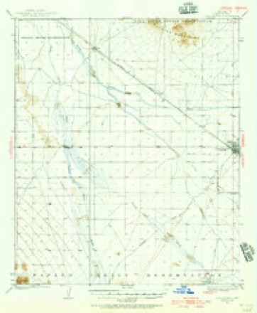
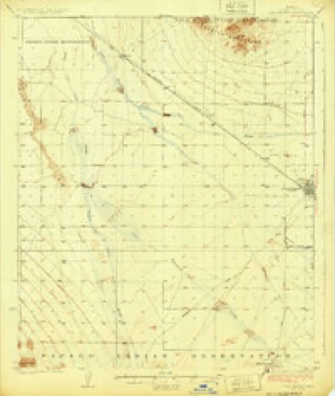
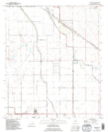
18 topographic sheets cover this place, the earliest surveyed in 1922 and the latest in 1994. It stands in the Maricopa-Stanfield census division. It lies in ZIP code area 85172. It stands on Santa Rosa Wash. The Survey maps it on the Stanfield quadrangle. 558 people lived here at the 2020 count. It stands 1,302 feet above sea level.
Population over time
3 figuresStanfield fell from 651 to 558 between 2000 and 2020. These are the recorded population figures Wikidata holds for this place, reached through the Geographic Names Information System number this page is keyed on rather than by name, so they belong to this place and not to another of the same name. Most are census counts, but not all are: an early figure may be a founding or settlement estimate, and an estimate published within five years of a census is left out. The change column is computed, and is left blank where more than 20 years separate a figure from the one before it, because a gap that long is not a change between two counts.
| Year | People | Change |
|---|---|---|
| 2000 | 651 | |
| 2010 | 740 | +89 (+14%) |
| 2020 | 558 | -182 (-25%) |
Topographic sheets covering this place
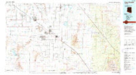
11 surveys from 18 printed sheetsMatched by testing this settlement's coordinate against the published boundary of every sheet in the United States Geological Survey's historical collection. Each opens the scanned sheet at the Survey.
- 1922 USGS Casa Grande quadrangle1:62500, 2 printings
- 1924 USGS Casa Grande quadrangle1:62500
- 1956 USGS Tucson quadrangle1:250000, 3 printings
- 1958 USGS Tucson quadrangle1:250000
- 1959 USGS Tucson quadrangle1:250000, 2 printings
- 1962 USGS Tucson quadrangle1:250000
- 1964 USGS Tucson quadrangle1:250000
- 1965 USGS Stanfield quadrangle1:24000, 2 printings
- 1971 USGS Stanfield quadrangle1:24000
- 1992 USGS Stanfield quadrangle1:24000
- 1994 USGS Casa Grande quadrangle1:100000, 3 printings

Fires near this place
114 since 1992Regional context, not property-specific evidence. The federal wildfire occurrence database lists 114 fires within 5 miles of Stanfield between 1992 and 2020, burning about 460 acres in total. 6 started naturally. 1 was recorded as arson. Distance is straight-line from the map coordinates, so a fire counted here may appear on a neighbouring settlement's page as well.
| Reported cause | Fires |
|---|---|
| Missing data/not specified/undetermined | 78 |
| Debris and open burning | 16 |
| Smoking | 7 |
| Natural | 6 |
| Equipment and vehicle use | 3 |
| Recreation and ceremony | 2 |
| Arson/incendiarism | 1 |
| Railroad operations and maintenance | 1 |
The most recent of them, most recent first, with the day each was reported and the service that recorded it.
| Date | Cause | Size | Reported by | Name on the report |
|---|---|---|---|---|
| 29 September 2011 | Missing data/not specified/undetermined | under an acre | Arizona Department of Forestry and Fire Management - State Office | POTTERS FIELD |
| 23 September 2017 | Missing data/not specified/undetermined | under an acre | Arizona Department of Forestry and Fire Management - Southeast District | POTTERS |
| 16 September 2001 | Debris and open burning | under an acre | Arizona Department of Forestry and Fire Management - State Office | SMITH |
| 15 September 2005 | Equipment and vehicle use | 3.0 acres | Arizona Department of Forestry and Fire Management - State Office | LOST WHEEL |
| 7 August 2015 | Missing data/not specified/undetermined | under an acre | Arizona Department of Forestry and Fire Management - State Office | ANDERSON |
| 30 August 2014 | Missing data/not specified/undetermined | under an acre | Arizona Department of Forestry and Fire Management - State Office | SHERBUNDY |
| 28 August 2005 | Missing data/not specified/undetermined | 2.0 acres | Arizona Department of Forestry and Fire Management - State Office | GREENE CANAL |
| 15 August 2019 | Missing data/not specified/undetermined | under an acre | Arizona Department of Forestry and Fire Management - Southeast District | ANDERSON |
Settlements close enough to share some of these fires:
Mines and quarries near this place
4 within 5 milesRegional context, not property-specific evidence. The federal mineral resources record lists 4 workings within 5 miles of Stanfield: 2 prospects, 1 past producer, 1 producer. 1 still produces. What was taken out: Copper, Iron, Molybdenum, Gold, Silver. Distance is straight-line from the map coordinates, so a quarry counted here may appear on a neighbouring settlement's page as well.
| Where | Site | Commodity | Status | Recorded |
|---|---|---|---|---|
| Oro Negro Mining Co Property 5 | Iron | Prospect | ||
| Santa Cruz | Copper, Molybdenum, Gold, Silver | Past Producer | 1976 | |
| Casa Grande Santa Cruz | Copper | Prospect | 1976 | |
| Inspiration Pits | Copper | Producer |
Storms near this place
45 since 1993Regional context, not property-specific evidence. The National Weather Service names Stanfield in 45 storm reports between 1993 and 2024: 25 thunderstorm wind, 7 hail, 5 flash flood, 3 heavy rain. No death or injury is recorded in these reports. Each account below is quoted exactly as the forecast office filed it, from the NOAA Storm Events Database, and each date opens the federal record of that event.
| When | Event | Place named | Harm | What the report says |
|---|---|---|---|---|
| September 2010 | Thunderstorm Wind | Stanfield | $300,000 | A trained weather spotter reported significant wind damage to portions of Stanfield. Several mobile homes were rolled over or destroyed. One house lost it's roof. Additional damage was reported in the vicinity of Javelina and Conejo Avenue. The damage was due to severe microburst winds estimated to be in excess of 80 knots. |
| July 2011 | Thunderstorm Wind | Stanfield | $75,000 | As reported by officers from the Casa Grande Police Department, thunderstorm microburst winds estimated to be near 80 knots severely damaged two mobile homes approximately 8 miles west of Casa Grande. No injuries were reported. |
| August 2020 | Thunderstorm Wind | Stanfield | $50,000 | Scattered thunderstorms, some with damaging outflow winds, developed to the southeast of Phoenix during the evening hours on August 20th. According to a report from the general public, a cluster of thunderstorms moved through the town of Stanfield at 2055MST; strong outflow winds generated by the storms produced significant roof and tree damage in the town. One of the damaged trees was a large 50 year old tree in town. Wind gusts were estimated to be as high as 70 mph. Stanfield is located about 12 miles west of the town of Casa Grande. There were no reports of injuries due to the strong damaging winds. |
| August 2000 | Thunderstorm Wind | Stanfield | $50,000 | Microburst winds tore down 26 power poles in western Pinal County. Arizona Public Service reported lines and poles down for about 1 mile paralleling White - Parker Road. HIdden Valley was also without power for some time. |
| July 2022 | Thunderstorm Wind | Stanfield | $40,000 | Images showed significant roof damage to a couple of homes and a flipped trailer home just north of I-8 near Montgomery Road. No injuries were reported. |
| September 2011 | Thunderstorm Wind | Stanfield | $35,000 | Scattered thunderstorms with strong, damaging winds developed over the south central Arizona deserts during the evening hours on September 9th. A trained weather spotter reported that shingles were torn off the roofs of several homes located about 11 miles west of Stanfield. In addition, mobile home skirting was damaged or destroyed on several of the mobile homes. A wind gust to 49 mph was measured, however peak gusts were likely in excess of 60 mph. |
| September 2010 | Thunderstorm Wind | Stanfield | $25,000 | The Pinal County sheriff's office reported that four power poles were blown down near the intersection of Amarillo Valley Road and Century Road. At least two vehicles were temporarily trapped by the downed poles and lines. |
| July 2022 | Thunderstorm Wind | Stanfield | $20,000 | Barnes Rd was closed from Amarillo Valley Rd to Warren Rd due to downed power lines. Timing estimated from radar. No injuries were reported. |
| August 2017 | Flash Flood | Stanfield | $20,000 | Thunderstorms with very heavy rain developed during the late afternoon hours over the southern portion of the greater Phoenix area, in the areas around the towns of Maricopa and Ak-Chin Village. Heavy rains led to rapidly rising flow down the Vekol Wash, which flowed downstream from around Interstate 8 northward and into the community of Ak-Chin Village. According to local law enforcement as well as trained spotters in the area, at 2045MST swiftly running water was moving through the Vekol Wash and through the Ak-Chin indian community resulting in on-going flooding. Water rescues were underway at Ralston Road and Val Vista Road where the Vekol Wash crosses the Roadway. A Flash Flood Watch had been issued earlier in the afternoon for the area but was cancelled at 1935MST. This was later replaced by a Flood Watch which was issued at 2151MST and remained in effect through 0040MST the next day. Fortunately, no injuries were reported due to the flash flooding. |
| July 2024 | Thunderstorm Wind | Stanfield | $15,000 | Approximately 15 downed power poles were reported in multiple areas along Stanfield. Wind gusts were estimated at between 55-60 mph. Timing estimated from radar. No injuries were reported. |
| July 2023 | Thunderstorm Wind | Stanfield | $12,000 | Approximately a dozen downed power lines were reported along Barnes Road between Fuqua and Stanfield Roads in Stanfield, causing the road to be closed down for multiple days. Timing estimated from radar. Wind gusts were estimated at 55-60 mph. No injuries were reported. |
| July 2022 | Thunderstorm Wind | Stanfield | $12,000 | Semi-truck flipped over due to strong winds on I-8 eastbound near MP 157. Winds were estimated at around 60 mph. Timing estimated from radar. No injuries were reported. |
| June 2000 | Thunderstorm Wind | Stanfield | $10,000 | Power poles downed by wind. |
| October 2018 | Flash Flood | Stanfield | $5,000 | Copious amounts of tropical moisture spread north and into the central deserts south of Phoenix during the morning hours on October 2nd. Widespread moderate to heavy showers developed south of the town of Maricopa, leading to an episode of flash flooding that impacted Highway 347 well to the south of Maricopa and just north of Interstate 8. According to a local police report, at 0950MST local fire department and rescue units were performing a water rescue near Highway 347 and Meadowview Road. No injuries were reported due to the flash flooding. A Flash Flood Warning was issued for the area beginning at 0713MST and the warning ran through 1315MST. |
| August 2013 | Thunderstorm Wind | Stanfield | $5,000 | Thunderstorms developed during the late afternoon hours across portions of northwest Pinal county on August 27th, and they produced gusty and damaging winds which affected Ak-Chin Village. A trained weather spotter 8 miles southwest of Ak-Chin Village reported that strong wind gusts and heavy rain blew down part of a porch roof. The winds were estimated to be in excess of 60 mph. Hail as large as 1 inch in diameter accompanied the strong winds. A Severe Thunderstorm Warning was in effect for the area starting at 1723MST and continuing until 1800MST. |
| July 2024 | Thunderstorm Wind | Stanfield | $3,000 | Three downed power poles were reported in the area of South Stanfield Road and West Peters Road in Stanfield. Wind gusts were estimated at between 55-60 mph. Timing estimated from radar. No injuries were reported. |
| September 2023 | Thunderstorm Wind | Stanfield | $3,000 | Three downed power poles along West Miller Road about two miles west of Highway 347. Timing based on radar. Wind gusts were estimated at approximately 60 mph. No injuries were reported. |
| July 2018 | Flash Flood | Stanfield | $3,000 | Thunderstorms with locally heavy rain developed over the central deserts during the afternoon hours on July 11th and they affected areas south of Phoenix and between Gila Bend and Casa Grande. The heavy rain led to flash flooding along Interstate 8 just east of the Maricopa County line. According to a report from the public, at 1619MST a wash crossing a roadway was flowing rapidly; flash flooding was occurring as water levels in the wash were rising quickly. The location of the flash flooding was near the intersection of Interstate 8 and Arizona State Route 84. A Flash Flood Warning was issued for the area at 1603MST and it remained in effect until 1900MST. |
| July 2024 | Thunderstorm Wind | Stanfield | $2,000 | Two downed power poles were reported in the area of West Barnes Road and North Fuqua Road in Stanfield. Wind gusts were estimated at between 55-60 mph. Timing estimated from radar. No injuries were reported. |
| January 2024 | Flood | Stanfield | $500 | West Agate Road wad closed from South Olivine Road to South Amarillo Valley Road due to running washes with the road washed out at the intersection with South Amarillo Valley Road. No injuries were reported. |
| January 2024 | Flood | Stanfield | $500 | West Sotol Road from South Quicksilver Road to South Amarillo Valley Road was closed due to running washes. No injuries were reported. |
| August 2022 | Thunderstorm Wind | Stanfield | $500 | A road sign along I-8 near milepost 151 was blown over with the supports snapped in half. No injuries were reported. |
| January 2024 | Flood | Stanfield | - | West Barnes Rd closed from Stanfield Road to North Pala Road due to running washes. No damages or injuries were reported. |
| August 2023 | Flash Flood | Stanfield | - | Barnes Road from Stanfield Road to Murphy Road closed due to Green Wash running. No damages or injuries were reported. |
| June 2022 | Tornado (EFU) | Stanfield | - | Multiple storm chaser photos show a landspout tornado developed northwest of Stanfield. It appeared to be moving northeast along a thunderstorm outflow through open farm fields. The exact location, timing, path length, and width were all estimated based on the photos and radar. It is unknown if the landspout caused any property or crop damage and no damage survey was conducted. An RV did flip and around 50 power poles did fall in this area, but these reports were attributed to downburst winds due to nearly all power poles falling to the north. No injuries were reported. |
| July 2021 | Flash Flood | Stanfield | - | A trained weather spotter reported multiple running washes with 6-12 inches of running water over Warren Road in multiple locations. |
| September 2019 | Tornado (EF0) | Stanfield | - | Scattered to numerous showers and thunderstorms continued to develop across the central deserts during the afternoon hours on September 23rd. In addition to producing very heavy rain, one exceptionally strong storm actually produced a weak tornado between Stanfield and Casa Grande during the late afternoon. Atmospheric conditions were especially favorable for weak tornadoes, given the elevated instability combined with much stronger than normal wind shear with height. In this case, a trained spotter viewed the weak landspout tornado over an open field; it quickly dissipated near State Route 84 and Midway Road. The tornado occurred at approximately 1825MST. Fortunately the tornado did not produce any damage or injuries. |
| August 2018 | Heavy Rain | Stanfield | - | Scattered thunderstorms moved northward and across the south and southwest portions of the greater Phoenix area during the late afternoon and early evening hours on August 2nd. Some of the stronger storms generated heavy rains with peak rain rates measured to be in excess over 2 inches per hour. At 1751MST a trained spotter located about 7 miles southwest of Ak Chin Village measured 0.8 inches of rain within a 20 minute period. He also reported gusts to 45 mph which were sufficient to blow some items around the area. No significant damages were reported. Shortly thereafter another spotter about 1 mile further west measured 1.1 inches of rain within 30 minutes. The heavy rain led to the issuance of a Flood Advisory at 1800MST for the area southwest of the town of Maricopa down to the Interstate 8 corridor. No flash flooding was reported. |
| October 2015 | Hail | Stanfield | - | An area of low pressure moving across Arizona acted upon elevated moisture and instability to produce scattered thunderstorms across the central deserts during the afternoon hours on October 18th. Some of the storms affected the community of Stanfield. According to a trained weather spotter, at 1436MST a strong storm dropped dime sized hail in Stanfield; the largest stones had a diameter of 0.75 inches. The large hail did not produce any damage. |
| August 2013 | Thunderstorm Wind | Stanfield | - | Thunderstorms with strong gusty winds developed across portions of the south central Arizona deserts during the late afternoon hours on August 27th. Although no damage was reported due to the strong winds, there were multiple reports of gusts reaching at least 60 mph in strength. At 1630MST, a local post office in Stanfield estimated a peak gust to 60 mph. The wind created locally dense blowing dust which lowered visibility below one mile. At 1737MST, a trained weather spotter 15 miles southwest of the town of Maricopa estimated wind gusts of 60 mph at the intersection of North Warren and West Miller roads. The spotter also reported pea sized hail. |
| August 2013 | Hail | Stanfield | - | Thunderstorms, some with large hail, developed across portions of northwestern Pinal county during the afternoon hours on August 27th. A trained weather spotter located 8 miles to the southwest of Ak-Chin Village reported dime to quarter sized hailstones along with locally heavy rainfall. He measured some of the larger hailstones at 1 inch diameter and also measured 0.54 inches of rain in a 15 minute period. |
| July 2012 | Heavy Rain | Stanfield | - | According to the Santa Rosa @ SR 84 Maricopa County Flood Control District gage, 1.54 inches of rainfall were observed a in 3 hour period ending at 11:30 AM on the 4th of July. Similar values were observed at a nearby gage to the east, Santa Cruz @ SR 84. Both gages were located along State Route 84, between the communities of Stanfield and Casa Grande. The heavy rainfall caused the Santa Rosa wash to run heavily. Water ponding on State Route 84 caused the temporary closure of the road during the late morning and early afternoon hours. No accidents were reported on SR 84. The heavy rain was produced by a cluster of thunderstorms that developed ahead of a weather disturbance approaching from northwest Mexico. |
| September 2012 | Heavy Rain | Stanfield | - | Isolated to scattered showers and thunderstorms developed across portions of western Pinal county during the late afternoon hours on September 6th. A few of the storms produced locally heavy rain with peak rain rates in excess of 2 inches per hour. At 502 pm, a trained weather spotter 8 miles southwest of the Ak-Chin Village measured 0.53 inches of rain in a 15 minute period. Although no serious flooding issues were reported with the heavy rain, a Flood Advisory was issued at 445 pm for west central Pinal county, primarily for the area from the town of Maricopa eastward to Sacaton. The heavy rain caused area washes to run, as well as ponding of water on roads and normally dry areas. |
| August 2007 | Thunderstorm Wind | Stanfield | - | Power and phones knocked out, tree limbs down, and 1.75 inches of rain in only 50 minutes. |
| June 2000 | Thunderstorm Wind | Stanfield | - | Large palo verde tree knocked down by wind. |
| August 1999 | Thunderstorm Wind | Stanfield | - | Winds snapped off large branches . |
| September 1997 | Hail | Stanfield | - | Spotter reported dime size hail. |
| September 1995 | Thunderstorm Wind | Stanfield | - | Thunderstorm winds knocked over 27 power poles. A sheriff's deputy spotted a funnel cloud over the Desert Carmel Subdivision approximately three miles west of Casa Grande. |
| September 1995 | Hail | Stanfield | - | Convective winds blew the roof off of a small building in the town of Maricopa. |
| September 1994 | Thunderstorm Wind | Stanfield | - | Thunderstorm winds knocked down several power poles between 1830 and 1945 MST. |
| August 1993 | Thunderstorm Wind | Stanfield | - | Power lines reported to be downed by high winds. |
| June 2006 | Hail | Stanfield | - | no account filed |
| September 2002 | Hail | Stanfield | - | no account filed |
| September 2002 | Hail | Stanfield | - | no account filed |
| July 1996 | Thunderstorm Wind | Stanfield | - | no account filed |
Nearest settlements
The eight closest, with where each one stands in the county. Distances are straight-line, computed from the Geographic Names Information System coordinates.
| Map | Place | Distance | Sheets |
|---|---|---|---|
| Peters Corner | 4.6 miles | 22 | |
| Bon | 6.8 miles | 18 | |
| Casa Grande | 10.9 miles | 18 | |
| Burns | 11.3 miles | 19 | |
| Vaiva Vo | 11.5 miles | 17 | |
| Ak Chin | 11.9 miles | 22 | |
| Ak-Chin Village | 12.1 miles | 22 | |
| Maricopa | 12.9 miles | 22 |
Elsewhere
Matched on this settlement's Geographic Names Information System number rather than its name, so it cannot be a different place of the same name in another state.
| Wikipedia article on Stanfield | An encyclopaedic summary. Its text is share-alike, so it is linked here rather than copied. |
| Wikidata item Q2502238 | The structured record the population and elevation above come from. Public domain (CC0). |
Provenance
This settlement is recorded in the Geographic Names Information System as feature 11780. The sheet list is computed by point-in-boundary test against the United States Geological Survey's historical topographic inventory. Both are works of the United States government and carry no copyright under 17 U.S.C. 105.
Wildfire. Short, Karen C. 2022. Spatial wildfire occurrence data for the United States, 1992-2020 [FPA_FOD_20221014]. 6th Edition. Fort Collins, CO: Forest Service Research Data Archive. https://doi.org/10.2737/RDS-2013-0009.6 Collected with United States Government funding and usable without additional permissions or fees.
Mines and quarries. USGS Mineral Resources Data System (MRDS) https://mrdata.usgs.gov/mrds/ A work of the United States government, no copyright under 17 U.S.C. 105.
Storms. NOAA National Centers for Environmental Information, Storm Events Database https://www.ncei.noaa.gov/stormevents/ A work of the United States government, no copyright under 17 U.S.C. 105. Narratives are quoted verbatim from the National Weather Service report and are not edited or summarised.