 Block
Sunnyside, Arizona
24 topographic sheets cover this place, the earliest surveyed in 1914 and the latest in 1996. It stands in the Bisbee census division. It lies in ZIP code area 85611. It lies near Eureka Canyon. The Survey maps it on the Huachuca Peak quadrangle.
Topographic sheets covering this place
12 surveys from 24 printed sheetsMatched by testing this settlement's coordinate against the published boundary of every sheet in the United States Geological Survey's historical collection. Each opens the scanned sheet at the Survey.
- 1914 USGS Hereford quadrangle1:125000, 3 printings
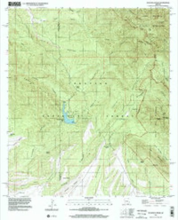
- 1922 USGS Sunnyside quadrangle1:62500
- 1938 USGS Sunnyside quadrangle1:62500, 2 printings
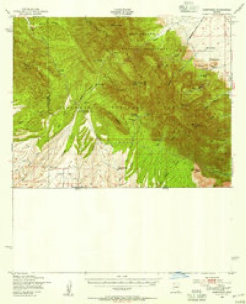
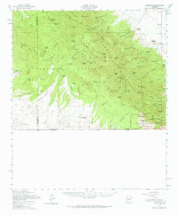
- 1948 USGS Huachuca Peak quadrangle1:24000
- 1948 USGS Sunnyside quadrangle1:62500
- 1956 USGS Nogales quadrangle1:250000, 4 printings
- 1958 USGS Huachuca Peak quadrangle1:24000, 5 printings
- 1958 USGS Nogales quadrangle1:250000
- 1958 USGS Sunnyside quadrangle1:62500, 2 printings
- 1959 USGS Nogales quadrangle1:250000
- 1994 USGS Nogales quadrangle1:100000, 2 printings
- 1996 USGS Huachuca Peak quadrangle1:24000
Fires near this place
143 since 1992Regional context, not property-specific evidence. The federal wildfire occurrence database lists 143 fires within 5 miles of Sunnyside between 1992 and 2020, burning about 25,234 acres in total. 38 started naturally. 2 were recorded as arson. Distance is straight-line from the map coordinates, so a fire counted here may appear on a neighbouring settlement's page as well.
| Reported cause | Fires |
|---|---|
| Recreation and ceremony | 81 |
| Natural | 38 |
| Missing data/not specified/undetermined | 10 |
| Equipment and vehicle use | 4 |
| Smoking | 4 |
| Misuse of fire by a minor | 2 |
| Arson/incendiarism | 2 |
| Fireworks | 1 |
| Debris and open burning | 1 |
The most recent of them, most recent first, with the day each was reported and the service that recorded it.
| Date | Cause | Size | Reported by | Name on the report |
|---|---|---|---|---|
| 29 September 2001 | Recreation and ceremony | under an acre | Coronado National Forest | BEAR CAMP |
| 29 September 2000 | Natural | under an acre | Coronado National Forest | NANCY |
| 1 September 1996 | Equipment and vehicle use | under an acre | Coronado National Forest | O'DONNELL |
| 6 August 1993 | Natural | under an acre | Coronado National Forest | GRANITE |
| 30 August 2002 | Natural | under an acre | Coronado National Forest | BROWN |
| 26 August 2000 | Natural | under an acre | Coronado National Forest | CREST |
| 15 August 2020 | Natural | 8.0 acres | Coronado National Forest | RAMSEY |
| 9 July 1993 | Natural | under an acre | Coronado National Forest | RATTLESNAKE |
Settlements close enough to share some of these fires:
Mines and quarries near this place
10 of 25 shownRegional context, not property-specific evidence. The federal mineral resources record lists 25 workings within 5 miles of Sunnyside: 15 past producers, 6 producers, 2 prospects, 1 occurrence. 6 still produce. What was taken out: Lead, Tungsten, Gold, Silver, Tungsten, Copper, Gold, Silver. Distance is straight-line from the map coordinates, so a quarry counted here may appear on a neighbouring settlement's page as well.
| Where | Site | Commodity | Status | Recorded |
|---|---|---|---|---|
| Copper Glance Mine | Copper, Gold, Silver | Past Producer | 1900 | |
| Eureka Canyon Zeolite Occurrence | Zeolites | Occurrence | Unknown | |
| Eureka Mine | Lead, Copper, Gold, Silver | Producer | 1951 | |
| Eureka Mine | Lead, Silver, Copper, Gold | Past Producer | 1900 | |
| Hamburg Mine | Copper, Lead, Zinc, Silver, Gold | Past Producer | 1913, 1950 | |
| Hamburg Mine | Gold, Lead, Silver, Zinc, Copper | Past Producer | 1912 | |
| Harper Mine | Gold, Silver, Copper, Tungsten, Lead | Producer | Bornite, Calcite, Chalcopyrite, Galena, Gold, Malachite, Pyrite, Scheelite, Silver | |
| Harper Mine | Tungsten, Silver, Gold, Lead, Copper | Past Producer | 1900 | |
| James Group | Zinc, Tungsten, Lead, Copper, Silver, Gold | Producer | Galena, Gold, Scheelite, Silver | |
| James Group | Lead, Tungsten, Copper, Gold, Silver, Zinc | Past Producer | 1918 |
Storms near this place
6 since 2010Regional context, not property-specific evidence. The National Weather Service names Sunnyside in 6 storm reports between 2010 and 2014: 3 flash flood, 1 lightning, 1 thunderstorm wind, 1 heavy rain. The reports record 2 injuries. Each account below is quoted exactly as the forecast office filed it, from the NOAA Storm Events Database, and each date opens the federal record of that event.
| When | Event | Place named | Harm | What the report says |
|---|---|---|---|---|
| August 2011 | Lightning | Sunnyside | 2 hurt | Two illegal immigrants were struck by lightning near Sierra Vista and transported to a hospital. The Border Patrol reported that the injuries sustained by the two illegal immigrants was consistent with a lightning strike. |
| March 2014 | Heavy Rain | Sunnyside | $15,000 | Heavy rain was determined to be the cause of a 1-vehicle accident involving two women at Kilometer 15 on 1-19 in Rio Rico. The car drifted to the left into the center median at approximately 1215 MST and struck a tree. One woman was killed and the other was seriously injured. |
| July 2014 | Flash Flood | Sunnyside | $5,000 | Heavy rain across Cochise County resulted in further flooding in parts of Sierra Vista. Early in the day, normally dry washes were still running from the previous day's rainfall, and storm debris (mainly rocks) remained on Willcox Drive and Buffalo Soldier Trail. After storms rolled through during the evening hours, law enforcement reported Moson Road closed yet again, this time at mile post 5, and Kings Ranch Road near Highway 92 was flooded over. The storm also washed out the only access for residents living along South Paloma Trail in Palominas, stranding several families. |
| September 2013 | Thunderstorm Wind | Sunnyside | $5,000 | Thunderstorm winds blew off a portion of a roof in Nogales. |
| August 2011 | Flash Flood | Sunnyside | - | Rainfall in excess of one inch under one hour on the Monument Fire burn area resulted in flooding along Montezuma Canyon Road. Heavy rainfall also resulted in water rushing across and down Hereford Road making the road impassable. |
| August 2010 | Flash Flood | Sunnyside | - | Thunderstorms dropped heavy rain with amounts ranging from 1 inch up to 3.5 inches, causing numerous streets to flood in Sierra Vista. In addition, the Hereford Road Bridge at the San Pedro River was closed due to flooding. |
Nearest settlements
The eight closest, with where each one stands in the county. Distances are straight-line, computed from the Geographic Names Information System coordinates.
| Map | Place | Distance | Sheets |
|---|---|---|---|
| Ramsey | 5.0 miles | 23 | |
| Bledsoe | 5.3 miles | 23 | |
| Black Bear Spring | 7.0 miles | 23 | |
| Bonnie Blink | 8.0 miles | 26 | |
| Nicksville | 8.3 miles | 19 | |
| Signal Village | 8.4 miles | 26 | |
| Cavalay Park | 8.5 miles | 26 | |
| Coronado Village | 8.5 miles | 26 |
Provenance
This settlement is recorded in the Geographic Names Information System as feature 34962. The sheet list is computed by point-in-boundary test against the United States Geological Survey's historical topographic inventory. Both are works of the United States government and carry no copyright under 17 U.S.C. 105.
Wildfire. Short, Karen C. 2022. Spatial wildfire occurrence data for the United States, 1992-2020 [FPA_FOD_20221014]. 6th Edition. Fort Collins, CO: Forest Service Research Data Archive. https://doi.org/10.2737/RDS-2013-0009.6 Collected with United States Government funding and usable without additional permissions or fees.
Mines and quarries. USGS Mineral Resources Data System (MRDS) https://mrdata.usgs.gov/mrds/ A work of the United States government, no copyright under 17 U.S.C. 105.
Storms. NOAA National Centers for Environmental Information, Storm Events Database https://www.ncei.noaa.gov/stormevents/ A work of the United States government, no copyright under 17 U.S.C. 105. Narratives are quoted verbatim from the National Weather Service report and are not edited or summarised.