 Block
From the record
One of 43 National Register listings published here for Gila County · listed in 2004 · category: Building.
Sources: the case file at the National Archives · the National Register database, National Park Service
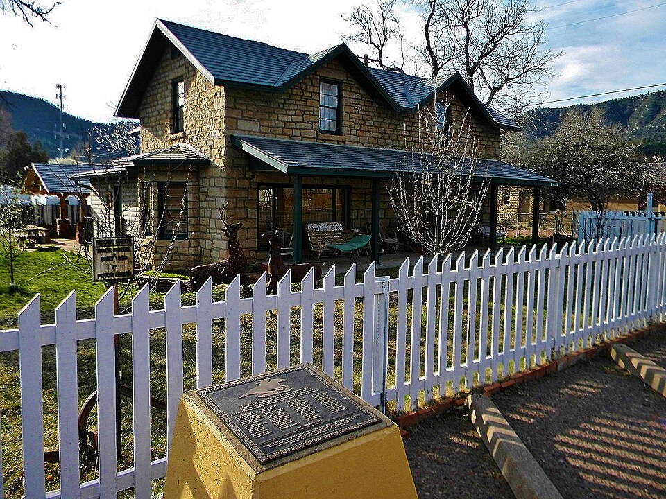
Listed on the National Register of Historic Places in 2004.
One of 43 National Register listings published here for Gila County · listed in 2004 · category: Building.
Sources: the case file at the National Archives · the National Register database, National Park Service
Regional context, not property-specific evidence. The federal wildfire occurrence database lists 332 fires within 5 miles of Pryor Miller House between 1992 and 2020, burning about 2,276 acres in total. 195 started naturally. 6 were recorded as arson. Distance is straight-line from the map coordinates, so a fire counted here may appear on a neighbouring settlement's page as well.
| Reported cause | Fires |
|---|---|
| Natural | 195 |
| Recreation and ceremony | 66 |
| Missing data/not specified/undetermined | 35 |
| Equipment and vehicle use | 8 |
| Debris and open burning | 8 |
| Arson/incendiarism | 6 |
| Smoking | 6 |
| Misuse of fire by a minor | 6 |
| Other causes | 1 |
| Fireworks | 1 |
The most recent of them, most recent first, with the day each was reported and the service that recorded it.
| Date | Cause | Size | Reported by | Name on the report |
|---|---|---|---|---|
| 9 September 2011 | Natural | under an acre | Coconino National Forest | SLED |
| 7 September 1994 | Recreation and ceremony | under an acre | Tonto National Forest | not named |
| 4 September 1995 | Recreation and ceremony | under an acre | Coconino National Forest | FOSSIL |
| 3 September 2001 | Arson/incendiarism | under an acre | Coconino National Forest | LATER |
| 3 September 2001 | Arson/incendiarism | under an acre | Coconino National Forest | LATE |
| 29 September 1998 | Recreation and ceremony | 10 acres | Coconino National Forest | RESERVE |
| 27 September 2018 | Missing data/not specified/undetermined | under an acre | Pine-Strawberry Fire District | 18544 |
| 27 September 2015 | Recreation and ceremony | under an acre | Coconino National Forest | FOUR |
Regional context, not property-specific evidence. The federal mineral resources record lists 6 workings within 5 miles of Pryor Miller House: 4 past producers, 1 prospect, 1 unknown. None of them still produces. What was taken out: Sand and Gravel, Construction, Kaolin, Molybdenum, Nickel, Limestone, Dimension. Distance is straight-line from the map coordinates, so a quarry counted here may appear on a neighbouring settlement's page as well.
| Where | Site | Commodity | Status | Recorded |
|---|---|---|---|---|
| Florence Ceramics | Kaolin | Past Producer | ||
| Gould Flagstone | Limestone, Dimension | Past Producer | ||
| Little Nickel Claim | Molybdenum, Nickel | Prospect | ||
| Gravel Pit | Sand and Gravel, Construction | Past Producer | ||
| Gravel Pit | Sand and Gravel, Construction | Unknown | ||
| Gravel Pit | Sand and Gravel, Construction | Past Producer |
Regional context, not property-specific evidence. The National Weather Service names Pine, the town this property stands in, in 29 storm reports between 1996 and 2025: 11 flash flood, 10 hail, 7 heavy rain, 1 thunderstorm wind. No death or injury is recorded in these reports. Each account below is quoted exactly as the forecast office filed it, from the NOAA Storm Events Database, and each date opens the federal record of that event.
| When | Event | Place named | Harm | What the report says |
|---|---|---|---|---|
| July 2025 | Flash Flood | Pine | - | Public reported a minor debris flow in the gully crossing Control Road (FS 64) after heavy rain fell on the West Fire scar. |
| September 2025 | Hail | Pine | - | Public reported hail up to the size of quarters in Pine. |
| September 2025 | Flash Flood | Pine | - | Public reported a rapid 4 foot water rise in Pine Creek at Tonto Natural Bridge State Park. |
| September 2025 | Flash Flood | Pine | - | Public reported water flowing over Fire Control Road in at least 8 spots west of Geronimo Estates. |
| September 2025 | Flash Flood | Pine | - | An mPING report was submitted of Sycamore Creek overflowing across Fire Control Road (Nf-64) near Pine. |
| July 2024 | Thunderstorm Wind | Pine | - | Thunderstorm winds blew down trees approximately a foot in diameter along Highway 87 in and around Pine. |
| July 2024 | Flash Flood | Pine | - | Pine Creek was flowing around 3 feet deep through Pine. Pinewood Tavern at Highway 87 and Hardscrabble Mesa Road was closed due to flooding. |
| August 2024 | Hail | Pine | - | Quarter sized hail (1.00 inch diameter) was reported 6 miles southeast of Pine. |
| July 2022 | Flash Flood | Pine | - | Tonto Natural Bridge State Park posted pictures of Pine Creek rising 4 feet between 5:47 PM and 5:52 PM. |
| December 2021 | Heavy Rain | Pine | - | Heavy rain fell across northern Gila County. Rainfall amounts ranged from over an inch and a half at Payson to 2.80 inches just south of Washington Park. |
| July 2021 | Flash Flood | Pine | - | A flash flood was reported over Highway 87 between Pine and Payson. Water was over the road with almost one lane covered. A road in East Verde Estates neighborhood flooded. |
| September 2018 | Flash Flood | Pine | - | Webber Creek rose 4 to 5 feet and had a with of 10 feet due to the heavy rain. |
| August 2016 | Heavy Rain | Pine | - | A thunderstorm produced 1.50 inches of rain in 60 minutes. |
| July 2016 | Heavy Rain | Pine | - | The visibility was less than 1/4 mile on Highway 87 near mile post 260. A co-op observer in Payson measured 0.98 inches of rain by 400 PM with rain continuing. An observer in Pine reported 4/5 inch diameter hail and that the washes were running full. |
| August 2014 | Heavy Rain | Pine | - | A thunderstorm produced 0.57 inches of rain in just 20 minutes in Pine. |
| January 2013 | Heavy Rain | Pine | - | Heavy rain fell across Northern Gila County. Some of the rainfall amounts (in inches) include: Tonto Creek Fish Hatchery 4.97, Red Lake 3.22, Pleasant Valley 2.36, and Payson Airport 2.13. |
| July 2012 | Flash Flood | Pine | - | Heavy rain from thunderstorms caused Pine Creek to overflow Bradshaw Road making it impassible. |
| July 2012 | Heavy Rain | Pine | - | Thunderstorms produced 3 inches of rain in just over three hours in Pine. |
| December 2008 | Heavy Rain | Pine | - | Heavy rain in the lower elevations of Gila County caused Tonto Creek to be come impassable. Residents were stranded on one side of the creek for several days. Between 400 and 600 people live on one side of the creek and often become stranded when the all three crossings become flooded. |
| September 2007 | Hail | Pine | - | Golf ball size (1.75 inches in diameter) hail reported along Highway 87 about nine miles south of Pine. |
| July 2006 | Hail | Pine | - | Golf ball sized hail was reported south of Pine. |
| July 2006 | Flash Flood | Pine | - | Flooding was reported along Highway 87 from about 7 miles south of Pine to the East Verde River. |
| July 2006 | Hail | Pine | - | Quarter sized hail was reported 5 miles south of Pine. |
| September 2002 | Hail | Pine | - | A spotter in Pine reported 3/4 inch hail for 5 minutes. |
| September 2002 | Hail | Pine | - | A second storm in Pine produced pea sized to 3/4 inch hail. |
| August 1999 | Flash Flood | Pine | - | Thunderstorm rainfall amounts of nearly three inches in two and half hours caused Pine Creek to leave its banks in the town of Pine. Numerous smaller drainages in the Pine area also flooded. |
| September 1997 | Hail | Pine | - | no account filed |
| September 1996 | Hail | Pine | - | no account filed |
| September 1996 | Hail | Pine | - | no account filed |
No historic map-sheet match is published for this property yet. That does not mean no map exists. This record needs a coordinate-quality review before it can be joined to a sheet boundary. Browse the county's mapped places while that work is pending.
Other National Register properties close enough to walk or drive between, ordered by distance from this one. Both positions come from the same geocoding pass that matched these properties to their map sheets.
| Photograph | Property | Distance | Listed |
|---|---|---|---|
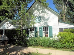 | Alfred Jason Randall House | under 500 feet | 2000 |
| Pine Community Center Historic District | 0.2 miles | 2005 | |
| Hunt Farmstead Historic District | 0.4 miles | 2021 | |
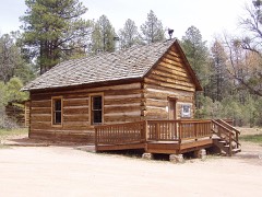 | Strawberry School | 3.9 miles | 2005 |
 | Natural Bridge Lodge | 4.4 miles | 1986 |
| National Archives record | The nomination case file for reference 04000146 in Record Group 79. |
| Gila County | All 43 listed properties in this county. |