 Block
From the record
One of 467 National Register listings published here for Maricopa County · listed in 2025 · category: District.
Sources: the National Register database, National Park Service
Listed on the National Register of Historic Places in 2025.
One of 467 National Register listings published here for Maricopa County · listed in 2025 · category: District.
Sources: the National Register database, National Park Service
Regional context, not property-specific evidence. The federal wildfire occurrence database lists 475 fires within 5 miles of Tal'-Wi-Wi Ranch between 1992 and 2020, burning about 195 acres in total. 6 started naturally. 17 were recorded as arson. Distance is straight-line from the map coordinates, so a fire counted here may appear on a neighbouring settlement's page as well.
| Reported cause | Fires |
|---|---|
| Missing data/not specified/undetermined | 441 |
| Arson/incendiarism | 17 |
| Natural | 6 |
| Equipment and vehicle use | 6 |
| Misuse of fire by a minor | 2 |
| Other causes | 1 |
| Smoking | 1 |
| Debris and open burning | 1 |
The most recent of them, most recent first, with the day each was reported and the service that recorded it.
| Date | Cause | Size | Reported by | Name on the report |
|---|---|---|---|---|
| 6 September 2019 | Missing data/not specified/undetermined | under an acre | El Mirage Fire Department | NOT NAMED |
| 6 September 2019 | Missing data/not specified/undetermined | under an acre | Sun City Fire Department | NOT NAMED |
| 4 September 2018 | Equipment and vehicle use | under an acre | El Mirage Fire Department | 3065 |
| 4 September 2011 | Missing data/not specified/undetermined | under an acre | Arizona Department of Forestry and Fire Management - State Office | AZ-111961 |
| 4 September 2003 | Missing data/not specified/undetermined | under an acre | Arizona Department of Forestry and Fire Management - State Office | AIRLINE CANAL |
| 30 September 2017 | Missing data/not specified/undetermined | under an acre | Sun City Fire Department | not named |
| 27 September 2011 | Missing data/not specified/undetermined | under an acre | Arizona Department of Forestry and Fire Management - State Office | AZ-111966 |
| 24 September 2018 | Missing data/not specified/undetermined | under an acre | El Mirage Fire Department | 3267 |
Regional context, not property-specific evidence. The federal mineral resources record lists 13 workings within 5 miles of Tal'-Wi-Wi Ranch: 7 producers, 4 past producers, 1 occurrence, 1 unknown. 7 still produce. What was taken out: Sand and Gravel, Construction, Halite, Salt, Gypsum-Anhydrite. Distance is straight-line from the map coordinates, so a quarry counted here may appear on a neighbouring settlement's page as well.
| Where | Site | Commodity | Status | Recorded |
|---|---|---|---|---|
| Agua Fria Pit Sun Valley Crushing | Sand and Gravel, Construction, Stone, Crushed/Broken | Past Producer | ||
| Alonzo Elder Muscovite #1 | Mica | Producer | ||
| Luke Salt Body - Southwest Salt Mine | Halite, Gypsum-Anhydrite | Producer | 1968 | |
| Maricopa Group | Manganese | Past Producer | 1915 | |
| Southwest Mine & Mill | Salt | Producer | ||
| Southwest Salt | Salt | Producer | ||
| Solid Salt Occurrence | Halite | Occurrence | ||
| Unidentified Halite Occurrence | Halite | Past Producer | Halite | |
| Arizona Sand & Rock, Agua Fria Plan | Sand and Gravel, Construction | Producer | ||
| Gravel Pit | Sand and Gravel, Construction | Unknown |
Regional context, not property-specific evidence. The National Weather Service names El Mirage, the town this property stands in, in 8 storm reports between 1994 and 2022: 5 thunderstorm wind, 1 heavy rain, 1 lightning, 1 flash flood. The reports record 2 injuries. Each account below is quoted exactly as the forecast office filed it, from the NOAA Storm Events Database, and each date opens the federal record of that event.
| When | Event | Place named | Harm | What the report says |
|---|---|---|---|---|
| August 2018 | Lightning | El Mirage | 2 hurt | Thunderstorms developed across the northwest portion of the greater Phoenix area during the evening hours on August 8th; in addition to strong wind and heavy rain, one of the storms generated very dangerous and nearly deadly cloud to ground lightning in the town of El Mirage. According to a local broadcast media report, at 1924MST cloud to ground lightning struck 2 males; both were 14 years of age and both suffered serious but not fatal injuries. The injuries occurred about 1 mile south of El Mirage and just north of the Pueble El Mirage Golf Club. |
| July 2018 | Thunderstorm Wind | El Mirage | $25,000 | Thunderstorms with strong and gusty outflow winds moved through the northwest portion of the greater Phoenix area during the evening hours on July 30th. Some of the stronger storms generated gusty damaging outflow winds that affected areas around the community of El Mirage. According to a trained weather spotter located about 2 miles northwest of El Mirage, two cars were damaged when tree limbs about 4 to 6 inches across were downed and fell upon the cars. The gusty winds were estimated to be as high as 65 mph. The cars were located in the parking lot of a Walmart store at Dysart Road and Thunderbird Road. The wind damage also resulted in telephones being out in the area. No injuries were reported. |
| August 2022 | Thunderstorm Wind | El Mirage | $500 | A large tree was uprooted near 91st Avenue and Beardsley Road. No injuries were reported. |
| July 2021 | Flash Flood | El Mirage | - | A photo shows a vehicle became stranded in two to three feet of water near the intersection of Dell Webb Boulevard and Bell Road. Timing estimated from radar and other nearby reports. No injuries were reported and extent of water damage to the vehicle is unknown. |
| February 2010 | Heavy Rain | El Mirage | - | Heavy rain and small hail reported. Hail diameter was about one quarter inch. |
| August 2010 | Thunderstorm Wind | El Mirage | - | A trained spotter reported multiple trees down along with extensive wind damage west of El Mirage, in the area between Greenway Road and Thunderbird, and 131st Avenue and Litchfield. In addition to trees blown over, limbs 6 inches in diameter and larger were blown off of trees. The damage was a result of microburst winds estimated to be in excess of 75kt. Emergency crews were reported to be in the area. |
| July 1994 | Thunderstorm Wind | El Mirage | - | Winds from a severe thunderstorm demolished a shed and uprooted a tree. |
| August 1996 | Thunderstorm Wind | El Mirage | - | no account filed |
No historic map-sheet match is published for this property yet. That does not mean no map exists. This record needs a coordinate-quality review before it can be joined to a sheet boundary. Browse the county's mapped places while that work is pending.
Other National Register properties close enough to walk or drive between, ordered by distance from this one. Both positions come from the same geocoding pass that matched these properties to their map sheets.
| Photograph | Property | Distance | Listed |
|---|---|---|---|
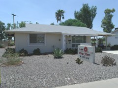 | Sun City DEVCO Model No.1 | 4.3 miles | 2015 |
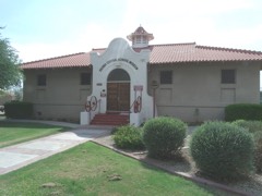 | Central School | 6.9 miles | 1982 |
 | Peoria High School Old Main | 6.9 miles | 2018 |
| Peoria Jail House | 6.9 miles | 2020 | |
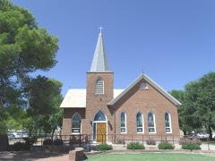 | First Presbyterian Church of Peoria | 6.9 miles | 2012 |
| National Archives record | The nomination case file for reference 100011259 in Record Group 79. |
| Maricopa County | All 467 listed properties in this county. |