 Block
From the record
One of 467 National Register listings published here for Maricopa County · listed in 1980 · category: Building.
Sources: the case file at the National Archives · the National Register database, National Park Service
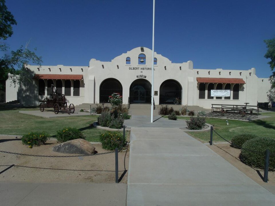
Listed on the National Register of Historic Places in 1980.
One of 467 National Register listings published here for Maricopa County · listed in 1980 · category: Building.
Sources: the case file at the National Archives · the National Register database, National Park Service
Regional context, not property-specific evidence. The federal wildfire occurrence database lists 842 fires within 5 miles of Gilbert Elementary School between 1992 and 2020, burning about 1,293 acres in total. 12 started naturally. 11 were recorded as arson. Distance is straight-line from the map coordinates, so a fire counted here may appear on a neighbouring settlement's page as well.
| Reported cause | Fires |
|---|---|
| Missing data/not specified/undetermined | 811 |
| Natural | 12 |
| Arson/incendiarism | 11 |
| Equipment and vehicle use | 5 |
| Smoking | 1 |
| Power generation/transmission/distribution | 1 |
| Debris and open burning | 1 |
The most recent of them, most recent first, with the day each was reported and the service that recorded it.
| Date | Cause | Size | Reported by | Name on the report |
|---|---|---|---|---|
| 9 September 2019 | Missing data/not specified/undetermined | under an acre | Mesa Fire and Medical Department | NOT NAMED |
| 9 September 2015 | Missing data/not specified/undetermined | under an acre | Arizona Department of Forestry and Fire Management - State Office | 153942 |
| 8 September 2020 | Missing data/not specified/undetermined | under an acre | Arizona Department of Forestry and Fire Management - State Office | not named |
| 8 September 2018 | Missing data/not specified/undetermined | under an acre | Mesa Fire and Medical Department | 71440 |
| 7 September 2018 | Missing data/not specified/undetermined | under an acre | Chandler Fire Department | 333144 |
| 7 September 2018 | Missing data/not specified/undetermined | under an acre | Mesa Fire and Medical Department | 71180 |
| 7 September 2015 | Missing data/not specified/undetermined | under an acre | Arizona Department of Forestry and Fire Management - State Office | 153941 |
| 7 September 2014 | Missing data/not specified/undetermined | under an acre | Arizona Department of Forestry and Fire Management - State Office | AZ-141255 |
Regional context, not property-specific evidence. The federal mineral resources record lists 1 working within 5 miles of Gilbert Elementary School: 1 producer. All of them still produce. What was taken out: Sand and Gravel, Construction. Distance is straight-line from the map coordinates, so a quarry counted here may appear on a neighbouring settlement's page as well.
| Where | Site | Commodity | Status | Recorded |
|---|---|---|---|---|
| Chandler Ready Mix Plant | Sand and Gravel, Construction | Producer |
Regional context, not property-specific evidence. The National Weather Service names Gilbert, the town this property stands in, in 25 storm reports between 1997 and 2025: 15 thunderstorm wind, 5 heavy rain, 3 lightning, 1 flood. The reports record 1 injury. Each account below is quoted exactly as the forecast office filed it, from the NOAA Storm Events Database, and each date opens the federal record of that event.
| When | Event | Place named | Harm | What the report says |
|---|---|---|---|---|
| August 1999 | Lightning | Gilbert | 1 hurt | A Gilbert backhoe driver in the 100 block of E. Guadalupe Road was injured and treated for minor injuries when his machinery was struck by lightning. |
| July 2012 | Heavy Rain | Gilbert | $110,000 | Numerous thunderstorms developed across the greater Phoenix metropolitan area, especially the southeastern valley communities, during the afternoon hours on July 14th. Due to the very moist and unstable nature of the atmosphere, the storms generated intense rainfall which led to episodes of flash flooding. Heavy rain in excess of 2 inches fell in the Gilbert area between 330 pm and 430 pm. During the peak of the heavy rainfall, approximately 1.5 inches of rain fell within 10 minutes, causing the collapse of the roof at Tees and More located at 313 North Gilbert Road. According to the store owners, Pete and Barb Addiego, the roof collapse caused at least 110 thousand dollars in damaged equipment and inventory. Fortunately, no injuries were reported. |
| July 2022 | Thunderstorm Wind | Gilbert | $40,000 | Social media images showed large trees down in the intersection of Lindsay with Baseline Roads. One of the trees fell onto and destroyed a car. There was also an image that showed a street sign toppled in the intersection of Lindsay with Melody Drive. Winds were estimated between 55-60 mph. Timing estimated from radar. No injuries were reported. |
| July 2014 | Thunderstorm Wind | Gilbert | $12,000 | Scattered to numerous thunderstorms affected the greater Phoenix area, including southeast valley communities such as Gilbert, during the late afternoon hours on July 13th. The stronger storms produced damaging microburst outflow winds estimated to be in excess of 60 mph. A trained weather spotter in Gilbert reported that several trees were uprooted and in addition, a light pole and some street signs were blown down near the intersection of Val Vista and Elliot Roads. |
| July 2022 | Thunderstorm Wind | Gilbert | $10,000 | Report from Gilbert Police of numerous downed trees and debris on roads. Winds were estimated at 60 mph. Timing estimated from radar. No injuries were reported. |
| August 2014 | Thunderstorm Wind | Gilbert | $10,000 | Scattered thunderstorms affected the greater Phoenix metropolitan area during the late afternoon and evening hours on August 12th, and some of them affected the communities of Gilbert and Chandler. In addition to heavy rain, the stronger storms produced gusty and damaging microburst winds. According to a trained weather spotter 2 miles southeast of Gilbert, thunderstorm wind gusts estimated to be at least 60 mph downed a number of trees at the intersection of Warner Road and Greenfield. No injuries were reported due to the fallen trees. |
| July 1999 | Lightning | Gilbert | $10,000 | A home in the 3800 block of East San Remo in east Gilbert was struck by lightning causing a 2 foot hole in the concrete shingles on the roof. No fire was involved but most electrical appliances were damaged. |
| July 2022 | Thunderstorm Wind | Gilbert | $5,000 | Photos from an employee of the Salt River Project Utility Company showed several large trees down as well as a street sign and a light post toppled. Winds were estimated between 55-60 mph. Timing estimated from radar. No injuries were reported. |
| May 2012 | Thunderstorm Wind | Gilbert | $5,000 | An upper level low pressure system moving east across southern Arizona spread moisture into eastern Arizona and led to scattered thunderstorms across the central deserts during the afternoon hours on May 9th. A few storms generated gusty and damaging winds estimated to be in excess of 60 knots. At 439 PM, a trained weather spotter reported that small trees and large limbs were down over the road at Ray and Cooper in Gilbert. Another weather spotter in Chandler reported that three large trees, all of them 36 inches wide, were blown over near south Dobson road and East Market Place at approximately 5 PM. Pictures of the downed trees were taken and sent to the Phoenix WCM. |
| July 2012 | Heavy Rain | Gilbert | $5,000 | Numerous thunderstorms developed across the greater Phoenix area during the afternoon hours on July 14th, especially across the southeast valley. Due to the very moist and unstable airmass in place, most of the storms generated locally heavy rain, with the highest rain rates observed to be in excess of 2 inches per hour. According to a trained weather spotter in Gilbert, 2.25 inches of rain fell between 330 pm and 430 pm at a home located at Val Vista and Elliot roads. The heavy rain led to some street flooding at the San Tan Village Mall. Marble sized hail also occurred, along with some gusty winds that damaged a few trees in the area. |
| July 2022 | Thunderstorm Wind | Gilbert | $3,000 | Image from social media showed the automatic doorframe to a Walmart, located in the intersection of Lindsay and Baseline Roads, pushed in. Winds were estimated between 55-60 mph. Timing estimated from radar. No injuries were reported. |
| August 2013 | Thunderstorm Wind | Gilbert | $3,000 | Scattered late afternoon thunderstorms moved across the southeast portion of the greater Phoenix metropolitan area on August 26th, and they affected the community of Gilbert. The atmosphere was moist and quite unstable and this allowed the thunderstorms to produce strong and gusty winds, estimated to be at least 60 mph. A trained weather spotter 2 miles southeast of Gilbert reported that a large tree was downed in far southern Gilbert, near the Chandler Heights and Higley area. He also indicated that large tree branches were broken in the same area. A Severe Thunderstorm Warning was issued for the Gilbert area at 1821MST and it continued until 1845MST. |
| August 2025 | Thunderstorm Wind | Gilbert | $2,000 | Large light pole down near the intersection of N Greenfield Road and E Guadalupe Road. |
| July 2022 | Thunderstorm Wind | Gilbert | $1,200 | Image taken by the Salt River Project Utility Company showed a snapped power pole along the northeast corner of N Lindsay and E Guadalupe Rd. Winds were estimated at 60 mph. Timing estimated from radar. No injuries were reported. |
| July 2022 | Flash Flood | Gilbert | - | US-60 at Val Vista was closed due to standing water on the highway. One car stalled in the standing water. No injuries were reported. |
| July 2021 | Thunderstorm Wind | Gilbert | - | Damaging wind gusts from severe thunderstorms resulted in a large uprooted tree on a playground in a park near Greenfield Road and Warner Road. No injuries were reported. |
| May 2015 | Heavy Rain | Gilbert | - | Aided by an unseasonably strong upper level low pressure system, scattered to numerous showers and thunderstorms developed across the central Arizona deserts during the evening hours on May 15th. The stronger storms produced locally heavy rainfall which affected the greater Phoenix area; a trained weather spotter 2 miles northwest of Gilbert measured 1.00 inch of rain within a 45 minute period ending at 2005MST. The rainfall resulted in minor street flooding in the area. Additionally, at 2022MST another spotter 2 miles northwest of the Chandler Fashion Place Mall estimated that 1.5 inches of rain fell during the evening resulting in water rising out of the street and across the front walk. The heavy rain and urban flooding resulted in the issuance of an Urban and Small Stream Flood Advisory. |
| August 2014 | Heavy Rain | Gilbert | - | Scattered to numerous thunderstorms developed across the southeastern portions of the greater Phoenix metropolitan area during the afternoon hours on August 12th, and they affected communities such as Mesa and Gilbert. The stronger storms produced locally heavy rainfall with peak rain rates in excess of 2 inches per hour. The heavy rain led to significant urban flooding; at 1639MST a trained spotter 4 miles northwest of Gilbert reported very heavy rain and street flooding at the intersection of Baseline Road and Gilbert Road. The rain was so heavy that visibility was lowered to near zero miles. A Flash Flood Warning was in effect at the time of the spotter report. |
| September 2000 | Heavy Rain | Gilbert | - | Very heavy rain associated with thunderstorms hit parts of the East Valley. A spotter in Gilbert reported 1.02 inches in only 30 minutes. |
| August 1999 | Lightning | Gilbert | - | Lightning struck a home in Gilbert resulting in a fire that destroyed the luxury dwelling. |
| August 1998 | Flood | Gilbert | - | One-half inch in 20 minutes; 1.10 inch in 45 minutes. |
| July 1998 | Thunderstorm Wind | Gilbert | - | Two TV antennas blown down, street signs blown down. |
| July 1997 | Thunderstorm Wind | Gilbert | - | Strong winds snapped several APS power poles near Neely Street and Pinon Way. Wind gust estimated from damage. |
| August 1997 | Thunderstorm Wind | Gilbert | - | Winds blew down several large trees which subsequently knocked down power lines. |
| July 1999 | Thunderstorm Wind | Gilbert | - | no account filed |
No historic map-sheet match is published for this property yet. That does not mean no map exists. This record needs a coordinate-quality review before it can be joined to a sheet boundary. Browse the county's mapped places while that work is pending.
Other National Register properties close enough to walk or drive between, ordered by distance from this one. Both positions come from the same geocoding pass that matched these properties to their map sheets.
| Photograph | Property | Distance | Listed |
|---|---|---|---|
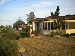 | Silk Stocking Neighborhood Historic District | 4.0 miles | 2011 |
 | Chandler High School | 4.1 miles | 2007 |
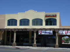 | Suhwaro Hotel | 4.3 miles | 1994 |
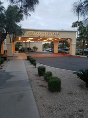 | San Marcos Hotel | 4.3 miles | 1982 |
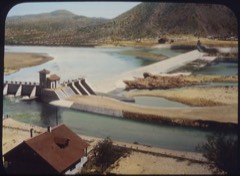 | Salt River Project Diversion and Conveyance System Historic District | 4.3 miles | 2017 |
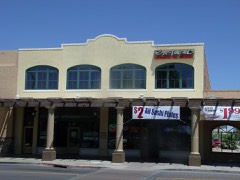 | Chandler Commercial Historic District | 4.4 miles | 2000 |
| National Archives record | The nomination case file for reference 80000762 in Record Group 79. |
| Maricopa County | All 467 listed properties in this county. |