 Block
BlockForest Falls, California
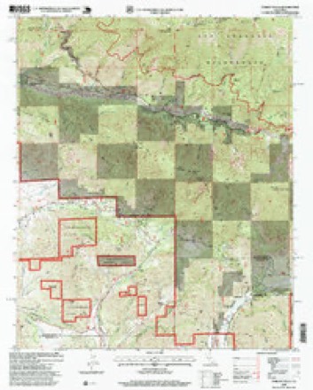
33 topographic sheets cover this place, the earliest surveyed in 1901 and the latest in 1996. It stands in the Big Bear census division. It lies in ZIP code area 92339. It stands on Snow Creek. The Survey maps it on the Forest Falls quadrangle. It stands 5,700 feet above sea level.
Research this city
Then and now
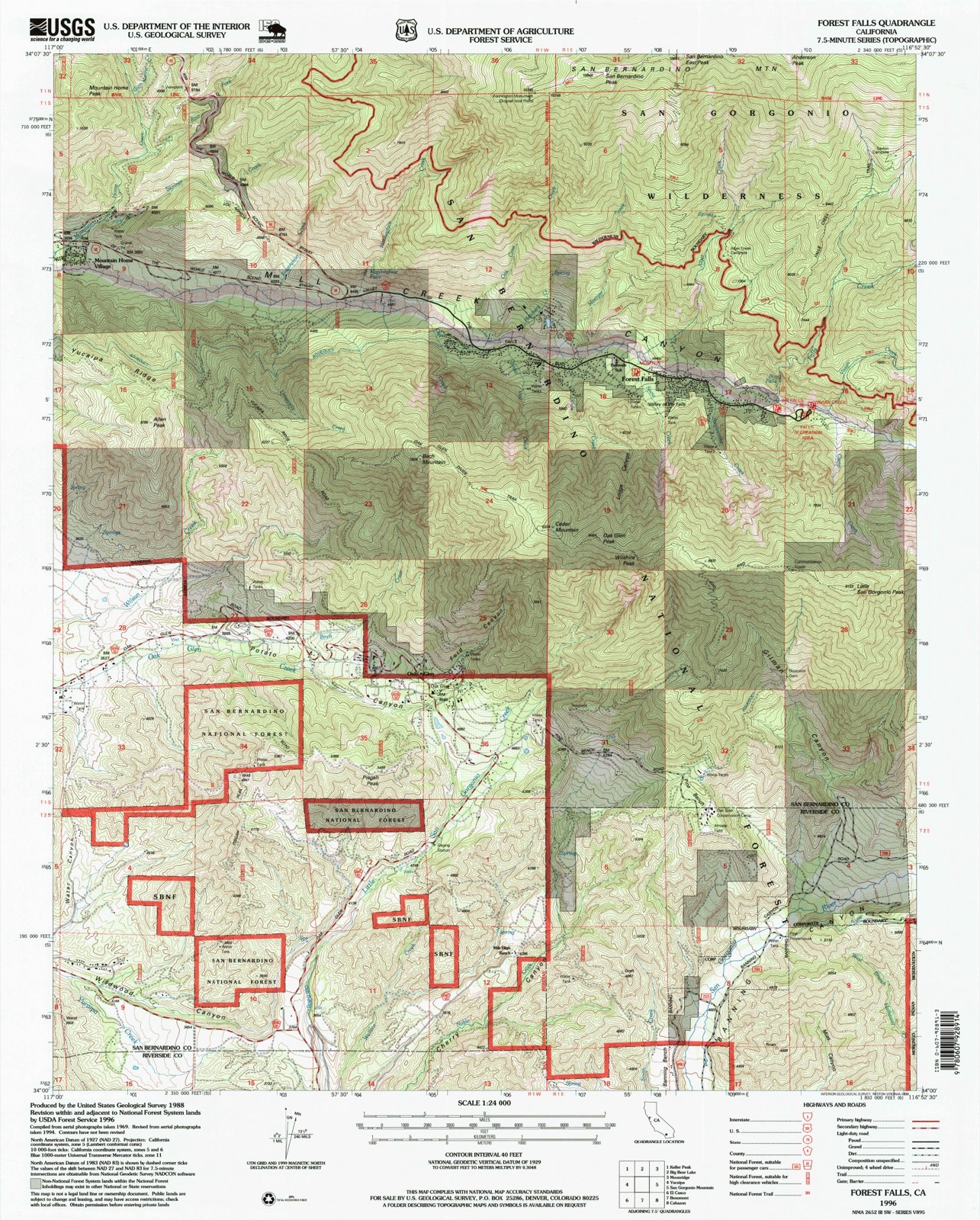
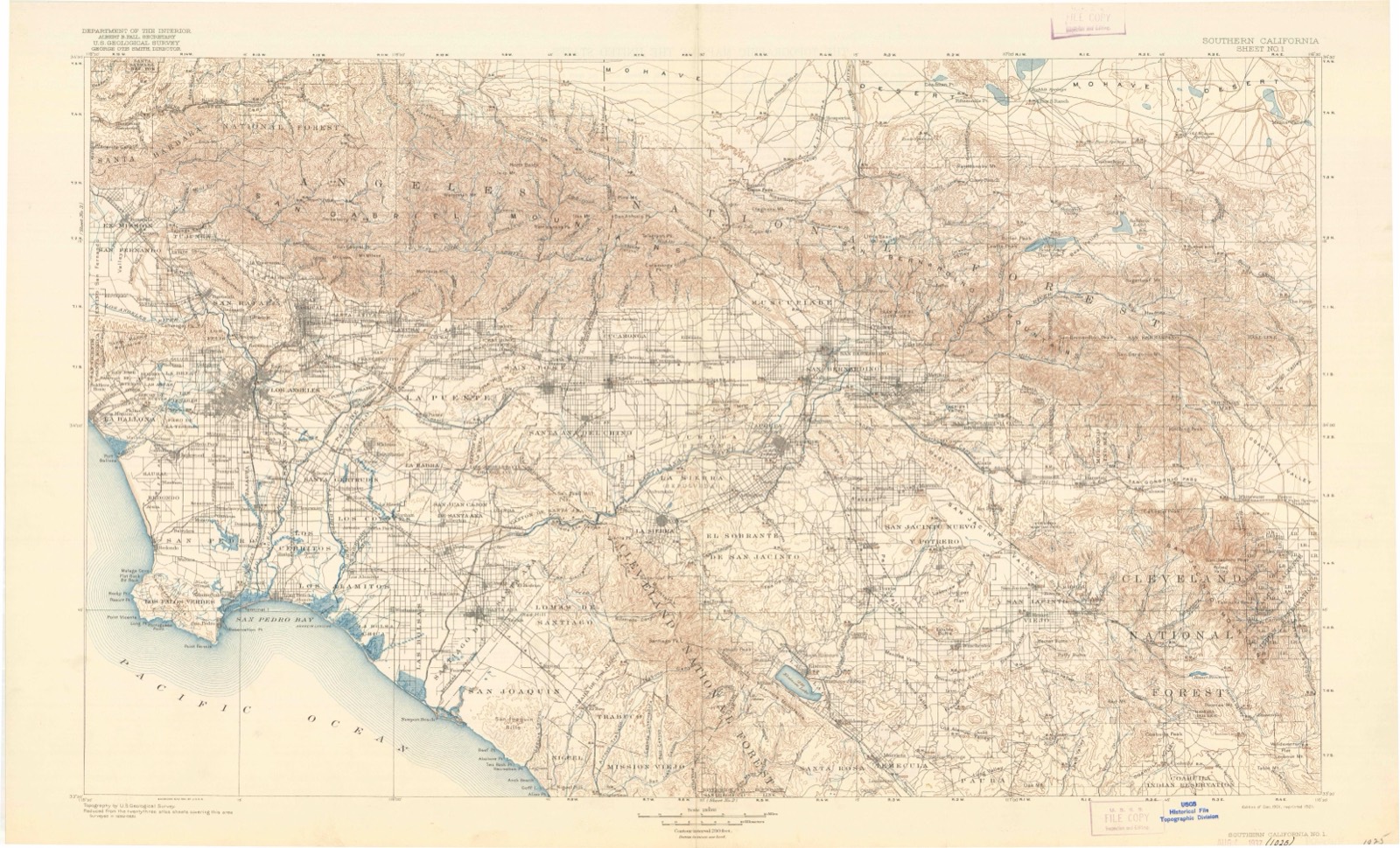
1901 to 1996The same ground, surveyed 95 years apart. Drag the handle to wipe between them. Both sheets are United States Geological Survey originals; neither has been altered.
Compare 1901 against another survey:
Topographic sheets covering this place
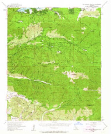
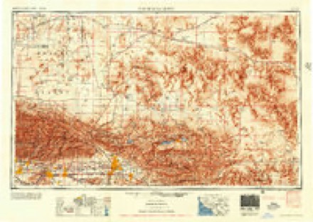
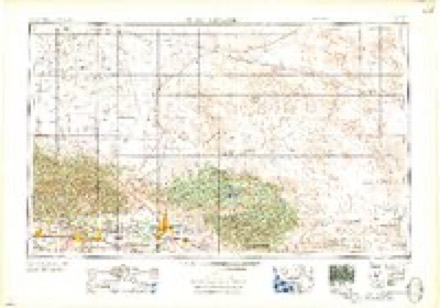
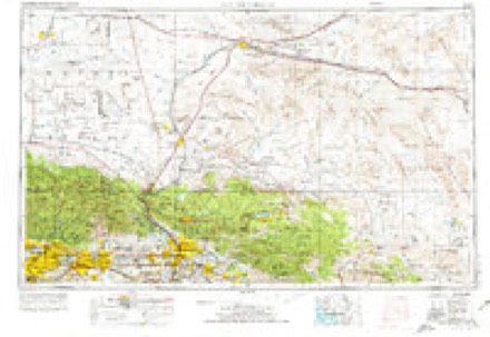
13 surveys from 33 printed sheetsMatched by testing this settlement's coordinate against the published boundary of every sheet in the United States Geological Survey's historical collection. Each opens the scanned sheet at the Survey.
- 1901 USGS Southern California Sheet No. 1 quadrangle1:250000, 6 printings
- 1902 USGS San Gorgonio quadrangle1:125000, 8 printings
- 1904 USGS Southern California Sheet No. 1 quadrangle1:250000, 2 printings
- 1953 USGS San Bernardino quadrangle1:250000, 2 printings
- 1954 USGS San Gorgonio Mountain quadrangle1:62500, 5 printings
- 1956 USGS San Bernardino quadrangle1:250000
- 1957 USGS San Bernardino quadrangle1:250000
- 1958 USGS San Bernardino quadrangle1:250000
- 1959 USGS San Bernardino quadrangle1:250000
- 1966 USGS San Bernardino quadrangle1:250000
- 1970 USGS Forest Falls quadrangle1:24000, 3 printings
- 1982 USGS Big Bear Lake quadrangle1:100000
- 1996 USGS Forest Falls quadrangle1:24000


Fires near this place
193 since 1992Regional context, not property-specific evidence. The federal wildfire occurrence database lists 193 fires within 5 miles of Forest Falls between 1992 and 2020, burning about 75,389 acres in total. 81 started naturally. 14 were recorded as arson. Distance is straight-line from the map coordinates, so a fire counted here may appear on a neighbouring settlement's page as well.
| Reported cause | Fires |
|---|---|
| Natural | 81 |
| Missing data/not specified/undetermined | 41 |
| Equipment and vehicle use | 23 |
| Recreation and ceremony | 16 |
| Arson/incendiarism | 14 |
| Debris and open burning | 5 |
| Misuse of fire by a minor | 4 |
| Other causes | 3 |
| Smoking | 3 |
| Fireworks | 2 |
| Power generation/transmission/distribution | 1 |
The most recent of them, most recent first, with the day each was reported and the service that recorded it.
| Date | Cause | Size | Reported by | Name on the report |
|---|---|---|---|---|
| 6 September 2006 | Natural | under an acre | San Bernardino National Forest | FALLS |
| 5 September 2020 | Fireworks | 22,744 acres | San Bernardino Unit | EL DORADO |
| 5 September 1998 | Missing data/not specified/undetermined | 1.0 acres | Joshua Tree National Monument | SILVER |
| 4 September 1995 | Recreation and ceremony | under an acre | San Bernardino National Forest | not named |
| 30 September 2010 | Natural | under an acre | San Bernardino National Forest | BLUFF |
| 3 September 2006 | Natural | 1.5 acres | San Bernardino National Forest | ANDERSON |
| 28 September 2002 | Arson/incendiarism | under an acre | San Bernardino Unit | JEFFERSON |
| 26 September 2010 | Missing data/not specified/undetermined | under an acre | San Bernardino National Forest | VIVIAN |
Settlements close enough to share some of these fires:
Mines and quarries near this place
8 within 5 milesRegional context, not property-specific evidence. The federal mineral resources record lists 8 workings within 5 miles of Forest Falls: 3 past producers, 2 producers, 2 prospects, 1 occurrence. 2 still produce. What was taken out: Stone, Crushed/Broken, Gold, Flagstone, Uranium. Distance is straight-line from the map coordinates, so a quarry counted here may appear on a neighbouring settlement's page as well.
| Where | Site | Commodity | Status | Recorded |
|---|---|---|---|---|
| Mill Creek Mine | Marble, Dimension, Tungsten | Past Producer | ||
| Road End | Silver, Manganese | Occurrence | ||
| Southern California Sandstone | Flagstone | Past Producer | ||
| St. Patrick's Group | Uranium | Past Producer | ||
| Mentone Sandstone | Stone, Crushed/Broken | Producer | Sedimentary | |
| Mountain Home Prospect | Gold | Prospect | ||
| So. Calif. Sandstone | Stone, Crushed/Broken | Producer | Sedimentary | |
| Unnamed Prospect | Gold | Prospect |
Storms near this place
59 since 1997Regional context, not property-specific evidence. The National Weather Service names Forest Falls in 59 storm reports between 1997 and 2025: 29 flash flood, 11 heavy rain, 7 debris flow, 5 flood. The reports record 3 deaths and 7 injuries. Each account below is quoted exactly as the forecast office filed it, from the NOAA Storm Events Database, and each date opens the federal record of that event.
| When | Event | Place named | Harm | What the report says |
|---|---|---|---|---|
| July 1999 | Flash Flood | Forest Falls | 1 killed, 5 hurt, $6,000,000 | no account filed |
| September 2022 | Debris Flow | Forest Falls | 1 killed, $6,000,000 | Heavy thunderstorms associated with remnant moisture from post-tropical cyclone Kay produced torrential rain over the Apple and El Dorado burn scars on the afternoon of September 12. Multiple debris flows occurred following torrential one-hour rainfall rates exceeding debris flow guidance from the USGS and CAGS. Two of the debris flows traveled several miles including the Banning Canyon wash showing debris logs and ash water. The most impactful debris flow occurred in Forest Falls and Oak Glen, where the flow traveled at least 3 miles down Oakland Road with 4 foot boulders, logs over-topping the road with several feet of mud, with several power poles destroyed. Another highly impactful debris flow formed in Forest Falls on Prospect Road, where large boulders, black water and logs took out trees and damaged several homes. Another debris flow occurred 0.5 mile away on Valley of the Falls Road, producing a 12-foot wall of dirt and rocks. An additional debris flow occurred on State Highway Route 38 just before Angeles Oaks. These flows are the most significant that have occurred since the fires in 2020. An estimated 30 homes were damaged and three vehicles were moved and damaged.||The following are recorded rain amounts from the same region:|Raywood Flats, 6 NNW Forest Falls: 2.44 inch in 1 hour and 2.75 inch for the day, resulting in the full closure of Highway 38.||Mesonet Station Yucc1 Little San Gorgonio Peak Yucaipa Ridge, 2 SE Forest Falls: 1.06 inch in 60 minutes.||Mesonet Station FFPC1, 1.5 W Forest Falls: 1.93 inch. |
| September 2015 | Flash Flood | Forest Falls | 1 killed | A flash flood at Mill Creek crossing...40 feet wide and 8 to 12 inches deep. The head of the flash flood was 3 to 4 feet deep. From Victor Valley news group: flood waters overtook a couple hiking. An off-duty sheriff's deputy heard the couple calling for help and was able to save the young woman, but the man was swept away. The body of the victim, a Rancho Cucamonga man in his 20s, was found shortly after 1800 PST. |
| September 1997 | Flash Flood | Forest Falls | 2 hurt, $3,450,000 | no account filed |
| July 1999 | Flash Flood | Forest Falls | $2,050,000 | no account filed |
| September 2022 | Flash Flood | Forest Falls | $200,000 | A large flash flood and debris flow occurred on Prospect street off of Valley of the Falls in Forest Falls, CA. The debris flow originated on the 2020 El Dorado burn scar after 1.1 inches of rain in an hour on Yucaipa Ridge. More than 1 debris flow occurred but the largest crossed Prospect street moving and damaging vehicles as well as damage homes. At least 2 homes had major damage. One fatality occurred when an older female was buried in debris, 3 days later found by search and rescue dogs. Residents took photos of debris flows and flash flooding including video and Ring security cameras. WCM visited the damage and SAR activity on September 13 and spoke with residents who shared additional photos and descriptions. A 20 foot boulder was lodged just above their home and their Jeep was washed down the hill (caught on Ring camera). |
| August 2002 | Wildfire | Forest Falls | $130,000 | no account filed |
| September 2022 | Flash Flood | Forest Falls | $100,000 | A storm survey by WCM found several debris flows on Valley of the Falls road in Forest Falls. The largest produced mud and rocks as high as 10 feet, completely covering the Valley of the Falls road. Other flash floods and debris occurred further into the canyon (deeper) affecting the roads and residences property. Homeowners discussed and described the flooding and impact. Most severe since August 2014. |
| September 2022 | Flash Flood | Forest Falls | $100,000 | A major flash flood debris flow occurred in Birch Creek through Potato Canyon. This area was affected by lesser debris flows October and December 2021 and August 2022 but this flood filled the entire channel in layers, overtopped and damage the Steakhouse restaurant in Oak Glen, took out power poles, pushed large boulder and layers of mud downstream onto Oak Glen Road and pushed up to windows on a couple homes. WCM Alex Tardy did a storm survey. Estimated 100,000 cubic yards of debris removed by San Bernardino Public Works. Video of the debris flow between 3 and 4 pm was recorded. |
| October 2004 | Flash Flood | Forest Falls | $25,000 | Valley of the Falls Dr was made impassable by mud and rocks that were deposited by flood waters which washed over a large stretch of the road early on the 20th. |
| January 2005 | Flash Flood | Forest Falls | $25,000 | no account filed |
| April 2002 | Flood | Forest Falls | $25,000 | no account filed |
| July 2005 | Flash Flood | Forest Falls | $20,000 | The town of Forest Falls was cut off from highway 38 when 3 mudslides came down across Valley of the Falls Dr. Each mudslide was about 3 to 4 feet deep. |
| February 2021 | Heavy Rain | Forest Falls | $10,000 | Narrow band of thunderstorms formed along the foothills of the San Bernardino mountains during the morning of February 12th. This heavy rain reached 0.30 inches in 30 minutes and caused minor mud and debris flow from El Dorado burn scar in Yucaipa and Oak Glen. |
| October 2021 | Flash Flood | Forest Falls | $5,000 | Large amount of water flow near Potato Canyon and Oak Glen Roads, possibly on Birch Creek Road. A vehicle was swept off roadway and rescue was performed. Heavy rainfall of 0.4 to 0.6 in 1 hour occurred across the El Dorado burn scar and San Bernardino Mountains. Highway 38 was closed for several hours through the evening while Caltrans removed mud and debris from the highway. Total rainfall in the area was about 0.75 to 1.00 inch. County Public Works removed 250 cubic yards of debris from Birch Creek. Survey of the flood and debris flow was done by California Geological Survey jointly with WCM Alex Tardy. |
| August 2005 | Flash Flood | Forest Falls | $5,000 | A thunderstorm triggered flooding in Mill Creek and a rockslide on Valley of the Falls Dr. |
| July 2006 | Flash Flood | Forest Falls | $5,000 | no account filed |
| July 2015 | Debris Flow | Forest Falls | $1,000 | The CHP reported a stalled tour bus being struck by a rock slide. No injuries occurred but the bus was disabled. |
| February 2025 | Heavy Rain | Forest Falls | - | Mesonet station FFPC1 1.5 W Forest Falls reported a total precipitation of 5.06 inches. |
| March 2023 | Flood | Forest Falls | - | The Department of Highways reported a rock slide on both the upbound and downbound lanes on SR-38. |
| August 2023 | Flash Flood | Forest Falls | - | Video received from Potato Canyon in Oak Glen of mud and rocks across the roadway. Mud and rocks surround a residence in Oak Glen following a debris flow. Widespread rocks and mud covers many roadways in the town. |
| August 2022 | Heavy Rain | Forest Falls | - | Mesonet station Yucc1 Yucaipa Ridge reported 2.28 inch of heavy rain from July 30 - August 2. |
| August 2022 | Debris Flow | Forest Falls | - | Mud slide under bridge at Valley of the Falls and Wood Road in Forest Falls. Mud and debris on Valley of the Falls Road. Yucaipa ridge reported 2.28 inch of rain, with 1.5 inch of rain in one hour. |
| August 2022 | Heavy Rain | Forest Falls | - | Mesonet HADS Station FFPC1 1.5 miles west of Forest Falls measured 0.53 inches of rain in 1 hour. |
| August 2022 | Debris Flow | Forest Falls | - | CHP reported rocks in the middle of lanes along Highway 38 just north of the Forest Falls junction. |
| August 2022 | Heavy Rain | Forest Falls | - | Yucaipa Ridge near Wilshire Peak at 9000 feet reported 0.79 inches of rainfall in 15 minutes, and 1.50 inches in 1 hour. |
| July 2022 | Flash Flood | Forest Falls | - | Flash flooding 4 SW Forest Falls. A car was reported stuck in flood waters at Oak Glen Road and Potato Canyon Road. Ten homes were shelter in place due to flash flooding of Potato Canyon from Birch Creek. Potato Canyon Road covered in mud and debris and eventually washed out at Birch Creek. Road closed from Saturday night into Sunday morning. Rainfall of 1.8 inch was measured at Yucaipa Ridge upstream, 1.2 of which occurred in one hour. |
| July 2022 | Heavy Rain | Forest Falls | - | Rain of 1.34 inch. Mesonet Yucaipa Ridge measured in one hour. |
| July 2022 | Heavy Rain | Forest Falls | - | Rainfall of 1.81 inch. Yucaipa Ridge daily total rainfall. |
| August 2018 | Debris Flow | Forest Falls | - | Public and Fire Radio reported that Valley of the Falls Drive was closed due to a debris flow. |
| July 2018 | Heavy Rain | Forest Falls | - | One day total rainfall from Mesonet 7 mi NE of Cherry Valley (yucc1) of 1.84 inches. |
| September 2018 | Flash Flood | Forest Falls | - | Isolated thunderstorms formed over Forest Falls late on Sunday September 30th. About 2 inches was estimated on radar. The runoff towards Mill Creek was significant can caused hikers to be stranded after dark as the water flow was not safe to cross. First responders were called to aid in the recovery. There was video posted on Facebook. |
| November 2018 | Debris Flow | Forest Falls | - | CalTrans reported an emergency closure of SR-38 at Valley of the Falls Drive due to a debris flow. |
| September 2015 | Debris Flow | Forest Falls | - | A debris flow along slide creek closed Valley of the Falls Drive, the main road going into Forest Falls. Also, Mill Creek experienced moderate flooding below Forest Falls. |
| December 2014 | Flood | Forest Falls | - | Valley of the Falls Road reported open, but minor flooding as Mill Creek was running full. Yucaipa Ridge reported 4 inches of rain in 6 hours. |
| September 2013 | Flash Flood | Forest Falls | - | Mill Creek was running 2 feet deep and 50 feet wide. Campers were stranded on the north side of the creek. |
| August 2012 | Flash Flood | Forest Falls | - | Several mudslides were reported in the Forest Falls area, the first of which was reported at Valley of the Falls Drive and Lilac Road with mud over the roadway. Numerous side streets are also covered in mud, with up to 5 feet of mud and debris in Mill Creek. No rescues or injuries but people are stuck in their cars and houses because of mud in the roads. The Yucaipa Ridge rain gauge (owned San Bernardino County Flood Control and just south of Forest Falls) reported massive rainfall of 5.36 inches in 1 hour and 45 minutes, between 1200 and 1347 PST. A short time later, the Mill Creek tributary, Rattlesnake Creek, was reported at bank-full. A spotter sent in a video of the water and debris flow in the normally dry creek, which was up to the bridge at one time. |
| September 2012 | Flash Flood | Forest Falls | - | Mill Creek in Forest Falls was running 100 feet wide at one point with significant debris flowing with it. Police evacuated some people in the town of Forest Falls.|The Yucaipa Ridge mesonet station recorded approximately 3 inches of rain between 1130 and 1230 PST. The Heart Bar mesonet station, in the mountains upstream of Mill creek, recorded 2.84 inches of rain during that same hour. |
| August 2012 | Flash Flood | Forest Falls | - | A spotter heard on a police scanner that a 3-foot wall of water came down near forest Falls and Angelus Oaks. Police evacuated people that were down at the bottom of the Santa Ana River/Mill Creek. The flooding was estimated to have occurred between 1330 and 1400 PST. |
| August 2010 | Flash Flood | Forest Falls | - | A thunderstorm near Forest Falls, CA dumped rain for approximately 45 minutes over the western portion of the community. Trees, boulders and mud were reported flowing down Valley of the Falls Road, causing that portion of the road to be closed to traffic for several hours. |
| August 2010 | Heavy Rain | Forest Falls | - | ALERT gauge 2801 at the Oak Glen Watershed measured 0.47 inches of rain between 1048 and 1119 PST on August 26th. |
| September 2007 | Flash Flood | Forest Falls | - | Heavy rain from thunderstorms caused at least 5 large rock and mud slides along highway 38 from near Valley of the Falls Drive to Angelus Oaks. The highway was temporarily shut down due to saftey concerns and to allow road crew to clean up the mess. |
| September 2007 | Flash Flood | Forest Falls | - | Flash flooding was reported in Mill Creek Canyon at Mountain Home Village. There were no reports of damage or injuries. |
| July 2005 | Hail | Forest Falls | - | Ping pong ball size hail was reported in Forest Falls during a thunderstorm. |
| July 2005 | Funnel Cloud | Forest Falls | - | A funnel cloud was seen in the San Gorgonio Wilderness about 5 miles east of Angelus Oaks. |
| July 2005 | Flash Flood | Forest Falls | - | A strong thunderstorm over the San Gorgonio Wilderness produced heavy rain, marble hail, and flash flooding above the 9,000 ft level. Heavy rain turned normally dry trails into rivers. Hikers at Dry Lake reported rapid runoff, heavy hail, and a large mudslide. Other hikers at 10,000 ft reported poor visibility and frequent lightning during the hailstorm. In addition to flooding and abundant hail, the storm also produced a funnel cloud. |
| July 2005 | Heavy Rain | Forest Falls | - | The Yucaipa Ridge alert gage recorded 0.75 inches of rain in 22 minutes during a thunderstorm. |
| July 2005 | Flash Flood | Forest Falls | - | Flash Flooding and 0.50 inch hail was reported with a thunderstorm in Angelus Oaks. |
| August 2005 | Flash Flood | Forest Falls | - | Mud and rockslides reported on Valley of the Falls Dr in Forest Falls. |
| December 2004 | Heavy Rain | Forest Falls | - | A trained spotter in Forest Falls recorded 10.50 inches of rain from one storm. Rain changed to snow near the end of the event. |
| January 2006 | Thunderstorm Wind | Forest Falls | - | no account filed |
| August 2002 | Wildfire | Forest Falls | - | no account filed |
| September 2001 | Flash Flood | Forest Falls | - | no account filed |
| August 2000 | Flash Flood | Forest Falls | - | no account filed |
| July 1999 | Flood | Forest Falls | - | no account filed |
| July 1999 | Hail | Forest Falls | - | no account filed |
| August 1998 | Flash Flood | Forest Falls | - | no account filed |
| August 1998 | Flood | Forest Falls | - | no account filed |
| September 1997 | Hail | Forest Falls | - | no account filed |
Nearest settlements
The eight closest, with where each one stands in the county. Distances are straight-line, computed from the Geographic Names Information System coordinates.
| Map | Place | Distance | Sheets |
|---|---|---|---|
| Oak Glen | 3.1 miles | 33 | |
| Mountain Home Village | 4.3 miles | 33 | |
| Angelus Oaks | 5.2 miles | 36 | |
| Glen Martin | 5.3 miles | 36 | |
| North Bench | 5.5 miles | 36 | |
| Pinezanita | 5.5 miles | 36 | |
| The Pines (historical) | 6.7 miles | 36 | |
| Seven Oaks | 6.8 miles | 36 |
Elsewhere
Matched on this settlement's Geographic Names Information System number rather than its name, so it cannot be a different place of the same name in another state.
| Wikipedia article on Forest Falls | An encyclopaedic summary. Its text is share-alike, so it is linked here rather than copied. |
| Wikidata item Q5468854 | The structured record the population and elevation above come from. Public domain (CC0). |
Provenance
This settlement is recorded in the Geographic Names Information System as feature 1656520. The sheet list is computed by point-in-boundary test against the United States Geological Survey's historical topographic inventory. Both are works of the United States government and carry no copyright under 17 U.S.C. 105.
Wildfire. Short, Karen C. 2022. Spatial wildfire occurrence data for the United States, 1992-2020 [FPA_FOD_20221014]. 6th Edition. Fort Collins, CO: Forest Service Research Data Archive. https://doi.org/10.2737/RDS-2013-0009.6 Collected with United States Government funding and usable without additional permissions or fees.
Mines and quarries. USGS Mineral Resources Data System (MRDS) https://mrdata.usgs.gov/mrds/ A work of the United States government, no copyright under 17 U.S.C. 105.
Storms. NOAA National Centers for Environmental Information, Storm Events Database https://www.ncei.noaa.gov/stormevents/ A work of the United States government, no copyright under 17 U.S.C. 105. Narratives are quoted verbatim from the National Weather Service report and are not edited or summarised.