 Block
From the record
13 National Register listings published here.
Sources: the National Register database, National Park Service
109 topographic sheets cover 23 settlements here, and 13 properties are on the National Register of Historic Places.
13 National Register listings published here.
Sources: the National Register database, National Park Service
Every property in this county listed on the National Register of Historic Places, with the year it was listed and the federal nomination document.
| Photograph | Property | Type | Listed | Reference |
|---|---|---|---|---|
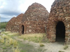 | Bromide Charcoal Kilns | structure | 2000 | 00000740 |
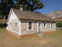 | Rial Chew Ranch Complex | district | 1987 | 86003392 |
| Craig School #2 | building | 2023 | 100008788 | |
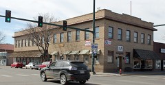 | First National Bank Building | building | 1997 | 97000793 |
| Denis Julien Inscription | site | 1986 | 86003395 | |
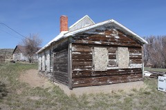 | Lay School | building | 2013 | 13000080 |
| Mantle's Cave | site | 1994 | 94000394 | |
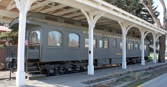 | Marcia (pullman car) | structure | 1975 | 75000526 |
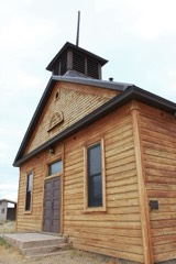 | Old Ladore School | building | 1975 | 75000525 |
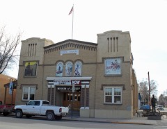 | State Armory | building | 1992 | 92000810 |
| Two-Bar Ranch | site | 1978 | 78000873 | |
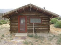 | Upper Wade and Curtis Cabin | district | 1986 | 86003399 |
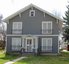 | Vanatta Apartments | building | 1996 | 95001511 |
Every wildfire the federal occurrence database records inside this county: 3,191 of them, burning about 284,999 acres. 2,886 started naturally and 7 were recorded as arson. Each settlement page carries the fires within five miles of it.
| Reported cause | Fires |
|---|---|
| Natural | 2886 |
| Missing data/not specified/undetermined | 148 |
| Equipment and vehicle use | 57 |
| Debris and open burning | 35 |
| Recreation and ceremony | 22 |
| Smoking | 14 |
| Power generation/transmission/distribution | 11 |
| Arson/incendiarism | 7 |
| Fireworks | 5 |
| Firearms and explosives use | 4 |
| Railroad operations and maintenance | 2 |
The five largest, by the area the report gives. None of them was recorded as arson.
| Date | Cause | Size | Reported by | Name on the report |
|---|---|---|---|---|
| 24 August 2008 | Natural | 25,385 acres | Northwest District, Craig | MAYBERRY |
| 29 June 2018 | Missing data/not specified/undetermined | 19,946 acres | Northwest District, Craig | DIVIDE |
| 23 July 2014 | Equipment and vehicle use | 19,569 acres | Northwest District, Craig | ALKALI |
| 3 August 1996 | Natural | 13,775 acres | Northwest District, Craig | O'PINION |
| 27 June 2017 | Natural | 12,839 acres | Northwest District, Craig | PEEKABOO |
| 10 July 1993 | Missing data/not specified/undetermined | 12,410 acres | Northwest District, Craig | SUNBEAM |
| 3 July 2000 | Natural | 11,032 acres | Northwest District, Craig | BUSTERFLAT |
| 16 August 1993 | Missing data/not specified/undetermined | 9,600 acres | Northwest District, Craig | WAPATI PK |
Every settlement page carries the fires within five miles of it - see the settlement index below.
The NOAA Storm Events Database holds 125 reports for this county, causing 1 death, no injuries and about $505,500 in recorded property damage. Each settlement page carries the reports that name it.
| Kind of event | Reports |
|---|---|
| Thunderstorm Wind | 43 |
| Wildfire | 24 |
| Hail | 21 |
| Funnel Cloud | 9 |
| Flood | 8 |
| Tornado | 7 |
| Flash Flood | 7 |
| Heavy Rain | 4 |
| Lightning | 1 |
| Debris Flow | 1 |
The most serious of them, by death, then injury, then recorded damage. The accounts are quoted exactly as the forecast office filed them.
| When | Event | Place named | Harm | What the report says |
|---|---|---|---|---|
| July 2019 | Flood | Greystone | 1 killed | A raft carrying several people down the Green River in Dinosaur National Monument flipped when it entered the rapids at Triplet Falls and became stuck on one of the rocks. Many of the passengers were ejected into the water and one man later died after he was pulled out of the river. |
| June 2020 | Thunderstorm Wind | Craig | $300,000 | Several homes on Dunn Drive in Craig, CO had severe damage. One home suffered damage to three sections of metal roofing. Also, the SW corner of a large pole barn lost many roof panels. Another house to the west lost 50% of its roof. A separate 2 car garage at the residence also lost the SW corner of the roof. Another home had part of its attached garage roof blown off when the south facing garage doors were blown in. A shed was also destroyed on this property. Another home, just to the south, also lost its roof. Finally, another home on the same road almost lost the entire metal roof off their single wide trailer. |
| September 1996 | Lightning | Craig | $31,000 | no account filed |
| July 2023 | Thunderstorm Wind | Craig Messa View Ran | $25,000 | A strong thunderstorm moved over rural portions of Moffat County. Gusty winds associated with the high-based storm produced significant wind damage across Black Mountain Road. Many trees fell across the road and stranded motorists. Some of the trees were 16 to 20 inches in diameter. No sensors nearby but wind gusts were estimated to be at least 60 mph. |
| June 2011 | Flood | Hiawatha Camp | $25,000 | Rapid snowmelt led to increased rises on area waterways across Moffat County through early June with areal flood warnings or advisories first issued on June 4th and persisting through June 22nd. The Yampa, Green and Little Snake River basins were impacted by flood waters which inundated many low lying areas. Camp site closures and bank erosions were reported along areas of the Green River in the western portions of the county. The Yampa River inundated portions of the infrastructure at Deerlodge Park in Dinosaur National Monument. Also along the Yampa River, pasture and ranch land were underwater near Craig with many outbuildings and some farm equipment being impacted. Bank erosion was also reported along both the Yampa and Little Snake Rivers due to the elevated flows. |
| August 1992 | Tornado (F0) | not stated | $25,000 | no account filed |
| September 2013 | Flash Flood | Greystone | $20,000 | Heavy rainfall on saturated soils led to flash flooding in the Browns Park National Wildlife Refuge, including flood waters that ran into basements of homes. |
| September 2013 | Hail | Greystone | $12,000 | The hail was reported to have damaged cars in the area. |
| August 2023 | Flood | Blue Mtn | $10,000 | Heavy rain from thunderstorms led to flooding across portions of County Road 95 (about 1/4 mile north of Moffat County Road 104) in western Moffat County. The road was impassable and closed shortly after. |
| July 2007 | Thunderstorm Wind | Craig | $10,000 | Personnel at a Craig radio station reported numerous large branches broken from trees, with several trees broken in half. Hotel signs were damaged and some were shattered. |
| September 2007 | Thunderstorm Wind | Craig | $10,000 | Strong gusty winds and heavy rain buffeted Craig causing power outages throughout town and minor street flooding. |
| June 2011 | Flash Flood | Sunbeam | $5,000 | Portions of Highway 318 were washed out by flash flood waters up to a foot deep across the road. |
| September 2007 | Hail | Maybell | $5,000 | Hail from 3/4 inch to 1 inch diameter occurred. The hail broke windows on some homes. The hail came down with such force in one area that it punched holes in a 5 gallon plastic bucket. |
| August 2004 | Hail | Hiawatha | $5,000 | no account filed |
| April 2023 | Flood | Craig | $4,000 | Rapid snowmelt resulted in flooding across portions of Moffat County, focused in downtown Craig. Fortification Creek near City Park exceeded its banks. Several county roads were closed as a result of the flooding. Flood waters did not recede for a couple of days. |
| September 1997 | Flash Flood | Craig | $4,000 | no account filed |
| September 2024 | Hail | Hiawatha Camp | $3,000 | Occurred at the Browns Park National Wildlife Refuge Headquarters location. Small hail mixed with heavy rain fell initially until larger stones fell up to golf ball size. Vehicles have damage, garden destroyed and chicken coop is full of holes. Accumulation of hail plugged up some of the culverts. |
| August 2004 | Tornado (F1) | Craig | $3,000 | no account filed |
| June 2024 | Thunderstorm Wind | (Cag)Craig/Moffat Ar | $2,000 | A severe thunderstorm that moved through Craig on the evening of the 21st produced several severe weather types, including winds. The peak gust was 66 mph, which was recorded at the KCAG ASOS at Craig-Moffat County Airport. In addition, at the nearby Loudy-Simpson Park, the Whittle the Wood festival sustained damage in the form of porta-potties and tents being blown over. In addition, multiple reports of downed limbs were received, some with a diameter of 4 inches. |
| August 2021 | Debris Flow | Craig Messa View Ran | $2,000 | A mudslide of unknown size temporarily closed down Colorado Highway 13 between County Road 73 and County Road 38. |
| July 2004 | Heavy Rain | Hamilton | $2,000 | no account filed |
| May 2023 | Flood | Elk Spgs | $1,000 | Flooding along the Yampa River resulted in the closure of the Deerlodge Park Campground within Dinosaur National Monument. |
| May 2008 | Flood | Maybell | $1,000 | The Yampa River at Deerlodge Park exceeded flood stage. The river also exceeded bankfull in the Maybell vicinity and caused flooding of a yard near the river. |
| June 2008 | Flood | Elk Spgs | $500 | The Yampa River at Deerlodge Park exceeded flood stage. |
| June 2025 | Thunderstorm Wind | Greystone | - | The Dinosaur NM 19N RAWS recorded a gust to 62 mph at approximately 8:22 PM MDT on June 12th. This gust was associated with a small thunderstorm that had formed over the Dinosaur National Monument area. This was the only gust recorded in the area, and no reports of damages, injuries, or fatalities were received associated with it. |
| June 2025 | Thunderstorm Wind | Great Divide | - | The Great Divide 2N RAWS recorded a wind gust to 60 mph at approximately 5:46 PM MDT on June 12th. This gust was associated with a passing band of showers and thunderstorms. No reports of damages, injuries, or fatalities were recorded. |
| July 2024 | Flash Flood | Greystone | - | Heavy rainfall rates of 0.5 to 1 inch in less than an hour from a strong thunderstorm resulted in flash flooding in Hells Canyon through Dinosaur National Monument. An additional inch accumulation of pea sized hail also accompanied the heavy rain resulting in the flash flooding. |
| June 2024 | Thunderstorm Wind | (Cag)Craig/Moffat Ar | - | The peak gust associated with this thunderstorm was 58 mph and was recorded at the KCAG ASOS at the Craig-Moffat County Airport at 3:31 PM MDT. Additional gusts with this storm, while strong, were generally below severe criteria. |
| June 2024 | Thunderstorm Wind | Massadona | - | The Pinto RAWS station recorded a gust to 60 mph with a passing thunderstorm. This storm also produced a gust to 49 mph at the KEEO ASOS at Meeker Airport. |
| July 2024 | Thunderstorm Wind | Massadona | - | Thunderstorms tracked across Rio Blanco and Routt counties on the afternoon of the 27th, producing strong to severe wind gusts as they did so. Recorded wind gusts ranged from 50 mph to 60 mph, with the peak gust being recorded at the PIRC2 Pinto mesonet site, 18 miles southeast of Massadona. Gusts into the 50s were recorded at KEEO ASOS at Meeker Airport and KHDN AWOS at Yampa Valley Airport in Hayden. No reports of damages or injuries were received. |
| July 2024 | Thunderstorm Wind | Great Divide | - | Showers and thunderstorms formed off the higher terrain in the western half of Moffat County, and gradually drifted east. As it did so, these storms produced a wind gust to 71 mph, that was recorded by the Mesonet site GDRC2, 2 miles southwest of Great Divide. This was the only recorded gust of this strength. No reports of injuries or damage were received. |
| June 2024 | Thunderstorm Wind | (Cag)Craig/Moffat Ar | - | A severe thunderstorm moved through portions of Moffat and Routt counties on the evening of the 21st, producing several forms of severe weather. The KCAG ASOS at Craig-Moffat County Airport recorded a severe wind gust to 66 mph at 6:19 PM MDT. This storm went on to cause damage near Hayden. |
| May 2023 | Flood | Slater | - | County Road 2 next to the USGS's Slater Fork gage south of the Wyoming/Colorado border had one lane closed due to flooding along Slater Creek. |
| July 2023 | Thunderstorm Wind | (Cag)Craig/Moffat Ar | - | A peak wind gust of 60 MPH was measured by the automated weather station at the CraigMoffat County Airport. |
| August 2021 | Thunderstorm Wind | (Cag)Craig/Moffat Ar | - | A peak wind gust of 58 MPH was measured by the automated weather station at the Craig-Moffat County Airport. |
| August 2021 | Thunderstorm Wind | (Cag)Craig/Moffat Ar | - | A peak wind gust of 60 MPH was measured by the automated weather station at the Craig-Moffat County Airport. |
| August 2021 | Thunderstorm Wind | (Cag)Craig/Moffat Ar | - | A peak wind gust of 66 MPH was measured by the automated weather station at the Craig-Moffat County Airport. |
| August 2021 | Thunderstorm Wind | Elk Spgs | - | A peak wind gust of 65 MPH was measured by the automated weather station 4 miles west-northwest of Elk Springs. |
| August 2020 | Thunderstorm Wind | (Cag)Craig/Moffat Ar | - | A peak wind gust of 64 mph was measured by the automated weather station at the Craig-Moffat Airport. |
| June 2020 | Hail | Blue Mtn | - | A severe thunderstorm produced large hail estimated to be the size of quarters east of Blue Mountain. |
| June 2020 | Thunderstorm Wind | Hiawatha Camp | - | A peak wind gust of 66 mph was measured by an automated weather station west-southwest of Hiawatha. |
| June 2020 | Thunderstorm Wind | Craig | - | Wind gusts estimated to be in the 70 to 75 mph range caused significant roof damage to a house in Craig, Colorado. |
| June 2020 | Thunderstorm Wind | Hiawatha Camp | - | A peak wind gust of 60 mph was measured by an automated weather station west-southwest of Hiawatha. |
| June 2020 | Thunderstorm Wind | Greystone | - | A peak wind gust of 67 mph was measured by an automated weather station northwest of Greystone. |
| June 2019 | Thunderstorm Wind | Elk Spgs | - | An automated weather station recorded a peak thunderstorm wind gust of 58 mph. |
| September 2019 | Thunderstorm Wind | (Cag)Craig/Moffat Ar | - | The automated weather station at the Craig-Moffat County Airport measured a peak wind gust of 59 mph as a severe thunderstorm moved through the area. |
| August 2019 | Thunderstorm Wind | Craig | - | A trained weather spotter west of Craig measured a peak wind gust of 66 mph from outflow winds associated with a collapsing thunderstorm. |
| May 2017 | Hail | Blue Mtn | - | A strong thunderstorm that traveled from southwest to northeast dropped hail up to the size of quarters along with pea-sized hail up to 1 inch in depth on U.S. Highway 40 near Blue Mountain. |
| June 2016 | Thunderstorm Wind | Craig | - | Spotter reported trees down due to wind gusts. Craig ASOS reported 59 mph wind gusts. Widespread power outages around the Craig area. |
| September 2016 | Hail | Elk Spgs | - | Firefighters on the Calico Wildfire were pelted with large hailstones. |
| July 2014 | Flash Flood | Maybell | - | Highway 318 was closed for several hours due to a large amount of debris that was deposited on the roadway from flash flood waters. |
| June 2011 | Thunderstorm Wind | Dinosaur | - | Thunderstorm wind gusts to 60 mph and half inch sized hail were reported in Dinosaur. |
| June 2011 | Thunderstorm Wind | Dinosaur | - | A severe thunderstorm with pea sized hail and winds estimated at 60 mph were reported at the Dinosaur National Monument area. |
| June 2011 | Thunderstorm Wind | Massadona | - | Thunderstorm outflow winds estimated to 65 mph knocked out power for 2 to 3 hours in Massadona. |
| June 2009 | Hail | Craig | - | A volunteer NWS storm spotter observed large hail mostly over open country. About half of the Rye crop was damaged. |
| June 2009 | Funnel Cloud | Craig | - | A funnel cloud was observed and photographed seven miles northwest of Craig. |
| June 2009 | Hail | Maybell | - | Hail up to one inch in diameter fell in the town of Maybell. Gardens were damaged. |
| June 2009 | Hail | Maybell | - | Nickel-size hail pummeled the town of Maybell. Gardens that were struck by hail earlier in the day were ravaged even further. |
| June 2009 | Hail | Massadona | - | Hail up to one inch in diameter completely covered the ground like a layer of snow. |
| August 2009 | Funnel Cloud | Craig | - | A funnel cloud was observed by many individuals in the Craig area. The funnel cloud was also photographed. |
The Survey's mineral resources record lists 280 workings inside this county. 10 still produce and 270 are closed or unrecorded. Each settlement page carries the workings within five miles of it.
| Commodity | Workings |
|---|---|
| Uranium | 127 |
| Sand and Gravel, Construction | 74 |
| Gold | 30 |
| Uranium, Vanadium | 14 |
| Copper | 8 |
| Stone, Crushed/Broken | 8 |
| Silver | 5 |
| Vanadium | 5 |
| Iron | 4 |
| Zinc | 3 |
| Zeolites | 2 |
| Copper, Lead | 2 |
| Uranium, Thorium | 1 |
| Gold, Silver, Molybdenum | 1 |
The least common of them first, because a county's hundredth gravel pit says nothing its first ten did not.
| Where | Site | Commodity | Status | Recorded |
|---|---|---|---|---|
| Bozo No. 1 | Copper, Uranium | Occurrence | ||
| Bromide Mine | Copper, Silver, Gold, Lead | Past Producer | 1912, 1973 | |
| Farnsworth Uranium Deposit | Vanadium, Uranium | Past Producer | ||
| Fourmile Creek District | Gold, Silver, Thorium, Titanium, Metal, REE, Niobium (Columbium), Iron | Past Producer | 1891, 1892, 1940 | |
| Housel Gulch Placer | Uranium, Thorium | Occurrence | Ilmenite, Monazite | |
| Joe L Knez | Cobalt | Past Producer | ||
| Joker Pit | Gold, Thorium, Titanium, Metal, Niobium (Columbium), Iron, REE | Producer | Fossil Placer | |
| Juniper Hot Springs | Geothermal | Unknown | ||
| Magpie Mine | Tungsten, Gold, Uranium | Past Producer | 1933 | |
| Mantle Mine | Zinc, Lead, Copper, Gold, Silver, Antimony, Arsenic | Past Producer | 1875 | |
| Mantle Mine | Copper, Lead, Zinc | Occurrence | ||
| Mantle-Jameson Group | Zinc, Copper | Producer | ||
| Maybell Mines | Uranium, Molybdenum | Producer | 1954, 1955 | |
| Paint Iron Mine | Iron, Titanium, Metal | Occurrence | Hematite, Limonite, Ocher | |
| Sugar Loaf Mine | Uranium, Vanadium, Gold, Silver, Molybdenum | Past Producer | Molybdenite, Uranophane | |
| Unnamed Mn Occurrence | Manganese | Occurrence | ||
| Breeze Mountain Mine | Zeolites | Past Producer | ||
| Mantle Mine | Zinc, Copper, Lead | Past Producer | ||
| Shepard Mine | Zinc, Copper, Lead | Past Producer | ||
| Vermillion Cliffs | Zeolites | Past Producer | ||
| Paint Iron Mine | Iron | Past Producer | ||
| Queen Anne and Black Sioux | Iron | Past Producer | ||
| Queen Anne, Black Sioux | Iron | Occurrence | Hematite | |
| Biles Shaft | Vanadium | Occurrence | ||
| Blue Mountain No. 4 | Uranium, Vanadium | Past Producer | ||
| Douglas Mountain | Copper, Silver | Past Producer | ||
| Gooldy Placer | Gold, Silver | Past Producer | 1894 | |
| Rock Springs Placer Co. Mine | Gold, Silver | Past Producer | 1891, 1892 | |
| Skull Creek | Copper, Vanadium | Unknown | ||
| Tec Open Pit A Thru L | Uranium, Vanadium | Producer | ||
| Timberlake Mining and Development Co. Placer | Gold, Silver | Past Producer | 1894 | |
| Trace Elements Corp. Mill | Uranium, Vanadium | Past Producer | ||
| Blue Mountain Group | Uranium, Vanadium, Copper | Past Producer | Carnotite, Uraninite | |
| Glory Bee Mine | Uranium, Vanadium, Copper | Past Producer | ||
| Unknown | Stone, Crushed/Broken | Occurrence | ||
| Unknown | Stone, Crushed/Broken | Occurrence | Scoria | |
| Unknown | Stone, Crushed/Broken | Occurrence | Scoria | |
| Unknown | Stone, Crushed/Broken | Occurrence | Sedimentary | |
| Unknown | Stone, Crushed/Broken | Occurrence | Sedimentary | |
| Unknown | Stone, Crushed/Broken | Occurrence | Sedimentary | |
| Unknown | Stone, Crushed/Broken | Occurrence | Sedimentary | |
| Unknown | Stone, Crushed/Broken | Occurrence | Scoria | |
| Unnamed Copper Prospect | Copper | Occurrence | Chalcocite | |
| Unnamed Copper Prospect | Copper | Occurrence | Malachite | |
| Unnamed Copper Prospect | Copper | Occurrence | Malachite | |
| Unnamed Copper Prospects | Copper | Occurrence | Chalcocite | |
| Buffalo Head Prospect | Uranium, Vanadium | Past Producer | Uranophane | |
| Doc Armor Mine | Uranium, Vanadium | Past Producer | Carnotite, Tyuyamunite | |
| Gertrude | Uranium, Vanadium | Past Producer | 1954, 1956 | |
| Johnson Lease | Uranium, Vanadium | Past Producer | Coffinite, Uraninite | |
| Little Star Claims | Uranium, Vanadium | Past Producer | Carnotite, Tyuyamunite | |
| Lucky Boy Claim | Uranium, Vanadium | Past Producer | ||
| Orr and T and L Claims | Uranium, Vanadium | Past Producer | 1955 | |
| Three Sisters Claim | Uranium, Vanadium | Past Producer | Uranophane | |
| Unknown | Uranium, Vanadium | Occurrence | ||
| Unknown | Uranium, Vanadium | Occurrence | Coffinite | |
| Unknown | Uranium, Vanadium | Occurrence | ||
| Blevins Placer | Gold | Past Producer | 1887, 1905 | |
| Blue Gravel Creek Placers | Gold | Occurrence | Placer | |
| Delta #2 | Gold | Past Producer | ||
| Dry Gulch | Gold | Past Producer | ||
| Fortifacation Creek Placers | Gold | Occurrence | Placer | |
| Fourmile Creek | Gold | Past Producer | Lode | |
| Goat #1 and #3 | Gold | Past Producer | ||
| Goat No. 1 and 3 Placers | Gold | Past Producer | Placer | |
| Housec Gold Placer Mine | Gold | Past Producer | ||
| Housel Gulch | Gold | Occurrence | Placer | |
| Iron Springs Mine | Gold | Past Producer | 1887 | |
| Joker Mining Company | Gold | Past Producer | ||
| Law Dredge Mine | Gold | Past Producer | 1897, 1900, 1904 | |
| Lay | Gold | Past Producer | ||
| Round Bottom | Gold | Past Producer | ||
| Unknown | Gold | Occurrence | ||
| Unnamed Placer Mine | Gold | Past Producer | 1887 | |
| Unnamed Placer Mine | Gold | Past Producer | Placer | |
| Unnamed Placer Mine | Gold | Past Producer | Placer | |
| Unnamed Placer Mine | Gold | Past Producer | Placer | |
| Unnamed Placer Mine | Gold | Past Producer | 1934 | |
| Unnamed Placer Mine | Gold | Past Producer | 1939 | |
| Unnamed Placer Mines | Gold | Past Producer | Placer | |
| Unnamed Placer Mines | Gold | Past Producer | Gold | |
| Utah Mining Company Property | Gold | Occurrence | Placer | |
| West Side Mining Assoc. Placer Mine | Gold | Past Producer | Placer | |
| Craig Pit | Sand and Gravel, Construction | Producer | ||
| Grace Pit | Sand and Gravel, Construction | Past Producer | ||
| Gravel Pit | Sand and Gravel, Construction | Unknown | ||
| Gravel Pit | Sand and Gravel, Construction | Unknown | ||
| Gravel Pit | Sand and Gravel, Construction | Past Producer | ||
| Gravel Pit | Sand and Gravel, Construction | Past Producer | ||
| Gravel Pit | Sand and Gravel, Construction | Past Producer | ||
| Gravel Pit | Sand and Gravel, Construction | Unknown | ||
| Gravel Pit | Sand and Gravel, Construction | Past Producer | ||
| Gravel Pit | Sand and Gravel, Construction | Past Producer | ||
| Gravel Pit | Sand and Gravel, Construction | Unknown | ||
| Gravel Pit | Sand and Gravel, Construction | Past Producer | ||
| Gravel Pit | Sand and Gravel, Construction | Unknown | ||
| Gravel Pit | Sand and Gravel, Construction | Past Producer | ||
| Gravel Pit | Sand and Gravel, Construction | Past Producer | ||
| Gravel Pit | Sand and Gravel, Construction | Unknown | ||
| Gravel Pit | Sand and Gravel, Construction | Past Producer | ||
| Gravel Pit | Sand and Gravel, Construction | Past Producer | ||
| Gravel Pit | Sand and Gravel, Construction | Past Producer | ||
| Gravel Pit | Sand and Gravel, Construction | Unknown | ||
| Gravel Pit | Sand and Gravel, Construction | Producer | ||
| Gravel Pit | Sand and Gravel, Construction | Past Producer | ||
| Gravel Pit | Sand and Gravel, Construction | Past Producer | ||
| Gravel Pit | Sand and Gravel, Construction | Unknown | ||
| Gravel Pit | Sand and Gravel, Construction | Past Producer | ||
| Gravel Pit | Sand and Gravel, Construction | Unknown | ||
| Gravel Pit | Sand and Gravel, Construction | Past Producer | ||
| Gravel Pit | Sand and Gravel, Construction | Past Producer | ||
| Gravel Pit | Sand and Gravel, Construction | Past Producer | ||
| Gravel Pit | Sand and Gravel, Construction | Past Producer | ||
| Gravel Pit | Sand and Gravel, Construction | Unknown | ||
| Gravel Pit | Sand and Gravel, Construction | Past Producer | ||
| Gravel Pit | Sand and Gravel, Construction | Unknown | ||
| Gravel Pit | Sand and Gravel, Construction | Past Producer | ||
| Gravel Pit | Sand and Gravel, Construction | Past Producer | ||
| Gravel Pit | Sand and Gravel, Construction | Unknown | ||
| Harshberger | Sand and Gravel, Construction | Unknown | ||
| Mack Pit | Sand and Gravel, Construction | Producer | ||
| Moon Pit | Sand and Gravel, Construction | Past Producer | ||
| Unknown | Sand and Gravel, Construction | Occurrence | Gravel | |
| Unknown | Sand and Gravel, Construction | Occurrence | Gravel | |
| Unknown | Sand and Gravel, Construction | Occurrence | Gravel | |
| Unknown | Sand and Gravel, Construction | Occurrence | Gravel | |
| Unknown | Sand and Gravel, Construction | Occurrence | Gravel | |
| Unknown | Sand and Gravel, Construction | Occurrence | Gravel | |
| Unknown | Sand and Gravel, Construction | Occurrence | Gravel | |
| Unknown | Sand and Gravel, Construction | Occurrence | Gravel | |
| Unknown | Sand and Gravel, Construction | Occurrence | Gravel | |
| Unknown | Sand and Gravel, Construction | Occurrence | Gravel | |
| Unknown | Sand and Gravel, Construction | Occurrence | Gravel | |
| Unknown | Sand and Gravel, Construction | Occurrence | Gravel | |
| Unknown | Sand and Gravel, Construction | Occurrence | Gravel | |
| Unknown | Sand and Gravel, Construction | Occurrence | Gravel | |
| Unknown | Sand and Gravel, Construction | Occurrence | Gravel | |
| Unknown | Sand and Gravel, Construction | Occurrence | Gravel | |
| Unknown | Sand and Gravel, Construction | Occurrence | Gravel | |
| Unknown | Sand and Gravel, Construction | Occurrence | Gravel | |
| Unknown | Sand and Gravel, Construction | Occurrence | Gravel | |
| Unknown | Sand and Gravel, Construction | Occurrence | Gravel | |
| Unknown | Sand and Gravel, Construction | Occurrence | Gravel | |
| Unknown | Sand and Gravel, Construction | Occurrence | Gravel | |
| Unknown | Sand and Gravel, Construction | Occurrence | Gravel | |
| Unknown | Sand and Gravel, Construction | Unknown | ||
| Unknown Gravel Pit | Sand and Gravel, Construction | Past Producer | ||
| Unknown Gravel Pit | Sand and Gravel, Construction | Unknown | ||
| Unknown Gravel Pit | Sand and Gravel, Construction | Unknown | ||
| Unknown Gravel Pit | Sand and Gravel, Construction | Unknown | ||
| Unknown Gravel Pit | Sand and Gravel, Construction | Unknown | ||
| Unknown Gravel Pit | Sand and Gravel, Construction | Unknown | ||
| Unknown Gravel Pit | Sand and Gravel, Construction | Past Producer | ||
| Unknown Gravel Pit | Sand and Gravel, Construction | Unknown | ||
| Unknown Gravel Pit | Sand and Gravel, Construction | Unknown | ||
| Unknown Gravel Pit | Sand and Gravel, Construction | Unknown | ||
| Unknown Gravel Pit | Sand and Gravel, Construction | Past Producer | ||
| Agnes No. 7 | Uranium | Past Producer | ||
| Agnes No. 7 Claim | Uranium | Unknown | ||
| Airborne Anomalous Area 57-10 | Uranium | Unknown | ||
| Airborne Anomaly | Uranium | Unknown | ||
| Airborne Anomaly 56- | Uranium | Unknown | ||
| Airborne Anomaly 56-10 | Uranium | Unknown | ||
| Airborne Anomaly 56-11 | Uranium | Unknown | ||
| Airborne Anomaly 56-12 | Uranium | Unknown | ||
| Airborne Anomaly 56-13 | Uranium | Unknown | ||
| Airborne Anomaly 56-14 | Uranium | Unknown | 1955 | |
| Airborne Anomaly 56-15 | Uranium | Unknown | ||
| Airborne Anomaly 56-9 | Uranium | Unknown | ||
| Airborne Anomaly B 17-104 | Uranium | Occurrence | Tyuyamunite | |
| Airborne Anomaly B17-101 | Uranium | Unknown | ||
| Airborne Anomaly B17-102 | Uranium | Unknown | ||
| Airborne Anomaly B17-103 | Uranium | Occurrence | Tyuyamunite | |
| Airborne Anomaly B17-103 | Uranium | Unknown | ||
| Airborne Anomaly B17-104 | Uranium | Unknown | ||
| Airborne Anomaly B17-105 | Uranium | Occurrence | Tyuyamunite | |
| Airborne Anomaly B17-105 | Uranium | Unknown | ||
| Airborne Anomaly B17-106 | Uranium | Occurrence | Tyuyamunite | |
| Airborne Anomaly B17-106 | Uranium | Unknown | ||
| Airborne Anomaly B17-107 | Uranium | Occurrence | Tyuyamunite | |
| Airborne Anomaly B17-107 | Uranium | Unknown | ||
| Airborne Anomaly B17-108 | Uranium | Occurrence | Tyuyamunite | |
| Airborne Anomaly B17-109 | Uranium | Occurrence | Tyuyamunite | |
| Airborne Anomaly B17-109 | Uranium | Unknown | ||
| Airborne Anomaly B17-110 | Uranium | Occurrence | Tyuyamunite | |
| Airborne Anomaly B17-111 | Uranium | Unknown | ||
| Airborne Anomaly B17-112 | Uranium | Occurrence | Tyuyamunite | |
| Airborne Anomaly B17-112 | Uranium | Unknown | ||
| Airborne Anomaly B17-113 | Uranium | Occurrence | ||
| Airborne Anomaly B17-114 | Uranium | Occurrence | Tyuyamunite | |
| Airborne Anomaly B17-114 | Uranium | Unknown | ||
| Airborne Anomaly B17-115 | Uranium | Unknown | ||
| Airborne Anomaly B17-117 | Uranium | Occurrence | Tyuyamunite | |
| Airborne Anomaly B17-117 | Uranium | Unknown | ||
| Airborne Anomaly B17-118 | Uranium | Occurrence | Tyuyamunite | |
| Airborne Anomaly B17-118 | Uranium | Unknown | ||
| Airborne Anomaly B17-119 | Uranium | Occurrence | Tyuyamunite | |
| Airborne Anomaly B17-119 | Uranium | Unknown | ||
| Airborne Anomaly B17-120 | Uranium | Occurrence | Tyuyamunite | |
| Airborne Anomaly B17-120 | Uranium | Unknown | ||
| Airborne Anomaly B17-121 | Uranium | Occurrence | Tyuyamunite | |
| Airborne Anomaly B17-121 | Uranium | Unknown | ||
| Airborne Anomaly B17-122 | Uranium | Occurrence | Tyuyamunite | |
| Airborne Anomaly B17-122 | Uranium | Unknown | ||
| Airborne Anomaly B17-123 | Uranium | Occurrence | Tyuyamunite | |
| Airborne Anomaly B17-124 | Uranium | Occurrence | Tyuyamunite | |
| Airborne Anomaly B17-124 | Uranium | Unknown | ||
| Airborne Anomaly B17-125 | Uranium | Unknown | ||
| Airborne Anomaly B17-125 | Uranium | Occurrence | Tyuyamunite | |
| Airborne Anomaly B17-126 | Uranium | Occurrence | Tyuyamunite | |
| Airborne Anomaly B17-126 | Uranium | Unknown | ||
| Airborne Anomaly B17-127 | Uranium | Occurrence | Tyuyamunite | |
| Airborne Anomaly B17-127 | Uranium | Unknown | ||
| Airborne Anomaly B17-128 | Uranium | Occurrence | Tyuyamunite | |
| Airborne Anomaly B17-128 | Uranium | Unknown | ||
| Airborne Anomaly B17-129 | Uranium | Occurrence | Tyuyamunite | |
| Airborne Anomaly B17-129 | Uranium | Unknown | ||
| Airborne Anomaly B17-130 | Uranium | Unknown | ||
| Airborne Anomaly B17-36 | Uranium | Unknown | ||
| Airborne Anomaly B17-89 | Uranium | Unknown | ||
| Airborne Anomaly B17-90 | Uranium | Unknown | ||
| Airborne Anomaly B17-93 | Uranium | Unknown | ||
| Airborne Anomaly B17-94 | Uranium | Unknown | ||
| Airborne Anomaly B17-95 | Uranium | Unknown | 1954 | |
| Airborne Anomaly B17-96 | Uranium | Past Producer | 1954 | |
| Bob Cat Group | Uranium | Occurrence | ||
| Buffalo Head Mining Co. Claim #6 | Uranium | Unknown | ||
| Buffalo Head Prospect | Uranium | Occurrence | ||
| Butler Lease | Uranium | Past Producer | Uranophane | |
| Cacey Machelheny Claims | Uranium | Unknown | ||
| Carol J. Claims | Uranium | Unknown | ||
| Cedars Mining Company Claim No. 1 | Uranium | Unknown | ||
| Cedars Prospect | Uranium | Producer | ||
| Cleta Group | Uranium | Past Producer | ||
| Eskridge Property | Uranium | Occurrence | ||
| Golden Grain Claims | Uranium | Unknown | ||
| Hazel Whetstone Property | Uranium | Unknown | ||
| Hex Claims | Uranium | Unknown | ||
| Hudson Claim Group | Uranium | Unknown | 1954 | |
| Humming Bird Claim | Uranium | Unknown | 1954 | |
| Iron and Copper Claims | Uranium | Unknown | ||
| Johnson M.C.S. | Uranium | Past Producer | 1954 | |
| Lay-Governor Groups | Uranium | Unknown | 1953 | |
| Leon Claims | Uranium | Unknown | ||
| Little Snake 1 | Uranium | Unknown | ||
| Little Star No 1 | Uranium | Past Producer | ||
| Lucky Claim | Uranium | Unknown | 1954 | |
| Marge Group | Uranium | Past Producer | 1954, 1955 | |
| Maybell Mine (Umetco Minerals) | Uranium | Occurrence | ||
| Maybell Pit | Uranium | Producer | ||
| Maybell Plant | Uranium | Producer | ||
| Olds Claim Group | Uranium | Unknown | ||
| Orr Claims | Uranium | Occurrence | ||
| Orr Et Al Claims | Uranium | Occurrence | Uranophane | |
| Rob Rollo Mine | Uranium | Past Producer | Uraninite | |
| Sage-Buella | Uranium | Past Producer | 1954, 1956 | |
| Sage-Buella Mine | Uranium | Past Producer | Coffinite, Uraninite | |
| Sec 16 T7n R93w | Uranium | Unknown | 1953 | |
| Sec.16 T6n R94w | Uranium | Unknown | 1953 | |
| Sec.16 T7n R94w | Uranium | Unknown | 1953 | |
| Sec.16 Tgn R94w | Uranium | Unknown | 1953 | |
| September Morn Claims | Uranium | Unknown | ||
| Shell Group | Uranium | Occurrence | ||
| Shell Group, Claim No. 1 | Uranium | Unknown | 1954 | |
| Star Prospect | Uranium | Occurrence | ||
| Sugarloaf | Uranium | Unknown | 1953 | |
| Three Sisters | Uranium | Past Producer | ||
| Trevenen Claims | Uranium | Unknown | 1954 | |
| Unknown | Uranium | Occurrence | ||
| Unknown | Uranium | Occurrence | ||
| Unknown | Uranium | Occurrence | ||
| Unknown | Uranium | Occurrence | ||
| Unknown | Uranium | Occurrence | ||
| Unknown | Uranium | Occurrence | ||
| Unknown | Uranium | Occurrence | ||
| Unknown | Uranium | Occurrence | ||
| Unknown | Uranium | Occurrence | ||
| Unknown | Uranium | Occurrence | ||
| Unknown | Uranium | Occurrence | ||
| Unknown | Uranium | Occurrence |
Named settlements recorded in the Geographic Names Information System, each with the topographic sheets covering it. Villages, hamlets and abandoned places alike. Each is shown with the nearest named watercourse or landform and the survey quadrangle it falls on.
Craig census division · 81641 · Near Mount Streeter · Axial quadrangle
17 sheets, 1910 to 1979
Dinosaur census division · 81610 · On Willow Creek · Rangely NE quadrangle
12 sheets, 1907 to 1979
Craig census division · 81625 · On Fortification Creek · Craig quadrangle
16 sheets, 1916 to 1979
Maybell-Powder Wash census division · 81640 · Near Diamond Mountain · Canyon of Lodore North quadrangle
13 sheets, 1954 to 1979
Craig census division · 81625 · Near Thompson Hill · Castor Gulch quadrangle
17 sheets, 1910 to 1979
Dinosaur census division · 81610 · Near Sand Draw · Dinosaur quadrangle
18 sheets, 1885 to 1980
Maybell-Powder Wash census division · 81640 · Greystone quadrangle
11 sheets, 1954 to 1979
Craig census division · 81638 · On Morapos Creek · Hamilton quadrangle
15 sheets, 1910 to 1979
Craig census division · 81641 · Near Seeping Spring Gulch · Monument Butte quadrangle
17 sheets, 1910 to 1979
Dinosaur census division · 81610 · Near Watson Draw · Skull Creek quadrangle
12 sheets, 1907 to 1979
Craig census division · 81625 · Near Temple Gulch · Juniper Hot Springs quadrangle
17 sheets, 1910 to 1979
Craig census division · 81641 · Near Seeping Spring Gulch · Monument Butte quadrangle
17 sheets, 1910 to 1979
Maybell-Powder Wash census division · 81640 · On Deception Creek · Maybell quadrangle
14 sheets, 1954 to 1986
Maybell-Powder Wash census division · 81640 · Sugarloaf Butte quadrangle
9 sheets, 1954 to 1979
Maybell-Powder Wash census division · 81625 · Powder Wash quadrangle
11 sheets, 1954 to 1979
Craig census division · 81625 · Near Serviceberry Mountain · Bakers Peak quadrangle
15 sheets, 1954 to 1979
Maybell-Powder Wash census division · 81640 · Near Thornburg Draw · Sunbeam quadrangle
13 sheets, 1954 to 1986
Maybell-Powder Wash census division · 81640 · On Vermillion Creek · Lodore School quadrangle
14 sheets, 1954 to 1979