 Block
Arapahoe, Colorado
14 topographic sheets cover this place, the earliest surveyed in 1892 and the latest in 1982. It stands in the Cheyenne Wells census division. It lies in ZIP code area 80802. The Survey maps it on the Arapahoe quadrangle. 102 people lived here at the 2020 count. It stands 4,009 feet above sea level.
Topographic sheets covering this place
6 surveys from 14 printed sheetsMatched by testing this settlement's coordinate against the published boundary of every sheet in the United States Geological Survey's historical collection. Each opens the scanned sheet at the Survey.
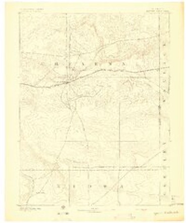
- 1892 USGS Cheyenne Wells quadrangle1:125000
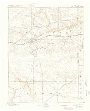
- 1894 USGS Cheyenne Wells quadrangle1:125000, 6 printings
- 1954 USGS Lamar quadrangle1:250000, 3 printings
- 1958 USGS Lamar quadrangle1:250000, 2 printings
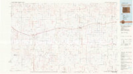
- 1981 USGS Cheyenne Wells quadrangle1:100000
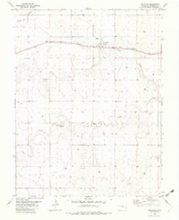
- 1982 USGS Arapahoe quadrangle1:24000
Fires near this place
2 since 2003Regional context, not property-specific evidence. The federal wildfire occurrence database lists 2 fires within 5 miles of Arapahoe between 2003 and 2011, burning about 4 acres in total. None started naturally. None was recorded as arson. Distance is straight-line from the map coordinates, so a fire counted here may appear on a neighbouring settlement's page as well.
| Reported cause | Fires |
|---|---|
| Missing data/not specified/undetermined | 2 |
The most recent of them, most recent first, with the day each was reported and the service that recorded it.
| Date | Cause | Size | Reported by | Name on the report |
|---|---|---|---|---|
| 29 August 2011 | Missing data/not specified/undetermined | 4.0 acres | Colorado State Forest Service-State Headquarters | ARAPAHOE |
| 3 April 2003 | Missing data/not specified/undetermined | under an acre | Colorado State Forest Service-State Headquarters | not named |
Storms near this place
60 of 125 shownRegional context, not property-specific evidence. The National Weather Service names Arapahoe in 125 storm reports between 1993 and 2025: 72 hail, 37 thunderstorm wind, 8 tornado, 5 flash flood. No death or injury is recorded in these reports. Each account below is quoted exactly as the forecast office filed it, from the NOAA Storm Events Database, and each date opens the federal record of that event.
| When | Event | Place named | Harm | What the report says |
|---|---|---|---|---|
| August 2019 | Thunderstorm Wind | Arapahoe | $80,000 | Significant damage and a power outage was originally reported by emergency management in Arapahoe due to thunderstorm wind gusts. Additional damage reports from the public in Arapahoe included the following: a 30 foot by 80 foot Quonset hut was completely destroyed, numerous power lines were downed, multiple houses had their roofs blown off, and a large steel building with a concrete base was destroyed as a result of this thunderstorm wind event. |
| June 2015 | Thunderstorm Wind | Arapahoe | $25,000 | A center pivot was tipped over from thunderstorm wind gusts. |
| May 2007 | Thunderstorm Wind | Arapahoe | $15,000 | Winds flipped over irrigation pivots. |
| July 2014 | Thunderstorm Wind | Arapahoe | $6,000 | Six utility poles were blown down by strong thunderstorm outflow at Hwy 385 and Road G south of Burlington. |
| July 2009 | Thunderstorm Wind | Arapahoe | $5,000 | Spotter reported winds estimated at 80 mph. Tree limbs were down in town. Nearby Cheyenne Wells had earlier measured a wind gust of 83 mph. |
| May 2020 | Thunderstorm Wind | Arapahoe | $2,000 | Thunderstorm wind gust of 74 MPH via a Davis Instrument. At the location, branches of unknown size were broken off trees and fascia was torn off a house. |
| May 1999 | Thunderstorm Wind | Arapahoe | $2,000 | Strong winds broke 6 inch tree limbs and destroyed several farm buildings. |
| March 1998 | Thunderstorm Wind | Arapahoe | $1,000 | Estimated 60-80 mph thunderstorm wind gust blew small kitchen cabinet 30 feet into tree. Lifted children's wagon about 4 feet off ground. Garage window blown out. Empty 55 gallen drums rolled. |
| July 1995 | Hail | Arapahoe | $1,000 | Also 80 mph winds with power poles down. |
| June 2024 | Thunderstorm Wind | Arapahoe | - | Kcoaprapa3 reports 58 MPH gust. |
| September 2024 | Thunderstorm Wind | Arapahoe | - | The mesonet site UP694 reported the wind gust. |
| July 2023 | Hail | Arapahoe | - | Pea to dime sized hail observed. |
| October 2023 | Thunderstorm Wind | Arapahoe | - | Report received of near zero visibility on Highway 385 near the Cheyenne-Kit Carson county line due to dust picked up by a thunderstorm outflow boundary gusting an estimated at 55 mph. The storm was located over Burlington, Colorado in Kit Carson County at the time of the report. No reports of a dust storm were reported from Kit Carson County, but it is likely similar conditions continued along the highway and the outflow. |
| June 2019 | Thunderstorm Wind | Arapahoe | - | Significant wind damage found in Arapahoe from a supercell thunderstorm. Damage consisted of tree limbs snapped, a garage structure lost at a home, and metal roofing and support structure blown off of concrete grain elevators. |
| June 2018 | Hail | Arapahoe | - | The hail ranged from pea to nickel in size and was accompanied by estimated wind gusts of 70 MPH and torrential rainfall. |
| June 2018 | Thunderstorm Wind | Arapahoe | - | Estimated wind gusts of 60-70 MPH occurred with pea to nickel size hail and torrential rainfall. |
| July 2018 | Thunderstorm Wind | Arapahoe | - | The wind report came from a mile north-northwest of town. |
| October 2017 | Hail | Arapahoe | - | Numerous reports of ping-pong ball size hail were received. There were also reports of hail larger than ping-pong ball falling, but no size was mentioned. Many windows were broken in houses around town from the hail. |
| July 2016 | Hail | Arapahoe | - | Estimated time of report from radar. |
| June 2015 | Hail | Arapahoe | - | Wind gusts were estimated to be near 50 MPH. No tree damage was observed. |
| May 2015 | Hail | Arapahoe | - | Pea to dime size hail fell for roughly 15 minutes. |
| June 2014 | Hail | Arapahoe | - | Some larger hail stones were nickel to quarter size but most were smaller. |
| August 2013 | Hail | Arapahoe | - | Relayed via twitter. Time estimated from radar. |
| September 2013 | Flash Flood | Arapahoe | - | Flash flooding occurred after extremely heavy rainfall of 6-9 inches fell in the Sandy Creek drainage, and was seen flowing over Road 57 just south of Road M in extreme eastern Kit Carson County. The water from overnight heavy rainfall could be heard roaring over the road as of 2 pm MDT Friday afternoon. |
| May 2013 | Tornado (EF0) | Arapahoe | - | The landspout lasted about 5 minutes before dissipating, remaining fairly stationary. |
| May 2013 | Tornado (EF0) | Arapahoe | - | Landspout remained fairly stationary before dissipating. |
| July 2009 | Thunderstorm Wind | Arapahoe | - | No damage was reported. |
| May 2008 | Tornado (EF0) | Arapahoe | - | Brief tornado observed in extreme eastern Cheyenne county Colorado near the Kansas border. This tornado remained over open country with no known damage. |
| July 2008 | Flash Flood | Arapahoe | - | Basement flooding occurred. Water in yard was over ankle deep. |
| April 2007 | Tornado (EF0) | Arapahoe | - | No known damage...over open fields. Tornado developed near Roads X, 57 and dissipated near Roads Z, 53. |
| April 2007 | Tornado (EF0) | Arapahoe | - | Cone-shaped tornado lasted about 19 minutes. No known damage...over open fields. Tornado developed near Roads CC, 56 and dissipated near Roads GG, 51. |
| May 2006 | Thunderstorm Wind | Arapahoe | - | Spotter also reported a 4-inch depth of pea size hail. |
| May 2006 | Hail | Arapahoe | - | Hail covered the ground. |
| June 2006 | Hail | Arapahoe | - | 5 inch hail depth on road with larger drifts in some locations. |
| June 2006 | Hail | Arapahoe | - | Via NSSL Severe hail project. |
| June 2006 | Hail | Arapahoe | - | Via NSSL Severe hail project. |
| July 2006 | Flash Flood | Arapahoe | - | 4.80 inches of rain measured with one foot of running water across county road 58 and road N. |
| July 2006 | Flash Flood | Arapahoe | - | Eight inches of rain measured in rain gauge with portions of county road 60 under water. |
| August 2006 | Heavy Rain | Arapahoe | - | 3.12 inches of rain fell in two hours. |
| June 2005 | Thunderstorm Wind | Arapahoe | - | 18-inch diameter tree limb down, also numerous smaller limbs down. Time of event was estimated from radar. |
| August 2005 | Hail | Arapahoe | - | Hail reported from nickel to golf ball size. |
| June 2004 | Thunderstorm Wind | Arapahoe | - | Power outage, small hail and 1.60 inches of rain with minor flooding. |
| June 2004 | Heavy Rain | Arapahoe | - | Water up to 6" deep in some low water crossings. |
| June 2002 | Thunderstorm Wind | Arapahoe | - | The strong thunderstorm winds combined with one inch diameter hail to break house and car windows. |
| May 2001 | Hail | Arapahoe | - | Quarter size hail completely covering the ground. |
| July 2001 | Flash Flood | Arapahoe | - | Water flowing over highway 40. |
| October 2000 | Hail | Arapahoe | - | Hail 3 to 4 inches deep on ground. |
| August 2000 | Hail | Arapahoe | - | Possible Funnel Cloud also observed. |
| August 1998 | Thunderstorm Wind | Arapahoe | - | Straight line winds reported by NWS Cooperative Observer. |
| July 1997 | Hail | Arapahoe | - | Hail up to 1 inch in diameter piled up to 1.5 feet along highway 40. Many roads in area became impassible. |
| April 1993 | Hail | Arapahoe | - | Hail measuring 1.50 inches in diameter fell in Arapahoe (38 miles southwest of Goodland Kansas). |
| May 2025 | Thunderstorm Wind | Arapahoe | - | no account filed |
| May 2025 | Thunderstorm Wind | Arapahoe | - | no account filed |
| June 2020 | Hail | Arapahoe | - | no account filed |
| June 2014 | Hail | Arapahoe | - | no account filed |
| May 2013 | Hail | Arapahoe | - | no account filed |
| July 2011 | Hail | Arapahoe | - | no account filed |
| June 2011 | Hail | Arapahoe | - | no account filed |
| April 2010 | Hail | Arapahoe | - | no account filed |
| June 2009 | Hail | Arapahoe | - | no account filed |
Nearest settlements
The eight closest, with where each one stands in the county. Distances are straight-line, computed from the Geographic Names Information System coordinates.
| Map | Place | Distance | Sheets |
|---|---|---|---|
| Old Wells | 8.4 miles | 14 | |
| Cheyenne Wells | 9.3 miles | 14 | |
| Firstview | 19.1 miles | 13 | |
| Kit Carson | 32.8 miles | 13 | |
| Mount Pearl | 33.1 miles | 13 | |
| Fort Big Spring | 34.8 miles | 13 | |
| Wild Horse | 44.0 miles | 12 | |
| Aroya | 50.0 miles | 12 |
Elsewhere
Matched on this settlement's Geographic Names Information System number rather than its name, so it cannot be a different place of the same name in another state.
| Wikipedia article on Arapahoe | An encyclopaedic summary. Its text is share-alike, so it is linked here rather than copied. |
| Wikidata item Q4784192 | The structured record the population and elevation above come from. Public domain (CC0). |
Provenance
This settlement is recorded in the Geographic Names Information System as feature 196392. The sheet list is computed by point-in-boundary test against the United States Geological Survey's historical topographic inventory. Both are works of the United States government and carry no copyright under 17 U.S.C. 105.
Wildfire. Short, Karen C. 2022. Spatial wildfire occurrence data for the United States, 1992-2020 [FPA_FOD_20221014]. 6th Edition. Fort Collins, CO: Forest Service Research Data Archive. https://doi.org/10.2737/RDS-2013-0009.6 Collected with United States Government funding and usable without additional permissions or fees.
Storms. NOAA National Centers for Environmental Information, Storm Events Database https://www.ncei.noaa.gov/stormevents/ A work of the United States government, no copyright under 17 U.S.C. 105. Narratives are quoted verbatim from the National Weather Service report and are not edited or summarised.