 Block
Durango, Colorado
30 topographic sheets cover this place, the earliest surveyed in 1898 and the latest in 1983. It stands in the Durango census division. It lies in ZIP code area 81301. It stands on Lightner Creek. The Survey maps it on the Durango West quadrangle. 19,071 people lived here at the 2020 count. It stands 6,522 feet above sea level.
Research this city
On record in Durango
Buildings and businesses the archive holds for this place. Each opens its own page, with the source record it came from.
On the National Register 12 records
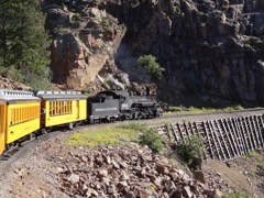 Durango-Silverton Narrow-Gauge RailroadNational Historic Landmark · listed 1966
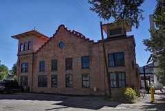 Colorado Ute Power Plantlisted 1983
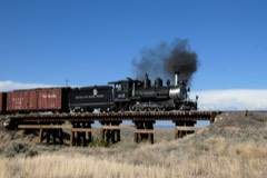 Denver and Rio Grande Western Railroad Locomotive No. 315listed 2008
 Durango High Schoollisted 2001
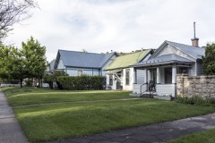 East Third Avenue Historic Residential Districtlisted 1984
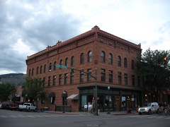 Newman Blocklisted 1979
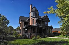 Ochsner Hospitallisted 1995
 Rochester Hotellisted 1996
- Animas Canon Toll Roadlisted 2017
- Animas City Schoollisted 2019
- Main Avenue Historic Districtlisted 1980
- Smiley Junior High Schoollisted 2002
Population over time
2 figuresDurango grew from 16,887 to 19,071 between 2010 and 2020. These are the recorded population figures Wikidata holds for this place, reached through the Geographic Names Information System number this page is keyed on rather than by name, so they belong to this place and not to another of the same name. Most are census counts, but not all are: an early figure may be a founding or settlement estimate, and an estimate published within five years of a census is left out. The change column is computed, and is left blank where more than 20 years separate a figure from the one before it, because a gap that long is not a change between two counts.
| Year | People | Change |
|---|---|---|
| 2010 | 16,887 | |
| 2020 | 19,071 | +2,184 (+13%) |
Topographic sheets covering this place
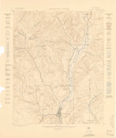
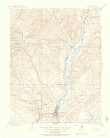
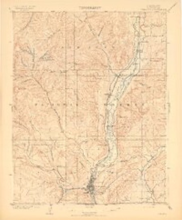
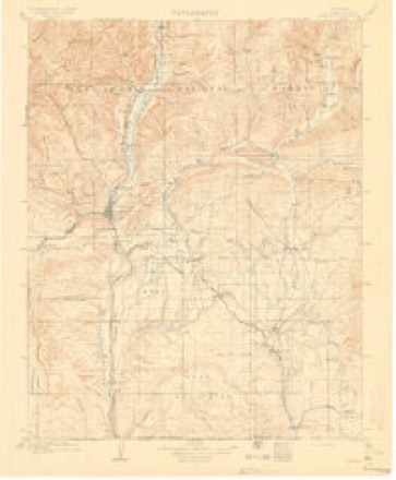
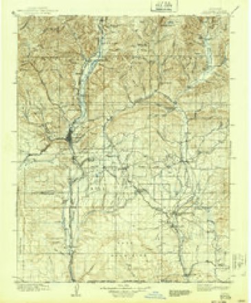
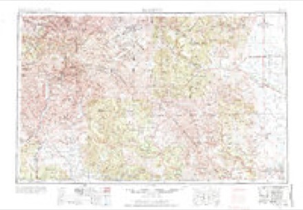
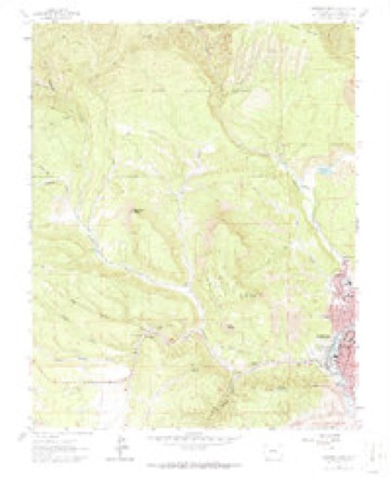
13 surveys from 30 printed sheetsMatched by testing this settlement's coordinate against the published boundary of every sheet in the United States Geological Survey's historical collection. Each opens the scanned sheet at the Survey.
- 1898 USGS Durango quadrangle1:62500
- 1907 USGS Durango quadrangle1:62500, 2 printings
- 1908 USGS Durango quadrangle1:62500, 3 printings
- 1908 USGS Ignacio quadrangle1:125000, 3 printings
- 1924 USGS Ignacio quadrangle1:125000, 4 printings
- 1945 USGS Durango quadrangle1:250000, 3 printings
- 1953 USGS Durango quadrangle1:250000
- 1954 USGS Durango quadrangle1:250000, 2 printings
- 1961 USGS Durango quadrangle1:250000
- 1963 USGS Durango quadrangle1:250000
- 1963 USGS Durango West quadrangle1:24000, 6 printings
- 1966 USGS Durango quadrangle1:250000, 2 printings
- 1983 USGS Durango quadrangle1:100000
What the histories say of this town
30,553 words1 chapter about Durango from the published histories of the county, public domain and reproduced complete.
| Chapter | From | Length |
|---|---|---|
| The Great San Juan of Colorado and New Mexico : a Brief History of the | The Great San Juan of Colorado and New Mexico : a Brief History of the Early Days Supplemented by a Review of the Vast Natural Resources of the San Juan Country : Durango, the Smelter City, Her Financial, Commercial and Industrial Interests, Present and Future (1901) | 30,553 words in 2 parts |
Fires near this place
340 since 1992Regional context, not property-specific evidence. The federal wildfire occurrence database lists 340 fires within 5 miles of Durango between 1992 and 2020, burning about 770 acres in total. 82 started naturally. 5 were recorded as arson. Distance is straight-line from the map coordinates, so a fire counted here may appear on a neighbouring settlement's page as well.
| Reported cause | Fires |
|---|---|
| Missing data/not specified/undetermined | 201 |
| Natural | 82 |
| Recreation and ceremony | 20 |
| Debris and open burning | 12 |
| Smoking | 9 |
| Railroad operations and maintenance | 6 |
| Arson/incendiarism | 5 |
| Equipment and vehicle use | 2 |
| Misuse of fire by a minor | 1 |
| Other causes | 1 |
| Fireworks | 1 |
The most recent of them, most recent first, with the day each was reported and the service that recorded it.
| Date | Cause | Size | Reported by | Name on the report |
|---|---|---|---|---|
| 9 September 2020 | Missing data/not specified/undetermined | under an acre | Durango Fire Rescue Authority | N/A |
| 8 September 2020 | Natural | under an acre | La Plata County | THREE SPRINGS |
| 7 September 2018 | Missing data/not specified/undetermined | under an acre | Durango Fire Rescue Authority | UNKNOWN |
| 6 September 2018 | Natural | under an acre | Durango Fire Rescue Authority | UNKNOWN |
| 6 September 2013 | Missing data/not specified/undetermined | under an acre | Durango Fire Rescue Authority | UNKNOWN |
| 5 September 2017 | Missing data/not specified/undetermined | under an acre | Durango Fire Rescue Authority | UNKNOWN |
| 5 September 2016 | Missing data/not specified/undetermined | under an acre | Durango Fire Rescue Authority | UNKNOWN |
| 30 September 2013 | Missing data/not specified/undetermined | under an acre | Durango Fire Rescue Authority | UNKNOWN |
Settlements close enough to share some of these fires:
Mines and quarries near this place
10 of 48 shownRegional context, not property-specific evidence. The federal mineral resources record lists 48 workings within 5 miles of Durango: 42 past producers, 5 occurrences, 1 producer. 1 still produces. What was taken out: Gold, Sand and Gravel, Construction, Silver, Uranium. Distance is straight-line from the map coordinates, so a quarry counted here may appear on a neighbouring settlement's page as well.
| Where | Site | Commodity | Status | Recorded |
|---|---|---|---|---|
| Bell Quarry | Calcium | Past Producer | ||
| Hazel Mine Group | Silver, Tellurium, Gold | Past Producer | ||
| Miller Mtn. | Lead | Past Producer | ||
| Schafer Ranch Deposit | Thorium, Titanium, Metal | Occurrence | Thorite | |
| Unknown | Clay | Past Producer | ||
| Durango Mill | Uranium, Vanadium | Past Producer | ||
| Unknown | Volcanic Materials | Occurrence | ||
| Unknown | Volcanic Materials | Occurrence | Ash | |
| V.C.A. Mill | Uranium, Vanadium | Past Producer | ||
| Uranium Enterprise Inc. | Uranium | Past Producer |
Storms near this place
60 of 104 shownRegional context, not property-specific evidence. The National Weather Service names Durango in 104 storm reports between 1996 and 2025: 36 flash flood, 26 heavy rain, 12 hail, 8 lightning. The reports record 2 deaths and 3 injuries. Each account below is quoted exactly as the forecast office filed it, from the NOAA Storm Events Database, and each date opens the federal record of that event.
| When | Event | Place named | Harm | What the report says |
|---|---|---|---|---|
| June 2020 | Lightning | Durango | 1 killed, 1 hurt | A 65-year-old woman was killed and her friend was injured when struck by lightning while walking in the 200 block of Silver Queen South in the Edgemont subdivision. The lightning bolt first struck a tree and moved laterally to strike the woman. |
| August 1997 | Lightning | Durango | 1 killed | no account filed |
| September 2002 | Flash Flood | Durango | 1 hurt, $100,000 | no account filed |
| July 2005 | Lightning | Durango | 1 hurt | no account filed |
| September 2002 | Flash Flood | Durango | $1,500,000 | no account filed |
| October 2006 | Flash Flood | Durango | $1,000,000 | A persistent fetch of subtropical moisture brought heavy rainfall to La Plata County in southwest Colorado for two consecutive days, October 5th and 6th. The two-day rainfall amounts in the areas of heaviest flooding ranged from 1.99 to 3.51 inches. The first reports of flooding and flash flooding came from the La Plata County Sheriff's office at 1530 MST on Friday October 6th, when flooding had occurred along County Road 250 north of Durango and also near Vallecito Reservoir. In the community of North Vallecito, a 44 foot self contained RV, a cabin, and a shed were carried by the flood waters down Vallecito Creek and totally destroyed, with pieces ending up in Vallecito Reservoir. Part of a garage and two snowmobiles were swept away by flood waters and an unattended SUV was swept into the current but later pulled to high ground. Vallecito Creek carved out a new 4 to 5 foot channel in North Vallecito in the back yards of residences, with the new channel adjacent to the back decks of some homes. An enormous amount of landscape was destroyed in Vallecito and North Vallecito. Dikes and levees built in 1970 around Vallecito Creek were initially breeched at several points around 2215 MST on 10-6-06 and were subsequently destroyed. Flood waters came up to the foundation of houses, and left at least 18 houses surrounded by water. Law enforcement and other emergency service providers evacuated residents of Vallecito and North Vallecito, mostly prior to the dike and levee failures. An underground telephone cable in North Vallecito became exposed and severed by logs in the flood waters, eliminating phone service to homes and businesses around Vallecito Reservoir. Flooding also occurred along Bolteus Creek. Roads were flooded at various locations in La Plata County with fast moving water generally 6 to 18 inches deep. Several landslides were also reported, some of which closed down the Durango-Silverton Narrow Gauge Railroad due to debris on the tracks. |
| July 2002 | Flash Flood | Durango | $400,000 | no account filed |
| August 2002 | Flash Flood | Durango | $400,000 | no account filed |
| September 2002 | Flash Flood | Durango | $100,000 | no account filed |
| September 2013 | Flash Flood | Durango | $50,000 | Mud flows and water up to a foot deep closed County Road 250. Flood waters also ran into some homes in the area. |
| July 1996 | Flash Flood | Durango | $50,000 | no account filed |
| August 2002 | Flash Flood | Durango | $40,000 | no account filed |
| July 2002 | Thunderstorm Wind | Durango | $30,000 | no account filed |
| October 2004 | Tornado (F1) | Durango | $25,000 | no account filed |
| September 2013 | Hail | Durango | $20,000 | Hail up to the size of golf balls accumulated 8 inches deep along County Road 240. A number of vehicles sustained damage and some windows were broken. |
| August 2002 | Flash Flood | Durango | $20,000 | no account filed |
| August 2013 | Thunderstorm Wind | Durango | $10,000 | Several large trees were blown down across the Durango area. |
| July 2003 | Lightning | Durango | $10,000 | no account filed |
| August 2003 | Flash Flood | Durango | $10,000 | no account filed |
| August 2003 | Flash Flood | Durango | $10,000 | no account filed |
| July 2003 | Flash Flood | Durango | $10,000 | no account filed |
| September 1998 | Heavy Rain | Durango | $6,000 | no account filed |
| September 2005 | Hail | Durango | $5,000 | no account filed |
| July 2003 | Lightning | Durango | $5,000 | no account filed |
| July 2003 | Flash Flood | Durango | $5,000 | no account filed |
| September 1997 | Flash Flood | Durango | $4,000 | no account filed |
| September 2005 | Hail | Durango | $3,000 | no account filed |
| September 2005 | Hail | Durango | $2,000 | no account filed |
| August 1999 | Lightning | Durango | $2,000 | no account filed |
| August 1999 | Flash Flood | Durango | $2,000 | no account filed |
| September 2022 | Flood | Durango | $1,000 | Minor street flooding occurred at the intersection of Main Ave and 32nd Street in Durango as a result of heavy rain from showers. A few rocks were in the road. |
| August 1999 | Flash Flood | Durango | $1,000 | no account filed |
| July 1998 | Lightning | Durango | $1,000 | no account filed |
| August 2016 | Debris Flow | Durango | $500 | The hill leading up to Fort Lewis College was temporarily closed due to mud and debris which flowed across the road. |
| September 2005 | Hail | Durango | $500 | no account filed |
| August 1999 | Thunderstorm Wind | Durango | $500 | no account filed |
| August 2022 | Debris Flow | Durango | $250 | Minor debris flows occurred north of Durango off of Highway 550 as a result of heavy rain from thunderstorms. |
| October 2025 | Debris Flow | Durango | - | Heavy rain resulted in a rockslide on County Road 250 around 430 MST. |
| May 2023 | Flood | Durango | - | Warm temperatures increased snowmelt and caused flooding at the Oxbow Preserve along the Animas River, which led to its closure. |
| May 2021 | Hail | Durango | - | A severe thunderstorm produced large hail measured to be the size of pennies west-southwest of Durango. The hail accumulated on the ground. |
| June 2018 | Debris Flow | Durango | - | Rock and other debris flowed just south of the Iron Horse Inn along and onto Highway 550 as a result of heavy rainfall. CoCoRaHS observers reported 0.70 inches of rain fell with storms near that area. |
| July 2017 | Heavy Rain | Durango | - | Thunderstorms produced 0.75 of an inch of rain within a couple of hours. |
| July 2017 | Heavy Rain | Durango | - | A total of 0.98 of an inch of rain fell within three hours. |
| September 2014 | Flash Flood | Durango | - | Flash flooding and urban flooding from heavy rainfall occurred in Durango and north of town. Highway 550 was closed north of town due to fast flowing water and rockslides over the roadway. Manhole covers where also blown off in portions of the city due to heavy runoff which overwhelmed storm drains. |
| July 2014 | Heavy Rain | Durango | - | A half inch of rain within a half hour produced minor flooding and mudslides onto County Road 204 below the Junction Creek Campground. Culverts under the road became clogged with a large amount of debris. |
| July 2014 | Flash Flood | Durango | - | A large mudslide was reported to be at least 6 inches deep and prevented travel at the intersection of Florida Road and North College Drive. |
| August 2013 | Heavy Rain | Durango | - | Street flooding occurred in many areas within and near Durango. Radar estimates and CoCoRaHS reports indicated localized spots having received between 0.75 and 1.00 of an inch of rain. |
| September 2013 | Flash Flood | Durango | - | Flash floods occurred along Highway 550, several county roads and through much of the Durango city limits. The heaviest flows were reported just north of Durango where Highway 550 was closed for several hours. Vehicles were trapped in the flow over the highway and several rescues were initiated. |
| September 2013 | Hail | Durango | - | Half dollar sized hail was reported in the town of Durango. |
| July 2012 | Funnel Cloud | Durango | - | A funnel cloud was photographed by a pilot who was at the Val Air gliderport. The funnel cloud was located to the west of the gliderport over the Rockridge subdivision and appeared to last around 5 minutes. It extended 300 to 400 feet below the cumulonimbus cloud base. |
| July 2008 | Heavy Rain | Durango | - | Heavy rainfall up to 0.50 inches fell in 10 minutes. Pea-sized hail also occurred. |
| September 2007 | Heavy Rain | Durango | - | Rainfall of .65 inches fell in 10 minutes. |
| September 2007 | Heavy Rain | Durango | - | Rainfall of .50 inches fell in 4 minutes with a total of .60 inches in 6 minutes. |
| December 2007 | Heavy Rain | Durango | - | Persistent rainfall which began on November 30 and continued into December resulted in 24 hour storm totals of 3.51 inches at Lemon Dam and 1.76 inches at a residence 6 miles west of Durango. |
| November 2007 | Heavy Rain | Durango | - | Storm total rainfall of 3.51 inches was measured at Lemon Dam and 1.76 inches was measured at a location 6 miles west of Durango. Both storm totals occurred within a 24 hour period. For a continuation on this event please see the December 2007 Storm Data publication. |
| July 2007 | Heavy Rain | Durango | - | Heavy rain caused mud and debris to flow onto Highway 550 in the 3400 block area on the north side of Durango. |
| September 2007 | Heavy Rain | Durango | - | Rainfall of .56 inches fell in 5 minutes. |
| August 2007 | Heavy Rain | Durango | - | A thunderstorm produced heavy rain and pea size hail in Durango. Minor flooding occurred across Highway 160 and 550 near the Home Depot. |
| October 2006 | Heavy Rain | Durango | - | A 22 hour rainfall total of 1.10 inches was measured. |
| October 2006 | Heavy Rain | Durango | - | A 24 hour rainfall total of 1.61 was measured. |
Nearest settlements
The eight closest, with where each one stands in the county. Distances are straight-line, computed from the Geographic Names Information System coordinates.
| Map | Place | Distance | Sheets |
|---|---|---|---|
| Carbon Junction | 2.7 miles | 20 | |
| Grandview | 4.3 miles | 20 | |
| Piñon Acres | 4.7 miles | 20 | |
| Loma Linda | 5.7 miles | 20 | |
| Griffth (historical) | 6.1 miles | 20 | |
| Falfa | 6.4 miles | 20 | |
| Florida | 7.9 miles | 20 | |
| Trimble | 8.1 miles | 29 |
Elsewhere
Matched on this settlement's Geographic Names Information System number rather than its name, so it cannot be a different place of the same name in another state.
| Wikipedia article on Durango | An encyclopaedic summary. Its text is share-alike, so it is linked here rather than copied. |
| Wikidata item Q1012665 | The structured record the population and elevation above come from. Public domain (CC0). |
Provenance
This settlement is recorded in the Geographic Names Information System as feature 202983. The sheet list is computed by point-in-boundary test against the United States Geological Survey's historical topographic inventory. Both are works of the United States government and carry no copyright under 17 U.S.C. 105.
Wildfire. Short, Karen C. 2022. Spatial wildfire occurrence data for the United States, 1992-2020 [FPA_FOD_20221014]. 6th Edition. Fort Collins, CO: Forest Service Research Data Archive. https://doi.org/10.2737/RDS-2013-0009.6 Collected with United States Government funding and usable without additional permissions or fees.
Mines and quarries. USGS Mineral Resources Data System (MRDS) https://mrdata.usgs.gov/mrds/ A work of the United States government, no copyright under 17 U.S.C. 105.
Storms. NOAA National Centers for Environmental Information, Storm Events Database https://www.ncei.noaa.gov/stormevents/ A work of the United States government, no copyright under 17 U.S.C. 105. Narratives are quoted verbatim from the National Weather Service report and are not edited or summarised.