 Block
From the record
45 National Register listings published here, 1 of them a National Historic Landmark.
Sources: the county history on the Internet Archive · the National Register database, National Park Service
132 topographic sheets cover 33 settlements here, and 45 properties are on the National Register of Historic Places.
45 National Register listings published here, 1 of them a National Historic Landmark.
Sources: the county history on the Internet Archive · the National Register database, National Park Service
Every property in this county listed on the National Register of Historic Places, with the year it was listed and the federal nomination document.
| Photograph | Property | Type | Listed | Reference |
|---|---|---|---|---|
| Animas Canon Toll Road | structure | 2017 | 100000787 | |
| Animas Canon Toll Road | structure | 2017 | 100000787 | |
| Animas Canon Toll Road | structure | 2017 | 100000787 | |
| Animas Canon Toll Road | structure | 2017 | 100000787 | |
| Animas Canon Toll Road | structure | 2017 | 100000787 | |
| Animas Canon Toll Road | structure | 2017 | 100000787 | |
| Animas Canon Toll Road | structure | 2017 | 100000787 | |
| Animas Canon Toll Road | structure | 2017 | 100000787 | |
| Animas Canon Toll Road | structure | 2017 | 100000787 | |
| Animas Canon Toll Road | structure | 2017 | 100000787 | |
| Animas Canon Toll Road | structure | 2017 | 100000787 | |
| Animas Canon Toll Road | structure | 2017 | 100000787 | |
| Animas Canon Toll Road | structure | 2017 | 100000787 | |
| Animas Canon Toll Road | structure | 2017 | 100000787 | |
| Animas Canon Toll Road | structure | 2017 | 100000787 | |
| Animas Canon Toll Road | structure | 2017 | 100000787 | |
| Animas Canon Toll Road | structure | 2017 | 100000787 | |
| Animas Canon Toll Road | structure | 2017 | 100000787 | |
| Animas Canon Toll Road | structure | 2017 | 100000787 | |
| Animas Canon Toll Road | structure | 2017 | 100000787 | |
| Animas Canon Toll Road | structure | 2017 | 100000787 | |
| Animas Canon Toll Road | structure | 2017 | 100000787 | |
| Animas Canon Toll Road | structure | 2017 | 100000787 | |
| Animas Canon Toll Road | structure | 2017 | 100000787 | |
| Animas Canon Toll Road | structure | 2017 | 100000787 | |
| Animas Canon Toll Road | structure | 2017 | 100000787 | |
| Animas Canon Toll Road | structure | 2017 | 100000787 | |
| Animas Canon Toll Road | structure | 2017 | 100000787 | |
| Animas Canon Toll Road | structure | 2017 | 100000787 | |
| Animas Canon Toll Road | structure | 2017 | 100000787 | |
| Animas Canon Toll Road | structure | 2017 | 100000787 | |
| Animas Canon Toll Road | structure | 2017 | 100000787 | |
| Animas Canon Toll Road | structure | 2017 | 100000787 | |
| Animas Canon Toll Road | structure | 2017 | 100000787 | |
| Animas City School | building | 2019 | 100003687 | |
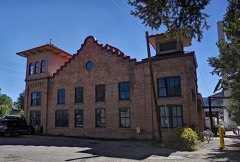 | Colorado Ute Power Plant | building | 1983 | 83001323 |
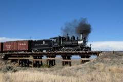 | Denver and Rio Grande Western Railroad Locomotive No. 315 | structure | 2008 | 08001008 |
 | Durango High School | building | 2001 | 01001119 |
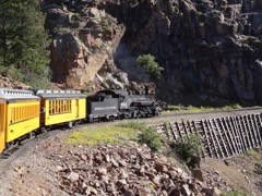 | Durango-Silverton Narrow-Gauge Railroad | district | 1966 | 66000247 |
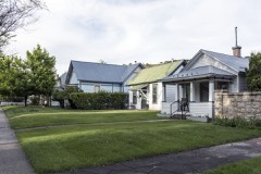 | East Third Avenue Historic Residential District | district | 1984 | 84000024 |
| Main Avenue Historic District | district | 1980 | 80000907 | |
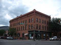 | Newman Block | building | 1979 | 79000613 |
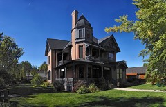 | Ochsner Hospital | building | 1995 | 95000534 |
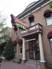 | Rochester Hotel | building | 1996 | 96000200 |
| Smiley Junior High School | building | 2002 | 02001462 |
Every wildfire the federal occurrence database records inside this county: 3,171 of them, burning about 153,997 acres. 1,742 started naturally and 17 were recorded as arson. Each settlement page carries the fires within five miles of it.
| Reported cause | Fires |
|---|---|
| Natural | 1742 |
| Missing data/not specified/undetermined | 834 |
| Recreation and ceremony | 244 |
| Debris and open burning | 147 |
| Smoking | 64 |
| Equipment and vehicle use | 47 |
| Railroad operations and maintenance | 42 |
| Misuse of fire by a minor | 23 |
| Arson/incendiarism | 17 |
| Fireworks | 6 |
| Power generation/transmission/distribution | 3 |
| Other causes | 1 |
| Firearms and explosives use | 1 |
The five largest, by the area the report gives. None of them was recorded as arson.
| Date | Cause | Size | Reported by | Name on the report |
|---|---|---|---|---|
| 9 June 2002 | Missing data/not specified/undetermined | 73,121 acres | San Juan National Forest | MISSIONARY RIDGE |
| 1 June 2018 | Missing data/not specified/undetermined | 54,129 acres | San Juan National Forest | 416 |
| 13 July 1994 | Natural | 7,271 acres | Southern Ute Agency | BLACK RIDG |
| 6 July 2003 | Natural | 1,869 acres | San Juan National Forest | BEAR CREEK WFU |
| 8 July 2007 | Natural | 1,550 acres | Southern Ute Agency | BEAR |
| 16 October 2012 | Natural | 1,400 acres | San Juan National Forest | VALLECITO |
| 12 August 2002 | Natural | 1,360 acres | Southern Ute Agency | CHERRY CRE |
| 29 August 2004 | Natural | 1,116 acres | Ute Mountain Ute Agency | WELL FIRE |
Every settlement page carries the fires within five miles of it - see the settlement index below.
The NOAA Storm Events Database holds 257 reports for this county, causing 2 deaths, 3 injuries and about $18,773,750 in recorded property damage. Each settlement page carries the reports that name it.
| Kind of event | Reports |
|---|---|
| Flash Flood | 64 |
| Heavy Rain | 59 |
| Hail | 40 |
| Thunderstorm Wind | 32 |
| Lightning | 14 |
| Debris Flow | 13 |
| Funnel Cloud | 12 |
| Wildfire | 10 |
| Flood | 7 |
| Tornado | 5 |
| Dust Devil | 1 |
The most serious of them, by death, then injury, then recorded damage. The accounts are quoted exactly as the forecast office filed them.
| When | Event | Place named | Harm | What the report says |
|---|---|---|---|---|
| June 2020 | Lightning | Durango | 1 killed, 1 hurt | A 65-year-old woman was killed and her friend was injured when struck by lightning while walking in the 200 block of Silver Queen South in the Edgemont subdivision. The lightning bolt first struck a tree and moved laterally to strike the woman. |
| August 1997 | Lightning | Durango | 1 killed | no account filed |
| September 2002 | Flash Flood | Durango | 1 hurt, $100,000 | no account filed |
| July 2005 | Lightning | Durango | 1 hurt | no account filed |
| July 2002 | Wildfire | Hermosa | $8,000,000 | no account filed |
| July 2002 | Wildfire | Hermosa | $2,500,000 | no account filed |
| July 2018 | Flash Flood | Rockwood | $2,000,000 | Major flooding, mud and rockslides occurred in the Animas Valley along the Colorado Highway 550 corridor between mile markers 33 and 37. Fast moving flood waters and debris flowed in excess of 6 feet deep in places. About 6 feet of debris blocked Highway 550. The highway was closed for approximately 4.5 hours for debris cleanup. The flood waters and debris also flowed across the Durango and Silverton Narrow Gauge Railroad tracks which lead the train to stop and, as a result of the closure of the highway, about 800 passengers were stranded north of Durango. A section of the railroad track was heavily damaged. Significant damage occurred in the Whispering Pines and Pine Acres subdivisions where flash flood waters flowed. The flash flood waters and debris also traveled across a section of County Road 250 and caused widespread damage at the Durango North/Riverside KOA campground. Radar estimated half an inch to an inch of rain fell within a short period of time in the general area of the flash flooding. |
| September 2002 | Flash Flood | Durango | $1,500,000 | no account filed |
| October 2006 | Flash Flood | Durango | $1,000,000 | A persistent fetch of subtropical moisture brought heavy rainfall to La Plata County in southwest Colorado for two consecutive days, October 5th and 6th. The two-day rainfall amounts in the areas of heaviest flooding ranged from 1.99 to 3.51 inches. The first reports of flooding and flash flooding came from the La Plata County Sheriff's office at 1530 MST on Friday October 6th, when flooding had occurred along County Road 250 north of Durango and also near Vallecito Reservoir. In the community of North Vallecito, a 44 foot self contained RV, a cabin, and a shed were carried by the flood waters down Vallecito Creek and totally destroyed, with pieces ending up in Vallecito Reservoir. Part of a garage and two snowmobiles were swept away by flood waters and an unattended SUV was swept into the current but later pulled to high ground. Vallecito Creek carved out a new 4 to 5 foot channel in North Vallecito in the back yards of residences, with the new channel adjacent to the back decks of some homes. An enormous amount of landscape was destroyed in Vallecito and North Vallecito. Dikes and levees built in 1970 around Vallecito Creek were initially breeched at several points around 2215 MST on 10-6-06 and were subsequently destroyed. Flood waters came up to the foundation of houses, and left at least 18 houses surrounded by water. Law enforcement and other emergency service providers evacuated residents of Vallecito and North Vallecito, mostly prior to the dike and levee failures. An underground telephone cable in North Vallecito became exposed and severed by logs in the flood waters, eliminating phone service to homes and businesses around Vallecito Reservoir. Flooding also occurred along Bolteus Creek. Roads were flooded at various locations in La Plata County with fast moving water generally 6 to 18 inches deep. Several landslides were also reported, some of which closed down the Durango-Silverton Narrow Gauge Railroad due to debris on the tracks. |
| April 1999 | Thunderstorm Wind | Bayfield | $1,000,000 | no account filed |
| July 2021 | Flash Flood | (Dro)Durango/Laplata | $500,000 | Heavy rain washed out a culvert on La Plata County Road 309A near Durango-La Plata County Airport. The road was closed for several days for repair work. The Durango Airport received 1.34 inches of rain with storms that day. |
| July 2002 | Flash Flood | Durango | $400,000 | no account filed |
| August 2002 | Flash Flood | Durango | $400,000 | no account filed |
| July 2021 | Flash Flood | (Dro)Durango/Laplata | $250,000 | Heavy rains washed out much of Shooter Lane near La Plata County Road 307 and also knocked down trees and fences along the road. The trees were 16 inches in diameter. Residents could hear Salt Creek roaring and estimated that the water was 10 feet deep compared to the normal 1 foot depth. Cattle got out as a result of the downed fences. |
| July 2018 | Flash Flood | Rockwood | $200,000 | Heavy rainfall resulted in flash flooding and mudslides over the eastern portion of the 416 fire burn scar. Radar indicated rainfall rates of up to an inch within 15 minutes from the storms. The intense rainfall only lasted 10 to 20 minutes before flash flooding and debris flows started on the east side of the fire. Rain gauges in the area measured 0.30 to 0.75 of an inch of rain. Mud, rocks and other debris flowed over five sections of Colorado Highway 550 and over one section of County Road 250, which resulted in temporary road closures. Three houses in a nearby subdivision were hit and damaged by a debris flow. The KOA campground along the Animas River was completely inundated. 140 to 200 people were evacuated. Numerous structures at the campground, including trailers, cabins, the clubhouse, laundry house and pool facilities incurred damage from the debris flow. The train tracks for the Durango and Silverton Narrow Gauge Railroad were covered by debris in about five places and the train had to stop above the first debris flow area on it's return trip to Durango. As a result, 450 people had to be evacuated by bus back to Durango. After this occurred, the bus slid off the road because of the mud and the people on the bus had to be evacuated for a second time. |
| September 2002 | Flash Flood | Durango | $100,000 | no account filed |
| September 2024 | Thunderstorm Wind | (Dro)Durango/Laplata | $50,000 | A severe thunderstorm moved through 8 miles west of Ignacio and tracked to the northeast at 30 mph. Path and time was estimated based on the Severe Thunderstorm Warning issued. Thunderstorm wind damage occurred with downed trees, a bent electric pole and a twisted power pole. Property damage occurred in which an RV camper was smashed in half from the downed trees. Uncertain if this was tornado or straight line wind/downburst damage but leaning downburst winds. |
| July 2021 | Flash Flood | (Dro)Durango/Laplata | $50,000 | County Road 310 southwest of the Durango-La Plata County Airport sustained damage from heavy rains and was temporarily closed. The extent of the damage is unknown. |
| September 2013 | Flash Flood | Durango | $50,000 | Mud flows and water up to a foot deep closed County Road 250. Flood waters also ran into some homes in the area. |
| August 1999 | Tornado (F1) | Marvel | $50,000 | no account filed |
| July 1996 | Flash Flood | Durango | $50,000 | no account filed |
| August 2013 | Thunderstorm Wind | Vallecito | $40,000 | Thunderstorm winds estimated near 60 mph caused damage to boat docks on the southern end of Vallecito Reservoir. A number of boats were also damaged by the 5 to 6 foot waves which crashed into the docks. |
| August 2002 | Flash Flood | Durango | $40,000 | no account filed |
| September 2013 | Flash Flood | Vallecito | $30,000 | Flash flooding led to mud flows and water over six inches deep across sections of County Road 240 near Lemon Dam. Significant road damage occurred to a 200 yard section of the paved road. |
| September 2013 | Flash Flood | Trimble | $30,000 | County Roads 240 and 247 were over-topped by fast moving water up to two feet deep. Considerable damage occurred to County Road 240. |
| October 2011 | Lightning | Vallecito | $30,000 | Lightning struck a communications tower near the 8000 foot level on Grassy Mountain between Vallecito and the Forest Lakes subdivision. The communications tower and nearby facilities were heavily damaged. |
| July 2002 | Thunderstorm Wind | Durango | $30,000 | no account filed |
| June 2022 | Flash Flood | Bayfield | $25,000 | Five homes were flooded with water, mud and debris after 2 to 3 inches of rain overwhelmed the culvert system. Over a foot of water was estimated to be in a basement in a home on Lupine Drive. Homes near the intersection of Mesa Avenue and Mustang Street had 4 feet of water close to cresting in their area. The neighboring portion of Colorado Highway 160 had some road debris as a result of the heavy rain. |
| September 2013 | Hail | Trimble | $25,000 | Large hail dented vehicles, broke windows, and caused other damage. |
| October 2004 | Tornado (F1) | Durango | $25,000 | no account filed |
| July 2018 | Flash Flood | Trimble | $20,000 | A 4 to 5 foot wall of water and debris flowed down Tripp Creek Gulch and across the yards of several homes along Tripp Creek Road at about 20 mph and spread out as it crossed County Road 203. Traffic across County Road 203 was temporarily restricted to one lane before the debris was cleared. Radar estimated three quarters of an inch to over an inch of rain fell within a short period of time. |
| September 2013 | Hail | Vallecito | $20,000 | Large hail accumulated to between 3 and 12 inches deep between Durango and Vallecito. The large hail damaged a number of vehicles. |
| September 2013 | Hail | Durango | $20,000 | Hail up to the size of golf balls accumulated 8 inches deep along County Road 240. A number of vehicles sustained damage and some windows were broken. |
| October 2011 | Lightning | Bayfield | $20,000 | Lightning struck the Tri-State Generation and Transmission substation in Bayfield, damaging the station's electronics. This resulted in a power outage that lasted nearly an hour for over 10,500 residents in eastern La Plata County and Archuleta County. |
| April 2005 | Flash Flood | Bayfield | $20,000 | no account filed |
| August 2002 | Flash Flood | Durango | $20,000 | no account filed |
| September 1997 | Flash Flood | Hermosa | $15,000 | no account filed |
| July 2014 | Thunderstorm Wind | Rockwood | $10,000 | Vehicles and trailers were damaged from strong thunderstorm microburst at a residence in the community of Rockwood. One trailer was lifted about 10 feet off the ground by the strong winds. A house and other buildings about 100 yards away from the impacted vehicles were not damaged. |
| August 2013 | Thunderstorm Wind | Durango | $10,000 | Several large trees were blown down across the Durango area. |
| July 2003 | Lightning | Durango | $10,000 | no account filed |
| August 2003 | Flash Flood | Durango | $10,000 | no account filed |
| August 2003 | Flash Flood | Durango | $10,000 | no account filed |
| July 2003 | Thunderstorm Wind | Ignacio | $10,000 | no account filed |
| July 2003 | Flash Flood | Durango | $10,000 | no account filed |
| June 1997 | Tornado (F1) | Ignacio | $10,000 | no account filed |
| September 1997 | Heavy Rain | Tacoma | $10,000 | no account filed |
| August 1997 | Lightning | Rockwood | $10,000 | no account filed |
| September 1997 | Flash Flood | Falfa | $8,000 | no account filed |
| August 2010 | Lightning | Trimble | $7,000 | Lightning from an early morning thunderstorm struck the roof of a house in the Durango Hills subdivision. Only moderate damage was reported by the resulting fire. |
| September 1998 | Heavy Rain | Durango | $6,000 | no account filed |
| September 2005 | Hail | Durango | $5,000 | no account filed |
| July 2003 | Lightning | Durango | $5,000 | no account filed |
| July 2003 | Flash Flood | Durango | $5,000 | no account filed |
| September 1997 | Flash Flood | Durango | $4,000 | no account filed |
| September 2005 | Hail | Durango | $3,000 | no account filed |
| September 2016 | Thunderstorm Wind | Bondad | $2,000 | Strong thunderstorm winds produced minor damage at a residence. The damage included a large trampoline which was anchored into the ground over a foot deep at all legs and was ripped out and totally demolished. |
| September 2005 | Hail | Durango | $2,000 | no account filed |
| July 2002 | Flood | Ignacio | $2,000 | no account filed |
| August 1999 | Lightning | Durango | $2,000 | no account filed |
| August 1999 | Flash Flood | Durango | $2,000 | no account filed |
The Survey's mineral resources record lists 350 workings inside this county. 5 still produce and 345 are closed or unrecorded. Each settlement page carries the workings within five miles of it.
| Commodity | Workings |
|---|---|
| Gold | 145 |
| Silver | 99 |
| Sand and Gravel, Construction | 56 |
| Gold, Silver | 27 |
| Copper, Lead | 16 |
| Silver, Gold | 16 |
| Copper | 16 |
| Geothermal | 14 |
| Lead, Silver | 9 |
| Copper, Silver | 8 |
| Uranium | 8 |
| Lead, Copper | 7 |
| Lead | 6 |
| Vanadium | 6 |
The least common of them first, because a county's hundredth gravel pit says nothing its first ten did not.
| Where | Site | Commodity | Status | Recorded |
|---|---|---|---|---|
| Aetna Mine | Gold, Silver, Copper, Lead, Bismuth, Manganese, Zinc | Past Producer | Vein | |
| Allard Stock | Copper, Gold, Silver, PGE, Lead | Occurrence | Galena, Pyrite | |
| Aurora Mine | Silver, Gold, Tellurium, Copper | Past Producer | 1882 | |
| Aztec Mine | Gold, Silver, Copper, Lead, Zinc, Manganese, Molybdenum | Past Producer | Vein | |
| Bay City Mine | Gold, Silver, Copper, Lead | Past Producer | 1876, 1918, 1987 | |
| Bell Quarry | Calcium | Past Producer | ||
| Bessie G. Mine | Silver, Gold, Copper, Antimony, Mercury, Zinc, Lead, Tellurium | Past Producer | 1880, 1987 | |
| Bessie Jr, Oroverde | Gold, Silver, Lead | Occurrence | ||
| Black Diamond Mine | Gold, Silver, Copper, Lead, Tellurium | Past Producer | 1895, 1900, 1939 | |
| Black Giant Mine | Copper, Gold, Silver, Lead, Zinc, Manganese | Occurrence | Vein | |
| Camp Bird | Sulfur | Prospect | ||
| Cascade District | Silver, Copper, Lead, Zinc, Gold | Past Producer | 1883, 1925 | |
| Chicago Basin Disseminated Molybdenum Deposit | Molybdenum, Copper, Lead, Zinc, Manganese | Occurrence | Chalcopyrite, Galena, Molybdenite, Pyrite, Sphalerite, Tetrahedrite | |
| Comstock Mine | Gold, Silver, Copper, Lead, Zinc, Tellurium, Bismuth, Antimony | Past Producer | 1873, 1875, 1931 | |
| Copper Hill Mine | Silver, Copper, Platinum, Gold, Palladium | Past Producer | 1902, 1911, 1917 | |
| Cumberland Mine | Gold, Silver, Zinc, Lead, Copper | Past Producer | 1878, 1921 | |
| Daisy-Hibernia Mine | Gold, Silver, Copper, Lead, Zinc, Antimony | Past Producer | 1885, 1895, 1925 | |
| Durango Girl Mine | Silver, Gold, Antimony, Vanadium, Tellurium, Mercury, Copper | Past Producer | 1893, 1939 | |
| Eureka, Whiton | Manganese, Zinc | Prospect | 1919 | |
| Gold King Mill | Silver, Gold, Lead, Zinc | Past Producer | ||
| Gold King-Swamp Angel | Gold, Coal | Past Producer | ||
| Gold King-Swamp Angel Group | Mercury, Copper, Gold | Past Producer | Vein | |
| Gold Nugget Group | Copper, Gold, Tungsten | Past Producer | 1900 | |
| Grizzly King, Bobby, and Lost Claims | Gold, Silver, Copper, Zinc, Lead | Past Producer | 1936 | |
| Hazel Mine Group | Silver, Tellurium, Gold | Past Producer | ||
| Holbrook | Copper, Zinc, Gold, Lead | Past Producer | ||
| Honeydew | Lead, Copper, Gold, Silver, Zinc | Prospect | ||
| Incas Mine | Gold, Silver, Copper, Lead, Zinc, Tellurium | Past Producer | 1904, 1909, 1922 | |
| Iridos | Gold, Mercury | Past Producer | ||
| Iron King | Copper, Lead, Silver, Zinc | Past Producer | ||
| Jennie Lind Mine | Silver, Gold, Lead, Copper, Zinc, Vanadium, Tellurium | Past Producer | 1887, 1892, 1967 | |
| Lady Eleanora | Gold, Silver, Zinc, Copper, Lead | Past Producer | ||
| Lady Eleanora Mine | Gold, Silver, Copper, Lead, Zinc, Antimony | Past Producer | 1882, 1885, 1923 | |
| Lady Maurine | Gold, Silver, Vanadium | Past Producer | ||
| Lucky Discovery | Gold, Zinc, Silver | Past Producer | ||
| Lucky Strike | Gold, Silver, Lead | Past Producer | ||
| Mark Thomas | Gold, Mercury, Platinum | Occurrence | Stream Placer | |
| Mars | Silver, Copper, Gold, Lead | Past Producer | ||
| Mastadon Mine | Silver, Lead, Gold | Occurrence | 1900 | |
| May Day | Gold, Silver, Lead, Zinc | Producer | ||
| May Rose Mine | Gold, Silver, Zinc, Lead, Copper, Tellurium | Past Producer | 1885, 1887, 1921 | |
| Mt. Eolus Mine | Silver, Gold, Copper, Lead, Zinc | Occurrence | Vein | |
| Muldoon Mine | Silver, Gold, Antimony, Arsenic | Past Producer | 1949 | |
| Needle Mountain District | Gold, Silver, Copper, Lead, Manganese, Molybdenum, Uranium, Antimony, Zinc, Bismuth | Past Producer | 1880, 1936 | |
| Neglected Mine | Silver, Gold, Antimony, Tellurium, Mercury, Copper | Past Producer | 1895, 1901, 1949 | |
| Oregon Claims | Molybdenum, Lead, Zinc | Occurrence | Vein | |
| Oro Negro Group | Gold, Silver, Zinc | Past Producer | ||
| Puzzle Mine | Gold, Silver, Copper, Lead, Tellurium, Antimony | Past Producer | 1880, 1902, 1930 | |
| Rosenite | Silver, Copper, Gold, Lead, Zinc | Past Producer | ||
| Ruby King Mine | Silver, Gold, Copper, Antimony, Arsenic, Tellurium | Past Producer | 1880, 1882 | |
| Sadie Mine | Gold, Silver, Antimony, Lead, Copper, Tellurium | Past Producer | 1928, 1930 | |
| Sarah G Claims | Silver, Lead, Copper | Producer | Cerargyrite, Chalcopyrite, Galena | |
| Sarah G. Claim | Lead, Copper, Silver, Zinc, Gold | Occurrence | 1953 | |
| Schafer Ranch Deposit | Thorium, Titanium, Metal | Occurrence | Thorite | |
| Sheridan Mine | Copper, Gold, Silver, Lead, Zinc | Occurrence | Vein | |
| Shorty - Pinky Claims | Uranium, Gold, Silver, Lead, Zinc | Occurrence | ||
| Shorty Lode | Vanadium, Uranium, Lead, Zinc, Silver, Gold | Past Producer | Vein | |
| Silver Star | Lead, Silver, Zinc, Gold | Past Producer | ||
| Small Hope Mine | Silver, Gold, Copper, Tellurium | Past Producer | 1887, 1892, 1919 | |
| Small Hope Mine | Silver, Gold, Copper | Producer | Vein | |
| Swamp Copper Deposit | Iron, Copper | Occurrence | Copper | |
| Texas Chief Mine | Copper, Silver, Gold, Lead, Zinc, Antimony | Past Producer | 1885, 1917, 1928 | |
| Tippecanoe Mine | Gold, Silver, Lead, Antimony | Past Producer | 1882, 1918 | |
| Tomahawk Mine | Gold, Silver, Lead, Copper, Zinc, Tellurium, Uranium, Manganese, Antimony | Past Producer | 1892, 1934 | |
| Unknown | Clay | Past Producer | ||
| Waterfall Mine | Copper, Silver, Gold | Occurrence | Chalcopyrite, Gold, Silver | |
| A | Gypsum-Anhydrite, Gold | Occurrence | ||
| American Minerals | Gold, Copper, Lead, Silver, Zinc | Past Producer | ||
| Cherry Creek | Gypsum-Anhydrite, Gold | Occurrence | ||
| Eureka Mine | Gold, Silver, Copper, Lead, Zinc, Manganese | Past Producer | Vein | |
| Flicker Group | Vanadium, Copper, Gold, Silver | Past Producer | ||
| Gold King | Gold, Silver, Lead, Copper, Zinc | Past Producer | ||
| Good Hope | Vanadium, Uranium, Gold, Silver | Past Producer | ||
| Idaho | Gold, Silver, Lead, Copper, Zinc | Past Producer | ||
| Jenny Lind | Gold, Zinc, Lead, Silver | Past Producer | ||
| Little Jim Mine | Silver, Gold, Copper, Lead, Zinc, Manganese | Past Producer | Vein | |
| Mason Milling & Mining | Gold, Copper, Lead, Silver | Past Producer | ||
| Mineral Wonder Mine | Silver, Gold, Lead, Copper, Arsenic, Antimony | Past Producer | 1880, 1885, 1922 | |
| Silver Nugget, Lions Den | Silver, Gold, Lead | Occurrence | Chalcopyrite, Galena, Pyrite | |
| Silver Reef Group | Gold, Copper, Lead, Silver | Prospect | ||
| Snowstrom Mine | Gold, Silver, Arsenic, Antimony | Past Producer | 1878, 1888 | |
| Southern Boy & Girl | Gold, Copper, Lead, Silver, Zinc | Past Producer | ||
| Unknown | Volcanic Materials | Occurrence | Ash | |
| Unknown | Volcanic Materials | Occurrence | ||
| Unnamed Prospect | Zinc, Lead, Silver, Copper, Gold | Occurrence | Vein | |
| Babcock Peak Magnetite | Iron | Past Producer | ||
| Babcock Peak Magnetite Deposit | Iron | Occurrence | Replacement | |
| Bay City Mine | Gold, Silver, Copper | Past Producer | ||
| Good Hope-Nevada Group | Uranium, Vanadium | Past Producer | Carnotite, Roscoelite | |
| John Graves Manganese Prospect | Manganese, Iron | Prospect | ||
| Semanda Mining Property | Uranium, Vanadium | Prospect | 1954 | |
| Tripp Gulch Mine | Uranium, Vanadium | Occurrence | ||
| Boren Gulch Group | Gold, Silver, Copper, Lead, Zinc | Past Producer | 1920 | |
| Jennie Hayes Mine | Gold, Silver, Copper, Lead, Zinc | Occurrence | Vein | |
| Silver State Smelting & Refining C | Gold, Copper, Lead, Zinc | Past Producer | ||
| Apache Mine | Silver, Gold, Copper, Lead, Zinc | Past Producer | Vein | |
| Black Horse Mine | Gold, Silver, Copper, Lead, Zinc | Occurrence | Vein | |
| Cason Manganese Prospect | Manganese | Occurrence | Vein | |
| Columbus Mine | Silver, Gold, Copper, Lead, Tellurium | Past Producer | 1895, 1913 | |
| Eureka-Bulldozer Mine | Silver, Gold, Lead, Copper, Tellurium | Past Producer | 1882, 1914 | |
| Little Nona Mine | Gold, Silver, Lead, Copper, Manganese | Past Producer | Vein | |
| Lucky Four Mine | Silver, Gold, Lead, Copper, Zinc | Past Producer | 1907, 1914 | |
| Mountain Lily Mine | Silver, Gold, Tellurium | Past Producer | 1895, 1942 | |
| Pittsburg Mine | Silver, Gold, Lead, Copper, Zinc | Past Producer | Vein | |
| Southern Boy Mine | Silver, Gold, Copper, Lead, Tellurium | Past Producer | 1891, 1924 | |
| Western Belle Mine | Gold, Silver, Tellurium | Past Producer | 1882, 1885, 1942 | |
| Atom Claims 1-9 | Uranium, Vanadium | Past Producer | ||
| Durango Mill | Uranium, Vanadium | Past Producer | ||
| Escalante | Lead, Copper | Past Producer | ||
| Lightner Creek Group | Uranium, Vanadium | Past Producer | ||
| Miller Mtn. | Lead | Past Producer | ||
| Nevada & Good Hope | Uranium, Vanadium | Past Producer | ||
| V.C.A. Mill | Uranium, Vanadium | Past Producer | ||
| Brooklyn Group | Gold, Silver, Lead, Copper | Past Producer | 1916 | |
| Good Hope Group | Uranium | Occurrence | Roscoelite | |
| Grassy Hills | Gold, Copper, Silver | Past Producer | ||
| La Plata | Gold, Copper, Silver | Prospect | ||
| May Rose Group | Gold, Copper, Silver | Past Producer | ||
| Puzzle | Gold, Copper, Silver | Past Producer | ||
| Ruby | Gold, Copper, Silver | Past Producer | ||
| Texarado Oil, Uranium Co. | Uranium | Past Producer | ||
| Texas Chief | Gold, Copper, Silver | Past Producer | ||
| Unknown | Gold, Copper, Silver | Past Producer | ||
| Uranium Enterprise Inc. | Uranium | Past Producer | ||
| Blackhawk | Gold, Lead, Silver | Past Producer | ||
| Bonnie Girl | Gold, Lead, Silver | Past Producer | ||
| Brawner Tunnel & Mill | Gold, Lead, Silver | Past Producer | ||
| Farmer Boy | Gold, Lead, Silver | Past Producer | ||
| Golden Girl | Gold, Lead, Silver | Past Producer | ||
| Lucky Four | Gold, Lead, Silver | Past Producer | ||
| Pat Lode | Gold, Lead, Silver | Past Producer | ||
| Western Belle | Gold, Lead, Silver | Past Producer | ||
| Western View Mng Group | Gold, Lead, Silver | Past Producer | ||
| Chattanooga Hot Spring | Geothermal | Unknown | ||
| Dunton Hot Spring | Geothermal | Unknown | ||
| Eoff Artesian Well | Geothermal | Unknown | ||
| Geyser Warm Spring | Geothermal | Unknown | ||
| Pagosa Springs | Geothermal | Unknown | ||
| Paradise Warm Spring | Geothermal | Unknown | ||
| Piedra River Hot Springs | Geothermal | Unknown | ||
| Pinkerton Hot Springs | Geothermal | Unknown | ||
| Railroad Spring | Geothermal | Unknown | ||
| Rainbow Hot Spring | Geothermal | Unknown | ||
| Rico Drill Hole Springs | Geothermal | Unknown | ||
| Stratten Warm Spring | Geothermal | Unknown | ||
| Trimble Hot Springs | Geothermal | Unknown | ||
| Tripp Hot Spring | Geothermal | Unknown | ||
| (Facility) Omaha-Grant Smelter | Copper | Plant | ||
| Bitteroot Mine | Silver, Copper | Past Producer | 1925 | |
| Bonnie Girl Mine | Gold, Silver, Copper | Past Producer | 1895, 1919 | |
| Castle Rock Springs Claim | Copper, Gold | Occurrence | 1833 | |
| Copper Age | Copper | Past Producer | ||
| Emerald Lake Mine | Gold, Silver, Copper, Lead | Occurrence | 1901 | |
| Jumbo | Silver, Copper, Lead | Past Producer | ||
| Jumbo-Morovoratz Mine | Silver, Gold, Copper, Lead | Past Producer | 1875, 1932 | |
| Little Kate Mine | Gold, Silver, Copper | Past Producer | 1892, 1895, 1900 | |
| Silver Star Extension Mine | Silver, Copper | Past Producer | 1925 | |
| Unnamed Prospect | Silver, Copper | Occurrence | Vein | |
| Wyatt Myers Group | Gold, Copper | Past Producer | ||
| Tomahawk Group | Gold, Silver | Past Producer | ||
| Animas Aggregate Pit | Sand and Gravel, Construction | Past Producer | ||
| Bob's Excavation | Sand and Gravel, Construction | Past Producer | ||
| Burnett Construction Pit | Sand and Gravel, Construction | Producer | ||
| Gravel Pit | Sand and Gravel, Construction | Past Producer | ||
| Gravel Pit | Sand and Gravel, Construction | Past Producer | ||
| Gravel Pit | Sand and Gravel, Construction | Past Producer | ||
| Gravel Pit | Sand and Gravel, Construction | Past Producer | ||
| Gravel Pit | Sand and Gravel, Construction | Past Producer | ||
| Gravel Pit | Sand and Gravel, Construction | Past Producer | ||
| Gravel Pit | Sand and Gravel, Construction | Past Producer | ||
| Gravel Pit | Sand and Gravel, Construction | Past Producer | ||
| Gravel Pit | Sand and Gravel, Construction | Past Producer | ||
| Gravel Pit | Sand and Gravel, Construction | Past Producer | ||
| Gravel Pit | Sand and Gravel, Construction | Past Producer | ||
| Gravel Pit | Sand and Gravel, Construction | Past Producer | ||
| Gravel Pit | Sand and Gravel, Construction | Past Producer | ||
| Gravel Pit | Sand and Gravel, Construction | Past Producer | ||
| Gravel Pit | Sand and Gravel, Construction | Past Producer | ||
| Gravel Pit | Sand and Gravel, Construction | Past Producer | ||
| Gravel Pit | Sand and Gravel, Construction | Past Producer | ||
| Gravel Pit | Sand and Gravel, Construction | Past Producer | ||
| Gravel Pit | Sand and Gravel, Construction | Past Producer | ||
| Gravel Pit | Sand and Gravel, Construction | Past Producer | ||
| Gravel Pit | Sand and Gravel, Construction | Past Producer | ||
| Gravel Pit | Sand and Gravel, Construction | Past Producer | ||
| Gravel Pit | Sand and Gravel, Construction | Past Producer | ||
| Gravel Pit | Sand and Gravel, Construction | Past Producer | ||
| Gravel Pit | Sand and Gravel, Construction | Past Producer | ||
| Gravel Pit | Sand and Gravel, Construction | Past Producer | ||
| Gravel Pit | Sand and Gravel, Construction | Past Producer | ||
| Gravel Pit | Sand and Gravel, Construction | Past Producer | ||
| Gravel Pit | Sand and Gravel, Construction | Past Producer | ||
| Gravel Pit | Sand and Gravel, Construction | Past Producer | ||
| Gravel Pit | Sand and Gravel, Construction | Past Producer | ||
| Gravel Pit | Sand and Gravel, Construction | Past Producer | ||
| Gravel Pit | Sand and Gravel, Construction | Past Producer | ||
| Gravel Pit | Sand and Gravel, Construction | Past Producer | ||
| Gravel Pit | Sand and Gravel, Construction | Past Producer | ||
| Gravel Pit | Sand and Gravel, Construction | Past Producer | ||
| Gravel Pit | Sand and Gravel, Construction | Past Producer | ||
| H. & H. Mining Co. | Gold, Sand and Gravel, Construction | Past Producer | ||
| Lemon Pit | Sand and Gravel, Construction | Past Producer | ||
| Morse Sand & Gravel | Sand and Gravel, Construction | Past Producer | ||
| Quarry | Sand and Gravel, Construction | Past Producer | ||
| Quarry | Sand and Gravel, Construction | Past Producer | ||
| Siegrist Pit | Sand and Gravel, Construction | Past Producer | ||
| Unknown | Sand and Gravel, Construction | Occurrence | Sand and Gravel | |
| Unknown | Sand and Gravel, Construction | Occurrence | Sand and Gravel | |
| Unknown | Sand and Gravel, Construction | Occurrence | Sand and Gravel | |
| Unknown | Sand and Gravel, Construction | Occurrence | Sand and Gravel | |
| Unknown | Sand and Gravel, Construction | Occurrence | Sand and Gravel | |
| Unknown | Sand and Gravel, Construction | Occurrence | Gravel | |
| Unknown | Sand and Gravel, Construction | Occurrence | Gravel | |
| Unknown | Sand and Gravel, Construction | Occurrence | Sand | |
| Unknown | Sand and Gravel, Construction | Occurrence | Sedimentary | |
| Unknown | Sand and Gravel, Construction | Occurrence | Gravel | |
| (Facility) Cumberland Mill | Gold, Silver | Past Producer | ||
| Aetna | Silver | Past Producer | ||
| Animas River Placers | Silver, Gold | Past Producer | ||
| Ashland-Ten Broek | Gold, Silver | Past Producer | ||
| Black Diamond Tunnel | Silver | Past Producer | ||
| Boren Ck Shaft | Gold, Silver | Occurrence | ||
| Boston | Silver | Past Producer | ||
| Brooklyn | Gold, Silver | Past Producer | ||
| Buffalo-Bristol Claims | Gold, Silver | Past Producer | ||
| Bull-Dover Et Al Claims | Silver | Past Producer | ||
| Castle #2 | Silver | Past Producer | ||
| Castle #4 | Silver | Past Producer | ||
| Champion | Gold, Silver | Past Producer | ||
| Champion Gold, Inc. | Gold, Silver | Past Producer | ||
| Checkmaker | Silver | Past Producer | ||
| City Mine | Silver | Past Producer | ||
| Comstock | Gold, Silver | Past Producer | ||
| Cunningham | Silver | Past Producer | ||
| Cunningham Tunnel | Gold, Silver | Past Producer | ||
| Daisy-Hibernia Group | Gold, Silver | Past Producer | ||
| Dr. Bell Group | Silver | Past Producer | ||
| Dunn | Silver | Past Producer | ||
| E.A.K. | Gold, Silver | Past Producer | ||
| Eagle Pass | Gold, Silver | Past Producer | ||
| Esmerelda | Silver, Gold | Past Producer | ||
| Eureka-Bulldozer | Gold, Silver | Prospect | ||
| Excelsior | Silver | Past Producer | ||
| Farmers | Silver | Past Producer | ||
| Fraction | Gold, Silver | Past Producer | ||
| Ft. Lewis | Silver | Past Producer | ||
| George A. Greenwood Group | Silver | Past Producer | ||
| Gold Wedge | Gold, Silver | Past Producer | ||
| Graves | Silver | Past Producer | ||
| Graves | Gold, Silver | Past Producer | ||
| Greenhorn | Silver | Prospect | ||
| Ground Hog Tunnel | Silver, Gold | Past Producer | ||
| Gustas Brothers | Silver | Past Producer | ||
| Havert | Silver | Past Producer | ||
| Hidden Treasure | Gold, Silver | Past Producer | ||
| Homestake Tunnel | Silver | Past Producer | ||
| Inca Claims | Gold, Silver | Past Producer | ||
| Jewell Group | Silver | Past Producer | ||
| Junction Creek Claims | Silver | Past Producer | ||
| Kennebec | Gold, Silver | Past Producer | ||
| Klondyke | Silver | Past Producer | ||
| Lewis Creek Adit | Gold, Silver | Occurrence | ||
| Little Jim | Gold, Silver | Past Producer | ||
| Little Nona | Gold, Silver | Past Producer | ||
| Lost Mine | Gold, Silver | Past Producer | 1931, 1933 | |
| Marcy-Shenandoah | Gold, Silver | Past Producer | ||
| Mary S. | Gold, Silver | Past Producer | ||
| Mastadon Group | Gold, Silver | Past Producer | ||
| Mccartney Group | Gold, Silver | Past Producer | ||
| Mineral Wonder | Silver | Prospect | ||
| Monarch | Gold, Silver | Past Producer | ||
| Monarch Mine | Gold, Silver | Past Producer | 1895, 1933 | |
| Moonlight | Gold, Silver | Prospect | ||
| Morovoratz | Gold, Silver | Past Producer | ||
| Mountain Lily | Gold, Silver | Past Producer | ||
| Muldoon | Silver | Past Producer | ||
| Oro Fino | Gold, Silver | Past Producer | ||
| Ruby King | Silver, Gold | Past Producer | ||
| Ruby Tunnel | Gold, Silver | Past Producer | ||
| Sadie | Gold, Silver | Past Producer | ||
| Saint Paul | Gold, Silver | Past Producer | ||
| Sarah G. Claim | Silver | Past Producer | ||
| Sarah S. | Gold, Silver | Past Producer | ||
| Schroeder Tunnel | Gold, Silver | Past Producer | ||
| Shoo Fly | Gold, Silver | Prospect | ||
| Small Hope | Gold, Silver | Past Producer | ||
| Snowstorm | Gold, Silver | Past Producer | ||
| Southern Cross | Gold, Silver | Past Producer | ||
| Timbrock | Gold, Silver | Past Producer | ||
| Uncle Sam | Silver, Gold | Past Producer | ||
| Unk | Silver | Past Producer | ||
| Unknown | Gold, Silver | Past Producer | ||
| Unknown | Silver | Past Producer | ||
| Unknown | Gold, Silver | Past Producer | ||
| Unknown | Silver | Past Producer | ||
| Unknown | Silver | Past Producer | ||
| Unknown | Silver | Past Producer | ||
| Vallecito Group | Silver | Past Producer | ||
| Valley View | Gold, Silver | Past Producer | ||
| Van Emmett Gold Mining | Gold, Silver | Past Producer | ||
| Victor | Gold, Silver | Prospect | ||
| Wheel of Fortune | Gold, Silver | Occurrence | ||
| Yellow Eye | Gold, Silver | Past Producer | ||
| Bakers Ridge Placer | Gold | Past Producer | 1933, 1938 | |
| Bank Claim | Gold | Occurrence | 1883 | |
| Black Diamond Group | Gold | Past Producer | ||
| Daisy | Gold | Past Producer | ||
| East Mancos River Placers | Gold | Past Producer | ||
| Gold Bar Placer | Gold | Past Producer | Placer | |
| Gold Coin | Gold | Past Producer | ||
| Golden Rose | Gold | Past Producer | ||
| Gracie I Fox | Gold | Past Producer | ||
| Grand View | Gold | Prospect | ||
| J.L. Russell-Jim Smith | Gold | Past Producer | ||
| La Plata River Placers | Gold | Past Producer | 1873 | |
| Last Chance | Gold | Past Producer | ||
| Little Kate | Gold | Past Producer | ||
| Maine | Gold | Past Producer | ||
| Mammoth | Gold | Prospect | ||
| Montezuma Gold Reef Group | Gold | Past Producer | ||
| Morning Glory | Gold | Past Producer | ||
| Morning Glory | Gold | Past Producer | ||
| Morning Star | Gold | Past Producer | ||
| Ohio-Indiana | Gold | Past Producer | ||
| P.W.Pittman Group | Gold | Past Producer | ||
| Painter Placer Claims | Gold | Past Producer | ||
| Peerless | Gold | Past Producer | ||
| Pine River | Gold | Past Producer | ||
| Pittsburg | Gold | Past Producer | ||
| Poverty Hill | Gold | Past Producer | ||
| Pro Patria Tunnel | Gold | Past Producer | ||
| R.M. Campbell Group | Gold | Past Producer | ||
| Revenue Tunnel | Gold | Past Producer | ||
| Shamrock | Gold | Occurrence | ||
| Slipper Tunnel | Gold | Past Producer | ||
| Suene De Oro | Gold | Past Producer | ||
| Sunshine | Gold | Past Producer | ||
| Supreme | Gold | Past Producer | ||
| Suprise Tunnel | Gold | Past Producer | ||
| Thomas Property | Gold | Past Producer | ||
| Triangle | Gold | Past Producer | ||
| Unknown | Gold | Past Producer | ||
| Unknown | Gold | Past Producer | ||
| Unknown | Gold | Past Producer | ||
| Unknown | Gold | Past Producer | ||
| Unknown | Gold | Past Producer | ||
| Unknown | Gold | Past Producer | ||
| Unknown | Gold | Past Producer | ||
| Victory | Gold | Past Producer | ||
| White Diamond Tunnel | Gold | Past Producer |
The part of each published history that is about one town: 1 chapter, each reproduced complete.
| Town | Chapter | From | Length |
|---|---|---|---|
| Durango | The Great San Juan of Colorado and New Mexico : a Brief History of the | The Great San Juan of Colorado and New Mexico : a Brief History of the Early Days Supplemented by a Review of the Vast Natural Resources of the San Juan Country : Durango, the Smelter City, Her Financial, Commercial and Industrial Interests, Present and Future (1901) | 30,553 words in 2 parts |
Named settlements recorded in the Geographic Names Information System, each with the topographic sheets covering it. Villages, hamlets and abandoned places alike. Each is shown with the nearest named watercourse or landform and the survey quadrangle it falls on.
Bayfield census division · 81122 · Near Arrowhead Hill · Bayfield quadrangle
20 sheets, 1908 to 1983
Durango Southwest census division · 81303 · Near Little Cow Canyon · Long Mountain quadrangle
19 sheets, 1908 to 1983
Durango Southwest census division · 81326 · Near Spring Gulch · Kline quadrangle
15 sheets, 1913 to 1982
Durango census division · 81301 · In Carbon Junction Canyon · Loma Linda quadrangle
20 sheets, 1908 to 1983
Durango census division · 81301 · Near Crazy Women Gulch · Electra Lake quadrangle
27 sheets, 1898 to 1982
Bayfield census division · 81122 · On Texas Creek · Rules Hill quadrangle
21 sheets, 1908 to 1983
Durango census division · 81301 · On Lightner Creek · Durango West quadrangle
30 sheets, 1898 to 1983
Durango census division · 81303 · Near Long Hollow · Loma Linda quadrangle
20 sheets, 1908 to 1983
Bayfield census division · 81122 · Near Hartman Canyon · Gem Village quadrangle
20 sheets, 1908 to 1983
Durango census division · 81303 · Near Sale Barn Canyon · Loma Linda quadrangle
20 sheets, 1908 to 1983
Durango Southwest census division · 81303 · Loma Linda quadrangle
20 sheets, 1908 to 1983
No longer a settlement
Durango census division · 81301 · Near Tripp Gulch · Hermosa quadrangle
29 sheets, 1898 to 1983
Ignacio census division · 81137 · Near Rattlesnake Hill · Ignacio quadrangle
19 sheets, 1908 to 1983
Ignacio census division · 81137 · In La Boca Canyon · Tiffany quadrangle
19 sheets, 1908 to 1983
Durango census division · 81301 · Near Spencer Gulch · La Plata quadrangle
19 sheets, 1895 to 1982
Durango Southwest census division · 81303 · In La Posta Canyon · Basin Mountain quadrangle
20 sheets, 1908 to 1983
Durango census division · 81301 · Near Crystal Valley · Columbine Pass quadrangle
24 sheets, 1900 to 1982
No longer a settlement
Durango census division · 81301 · Near Little Deadwood Gulch · Hesperus quadrangle
18 sheets, 1895 to 1982
Durango Southwest census division · 81326 · Near Butch Henry Draw · Redmesa quadrangle
15 sheets, 1913 to 1982
Durango census division · 81301 · On Goulding Creek · Hermosa quadrangle
29 sheets, 1898 to 1983
Durango census division · 81301 · On Canyon Creek · Electra Lake quadrangle
27 sheets, 1898 to 1982
Durango census division · 81301 · Near Kroeger Canyon · Hermosa quadrangle
29 sheets, 1898 to 1983
Bayfield census division · 81122 · Near Runlett Park · Granite Peak quadrangle
21 sheets, 1924 to 1983
No longer a settlement
Bayfield census division · 81122 · On Jack Creek · Vallecito Reservoir quadrangle
23 sheets, 1908 to 1983
The vanished settlements of La Plata County: the places named above that are no longer on the map.