 Block
Avon, Connecticut
31 topographic sheets cover this place, the earliest surveyed in 1892 and the latest in 1994. It stands in Avon town. It lies in ZIP code area 06001. It stands on Nod Brook. The Survey maps it on the Avon quadrangle. 18,932 people lived here at the 2020 count. It stands 276 feet above sea level.
On record in Avon
Buildings and businesses the archive holds for this place. Each opens its own page, with the source record it came from.
On the National Register 2 records
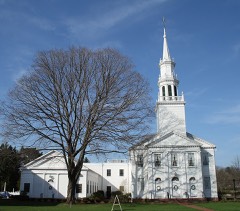 Avon Congregational Churchlisted 1972
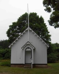 Pine Grove Historic Districtlisted 1980
Population over time
2 figuresAvon grew from 18,098 to 18,932 between 2010 and 2020. These are the recorded population figures Wikidata holds for this place, reached through the Geographic Names Information System number this page is keyed on rather than by name, so they belong to this place and not to another of the same name. Most are census counts, but not all are: an early figure may be a founding or settlement estimate, and an estimate published within five years of a census is left out. The change column is computed, and is left blank where more than 20 years separate a figure from the one before it, because a gap that long is not a change between two counts.
| Year | People | Change |
|---|---|---|
| 2010 | 18,098 | |
| 2020 | 18,932 | +834 (+5%) |
Topographic sheets covering this place
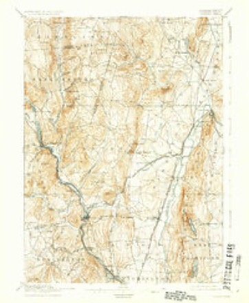
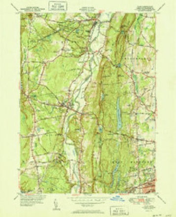
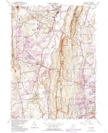
11 surveys from 31 printed sheetsMatched by testing this settlement's coordinate against the published boundary of every sheet in the United States Geological Survey's historical collection. Each opens the scanned sheet at the Survey.
- 1892 USGS Granby quadrangle1:62500, 8 printings
- 1906 USGS Farmington quadrangle1:125000, 2 printings
- 1947 USGS Hartford quadrangle1:250000, 2 printings
- 1948 USGS Hartford quadrangle1:250000, 2 printings
- 1951 USGS Avon quadrangle1:31680, 2 printings
- 1957 USGS Avon quadrangle1:24000, 6 printings
- 1961 USGS Hartford quadrangle1:250000
- 1962 USGS Hartford quadrangle1:250000, 3 printings
- 1965 USGS Hartford quadrangle1:250000, 2 printings
- 1986 USGS Hartford quadrangle1:100000
- 1994 USGS Hartford quadrangle1:100000, 2 printings








In the county-history sources
2,709 words on this townshipThe Memorial History of Hartford County, Connecticut, 1633-1884;, published 1886 names this settlement in its chapter on Avon Town. These are the passages that mention it, exactly as the scans read.
The area of Avon is about thirty-three square miles. A considerable portion is level fertile land in the valley of the Farmington River. This river passes through the town twice, first flowing south along its western boundary, and then, after describing a semicircle in Farmington, re-entering Avon on its eastern side near the base of Talcott Mountain, and passing to the north into the town of Simsbury.
Passage source: The Memorial History of Hartford County, Connecticut, 1633-1884;, published 1886.
The northeastern corner of the town is remarkable for the beauty of its natural scenery. Here is the highest ridge, south of Mount Tom, Massachusetts, of that trap formation which intersects the State from north to south. On its highest point, and within the boundary of Avon, which follows the top of the ridge for five miles, stands the observatory known as Bartlctt's Tower, built in 1867, a short distance from the site of the towers erected by Daniel Wadsworth in 1810 and 1840, whicli were successively destroyed, one by wind and the other by fire. Near by, too, is Mr. Wadsworth's former summer residence, called ]\Ionte Video.i Professor Benjamin Silliman, in his "Tour from Hartford to Quebec," published in 1824, speaks of " the beautiful and grand scenery of Monte Video, which makes this villa, with its surrounding objects, quite without a parallel in America, and probably with few in the world."
Passage source: The Memorial History of Hartford County, Connecticut, 1633-1884;, published 1886.
The history of the community subsequently forming the town of Avon begins with the formation of the parish of Northington (a name contracted from North Farmington). In May, 1746, Preserved Marshall, Daniel Wilcox, Joseph Woodford, Joseph Woodford, Jr., John Woodford, and William Woodford petitioned the General Assembly, representing that they lived in the northern part of Farmington, near the boundary line of Simsbury, and that they attended worship in Simsbury, and wished to be annexed to that society, so that they might ])ay their taxes where they worshipped. This petition was opposed by Farmington, on the ground that it would be l)etter to form a society among themselves, as there were thirty-one families, embracing more than one hundred and sixty souls. This remonstrance was accompanied by a petition for "winter privileges," - that is, the right to hire a minister four months in a year, from December 1 to March 31, with exemption from a like proportion of taxes for the support of preaching in the Farmington society. Neither petition was granted at this time, but at the October session in the same year the petition for winter privileges was renewed and granted. After four winters of these privileges, enjoyed from house to house, it was felt that time had come for a separate religious organization. Accordingly a [)etition to that effect was addressed to the General Assembly at the May session, 1750. The Farmington society declaring its free consent, the petition was granted, and on the 20tli of November of the next year the church was organized. One week later the Rev. Ebenezer Booge was ordained the pastor, and continued in the office
Passage source: The Memorial History of Hartford County, Connecticut, 1633-1884;, published 1886.
Machine-read from a century-old scan, so expect the errors a machine makes: misspelled names, dropped words, stray characters.
Read the whole chapter on Avon Town - it names this place 10 more 10 times.
Fires near this place
36 since 1994Regional context, not property-specific evidence. The federal wildfire occurrence database lists 36 fires within 5 miles of Avon between 1994 and 2020, burning about 105 acres in total. None started naturally. 5 were recorded as arson. Distance is straight-line from the map coordinates, so a fire counted here may appear on a neighbouring settlement's page as well.
| Reported cause | Fires |
|---|---|
| Missing data/not specified/undetermined | 18 |
| Recreation and ceremony | 7 |
| Arson/incendiarism | 5 |
| Debris and open burning | 3 |
| Misuse of fire by a minor | 2 |
| Equipment and vehicle use | 1 |
The most recent of them, most recent first, with the day each was reported and the service that recorded it.
| Date | Cause | Size | Reported by | Name on the report |
|---|---|---|---|---|
| 2 September 2001 | Missing data/not specified/undetermined | 2.0 acres | Connecticut Division of Forestry | not named |
| 9 August 2001 | Missing data/not specified/undetermined | 2.0 acres | Connecticut Division of Forestry | not named |
| 2 August 2001 | Recreation and ceremony | 2.0 acres | Connecticut Division of Forestry | not named |
| 2 August 1997 | Misuse of fire by a minor | under an acre | Connecticut Division of Forestry | not named |
| 25 July 2016 | Missing data/not specified/undetermined | under an acre | Connecticut Division of Forestry | STRATTON BROOK STATE PARK |
| 25 July 2000 | Missing data/not specified/undetermined | under an acre | Connecticut Division of Forestry | not named |
| 16 July 1999 | Missing data/not specified/undetermined | 1.0 acres | Connecticut Division of Forestry | not named |
| 7 June 1999 | Missing data/not specified/undetermined | under an acre | Connecticut Division of Forestry | not named |
Settlements close enough to share some of these fires:
Mines and quarries near this place
10 of 21 shownRegional context, not property-specific evidence. The federal mineral resources record lists 21 workings within 5 miles of Avon: 19 past producers, 1 producer, 1 plant. 2 still produce. What was taken out: Stone, Dimension, Sand and Gravel, Construction, Stone, Crushed/Broken, Flagstone. Distance is straight-line from the map coordinates, so a quarry counted here may appear on a neighbouring settlement's page as well.
| Where | Site | Commodity | Status | Recorded |
|---|---|---|---|---|
| Copper Mine No. Di-008 | Sulfur, Copper | Past Producer | Metamorphosed Sedimentary | |
| Lead Mine | Lead | Past Producer | ||
| Sandstone Quarry | Flagstone | Past Producer | ||
| Sandstone Quarry #Di-012 | Flagstone | Past Producer | ||
| Basalt Rock Quarry No. Di-010 | Stone, Crushed/Broken | Past Producer | Basalt | |
| Basalt Rock Quarry No. Di-011 | Stone, Crushed/Broken | Past Producer | Basalt | |
| Basalt Rock Quarry No. Dj-021 | Stone, Crushed/Broken | Past Producer | Basalt | |
| Lime Quarry | Stone, Crushed/Broken | Past Producer | ||
| Avon Plant | Sand and Gravel, Construction | Plant | ||
| Bradford Estate | Sand and Gravel, Construction | Past Producer |
Storms near this place
17 since 1994Regional context, not property-specific evidence. The National Weather Service names Avon in 17 storm reports between 1994 and 2024: 6 thunderstorm wind, 6 hail, 3 flash flood, 1 tornado. No death or injury is recorded in these reports. Each account below is quoted exactly as the forecast office filed it, from the NOAA Storm Events Database, and each date opens the federal record of that event.
| When | Event | Place named | Harm | What the report says |
|---|---|---|---|---|
| May 1994 | Thunderstorm Wind | Avon | $50,000 | Numerous trees were blown down along a path about one-half mile long by 100 yards wide near Mountain View Road and Route 44. Several autos were damaged by falling trees in the Route 44 plaza. The National Weather Service investigated and determined this to be caused by a straight line wind, or microburst. About 6600 electric utility customers lost power, mostly in the western part of the state, including 2300 in Torrington, 2000 in Simsbury, and 1000 in East Granby. There were numerous reports of small hail across the northern part of Connecticut. |
| August 2021 | Flash Flood | Avon | $18,000 | In Avon, Waterville Road (Route 10 southbound), just south of Route 44, had 5 cars stuck in flash flood waters. Rainfall totals ended up between 5.0 and 5.8 inches in portions of Hartford and Tolland Counties. |
| July 2008 | Thunderstorm Wind | Avon | $15,000 | In Avon, a tree was downed on power lines snapping the utility pole and subsequently landing on a house. In Farmington, trees on Extension Street, Huckleberry Road, Route 4, and in the Unionville section of town were downed by thunderstorm winds. |
| August 2008 | Lightning | Avon | $15,000 | Lightning struck a house on Saddle Crossing causing a fire. |
| July 2009 | Thunderstorm Wind | Avon | $10,000 | Trees on Avon Road were downed by thunderstorm winds. |
| May 2010 | Thunderstorm Wind | Avon | $5,000 | Wires on Arch Road were downed by thunderstorm winds. |
| June 2010 | Thunderstorm Wind | Avon | $5,000 | Trees on Burnham Road were downed by thunderstorm winds. |
| July 2008 | Thunderstorm Wind | Avon | $3,000 | A tree on Huckleberry Road was downed by thunderstorm winds, blocking the road. |
| June 2024 | Flash Flood | Avon | - | In Avon, parts of Rt 44 had flooding with water covering the road. |
| September 2023 | Flash Flood | Avon | - | In Avon, there was significant street flooding on the intersection of Rt 10 and Rt 44. |
| July 2009 | Hail | Avon | - | Penny to quarter size hail fell on the northern side of Avon. |
| June 1994 | Tornado (F0) | Avon | - | Numerous trees were knocked down at their bases intermittently along an easterly track one mile long and 200 yards wide. Along the north flank, trees were snapped off half-way up and some were twisted. National Weather Service investigation determined that an eastward moving microburst was accompanied by a weak tornado that touched down intermittently along its northern flank. The twisted trees displayed evidence of convergence toward a central track. A small gazebo was damaged, but otherwise there was no property damage to houses observed. |
| July 2011 | Hail | Avon | - | no account filed |
| July 2009 | Hail | Avon | - | no account filed |
| May 2004 | Hail | Avon | - | no account filed |
| August 2003 | Hail | Avon | - | no account filed |
| June 2000 | Hail | Avon | - | no account filed |
Nearest settlements
The eight closest, with where each one stands in the county. Distances are straight-line, computed from the Geographic Names Information System coordinates.
| Map | Place | Distance | Sheets |
|---|---|---|---|
| Old Avon Village | 0.2 miles | 31 | |
| Avon Park North | 0.3 miles | 31 | |
| Avon Park South | 0.6 miles | 31 | |
| Alsop Corner | 0.8 miles | 31 | |
| Crowleys Corner | 2.0 miles | 31 | |
| West Avon | 2.2 miles | 31 | |
| Weatogue | 2.3 miles | 31 | |
| Cherry Park | 3.0 miles | 30 |
Elsewhere
Matched on this settlement's Geographic Names Information System number rather than its name, so it cannot be a different place of the same name in another state.
| Wikipedia article on Avon | An encyclopaedic summary. Its text is share-alike, so it is linked here rather than copied. |
| Wikidata item Q791265 | The structured record the population and elevation above come from. Public domain (CC0). |
Provenance
This settlement is recorded in the Geographic Names Information System as feature 205171. The sheet list is computed by point-in-boundary test against the United States Geological Survey's historical topographic inventory. Both are works of the United States government and carry no copyright under 17 U.S.C. 105.
Wildfire. Short, Karen C. 2022. Spatial wildfire occurrence data for the United States, 1992-2020 [FPA_FOD_20221014]. 6th Edition. Fort Collins, CO: Forest Service Research Data Archive. https://doi.org/10.2737/RDS-2013-0009.6 Collected with United States Government funding and usable without additional permissions or fees.
Mines and quarries. USGS Mineral Resources Data System (MRDS) https://mrdata.usgs.gov/mrds/ A work of the United States government, no copyright under 17 U.S.C. 105.
Storms. NOAA National Centers for Environmental Information, Storm Events Database https://www.ncei.noaa.gov/stormevents/ A work of the United States government, no copyright under 17 U.S.C. 105. Narratives are quoted verbatim from the National Weather Service report and are not edited or summarised.