 Block
Canton, Connecticut
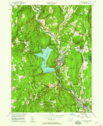
30 topographic sheets cover this place, the earliest surveyed in 1892 and the latest in 1994. It stands in Canton town. It lies in ZIP code area 06019. It lies near Mount Horr. The Survey maps it on the Collinsville quadrangle.
On record in Canton
Buildings and businesses the archive holds for this place. Each opens its own page, with the source record it came from.
On the National Register 2 records
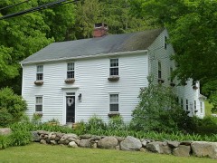 Canton Center Historic Districtlisted 1997
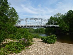 Town Bridgelisted 1999
Topographic sheets covering this place
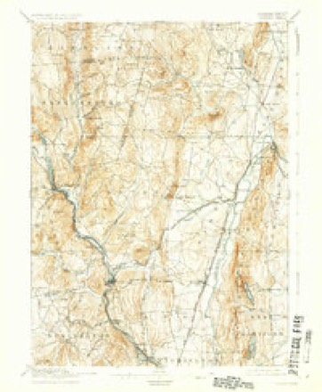
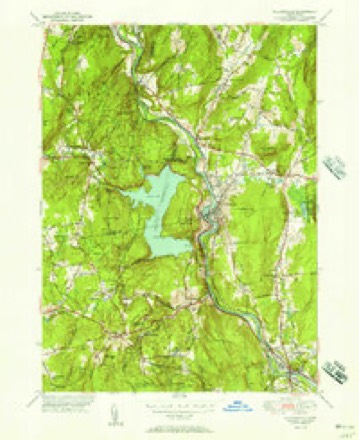
11 surveys from 30 printed sheetsMatched by testing this settlement's coordinate against the published boundary of every sheet in the United States Geological Survey's historical collection. Each opens the scanned sheet at the Survey.
- 1892 USGS Granby quadrangle1:62500, 8 printings
- 1906 USGS Farmington quadrangle1:125000, 2 printings
- 1947 USGS Hartford quadrangle1:250000, 2 printings
- 1948 USGS Hartford quadrangle1:250000, 2 printings
- 1951 USGS Collinsville quadrangle1:31680, 2 printings
- 1956 USGS Collinsville quadrangle1:24000, 5 printings
- 1961 USGS Hartford quadrangle1:250000
- 1962 USGS Hartford quadrangle1:250000, 3 printings
- 1965 USGS Hartford quadrangle1:250000, 2 printings
- 1986 USGS Hartford quadrangle1:100000
- 1994 USGS Hartford quadrangle1:100000, 2 printings








In the county-history sources
3,778 words on this townshipThe Memorial History of Hartford County, Connecticut, 1633-1884;, published 1886 names this settlement in its chapter on Canton Town. These are the passages that mention it, exactly as the scans read.
The surface of the territory is much broken by hills. There are Rocky, Rattlesnake, Onion, Crump's, and Wildcat mountains. The valley of the Farmington River in the southwest part of the town is fertile, and Cherry Brook valley, where Canton Centre lies, is noted for its fine farms, though the most valuable agricultural land in the town limits is said to be in the low plain near the eastern boundary. The great "Jefferson flood" of 1801, which made many changes along the Farmington valley, washed away much of a very valuable tract, called the Hop Yard, that lay between Cherry Brook and Farmington River, and the river at that time took permanent possession of the channel of the stream.
Passage source: The Memorial History of Hartford County, Connecticut, 1633-1884;, published 1886.
Rattlesnake Mountain derives its name from the fact, or tradition, that an early settler, Mrs, Wilcox, while driving home her cows, met near there a very large number of rattlesnakes. She killed forty of them (all full grown) and came unharmed out of the conflict ; but the mountain, by a curious freak of history, takes its title from the defeated forces. Crump's Mountain, one and a half miles north of Canton Centre, is named from Crumpus, a noted Indian who had his wigwam on its summit for many years after the whites came. Indian Hill, near the New Hartford line, was for some time the home of a band of Indians, - a peaceful set who were much troubled by other Indians, that lived in and gave the name to that part of ^ew Hartford known as Satan's
Passage source: The Memorial History of Hartford County, Connecticut, 1633-1884;, published 1886.
The following historical sketches of the first settlers were prepared by the late Ephraim Mills, Esq., and they were published in Phelps's " History of Simsbury, Granby, and Canton," in 1845. They are now revised for this work.
Passage source: The Memorial History of Hartford County, Connecticut, 1633-1884;, published 1886.
Machine-read from a century-old scan, so expect the errors a machine makes: misspelled names, dropped words, stray characters.
Read the whole chapter on Canton Town - it names this place 22 more 22 times.
Fires near this place
28 since 1996Regional context, not property-specific evidence. The federal wildfire occurrence database lists 28 fires within 5 miles of Canton between 1996 and 2020, burning about 84 acres in total. None started naturally. 2 were recorded as arson. Distance is straight-line from the map coordinates, so a fire counted here may appear on a neighbouring settlement's page as well.
| Reported cause | Fires |
|---|---|
| Missing data/not specified/undetermined | 18 |
| Recreation and ceremony | 4 |
| Misuse of fire by a minor | 2 |
| Arson/incendiarism | 2 |
| Equipment and vehicle use | 1 |
| Railroad operations and maintenance | 1 |
The most recent of them, most recent first, with the day each was reported and the service that recorded it.
| Date | Cause | Size | Reported by | Name on the report |
|---|---|---|---|---|
| 23 September 2020 | Missing data/not specified/undetermined | 1.0 acres | Connecticut Division of Forestry | 2 INDIAN HILL ROAD |
| 2 September 2001 | Missing data/not specified/undetermined | 2.0 acres | Connecticut Division of Forestry | not named |
| 24 August 2019 | Missing data/not specified/undetermined | under an acre | Connecticut Division of Forestry | not named |
| 22 August 2020 | Railroad operations and maintenance | under an acre | Connecticut Division of Forestry | 7 RIDGEVIEW TERRANCE |
| 2 August 2001 | Recreation and ceremony | 2.0 acres | Connecticut Division of Forestry | not named |
| 2 August 1997 | Misuse of fire by a minor | under an acre | Connecticut Division of Forestry | not named |
| 25 July 2016 | Missing data/not specified/undetermined | under an acre | Connecticut Division of Forestry | STRATTON BROOK STATE PARK |
| 7 June 1999 | Missing data/not specified/undetermined | under an acre | Connecticut Division of Forestry | not named |
Settlements close enough to share some of these fires:
Mines and quarries near this place
10 of 19 shownRegional context, not property-specific evidence. The federal mineral resources record lists 19 workings within 5 miles of Canton: 16 past producers, 1 prospect, 1 producer, 1 plant. 2 still produce. What was taken out: Sand and Gravel, Construction, Stone, Dimension, Flagstone, Mica. Distance is straight-line from the map coordinates, so a quarry counted here may appear on a neighbouring settlement's page as well.
| Where | Site | Commodity | Status | Recorded |
|---|---|---|---|---|
| Asbestos Mine | Asbestos | Past Producer | ||
| Copper Mine No. Di-008 | Sulfur, Copper | Past Producer | Metamorphosed Sedimentary | |
| Knapp Mica Prospect | Mica, Feldspar | Past Producer | Muscovite, Plagioclase, Quartz | |
| Knapp Mica Prospect | Feldspar, Mica | Prospect | ||
| Lead Mine | Lead | Past Producer | ||
| Soapstone Mine | Talc-Soapstone | Past Producer | ||
| Sandstone Quarry | Flagstone | Past Producer | ||
| Sandstone Quarry #Di-012 | Flagstone | Past Producer | ||
| Millstone Quarry | Stone, Dimension | Past Producer | ||
| Quarry | Stone, Dimension | Past Producer |
Storms near this place
22 since 1994Regional context, not property-specific evidence. The National Weather Service names Canton in 22 storm reports between 1994 and 2025: 14 thunderstorm wind, 6 hail, 1 lightning, 1 flash flood. The reports record 8 injuries. Each account below is quoted exactly as the forecast office filed it, from the NOAA Storm Events Database, and each date opens the federal record of that event.
| When | Event | Place named | Harm | What the report says |
|---|---|---|---|---|
| June 2000 | Thunderstorm Wind | Canton | 8 hurt | no account filed |
| November 2013 | Thunderstorm Wind | Canton | $25,000 | A large tree in Canton, a tree and wires on Lovely Street in Avon, and numerous power lines across southern Hartford were all downed by thunderstorm winds. |
| August 2009 | Thunderstorm Wind | Canton | $20,000 | Numerous trees along Route 179 were downed by thunderstorm winds. |
| May 2018 | Thunderstorm Wind | North Canton | $15,000 | At 3:45 PM EST numerous trees were reported down on Old Farms Road near Tollgale Lane, Holcomb Street at Cardinal Road, and Barndoor Hills Road at Firetown Road. A single tree was down across Richard Road. |
| June 2017 | Thunderstorm Wind | Canton | $10,000 | At 515 PM EST, a tree was down on a car on Notch Road in Simsbury. Also, trees were down on wires on West Mountain Road near Roswell Road. |
| July 2009 | Thunderstorm Wind | Canton | $7,000 | Several trees were downed by thunderstorm winds, including one that blocked Torrington Avenue. |
| July 2021 | Thunderstorm Wind | North Canton | $4,000 | In Canton, a tree was down onto a house on Cherry Brook Road. |
| June 2024 | Thunderstorm Wind | Canton | $3,000 | In Canton, multiple trees were down on wires. |
| April 2017 | Lightning | Canton | $2,500 | At 5:31 PM EST, a house on Trailsend Drive was struck by lightning. |
| April 2021 | Thunderstorm Wind | North Canton | $2,000 | In Simsbury a tree was down on a house on The Butterchurn. |
| July 2002 | Thunderstorm Wind | Canton | $2,000 | no account filed |
| July 2009 | Thunderstorm Wind | Canton | $1,000 | Large limbs were downed by thunderstorm winds. |
| July 2025 | Flash Flood | Canton | - | In Canton, there was water pouring into a basement through a hatchway. |
| June 2007 | Thunderstorm Wind | Canton | - | Several large trees down along Mountain Road. |
| July 1994 | Thunderstorm Wind | Canton | - | Thunderstorms brought strong winds and pea- to dime-size hail. A number of trees were blown down, bring down power lines. |
| July 2009 | Hail | Canton | - | no account filed |
| July 2009 | Hail | Canton | - | no account filed |
| July 2009 | Hail | Canton | - | no account filed |
| July 2008 | Hail | Canton | - | no account filed |
| June 1999 | Thunderstorm Wind | Canton | - | no account filed |
| June 1999 | Hail | Canton | - | no account filed |
| June 1999 | Hail | Canton | - | no account filed |
Nearest settlements
The eight closest, with where each one stands in the county. Distances are straight-line, computed from the Geographic Names Information System coordinates.
| Map | Place | Distance | Sheets |
|---|---|---|---|
| Canton Valley | 0.7 miles | 30 | |
| Silvermine Acres | 0.9 miles | 30 | |
| Cherry Park | 1.0 miles | 30 | |
| Bahre Corner | 1.5 miles | 30 | |
| Crowleys Corner | 1.5 miles | 31 | |
| Collinsville | 1.6 miles | 30 | |
| Huckleberry Hills Trails | 1.9 miles | 30 | |
| Canton Center | 2.5 miles | 30 |
Provenance
This settlement is recorded in the Geographic Names Information System as feature 206028. The sheet list is computed by point-in-boundary test against the United States Geological Survey's historical topographic inventory. Both are works of the United States government and carry no copyright under 17 U.S.C. 105.
Wildfire. Short, Karen C. 2022. Spatial wildfire occurrence data for the United States, 1992-2020 [FPA_FOD_20221014]. 6th Edition. Fort Collins, CO: Forest Service Research Data Archive. https://doi.org/10.2737/RDS-2013-0009.6 Collected with United States Government funding and usable without additional permissions or fees.
Mines and quarries. USGS Mineral Resources Data System (MRDS) https://mrdata.usgs.gov/mrds/ A work of the United States government, no copyright under 17 U.S.C. 105.
Storms. NOAA National Centers for Environmental Information, Storm Events Database https://www.ncei.noaa.gov/stormevents/ A work of the United States government, no copyright under 17 U.S.C. 105. Narratives are quoted verbatim from the National Weather Service report and are not edited or summarised.