 Block
East River, Connecticut
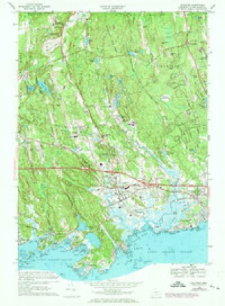
29 topographic sheets cover this place, the earliest surveyed in 1893 and the latest in 1983. It stands in Madison town. It lies in ZIP code area 06443. It lies near Cedar Island. The Survey maps it on the Guilford quadrangle.
On record in East River
Buildings and businesses the archive holds for this place. Each opens its own page, with the source record it came from.
On the National Register within a mile 1 record
The National Register names another town for these. They stand within one mile of this settlement's coordinate.
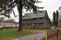 Shelley Houselisted 1989 · 0.7 miles away
Topographic sheets covering this place
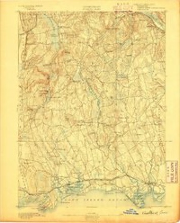
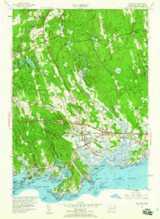
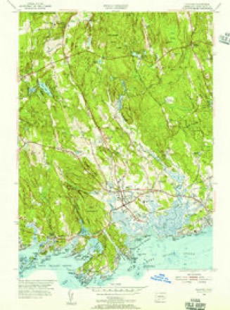
10 surveys from 29 printed sheetsMatched by testing this settlement's coordinate against the published boundary of every sheet in the United States Geological Survey's historical collection. Each opens the scanned sheet at the Survey.
- 1893 USGS Guilford quadrangle1:62500, 8 printings
- 1947 USGS Hartford quadrangle1:250000, 2 printings
- 1948 USGS Hartford quadrangle1:250000, 2 printings
- 1954 USGS Guilford quadrangle1:24000, 3 printings
- 1954 USGS Guilford quadrangle1:31680
- 1961 USGS Hartford quadrangle1:250000
- 1962 USGS Hartford quadrangle1:250000, 3 printings
- 1965 USGS Hartford quadrangle1:250000, 2 printings
- 1968 USGS Guilford quadrangle1:24000, 5 printings
- 1983 USGS New Haven quadrangle1:100000, 2 printings






In the county-history sources
12,265 words on this townshipHistory of New Haven County, Connecticut, published 1892 names this settlement in its chapter on Madison Town. These are the passages that mention it, exactly as the scans read.
The first bridge across the East river was built in 1649; the one across the Hammonassett in 1690. In 1714 the town directed that there should be an open highway to the bridge. The only turnpike in the town, the "Pettipauge and Guilford Pike," surrendered its charter after about sixteen years, and in 1840 the town voted to use it as a highway. The Shore road east has for more than two centuries been the main thoroughfare. Since July, 1852, the town has had the railway facilities afforded by the Shore Line Division of the New York, New Haven & Hartford railroad. Stations are maintained at Madison village and East River. Prior to this the products of the town were shipped from the wharves on the sound or East river, several being in the town. In this period the vessels owned in Madison were valued at more than $50,000. A number were engaged in the white fishing business, which was here first begun in 1798, the fish being used for fertilizing purposes.
Passage source: History of New Haven County, Connecticut, published 1892.
For many years the inhabitants of the town were almost exclusively devoted to agriculture, but later ship building and the timber interests of the town gave employment to many people. In the northern part of the town, which was heavily timbered, large quantities of charcoal were burned. At East River bridge Samuel H. Chittenden had a lumber mill, sash and blind factory, from about 1825 until before the civil war, which were extensively operated, and had the reputation of being one of the best establishments of the kind on the New Haven county coast. The machinery was removed many years ago. Near by Eber S. Hotchkiss built a small sloop, drawing it to the water's edge by oxen. Later he was an extensive builder of vessels in this locality, on the Guilford side. From the East River wharf packets plied to New York regularly. For some years Captain Henry Crittenden commanded one of these vessels, and was the first to bring a cargo of anthracite coal into the town. The shipment was but fifteen tons, but the supply lasted three years. Russell Crampton and Captain Fred Bishop were also sloop owners. Philo Blatchley was one of the last to touch here regularly. Much ship timber was taken from this point, and a limited quantity is still sent forward by rail.
Passage source: History of New Haven County, Connecticut, published 1892.
At East River, Munger & Son are manufacturers of school apparatus. This interest was begun in New Haven by George Munger, who first made liquid slating. In 1868 he removed to Guilford, and was a member of the firm of J. W. Schermerhorn & Co., which there made school apparatus. He located at East River in 1877, and with his son, George B. Munger, established the present business. Well equipped shops are occupied and about a dozen men are engaged in the manufacture of blackboards and blackboard goods. Steam is used as the motive power.
Passage source: History of New Haven County, Connecticut, published 1892.
Machine-read from a century-old scan, so expect the errors a machine makes: misspelled names, dropped words, stray characters.
Read the whole chapter on Madison Town - it names this place 3 more 3 times.
Fires near this place
13 since 1992Regional context, not property-specific evidence. The federal wildfire occurrence database lists 13 fires within 5 miles of East River between 1992 and 2019, burning about 124 acres in total. None started naturally. None was recorded as arson. Distance is straight-line from the map coordinates, so a fire counted here may appear on a neighbouring settlement's page as well.
| Reported cause | Fires |
|---|---|
| Missing data/not specified/undetermined | 6 |
| Misuse of fire by a minor | 3 |
| Recreation and ceremony | 2 |
| Debris and open burning | 2 |
The most recent of them, most recent first, with the day each was reported and the service that recorded it.
| Date | Cause | Size | Reported by | Name on the report |
|---|---|---|---|---|
| 18 September 2017 | Missing data/not specified/undetermined | under an acre | Connecticut Division of Forestry | 216 RIVER RD. |
| 20 August 2016 | Debris and open burning | under an acre | Connecticut Division of Forestry | 116 COW HILL ROAD KILLINGWORTH |
| 12 June 1997 | Misuse of fire by a minor | 3.0 acres | Connecticut Division of Forestry | not named |
| 15 May 1992 | Misuse of fire by a minor | 75 acres | Connecticut Division of Forestry | not named |
| 25 April 2008 | Debris and open burning | 25 acres | Connecticut Division of Forestry | not named |
| 23 April 2008 | Missing data/not specified/undetermined | 4.0 acres | Connecticut Division of Forestry | not named |
| 17 April 2002 | Missing data/not specified/undetermined | 1.5 acres | Connecticut Division of Forestry | not named |
| 14 April 1998 | Misuse of fire by a minor | 2.0 acres | Connecticut Division of Forestry | not named |
Settlements close enough to share some of these fires:
Mines and quarries near this place
7 within 5 milesRegional context, not property-specific evidence. The federal mineral resources record lists 7 workings within 5 miles of East River: 6 past producers, 1 producer. 1 still produces. What was taken out: Granite, Stone, Dimension, Sand and Gravel, Construction. Distance is straight-line from the map coordinates, so a quarry counted here may appear on a neighbouring settlement's page as well.
| Where | Site | Commodity | Status | Recorded |
|---|---|---|---|---|
| Shoreline Washed Sandstone | Sand and Gravel, Construction | Past Producer | ||
| Leete Island Granite Rock Quarry | Stone, Dimension | Past Producer | Unknown | |
| Sachem Head Granite Gneiss Rock Quarry | Stone, Dimension | Past Producer | 1893 | |
| Leete Island Quarry | Granite | Past Producer | ||
| Sacher Hill Sachem Head ? Quarry | Granite | Past Producer | ||
| Stony Creek Pink Granite Quarry | Granite | Past Producer | Granite | |
| Stony Creek Pink Granite Quarry | Granite | Producer |
Storms near this place
6 since 2009Regional context, not property-specific evidence. The National Weather Service names East River in 6 storm reports between 2009 and 2019: 4 thunderstorm wind, 1 tornado, 1 flash flood. No death or injury is recorded in these reports. Each account below is quoted exactly as the forecast office filed it, from the NOAA Storm Events Database, and each date opens the federal record of that event.
| When | Event | Place named | Harm | What the report says |
|---|---|---|---|---|
| July 2009 | Tornado (EF1) | East River | $10,000 | The tornado cut a narrow, discontinuous swath of damage nearly 3 miles long from near Copse Trail east-southeast to Hull Road between Acorn and Saxon Roads. Downed trees on Wellsweep Drive were strewn in multiple directions in a pattern indicative of a tornado. Snapped and uprooted hardwood trees were also indicative of maximum wind speeds around 100 mph, or EF1 on the Enhanced Fujita Scale. |
| August 2019 | Thunderstorm Wind | East River | $3,000 | Large tree branch and powerlines down along Route 1 near Longshore Road. |
| July 2013 | Thunderstorm Wind | East River | $2,000 | Numerous trees were reported down along Neck Road. |
| August 2019 | Thunderstorm Wind | East River | $1,000 | A tree branch down along Route 1 before Horseshoe Road. Branch is blocking the road. |
| August 2019 | Thunderstorm Wind | East River | $1,000 | Pine tree snapped on East River Road near the Madison town line. |
| August 2014 | Flash Flood | East River | - | Route 1 was closed under the railroad tressel in Madison due to flooding. |
Nearest settlements
The eight closest, with where each one stands in the county. Distances are straight-line, computed from the Geographic Names Information System coordinates.
| Map | Place | Distance | Sheets |
|---|---|---|---|
| Madison | 2.2 miles | 27 | |
| Flanders (historical) | 2.2 miles | 27 | |
| Guilford | 2.3 miles | 29 | |
| Middle Beach | 2.6 miles | 27 | |
| Podunk | 2.6 miles | 29 | |
| Seaview Beach | 3.0 miles | 27 | |
| Nut Plains | 3.6 miles | 29 | |
| Leetes Island | 4.2 miles | 29 |
Provenance
This settlement is recorded in the Geographic Names Information System as feature 206845. The sheet list is computed by point-in-boundary test against the United States Geological Survey's historical topographic inventory. Both are works of the United States government and carry no copyright under 17 U.S.C. 105.
Wildfire. Short, Karen C. 2022. Spatial wildfire occurrence data for the United States, 1992-2020 [FPA_FOD_20221014]. 6th Edition. Fort Collins, CO: Forest Service Research Data Archive. https://doi.org/10.2737/RDS-2013-0009.6 Collected with United States Government funding and usable without additional permissions or fees.
Mines and quarries. USGS Mineral Resources Data System (MRDS) https://mrdata.usgs.gov/mrds/ A work of the United States government, no copyright under 17 U.S.C. 105.
Storms. NOAA National Centers for Environmental Information, Storm Events Database https://www.ncei.noaa.gov/stormevents/ A work of the United States government, no copyright under 17 U.S.C. 105. Narratives are quoted verbatim from the National Weather Service report and are not edited or summarised.