 Block
Fenwick, Connecticut
30 topographic sheets cover this place, the earliest surveyed in 1893 and the latest in 1983. It stands in Old Saybrook town. It lies in ZIP code area 06475. It stands on Beamon Creek. The Survey maps it on the Old Lyme quadrangle. 53 people lived here at the 2020 count. It stands 30 feet above sea level.
On record in Fenwick
Buildings and businesses the archive holds for this place. Each opens its own page, with the source record it came from.
On the National Register 1 record
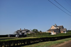 Fenwick Historic Districtlisted 1995
Population over time
3 figuresFenwick grew from 52 to 53 between 2000 and 2020. These are the recorded population figures Wikidata holds for this place, reached through the Geographic Names Information System number this page is keyed on rather than by name, so they belong to this place and not to another of the same name. Most are census counts, but not all are: an early figure may be a founding or settlement estimate, and an estimate published within five years of a census is left out. The change column is computed, and is left blank where more than 20 years separate a figure from the one before it, because a gap that long is not a change between two counts.
| Year | People | Change |
|---|---|---|
| 2000 | 52 | |
| 2010 | 43 | -9 (-17%) |
| 2020 | 53 | +10 (+23%) |
Topographic sheets covering this place
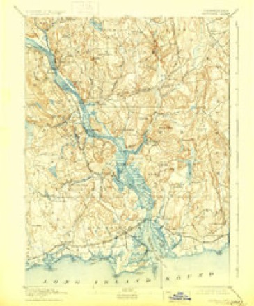
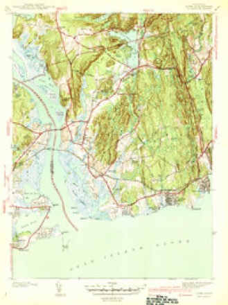
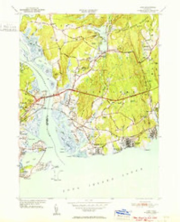
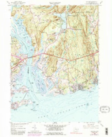
10 surveys from 30 printed sheetsMatched by testing this settlement's coordinate against the published boundary of every sheet in the United States Geological Survey's historical collection. Each opens the scanned sheet at the Survey.
- 1893 USGS Saybrook quadrangle1:62500, 8 printings
- 1941 USGS Lyme quadrangle1:31680, 2 printings
- 1947 USGS Hartford quadrangle1:250000, 2 printings
- 1948 USGS Hartford quadrangle1:250000, 2 printings
- 1951 USGS Lyme quadrangle1:31680, 2 printings
- 1958 USGS Old Lyme quadrangle1:24000, 6 printings
- 1961 USGS Hartford quadrangle1:250000
- 1962 USGS Hartford quadrangle1:250000, 3 printings
- 1965 USGS Hartford quadrangle1:250000, 2 printings
- 1983 USGS New Haven quadrangle1:100000, 2 printings






In the county-history sources
72,125 words on this townshipHistory of Middlesex County, Connecticut, with Biographical Sketches of Its Prominent Men, published 1884 names this settlement in its chapter on Old Saybrook Town. These are the passages that mention it, exactly as the scans read.
Colonel George Fenwick was probably the only one of the patentees who ever visited the colony. He arrived in May 1636 - a few months after Gardiner took possession. How long he remained is not known, but he probably returned to England in the autumn of the same year. In July 1639, Colonel Fenwick came again to Connecticut, this time accompanied by his wife and family. They came in one of two ships that arrived at Quinnipiac, direct from England, after a passage of seven weeks. These are said to have been the first European vessels that ever anchored in New Haven Harbor.
Passage source: History of Middlesex County, Connecticut, with Biographical Sketches of Its Prominent Men, published 1884.
We catch only an occasional glimpse of the daily life of the Fenwicks, at the fort, and that through contemporary correspondence. Thomas Lechford, a London attorney, who lived in Boston for a few years, and returned to England in 1641, tells, in his " Newes from New England," that Master " Fenwike, with the Lady Boteler," were living at the mouth of Connecticut River, "in a fair house and well fortified; and on one side Master Higginson, a young man, their chaplain." "The Lady was lately admitted of Master Hooker's church [in Hartford] and thereupon their child was baptized." The exact date of Colonel Fenwick's departure for England has not been ascertained.
Passage source: History of Middlesex County, Connecticut, with Biographical Sketches of Its Prominent Men, published 1884.
Mr. Fenwick was present with the magistrates- at the sessions of the court, October 8th and 9th, and one writer* thinks that he sailed for England soon after, as among the proceedings of the General Court, December ist 164s, was an Older that "the noats that should be sent by ech vessell to Seabrooke shalbe sent in to Mr. Hopkins as Mr. F. assigne." If so, he again returned to Connecticut, as he was present among the magistrates at . the session of May 20th 1647, and that of May i8th 1648, the latter being the last time that his name appears among the list of magistrates. At the session of the court, December 6th 1648, the treasurer was directed to send out warrants to the constables of each town upon the river for the gathering of corn for Mr. Fenwick, in payment of the " Fortt Rate," by the ist of March, " that it may be in readines, when called for, according to order and covenant, by Mr. Fenvvicke or his assigne." In the proceedings of the court in 1652, Capt. Cullick is spoken of as Mr. Fenwick's agent, so that there is nothing between 1648 and 1652, in the Colonial Records, by which to determine the date of his departure. Tradition finds the cause of his return in the death of his wife, and the necessity of finding a more suitable home for his infant children. Tradition has given 1648 as the date of the death of Lady Fenwick, but J. Hammond Trumbull says that " his wife's death must have occurred shortly after the birth of her daughter, Dorothy, November 4th
Passage source: History of Middlesex County, Connecticut, with Biographical Sketches of Its Prominent Men, published 1884.
Machine-read from a century-old scan, so expect the errors a machine makes: misspelled names, dropped words, stray characters.
Read the whole chapter on Old Saybrook Town - it names this place 33 more 33 times.
Fires near this place
78 since 1993Regional context, not property-specific evidence. The federal wildfire occurrence database lists 78 fires within 5 miles of Fenwick between 1993 and 2020, burning about 70 acres in total. None started naturally. 1 was recorded as arson. Distance is straight-line from the map coordinates, so a fire counted here may appear on a neighbouring settlement's page as well.
| Reported cause | Fires |
|---|---|
| Missing data/not specified/undetermined | 44 |
| Recreation and ceremony | 14 |
| Debris and open burning | 12 |
| Smoking | 5 |
| Power generation/transmission/distribution | 1 |
| Misuse of fire by a minor | 1 |
| Arson/incendiarism | 1 |
The most recent of them, most recent first, with the day each was reported and the service that recorded it.
| Date | Cause | Size | Reported by | Name on the report |
|---|---|---|---|---|
| 9 September 2007 | Recreation and ceremony | 5.0 acres | Connecticut Division of Forestry | not named |
| 27 September 2007 | Missing data/not specified/undetermined | under an acre | Connecticut Division of Forestry | not named |
| 21 September 2015 | Missing data/not specified/undetermined | under an acre | Connecticut Division of Forestry | not named |
| 16 September 2007 | Missing data/not specified/undetermined | under an acre | Connecticut Division of Forestry | not named |
| 15 September 2015 | Recreation and ceremony | 1.0 acres | Connecticut Division of Forestry | not named |
| 12 September 2007 | Missing data/not specified/undetermined | under an acre | Connecticut Division of Forestry | not named |
| 1 September 2010 | Missing data/not specified/undetermined | 1.0 acres | Connecticut Division of Forestry | not named |
| 5 August 2020 | Debris and open burning | under an acre | Connecticut Division of Forestry | PETTIPAUG ROAD/ESSEX ROAD |
Settlements close enough to share some of these fires:
Mines and quarries near this place
3 within 5 milesRegional context, not property-specific evidence. The federal mineral resources record lists 3 workings within 5 miles of Fenwick: 3 past producers. None of them still produces. What was taken out: Granite, Stone. Distance is straight-line from the map coordinates, so a quarry counted here may appear on a neighbouring settlement's page as well.
| Where | Site | Commodity | Status | Recorded |
|---|---|---|---|---|
| Biotite Granite Gneiss Quarries No. Bk-005 | Stone | Past Producer | ||
| Granite Gneiss Quarries | Granite | Past Producer | ||
| Maccurdy Quarry | Granite | Past Producer |
Nearest settlements
The eight closest, with where each one stands in the county. Distances are straight-line, computed from the Geographic Names Information System coordinates.
| Map | Place | Distance | Sheets |
|---|---|---|---|
| Fenwood | 0.7 miles | 30 | |
| Saybrook Point | 0.9 miles | 30 | |
| Knollwood | 1.6 miles | 28 | |
| Old Saybrook | 1.9 miles | 28 | |
| Cornfield Park | 1.9 miles | 28 | |
| Plum Bank Beach | 2.1 miles | 28 | |
| Saybrook Manor | 2.6 miles | 28 | |
| Floral Park | 3.5 miles | 30 |
Elsewhere
Matched on this settlement's Geographic Names Information System number rather than its name, so it cannot be a different place of the same name in another state.
| Wikipedia article on Fenwick | An encyclopaedic summary. Its text is share-alike, so it is linked here rather than copied. |
| Wikidata item Q753238 | The structured record the population and elevation above come from. Public domain (CC0). |
Provenance
This settlement is recorded in the Geographic Names Information System as feature 207058. The sheet list is computed by point-in-boundary test against the United States Geological Survey's historical topographic inventory. Both are works of the United States government and carry no copyright under 17 U.S.C. 105.
Wildfire. Short, Karen C. 2022. Spatial wildfire occurrence data for the United States, 1992-2020 [FPA_FOD_20221014]. 6th Edition. Fort Collins, CO: Forest Service Research Data Archive. https://doi.org/10.2737/RDS-2013-0009.6 Collected with United States Government funding and usable without additional permissions or fees.
Mines and quarries. USGS Mineral Resources Data System (MRDS) https://mrdata.usgs.gov/mrds/ A work of the United States government, no copyright under 17 U.S.C. 105.