 Block
Old Saybrook, Connecticut
28 topographic sheets cover this place, the earliest surveyed in 1893 and the latest in 1983. It stands in Old Saybrook town. It lies in ZIP code area 06475. It lies near Dunks Island. The Survey maps it on the Essex quadrangle. 10,481 people lived here at the 2020 count. It stands 34 feet above sea level.
On record in Old Saybrook
Buildings and businesses the archive holds for this place. Each opens its own page, with the source record it came from.
On the National Register 12 of 20 shown
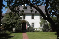 Black Horse Tavernlisted 1978
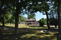 Elisha Bushnell Houselisted 1978
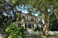 Bushnell-Dickinson Houselisted 2013
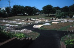 Connecticut Valley Railroad Roundhouse and Turntable Sitelisted 1994
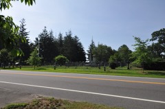 Cypress Cemeterylisted 2018
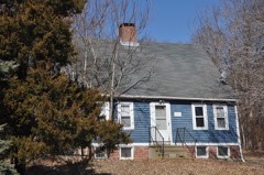 Jedidiah Dudley Houselisted 1982
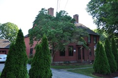 Samuel Eliot Houselisted 1972
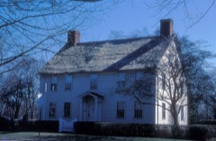 Gen. William Hart Houselisted 1972
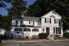 James Pharmacylisted 1994
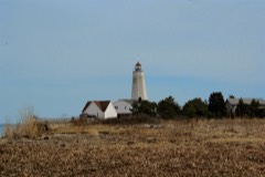 Lynde Point Lighthouselisted 1990
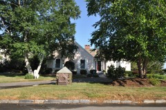 North Cove Historic Districtlisted 1994
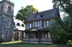 Old Saybrook South Greenlisted 1976
Population over time
2 figuresOld Saybrook grew from 10,242 to 10,481 between 2010 and 2020. These are the recorded population figures Wikidata holds for this place, reached through the Geographic Names Information System number this page is keyed on rather than by name, so they belong to this place and not to another of the same name. Most are census counts, but not all are: an early figure may be a founding or settlement estimate, and an estimate published within five years of a census is left out. The change column is computed, and is left blank where more than 20 years separate a figure from the one before it, because a gap that long is not a change between two counts.
| Year | People | Change |
|---|---|---|
| 2010 | 10,242 | |
| 2020 | 10,481 | +239 (+2%) |
Topographic sheets covering this place
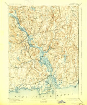
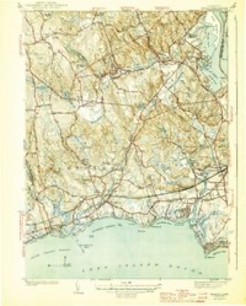
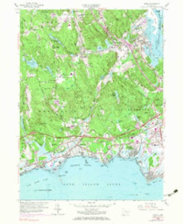
9 surveys from 28 printed sheetsMatched by testing this settlement's coordinate against the published boundary of every sheet in the United States Geological Survey's historical collection. Each opens the scanned sheet at the Survey.
- 1893 USGS Saybrook quadrangle1:62500, 8 printings
- 1944 USGS Essex quadrangle1:31680, 3 printings
- 1947 USGS Hartford quadrangle1:250000, 2 printings
- 1948 USGS Hartford quadrangle1:250000, 2 printings
- 1958 USGS Essex quadrangle1:24000, 5 printings
- 1961 USGS Hartford quadrangle1:250000
- 1962 USGS Hartford quadrangle1:250000, 3 printings
- 1965 USGS Hartford quadrangle1:250000, 2 printings
- 1983 USGS New Haven quadrangle1:100000, 2 printings






In the county-history sources
72,125 words on this townshipHistory of Middlesex County, Connecticut, with Biographical Sketches of Its Prominent Men, published 1884 names this settlement in its chapter on Old Saybrook Town. These are the passages that mention it, exactly as the scans read.
Block was thus the first European navigator of the river, and probably the first to set foot on the site of what is now the town of Old Saybrook. Not long after this, the Dutch traders began to visit the country every year, and soon established a large trade with the natives; buying annually, it was said, not less than 10,000 beaver skins, beside such other commodities as the country could furnish.
Passage source: History of Middlesex County, Connecticut, with Biographical Sketches of Its Prominent Men, published 1884.
When the English first entered the river, to take possession of Kievet's Hook, the first land on the west side of the river that met their gaze, was the " Neck," or Lynde's Point," as it was afterward called. This Neck was about two miles long, and nearly half a mile wide at its greatest breadth, and was bounded by the Sound on one side, and a cove, known as the South Cove, which is about a mile and a half long, and three-fourths of a mile wide, on the oilier side. North of this cove, and about a mile from the mouth of the river, was " Kievet's Hook," or Saybrook Point proper, which was formed by another cove putting up from the river, and known as the North Cove. This point was about a mile in length and about half a mile in breadth,the Neck where it joined the niiin land probably not being over an eighth of a mile in width, including the marsh. At the present time, the upland at the Neck, which is low, is only about ten or twelve rods wide, but there is quite a stretch of salt marsh, which has been, and is constantly encroaching upon the coves. The tides probably flowed across the neck, at every season of spring tides, as they do over the marshes on each side at the present time, but the road has been raised so much above its former level, that it has not turned the point into an island for several years. In fact it had not done so for many years, except when a heavy easterly storm occurred on the high course of tides. These coves are shallow, except in the channels which are narrow, and which extend but a short distance from the mouth, there being about four feet of water at high tide, and often almost none at all at low tide. The coves are constantly filling up, and the marshes which surround them on nearly all sides have extended considerably into them, within the memory of a generation, but there was undoubtedly quite a tract of marsh when the English took possession. It was the reeds and grass upon these marshes at this Neck that Lieut. Gardiner went out to burn on the 22d of February 1637 At this place afterward a row of palisades was extended across from cove to cove, a ditch was dug, and some kind of a fortification erected, with, of course, a guard to watch for hostile Indians. The gate through the palisades is several times mentioned in old deeds as " the Neck gate anciently so called." The North Cove at its mouth, where it joins the river, is quite deep, and forms what is called the " anchoring ground," where 50 vessels may anchor at once. An English book published early in the history of the colony, and giving some account of Saybrook, says that on each side of the point are two bays, in which several hundred sail of vessels may ride at anchor. The bays probably had not been sounded, at least by the writer of the book. These coves abounded with bass, chequit, eels, and crabs, and were the feeding ground of numerous flocks of wild ducks and geese in their season, while the fiats west of Cornfield Point furnished an abundant supply of clams. The river, and even the creeks, were alive with shad and salmon, and it is no wonder that it was a favorite resort of the Indians. Back from this neck, and from the sea coast, a plain, nearly level, and from one to two miles wide, stretched to the first tier of low hills, which abounded in the other sections of the town. The first stream west of Connecticut River was called Oyster River, from the natural beds of oysters that were found in it near its mouth. It rises near the northern boundary of the present town of Old Saybrook, and empties into the Sound about half a mile west of Cornfield Point. J^ike many or most of the Connecticut towns, a large part of its surface is broken and hilly, but the pl.iin upon which the principal part of the village stands is fertile and easy of cultivation. The soil on Saybrook Point, that on Lynde's Neck at the mouth of the river, and that in the village near the center is light, as is that in the Ferry District, but in Oyster River District the soil is a little heavier, and the farms are equal to any in the State.
Passage source: History of Middlesex County, Connecticut, with Biographical Sketches of Its Prominent Men, published 1884.
A large part of the land in the present town of Old Saybrook was owned and held in common for about a hundred years by proprietors, rights being set off to them according to the amount of money invested. At a town meeting, April 13th 1695, the preamble recites that on the 24th of December last, by an act of the town, the northern part of the Commons was put into the hands of the original proprietors for division, and they having met, recommended to the town that not only the northern part, but all undivided lands in town commons, should remain a perpetual common for the use of the inhabitants of the town. The town, therefore, voted " that from this time and hereafter forever, these lands commonly known by the name of the town commons, which are bounded on the nothern and westerne sides by potapauge, and oyster River Quarters, on the easterne part by the greate river, and on the southern part by the highway to the mill," such as were not already granted, should not be subject to general distribution. At one time the town commons were set in the list at ;£'7,ooo.
Passage source: History of Middlesex County, Connecticut, with Biographical Sketches of Its Prominent Men, published 1884.
Machine-read from a century-old scan, so expect the errors a machine makes: misspelled names, dropped words, stray characters.
Read the whole chapter on Old Saybrook Town - it names this place 17 more 17 times.
Fires near this place
126 since 1993Regional context, not property-specific evidence. The federal wildfire occurrence database lists 126 fires within 5 miles of Old Saybrook between 1993 and 2020, burning about 110 acres in total. None started naturally. 1 was recorded as arson. Distance is straight-line from the map coordinates, so a fire counted here may appear on a neighbouring settlement's page as well.
| Reported cause | Fires |
|---|---|
| Missing data/not specified/undetermined | 73 |
| Debris and open burning | 23 |
| Recreation and ceremony | 16 |
| Smoking | 6 |
| Power generation/transmission/distribution | 3 |
| Railroad operations and maintenance | 2 |
| Misuse of fire by a minor | 1 |
| Arson/incendiarism | 1 |
| Equipment and vehicle use | 1 |
The most recent of them, most recent first, with the day each was reported and the service that recorded it.
| Date | Cause | Size | Reported by | Name on the report |
|---|---|---|---|---|
| 9 September 2007 | Recreation and ceremony | 5.0 acres | Connecticut Division of Forestry | not named |
| 27 September 2007 | Missing data/not specified/undetermined | under an acre | Connecticut Division of Forestry | not named |
| 24 September 2020 | Missing data/not specified/undetermined | under an acre | Connecticut Division of Forestry | 112 NECK ROAD |
| 22 September 2020 | Missing data/not specified/undetermined | under an acre | Connecticut Division of Forestry | 1238 BOSTON POST ROAD |
| 21 September 2015 | Missing data/not specified/undetermined | under an acre | Connecticut Division of Forestry | not named |
| 16 September 2017 | Missing data/not specified/undetermined | under an acre | Connecticut Division of Forestry | 2 DENNISON RD |
| 16 September 2007 | Missing data/not specified/undetermined | under an acre | Connecticut Division of Forestry | not named |
| 15 September 2015 | Recreation and ceremony | 1.0 acres | Connecticut Division of Forestry | not named |
Settlements close enough to share some of these fires:
Mines and quarries near this place
4 within 5 milesRegional context, not property-specific evidence. The federal mineral resources record lists 4 workings within 5 miles of Old Saybrook: 4 past producers. None of them still produces. What was taken out: Granite, Stone, Stone, Dimension. Distance is straight-line from the map coordinates, so a quarry counted here may appear on a neighbouring settlement's page as well.
| Where | Site | Commodity | Status | Recorded |
|---|---|---|---|---|
| Bethel Pegmatite Quarry | Stone, Dimension | Past Producer | ||
| Biotite Granite Gneiss Quarries No. Bk-005 | Stone | Past Producer | ||
| Granite Gneiss Quarries | Granite | Past Producer | ||
| Maccurdy Quarry | Granite | Past Producer |
Storms near this place
3 since 1995Regional context, not property-specific evidence. The National Weather Service names Old Saybrook in 3 storm reports between 1995 and 2010: 2 thunderstorm wind, 1 funnel cloud. No death or injury is recorded in these reports. Each account below is quoted exactly as the forecast office filed it, from the NOAA Storm Events Database, and each date opens the federal record of that event.
| When | Event | Place named | Harm | What the report says |
|---|---|---|---|---|
| May 2010 | Thunderstorm Wind | Old Saybrook | $1,500 | Three large trees were downed by strong winds. |
| October 1995 | Thunderstorm Wind | Old Saybrook | - | A squall line moving through the area generated thunderstorms strong enough to down numerous trees and power lines. Heavy rains also accompanied these storms which in turn caused some road and highway flooding. |
| June 2000 | Funnel Cloud | Old Saybrook | - | no account filed |
Nearest settlements
The eight closest, with where each one stands in the county. Distances are straight-line, computed from the Geographic Names Information System coordinates.
| Map | Place | Distance | Sheets |
|---|---|---|---|
| Saybrook Manor | 1.3 miles | 28 | |
| Saybrook Point | 1.3 miles | 30 | |
| Fenwood | 1.6 miles | 30 | |
| Knollwood | 1.8 miles | 28 | |
| Plum Bank Beach | 1.8 miles | 28 | |
| Fenwick | 1.9 miles | 30 | |
| Cornfield Park | 2.1 miles | 28 | |
| Floral Park | 2.2 miles | 30 |
Elsewhere
Matched on this settlement's Geographic Names Information System number rather than its name, so it cannot be a different place of the same name in another state.
| Wikipedia article on Old Saybrook | An encyclopaedic summary. Its text is share-alike, so it is linked here rather than copied. |
| Wikidata item Q1020609 | The structured record the population and elevation above come from. Public domain (CC0). |
Provenance
This settlement is recorded in the Geographic Names Information System as feature 209498. The sheet list is computed by point-in-boundary test against the United States Geological Survey's historical topographic inventory. Both are works of the United States government and carry no copyright under 17 U.S.C. 105.
Wildfire. Short, Karen C. 2022. Spatial wildfire occurrence data for the United States, 1992-2020 [FPA_FOD_20221014]. 6th Edition. Fort Collins, CO: Forest Service Research Data Archive. https://doi.org/10.2737/RDS-2013-0009.6 Collected with United States Government funding and usable without additional permissions or fees.
Mines and quarries. USGS Mineral Resources Data System (MRDS) https://mrdata.usgs.gov/mrds/ A work of the United States government, no copyright under 17 U.S.C. 105.
Storms. NOAA National Centers for Environmental Information, Storm Events Database https://www.ncei.noaa.gov/stormevents/ A work of the United States government, no copyright under 17 U.S.C. 105. Narratives are quoted verbatim from the National Weather Service report and are not edited or summarised.