 Block
Haddam, Connecticut
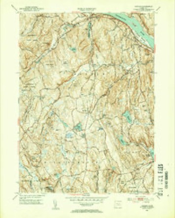
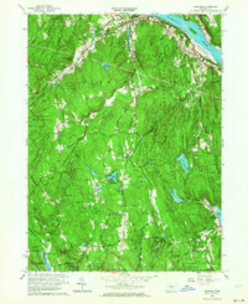
26 topographic sheets cover this place, the earliest surveyed in 1893 and the latest in 1983. It stands in Haddam town. It lies in ZIP code area 06438. It lies near Great Hill. The Survey maps it on the Haddam quadrangle.
On record in Haddam
Buildings and businesses the archive holds for this place. Each opens its own page, with the source record it came from.
On the National Register 5 records
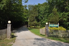 Camp Bethellisted 2007
 Haddam Center Historic Districtlisted 1989
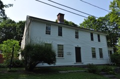 James Hazelton Houselisted 1988
- D & H Scovil Industrial Historic Districtlisted 2024
- Higganum Landing Historic Districtlisted 2018
Topographic sheets covering this place
10 surveys from 26 printed sheetsMatched by testing this settlement's coordinate against the published boundary of every sheet in the United States Geological Survey's historical collection. Each opens the scanned sheet at the Survey.
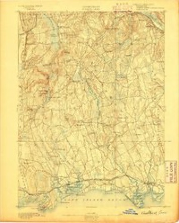
- 1893 USGS Guilford quadrangle1:62500, 8 printings
- 1947 USGS Hartford quadrangle1:250000, 2 printings
- 1948 USGS Hartford quadrangle1:250000, 2 printings
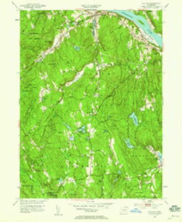
- 1952 USGS Haddam quadrangle1:24000
- 1952 USGS Haddam quadrangle1:31680, 2 printings
- 1961 USGS Haddam quadrangle1:24000, 3 printings
- 1961 USGS Hartford quadrangle1:250000
- 1962 USGS Hartford quadrangle1:250000, 3 printings
- 1965 USGS Hartford quadrangle1:250000, 2 printings
- 1983 USGS New Haven quadrangle1:100000, 2 printings






In the county-history sources
46,128 words on this townshipHistory of Middlesex County, Connecticut, with Biographical Sketches of Its Prominent Men, published 1884 names this settlement in its chapter on Haddam Town. These are the passages that mention it, exactly as the scans read.
The town contains four railroad stations, on the Connecticut Valley Railroad, viz.: Higganum, Haddam, Arnold's and Goodspeeds; four post ofifices: Haddam, Higganum, Haddam Neck, and Tylerville; eight churches; and fourteen school districts.
Passage source: History of Middlesex County, Connecticut, with Biographical Sketches of Its Prominent Men, published 1884.
Extensive flats of natural meadow of apparently exhaustless fertility skirt the river at Haddam, on the west side, and opposite Shailerville and Higganum on the east side. The town contains about 30,000 acres. That part of it lying on the west side of the river was formerly cal'ed Haddam Society, that on the east side Haddam Neck, and a section in the northwest part, which has since been joined to Durham, Haddam Quarter.
Passage source: History of Middlesex County, Connecticut, with Biographical Sketches of Its Prominent Men, published 1884.
Two islands lie in the middle of the river opposite this town. These are Lord's Island, called by the early settlers Twenty Mile Island, from the fact that it was supposed to be 20 miles from the river's mouth, and Haddam Island, in the same way called Thirty Mile Island. The first is on the line between this town and Chester, only the upper end of it being abreast of this town. The second lies between Haddam Centre and Higganum. The distances suggested by their names are considerably in excess of the truth, and they are not 10 miles apart. Haddam Island, which is entirely within the limits of this town, was for many years one of the most valuable fishing stations on the river. The water upon the east side of the island was deep and much frequented by fish, and being narrow, was easily swept with a seine. Two fishing companies, one at either end, occupy it for this purpose. Legends exist that some of Kidd's fabulous treasures were deposited in this island, and many seekers after hidden wealth have dug for it here.
Passage source: History of Middlesex County, Connecticut, with Biographical Sketches of Its Prominent Men, published 1884.
Machine-read from a century-old scan, so expect the errors a machine makes: misspelled names, dropped words, stray characters.
Read the whole chapter on Haddam Town - it names this place 125 more 125 times.
Fires near this place
186 since 1993Regional context, not property-specific evidence. The federal wildfire occurrence database lists 186 fires within 5 miles of Haddam between 1993 and 2020, burning about 376 acres in total. 1 started naturally. 3 were recorded as arson. Distance is straight-line from the map coordinates, so a fire counted here may appear on a neighbouring settlement's page as well.
| Reported cause | Fires |
|---|---|
| Missing data/not specified/undetermined | 100 |
| Debris and open burning | 30 |
| Recreation and ceremony | 26 |
| Misuse of fire by a minor | 12 |
| Smoking | 6 |
| Equipment and vehicle use | 5 |
| Arson/incendiarism | 3 |
| Power generation/transmission/distribution | 2 |
| Other causes | 1 |
| Natural | 1 |
The most recent of them, most recent first, with the day each was reported and the service that recorded it.
| Date | Cause | Size | Reported by | Name on the report |
|---|---|---|---|---|
| 8 September 2015 | Arson/incendiarism | 10 acres | Connecticut Division of Forestry | not named |
| 6 September 2015 | Recreation and ceremony | 1.0 acres | Connecticut Division of Forestry | not named |
| 3 September 2019 | Missing data/not specified/undetermined | under an acre | Connecticut Division of Forestry | not named |
| 16 September 2017 | Debris and open burning | under an acre | Connecticut Division of Forestry | 10 PONSETT RD. |
| 10 September 2016 | Recreation and ceremony | under an acre | Connecticut Division of Forestry | 573 KILLINGWORTH ROAD HADDAM |
| 27 August 2015 | Debris and open burning | under an acre | Connecticut Division of Forestry | not named |
| 26 August 2010 | Missing data/not specified/undetermined | 1.0 acres | Connecticut Division of Forestry | not named |
| 26 August 2005 | Missing data/not specified/undetermined | 1.0 acres | Connecticut Division of Forestry | not named |
Settlements close enough to share some of these fires:
Mines and quarries near this place
10 of 53 shownRegional context, not property-specific evidence. The federal mineral resources record lists 53 workings within 5 miles of Haddam: 42 past producers, 4 producers, 4 prospects, 3 occurrences. 4 still produce. What was taken out: Feldspar, Stone, Dimension, Mica, Stone. Distance is straight-line from the map coordinates, so a quarry counted here may appear on a neighbouring settlement's page as well.
| Where | Site | Commodity | Status | Recorded |
|---|---|---|---|---|
| Anderson Mica Mines and Swanson Lithia Mine | Mica, Lithium | Past Producer | Pegmatite Dike | |
| Anderson No. 1 Mica Mine | Mica, Feldspar, Lithium | Past Producer | ||
| East Selden Mica, Beryl, Feldspar Quarry | Mica, Feldspar, Tantalum, Niobium (Columbium), Beryllium | Past Producer | Pegmatite Dike | |
| Gillette Gem Tourmaline, Mineral Specimens, Mica, Feldspar Mine (Also | Gemstone, Mica, Feldspar | Past Producer | 1896 | |
| Gillette Quarry | Tin, Feldspar, Semiprecious Gemstone, Mica | Past Producer | 1896 | |
| Halberg Quarries | Mica, Beryllium, Feldspar | Past Producer | ||
| Reeb Mica Mine | Feldspar, Mica | Prospect | ||
| Selden Property | Feldspar, Mica, Beryllium, Niobium (Columbium), Tantalum | Past Producer | ||
| Slocum Beryl Prospect | Feldspar, Beryllium, Mica, Niobium (Columbium), Tantalum | Past Producer | ||
| Upper Triassic Copper Prospects No. Cj-053 | Copper | Occurrence | Triassic Dike Intrusive |
Storms near this place
8 since 1995Regional context, not property-specific evidence. The National Weather Service names Haddam in 8 storm reports between 1995 and 2021: 6 thunderstorm wind, 1 lightning, 1 hail. No death or injury is recorded in these reports. Each account below is quoted exactly as the forecast office filed it, from the NOAA Storm Events Database, and each date opens the federal record of that event.
| When | Event | Place named | Harm | What the report says |
|---|---|---|---|---|
| November 2021 | Thunderstorm Wind | Haddam | $5,000 | Trees snapped and downed in backyard in Haddam Neck. |
| May 2010 | Thunderstorm Wind | Haddam | $500 | Large tree branches were downed in Haddam. |
| July 2008 | Thunderstorm Wind | Haddam | - | Trees and wires were downed on Meeting House Road. |
| July 2007 | Thunderstorm Wind | Haddam | - | A severe thunderstorm produced high winds that downed a large tree in Haddam. |
| June 1995 | Thunderstorm Wind | Haddam | - | A cold front moving across the area generated severe thunderstorms which produced large hail and gusty winds. Baseball-size hail lasted for up to 20 minutes in Deep River causing hundreds of thousands of dollars in damage. The hailstones broke hundreds of windows in buildings and automobiles, tore holes in roofs, dented siding and automobiles, and ruined gardens. Some automobiles were totalled. In one historic building, the hail broke 25 windows, including a 100-year curved window. Thirty-two windows were smashed in an elementary school and its roof was damaged. Most of the damage was covered by insurance. |
| July 2004 | Hail | East Haddam | - | no account filed |
| June 1998 | Lightning | East Haddam | - | no account filed |
| June 1997 | Thunderstorm Wind | Haddam | - | no account filed |
Nearest settlements
The eight closest, with where each one stands in the county. Distances are straight-line, computed from the Geographic Names Information System coordinates.
| Map | Place | Distance | Sheets |
|---|---|---|---|
| Arnolds | 0.8 miles | 26 | |
| Shailerville | 1.0 miles | 29 | |
| Rock Landing | 1.4 miles | 26 | |
| Ponset | 2.5 miles | 26 | |
| Scovill Landing | 2.6 miles | 29 | |
| Johnsonville (historical) | 2.7 miles | 29 | |
| Higganum | 2.7 miles | 26 | |
| Tylerville | 2.8 miles | 29 |
Provenance
This settlement is recorded in the Geographic Names Information System as feature 207580. The sheet list is computed by point-in-boundary test against the United States Geological Survey's historical topographic inventory. Both are works of the United States government and carry no copyright under 17 U.S.C. 105.
Wildfire. Short, Karen C. 2022. Spatial wildfire occurrence data for the United States, 1992-2020 [FPA_FOD_20221014]. 6th Edition. Fort Collins, CO: Forest Service Research Data Archive. https://doi.org/10.2737/RDS-2013-0009.6 Collected with United States Government funding and usable without additional permissions or fees.
Mines and quarries. USGS Mineral Resources Data System (MRDS) https://mrdata.usgs.gov/mrds/ A work of the United States government, no copyright under 17 U.S.C. 105.
Storms. NOAA National Centers for Environmental Information, Storm Events Database https://www.ncei.noaa.gov/stormevents/ A work of the United States government, no copyright under 17 U.S.C. 105. Narratives are quoted verbatim from the National Weather Service report and are not edited or summarised.