 Block
Hartford, Connecticut
35 topographic sheets cover this place, the earliest surveyed in 1892 and the latest in 1994. It stands in Hartford town. It lies in ZIP code area 06106. It stands on North Branch Park River. The Survey maps it on the Hartford North quadrangle. 121,054 people lived here at the 2020 count. It stands 59 feet above sea level.
Research this city
On record in Hartford
Buildings and businesses the archive holds for this place. Each opens its own page, with the source record it came from.
On the National Register 12 of 150 shown
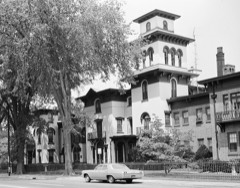 ArmsmearNational Historic Landmark · listed 1966
 A. Everett Austin Jr. HouseNational Historic Landmark · listed 1994
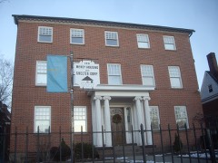 Henry Barnard HouseNational Historic Landmark · listed 1966
 Connecticut State CapitolNational Historic Landmark · listed 1970
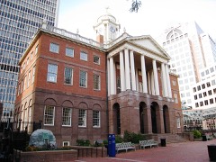 Connecticut StatehouseNational Historic Landmark · listed 1966
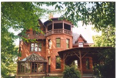 Mark Twain House AnnexNational Historic Landmark · listed 1966
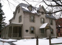 Harriet Beecher Stowe HouseNational Historic Landmark · listed 1970
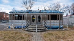 Aetna Dinerlisted 2021
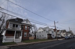 Allen Place-Lincoln Street Historic Districtlisted 2003
 Ambassador Apartmentslisted 2008
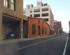 Ann Street Historic Districtlisted 1983
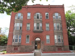 Apartment at 49-51 Spring Streetlisted 1983
Population over time
2 figuresHartford fell from 124,775 to 121,054 between 2010 and 2020. These are the recorded population figures Wikidata holds for this place, reached through the Geographic Names Information System number this page is keyed on rather than by name, so they belong to this place and not to another of the same name. Most are census counts, but not all are: an early figure may be a founding or settlement estimate, and an estimate published within five years of a census is left out. The change column is computed, and is left blank where more than 20 years separate a figure from the one before it, because a gap that long is not a change between two counts.
| Year | People | Change |
|---|---|---|
| 2010 | 124,775 | |
| 2020 | 121,054 | -3,721 (-3%) |
Topographic sheets covering this place
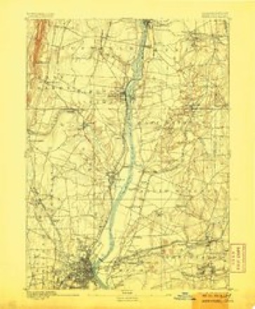
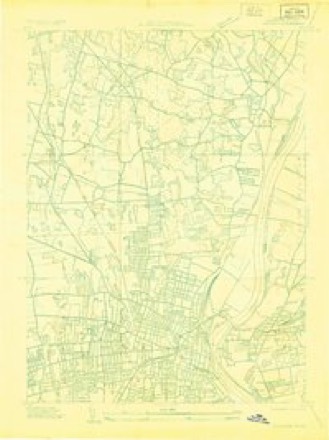
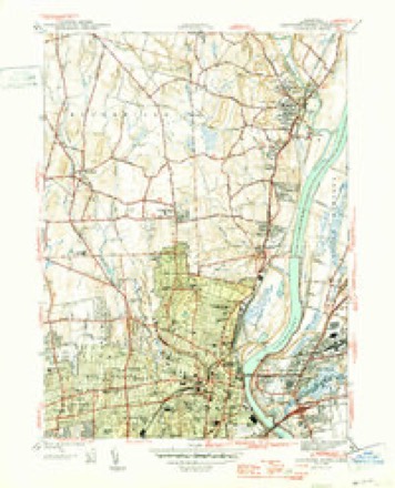
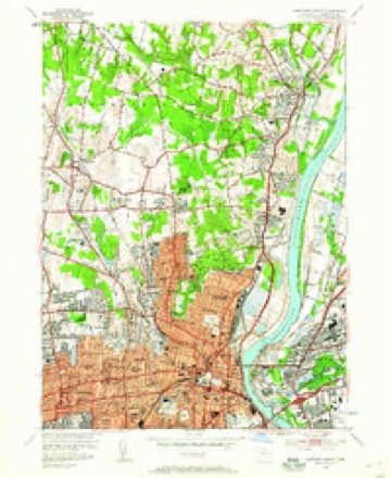
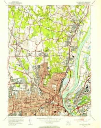
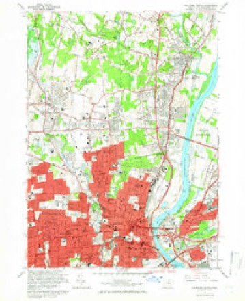
14 surveys from 35 printed sheetsMatched by testing this settlement's coordinate against the published boundary of every sheet in the United States Geological Survey's historical collection. Each opens the scanned sheet at the Survey.
- 1892 USGS Hartford quadrangle1:62500, 8 printings
- 1906 USGS Farmington quadrangle1:125000, 2 printings
- 1928 USGS Windsor quadrangle1:24000
- 1945 USGS Hartford North quadrangle1:31680, 2 printings
- 1947 USGS Hartford quadrangle1:250000, 2 printings
- 1948 USGS Hartford quadrangle1:250000, 2 printings
- 1952 USGS Hartford North quadrangle1:24000
- 1952 USGS Hartford North quadrangle1:31680, 2 printings
- 1961 USGS Hartford quadrangle1:250000
- 1962 USGS Hartford quadrangle1:250000, 3 printings
- 1964 USGS Hartford North quadrangle1:24000, 6 printings
- 1965 USGS Hartford quadrangle1:250000, 2 printings
- 1986 USGS Hartford quadrangle1:100000
- 1994 USGS Hartford quadrangle1:100000, 2 printings








Fires near this place
7 since 1992Regional context, not property-specific evidence. The federal wildfire occurrence database lists 7 fires within 5 miles of Hartford between 1992 and 2020, burning about 60 acres in total. None started naturally. 2 were recorded as arson. Distance is straight-line from the map coordinates, so a fire counted here may appear on a neighbouring settlement's page as well.
| Reported cause | Fires |
|---|---|
| Missing data/not specified/undetermined | 3 |
| Arson/incendiarism | 2 |
| Debris and open burning | 1 |
| Power generation/transmission/distribution | 1 |
The most recent of them, most recent first, with the day each was reported and the service that recorded it.
| Date | Cause | Size | Reported by | Name on the report |
|---|---|---|---|---|
| 9 August 2020 | Power generation/transmission/distribution | under an acre | Connecticut Division of Forestry | NAUBUC AVENUE |
| 7 May 1992 | Arson/incendiarism | 1.5 acres | Connecticut Division of Forestry | not named |
| 30 April 1992 | Arson/incendiarism | 50 acres | Connecticut Division of Forestry | not named |
| 18 April 2005 | Missing data/not specified/undetermined | 3.0 acres | Connecticut Division of Forestry | not named |
| 31 March 2016 | Debris and open burning | 2.0 acres | Connecticut Division of Forestry | 380 WIESE ALBERT ROAD |
| 30 October 2001 | Missing data/not specified/undetermined | 2.0 acres | Connecticut Division of Forestry | not named |
| 30 October 2001 | Missing data/not specified/undetermined | 1.0 acres | Connecticut Division of Forestry | not named |
Settlements close enough to share some of these fires:
Mines and quarries near this place
10 of 12 shownRegional context, not property-specific evidence. The federal mineral resources record lists 12 workings within 5 miles of Hartford: 8 past producers, 2 producers, 2 plants. 4 still produce. What was taken out: Stone, Crushed/Broken, Stone, Dimension, Sand and Gravel, Construction, Iron. Distance is straight-line from the map coordinates, so a quarry counted here may appear on a neighbouring settlement's page as well.
| Where | Site | Commodity | Status | Recorded |
|---|---|---|---|---|
| Abbott Ball Co/ Hartford, Ct. | Corundum | Plant | ||
| American Steel & Aluminum/Hartford | Iron | Plant | ||
| Russo Brothers Pit | Sand and Gravel, Construction | Past Producer | Sedimentary | |
| Russo Brothers Pit | Sand and Gravel, Construction | Past Producer | ||
| Quarry | Stone, Dimension | Past Producer | ||
| Traprock Quarry | Stone, Dimension | Past Producer | ||
| Traprock Quarry | Stone, Dimension | Past Producer | ||
| Balf Newington Quarry | Stone, Crushed/Broken | Producer | ||
| Basalt Rock Quarry No. Cj-063 | Stone, Crushed/Broken | Past Producer | Basalt | |
| Basalt Rock Quarry No. Cj-064 | Stone, Crushed/Broken | Past Producer | Basalt |
Storms near this place
60 of 94 shownRegional context, not property-specific evidence. The National Weather Service names Hartford in 94 storm reports between 1995 and 2024: 42 thunderstorm wind, 23 flash flood, 15 hail, 10 flood. No death or injury is recorded in these reports. Each account below is quoted exactly as the forecast office filed it, from the NOAA Storm Events Database, and each date opens the federal record of that event.
| When | Event | Place named | Harm | What the report says |
|---|---|---|---|---|
| September 2021 | Flash Flood | East Hartford | $100,000 | In East Hartford, Willow Brook went out of its banks, inundating parking lots and roadways at Rentschler Field at Pratt & Whitney Stadium. Roads and buildings also were flooded elsewhere in town, including several homes. |
| August 2021 | Flash Flood | Hartford | $100,000 | Significant urban flash flooding occurred in Hartford. The Fire Dept. reported that Homestead Avenue was closed due to flash flooding. Cars were stuck, with water up to the roofs of the cars. Amateur radio operators reported that sections of Albany Avenue, Laurel Street, and Farmington Acenue were all closed due to flash flooding. On South Whitney Street at Warrenton Avenue, there was 3 feet of water at the intersection. There was basement flooding inside St. Francis Hospital. Rainfall totals ended up between 5.0 and 5.8 inches in northern Hartford and Tolland Counties. |
| June 2009 | Thunderstorm Wind | Hartford | $100,000 | Trees were downed by thunderstorm winds. |
| June 2009 | Thunderstorm Wind | West Hartford | $75,000 | Several trees and five utility poles were downed by thunderstorm winds. |
| July 2020 | Flash Flood | West Hartford | $60,000 | More than 2 inches of rain fell in less than 1 hour. In Hartford, numerous cars were stuck in flash flood waters... on Franklin Street at South Street; Buckingham, John, Hamilton, Bonner, and Brown Streets, and Hillside Avenue. A small portion of Airport Road in Hartford, east of Wethersfield Avenue, buckled inward as a result of the heavy rainfall. A family on Sisson Avenue was forced from their home when water entered the home. A basement was flooded on Wolcott Street. Reports were from a combination of law enforcement, amateur radio, and newspaper and tv stations. |
| June 2009 | Thunderstorm Wind | Hartford | $50,000 | Trees were downed by thunderstorm winds, some of them are blocking a road. |
| July 2009 | Thunderstorm Wind | Hartford | $40,000 | Trees were downed by thunderstorm winds, including one that fell on a house on North Main Street. |
| July 2013 | Thunderstorm Wind | Hartford | $30,000 | A tree on Ledyard Road and two trees on Albany Avenue were downed by thunderstorm winds. A telephone pole on Albany Avenue also was downed by the thunderstorm winds. |
| August 2021 | Flash Flood | East Hartford | $25,000 | In East Hartford, Governor Street was closed due to flash flooding, with cars stuck in the waters. |
| July 2005 | Flash Flood | East Hartford | $20,000 | no account filed |
| July 2005 | Lightning | Hartford | $20,000 | no account filed |
| June 2001 | Lightning | Hartford | $20,000 | no account filed |
| June 2012 | Thunderstorm Wind | Hartford | $15,000 | Several trees were downed by thunderstorm winds. |
| August 2011 | Thunderstorm Wind | Hartford | $15,000 | A large tree on Pliny Street was downed by thunderstorm winds, landing on a house. |
| June 2006 | Thunderstorm Wind | West Hartford | $15,000 | no account filed |
| July 2006 | Thunderstorm Wind | East Hartford | $15,000 | no account filed |
| May 2003 | Lightning | West Hartford | $15,000 | no account filed |
| August 2021 | Flash Flood | Hartford | $10,000 | In West Hartford, a car was stuck in flood waters on Brewster Road at Skonet Road. South Main Street and Woodrow Street were flooded and impassable. Also, King Philip Drive at Mohawk Drive was flooded and impassable with cars stuck in the flood waters. Rainfall totals ended up between 5.0 and 5.8 inches in northern Hartford and Tolland Counties. |
| August 2019 | Flash Flood | Hartford | $10,000 | In Hartford, cars were stuck in flash flooding at Cornwall and Granby Streets. Cars were stuck in flash flood waters that were several feet deep at Granby and Burlington Streets and at Cornwall and Burlington Streets. |
| February 2016 | Thunderstorm Wind | Hartford | $10,000 | Trees and wires on Hubbard Road in Hartford were downed by severe thunderstorm winds. |
| July 2005 | Thunderstorm Wind | Hartford | $10,000 | no account filed |
| July 2005 | Lightning | Hartford | $10,000 | no account filed |
| August 2005 | Thunderstorm Wind | Hartford | $10,000 | no account filed |
| July 2019 | Thunderstorm Wind | Hartford | $8,000 | Numerous trees and wires were downed on Albany Avenue in West Hartford. |
| August 2019 | Flash Flood | Hartford | $8,000 | In West Hartford, Albany Avenue at Mohegan Drive was flooded and impassable. Cars were stuck in flash flood waters at King Philip Drive and Brewster Road. There were reports of eight cars stuck in flash flood waters on Mohegan Drive near the intersection with Brewster Road, which was impassable. |
| February 2016 | Thunderstorm Wind | Hartford | $5,000 | Power lines on Newbury Street and a large limb and wires on Grandview Terrace in Hartford were downed by severe thunderstorm winds. |
| July 2009 | Thunderstorm Wind | Hartford | $5,000 | Trees on Lasalle Road were downed by thunderstorm winds. |
| June 2008 | Thunderstorm Wind | Hartford | $5,000 | Large branches and wires were downed by thunderstorm winds. |
| June 2008 | Thunderstorm Wind | Hartford | $5,000 | Large tree limbs, trees and wires in Hartford and Newington were downed by thunderstorm winds. |
| September 2005 | Thunderstorm Wind | West Hartford | $5,000 | no account filed |
| July 2013 | Flash Flood | Hartford | $3,000 | Three feet of water flooded Love Lane in Hartford. A car was stuck in flood waters on Lyme and Palm Streets. |
| July 2010 | Thunderstorm Wind | Hartford | $3,000 | Wires were downed by thunderstorm winds. |
| June 2008 | Thunderstorm Wind | Hartford | $3,000 | Wires were downed by thunderstorm winds. |
| June 2010 | Thunderstorm Wind | Hartford | $2,000 | Trees, wires, and large tree limbs were downed by thunderstorm winds in East Hartford and West Hartford. |
| June 2024 | Thunderstorm Wind | West Hartford | $1,500 | In West Hartford, there were wires down on South Highland St and a tree and wires down on Quaker Ln. |
| June 2024 | Thunderstorm Wind | Hartford | $1,500 | In West Hartford, trees and wires were down. |
| June 2024 | Thunderstorm Wind | Hartford | $1,000 | In West Hartford, there was a tree down on Overlook Rd and on Beverly Rd. |
| June 2024 | Thunderstorm Wind | Hartford | $1,000 | In West Hartford, trees were down on several roads across town. |
| June 2024 | Thunderstorm Wind | West Hartford | $1,000 | In West Hartford, a tree was down into a window on the third floor of an apartment. |
| July 2023 | Thunderstorm Wind | Hartford | $1,000 | In West Hartford, a tree was down on wires and a utility pole was snapped. |
| June 2021 | Thunderstorm Wind | East Hartford | $1,000 | In Hartford at 247 PM EDT (147 PM EST), two trees were down on Jennings Road. |
| August 2019 | Flood | Hartford | $1,000 | In West Hartford, North Main Street at Albany Avenue was flooded and impassable, with a car stuck in flood waters. Albany Avenue at Trout Brook Drive was also flooded and impassable. |
| May 2010 | Thunderstorm Wind | Hartford | $1,000 | A tree on Capen Street was downed by thunderstorm winds. |
| June 2010 | Thunderstorm Wind | Hartford | $1,000 | Wires on Brook and Atwood Streets were downed by thunderstorm winds. |
| July 2024 | Thunderstorm Wind | Hartford | $800 | In West Hartford, there were multiple reports of trees and wires down including Timber Ln. |
| November 2020 | Thunderstorm Wind | Hartford | $500 | In West Hartford, a tree was down on Route 44 at Toll House Lane. |
| July 2009 | Thunderstorm Wind | Hartford | $500 | Large branches on Cotton Road were downed by thunderstorm winds. |
| April 2008 | Thunderstorm Wind | East Hartford | $500 | Five inch diameter tree limbs were downed on Burnside Avenue in East Hartford. |
| June 2024 | Flash Flood | West Hartford | - | In West Hartford, a car was stuck in street flooding at Flatbush Ave and Oakwood Ave. |
| September 2023 | Flash Flood | West Hartford | - | In West Hartford, the parking lot at Armory building flooded up to wheelbases. |
| July 2023 | Flash Flood | West Hartford | - | In West Hartford, there was 3 feet of water on Argyle Rd with a vehicle stuck. |
| July 2023 | Flash Flood | Hartford | - | In Hartford, a car was stuck in flood waters on Prospect St. |
| July 2023 | Flash Flood | Hartford | - | In Hartford, cars were stuck in flood waters on Albany Ave. Water rescues were performed. |
| July 2023 | Flash Flood | Hartford | - | In Hartford, several cars were stuck in flood waters on Scarborough St. |
| September 2021 | Flash Flood | West Hartford | - | In West Hartford, the Dept. of Public Works sent a Twitter photo showing that a large stretch of Fern Street, from Mountain Road to North Main Street, was closed due to flooding. |
| July 2019 | Flood | Hartford | - | In West Hartford, Trout Brook Drive was closed north of Farmington Avenue due to flooding. |
| August 2019 | Flood | Hartford | - | In West Hartford, Trout Brook Road at Asylum Avenue was flooded and impassable. All surrounding areas were also closed due to flooding. |
| August 2019 | Flash Flood | Hartford | - | In Hartford, flash flooding caused the intersection of Farmington Avenue and Woodland street to be impassable. |
| August 2019 | Flood | Hartford | - | In Hartford, Milford Street at Homestead Avenue was flooded and impassable. |
| September 2018 | Flood | West Hartford | - | At 12 PM EST, the intersection of Arlington Road and Farmington Avenue in West Hartford was under two feet of water. |
Nearest settlements
The eight closest, with where each one stands in the county. Distances are straight-line, computed from the Geographic Names Information System coordinates.
| Map | Place | Distance | Sheets |
|---|---|---|---|
| Parkville | 0.5 miles | 35 | |
| Smith Tower Housing | 0.8 miles | 35 | |
| Dutch Point Colony | 1.0 miles | 35 | |
| Rocky Hill (historical) | 1.0 miles | 37 | |
| Saybrooke Village | 1.4 miles | 37 | |
| Childrens Village of the Hartford Orphan Asylum | 2.1 miles | 35 | |
| Stowe Village Housing Project | 2.2 miles | 35 | |
| West Hill | 2.6 miles | 35 |
Elsewhere
Matched on this settlement's Geographic Names Information System number rather than its name, so it cannot be a different place of the same name in another state.
| Wikipedia article on Hartford | An encyclopaedic summary. Its text is share-alike, so it is linked here rather than copied. |
| Wikidata item Q33486 | The structured record the population and elevation above come from. Public domain (CC0). |
Provenance
This settlement is recorded in the Geographic Names Information System as feature 213160. The sheet list is computed by point-in-boundary test against the United States Geological Survey's historical topographic inventory. Both are works of the United States government and carry no copyright under 17 U.S.C. 105.
Wildfire. Short, Karen C. 2022. Spatial wildfire occurrence data for the United States, 1992-2020 [FPA_FOD_20221014]. 6th Edition. Fort Collins, CO: Forest Service Research Data Archive. https://doi.org/10.2737/RDS-2013-0009.6 Collected with United States Government funding and usable without additional permissions or fees.
Mines and quarries. USGS Mineral Resources Data System (MRDS) https://mrdata.usgs.gov/mrds/ A work of the United States government, no copyright under 17 U.S.C. 105.
Storms. NOAA National Centers for Environmental Information, Storm Events Database https://www.ncei.noaa.gov/stormevents/ A work of the United States government, no copyright under 17 U.S.C. 105. Narratives are quoted verbatim from the National Weather Service report and are not edited or summarised.