 Block
West Hartford, Connecticut
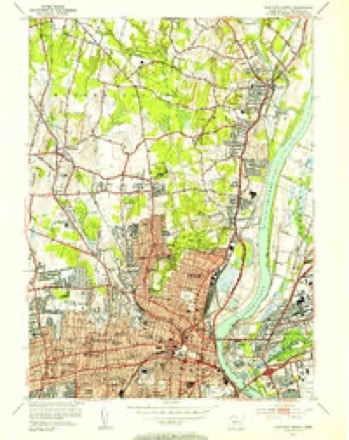
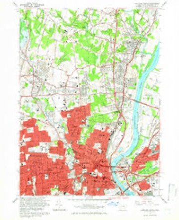
35 topographic sheets cover this place, the earliest surveyed in 1892 and the latest in 1994. It stands in West Hartford town. It lies in ZIP code area 06107. It lies near Hamilton Hill. The Survey maps it on the Hartford North quadrangle.
On record in West Hartford
Buildings and businesses the archive holds for this place. Each opens its own page, with the source record it came from.
On the National Register 12 of 27 shown
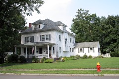 Edward W. Morley HouseNational Historic Landmark · listed 1975
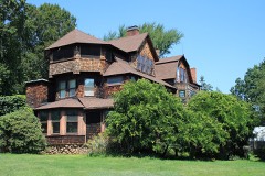 Charles E. Beach Houselisted 1990
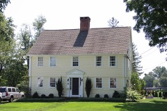 Beardsley-Mix Houselisted 1986
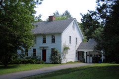 Brace, Moses-Uriah Cadwell Houselisted 1986
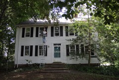 James Butler Houselisted 1986
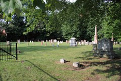 Center Burying Yard, Oldlisted 2002
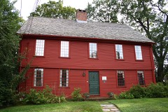 Benjamin Colton Houselisted 1986
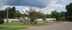 Elizabeth Parklisted 1983
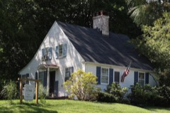 Samuel Farnsworth Houselisted 1986
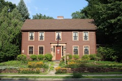 Asa Gillett Houselisted 1986
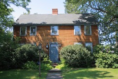 Timothy Goodman Houselisted 1986
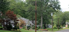 Hartford Golf Club Historic Districtlisted 1986
Topographic sheets covering this place
14 surveys from 35 printed sheetsMatched by testing this settlement's coordinate against the published boundary of every sheet in the United States Geological Survey's historical collection. Each opens the scanned sheet at the Survey.
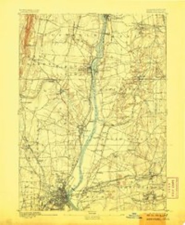
- 1892 USGS Hartford quadrangle1:62500, 8 printings
- 1906 USGS Farmington quadrangle1:125000, 2 printings
- 1928 USGS Windsor quadrangle1:24000
- 1945 USGS Hartford North quadrangle1:31680, 2 printings
- 1947 USGS Hartford quadrangle1:250000, 2 printings
- 1948 USGS Hartford quadrangle1:250000, 2 printings
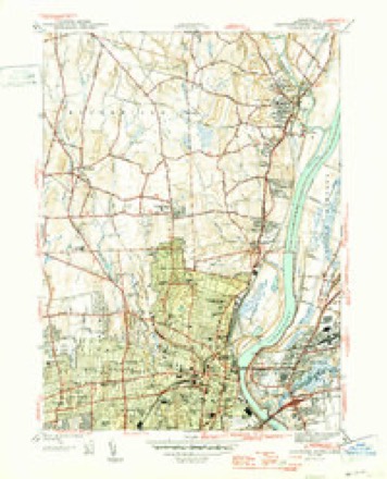
- 1952 USGS Hartford North quadrangle1:24000
- 1952 USGS Hartford North quadrangle1:31680, 2 printings
- 1961 USGS Hartford quadrangle1:250000
- 1962 USGS Hartford quadrangle1:250000, 3 printings
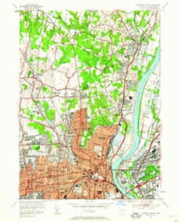
- 1964 USGS Hartford North quadrangle1:24000, 6 printings
- 1965 USGS Hartford quadrangle1:250000, 2 printings
- 1986 USGS Hartford quadrangle1:100000
- 1994 USGS Hartford quadrangle1:100000, 2 printings








What happened here
An account from the chapter on West Hartford town. The inset identifies its exact source book and publication year.
West Hartfoed
The most remarkable pastorate was that of Nathan Perkins. He served sixty-six years, liis pastorate being ^yell begun when the first shot was fired at Lexington, and not quite over when the financial panic of 1837 occurred. Thoug]i probably inferior in nj,tural ability to his distinguished y'^^
In the county-history sources
4,104 words on this townshipThe Memorial History of Hartford County, Connecticut, 1633-1884;, published 1886 names this settlement in its chapter on West Hartford Town. These are the passages that mention it, exactly as the scans read.
THE locality now known as the town of West Hartford was two hundred years ago an undivided tract of land in the West Division of Hartford, It was owned by a large company of proprietors, sixty-eight of whom are named in the division record. On the 30th of January, 1672, the joint owners of this tract voted to divide a portion of the same according to their individual interests. In pursuance of this vote a committee set off, in November, 1674, an oblong section of land extending from the northern to the southern l)oundary of the town of Hartford, and from the eastern boundary of Farmington one mile and a half east. The Farmington line was at that time along the level land at the foot of Talcott iMountain, and the eastern bound of this new rectangle was not far from what is now known as Vanderbilt Hill. This strip of land was divided into lots running the entire distance across it, the width being proportioned to each pei'son's interest in the undivided territory. The widest tract was ninety-one rods wide ; the narrowest, a mere whip-lash three rods wide and a mile and a half long. The original strip was subsequently enlarged and made more symmetrical by pushing the Farmington lino westward to the top of Talcott Mountain and adding a strip of land to the east end of the division lots. This part of the town of Hartford was commonly called the West Division. It never ceased to agitate for its individuality until it became a distinct ecclesiastical society, and, very recently, a separate township.
Passage source: The Memorial History of Hartford County, Connecticut, 1633-1884;, published 1886.
The church related to the Ecclesiastical Society was organized on or about tlie 24th of February, 1713, when also the first pastor, Benjamin Colton, was ordained and installed. Starting with a membership of twenty-nine, it now numbers three Iff/^C^^t^^ hundred and twenty-five, having received into its communion during its life of a hundred and seventy-one years nearly two thousand i)ersons. It was originally called the Fourth Church of Christ in Hartford, but for a long series of years has been knoAvn as the Church of Christ in West Hartford, Mr. Colton was pastor of the church about forty -three years, and several of his descendants became clergymen. One of these was his son George, the famous and eccentric " Colton of Bolton." The latter part of this long pastorate was marred by some unhappy divisions, which were healed only by summoning advice from wdthout.
Passage source: The Memorial History of Hartford County, Connecticut, 1633-1884;, published 1886.
Myron N. Morris was pastor of the church for about twenty -three years, from 1852, and still lives an honored citizen of the town where he so long and so faitlifully labored. He has always been intrusted with the most important religious concerns of his State, and is still one of the corporation of Yale College. Twice he represented his town in the legislature ; and he has published, among other monographs, two discourses which contain the most complete history of the West Hartford church and community up to 1863. ^ The present pastor of this church is Henry B. Roberts.
Passage source: The Memorial History of Hartford County, Connecticut, 1633-1884;, published 1886.
Machine-read from a century-old scan, so expect the errors a machine makes: misspelled names, dropped words, stray characters.
Read the whole chapter on West Hartford Town - it names this place 9 more 9 times.
Fires near this place
7 since 1992Regional context, not property-specific evidence. The federal wildfire occurrence database lists 7 fires within 5 miles of West Hartford between 1992 and 2016, burning about 60 acres in total. None started naturally. 2 were recorded as arson. Distance is straight-line from the map coordinates, so a fire counted here may appear on a neighbouring settlement's page as well.
| Reported cause | Fires |
|---|---|
| Missing data/not specified/undetermined | 3 |
| Arson/incendiarism | 2 |
| Smoking | 1 |
| Debris and open burning | 1 |
The most recent of them, most recent first, with the day each was reported and the service that recorded it.
| Date | Cause | Size | Reported by | Name on the report |
|---|---|---|---|---|
| 7 May 1992 | Arson/incendiarism | 1.5 acres | Connecticut Division of Forestry | not named |
| 30 April 1992 | Arson/incendiarism | 50 acres | Connecticut Division of Forestry | not named |
| 23 April 2016 | Smoking | under an acre | Connecticut Division of Forestry | 175 LOWREY PL, NEWINGTON, CT 06111 |
| 18 April 2005 | Missing data/not specified/undetermined | 3.0 acres | Connecticut Division of Forestry | not named |
| 31 March 2016 | Debris and open burning | 2.0 acres | Connecticut Division of Forestry | 380 WIESE ALBERT ROAD |
| 30 October 2001 | Missing data/not specified/undetermined | 2.0 acres | Connecticut Division of Forestry | not named |
| 30 October 2001 | Missing data/not specified/undetermined | 1.0 acres | Connecticut Division of Forestry | not named |
Settlements close enough to share some of these fires:
Mines and quarries near this place
10 of 24 shownRegional context, not property-specific evidence. The federal mineral resources record lists 24 workings within 5 miles of West Hartford: 20 past producers, 2 producers, 2 plants. 4 still produce. What was taken out: Stone, Crushed/Broken, Stone, Dimension, Sand and Gravel, Construction, Iron. Distance is straight-line from the map coordinates, so a quarry counted here may appear on a neighbouring settlement's page as well.
| Where | Site | Commodity | Status | Recorded |
|---|---|---|---|---|
| Abbott Ball Co/ Hartford, Ct. | Corundum | Plant | ||
| American Steel & Aluminum/Hartford | Iron | Plant | ||
| Sandstone Quarry | Flagstone | Past Producer | ||
| Russo Brothers Pit | Sand and Gravel, Construction | Past Producer | Sedimentary | |
| Russo Brothers Pit | Sand and Gravel, Construction | Past Producer | ||
| Quarry | Stone, Dimension | Past Producer | ||
| Sandstone Rock Quarry No. Di-009 | Stone, Dimension | Past Producer | Sandstone | |
| Traprock Quarries | Stone, Dimension | Past Producer | ||
| Traprock Quarries | Stone, Dimension | Past Producer | ||
| Traprock Quarries | Stone, Dimension | Past Producer |
Storms near this place
21 since 1995Regional context, not property-specific evidence. The National Weather Service names West Hartford in 21 storm reports between 1995 and 2024: 8 thunderstorm wind, 6 flash flood, 4 hail, 2 flood. No death or injury is recorded in these reports. Each account below is quoted exactly as the forecast office filed it, from the NOAA Storm Events Database, and each date opens the federal record of that event.
| When | Event | Place named | Harm | What the report says |
|---|---|---|---|---|
| June 2009 | Thunderstorm Wind | West Hartford | $75,000 | Several trees and five utility poles were downed by thunderstorm winds. |
| July 2020 | Flash Flood | West Hartford | $60,000 | More than 2 inches of rain fell in less than 1 hour. In Hartford, numerous cars were stuck in flash flood waters... on Franklin Street at South Street; Buckingham, John, Hamilton, Bonner, and Brown Streets, and Hillside Avenue. A small portion of Airport Road in Hartford, east of Wethersfield Avenue, buckled inward as a result of the heavy rainfall. A family on Sisson Avenue was forced from their home when water entered the home. A basement was flooded on Wolcott Street. Reports were from a combination of law enforcement, amateur radio, and newspaper and tv stations. |
| June 2006 | Thunderstorm Wind | West Hartford | $15,000 | no account filed |
| May 2003 | Lightning | West Hartford | $15,000 | no account filed |
| September 2005 | Thunderstorm Wind | West Hartford | $5,000 | no account filed |
| June 2024 | Thunderstorm Wind | West Hartford | $1,500 | In West Hartford, there were wires down on South Highland St and a tree and wires down on Quaker Ln. |
| June 2024 | Thunderstorm Wind | West Hartford | $1,000 | In West Hartford, a tree was down into a window on the third floor of an apartment. |
| June 2024 | Flash Flood | West Hartford | - | In West Hartford, a car was stuck in street flooding at Flatbush Ave and Oakwood Ave. |
| September 2023 | Flash Flood | West Hartford | - | In West Hartford, the parking lot at Armory building flooded up to wheelbases. |
| July 2023 | Flash Flood | West Hartford | - | In West Hartford, there was 3 feet of water on Argyle Rd with a vehicle stuck. |
| September 2021 | Flash Flood | West Hartford | - | In West Hartford, the Dept. of Public Works sent a Twitter photo showing that a large stretch of Fern Street, from Mountain Road to North Main Street, was closed due to flooding. |
| September 2018 | Flood | West Hartford | - | At 12 PM EST, the intersection of Arlington Road and Farmington Avenue in West Hartford was under two feet of water. |
| July 2015 | Flood | West Hartford | - | Heavy rain produced flooding on Trout Brook Drive. |
| June 2007 | Hail | West Hartford | - | Nickel size hail. |
| July 2007 | Thunderstorm Wind | West Hartford | - | Trees down blocking road. |
| May 2004 | Hail | West Hartford | - | no account filed |
| August 2001 | Thunderstorm Wind | West Hartford | - | no account filed |
| March 1998 | Flash Flood | West Hartford | - | no account filed |
| May 1997 | Hail | West Hartford | - | no account filed |
| July 1996 | Thunderstorm Wind | West Hartford | - | no account filed |
| July 1995 | Hail | West Hartford | - | no account filed |
Nearest settlements
The eight closest, with where each one stands in the county. Distances are straight-line, computed from the Geographic Names Information System coordinates.
| Map | Place | Distance | Sheets |
|---|---|---|---|
| Fernridge Place | 0.5 miles | 35 | |
| Foote Corners | 1.3 miles | 31 | |
| West Hill | 1.6 miles | 35 | |
| Westmoor Park | 1.7 miles | 31 | |
| Whitings Corner | 2.2 miles | 31 | |
| Elmwood | 2.2 miles | 37 | |
| Childrens Village of the Hartford Orphan Asylum | 2.4 miles | 35 | |
| Saybrooke Village | 2.5 miles | 37 |
Provenance
This settlement is recorded in the Geographic Names Information System as feature 211952. The sheet list is computed by point-in-boundary test against the United States Geological Survey's historical topographic inventory. Both are works of the United States government and carry no copyright under 17 U.S.C. 105.
Wildfire. Short, Karen C. 2022. Spatial wildfire occurrence data for the United States, 1992-2020 [FPA_FOD_20221014]. 6th Edition. Fort Collins, CO: Forest Service Research Data Archive. https://doi.org/10.2737/RDS-2013-0009.6 Collected with United States Government funding and usable without additional permissions or fees.
Mines and quarries. USGS Mineral Resources Data System (MRDS) https://mrdata.usgs.gov/mrds/ A work of the United States government, no copyright under 17 U.S.C. 105.
Storms. NOAA National Centers for Environmental Information, Storm Events Database https://www.ncei.noaa.gov/stormevents/ A work of the United States government, no copyright under 17 U.S.C. 105. Narratives are quoted verbatim from the National Weather Service report and are not edited or summarised.