 Block
Lebanon, Connecticut
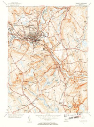
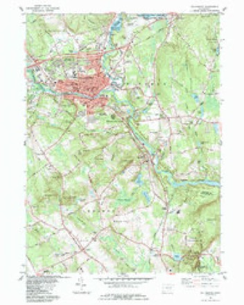
30 topographic sheets cover this place, the earliest surveyed in 1892 and the latest in 1994. It stands in Lebanon town. It lies in ZIP code area 06249. It lies near Tinsdale Hill. The Survey maps it on the Willimantic quadrangle.
On record in Lebanon
Buildings and businesses the archive holds for this place. Each opens its own page, with the source record it came from.
On the National Register 5 records
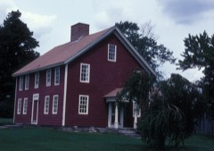 John Trumbull BirthplaceNational Historic Landmark · listed 1966
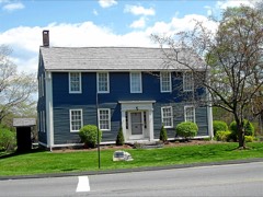 William Williams HouseNational Historic Landmark · listed 1971
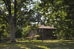 Clark Homesteadlisted 1978
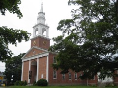 Lebanon Green Historic Districtlisted 1979
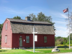 War Officelisted 1970
Topographic sheets covering this place
12 surveys from 30 printed sheetsMatched by testing this settlement's coordinate against the published boundary of every sheet in the United States Geological Survey's historical collection. Each opens the scanned sheet at the Survey.
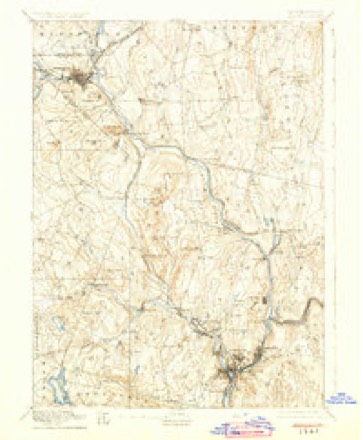
- 1892 USGS Norwich quadrangle1:62500, 8 printings
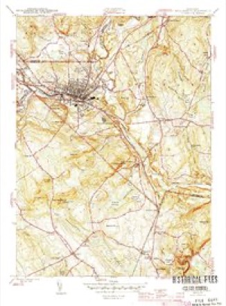
- 1945 USGS Willimantic quadrangle1:31680, 3 printings
- 1947 USGS Hartford quadrangle1:250000, 2 printings
- 1948 USGS Hartford quadrangle1:250000, 2 printings
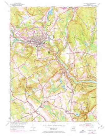
- 1953 USGS Willimantic quadrangle1:24000, 3 printings
- 1953 USGS Willimantic quadrangle1:31680, 2 printings
- 1961 USGS Hartford quadrangle1:250000
- 1962 USGS Hartford quadrangle1:250000, 3 printings
- 1965 USGS Hartford quadrangle1:250000, 2 printings
- 1984 USGS Willimantic quadrangle1:24000
- 1986 USGS Hartford quadrangle1:100000
- 1994 USGS Hartford quadrangle1:100000, 2 printings







In the county-history sources
27,856 words on this townshipHistory of New London County, Connecticut, with Biographical Sketches of Many of Its Pioneers and Prominent Men, published 1882 names this settlement in its chapter on Lebanon Town. These are the passages that mention it, exactly as the scans read.
The town of Lebanon lies in the northwestern part of the county, and is bounded as follows : on the north by Tolland and Windham Counties, Conn., on the east by Windham County and the towns of Franklin and Bozrah, on the south by Franklin, Bozrah, and Colchester, and on the west by Colchester and Tolland County. The surface is moderately hilly, the soil fertile and well adapted to agricultural pursuits. It is one of the leading agricultural towns in the county.
Passage source: History of New London County, Connecticut, with Biographical Sketches of Many of Its Pioneers and Prominent Men, published 1882.
In presenting the history of Lebanon it is deemed advisable to reproduce as introductory an historical address delivered in Lebanon, July 4, 1876, by Rev. Orlo D. Hine, pastor of the First Church. Herein is embodied a mass of valuable information bearing upon the history of the town. Mr. Hine is an enthusiast in matters of historic lore, and in this address he builded better than he knew, and delivered an address that will live as long as Lebanon itself has an existence. The article is reproduced by permission of Mr. Hine, to whom we are under special obligations.
Passage source: History of New London County, Connecticut, with Biographical Sketches of Many of Its Pioneers and Prominent Men, published 1882.
The territory which now constitutes the town of Lebanon, called by the Indians, as to its main part, Po-que-chan-neeg, was originally claimed by the Indian chief Uncas. He belonged to the Pequot tribe, which had its seat in the present town of Stonington, near the village of Mystic. He was of the royal family, and married a princess of the royal family of the same tribe. Aspiring to the leadership of the tribe by means decidedly crooked and summary, and failing in his rash purpose, he was obliged to secede, and with a few adherents withdrew across the Pequot, now the Thames River, where he established himself on lands which have since been held by the remnant of Indians, in the present town of Montville. Here he set up a claim to a territory twenty-two milea wide, bounded on the east by the Thames River, and on the west by the Connecticut, and extending from the sea-shore north indefinitely, embracing large portions of the present territory of Tolland and Windham Counties. This included the tract which formed this town.
Passage source: History of New London County, Connecticut, with Biographical Sketches of Many of Its Pioneers and Prominent Men, published 1882.
Machine-read from a century-old scan, so expect the errors a machine makes: misspelled names, dropped words, stray characters.
Read the whole chapter on Lebanon Town - it names this place 99 more 99 times.
Fires near this place
35 since 1999Regional context, not property-specific evidence. The federal wildfire occurrence database lists 35 fires within 5 miles of Lebanon between 1999 and 2020, burning about 52 acres in total. 1 started naturally. 2 were recorded as arson. Distance is straight-line from the map coordinates, so a fire counted here may appear on a neighbouring settlement's page as well.
| Reported cause | Fires |
|---|---|
| Missing data/not specified/undetermined | 17 |
| Debris and open burning | 6 |
| Recreation and ceremony | 6 |
| Misuse of fire by a minor | 3 |
| Arson/incendiarism | 2 |
| Natural | 1 |
The most recent of them, most recent first, with the day each was reported and the service that recorded it.
| Date | Cause | Size | Reported by | Name on the report |
|---|---|---|---|---|
| 5 September 2016 | Missing data/not specified/undetermined | under an acre | Connecticut Division of Forestry | 164 LEONARD BRIDGE RD, LEBANON CT |
| 5 September 2016 | Arson/incendiarism | 2.0 acres | Connecticut Division of Forestry | LEONARDS BRIDGE ROAD |
| 2 September 2007 | Missing data/not specified/undetermined | under an acre | Connecticut Division of Forestry | not named |
| 5 August 2016 | Recreation and ceremony | 1.0 acres | Connecticut Division of Forestry | HAIN MATERIAL CORP, IN THE REAR OF |
| 22 July 2016 | Natural | 6.5 acres | Connecticut Division of Forestry | BEHIND THE MUSHROOM FARM |
| 21 July 2016 | Missing data/not specified/undetermined | under an acre | Connecticut Division of Forestry | 931 ROUTE 32, FRANKLIN CT |
| 1 July 2009 | Recreation and ceremony | 1.5 acres | Connecticut Division of Forestry | not named |
| 25 June 2020 | Missing data/not specified/undetermined | 1.0 acres | Connecticut Division of Forestry | ROUTE 32/ ROUTE 207 |
Settlements close enough to share some of these fires:
Mines and quarries near this place
10 of 19 shownRegional context, not property-specific evidence. The federal mineral resources record lists 19 workings within 5 miles of Lebanon: 13 past producers, 5 producers, 1 unknown. 5 still produce. What was taken out: Sand and Gravel, Construction, Stone, Stone, Dimension. Distance is straight-line from the map coordinates, so a quarry counted here may appear on a neighbouring settlement's page as well.
| Where | Site | Commodity | Status | Recorded |
|---|---|---|---|---|
| Gabbro Rock Quarry No. Aj-014 | Stone | Past Producer | ||
| Gabbro Rock Quarry No. Aj-015 | Stone | Past Producer | ||
| Gneiss Rock Quarry No. Aj-012 | Stone | Producer | ||
| Gneiss Rock Quarry No. Bj-006 | Stone | Past Producer | Hornblende | |
| Gneiss Rock Quarry No. Bj-008 | Stone | Past Producer | Hornblende | |
| Granodiorite Gneiss Rock Quarry No. Bj-005 | Stone | Past Producer | Gneiss | |
| Quarry | Stone, Dimension | Past Producer | ||
| Quarry | Stone, Dimension | Past Producer | ||
| Quarry | Stone, Dimension | Past Producer | ||
| Quarry | Stone, Dimension | Past Producer |
Storms near this place
15 since 1996Regional context, not property-specific evidence. The National Weather Service names Lebanon in 15 storm reports between 1996 and 2021: 10 thunderstorm wind, 4 flash flood, 1 flood. No death or injury is recorded in these reports. Each account below is quoted exactly as the forecast office filed it, from the NOAA Storm Events Database, and each date opens the federal record of that event.
| When | Event | Place named | Harm | What the report says |
|---|---|---|---|---|
| July 2021 | Thunderstorm Wind | Lebanon | $4,000 | Large tree limbs reported down on power lines. |
| November 2021 | Thunderstorm Wind | Lebanon | $500 | Large tree branches snapped and twisted on Lebanon ave. |
| September 2018 | Flash Flood | Lebanon | - | Several roads were closed due to flooding in Lebanon, with basements reported flooded on Goshen Heights Road and Watermand Road. |
| September 2018 | Flash Flood | Lebanon | - | A car was stuck in flood waters on Santa Anna Road in Lebanon. |
| September 2018 | Flash Flood | Lebanon | - | A section of Route 207 was flooded and impassable in Lebanon. In addition, a car was stuck in flood waters at the intersection of Smith Road and Goshen Hill Road. |
| June 2009 | Flash Flood | Lebanon | - | A trained spotter reported that streams had overflowed their banks due to heavy rainfall. |
| July 2005 | Thunderstorm Wind | Lebanon | - | Hundreds of trees knocked down by severe thunderstorm winds from Lebanon to Colchester to Norwich. Power not totally restored to parts of the area until two days after the event. |
| September 2005 | Thunderstorm Wind | Lebanon | - | Trees and wires downed. |
| July 2002 | Thunderstorm Wind | Lebanon | - | Law Enforcement reported that thunderstorm high winds downed tree limbs. |
| July 2006 | Thunderstorm Wind | Lebanon | - | no account filed |
| July 1999 | Thunderstorm Wind | Lebanon | - | no account filed |
| July 1999 | Thunderstorm Wind | Lebanon | - | no account filed |
| August 1998 | Flood | Lebanon | - | no account filed |
| August 1997 | Thunderstorm Wind | Lebanon | - | no account filed |
| May 1996 | Thunderstorm Wind | Lebanon | - | no account filed |
Nearest settlements
The eight closest, with where each one stands in the county. Distances are straight-line, computed from the Geographic Names Information System coordinates.
| Map | Place | Distance | Sheets |
|---|---|---|---|
| Avery Corner | 2.6 miles | 30 | |
| North Franklin | 2.6 miles | 30 | |
| Exeter | 3.0 miles | 29 | |
| Liberty Hill | 3.0 miles | 29 | |
| Williams Crossing | 3.2 miles | 30 | |
| Village Hill | 3.5 miles | 30 | |
| Franklin | 4.0 miles | 30 | |
| Gilman | 4.1 miles | 30 |
Provenance
This settlement is recorded in the Geographic Names Information System as feature 208424. The sheet list is computed by point-in-boundary test against the United States Geological Survey's historical topographic inventory. Both are works of the United States government and carry no copyright under 17 U.S.C. 105.
Wildfire. Short, Karen C. 2022. Spatial wildfire occurrence data for the United States, 1992-2020 [FPA_FOD_20221014]. 6th Edition. Fort Collins, CO: Forest Service Research Data Archive. https://doi.org/10.2737/RDS-2013-0009.6 Collected with United States Government funding and usable without additional permissions or fees.
Mines and quarries. USGS Mineral Resources Data System (MRDS) https://mrdata.usgs.gov/mrds/ A work of the United States government, no copyright under 17 U.S.C. 105.
Storms. NOAA National Centers for Environmental Information, Storm Events Database https://www.ncei.noaa.gov/stormevents/ A work of the United States government, no copyright under 17 U.S.C. 105. Narratives are quoted verbatim from the National Weather Service report and are not edited or summarised.