 Block
Franklin, Connecticut
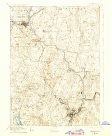
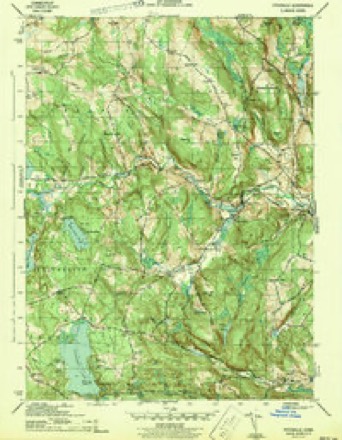
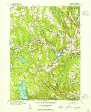
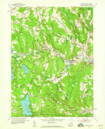
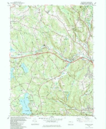
30 topographic sheets cover this place, the earliest surveyed in 1892 and the latest in 1994. It stands in Franklin town. It lies in ZIP code area 06254. It lies near Meeting House Hill. The Survey maps it on the Fitchville quadrangle.
On record in Franklin
Buildings and businesses the archive holds for this place. Each opens its own page, with the source record it came from.
On the National Register 1 record
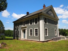 Ashbel Woodward Houselisted 1992
Topographic sheets covering this place
12 surveys from 30 printed sheetsMatched by testing this settlement's coordinate against the published boundary of every sheet in the United States Geological Survey's historical collection. Each opens the scanned sheet at the Survey.
- 1892 USGS Norwich quadrangle1:62500, 8 printings
- 1943 USGS Fitchville quadrangle1:31680, 3 printings
- 1947 USGS Hartford quadrangle1:250000, 2 printings
- 1948 USGS Hartford quadrangle1:250000, 2 printings
- 1953 USGS Fitchville quadrangle1:31680, 2 printings
- 1953 USGS Fitchville quadrangle1:24000, 3 printings
- 1961 USGS Hartford quadrangle1:250000
- 1962 USGS Hartford quadrangle1:250000, 3 printings
- 1965 USGS Hartford quadrangle1:250000, 2 printings
- 1983 USGS Fitchville quadrangle1:24000
- 1986 USGS Hartford quadrangle1:100000
- 1994 USGS Hartford quadrangle1:100000, 2 printings







In the county-history sources
1,496 words on this townshipHistory of New London County, Connecticut, with Biographical Sketches of Many of Its Pioneers and Prominent Men, published 1882 names this settlement in its chapter on Franklin Town. These are the passages that mention it, exactly as the scans read.
Ashbel Woodward, M.D., son of Abner and Eunice (Fuller) Woodward, and the eighth by lineal descent from Richard Woodward, the emigrant ancestor of the family, was born at Wellington, Conn., during the first decade of the present century. After receiving a thorough preparatory course of education, he graduated at the Medical Department of Bowdoin College in May, 1829, and two months later he commenced his professional career at Franklin, Conn., at which place, after a period of unusual continuanQe, he is still engaged in active practice.^ He early mar-
Passage source: History of New London County, Connecticut, with Biographical Sketches of Many of Its Pioneers and Prominent Men, published 1882.
Henry Williams Kingsley, son of Jason W. Kingsley and Eunice Hartshorn, was born in Frauklin, Conn., April 9, 1820. His father, Jason W., son of Alpheus Kingsley and Eunice Williams, a descendant of the old Williams family of Lebanon, was born in Franklin, Conn., married Eunice Hartshorn, daughter of Silas Hartshorn, and granddaughter of Ebenezer Hartshorn, who lived to be ninety years of age, and who was a magistrate till his death, and whose decision was never reversed by a higher court. Jason had six children, - Silas H., deceased ; Henry W. ; Junius E., proprietor of the Continental Hotel, Philadelphia; Charles A., living on the old home in Franklin ; Julia, died at three ; and Julia A., died at twenty-three.
Passage source: History of New London County, Connecticut, with Biographical Sketches of Many of Its Pioneers and Prominent Men, published 1882.
Jason Kingsley was a farmer and mechanic. He was prominent in town, church, and society affairs. In politics a Whig and Kepublican, and held all the important town offices. He died in November, 1866, aged seventy-seven, and wife died Dec. 30, 1868, aged seventy-five, and both were buried in the Franklin Cemetery.
Passage source: History of New London County, Connecticut, with Biographical Sketches of Many of Its Pioneers and Prominent Men, published 1882.
Machine-read from a century-old scan, so expect the errors a machine makes: misspelled names, dropped words, stray characters.
Read the whole chapter on Franklin Town - it names this place 4 more 4 times.
Fires near this place
70 since 1999Regional context, not property-specific evidence. The federal wildfire occurrence database lists 70 fires within 5 miles of Franklin between 1999 and 2020, burning about 79 acres in total. 1 started naturally. 3 were recorded as arson. Distance is straight-line from the map coordinates, so a fire counted here may appear on a neighbouring settlement's page as well.
| Reported cause | Fires |
|---|---|
| Missing data/not specified/undetermined | 40 |
| Recreation and ceremony | 10 |
| Debris and open burning | 9 |
| Arson/incendiarism | 3 |
| Misuse of fire by a minor | 3 |
| Equipment and vehicle use | 2 |
| Railroad operations and maintenance | 1 |
| Power generation/transmission/distribution | 1 |
| Natural | 1 |
The most recent of them, most recent first, with the day each was reported and the service that recorded it.
| Date | Cause | Size | Reported by | Name on the report |
|---|---|---|---|---|
| 2 September 2007 | Missing data/not specified/undetermined | under an acre | Connecticut Division of Forestry | not named |
| 22 August 2005 | Missing data/not specified/undetermined | 1.0 acres | Connecticut Division of Forestry | not named |
| 15 August 2005 | Missing data/not specified/undetermined | 2.0 acres | Connecticut Division of Forestry | not named |
| 4 July 2017 | Missing data/not specified/undetermined | under an acre | Connecticut Division of Forestry | 75 MURPHY HILL RD |
| 31 July 1999 | Debris and open burning | 1.5 acres | Connecticut Division of Forestry | not named |
| 22 July 2016 | Natural | 6.5 acres | Connecticut Division of Forestry | BEHIND THE MUSHROOM FARM |
| 21 July 2016 | Missing data/not specified/undetermined | under an acre | Connecticut Division of Forestry | 931 ROUTE 32, FRANKLIN CT |
| 18 July 2008 | Arson/incendiarism | under an acre | Connecticut Division of Forestry | not named |
Settlements close enough to share some of these fires:
Mines and quarries near this place
10 of 14 shownRegional context, not property-specific evidence. The federal mineral resources record lists 14 workings within 5 miles of Franklin: 12 past producers, 2 producers. 2 still produce. What was taken out: Sand and Gravel, Construction, Stone, Dimension, Stone, Gold. Distance is straight-line from the map coordinates, so a quarry counted here may appear on a neighbouring settlement's page as well.
| Where | Site | Commodity | Status | Recorded |
|---|---|---|---|---|
| Gold Mine | Gold | Past Producer | ||
| Granite Quarry | Granite | Past Producer | ||
| Quartz Monzonite Rock Quarry No. Aj-016 | Stone | Past Producer | Unknown | |
| Building Stone Quarry | Stone, Dimension | Past Producer | ||
| Building Stone Quarry | Stone, Dimension | Past Producer | ||
| Building Stone Quarry | Stone, Dimension | Past Producer | ||
| Building Stone Quarry | Stone, Dimension | Past Producer | ||
| Quartz Monzonite Quarry #Aj???. | Stone, Dimension | Past Producer | ||
| Adelman Pit | Sand and Gravel, Construction | Past Producer | Sedimentary | |
| Route 87 Pit | Sand and Gravel, Construction | Past Producer | Sedimentary |
Storms near this place
14 since 1997Regional context, not property-specific evidence. The National Weather Service names Franklin in 14 storm reports between 1997 and 2025: 10 thunderstorm wind, 3 hail, 1 flash flood. No death or injury is recorded in these reports. Each account below is quoted exactly as the forecast office filed it, from the NOAA Storm Events Database, and each date opens the federal record of that event.
| When | Event | Place named | Harm | What the report says |
|---|---|---|---|---|
| August 2022 | Thunderstorm Wind | Franklin | $10,000 | Law Enforcement reports 12 downed trees near Tyler Drive. |
| July 2015 | Thunderstorm Wind | North Franklin | $7,500 | Multiple trees and wires were reported down on Babcock Hill Road. |
| May 2018 | Thunderstorm Wind | Franklin | $5,000 | Multiple trees and wires down between 5:45 and 6 pm on Baltic Road, Old Route 87, and Powder Hill Lane. |
| July 2025 | Thunderstorm Wind | Franklin | $3,000 | Tree and wires down on CT 87 near Franklin. |
| July 2025 | Thunderstorm Wind | Franklin | $1,000 | Tree branch down on wires on Champion Road with the road impassable. |
| August 2024 | Thunderstorm Wind | Franklin | $1,000 | Tree down on Baltic Road. Road closed. |
| June 2015 | Thunderstorm Wind | Franklin | $1,000 | A tree was reported down along Route 32. |
| July 2011 | Thunderstorm Wind | Franklin | $750 | A tree was reported down across Birch Heights Road in Franklin. |
| September 2018 | Flash Flood | North Franklin | - | A car was stranded in flood waters on Pond Road in Franklin. |
| August 2004 | Thunderstorm Wind | Franklin | - | Trees and power lines were downed. |
| May 2002 | Hail | Franklin | - | no account filed |
| June 2000 | Thunderstorm Wind | Franklin | - | no account filed |
| June 1998 | Hail | Franklin | - | no account filed |
| August 1997 | Hail | Franklin | - | no account filed |
Nearest settlements
The eight closest, with where each one stands in the county. Distances are straight-line, computed from the Geographic Names Information System coordinates.
| Map | Place | Distance | Sheets |
|---|---|---|---|
| Smith Corner | 1.5 miles | 30 | |
| North Franklin | 1.9 miles | 30 | |
| Fitchville | 3.1 miles | 30 | |
| Baltic | 3.3 miles | 30 | |
| Williams Crossing | 3.4 miles | 30 | |
| Avery Corner | 3.5 miles | 30 | |
| Gilman | 3.6 miles | 30 | |
| Yantic | 3.6 miles | 30 |
Provenance
This settlement is recorded in the Geographic Names Information System as feature 212462. The sheet list is computed by point-in-boundary test against the United States Geological Survey's historical topographic inventory. Both are works of the United States government and carry no copyright under 17 U.S.C. 105.
Wildfire. Short, Karen C. 2022. Spatial wildfire occurrence data for the United States, 1992-2020 [FPA_FOD_20221014]. 6th Edition. Fort Collins, CO: Forest Service Research Data Archive. https://doi.org/10.2737/RDS-2013-0009.6 Collected with United States Government funding and usable without additional permissions or fees.
Mines and quarries. USGS Mineral Resources Data System (MRDS) https://mrdata.usgs.gov/mrds/ A work of the United States government, no copyright under 17 U.S.C. 105.
Storms. NOAA National Centers for Environmental Information, Storm Events Database https://www.ncei.noaa.gov/stormevents/ A work of the United States government, no copyright under 17 U.S.C. 105. Narratives are quoted verbatim from the National Weather Service report and are not edited or summarised.