 Block
Moodus, Connecticut
29 topographic sheets cover this place, the earliest surveyed in 1892 and the latest in 1994. It stands in East Haddam town. It lies in ZIP code area 06469. It stands on Shady Brook. The Survey maps it on the Moodus quadrangle. 1,982 people lived here at the 2020 count. It stands 230 feet above sea level.
On record in Moodus
Buildings and businesses the archive holds for this place. Each opens its own page, with the source record it came from.
On the National Register 1 record
 Amasa Day Houselisted 1972
Population over time
2 figuresMoodus grew from 1,413 to 1,982 between 2010 and 2020. These are the recorded population figures Wikidata holds for this place, reached through the Geographic Names Information System number this page is keyed on rather than by name, so they belong to this place and not to another of the same name. Most are census counts, but not all are: an early figure may be a founding or settlement estimate, and an estimate published within five years of a census is left out. The change column is computed, and is left blank where more than 20 years separate a figure from the one before it, because a gap that long is not a change between two counts.
| Year | People | Change |
|---|---|---|
| 2010 | 1,413 | |
| 2020 | 1,982 | +569 (+40%) |
Topographic sheets covering this place
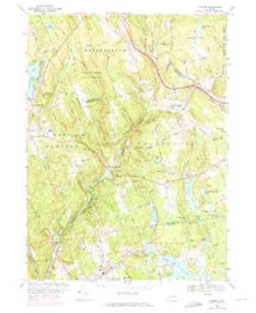
12 surveys from 29 printed sheetsMatched by testing this settlement's coordinate against the published boundary of every sheet in the United States Geological Survey's historical collection. Each opens the scanned sheet at the Survey.
- 1892 USGS Gilead quadrangle1:62500, 7 printings
- 1946 USGS Moodus quadrangle1:31680, 2 printings
- 1947 USGS Hartford quadrangle1:250000, 2 printings
- 1948 USGS Hartford quadrangle1:250000, 2 printings
- 1952 USGS Moodus quadrangle1:24000
- 1952 USGS Moodus quadrangle1:31680, 2 printings
- 1961 USGS Hartford quadrangle1:250000
- 1962 USGS Hartford quadrangle1:250000, 3 printings
- 1965 USGS Hartford quadrangle1:250000, 2 printings
- 1967 USGS Moodus quadrangle1:24000, 4 printings
- 1986 USGS Hartford quadrangle1:100000
- 1994 USGS Hartford quadrangle1:100000, 2 printings







In the county-history sources
43,998 words on this townshipHistory of Middlesex County, Connecticut, with Biographical Sketches of Its Prominent Men, published 1884 names this settlement in its chapter on East Haddam Town. These are the passages that mention it, exactly as the scans read.
October 1733. - " Upon the memorial of Jonathan Beebe, Samuel Olmsted jun, and Thomas Clark, in behalf of themselves and the rest of the inhabitants of the easterly part of East Haddani, praying to be a society distinct by themselves and to have the privileges allowed to them that are usually granted to other societies: Granted by this Assembly to the memorialists, to be a society and to have the privileges as prayed for, and that the bounds of said parish shall be as follows, (viz:) on the west, a line running from the mouth of the brook that runs into the southern end of the pond near to John Bates's, and from thence extending southerly till said line strike the middle of the line that divides between the town of Lyme and said East Haddam, then with a line beginning at the place where the brook runs out of said pond, thence running by said brook to the bridge called Moodus bridge, and from said bridge a north line to Colchester bounds; bounded easterly, partly on Colchester and partly on Lyme; northerly, on part of Colchester; and southerly, on Lyme; and that said parish shall be called by the name of Miilington.
Passage source: History of Middlesex County, Connecticut, with Biographical Sketches of Its Prominent Men, published 1884.
First, or Center District, 37 scholars; Second, or Landing, 79; Third, or Red Lane, 53; Fourth, or Uptown, 27; Fifth, or Bashan, 68; Sixth, or Town Hill, 19; Seventh, or Nicket Lane, 33; Eighth, or Leesvill-, 16; Ninth, or Moodus, 130; Tenth, or Millington Green, 31; Eleventh, or Plain, 2r; Twelfth, or Olmstead, 16; Thirteenth, or Foxtown, 8; Fourteenth, or Tater Hill, 18; Fifteenth, or Millington West, 19; Sixteenth, or Acby, 20; Seventeenth, or Hadlyme, 47; a total of 633.
Passage source: History of Middlesex County, Connecticut, with Biographical Sketches of Its Prominent Men, published 1884.
The other grave yards in East Haddam were laid out or commenced as follows: Old yard in Hadlyme, 1723; Long Pond yard, 1726; Moodus yard, 1748; Meeting House^yard, in Hadlyme, 1750; Bashan, 1760; "Tater Hill," 1760; Near Millington Green, 1764; Eight Mile River, 1769; Landing, 1773; Mt. Parnassus, 1774; Center Congregational Church, 1778; Wicket old accounts refer to periods when virulent diseases prevailed throughout the town, but of nothing very serious. Within a few years past malaria~has prevailed to some extent along the river, and, in fact, it has prevailed throughout the whole State. In 1775, there were ^^^^ 40 deaths in the town; in the year following, more than 50. The population of East Haddam in 1800 was 2,805. The total number of deaths in the town for 10 years after was 614, or an average of over 60 each year, being h much larger average of mortality than has existed since that time. In 1870, the population was but 2,952, or 147 more thsn it was at the beginning of the century. The number of deaths during the year ending June ist 1870 was 54, or an average of one in 55 persons. Twenty of these deaths were caufed by consumption, six by typhoid fever, and two were accidental. The other deaths resulted from diseases pertaining to childhood and old age. Twenty-two of the number were under 33 years of age, ii over 70; 7 over 80, and one over 90 years. Thus while two-fifths failed to reach the average of human life, more than one-third passed the three score years and ten allotted to man.
Passage source: History of Middlesex County, Connecticut, with Biographical Sketches of Its Prominent Men, published 1884.
Machine-read from a century-old scan, so expect the errors a machine makes: misspelled names, dropped words, stray characters.
Read the whole chapter on East Haddam Town - it names this place 34 more 34 times.
Fires near this place
175 since 1993Regional context, not property-specific evidence. The federal wildfire occurrence database lists 175 fires within 5 miles of Moodus between 1993 and 2020, burning about 392 acres in total. 1 started naturally. 3 were recorded as arson. Distance is straight-line from the map coordinates, so a fire counted here may appear on a neighbouring settlement's page as well.
| Reported cause | Fires |
|---|---|
| Missing data/not specified/undetermined | 96 |
| Recreation and ceremony | 24 |
| Debris and open burning | 24 |
| Misuse of fire by a minor | 12 |
| Smoking | 7 |
| Equipment and vehicle use | 5 |
| Arson/incendiarism | 3 |
| Other causes | 1 |
| Natural | 1 |
| Power generation/transmission/distribution | 1 |
| Fireworks | 1 |
The most recent of them, most recent first, with the day each was reported and the service that recorded it.
| Date | Cause | Size | Reported by | Name on the report |
|---|---|---|---|---|
| 8 September 2015 | Arson/incendiarism | 10 acres | Connecticut Division of Forestry | not named |
| 6 September 2015 | Recreation and ceremony | 1.0 acres | Connecticut Division of Forestry | not named |
| 3 September 2019 | Missing data/not specified/undetermined | under an acre | Connecticut Division of Forestry | not named |
| 2 September 2017 | Recreation and ceremony | under an acre | Connecticut Division of Forestry | 81 SCHULMAN VESELAK |
| 26 August 2005 | Missing data/not specified/undetermined | 1.0 acres | Connecticut Division of Forestry | not named |
| 25 August 2018 | Power generation/transmission/distribution | under an acre | Connecticut Division of Forestry | 30 SAYBROOK ROAD |
| 25 August 2005 | Missing data/not specified/undetermined | 5.0 acres | Connecticut Division of Forestry | not named |
| 22 August 2020 | Debris and open burning | under an acre | Connecticut Division of Forestry | WARNER ROAD |
Settlements close enough to share some of these fires:
Mines and quarries near this place
10 of 42 shownRegional context, not property-specific evidence. The federal mineral resources record lists 42 workings within 5 miles of Moodus: 32 past producers, 4 producers, 3 occurrences, 3 prospects. 4 still produce. What was taken out: Feldspar, Mica, Stone, Dimension, Beryllium. Distance is straight-line from the map coordinates, so a quarry counted here may appear on a neighbouring settlement's page as well.
| Where | Site | Commodity | Status | Recorded |
|---|---|---|---|---|
| Anderson Mica Mines and Swanson Lithia Mine | Mica, Lithium | Past Producer | Pegmatite Dike | |
| Anderson No. 1 Mica Mine | Mica, Feldspar, Lithium | Past Producer | ||
| Bainerd Quarry | Feldspar, Mica, Beryllium | Past Producer | ||
| East Selden Mica, Beryl, Feldspar Quarry | Mica, Feldspar, Tantalum, Niobium (Columbium), Beryllium | Past Producer | Pegmatite Dike | |
| Gillette Gem Tourmaline, Mineral Specimens, Mica, Feldspar Mine (Also | Gemstone, Mica, Feldspar | Past Producer | 1896 | |
| Gillette Quarry | Tin, Feldspar, Semiprecious Gemstone, Mica | Past Producer | 1896 | |
| Halberg Quarries | Mica, Beryllium, Feldspar | Past Producer | ||
| Selden Property | Feldspar, Mica, Beryllium, Niobium (Columbium), Tantalum | Past Producer | ||
| Slocum Beryl Prospect | Feldspar, Beryllium, Mica, Niobium (Columbium), Tantalum | Past Producer | ||
| Upper Triassic Copper Prospects No. Cj-053 | Copper | Occurrence | Triassic Dike Intrusive |
Storms near this place
3 since 2007Regional context, not property-specific evidence. The National Weather Service names Moodus in 3 storm reports between 2007 and 2018: 2 thunderstorm wind, 1 flash flood. No death or injury is recorded in these reports. Each account below is quoted exactly as the forecast office filed it, from the NOAA Storm Events Database, and each date opens the federal record of that event.
| When | Event | Place named | Harm | What the report says |
|---|---|---|---|---|
| May 2018 | Thunderstorm Wind | Moodus | $5,000 | Numerous trees down. |
| September 2018 | Flash Flood | Moodus | - | The Neptune Avenue bridge in East Haddam was washed out due to flash flooding. |
| July 2007 | Thunderstorm Wind | Moodus | - | Trees down along Sillimanville Rd. |
Nearest settlements
The eight closest, with where each one stands in the county. Distances are straight-line, computed from the Geographic Names Information System coordinates.
| Map | Place | Distance | Sheets |
|---|---|---|---|
| Johnsonville (historical) | 1.0 miles | 29 | |
| Bashan | 1.1 miles | 29 | |
| Scovill Landing | 1.2 miles | 29 | |
| Bailey Beach | 1.5 miles | 29 | |
| Little Haddam | 1.5 miles | 29 | |
| Leesville | 1.8 miles | 29 | |
| Wopowog | 2.3 miles | 29 | |
| Mount Parnassus | 2.9 miles | 29 |
Elsewhere
Matched on this settlement's Geographic Names Information System number rather than its name, so it cannot be a different place of the same name in another state.
| Wikipedia article on Moodus | An encyclopaedic summary. Its text is share-alike, so it is linked here rather than copied. |
| Wikidata item Q755821 | The structured record the population and elevation above come from. Public domain (CC0). |
Provenance
This settlement is recorded in the Geographic Names Information System as feature 209012. The sheet list is computed by point-in-boundary test against the United States Geological Survey's historical topographic inventory. Both are works of the United States government and carry no copyright under 17 U.S.C. 105.
Wildfire. Short, Karen C. 2022. Spatial wildfire occurrence data for the United States, 1992-2020 [FPA_FOD_20221014]. 6th Edition. Fort Collins, CO: Forest Service Research Data Archive. https://doi.org/10.2737/RDS-2013-0009.6 Collected with United States Government funding and usable without additional permissions or fees.
Mines and quarries. USGS Mineral Resources Data System (MRDS) https://mrdata.usgs.gov/mrds/ A work of the United States government, no copyright under 17 U.S.C. 105.
Storms. NOAA National Centers for Environmental Information, Storm Events Database https://www.ncei.noaa.gov/stormevents/ A work of the United States government, no copyright under 17 U.S.C. 105. Narratives are quoted verbatim from the National Weather Service report and are not edited or summarised.