 Block
Newington, Connecticut
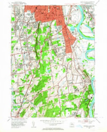
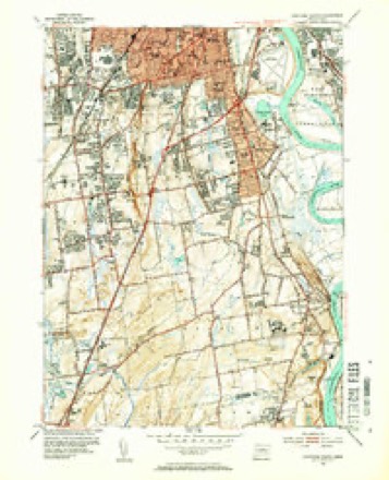
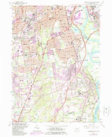
37 topographic sheets cover this place, the earliest surveyed in 1893 and the latest in 1994. It stands in Newington town. It lies in ZIP code area 06111. It lies near Cedar Mountain. The Survey maps it on the Hartford South quadrangle.
On record in Newington
Buildings and businesses the archive holds for this place. Each opens its own page, with the source record it came from.
On the National Register 9 records
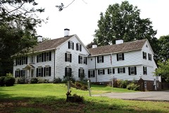 Gen. Martin Kellogg Houselisted 1987
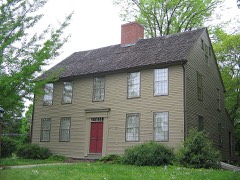 Enoch Kelsey Houselisted 1982
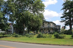 Newington Junction North Historic Districtlisted 1987
 Newington Junction Railroad Depotlisted 1986
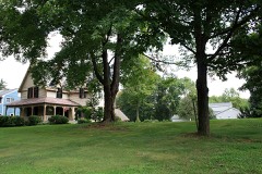 Newington Junction South Historic Districtlisted 1987
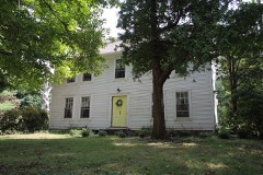 Unni II Robbins Houselisted 2005
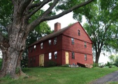 Willard Homesteadlisted 1986
- Newington Junction West Historic Districtlisted 1987
- Newington VA Hospital Historic Districtlisted 2022
Topographic sheets covering this place
13 surveys from 37 printed sheetsMatched by testing this settlement's coordinate against the published boundary of every sheet in the United States Geological Survey's historical collection. Each opens the scanned sheet at the Survey.
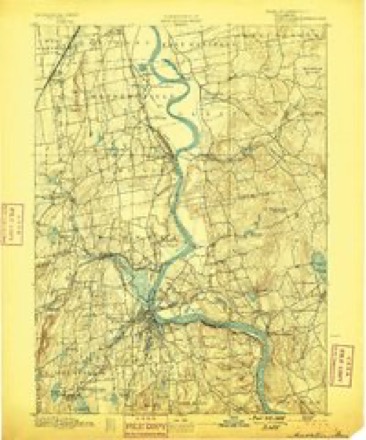
- 1893 USGS Middletown quadrangle1:62500, 10 printings
- 1906 USGS Farmington quadrangle1:125000, 2 printings
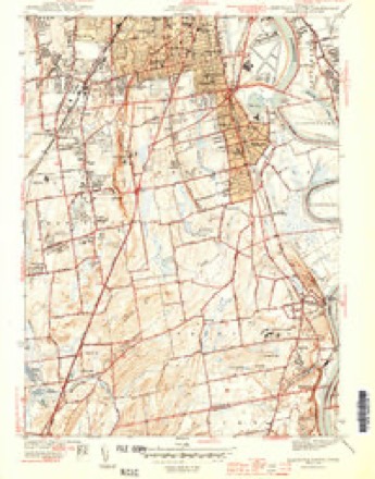
- 1944 USGS Hartford South quadrangle1:31680, 3 printings
- 1947 USGS Hartford quadrangle1:250000, 2 printings
- 1948 USGS Hartford quadrangle1:250000, 2 printings
- 1952 USGS Hartford South quadrangle1:24000, 2 printings
- 1952 USGS Hartford South quadrangle1:31680, 2 printings
- 1961 USGS Hartford quadrangle1:250000
- 1962 USGS Hartford quadrangle1:250000, 3 printings
- 1964 USGS Hartford South quadrangle1:24000, 5 printings
- 1965 USGS Hartford quadrangle1:250000, 2 printings
- 1986 USGS Hartford quadrangle1:100000
- 1994 USGS Hartford quadrangle1:100000, 2 printings








In the county-history sources
7,863 words on this townshipThe Memorial History of Hartford County, Connecticut, 1633-1884;, published 1886 names this settlement in its chapter on Newington Town. These are the passages that mention it, exactly as the scans read.
Sowheag, a sachem of the Mattabesett tribe, originally sold the land in Newington to the first settlers of Wethersfield. A committee appointed by the two towns of Wethersfield and Farmington definitely settled the western limit of this Indian purchase on the 29th of October, 1670, by a line which established their boundary, running from
Passage source: The Memorial History of Hartford County, Connecticut, 1633-1884;, published 1886.
There was another general division of common land authorized by the town in February, 1G94. In October following a committee was appointed to make the division. In April, 1005, it reported a division of five different tiers of lots. The third tier ran east from the Woodbridge grant, abutting north on the Hartford line and south on what is now called Jordan Lane, which then extended west of Cedar Mountain in what was as nearly a straight line as the topographical character of the mountain would permit. The lots ran north and south one hundred rods across the tier, and being of shorter length than was usual, Avere called short lots." There were but nine of these lots in all, numbered 70 to 87 inclusive, extending from Ensign Stedman's on the east to the Woodbridge grant on the west. Land was left for a highway south af them. The first, second, and fifth tiers were in Wethersfield, in that part now constituting Rocky Hill. The fourth tier of lots was wholly in Newington, called the East Tier, and ran ])arallel to the West Division, and half a mile cast ; being separated from it by a strip of common land called the Half-mile Common. It was a half-mile wide, and extended from the highway south of the " slioi't lots " to the New Haven road as its southern terminus, or about four miles. It contained thirty-nine lots, beginning at the north end with lot 88, and ending with lot 126 at the south. The lots of this second division were all apportioned according to the lists of the proprietors as taken in October, 1693, because a purchase of land had been made from the Indians and paid for by a special tax laid u])on the list.
Passage source: The Memorial History of Hartford County, Connecticut, 1633-1884;, published 1886.
None of these settlers except the first drew lots in either of the two West Divisions. There was another settler in the extreme south part of the place who was undoubtedly the first in point of time, and pre-eminent in the extent of his land. Sergeant Richard Beckley received a grant from the General Court, Oct. 8, 1668, of three hundred acres lying on both sides of Mattabesett River to run up from New Haven path, Tliis grant was confirmed by the town at a meeting held Feb. 23, 1670-71, in which it is described as obtained by him "by purchase of Turramuggus, Indian, with the consent of the court and town . . . whereon his houseing and barn standeth," so that at this date he had a house and barn in Newington. This confirmation of his grant from Turramuggus is, however, stipulated to be on the condition that he give up all right or lot in the West Division, which was separated from his land only by a highway. The tradition is that he married a daughter of Turramuggus. As the latter was a successor of the sachem Sowheag, and one of his heirs, and had the disposal of so much land, an alliance with the royal line of native chiefs may not have been disadvantageous, and may account for this grant and for his location near the home of the chief.^ Other Beckleys in process of time settled around him, until the name of Beckley Quarter was acquired by the locality. He appears to have been one of the first settlers of New Haven, and one of the pillars of Mr. Davenport's cliurch. The records of that colony show that he resided there from 1639 to 1659. In 1646 he and " sister Beckley," who was probably his wife, were " seated " in Mr. Davenport's church in the second seat, indicating his prominence. He is stated to have married for his second wife a daughter of John Dcming, of Wethersfield. In 1662 he was appointed a constable in Wethersfield, so that his removal from New Haven to Wethersfield was between 1659 and 1662. He died Aug. 5, 1690. As the land in Newington was highly productive, the pioneer settlers were soon joined by others, and in a few years this small beginning grew into a considerable and prosperous settlement.
Passage source: The Memorial History of Hartford County, Connecticut, 1633-1884;, published 1886.
Machine-read from a century-old scan, so expect the errors a machine makes: misspelled names, dropped words, stray characters.
Read the whole chapter on Newington Town - it names this place 17 more 17 times.
Fires near this place
3 since 2011Regional context, not property-specific evidence. The federal wildfire occurrence database lists 3 fires within 5 miles of Newington between 2011 and 2016, burning about 4 acres in total. None started naturally. None was recorded as arson. Distance is straight-line from the map coordinates, so a fire counted here may appear on a neighbouring settlement's page as well.
| Reported cause | Fires |
|---|---|
| Missing data/not specified/undetermined | 1 |
| Smoking | 1 |
| Debris and open burning | 1 |
The most recent of them, most recent first, with the day each was reported and the service that recorded it.
| Date | Cause | Size | Reported by | Name on the report |
|---|---|---|---|---|
| 3 April 2011 | Missing data/not specified/undetermined | 2.0 acres | Connecticut Division of Forestry | NEWINGTON |
| 23 April 2016 | Smoking | under an acre | Connecticut Division of Forestry | 175 LOWREY PL, NEWINGTON, CT 06111 |
| 31 March 2016 | Debris and open burning | 2.0 acres | Connecticut Division of Forestry | 380 WIESE ALBERT ROAD |
Settlements close enough to share some of these fires:
Mines and quarries near this place
10 of 37 shownRegional context, not property-specific evidence. The federal mineral resources record lists 37 workings within 5 miles of Newington: 33 past producers, 3 producers, 1 plant. 4 still produce. What was taken out: Stone, Crushed/Broken, Stone, Dimension, Sand and Gravel, Construction, Lead. Distance is straight-line from the map coordinates, so a quarry counted here may appear on a neighbouring settlement's page as well.
| Where | Site | Commodity | Status | Recorded |
|---|---|---|---|---|
| American Steel & Aluminum/Hartford | Iron | Plant | ||
| Lead Mine | Lead | Past Producer | ||
| Mc Keon Pit | Sand and Gravel, Construction | Past Producer | ||
| Rocky Hill Mine | Sand and Gravel, Construction | Past Producer | ||
| Quarry | Stone, Dimension | Past Producer | ||
| Traprock Quarries | Stone, Dimension | Past Producer | ||
| Traprock Quarries | Stone, Dimension | Past Producer | ||
| Traprock Quarries | Stone, Dimension | Past Producer | ||
| Traprock Quarries | Stone, Dimension | Past Producer | ||
| Traprock Quarries | Stone, Dimension | Past Producer |
Storms near this place
18 since 1994Regional context, not property-specific evidence. The National Weather Service names Newington in 18 storm reports between 1994 and 2025: 8 thunderstorm wind, 5 hail, 2 flood, 2 flash flood. No death or injury is recorded in these reports. Each account below is quoted exactly as the forecast office filed it, from the NOAA Storm Events Database, and each date opens the federal record of that event.
| When | Event | Place named | Harm | What the report says |
|---|---|---|---|---|
| June 2009 | Thunderstorm Wind | Newington | $150,000 | Large branches up to one foot in diameter and numerous trees were downed by thunderstorm winds. A two foot diameter tree landed on a house on Cedar Street when it was downed by thunderstorm winds. This tree also blocked Cedar Street, resulting in its closure. |
| July 2016 | Thunderstorm Wind | Newington | $75,000 | Trees and wires were downed throughout town. On Mountain View Drive, a large tree was downed onto five cars parked in a driveway. All were damaged, two were totaled. |
| June 2009 | Hail | Newington | $50,000 | Ping-pong ball to golf ball size hail fell in a swath from Newington to Wethersfield, denting cars. |
| August 2008 | Thunderstorm Wind | Newington | $8,000 | Trees along Route 5 near Wethersfield and along Route 75 near Newington were downed by thunderstorm winds. |
| June 2008 | Thunderstorm Wind | Newington | $5,000 | Trees and wires were downed by thunderstorm winds. |
| June 2008 | Thunderstorm Wind | Newington | $5,000 | Trees and wires on New Britain Avenue downed by thunderstorm winds. |
| July 2025 | Thunderstorm Wind | Newington | $500 | In Newington, a number of large branches were down. |
| August 2024 | Flash Flood | Newington | - | In Newington, there were several reports of flooding around town. Main St and Dowd St was flooded and impassable. |
| June 2024 | Thunderstorm Wind | Newington | - | In Newington, a spotter measured a gust to 60 mph. |
| September 2023 | Flash Flood | Newington | - | In Newington, there was a car stuck in flood waters at the 300 block of Main St. |
| January 2018 | Flood | Newington | - | At 336 PM EST in Newington, Willard Avenue at Garfield Street was reported closed due to flooding. Rainfall between 1.5 inches and 3.0 inches was reported in Hartford County. |
| October 2018 | Flood | Newington | - | At 5:32 PM EST, part of Atwood Street was closed due to flooding. |
| May 2009 | Hail | Newington | - | Penny sized hail fell on Willard Avenue. |
| June 2009 | Hail | Newington | - | Nickel to quarter size hail fell near Indian Hill Golf Course and on Main Street. |
| July 1994 | Thunderstorm Wind | Newington | - | Large trees and branches were blown down causing power outages. |
| June 2013 | Hail | Newington | - | no account filed |
| August 2011 | Hail | Newington | - | no account filed |
| July 1996 | Funnel Cloud | Newington | - | no account filed |
Nearest settlements
The eight closest, with where each one stands in the county. Distances are straight-line, computed from the Geographic Names Information System coordinates.
| Map | Place | Distance | Sheets |
|---|---|---|---|
| Newington Junction | 1.3 miles | 37 | |
| Elm Hill | 2.0 miles | 37 | |
| Elmwood | 2.4 miles | 37 | |
| Griswoldville | 2.8 miles | 37 | |
| Saybrooke Village | 3.6 miles | 37 | |
| East Farmington Heights | 3.6 miles | 38 | |
| South Wethersfield | 3.6 miles | 37 | |
| New Britain | 3.9 miles | 38 |
Provenance
This settlement is recorded in the Geographic Names Information System as feature 209272. The sheet list is computed by point-in-boundary test against the United States Geological Survey's historical topographic inventory. Both are works of the United States government and carry no copyright under 17 U.S.C. 105.
Wildfire. Short, Karen C. 2022. Spatial wildfire occurrence data for the United States, 1992-2020 [FPA_FOD_20221014]. 6th Edition. Fort Collins, CO: Forest Service Research Data Archive. https://doi.org/10.2737/RDS-2013-0009.6 Collected with United States Government funding and usable without additional permissions or fees.
Mines and quarries. USGS Mineral Resources Data System (MRDS) https://mrdata.usgs.gov/mrds/ A work of the United States government, no copyright under 17 U.S.C. 105.
Storms. NOAA National Centers for Environmental Information, Storm Events Database https://www.ncei.noaa.gov/stormevents/ A work of the United States government, no copyright under 17 U.S.C. 105. Narratives are quoted verbatim from the National Weather Service report and are not edited or summarised.