 Block
Newtown, Connecticut
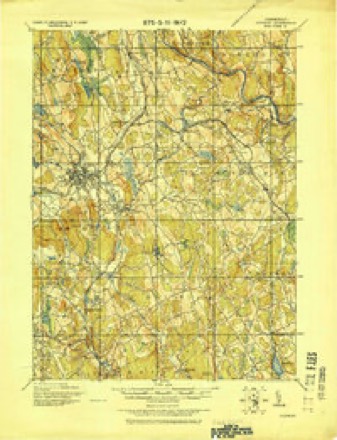
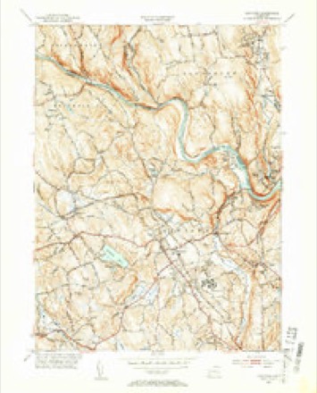
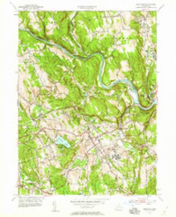
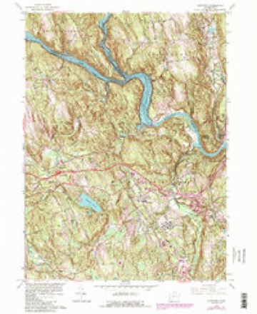
32 topographic sheets cover this place, the earliest surveyed in 1892 and the latest in 1986. It stands in Newtown town. It lies in ZIP code area 06470. It lies near Sunset Hill. The Survey maps it on the Newtown quadrangle. 1,914 people lived here at the 2020 count.
On record in Newtown
Buildings and businesses the archive holds for this place. Each opens its own page, with the source record it came from.
On the National Register 10 records
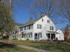 Caleb Baldwin Tavernlisted 2002
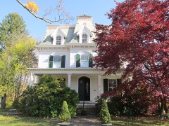 Glover Houselisted 1982
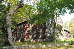 John Glover Houselisted 2001
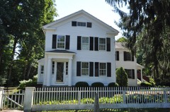 Hattertown Historic Districtlisted 1996
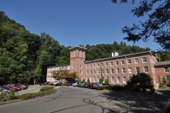 New York Belting and Packing Co.listed 1982
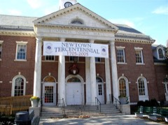 Newtown Borough Historic Districtlisted 1996
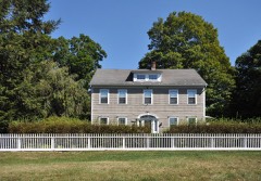 Sanford-Curtis-Thurber Houselisted 2007
- Fairfield Hills Campus Historic Districtlisted 2024
- Nathan B. Lattin Farmlisted 1990
- March Route of Rochambeau's Army: Reservoir Roadlisted 2003
Population over time
2 figuresNewtown fell from 1,941 to 1,914 between 2010 and 2020. These are the recorded population figures Wikidata holds for this place, reached through the Geographic Names Information System number this page is keyed on rather than by name, so they belong to this place and not to another of the same name. Most are census counts, but not all are: an early figure may be a founding or settlement estimate, and an estimate published within five years of a census is left out. The change column is computed, and is left blank where more than 20 years separate a figure from the one before it, because a gap that long is not a change between two counts.
| Year | People | Change |
|---|---|---|
| 2010 | 1,941 | |
| 2020 | 1,914 | -27 (-1%) |
Topographic sheets covering this place
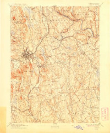
11 surveys from 32 printed sheetsMatched by testing this settlement's coordinate against the published boundary of every sheet in the United States Geological Survey's historical collection. Each opens the scanned sheet at the Survey.
- 1892 USGS Danbury quadrangle1:62500, 11 printings
- 1915 USGS Danbury quadrangle1:62500
- 1947 USGS Hartford quadrangle1:250000, 2 printings
- 1948 USGS Hartford quadrangle1:250000, 2 printings
- 1953 USGS Newtown quadrangle1:31680, 2 printings
- 1953 USGS Newtown quadrangle1:24000
- 1961 USGS Hartford quadrangle1:250000
- 1962 USGS Hartford quadrangle1:250000, 3 printings
- 1963 USGS Newtown quadrangle1:24000, 4 printings
- 1965 USGS Hartford quadrangle1:250000, 2 printings
- 1986 USGS Bridgeport quadrangle1:100000, 3 printings






In the county-history sources
2,459 words on this townshipHistory of Fairfield County, Connecticut : with Illustrations and Biographical Sketches of Its Prominent Men and Pioneers, published 1881 names this settlement in its chapter on Newtown Town. These are the passages that mention it, exactly as the scans read.
Among the prominent lawyers who were either born or practiced their profession in Newtown, was William Edmonds. He served in the Revolutionary war, and was wounded at the battle of Eidgefield and lay on the field over night. He afterwards became judge of the Superior Court.
Passage source: History of Fairfield County, Connecticut : with Illustrations and Biographical Sketches of Its Prominent Men and Pioneers, published 1881.
PHYSICIANS. The first disciple of ^Esculapius in Newtown was Dr. Gideon Shepherd. He was followed by Bennet Perry, Oliver Bancroft, John Judson, Thomas D. Shepherd, C. H. Booth, Dr. Shelton, Dr. Skidmore, George Judson, Erastus Erwiii, Thomas Dutton, and Graves.
Passage source: History of Fairfield County, Connecticut : with Illustrations and Biographical Sketches of Its Prominent Men and Pioneers, published 1881.
MERCHANTS. The first merchant in Newtown was David Curtis, who kept a store on the site of the present store of Sanford & Hawley. The old building is standing, and occupied by the Bee office and a tin-shop. He was succeeded in the same building by Elijah Nichols & Son, who remained a number of years, when it passed into the hands of Nichols & Prince. This firm was
Passage source: History of Fairfield County, Connecticut : with Illustrations and Biographical Sketches of Its Prominent Men and Pioneers, published 1881.
Machine-read from a century-old scan, so expect the errors a machine makes: misspelled names, dropped words, stray characters.
Read the whole chapter on Newtown Town - it names this place 6 more 6 times.
Fires near this place
40 since 1994Regional context, not property-specific evidence. The federal wildfire occurrence database lists 40 fires within 5 miles of Newtown between 1994 and 2020, burning about 97 acres in total. None started naturally. 4 were recorded as arson. Distance is straight-line from the map coordinates, so a fire counted here may appear on a neighbouring settlement's page as well.
| Reported cause | Fires |
|---|---|
| Missing data/not specified/undetermined | 26 |
| Arson/incendiarism | 4 |
| Misuse of fire by a minor | 3 |
| Recreation and ceremony | 3 |
| Railroad operations and maintenance | 3 |
| Equipment and vehicle use | 1 |
The most recent of them, most recent first, with the day each was reported and the service that recorded it.
| Date | Cause | Size | Reported by | Name on the report |
|---|---|---|---|---|
| 30 August 2016 | Missing data/not specified/undetermined | under an acre | Connecticut Division of Forestry | LAKE ZOAR WMA |
| 2 August 1999 | Recreation and ceremony | under an acre | Connecticut Division of Forestry | not named |
| 5 June 1994 | Railroad operations and maintenance | 3.0 acres | Connecticut Division of Forestry | not named |
| 4 June 2020 | Missing data/not specified/undetermined | under an acre | Connecticut Division of Forestry | ROUTE 84E, EXICTS 11 AND 13 |
| 27 June 2020 | Missing data/not specified/undetermined | 1.0 acres | Connecticut Division of Forestry | 135 LITTLE YORK ROAD |
| 18 June 1994 | Railroad operations and maintenance | 2.0 acres | Connecticut Division of Forestry | not named |
| 10 June 1994 | Recreation and ceremony | 2.0 acres | Connecticut Division of Forestry | not named |
| 9 May 2001 | Missing data/not specified/undetermined | under an acre | Connecticut Division of Forestry | not named |
Settlements close enough to share some of these fires:
Mines and quarries near this place
10 of 20 shownRegional context, not property-specific evidence. The federal mineral resources record lists 20 workings within 5 miles of Newtown: 15 past producers, 3 producers, 1 unknown, 1 occurrence. 3 still produce. What was taken out: Sand and Gravel, Construction, Feldspar, Quartz, Beryllium, Feldspar, Mica. Distance is straight-line from the map coordinates, so a quarry counted here may appear on a neighbouring settlement's page as well.
| Where | Site | Commodity | Status | Recorded |
|---|---|---|---|---|
| Captain Cook Quarry | Beryllium, Feldspar, Mica | Past Producer | ||
| Gold & Silver Mine | Gold, Silver | Past Producer | ||
| Lane's Mine | Tungsten | Past Producer | ||
| Old Sandy Hook Gold Mine Prospect and Sulfide Occurrence | Lead | Occurrence | Probably Vein Quartz | |
| Bethel Feldspar Pegmatite Quarry | Feldspar, Quartz | Past Producer | Feldspar | |
| Captain Cook Pegmatite Quarry | Feldspar, Quartz | Past Producer | Feldspar | |
| Cappys Pit | Sand and Gravel, Construction | Past Producer | Sedimentary | |
| Cappys Pit | Sand and Gravel, Construction | Past Producer | ||
| Central Pit | Sand and Gravel, Construction | Past Producer | Sedimentary | |
| Central Pit | Sand and Gravel, Construction | Past Producer |
Storms near this place
26 since 1996Regional context, not property-specific evidence. The National Weather Service names Newtown in 26 storm reports between 1996 and 2024: 19 thunderstorm wind, 3 hail, 2 lightning, 1 flash flood. The reports record 1 injury. Each account below is quoted exactly as the forecast office filed it, from the NOAA Storm Events Database, and each date opens the federal record of that event.
| When | Event | Place named | Harm | What the report says |
|---|---|---|---|---|
| July 1997 | Lightning | Newtown | 1 hurt | no account filed |
| June 2010 | Thunderstorm Wind | Newtown | $35,000 | Numerous trees and power lines were downed throughout Newtown. Over 11,000 customers lost power in the region. Over 25 roads were closed due to the damage. |
| October 2020 | Thunderstorm Wind | Newtown | $10,000 | Multiple reports of large branches and wires down across town. |
| May 2018 | Thunderstorm Wind | Newtown | $10,000 | Numerous roads closed due to downed trees in the Newtown / Monroe area. |
| July 2008 | Thunderstorm Wind | Newtown | $10,000 | Utility lines and several trees, including a massive tree, were downed in Newtown. A tree went through the roof of a residence, and a small fire was set by downed wires. Main Street was closed for several hours. |
| June 2024 | Thunderstorm Wind | Newtown | $8,000 | Dozens of reports across Newtown involving downed trees with a few of them involving wires. |
| June 2010 | Thunderstorm Wind | Newtown | $8,000 | Numerous trees and wires were downed in Newtown. The areas impacted most heavily ranged from the center of town to the Route 302 and Route 6 areas. |
| May 2018 | Thunderstorm Wind | Newtown | $5,000 | At Gelding Hill Road, numerous trees down. Power lines down. |
| July 2014 | Lightning | Newtown | $5,000 | A house was struck on Elona Lane. |
| July 2014 | Thunderstorm Wind | Newtown | $4,000 | Several trees and wires were reported down around the town. |
| July 2014 | Thunderstorm Wind | Newtown | $2,000 | Multiple trees were reported down at the intersection of Glen Road and Cherry Street. |
| July 2014 | Thunderstorm Wind | Newtown | $2,000 | Numerous trees were reported down around the town of Newtown. |
| May 2009 | Thunderstorm Wind | Newtown | $1,000 | Trees fell on wires on Sugar Hill Road. |
| May 2009 | Thunderstorm Wind | Newtown | $1,000 | A tree fell on wires at 4 Nelson Lane. |
| March 2019 | Hail | Newtown | - | Hail of 0.75 inches in diameter reported. |
| March 2019 | Hail | Newtown | - | Half dollar size hail reported with size estimated from picture. |
| May 2007 | Thunderstorm Wind | Newtown | - | Numerous trees down. |
| June 2007 | Thunderstorm Wind | Newtown | - | Downed trees. |
| May 2007 | Tornado (EF1) | Newtown | - | An EF-1 tornado touched down near the Rock Ridge Country Club, just north of Route 302. It traveled east to northeast and passed just south of the main town center in Newtown. The tornado passed across Route 25, South Main Street and lifted along Sugarloaf Road, between Toddy Hill Road and Berkshire Drive.||High winds damaged many trees which fell through houses and cars along this path, which was approximately 4.5 miles with an average path width of 100 yards. There was a well defined narrow track of discontinuous damage, where the damage converged in toward the track center. Eye witness reports of funnel clouds were observed.|| |
| June 2007 | Hail | Newtown | - | no account filed |
| June 2001 | Thunderstorm Wind | Newtown | - | no account filed |
| June 2001 | Thunderstorm Wind | Newtown | - | no account filed |
| August 2001 | Thunderstorm Wind | Newtown | - | no account filed |
| July 2000 | Flash Flood | Newtown | - | no account filed |
| August 1998 | Thunderstorm Wind | Newtown | - | no account filed |
| August 1996 | Thunderstorm Wind | Newtown | - | no account filed |
Nearest settlements
The eight closest, with where each one stands in the county. Distances are straight-line, computed from the Geographic Names Information System coordinates.
| Map | Place | Distance | Sheets |
|---|---|---|---|
| Morgan Fair Corners | 0.4 miles | 32 | |
| Sandy Hook | 1.2 miles | 32 | |
| Rocky Glen | 2.1 miles | 32 | |
| Berkshire | 2.4 miles | 32 | |
| Pootatuck Park | 2.5 miles | 32 | |
| Shady Rest | 2.9 miles | 32 | |
| Hawleyville | 2.9 miles | 32 | |
| Riverside | 3.2 miles | 32 |
Elsewhere
Matched on this settlement's Geographic Names Information System number rather than its name, so it cannot be a different place of the same name in another state.
| Wikipedia article on Newtown | An encyclopaedic summary. Its text is share-alike, so it is linked here rather than copied. |
| Wikidata item Q981265 | The structured record the population and elevation above come from. Public domain (CC0). |
Provenance
This settlement is recorded in the Geographic Names Information System as feature 209274. The sheet list is computed by point-in-boundary test against the United States Geological Survey's historical topographic inventory. Both are works of the United States government and carry no copyright under 17 U.S.C. 105.
Wildfire. Short, Karen C. 2022. Spatial wildfire occurrence data for the United States, 1992-2020 [FPA_FOD_20221014]. 6th Edition. Fort Collins, CO: Forest Service Research Data Archive. https://doi.org/10.2737/RDS-2013-0009.6 Collected with United States Government funding and usable without additional permissions or fees.
Mines and quarries. USGS Mineral Resources Data System (MRDS) https://mrdata.usgs.gov/mrds/ A work of the United States government, no copyright under 17 U.S.C. 105.
Storms. NOAA National Centers for Environmental Information, Storm Events Database https://www.ncei.noaa.gov/stormevents/ A work of the United States government, no copyright under 17 U.S.C. 105. Narratives are quoted verbatim from the National Weather Service report and are not edited or summarised.