 Block
North Canton, Connecticut
31 topographic sheets cover this place, the earliest surveyed in 1892 and the latest in 1994. It stands in Canton town. It lies in ZIP code area 06019. It lies near West Ledge. The Survey maps it on the New Hartford quadrangle.
Topographic sheets covering this place
11 surveys from 31 printed sheetsMatched by testing this settlement's coordinate against the published boundary of every sheet in the United States Geological Survey's historical collection. Each opens the scanned sheet at the Survey.
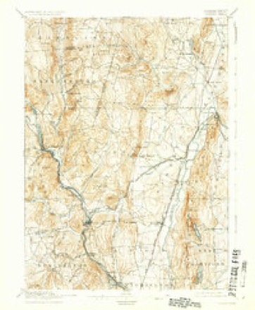
- 1892 USGS Granby quadrangle1:62500, 8 printings
- 1906 USGS Farmington quadrangle1:125000, 2 printings
- 1947 USGS Hartford quadrangle1:250000, 2 printings
- 1948 USGS Hartford quadrangle1:250000, 2 printings
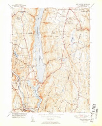
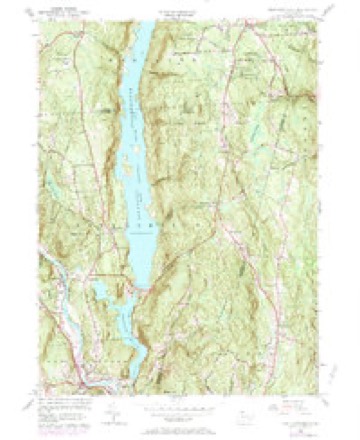
- 1951 USGS New Hartford quadrangle1:31680, 2 printings
- 1956 USGS New Hartford quadrangle1:24000, 6 printings
- 1961 USGS Hartford quadrangle1:250000
- 1962 USGS Hartford quadrangle1:250000, 3 printings
- 1965 USGS Hartford quadrangle1:250000, 2 printings
- 1986 USGS Hartford quadrangle1:100000
- 1994 USGS Hartford quadrangle1:100000, 2 printings








In the county-history sources
3,778 words on this townshipThe Memorial History of Hartford County, Connecticut, 1633-1884;, published 1886 names this settlement in its chapter on Canton Town. These are the passages that mention it, exactly as the scans read.
The people of West Simsbury began holding Sunday services in private houses about 1741. In September, 1746, at the house of Richard Case, they organized an ecclesiastical society ; and at the May session, 1750, the legislature created West Simsbury a distinct parish and the First Congregational Church was formed. Between 1747 and 1750 there was preaching liy the Rev's Adonijah Bidwell and Timothy Pitkin. When the church was formed, the Rev. Evander Morrison was called, at a salary of <£250, "old tenor," and thirty cords of wood, - the church to build him a house if he would furnish nails and glass. As the result of a quarrel he was dismissed in eleven months, and the house was not built. Succeeding pastors have been the Rev's Gideon Mills, 1759 to 1772, when he died ; Seth Sage, 1774, to his dismissal in 1778 ; Jeremiah Hallock, 1785, to his death, after forty-one years' pastorate, in 1826 ; Jairus Burt, 1826, to his death in 1857 ; and since then, the Rev's W. C. Fisk, Charles N. Lyman, A. Gardner, and David B. Hubbard. There was a secession from the church in 1778, led by the Rev. Mr. Sage. Meetings were held in private houses in the north part of the town for some years, and in 1783 a meeting-house was built on the Granby road, half a mile north of the present North Canton Methodist church. The organization was scattered at Mr. Sage's death. In 1783 another schism occurred, when the " Separatists " left the church ; and in 1785 these again separated, and the Baptist society was then established. Their first pastor was Elder Jared Mills. Their church was moved and rebuilt in 1839. A Methodist church was built in North Canton in 1871, and one in Collins ville in 1868 ; but this was closed in 1878. As early as 1751 there was a movement into the Episcopal church, but the withdrawing members joined the church in Scotland (Bloomfield). It was not until 1875 that a society was organized here. The Episcopal church was built in 1876. The Roman Catholic church in Collinsville was built in 1852.
Passage source: The Memorial History of Hartford County, Connecticut, 1633-1884;, published 1886.
to meet the few wants of the local population, and later to supply the growing demands from outside ; until now. with the vast development of the works at Collinsville, it has come to be one of the great manufacturing centres of the State, whose products are known and used all over the world. The first forge for the manufacture of iron was started in 1774 by Colonel Talcott and Messrs. Forbes & Smith. It was just below the present covered bridge, near the house of Julius E. Case. This forge, and that set up in the south part of the town in 1792 by the brothers Captain Frederick and Colonel George Humijhrey, were carried off by the flood of 1801. There have been grist-mills of Daniel Case, on Cherry Brook ; of Ambrose Case, in the north part of the parish ; of Joseph Segur, near the present Collinsville covered bridge (he crossed daily to his mill by canoe) ; and of Orville Case, near the junction of Albany turnpike and Cherry Brook road. At one time there were seven saw-mills in Canton. The blacksmith's trade, of course, and wood-working and wagon-making were among the local industries. There was a flax-mill about sixty years ago on a stream south of the present residence of G. Woodford Mills. There have been several carding-mills in the town. Of the industries that have disappeared, the most important were the manufacture of those two great forces, gunpowder and brandy, wliicli have had so much influence upon society and human history. In 1825 there were not less than forty distilleries in Canton ; now, with double the population, there are less than half a dozen. The first powder-mills were built by Jared Mills and Edmund Fowler, on the Nepaug stream, near its junction with the Farmington. Here the manufacture was carried on for sixty years, and not less than thirty people were killed in its successive explosions. In 183-1 another powder-mill was built on Cherry Brook, near the North Canton cemetery, by Swett & Humphrey. This ran about twenty years. The whole business of powder-making was abandoned in the town about 1865.
Passage source: The Memorial History of Hartford County, Connecticut, 1633-1884;, published 1886.
Machine-read from a century-old scan, so expect the errors a machine makes: misspelled names, dropped words, stray characters.
Fires near this place
137 since 1994Regional context, not property-specific evidence. The federal wildfire occurrence database lists 137 fires within 5 miles of North Canton between 1994 and 2020, burning about 141 acres in total. None started naturally. 10 were recorded as arson. Distance is straight-line from the map coordinates, so a fire counted here may appear on a neighbouring settlement's page as well.
| Reported cause | Fires |
|---|---|
| Missing data/not specified/undetermined | 98 |
| Debris and open burning | 15 |
| Arson/incendiarism | 10 |
| Recreation and ceremony | 10 |
| Smoking | 2 |
| Railroad operations and maintenance | 1 |
| Misuse of fire by a minor | 1 |
The most recent of them, most recent first, with the day each was reported and the service that recorded it.
| Date | Cause | Size | Reported by | Name on the report |
|---|---|---|---|---|
| 4 September 2017 | Missing data/not specified/undetermined | under an acre | Connecticut Division of Forestry | 21 COTTAGE ST |
| 30 September 2006 | Missing data/not specified/undetermined | under an acre | Connecticut Division of Forestry | not named |
| 23 September 2020 | Missing data/not specified/undetermined | 1.0 acres | Connecticut Division of Forestry | 2 INDIAN HILL ROAD |
| 18 September 2010 | Recreation and ceremony | under an acre | Connecticut Division of Forestry | not named |
| 11 September 2002 | Missing data/not specified/undetermined | under an acre | Connecticut Division of Forestry | not named |
| 9 August 2001 | Missing data/not specified/undetermined | 2.0 acres | Connecticut Division of Forestry | not named |
| 8 August 2001 | Missing data/not specified/undetermined | under an acre | Connecticut Division of Forestry | not named |
| 5 August 2007 | Missing data/not specified/undetermined | under an acre | Connecticut Division of Forestry | not named |
Settlements close enough to share some of these fires:
Mines and quarries near this place
7 within 5 milesRegional context, not property-specific evidence. The federal mineral resources record lists 7 workings within 5 miles of North Canton: 5 past producers, 1 prospect, 1 producer. 1 still produces. What was taken out: Sand and Gravel, Construction, Stone, Dimension, Mica, Feldspar. Distance is straight-line from the map coordinates, so a quarry counted here may appear on a neighbouring settlement's page as well.
| Where | Site | Commodity | Status | Recorded |
|---|---|---|---|---|
| Copper Mine No. Di-008 | Sulfur, Copper | Past Producer | Metamorphosed Sedimentary | |
| Knapp Mica Prospect | Mica, Feldspar | Past Producer | Muscovite, Plagioclase, Quartz | |
| Knapp Mica Prospect | Feldspar, Mica | Prospect | ||
| Hart's Pit | Sand and Gravel, Construction | Producer | ||
| Quarry | Stone, Dimension | Past Producer | ||
| Riprap Quarry | Stone, Dimension | Past Producer | ||
| Simsbury Pit | Sand and Gravel, Construction | Past Producer |
Storms near this place
3 since 2018Regional context, not property-specific evidence. The National Weather Service names North Canton in 3 storm reports between 2018 and 2021: 3 thunderstorm wind. No death or injury is recorded in these reports. Each account below is quoted exactly as the forecast office filed it, from the NOAA Storm Events Database, and each date opens the federal record of that event.
| When | Event | Place named | Harm | What the report says |
|---|---|---|---|---|
| May 2018 | Thunderstorm Wind | North Canton | $15,000 | At 3:45 PM EST numerous trees were reported down on Old Farms Road near Tollgale Lane, Holcomb Street at Cardinal Road, and Barndoor Hills Road at Firetown Road. A single tree was down across Richard Road. |
| July 2021 | Thunderstorm Wind | North Canton | $4,000 | In Canton, a tree was down onto a house on Cherry Brook Road. |
| April 2021 | Thunderstorm Wind | North Canton | $2,000 | In Simsbury a tree was down on a house on The Butterchurn. |
Nearest settlements
The eight closest, with where each one stands in the county. Distances are straight-line, computed from the Geographic Names Information System coordinates.
| Map | Place | Distance | Sheets |
|---|---|---|---|
| West Simsbury | 2.5 miles | 31 | |
| Tootin' Hills | 3.0 miles | 31 | |
| Canton Center | 3.1 miles | 30 | |
| Hampsted | 3.6 miles | 31 | |
| Bahre Corner | 3.7 miles | 30 | |
| Firetown | 3.7 miles | 31 | |
| Canton Valley | 4.4 miles | 30 | |
| Silvermine Acres | 4.7 miles | 30 |
Elsewhere
Matched on this settlement's Geographic Names Information System number rather than its name, so it cannot be a different place of the same name in another state.
| Wikidata item Q135815517 | The structured record the population and elevation above come from. Public domain (CC0). |
Provenance
This settlement is recorded in the Geographic Names Information System as feature 212524. The sheet list is computed by point-in-boundary test against the United States Geological Survey's historical topographic inventory. Both are works of the United States government and carry no copyright under 17 U.S.C. 105.
Wildfire. Short, Karen C. 2022. Spatial wildfire occurrence data for the United States, 1992-2020 [FPA_FOD_20221014]. 6th Edition. Fort Collins, CO: Forest Service Research Data Archive. https://doi.org/10.2737/RDS-2013-0009.6 Collected with United States Government funding and usable without additional permissions or fees.
Mines and quarries. USGS Mineral Resources Data System (MRDS) https://mrdata.usgs.gov/mrds/ A work of the United States government, no copyright under 17 U.S.C. 105.
Storms. NOAA National Centers for Environmental Information, Storm Events Database https://www.ncei.noaa.gov/stormevents/ A work of the United States government, no copyright under 17 U.S.C. 105. Narratives are quoted verbatim from the National Weather Service report and are not edited or summarised.