 Block
Old Greenwich, Connecticut
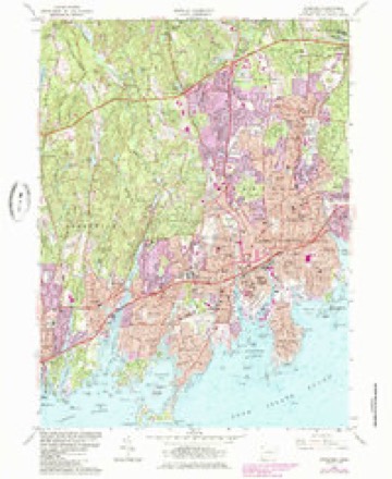
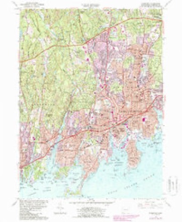
31 topographic sheets cover this place, the earliest surveyed in 1892 and the latest in 1987. It stands in Greenwich town. It lies in ZIP code area 06870. It lies near Greenwich Island. The Survey maps it on the Stamford quadrangle. 6,962 people lived here at the 2020 count.
On record in Old Greenwich
Buildings and businesses the archive holds for this place. Each opens its own page, with the source record it came from.
On the National Register within a mile 1 record
The National Register names another town for these. They stand within one mile of this settlement's coordinate.
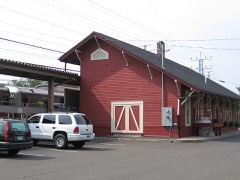 Sound Beach Railroad Stationlisted 1989 · 0.7 miles away
Population over time
2 figuresOld Greenwich grew from 6,611 to 6,962 between 2010 and 2020. These are the recorded population figures Wikidata holds for this place, reached through the Geographic Names Information System number this page is keyed on rather than by name, so they belong to this place and not to another of the same name. Most are census counts, but not all are: an early figure may be a founding or settlement estimate, and an estimate published within five years of a census is left out. The change column is computed, and is left blank where more than 20 years separate a figure from the one before it, because a gap that long is not a change between two counts.
| Year | People | Change |
|---|---|---|
| 2010 | 6,611 | |
| 2020 | 6,962 | +351 (+5%) |
Topographic sheets covering this place
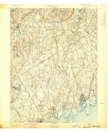
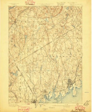
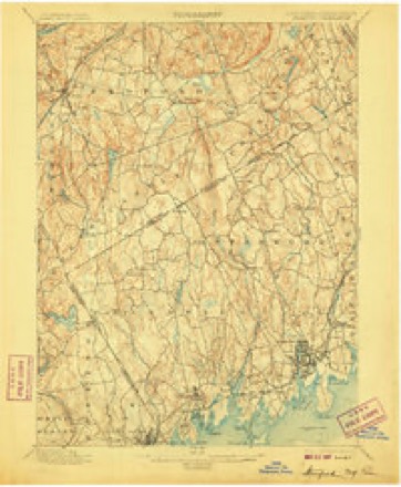
11 surveys from 31 printed sheetsMatched by testing this settlement's coordinate against the published boundary of every sheet in the United States Geological Survey's historical collection. Each opens the scanned sheet at the Survey.
- 1892 USGS Stamford quadrangle1:62500
- 1893 USGS Stamford quadrangle1:62500
- 1899 USGS Stamford quadrangle1:62500, 13 printings
- 1947 USGS Hartford quadrangle1:250000, 2 printings
- 1948 USGS Hartford quadrangle1:250000, 2 printings
- 1960 USGS Stamford quadrangle1:24000, 2 printings
- 1961 USGS Hartford quadrangle1:250000
- 1962 USGS Hartford quadrangle1:250000, 3 printings
- 1965 USGS Hartford quadrangle1:250000, 2 printings
- 1986 USGS Bridgeport quadrangle1:100000, 3 printings
- 1987 USGS Stamford quadrangle1:24000






What happened here
An account from the chapter on Greenwich town. The inset identifies its exact source book and publication year.
Green
For five or six years after the first settlement (1640 -46) the people of Greenwich had much trouble with their Indian neighbors, the indirect cause being rum, - "cussed fire-water," as the savage-! called it, - bought of the Dutch at New York. To begin with (1642), some Dutch traders, a drunken Indian, cheating in a bargain for furs, and a murdered Indian, all near New York.
In the county-history sources
24,517 words on this townshipHistory of Fairfield County, Connecticut : with Illustrations and Biographical Sketches of Its Prominent Men and Pioneers, published 1881 names this settlement in its chapter on Greenwich Town. These are the passages that mention it, exactly as the scans read.
Jeffere Ferris was an early settler, whose descendants now abound in " Old Greenwich." Several Dutchmen were among the first comers, and one of them, Cornelius Labden, left his name to a ninetyfoot precipice, now known as Labden's Rock, over which he is said to have plunged on horseback rather than be taken prisoner by some pursuing savages.
Passage source: History of Fairfield County, Connecticut : with Illustrations and Biographical Sketches of Its Prominent Men and Pioneers, published 1881.
In 1G89 it is voted that " ye towne per vote hathe agreed to bye a bulle." In 1691 it was voted to have a new meeting -house ; and John Mead, Sr., John Mead, Jr., John Hubbe, Daniel Smith, and Samuel Peck were appointed a committee to procure materials and build the house. A subsequent meeting made its dimensions thirty-two feet long, twenty-six feet wide, and fifteen feet high. A controversy which lasted for years concerning the site del.ayed the putting up of the building. It was finally built uj^on a small rise of ground northwest of the old buryingground in Old Greenwich.
Passage source: History of Fairfield County, Connecticut : with Illustrations and Biographical Sketches of Its Prominent Men and Pioneers, published 1881.
"It has been thought tliat the dismission of Mr. Morgan was the last action of the town in ecclesiastical affairs. There were, however, votes of the town in 1709 and 1711 for providing a parsonage for the West Society, and also a vote in 1713 assigning a location for their church, "wliich was near tlie site we now occupy. Three years later, December, 1710, M'e find the town lioliling a meeting in the new house, "which shows that the building is erected and so far advanced towards completion as to be occupied. It also indicates that the centre of population was changing from the east to the west side of the river. We ascertain, then, with tolerable certainty the following fiicts: That on the 5th of March, 1705, the two congregations became distinct by mutual agreement. Of course we must presume that this church was at that time regularly organized, witli Joseph Jlorgau for its acting pastor. Its first house of worship was built by the town eleven years afterwards, in 1710. Its erection was voted through a series of years, from 1094 to 1713; the building itself, however, meanwhile made no progress. It would be ditticult to say at what time its foundations were actually laid ; probably, however, it was soon after the vote of 1713, which fixed its site between tlie dwellings of Joseph Close and Ephraim Palmer. Tliat house stood from 1716 to Jan. 7, 1799, a period of eighty-two years. During the latter part of this time it was in a very dilapidated state. At length the f This is nnderstood to be in the east settlement, now called Old Greenwich ; and it may hero be noted that in all early votes " the town" describes tliis settlement, then the seat of power.
Passage source: History of Fairfield County, Connecticut : with Illustrations and Biographical Sketches of Its Prominent Men and Pioneers, published 1881.
Machine-read from a century-old scan, so expect the errors a machine makes: misspelled names, dropped words, stray characters.
Read the whole chapter on Greenwich Town - it names this place 2 more 2 times.
Fires near this place
5 since 2003Regional context, not property-specific evidence. The federal wildfire occurrence database lists 5 fires within 5 miles of Old Greenwich between 2003 and 2020, burning about 8 acres in total. None started naturally. 1 was recorded as arson. Distance is straight-line from the map coordinates, so a fire counted here may appear on a neighbouring settlement's page as well.
| Reported cause | Fires |
|---|---|
| Missing data/not specified/undetermined | 3 |
| Arson/incendiarism | 1 |
| Power generation/transmission/distribution | 1 |
The most recent of them, most recent first, with the day each was reported and the service that recorded it.
| Date | Cause | Size | Reported by | Name on the report |
|---|---|---|---|---|
| 4 August 2020 | Missing data/not specified/undetermined | under an acre | Connecticut Division of Forestry | 54 GARDINER STREET |
| 5 July 2003 | Missing data/not specified/undetermined | under an acre | Fire Department of New York | not named |
| 20 April 2016 | Arson/incendiarism | 5.0 acres | Connecticut Division of Forestry | WOODLAND PARK, |
| 7 March 2020 | Power generation/transmission/distribution | 2.0 acres | Connecticut Division of Forestry | RESEARCH DRIVE |
| 7 March 2020 | Missing data/not specified/undetermined | 1.0 acres | Connecticut Division of Forestry | 535 HOPE STREET |
Settlements close enough to share some of these fires:
Mines and quarries near this place
9 within 5 milesRegional context, not property-specific evidence. The federal mineral resources record lists 9 workings within 5 miles of Old Greenwich: 9 past producers. None of them still produces. What was taken out: Granite, Stone, Dimension, Stone, Sand and Gravel, Construction. Distance is straight-line from the map coordinates, so a quarry counted here may appear on a neighbouring settlement's page as well.
| Where | Site | Commodity | Status | Recorded |
|---|---|---|---|---|
| Christiano Oak Ridge Diorite Gneiss Rock Quarry | Stone | Past Producer | 1833 | |
| Dolphin Cove Pit | Sand and Gravel, Construction | Past Producer | ||
| Christiano Hamilton Avenue Diorite Gneiss Rock Quarry | Stone, Dimension | Past Producer | 1873 | |
| Ritch Diorite Gneiss Rock Quarry | Stone, Dimension | Past Producer | Unknown | |
| Voorhis Diorite Gneiss Rock Quarry | Stone, Dimension | Past Producer | ||
| Christiano Hamilton Avenue Quarry | Granite | Past Producer | ||
| Chritiano Oak Ridge Quarry | Granite | Past Producer | ||
| Ritch Quarry | Granite | Past Producer | ||
| Voorhis Quarry | Granite | Past Producer |
Nearest settlements
The eight closest, with where each one stands in the county. Distances are straight-line, computed from the Geographic Names Information System coordinates.
| Map | Place | Distance | Sheets |
|---|---|---|---|
| Dolphin Cove | 0.9 miles | 31 | |
| South End | 1.9 miles | 31 | |
| Cos Cob | 2.0 miles | 31 | |
| Mianus | 2.0 miles | 31 | |
| Shippan Point | 2.2 miles | 31 | |
| Indian Field | 2.2 miles | 31 | |
| Stamford | 2.5 miles | 31 | |
| Palmers Hill | 2.8 miles | 31 |
Elsewhere
Matched on this settlement's Geographic Names Information System number rather than its name, so it cannot be a different place of the same name in another state.
| Wikipedia article on Old Greenwich | An encyclopaedic summary. Its text is share-alike, so it is linked here rather than copied. |
| Wikidata item Q984521 | The structured record the population and elevation above come from. Public domain (CC0). |
Provenance
This settlement is recorded in the Geographic Names Information System as feature 209476. The sheet list is computed by point-in-boundary test against the United States Geological Survey's historical topographic inventory. Both are works of the United States government and carry no copyright under 17 U.S.C. 105.
Wildfire. Short, Karen C. 2022. Spatial wildfire occurrence data for the United States, 1992-2020 [FPA_FOD_20221014]. 6th Edition. Fort Collins, CO: Forest Service Research Data Archive. https://doi.org/10.2737/RDS-2013-0009.6 Collected with United States Government funding and usable without additional permissions or fees.
Mines and quarries. USGS Mineral Resources Data System (MRDS) https://mrdata.usgs.gov/mrds/ A work of the United States government, no copyright under 17 U.S.C. 105.