 Block
Mianus, Connecticut
31 topographic sheets cover this place, the earliest surveyed in 1892 and the latest in 1987. It stands in Greenwich town. It lies in ZIP code area 06807. It stands on Mianus River. The Survey maps it on the Stamford quadrangle. It stands 23 feet above sea level.
On record in Mianus
Buildings and businesses the archive holds for this place. Each opens its own page, with the source record it came from.
On the National Register within a mile 6 records
The National Register names another town for these. They stand within one mile of this settlement's coordinate.
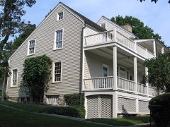 Bush-Holley HouseNational Historic Landmark · listed 1988 · 0.8 miles away
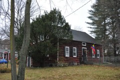 Samuel Ferris Houselisted 1989 · 0.2 miles away
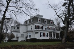 River Road-Mead Avenue Historic Districtlisted 2014 · 0.6 miles away
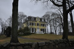 Strickland Road Historic Districtlisted 1990 · 0.7 miles away
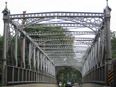 Riverside Avenue Bridgelisted 1977 · 0.9 miles away
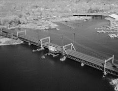 Mianus River Railroad Bridgelisted 1987 · 0.9 miles away
Topographic sheets covering this place
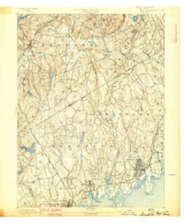
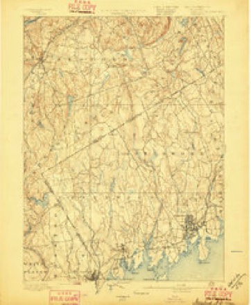
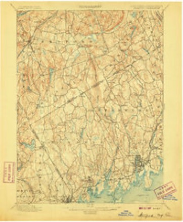
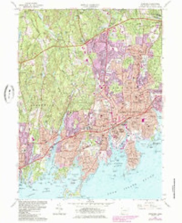
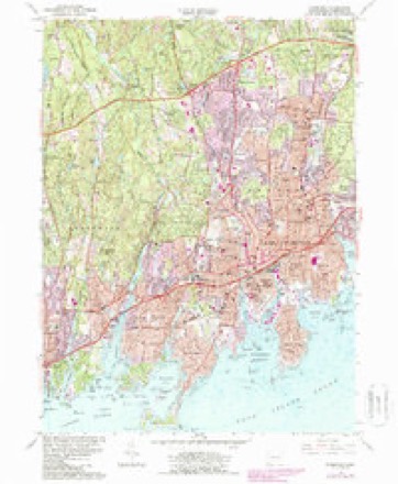
11 surveys from 31 printed sheetsMatched by testing this settlement's coordinate against the published boundary of every sheet in the United States Geological Survey's historical collection. Each opens the scanned sheet at the Survey.
- 1892 USGS Stamford quadrangle1:62500
- 1893 USGS Stamford quadrangle1:62500
- 1899 USGS Stamford quadrangle1:62500, 13 printings
- 1947 USGS Hartford quadrangle1:250000, 2 printings
- 1948 USGS Hartford quadrangle1:250000, 2 printings
- 1960 USGS Stamford quadrangle1:24000, 2 printings
- 1961 USGS Hartford quadrangle1:250000
- 1962 USGS Hartford quadrangle1:250000, 3 printings
- 1965 USGS Hartford quadrangle1:250000, 2 printings
- 1986 USGS Bridgeport quadrangle1:100000, 3 printings
- 1987 USGS Stamford quadrangle1:24000






What happened here
An account from the chapter on Greenwich town. The inset identifies its exact source book and publication year.
Green
For five or six years after the first settlement (1640 -46) the people of Greenwich had much trouble with their Indian neighbors, the indirect cause being rum, - "cussed fire-water," as the savage-! called it, - bought of the Dutch at New York. To begin with (1642), some Dutch traders, a drunken Indian, cheating in a bargain for furs, and a murdered Indian, all near New York.
In the county-history sources
24,517 words on this townshipHistory of Fairfield County, Connecticut : with Illustrations and Biographical Sketches of Its Prominent Men and Pioneers, published 1881 names this settlement in its chapter on Greenwich Town. These are the passages that mention it, exactly as the scans read.
Soion after, receiving fresh news of a great body of savages at Greenwich, Governor Keift (February, 1644) dispatched a second expedition in fjue<t of them. The force consisted of one hundred and thirty men, under command of Capt. John Underliill, who reached Stamford in the evening and in a heavy snowstorm, which detained him there all night. Next day he made a slow march through two feet or more of snow, and about eiglit o'clock in the evening reached the Mianus liiver, wliere he rested two hours till the moon rose. Crossing the river at, or not far aliove, the j)resent village of Mianus, and ascending the high western bank not far north of the present main road between Greenwich and Stamford, he had in front of him "Strickland's Plain," lying to the north and northwest of the present village of Cascob. On the western border of this plain, half a mile distant, he could see the lights of the " long-sought-for Petuipia- 25acn," - a village containing " more than a hundred permanent huts," partially protected by palisades, with numerous outside wigwams, the whole village lying under a low wooded rise of ground, which sheltered it from the northwest winds. The savage ' had warning of the approach of their enemies, and were prepared to give them a warm reception. Only the warriors held the village, the women and children having been sent to a place of safety.
Passage source: History of Fairfield County, Connecticut : with Illustrations and Biographical Sketches of Its Prominent Men and Pioneers, published 1881.
The Methodist Society at Mianus is quite young in its separate existence. The circuit to which it belonged was for many years called " The Greenwich, Round Hill, Roxbury, Stanwich, and Mianus Circuit." Not until June, 1871, was Mianus recognized as an independent charge. The society prior to 1878 met in the old neglected structure near the junction of the Stanwich and Stamford roads. The church was gathering her means to build, so the old building suffered neglect.
Passage source: History of Fairfield County, Connecticut : with Illustrations and Biographical Sketches of Its Prominent Men and Pioneers, published 1881.
"In March, 1082, the town, by their vote, directed that a number of home-lots should be laid out at Hoi-seueck, but at the same time forbid the occupants from seeking any organization, civil or religious, separate from the town. Twelve years later, 1094, tlie town voted to build a new meeting-house, 32 by 26, which vote, however, does not seem to have been carried into effect.f Nearly at the same time there began to be dissensions between the inhabitants on the two sides of the river about the maintenance of worship on this side. Two yeais later, in 169G, Salmon Treat was called to settle in the town, with a provision for his preaching every third Sabbath at Horseneck, - the first recognition of this place as entitled to preaching, - but he did not accept the call. Early in 1099, by vote of the town, a home-lot was granted for a parsonage at Horseneck. The Eev. Joseph Morgan, the next minister, is believed to have come here in the autumn of 1G9C. He preached at first on both sides of tlie river, as it had been contemplated Mr. Treat should do; but it soon created dissatisfaction. The proprietors of the town say by vote that 'Mr. Morgan preaching part of the time at Horseneck is a damage to them, and takes away their religious privileges. 'J Mr. Morgan continued the minister of the town four years, till May, 1700. He then left the settlement east of the Mianus, and assigned as a reason the want of union among the people. . He seems after that to have labored on this side of the river, as we find the inhabitants bestowing upon him in January, 1705, some special privileges. On the 5th of March following the town was by vote divided iuto two societies; and here we suppose that we find the true date of the founding of this church. After this, Mr. Morgan continued its pastor till he was dismissed, October, 1703, by vote of the town, whether with or without any other formalities does not appear.^
Passage source: History of Fairfield County, Connecticut : with Illustrations and Biographical Sketches of Its Prominent Men and Pioneers, published 1881.
Machine-read from a century-old scan, so expect the errors a machine makes: misspelled names, dropped words, stray characters.
Read the whole chapter on Greenwich Town - it names this place 3 more 3 times.
Fires near this place
27 since 2000Regional context, not property-specific evidence. The federal wildfire occurrence database lists 27 fires within 5 miles of Mianus between 2000 and 2020, burning about 21 acres in total. None started naturally. 8 were recorded as arson. Distance is straight-line from the map coordinates, so a fire counted here may appear on a neighbouring settlement's page as well.
| Reported cause | Fires |
|---|---|
| Missing data/not specified/undetermined | 15 |
| Arson/incendiarism | 8 |
| Misuse of fire by a minor | 2 |
| Equipment and vehicle use | 1 |
| Power generation/transmission/distribution | 1 |
The most recent of them, most recent first, with the day each was reported and the service that recorded it.
| Date | Cause | Size | Reported by | Name on the report |
|---|---|---|---|---|
| 5 July 2003 | Missing data/not specified/undetermined | under an acre | Fire Department of New York | not named |
| 26 July 2014 | Missing data/not specified/undetermined | under an acre | Fire Department of New York | N/A |
| 26 July 2003 | Missing data/not specified/undetermined | 2.5 acres | Fire Department of New York | not named |
| 13 July 2001 | Equipment and vehicle use | 1.0 acres | Fire Department of New York | not named |
| 20 April 2016 | Arson/incendiarism | 5.0 acres | Connecticut Division of Forestry | WOODLAND PARK, |
| 7 March 2020 | Power generation/transmission/distribution | 2.0 acres | Connecticut Division of Forestry | RESEARCH DRIVE |
| 7 March 2020 | Missing data/not specified/undetermined | 1.0 acres | Connecticut Division of Forestry | 535 HOPE STREET |
| 5 December 2004 | Missing data/not specified/undetermined | under an acre | Fire Department of New York | not named |
Settlements close enough to share some of these fires:
Mines and quarries near this place
9 within 5 milesRegional context, not property-specific evidence. The federal mineral resources record lists 9 workings within 5 miles of Mianus: 9 past producers. None of them still produces. What was taken out: Granite, Stone, Dimension, Stone, Sand and Gravel, Construction. Distance is straight-line from the map coordinates, so a quarry counted here may appear on a neighbouring settlement's page as well.
| Where | Site | Commodity | Status | Recorded |
|---|---|---|---|---|
| Christiano Oak Ridge Diorite Gneiss Rock Quarry | Stone | Past Producer | 1833 | |
| Dolphin Cove Pit | Sand and Gravel, Construction | Past Producer | ||
| Christiano Hamilton Avenue Diorite Gneiss Rock Quarry | Stone, Dimension | Past Producer | 1873 | |
| Ritch Diorite Gneiss Rock Quarry | Stone, Dimension | Past Producer | Unknown | |
| Voorhis Diorite Gneiss Rock Quarry | Stone, Dimension | Past Producer | ||
| Christiano Hamilton Avenue Quarry | Granite | Past Producer | ||
| Chritiano Oak Ridge Quarry | Granite | Past Producer | ||
| Ritch Quarry | Granite | Past Producer | ||
| Voorhis Quarry | Granite | Past Producer |
Nearest settlements
The eight closest, with where each one stands in the county. Distances are straight-line, computed from the Geographic Names Information System coordinates.
| Map | Place | Distance | Sheets |
|---|---|---|---|
| Cos Cob | 0.9 miles | 31 | |
| North Mianus | 1.6 miles | 31 | |
| Indian Field | 1.8 miles | 31 | |
| Palmers Hill | 1.9 miles | 31 | |
| Old Greenwich | 2.0 miles | 31 | |
| Greenwich | 2.3 miles | 36 | |
| Ridgeway | 2.5 miles | 31 | |
| Dolphin Cove | 2.5 miles | 31 |
Elsewhere
Matched on this settlement's Geographic Names Information System number rather than its name, so it cannot be a different place of the same name in another state.
| Wikipedia article on Mianus | An encyclopaedic summary. Its text is share-alike, so it is linked here rather than copied. |
| Wikidata item Q446413 | The structured record the population and elevation above come from. Public domain (CC0). |
Provenance
This settlement is recorded in the Geographic Names Information System as feature 208855. The sheet list is computed by point-in-boundary test against the United States Geological Survey's historical topographic inventory. Both are works of the United States government and carry no copyright under 17 U.S.C. 105.
Wildfire. Short, Karen C. 2022. Spatial wildfire occurrence data for the United States, 1992-2020 [FPA_FOD_20221014]. 6th Edition. Fort Collins, CO: Forest Service Research Data Archive. https://doi.org/10.2737/RDS-2013-0009.6 Collected with United States Government funding and usable without additional permissions or fees.
Mines and quarries. USGS Mineral Resources Data System (MRDS) https://mrdata.usgs.gov/mrds/ A work of the United States government, no copyright under 17 U.S.C. 105.