 Block
Riverton, Connecticut
35 topographic sheets cover this place, the earliest surveyed in 1892 and the latest in 1993. It stands in Barkhamsted town. It lies in ZIP code area 06065. It stands on Still River. The Survey maps it on the Winsted quadrangle. 160 people lived here at the 2020 count. It stands 512 feet above sea level.
On record in Riverton
Buildings and businesses the archive holds for this place. Each opens its own page, with the source record it came from.
On the National Register 2 records
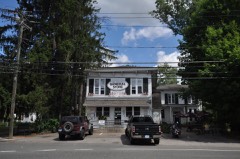 Riverton Historic Districtlisted 2007
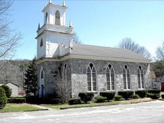 Union Church/St. Paul's Churchlisted 1985
Topographic sheets covering this place
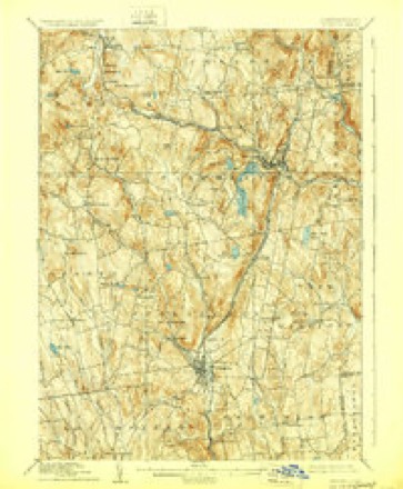
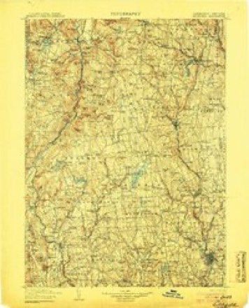
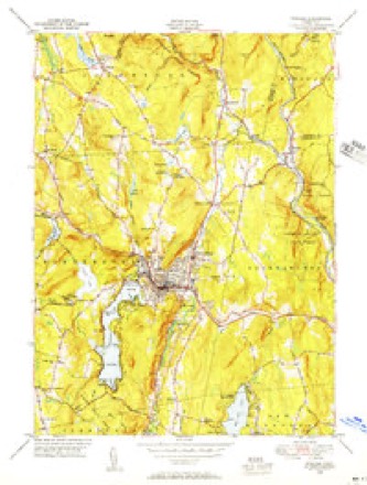
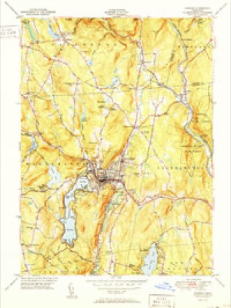
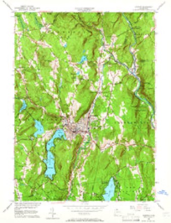
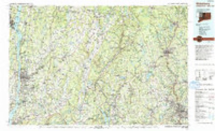
12 surveys from 35 printed sheetsMatched by testing this settlement's coordinate against the published boundary of every sheet in the United States Geological Survey's historical collection. Each opens the scanned sheet at the Survey.
- 1892 USGS Winsted quadrangle1:62500, 10 printings
- 1904 USGS Litchfield quadrangle1:125000, 3 printings
- 1947 USGS Hartford quadrangle1:250000, 2 printings
- 1948 USGS Hartford quadrangle1:250000, 2 printings
- 1948 USGS Winsted quadrangle1:31680
- 1951 USGS Winsted quadrangle1:31680, 2 printings
- 1956 USGS Winsted quadrangle1:24000, 7 printings
- 1961 USGS Hartford quadrangle1:250000
- 1962 USGS Hartford quadrangle1:250000, 3 printings
- 1965 USGS Hartford quadrangle1:250000, 2 printings
- 1985 USGS Waterbury quadrangle1:100000
- 1993 USGS Waterbury quadrangle1:100000





In the county-history sources
5,901 words on this townshipHistory of Litchfield County, Connecticut, published 1881 names this settlement in its chapter on Barkhamsted Town. These are the passages that mention it, exactly as the scans read.
The village of Riverton until the year 1866 was known as Hitchcocksville, deriving the latter name from Lambert Hitchcock, who came from Cheshire in 1818. Before this time the locality had been known as " the forks of the river." Mr. Hitchcock first started a turning-lathe in a saw-mill where Ward's paper-mill now stands. At this latter he turned out chair materials, which he took to Charleston, S. C, put together, and sold them. The next year he returned, built a two-story shop twenty-five by thirtysix feet, and a dam about thirty rods above the present dam. Near the dam he built a small turningshop, where he turned and sawed chair materials, which were put together, finished, and painted in a two-story shop which stood near the main street. He now employed from ten to fifteen hands, and the place began to be called " Hitchcock's Mill," the name by natural habit becoming Hitchcocksville. Business increased continually until 1825 and 1826, when he built the large brick shop now occupied by Stephens & Co., and employed from ninety to one hundred men, women, and children. In 1829, Mr. Hitchcock made an assignment of his property, but compromised with his creditors, and, with Arba Alford, continued the business under the firm-name of Hitchcock & Alford. Afterwards, Josiah H. Sage having taken an interest, "Co." was added to the firm-name.
Passage source: History of Litchfield County, Connecticut, published 1881.
John Ward and his two sons came to Riverton in the year 1836 and built a large calico-print worlcs. Although their factory was just over the Barkham-sted line in the town of Hartland, it was nevertheless within the village, and is identified with its interests. This concern manufactured from two hundred thousand to three hundred thousand dollars worth of goods per year, and employed a large number of hands. In 1851 the firm dissolved, and the business of calicoprinting ceased, the ])roperty passing into the hands of Michael Ward. From 1851 very little was done with the property until 1878, when the sons of Michael Ward, under the name of Ward Brothers, commenced here the manufacture of paper, making at first about one ton of fine manilla paper daily, but, with increased facilities, are now able to make double that quantity. They receive and ship about two thousand tons of raw and manufactured material yearly.
Passage source: History of Litchfield County, Connecticut, published 1881.
Some eighteen years ago a saw-mill was built in Riverton, near the Eagle Scythe- Works, which is still in operation and known as Hart's mill. Several other small saw-mills are running in the town.
Passage source: History of Litchfield County, Connecticut, published 1881.
Machine-read from a century-old scan, so expect the errors a machine makes: misspelled names, dropped words, stray characters.
Fires near this place
121 since 1992Regional context, not property-specific evidence. The federal wildfire occurrence database lists 121 fires within 5 miles of Riverton between 1992 and 2020, burning about 129 acres in total. 1 started naturally. 4 were recorded as arson. Distance is straight-line from the map coordinates, so a fire counted here may appear on a neighbouring settlement's page as well.
| Reported cause | Fires |
|---|---|
| Missing data/not specified/undetermined | 94 |
| Recreation and ceremony | 12 |
| Debris and open burning | 10 |
| Arson/incendiarism | 4 |
| Natural | 1 |
The most recent of them, most recent first, with the day each was reported and the service that recorded it.
| Date | Cause | Size | Reported by | Name on the report |
|---|---|---|---|---|
| 7 September 2020 | Missing data/not specified/undetermined | under an acre | Connecticut Division of Forestry | 10 BAKER STREET |
| 7 September 2020 | Missing data/not specified/undetermined | under an acre | Connecticut Division of Forestry | 98 SPENCER STREET |
| 24 September 2019 | Missing data/not specified/undetermined | under an acre | Connecticut Division of Forestry | not named |
| 21 September 1994 | Arson/incendiarism | 4.0 acres | Connecticut Division of Forestry | not named |
| 20 September 2010 | Recreation and ceremony | under an acre | Connecticut Division of Forestry | not named |
| 18 September 2010 | Recreation and ceremony | under an acre | Connecticut Division of Forestry | not named |
| 15 September 2012 | Missing data/not specified/undetermined | under an acre | Connecticut Division of Forestry | COLEBROOK |
| 12 September 2010 | Recreation and ceremony | under an acre | Connecticut Division of Forestry | not named |
Settlements close enough to share some of these fires:
Mines and quarries near this place
8 within 5 milesRegional context, not property-specific evidence. The federal mineral resources record lists 8 workings within 5 miles of Riverton: 8 past producers. None of them still produces. What was taken out: Stone, Stone, Dimension, Granite, Mica. Distance is straight-line from the map coordinates, so a quarry counted here may appear on a neighbouring settlement's page as well.
| Where | Site | Commodity | Status | Recorded |
|---|---|---|---|---|
| Granitic Gneiss Rock Quarry | Granite | Past Producer | ||
| Mica Mines | Mica | Past Producer | ||
| Gneiss Rock Quarry No. Ei-003 | Stone | Past Producer | Gneiss | |
| Gneiss Rock Quarry No. Ei-003 | Stone, Dimension | Past Producer | ||
| Granitic Gneiss Rock Quarry | Stone, Dimension | Past Producer | ||
| Granitic Gneiss Rock Quarry No. Ei-001 | Stone | Past Producer | Gneiss | |
| Granitic Gneiss Rock Quarry No. Ei-002 | Stone | Past Producer | Gneiss | |
| Riprap Quarry | Stone, Dimension | Past Producer |
Storms near this place
3 since 2013Regional context, not property-specific evidence. The National Weather Service names Riverton in 3 storm reports between 2013 and 2021: 2 thunderstorm wind, 1 flash flood. No death or injury is recorded in these reports. Each account below is quoted exactly as the forecast office filed it, from the NOAA Storm Events Database, and each date opens the federal record of that event.
| When | Event | Place named | Harm | What the report says |
|---|---|---|---|---|
| August 2021 | Thunderstorm Wind | Riverton | - | Multiple trees were downed along Huntington Road near Winsted. One was downed on a house, one on powerlines, one on a driveway and a few in a yard at the top of the hill. |
| August 2021 | Thunderstorm Wind | Riverton | - | A tree was downed onto wires at the intersection of Wallens Hill Road and Ram's Gate Lane north of Winsted. |
| August 2013 | Flash Flood | Riverton | - | Flash flooding was reported from heavy rainfall in Riverton. Six to ten inches of water was flowing across Route 20. |
Nearest settlements
The eight closest, with where each one stands in the county. Distances are straight-line, computed from the Geographic Names Information System coordinates.
| Map | Place | Distance | Sheets |
|---|---|---|---|
| Robertsville | 1.8 miles | 35 | |
| Nelsons Corner | 2.1 miles | 35 | |
| Barkhampsted Center | 3.5 miles | 31 | |
| Winsted | 3.7 miles | 35 | |
| Pleasant Valley | 3.8 miles | 31 | |
| Mooreville | 4.3 miles | 35 | |
| Colebrook | 4.6 miles | 35 | |
| Mill Brook | 5.4 miles | 35 |
Elsewhere
Matched on this settlement's Geographic Names Information System number rather than its name, so it cannot be a different place of the same name in another state.
| Wikipedia article on Riverton | An encyclopaedic summary. Its text is share-alike, so it is linked here rather than copied. |
| Wikidata item Q106506460 | The structured record the population and elevation above come from. Public domain (CC0). |
Provenance
This settlement is recorded in the Geographic Names Information System as feature 210220. The sheet list is computed by point-in-boundary test against the United States Geological Survey's historical topographic inventory. Both are works of the United States government and carry no copyright under 17 U.S.C. 105.
Wildfire. Short, Karen C. 2022. Spatial wildfire occurrence data for the United States, 1992-2020 [FPA_FOD_20221014]. 6th Edition. Fort Collins, CO: Forest Service Research Data Archive. https://doi.org/10.2737/RDS-2013-0009.6 Collected with United States Government funding and usable without additional permissions or fees.
Mines and quarries. USGS Mineral Resources Data System (MRDS) https://mrdata.usgs.gov/mrds/ A work of the United States government, no copyright under 17 U.S.C. 105.
Storms. NOAA National Centers for Environmental Information, Storm Events Database https://www.ncei.noaa.gov/stormevents/ A work of the United States government, no copyright under 17 U.S.C. 105. Narratives are quoted verbatim from the National Weather Service report and are not edited or summarised.