 Block
Salmon Brook, Connecticut
31 topographic sheets cover this place, the earliest surveyed in 1892 and the latest in 1994. It stands in Granby town. It lies in ZIP code area 06035. It stands on Kendell Brook. The Survey maps it on the Tariffville quadrangle. 2,428 people lived here at the 2020 count. It stands 215 feet above sea level.
On record in Salmon Brook
Buildings and businesses the archive holds for this place. Each opens its own page, with the source record it came from.
On the National Register within a mile 3 records
The National Register names another town for these. They stand within one mile of this settlement's coordinate.
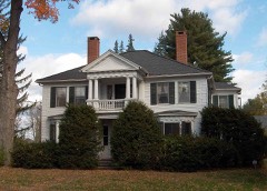 Granby Center Historic Districtlisted 1985 · 0.5 miles away
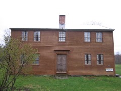 Rowe and Weed Houseslisted 1978 · 0.8 miles away
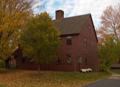 Nathaniel Holcomb III Houselisted 1982 · 0.9 miles away
Population over time
2 figuresSalmon Brook grew from 2,324 to 2,428 between 2010 and 2020. These are the recorded population figures Wikidata holds for this place, reached through the Geographic Names Information System number this page is keyed on rather than by name, so they belong to this place and not to another of the same name. Most are census counts, but not all are: an early figure may be a founding or settlement estimate, and an estimate published within five years of a census is left out. The change column is computed, and is left blank where more than 20 years separate a figure from the one before it, because a gap that long is not a change between two counts.
| Year | People | Change |
|---|---|---|
| 2010 | 2,324 | |
| 2020 | 2,428 | +104 (+4%) |
Topographic sheets covering this place
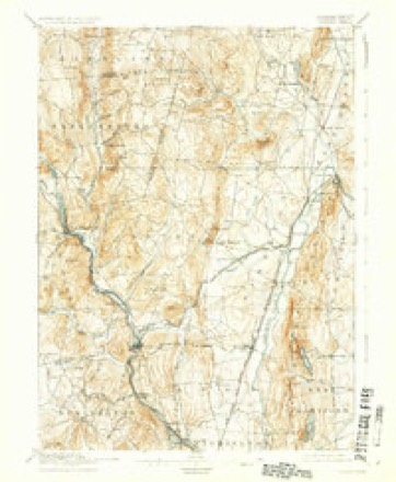
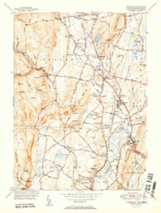
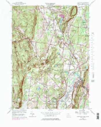
11 surveys from 31 printed sheetsMatched by testing this settlement's coordinate against the published boundary of every sheet in the United States Geological Survey's historical collection. Each opens the scanned sheet at the Survey.
- 1892 USGS Granby quadrangle1:62500, 8 printings
- 1906 USGS Farmington quadrangle1:125000, 2 printings
- 1947 USGS Hartford quadrangle1:250000, 2 printings
- 1948 USGS Hartford quadrangle1:250000, 2 printings
- 1951 USGS Tariffville quadrangle1:31680, 2 printings
- 1956 USGS Tariffville quadrangle1:24000, 6 printings
- 1961 USGS Hartford quadrangle1:250000
- 1962 USGS Hartford quadrangle1:250000, 3 printings
- 1965 USGS Hartford quadrangle1:250000, 2 printings
- 1986 USGS Hartford quadrangle1:100000
- 1994 USGS Hartford quadrangle1:100000, 2 printings








In the county-history sources
4,302 words on this townshipThe Memorial History of Hartford County, Connecticut, 1633-1884;, published 1886 names this settlement in its chapter on Granby Town. These are the passages that mention it, exactly as the scans read.
In the early days of the settlement the Indians were never slow to take advantage of its weak state, and many acts of depredation and malicious deviltry took place. The most noteworthy of these was probably the capture of Daniel Hays,i an early settler, alluded to before. Hays, as has been stated, lived at Salmon Brook. At that time a young man of twenty -two or twenty- three years, he was captured on his way to the pasture in search of his horse. The three Indians who had thus lain in wait for him immediately bound their captive and started for the north. A general alarm was soon spread among the settlers, and a party made up of men from his own town and the neighboring town of Windsor was soon scouring the woods in search of the savages. All their efforts were vain, however, and in the mean time the captive was hurried on to Canada, treated with all manner of insults and indignities. After a journey of nearly thirty days he was brought to a great Indian encampment on the Canada border. Here he was compelled to " run the gauntlet," which terrible ordeal he was fortunate enough to pass through alive, and was at length by unusual good fortune adopted into an Indian family. After a lapse of several years he was sold to a Frenchman at Montreal, who took pity on him and allowed him the privilege of purchasing his own freedom after a service of some years. He returned to his family after an absence of about seven years, and lived from that time in an uninterrupted course of peace and happiness. He died in 1756, and was buried in the cemetery
Passage source: The Memorial History of Hartford County, Connecticut, 1633-1884;, published 1886.
The work of settlement and population was very slow and discouraging. Records show that as late as 1709 there w^ere only eleven families settled within the present boundai'ies of the town. It has been afifirmed that frequent Indian outbreaks kept the place entirely deserted for considerable periods of time. As the town grew in numbers and strength, however, apprehension of dangers from these sources gradually disappeared, and the population seems to have increased with considerable rapidity, as in 1736 two ecclesiastical societies were established, called respectively the Northeast and Northwest societies. It must be remembered that all public measures prior to 1786 were carried out only with the approval of the town of Simsljury, of which the settlements at the Falls and at Salmon Brook and Turkey Hills were a part. The " meetings " of the Northwest or Salmon Brook Society were held for a time in the house of Daniel Hays, which was also used as a tavern ; but in 1739 a meeting of this society was convened to adopt measures for building a meeting-house. Local feeling was strong, and the General Assembly was at length referred to, in order to settle disputes and decide upon a location for the new building. This august body appointed a committee, in accordance with whose report the site finally adopted was upon Seminary Hill, at Salmon Brook. This result of outside arbitration seems to have by no means put an end to internal dissensions, however ; for in 1775 the building was taken down and rebuilt on a spot designated by another committee of arbitration, some two miles north of its first location. This in turn was taken down, and another building erected in 1834, which is still standing, and is occupied by the First Society.
Passage source: The Memorial History of Hartford County, Connecticut, 1633-1884;, published 1886.
The next pastor Avas the Rev. Chauncey D. Rice, who served in that capacity from 1839 to 1841. A new parsonage was built for Mr. Rice, adjoining the present church building. The Rev. Israel P. Warren was his successor. He was ordained in 1842. Mr. Warren was considered rather " liberal " in his theology, and, after the manner of his kind, his pastorate was marked by contests between himself and the more conservative element. He afterward removed to Boston, and rose to considerable eminence in his profession. After his dismissal the pulpit was filled for some time by " supplies," and not until 1855 was the next regular minister ordained. This was the Rev. William Gilbert, who remained in charge until 1863. The Rev. Thomas D. Murphy (Yale, 1863) was ordained in 1866, the Rev. Dr. Leonard Bacon, of New Haven, preaching tlie ordination sermon. Mr. Murphy was pastor of the church until 1871. Shortly after the organization of the South Church at Salmon Brook in 1872 Mr. Murphy became its pastor, and remained as such until 1880. The Rev. William Hammond succeeded him in the pastorate of the First Church, and remained two years. Mr. Hammond was followed by the Rev. James B, Cleaveland, the present pastor. At the South Church the pulpit "was filled, after Mr. Murphy's dismissal, by the Rev. George W. Griffith, at that time a student in the Yale Theological Seminary. Upon his graduation (1881) Mr. Griffith became the pastor of the church, remaining in that position one year. He was succeeded by the Rev. W. D. McFarland, who left at the expiration of a year's service to accept a position upon the staff of " The Gospel in All Lands," a religious paper published at Baltimore. From the time of Mr. McFarland's dismissal the church has had no settled pastor.
Passage source: The Memorial History of Hartford County, Connecticut, 1633-1884;, published 1886.
Machine-read from a century-old scan, so expect the errors a machine makes: misspelled names, dropped words, stray characters.
Read the whole chapter on Granby Town - it names this place 7 more 7 times.
Fires near this place
34 since 1993Regional context, not property-specific evidence. The federal wildfire occurrence database lists 34 fires within 5 miles of Salmon Brook between 1993 and 2020, burning about 28 acres in total. 3 started naturally. 1 was recorded as arson. Distance is straight-line from the map coordinates, so a fire counted here may appear on a neighbouring settlement's page as well.
| Reported cause | Fires |
|---|---|
| Missing data/not specified/undetermined | 17 |
| Recreation and ceremony | 5 |
| Debris and open burning | 4 |
| Natural | 3 |
| Fireworks | 1 |
| Arson/incendiarism | 1 |
| Smoking | 1 |
| Power generation/transmission/distribution | 1 |
| Equipment and vehicle use | 1 |
The most recent of them, most recent first, with the day each was reported and the service that recorded it.
| Date | Cause | Size | Reported by | Name on the report |
|---|---|---|---|---|
| 9 September 2007 | Missing data/not specified/undetermined | under an acre | Connecticut Division of Forestry | not named |
| 23 September 2020 | Fireworks | 1.0 acres | Connecticut Division of Forestry | RT187 AND SPOONVILLE ROAD |
| 25 August 2015 | Recreation and ceremony | under an acre | Massachusetts Bureau of Forest Fire Control | not named |
| 17 August 2008 | Debris and open burning | under an acre | Connecticut Division of Forestry | not named |
| 14 August 2010 | Recreation and ceremony | under an acre | Connecticut Division of Forestry | not named |
| 12 August 2006 | Missing data/not specified/undetermined | under an acre | Connecticut Division of Forestry | not named |
| 9 July 2018 | Recreation and ceremony | under an acre | Massachusetts Bureau of Forest Fire Control | not named |
| 18 July 1993 | Natural | 2.0 acres | Connecticut Division of Forestry | not named |
Settlements close enough to share some of these fires:
Mines and quarries near this place
10 of 31 shownRegional context, not property-specific evidence. The federal mineral resources record lists 31 workings within 5 miles of Salmon Brook: 27 past producers, 4 producers. 4 still produce. What was taken out: Stone, Dimension, Sand and Gravel, Construction, Copper, Stone, Crushed/Broken. Distance is straight-line from the map coordinates, so a quarry counted here may appear on a neighbouring settlement's page as well.
| Where | Site | Commodity | Status | Recorded |
|---|---|---|---|---|
| Pegmatite Prospect No. Di-002 | Feldspar, Quartz | Past Producer | Feldspar | |
| Sandstone Quarry | Flagstone | Past Producer | ||
| Sandstone Quarry #Di-005 | Flagstone | Past Producer | ||
| Higley Copper Mine | Copper, Sulfur | Past Producer | Breccia Filling And Replacement | |
| Simsbury Copper Mine | Copper, Sulfur | Past Producer | Void Filling And Replacement | |
| Simsbury Newgate Prison Copper Mine | Copper, Sulfur | Past Producer | 1707 | |
| Basalt Rock Quarry No. Di-004 | Stone, Crushed/Broken | Past Producer | Basalt | |
| Diabase Rock Quarry No. Di-001 | Stone, Crushed/Broken | Past Producer | Diabase | |
| Diabase Rock Quarry No. Di-003 | Stone, Crushed/Broken | Past Producer | Diabase | |
| Quarry Road Pit | Stone, Crushed/Broken | Producer |
Nearest settlements
The eight closest, with where each one stands in the county. Distances are straight-line, computed from the Geographic Names Information System coordinates.
| Map | Place | Distance | Sheets |
|---|---|---|---|
| Granby | 0.4 miles | 31 | |
| Windmill Springs | 0.5 miles | 31 | |
| Meadowgate | 0.7 miles | 31 | |
| The Gables | 0.8 miles | 31 | |
| Mechanicsville | 0.9 miles | 31 | |
| Chatsworth Village | 1.2 miles | 31 | |
| Pegville | 1.3 miles | 31 | |
| Hungary | 1.6 miles | 31 |
Elsewhere
Matched on this settlement's Geographic Names Information System number rather than its name, so it cannot be a different place of the same name in another state.
| Wikipedia article on Salmon Brook | An encyclopaedic summary. Its text is share-alike, so it is linked here rather than copied. |
| Wikidata item Q650756 | The structured record the population and elevation above come from. Public domain (CC0). |
Provenance
This settlement is recorded in the Geographic Names Information System as feature 1867099. The sheet list is computed by point-in-boundary test against the United States Geological Survey's historical topographic inventory. Both are works of the United States government and carry no copyright under 17 U.S.C. 105.
Wildfire. Short, Karen C. 2022. Spatial wildfire occurrence data for the United States, 1992-2020 [FPA_FOD_20221014]. 6th Edition. Fort Collins, CO: Forest Service Research Data Archive. https://doi.org/10.2737/RDS-2013-0009.6 Collected with United States Government funding and usable without additional permissions or fees.
Mines and quarries. USGS Mineral Resources Data System (MRDS) https://mrdata.usgs.gov/mrds/ A work of the United States government, no copyright under 17 U.S.C. 105.