 Block
Granby, Connecticut
31 topographic sheets cover this place, the earliest surveyed in 1892 and the latest in 1994. It stands in Granby town. It lies in ZIP code area 06035. It stands on Kendell Brook. The Survey maps it on the Tariffville quadrangle. 2,428 people lived here at the 2020 count. It stands 215 feet above sea level.
On record in Granby
Buildings and businesses the archive holds for this place. Each opens its own page, with the source record it came from.
On the National Register 8 records
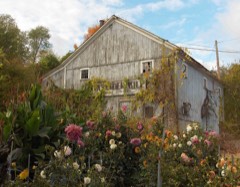 Allen's Cider Milllisted 1992
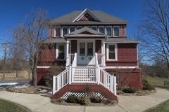 Frederick H. Cossitt Librarylisted 1988
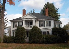 Granby Center Historic Districtlisted 1985
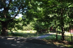 Samuel II Hayes Houselisted 1992
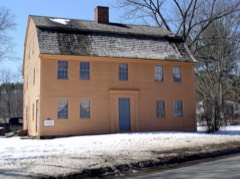 Judah Holcomb Houselisted 1988
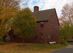 Nathaniel Holcomb III Houselisted 1982
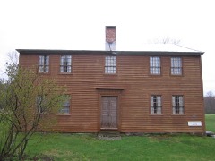 Rowe and Weed Houseslisted 1978
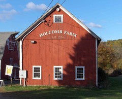 West Granby Historic Districtlisted 1992
Population over time
2 figuresGranby grew from 2,324 to 2,428 between 2010 and 2020. These are the recorded population figures Wikidata holds for this place, reached through the Geographic Names Information System number this page is keyed on rather than by name, so they belong to this place and not to another of the same name. Most are census counts, but not all are: an early figure may be a founding or settlement estimate, and an estimate published within five years of a census is left out. The change column is computed, and is left blank where more than 20 years separate a figure from the one before it, because a gap that long is not a change between two counts.
| Year | People | Change |
|---|---|---|
| 2010 | 2,324 | |
| 2020 | 2,428 | +104 (+4%) |
Topographic sheets covering this place
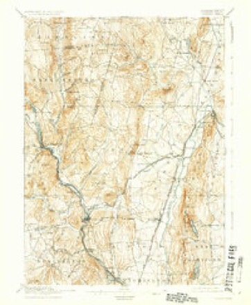
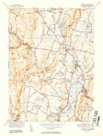
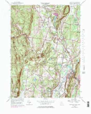
11 surveys from 31 printed sheetsMatched by testing this settlement's coordinate against the published boundary of every sheet in the United States Geological Survey's historical collection. Each opens the scanned sheet at the Survey.
- 1892 USGS Granby quadrangle1:62500, 8 printings
- 1906 USGS Farmington quadrangle1:125000, 2 printings
- 1947 USGS Hartford quadrangle1:250000, 2 printings
- 1948 USGS Hartford quadrangle1:250000, 2 printings
- 1951 USGS Tariffville quadrangle1:31680, 2 printings
- 1956 USGS Tariffville quadrangle1:24000, 6 printings
- 1961 USGS Hartford quadrangle1:250000
- 1962 USGS Hartford quadrangle1:250000, 3 printings
- 1965 USGS Hartford quadrangle1:250000, 2 printings
- 1986 USGS Hartford quadrangle1:100000
- 1994 USGS Hartford quadrangle1:100000, 2 printings








In the county-history sources
4,302 words on this townshipThe Memorial History of Hartford County, Connecticut, 1633-1884;, published 1886 names this settlement in its chapter on Granby Town. These are the passages that mention it, exactly as the scans read.
Granby proper, and the first house there stood near the present residence of Mr. Dennison Case. Daniel Hays, of Indian fame, lived, about 1720, in a house which stood " below the hill," and near the present home of Mr. Joseph Sanford. It is also generally supposed that a block-house was erected still farther south, immediately in the rear of the house lately occupied by Mr. Charles Pettibone, where the settlers flocked in times of danger, and when in fear of any outbreak from the savage proprietors of the country.
Passage source: The Memorial History of Hartford County, Connecticut, 1633-1884;, published 1886.
The Rev. Israel Holly succeeded him in the parish, in October, 1784, remaining until 1793, when he in turn gave way to the Rev. Isaac Porter, who was ordained in June, 1794, and remained in the pastorate for more than thirty-eight years. Mr. Porter experienced many difiiculties during his long ministry. It would seem, from appearances, that he was a strict disciplinarian, and ruled his congregation with a rod of iron. Members were disciplined for absenting themselves from church services, and much dissatisfaction followed. At last Simeon Holcomb brought specific charges against the church, criticising the manner in which the sacrament was administered, complaining that the pastor had not been ordained and was not supported " in the Gospel way," and avowing that the church was impure and corrupt in many of its members. After Mr. Porter's dismissal he lost his property, and became dependent for his support upon the generosity of individuals ; the church, be it said to her shame, withholding her aid, in spite of his long and faithful pastorate. His successor, the Rev. Charles Bentley, was pastor from 1833 to 1839. Mr. Bentley consented to settle in Granby only on condition that a new church be erected ; and the present edifice was completed early in his pastorate.
Passage source: The Memorial History of Hartford County, Connecticut, 1633-1884;, published 1886.
The Methodists erected their present church building in West Granbv in 1845, and the societv is now in a comfortablv flourishing condition. There is also a society of Universalists possessing a substantial little church located in North Granby, some few hundred rods above the old North Church of the Congregationalists. They are prosperous and independent enough to employ their own minister, and their numerical strength, although confined almost exclusively to the northern section of the town, is considerable.
Passage source: The Memorial History of Hartford County, Connecticut, 1633-1884;, published 1886.
Machine-read from a century-old scan, so expect the errors a machine makes: misspelled names, dropped words, stray characters.
Read the whole chapter on Granby Town - it names this place 13 more 13 times.
Fires near this place
33 since 1993Regional context, not property-specific evidence. The federal wildfire occurrence database lists 33 fires within 5 miles of Granby between 1993 and 2020, burning about 27 acres in total. 3 started naturally. 1 was recorded as arson. Distance is straight-line from the map coordinates, so a fire counted here may appear on a neighbouring settlement's page as well.
| Reported cause | Fires |
|---|---|
| Missing data/not specified/undetermined | 17 |
| Recreation and ceremony | 5 |
| Debris and open burning | 4 |
| Natural | 3 |
| Fireworks | 1 |
| Arson/incendiarism | 1 |
| Smoking | 1 |
| Equipment and vehicle use | 1 |
The most recent of them, most recent first, with the day each was reported and the service that recorded it.
| Date | Cause | Size | Reported by | Name on the report |
|---|---|---|---|---|
| 9 September 2007 | Missing data/not specified/undetermined | under an acre | Connecticut Division of Forestry | not named |
| 23 September 2020 | Fireworks | 1.0 acres | Connecticut Division of Forestry | RT187 AND SPOONVILLE ROAD |
| 25 August 2015 | Recreation and ceremony | under an acre | Massachusetts Bureau of Forest Fire Control | not named |
| 17 August 2008 | Debris and open burning | under an acre | Connecticut Division of Forestry | not named |
| 14 August 2010 | Recreation and ceremony | under an acre | Connecticut Division of Forestry | not named |
| 12 August 2006 | Missing data/not specified/undetermined | under an acre | Connecticut Division of Forestry | not named |
| 9 July 2018 | Recreation and ceremony | under an acre | Massachusetts Bureau of Forest Fire Control | not named |
| 18 July 1993 | Natural | 2.0 acres | Connecticut Division of Forestry | not named |
Settlements close enough to share some of these fires:
Mines and quarries near this place
10 of 33 shownRegional context, not property-specific evidence. The federal mineral resources record lists 33 workings within 5 miles of Granby: 29 past producers, 4 producers. 4 still produce. What was taken out: Stone, Dimension, Sand and Gravel, Construction, Stone, Crushed/Broken, Copper. Distance is straight-line from the map coordinates, so a quarry counted here may appear on a neighbouring settlement's page as well.
| Where | Site | Commodity | Status | Recorded |
|---|---|---|---|---|
| Pegmatite Prospect No. Di-002 | Feldspar, Quartz | Past Producer | Feldspar | |
| Sandstone Quarry | Flagstone | Past Producer | ||
| Sandstone Quarry #Di-005 | Flagstone | Past Producer | ||
| Higley Copper Mine | Copper, Sulfur | Past Producer | Breccia Filling And Replacement | |
| Simsbury Copper Mine | Copper, Sulfur | Past Producer | Void Filling And Replacement | |
| Simsbury Newgate Prison Copper Mine | Copper, Sulfur | Past Producer | 1707 | |
| Basalt Rock Quarry No. Di-004 | Stone, Crushed/Broken | Past Producer | Basalt | |
| Burkhart Pit | Sand and Gravel, Construction | Past Producer | Sedimentary | |
| Burkhart Pit | Sand and Gravel, Construction | Past Producer | ||
| Crushed Basalt Stone Quarry No. Ci-001 | Stone, Crushed/Broken | Past Producer | Basalt |
Storms near this place
34 since 1997Regional context, not property-specific evidence. The National Weather Service names Granby in 34 storm reports between 1997 and 2025: 20 thunderstorm wind, 7 hail, 4 flood, 2 lightning. No death or injury is recorded in these reports. Each account below is quoted exactly as the forecast office filed it, from the NOAA Storm Events Database, and each date opens the federal record of that event.
| When | Event | Place named | Harm | What the report says |
|---|---|---|---|---|
| May 2018 | Hail | Granby | $70,000 | At 3:15 PM EST, car windshields and house windows in Granby were smashed by tennis ball size hail. Tennis ball size hail was also reported in East Hartland. |
| April 2007 | Flood | Granby | $50,000 | Several roads were flooded in Granby. The Mockanum River in Manchester came out of its banks and threatened nearby homes. In Bristol, flooding was reported along a portion of Route 72. Several businesses were also flooded and Memorial Boulevard was closed. |Minor to moderate flooding also affected the larger mainstem rivers. The Connecticut River at Thompsonville crested at 7 feet at 3 pm on the 17th (flood stage is 5 feet), and at Hartford it crested at 23.4 feet at 1215 pm on the 18th (flood stage is 16 feet). On the Farmington River, a crest of 16.6 feet was recorded at Simsbury at 915 am on the 17th (flood stage is 12 feet), while at Tarriffville the river crested at 9.9 feet at 430 pm on the 17th (flood stage is 9 feet). |
| June 2006 | Lightning | Granby | $50,000 | no account filed |
| July 2016 | Thunderstorm Wind | Granby | $30,000 | Multiple trees and wires down throughout town, with several roads closed. |
| May 2010 | Thunderstorm Wind | Granby | $20,000 | Large trees were downed onto power lines by thunderstorm winds. |
| June 2010 | Thunderstorm Wind | Granby | $15,000 | Many trees were downed by thunderstorm winds. |
| July 2008 | Thunderstorm Wind | Granby | $7,000 | Wires and a utility pole on Granby Road were downed by thunderstorm winds. The utility pole was downed across the road. |
| August 2018 | Thunderstorm Wind | West Granby | $5,000 | At 3:!5 PM EDT, thunderstorm winds brought trees and power lines down on Simsbury Road at Firetown Road. Numerous power outages. |
| August 2015 | Thunderstorm Wind | East Granby | $5,000 | A tree on Route 189 was downed by thunderstorm winds at the intersection with Floydville Road. |
| August 2012 | Thunderstorm Wind | Granby | $5,000 | A tree was downed by thunderstorm winds blocking the road. |
| June 2008 | Thunderstorm Wind | East Granby | $5,000 | Numerous trees were downed throughout East Granby, including one on Newgate Road. Several of these trees fell on utility wires. |
| August 2008 | Thunderstorm Wind | Granby | $5,000 | Trees and wires on Hartford Avenue were downed by thunderstorm winds. |
| June 2006 | Flood | Granby | $5,000 | no account filed |
| July 2006 | Thunderstorm Wind | Granby | $5,000 | no account filed |
| August 2022 | Thunderstorm Wind | East Granby | $3,000 | In East Granby, trees were down on power lines on Holcomb Street. Trees were down on Metacomet Drive. Trees were down on Sweetbriar Road. |
| June 2008 | Thunderstorm Wind | East Granby | $3,000 | A tree on North Road was downed by thunderstorm winds onto wires. |
| May 2025 | Thunderstorm Wind | Granby | $2,000 | In Granby, multiple trees were down on power lines on Buttles Rd. |
| June 2017 | Thunderstorm Wind | North Granby | $1,000 | Tree down on Loomis Street, partially blocking road in Granby. |
| July 2017 | Lightning | West Granby | $1,000 | At 241 PM EST, an amateur radio operator reported a tree down by lightning and blocking Simsbury Road in Granby. |
| August 2024 | Thunderstorm Wind | East Granby | $800 | In East Granby there were multiple trees and wires down. |
| March 2016 | Thunderstorm Wind | Granby | $500 | A large tree limb was downed onto Higley Street in Granby by thunderstorm winds. |
| July 2017 | Hail | East Granby | - | At noon EST, broadcast media reported 1 inch diameter hail falling at East Granby. |
| May 2015 | Flood | Granby | - | Route 189 was blocked by flood waters that were not draining. |
| August 2011 | Flood | Granby | - | Six to eight inches of heavy rain from Tropical Storm Irene resulted in the closure of Copper Hill Road in Granby due to flooding. |
| July 2007 | Thunderstorm Wind | Granby | - | Several trees downed on Route 189. |
| August 2008 | Hail | Granby | - | no account filed |
| July 2006 | Hail | Granby | - | no account filed |
| June 2002 | Hail | Granby | - | no account filed |
| June 2001 | Thunderstorm Wind | Granby | - | no account filed |
| May 2000 | Thunderstorm Wind | Granby | - | no account filed |
| June 2000 | Hail | Granby | - | no account filed |
| June 2000 | Funnel Cloud | Granby | - | no account filed |
| July 1999 | Thunderstorm Wind | Granby | - | no account filed |
| July 1997 | Hail | Granby | - | no account filed |
Nearest settlements
The eight closest, with where each one stands in the county. Distances are straight-line, computed from the Geographic Names Information System coordinates.
| Map | Place | Distance | Sheets |
|---|---|---|---|
| Windmill Springs | 0.2 miles | 31 | |
| Salmon Brook | 0.4 miles | 31 | |
| Meadowgate | 0.5 miles | 31 | |
| The Gables | 0.7 miles | 31 | |
| Mechanicsville | 1.1 miles | 31 | |
| Chatsworth Village | 1.1 miles | 31 | |
| Granbrook Park | 1.6 miles | 31 | |
| Pegville | 1.6 miles | 31 |
Elsewhere
Matched on this settlement's Geographic Names Information System number rather than its name, so it cannot be a different place of the same name in another state.
| Wikipedia article on Granby | An encyclopaedic summary. Its text is share-alike, so it is linked here rather than copied. |
| Wikidata item Q650756 | The structured record the population and elevation above come from. Public domain (CC0). |
Provenance
This settlement is recorded in the Geographic Names Information System as feature 207392. The sheet list is computed by point-in-boundary test against the United States Geological Survey's historical topographic inventory. Both are works of the United States government and carry no copyright under 17 U.S.C. 105.
Wildfire. Short, Karen C. 2022. Spatial wildfire occurrence data for the United States, 1992-2020 [FPA_FOD_20221014]. 6th Edition. Fort Collins, CO: Forest Service Research Data Archive. https://doi.org/10.2737/RDS-2013-0009.6 Collected with United States Government funding and usable without additional permissions or fees.
Mines and quarries. USGS Mineral Resources Data System (MRDS) https://mrdata.usgs.gov/mrds/ A work of the United States government, no copyright under 17 U.S.C. 105.
Storms. NOAA National Centers for Environmental Information, Storm Events Database https://www.ncei.noaa.gov/stormevents/ A work of the United States government, no copyright under 17 U.S.C. 105. Narratives are quoted verbatim from the National Weather Service report and are not edited or summarised.