 Block
Stratford, Connecticut
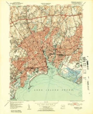
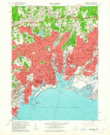
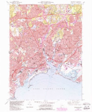
31 topographic sheets cover this place, the earliest surveyed in 1891 and the latest in 1986. It stands in Stratford town. It lies in ZIP code area 06615. It lies near Academy Hill. The Survey maps it on the Bridgeport quadrangle. 52,355 people lived here at the 2020 count.
On record in Stratford
Buildings and businesses the archive holds for this place. Each opens its own page, with the source record it came from.
On the National Register 9 records
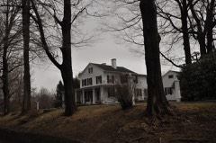 Nathan B. Booth Houselisted 1992
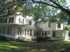 Boothe Homesteadlisted 1985
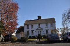 Nathaniel Curtis Houselisted 1982
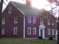 Capt. David Judson Houselisted 1973
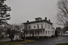 Isaac Lewis Houselisted 1991
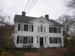 Sterling Homesteadlisted 1976
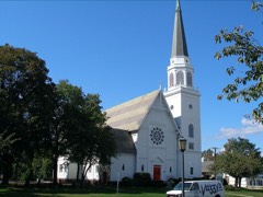 Stratford Center Historic Districtlisted 1983
 Stratford Point Lighthouselisted 1990
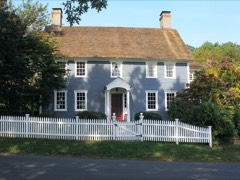 Ephraim Wheeler Houselisted 1992
Population over time
2 figuresStratford grew from 51,384 to 52,355 between 2010 and 2020. These are the recorded population figures Wikidata holds for this place, reached through the Geographic Names Information System number this page is keyed on rather than by name, so they belong to this place and not to another of the same name. Most are census counts, but not all are: an early figure may be a founding or settlement estimate, and an estimate published within five years of a census is left out. The change column is computed, and is left blank where more than 20 years separate a figure from the one before it, because a gap that long is not a change between two counts.
| Year | People | Change |
|---|---|---|
| 2010 | 51,384 | |
| 2020 | 52,355 | +971 (+2%) |
Topographic sheets covering this place
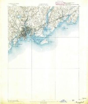
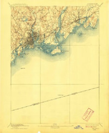
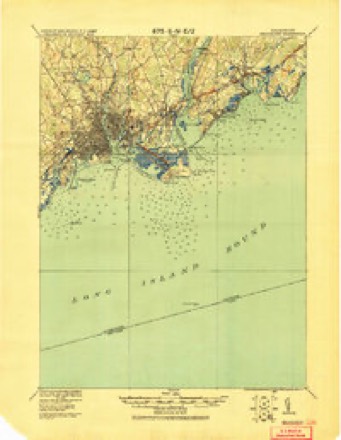
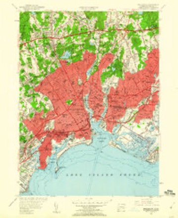
13 surveys from 31 printed sheetsMatched by testing this settlement's coordinate against the published boundary of every sheet in the United States Geological Survey's historical collection. Each opens the scanned sheet at the Survey.
- 1891 USGS Bridgeport quadrangle1:62500
- 1893 USGS Bridgeport quadrangle1:62500, 8 printings
- 1920 USGS Bridgeport quadrangle1:62500
- 1947 USGS Hartford quadrangle1:250000, 2 printings
- 1948 USGS Hartford quadrangle1:250000, 2 printings
- 1951 USGS Bridgeport quadrangle1:24000, 2 printings
- 1951 USGS Bridgeport quadrangle1:31680
- 1960 USGS Bridgeport quadrangle1:24000
- 1961 USGS Hartford quadrangle1:250000
- 1962 USGS Hartford quadrangle1:250000, 3 printings
- 1965 USGS Hartford quadrangle1:250000, 2 printings
- 1970 USGS Bridgeport quadrangle1:24000, 4 printings
- 1986 USGS Bridgeport quadrangle1:100000, 3 printings






In the county-history sources
215,742 words on this townshipHistory of Fairfield County, Connecticut, published 1881 names this settlement in its chapter on Stratford Town. These are the passages that mention it, exactly as the scans read.
" About 1664, while these contentions were going on at Hartford and otlier places, the people at Stratford fell into the same unliappy divisions and controversies in regard to the same subjects. During the administrations of Mr. Blackman,* their first pa.stor, the church and town enjoyed great ])eace, and conducted their ecclesiastical affairs with e.vemplary harmony. About 1663, beiug far advanced in years, he became very infirm and unable to perform his ministerial labors. The church, therefore, applied to Mr. Israel Chauncy, son of President Charles Chauney, of Cambridge, t!) nuike them a visit and preach among them. A majority of the church chose him for their pastor, and in 1665 he was ordained in the independent mode. But a large and respectable part of the church and town were oppo.sed to his ordination. It was therefore agreed that if, after hearing Mr. Chauncy a certain time, they should continue to be dissatisfied with his ministry, they should have liberty to call and settle another minister, and have the same privileges in the niceting-hou-se as the other party. Accordingly, after hearing Mr. Chauney the time agreed upon, and continuing to he dissatisfied with his ministrations, they invited Mr. Zachariah Walker to preach to them, and finally chose him for their pastor. Both ministers performed public worship in the same house. Mr. Chauncy performed his services at the usual Iiours, and Mr. Walker was allowed two hours in the middle of the day. But, after scjnic time, it so happened that one day Mr. Walker continued hisserviccs longer than u-mal. Mr. Cliauney and his people, finding that Mr. Walker's exercises were not finished, retired to a i)rivate house, and there held their afternoon devotions. They were, however, so much displeased that tlie next day they went over to Fairfield and made a complaint toMaj. Gold, one of the magistrates, against Mr. Walker. The major, upon hearing the case, advised pacific mea-sures, and that Mr. Walker should be allowed three hours for the time of liis public exercises.
Passage source: History of Fairfield County, Connecticut, published 1881.
" The principal cause of difference was in regard to church membershi]), baptism, and the discipline of church members. What the precise nature of the controversy was could not be distinctly understood by the most learned and pious even of that day. It was the same as that which existed at Hartford, Wethersfield, and other places. One would say, at this distance of time, that the question to be decided was, whctlier the ' Half-way Covenant Practice' should be introduced into the church or not. Upon this question there was the most grave difference of opinion among the best and most distinguished men in New England. By this plan a person of good moral character might own or renew the covenant of bajitisin, confessing the same creed as members of churches in full communion, and affirming his intention of becoming truly pious in heart and in life, and have the privilege of presenting himself and children for baptism. Nor did the jirivilege stop here: he might also present for baptism hisgrandchililren, children bound to liiin as api)renticcs, and even his slave-s, by giving a pledge for their religious education. Persons thus owning the covenant were considered church members to all intents and purposes, except that they might not come to the communion table. For conduct unbecoming church members they could be and were dealt with and punished in the same manner as members in full communion. In this way a church could never run down in point of numbers, so long as unconverted persons enough to keep it up were willing to own the covenant of baptism. Abundtint proof of the foregoing statements is fouhd in the first book of ministerial records of the Second Cliurch of Stratford, now the First Churoli of Woodhury, !ia|>pily in a fine state of preservation. Consfijuciit U|iou tliis |>raetiee baptisms followed close njioii hirths; very many instances may be tbund upon tlicse records where the child was but from one to eight days old at the time of tlie ceremony. If the child appeared to be in danger of "non-continuance," it was bapti/cil on the day of its birth. The children of ministers, deacons, and otlier leading men in the church were generally less than a week old when presented for bajilism. Young persons did not usually own the covenant till they became parents, and wishe<l baptism for their children.
Passage source: History of Fairfield County, Connecticut, published 1881.
" Gliws and nails were expensive, imported lu.xuries, if indeed the former could be afforded. Hence the windows were small and few. Aged people were living not long ago who remembered when nails were at two shillings per pound. In 1674, 1000 shinglenails were inventoried at 1.3 shillings sterling. The price of a house in 1664 is £20; another, in 1674, £22. The inventories of estates from 16.50 to 1074, on Stratford records, disclose no glassware, only one carpet, one silver spoon, no chinaware, nor any crock-' ery, excepting two shillings' worth of earthenware. The common utensils were of pewter, iron, or wood. For money values barter wa.s substituted, and the General Court regulated for this purpose the commercial worth of corn, peas, wheat, beef, pork, cider, etc. AVamjium was likewise legalized as money. It was neatly made, the white of the core of the periwinkle and the black of muscle-shell, each strung in parcels, the white at six for a i)enny and the black at three for a penny. The strings represented respectively, in white wampum, one penny, three pence, twelve pence, and five shillings; and, in black, two pence, six pence, two shillings and sixpence, and ten shillings.
Passage source: History of Fairfield County, Connecticut, published 1881.
Machine-read from a century-old scan, so expect the errors a machine makes: misspelled names, dropped words, stray characters.
Read the whole chapter on Stratford Town - it names this place 13 more 13 times.
Fires near this place
47 since 1998Regional context, not property-specific evidence. The federal wildfire occurrence database lists 47 fires within 5 miles of Stratford between 1998 and 2020, burning about 273 acres in total. None started naturally. 6 were recorded as arson. Distance is straight-line from the map coordinates, so a fire counted here may appear on a neighbouring settlement's page as well.
| Reported cause | Fires |
|---|---|
| Missing data/not specified/undetermined | 37 |
| Arson/incendiarism | 6 |
| Debris and open burning | 2 |
| Equipment and vehicle use | 1 |
| Fireworks | 1 |
The most recent of them, most recent first, with the day each was reported and the service that recorded it.
| Date | Cause | Size | Reported by | Name on the report |
|---|---|---|---|---|
| 3 September 2017 | Missing data/not specified/undetermined | 3.8 acres | Connecticut Division of Forestry | 191 MAIN ST S (RT 133 |
| 17 September 2020 | Missing data/not specified/undetermined | 1.0 acres | Connecticut Division of Forestry | 11 RT8 NB |
| 29 August 2016 | Missing data/not specified/undetermined | under an acre | Connecticut Division of Forestry | 10 BARNUM DYKE BRIDGEPORT |
| 20 August 2016 | Missing data/not specified/undetermined | under an acre | Connecticut Division of Forestry | MERRITT PARKWAY EXIT 50 |
| 13 August 2020 | Missing data/not specified/undetermined | under an acre | Connecticut Division of Forestry | 49 RT15 SOUTH BOUND |
| 1 August 2020 | Missing data/not specified/undetermined | under an acre | Connecticut Division of Forestry | I-95, EXITS 31-32 |
| 9 July 2020 | Missing data/not specified/undetermined | under an acre | Connecticut Division of Forestry | 49 RT15 NORTH BOUND |
| 4 July 2016 | Fireworks | under an acre | Connecticut Division of Forestry | QUAIL STREET STRATFORD |
Settlements close enough to share some of these fires:
Mines and quarries near this place
10 of 12 shownRegional context, not property-specific evidence. The federal mineral resources record lists 12 workings within 5 miles of Stratford: 8 past producers, 2 unknowns, 1 occurrence, 1 plant. 1 still produces. What was taken out: Stone, Dimension, Granite, Stone, Crushed/Broken, Sand and Gravel, Construction. Distance is straight-line from the map coordinates, so a quarry counted here may appear on a neighbouring settlement's page as well.
| Where | Site | Commodity | Status | Recorded |
|---|---|---|---|---|
| Bridgeport Steel/ Milford, Ct. | Iron | Plant | ||
| Microscopic Fluorite Occurrence No. El-001 | Fluorine-Fluorite | Occurrence | Fluorite | |
| Basalt Rock Quarry No. El-003 | Stone, Crushed/Broken | Past Producer | Diabase | |
| County Jail Granite Gneiss Rock Quarry | Stone, Crushed/Broken | Past Producer | Unknown | |
| Gorman Aggregates Operation | Sand and Gravel, Construction | Unknown | ||
| Oronoque Pit | Sand and Gravel, Construction | Unknown | ||
| Burlison Quarry | Granite | Past Producer | ||
| Burlisonparsonsgranite Gneiss Rock Quarry | Stone, Dimension | Past Producer | Surface | |
| Burr's Quarry | Granite | Past Producer | ||
| County Jail Quarry | Granite | Past Producer |
Storms near this place
30 since 1993Regional context, not property-specific evidence. The National Weather Service names Stratford in 30 storm reports between 1993 and 2024: 14 flash flood, 11 thunderstorm wind, 2 funnel cloud, 2 hail. The reports record 1 injury. Each account below is quoted exactly as the forecast office filed it, from the NOAA Storm Events Database, and each date opens the federal record of that event.
| When | Event | Place named | Harm | What the report says |
|---|---|---|---|---|
| June 2010 | Thunderstorm Wind | Stratford | 1 hurt, $100,000 | Hundreds of trees were reported down in Stratford, with the Lordship section hardest hit, with the Paradise Green section a close second. Several structures as well as a few cars were reported to have trees fall on them. One person was injured when a tree branch fell on the car they were in, and a police car had its windshield blown out by the winds. |
| August 2008 | Thunderstorm Wind | Stratford | $25,000 | Shingles were torn off a house near the corner of Nichols Road and North Avenue. This damage marked the southwest end of a 0.8 mile wide damage swath that extended northeast to Wilcoxson and Main, where trees were down. The microburst then traveled southeast to the mouth of the Housatonic River, downing dozens of trees and power lines, including some on top of vehicles. |
| June 2010 | Thunderstorm Wind | Stratford | $10,000 | Two trees were reported down on a house located on Bond Street in Bridgeport. |
| June 2010 | Thunderstorm Wind | Stratford | $5,000 | A large tree was uprooted and a large shed picked up by winds and dropped on top of another shed 6 feet away in the Success Hill section of Bridgeport. |
| June 2008 | Lightning | Stratford | $5,000 | Lightning caused a house fire in Stratford. |
| July 2024 | Thunderstorm Wind | Stratford | $3,000 | Multiple trees down on Glenfield Avenue near Wooster Park. |
| August 2008 | Thunderstorm Wind | Stratford | $2,500 | Numerous trees were reported down in Stratford. |
| July 2024 | Thunderstorm Wind | Stratford | $2,000 | Trees down on Nichols Avenue in Stratford. |
| June 2008 | Thunderstorm Wind | Stratford | $1,000 | Trees were downed in the vicinity of Interstate 95 in Stratford. |
| July 2023 | Flash Flood | Stratford | - | Several Metro North Railroad underpasses impassible. Several roads closed due to flooding including Cutspring Road. |
| July 2021 | Flash Flood | Stratford | - | Multiple roads were closed due to flooding in Bridgeport including the intersections of Bishop Avenue and Connecticut Avenue, Lincoln Avenue and Arlington Street, Gregory Street and Columbia Street, East Washington Street and East Main Street, and Seaview Avenue at the I-95 exit ramp. |
| July 2020 | Flash Flood | Stratford | - | A vehicle was stranded in high water at Third Street and Connecticut Avenue in Bridgeport. |
| April 2018 | Flash Flood | Stratford | - | The intersection of Bruce Avenue and Stratford Avenue was closed due to flooding in Stratford. |
| April 2018 | Flash Flood | Stratford | - | The intersection of King Street and Broadbridge Avenue in Stratford was impassable due to flooding. |
| July 2018 | Flash Flood | Stratford | - | A vehicle was trapped in flood waters under the railroad overpass on West Broad Street between Knowlton Street and Linden Avenue in Stratford. |
| April 2017 | Flash Flood | Stratford | - | The fire department responded to a water rescue at the intersection of Barnum Avenue and Bishop Avenue in Mill Hill, between Bridgeport and Stratford. |
| October 2010 | Flash Flood | Stratford | - | Sections of Route 25 in Monroe and off Exit 33 of Interstate 95 in Stratford were closed due to flooding. |
| August 2008 | Flash Flood | Stratford | - | Many roads on the east side of Bridgeport were flooded. There were road closures and property damage due to the flooding. The intersection of Arctic St. and Pembroke St. had several inches of water on it, which also covered the side walks. |
| August 2008 | Flash Flood | Stratford | - | Severe flooding occurred on Terrill Rd. in Stratford. Water levels were approximately 2 feet high with residents using kayaks and other floatation devices on the street to manuver through the high waters. |
| August 2008 | Funnel Cloud | Stratford | - | A funnel cloud was seen 1/2 mile to the northeast of Bridgeport, near the corner of Success Avenue and Stonybrook Road. |
| August 2008 | Flash Flood | Stratford | - | A car was stranded in high waters under a flooded viaduct at East Main St. and Crescent Ave. in Bridgeport. The 2 occupants (an adult and a child) were rescued by local firefighters. A new school on Waterview Ave. in Bridgeport was also flooded. |
| August 2008 | Hail | Stratford | - | Hail, up to quarter in size, was reported covering the ground. |
| September 2004 | Flash Flood | Stratford | - | Torrential rains caused flash flooding of roads. |
| August 1993 | Thunderstorm Wind | Stratford | - | A gust to 59 mph was recorded at the Sikorsky Memorial Airport National Weather Service Office in Stratford. One small plane flipped over. Additionally, considerable tree and power line damage was reported in Greenwich and Darien by Darien Police. |
| October 2010 | Hail | Stratford | - | no account filed |
| October 2006 | Flash Flood | Stratford | - | no account filed |
| April 2000 | Flash Flood | Stratford | - | no account filed |
| May 2000 | Thunderstorm Wind | Stratford | - | no account filed |
| May 1997 | Funnel Cloud | Stratford | - | no account filed |
| July 1996 | Thunderstorm Wind | Stratford | - | no account filed |
Nearest settlements
The eight closest, with where each one stands in the county. Distances are straight-line, computed from the Geographic Names Information System coordinates.
| Map | Place | Distance | Sheets |
|---|---|---|---|
| Cupheag (historical) | 0.0 miles | 31 | |
| Mill Hill | 1.5 miles | 31 | |
| Newfield | 1.8 miles | 31 | |
| Lordship | 2.4 miles | 31 | |
| East Bridgeport | 2.6 miles | 31 | |
| Pecks Mill | 2.8 miles | 31 | |
| Putney | 3.7 miles | 31 | |
| Bridgeport | 4.0 miles | 31 |
Elsewhere
Matched on this settlement's Geographic Names Information System number rather than its name, so it cannot be a different place of the same name in another state.
| Wikipedia article on Stratford | An encyclopaedic summary. Its text is share-alike, so it is linked here rather than copied. |
| Wikidata item Q755140 | The structured record the population and elevation above come from. Public domain (CC0). |
Provenance
This settlement is recorded in the Geographic Names Information System as feature 211246. The sheet list is computed by point-in-boundary test against the United States Geological Survey's historical topographic inventory. Both are works of the United States government and carry no copyright under 17 U.S.C. 105.
Wildfire. Short, Karen C. 2022. Spatial wildfire occurrence data for the United States, 1992-2020 [FPA_FOD_20221014]. 6th Edition. Fort Collins, CO: Forest Service Research Data Archive. https://doi.org/10.2737/RDS-2013-0009.6 Collected with United States Government funding and usable without additional permissions or fees.
Mines and quarries. USGS Mineral Resources Data System (MRDS) https://mrdata.usgs.gov/mrds/ A work of the United States government, no copyright under 17 U.S.C. 105.
Storms. NOAA National Centers for Environmental Information, Storm Events Database https://www.ncei.noaa.gov/stormevents/ A work of the United States government, no copyright under 17 U.S.C. 105. Narratives are quoted verbatim from the National Weather Service report and are not edited or summarised.